- The trail passes the remains of majestic railway trestle bridges set in beautiful rainforest. It also goes through attractive woodlands, dairy-farming and cattle-grazing country
- At Timboon, it connects to the 20km Twelve Apostles Trail, which enables cyclists to reach Port Campbell along a shared path with magnificent views. Walkers can also get to that coastal town via steps and a $3.5 million suspension bridge over Port Campbell Creek
- There’s a major bike and e-bike hire company in the area that operates shuttle services
Nearby Attractions
- Lake Bullen Merri, Lake Gnotuk and other crater lakes
- The Twelve Apostles Food Artisans gourmet trail includes berries, fudge, wine and much more
- The Twelve Apostles Trail, now open from Timboon, provides a 40km round trip starting near the Timboon Railway Shed Distillery and passing the Schulz Organic Creamery and Cafe … perhaps better visited on the way back
- The 100km Great Ocean Walk from Port Campbell to Apollo Bay
- The Timboon distillery occupies the original goods shed and produces a range of spirits including single malt whiskey, vodka (with vanilla bean), coffee cream, strawberry schnapps and lemon liqueur. A wide variety of local produce is available
- Cobden Miniature Railway
Last updated: 9 April 2024
- This rail trail can be split into two sections. Camperdown to Cobden is 18km, with 11 of those being on-road and 7km, from Naroghid Rd, a dedicated rail trail. From Cobden it passes pleasant farmland and goes through scenic bush for 23km. The trail is primarily constructed of compacted earth and coarse gravel. It is liberally supplied with bench seats, tables and interpretive signs. Five low-level bridges between Merretts Rd and Curdies River were built by volunteers from timber. Two have been replaced with modern structures with another two underway. Distance markers are located at 1km intervals. In an emergency, call 000 or 112 and quote the distance from the marker nearest to you (eg Cobden 4km). The Ride With Us shuttle service is available from numerous points on the Timboon and Twelve Apostles trails. Click on the GET AROUND tab for details
Horse riding is prohibited on the section with the low-level bridges
Section Guides
Camperdown to Naroghid (11km)
- Camperdown is a major town with tree-lined avenues, botanic gardens and two volcanic lakes. It has a wide range of accommodation, dining options and ancillary services
- If you are arriving by train, an on-road route is signposted from the Camperdown Railway Station to the start of the rail trail proper on Naroghid Rd, where there is off-street parking
- The signposted on-road route along Fenton St, Park Lane and Sadlers Rd offers some nice views, but involves two steep hills courtesy of the volcanic crater lakes it passes. An alternative, flatter route means some time on Camperdown-Cobden Rd (C164), which has no shoulder and no signs to the trail
- There are no toilets at the trailhead but nearby Lake Bullen Merri Recreation Reserve has them, and BBQ facilities
Naroghid to Cobden (7km)
- From the Naroghid Rd car park, it’s 200m south to a reproduction station shelter and picnic area on the trail
- The shared pathl now heads through scenic farmland to Cobden. Often your progress will be closely monitored by herds of curious cows
- At Cobden, the path continues on the railway easement through the Cobden Golf Club’s course but you have to navigate between the 9th and 14th tees before reaching the safety of the rail corridor’s trees. Horse riders must detour along Bond St and past the technical school
- Cobden is a pleasant town in the heart of dairy country. Stop at the golf club’s bistro or Thommo’s Hotel, for a classic pub lunch. Enjoy a ride on the Cobden Miniature Railway trains or play a round at Cobden Mini Golf.
- Camping by donation is available near the golf course on Bond St (see map) and at pretty Lake Elingamite
- There’s a 4km walking trail called Circuit de Savage along Bond, Grayland and Neylon streets which have solar lighting for time-poor walkers and runners
Cobden to Glenfyne (11km)
- The trail leaves the railway alignment after the golf course, as the station area is now an industrial estate
- Follow the signs past the CFA shed, right along the shared path on Neylon St (Camberdown-Timboon Rd) and right again on Grayland St near the Fonterra factory. The trail resumes on the left behind the Hewitt and Whitty farm supplies shop
- Prepare for several major road crossings. The trail runs beside Cobden-Warrnambool Rd for most of this section, crossing that road a couple of times before Glenfyne
Glenfyne to Curdies River (7km)
- If starting here, there is parking available at Glenfyne Public Hall, on Cobden-Warrnambool Rd, but leave your cars outside the fence in winter
- There are BBQ facilities and tank water available, but not for washing horses!
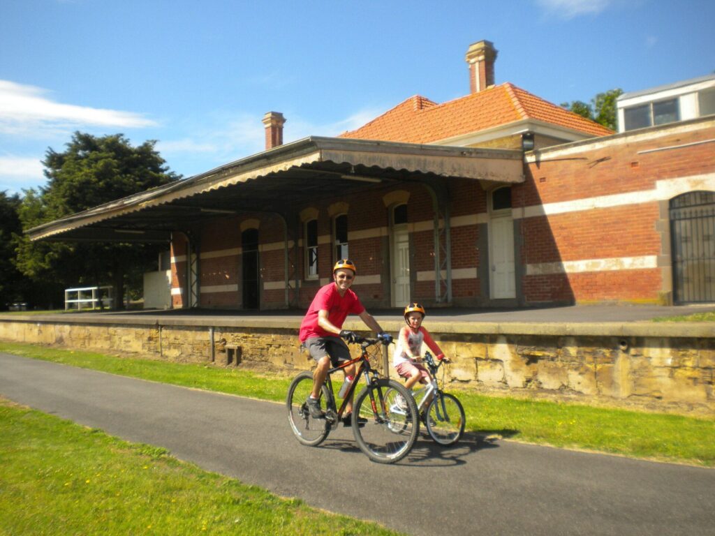
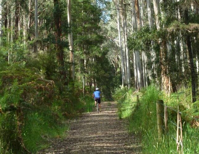
- After Merretts Rd, there is a scenic section through dense bush along Limestone Creek that still has some rails and sleepers in place
- Five low-level bridges were built by volunteers across the creek to bypass the rotting originals. The first two, #11 and #12, have been replaced with galvanised steel ones and two more are due to be done in 2024. In the meantime, the trail is narrow and muddy in parts after heavy rain. Some people may prefer to avoid this section
- It has very high conservation values. The giant yellow-bellied glider possum, white goshawks and Powerful Owls live here. Wallabies, kangaroos and koalas are commonly seen along the trail. Rare plants, including lime ferns, are another highlight.
- It is only suitable for walkers and mountain bike riders and can be difficult in winter
Horses are not permitted on the section from Bridges 11 to 15, which are after Merretts Rd
Cyclists are strongly advised to dismount for the three low-level bridges and their approaches, especially in winter
Curdies River to Timboon (5km)
- Parking is available near the old platform on the southern side of the trestle bridge. There is a station shed and trail maps may be available there.
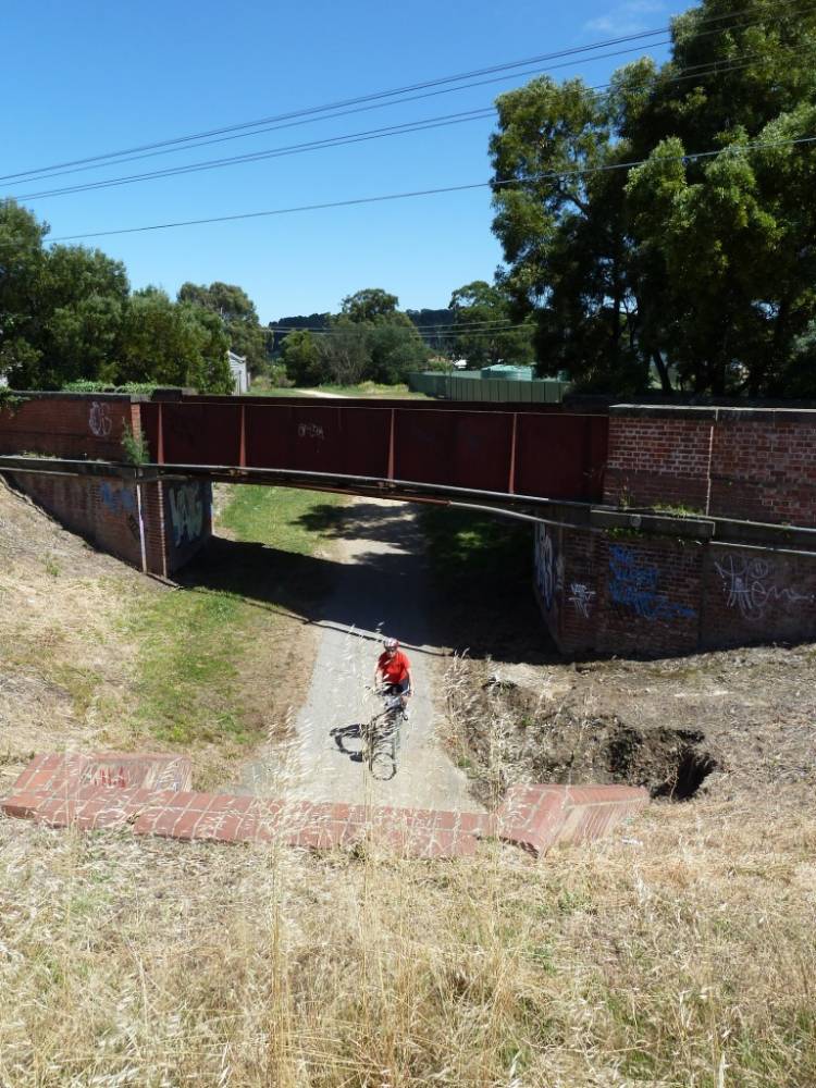
- The bridge has undergone restoration but the decking can be very slippery in winter. From here, the trail passes through bush and farmland to the Timboon railyard, where the station office remains in place. Conveniences are around the corner to the left, in Bailey St
- This town is a bit of a surprise, with numerous shops and cafes for provisions and meals, a supermarket, ice creamery, berry farm and cheese factories. A boutique whiskey distillery has been established in the old goods shed, with meals also available there
Connecting Trails
- There’s a 4km walking/running trail in Cobden called Circuit de Savage. It runs along Bond, Grayland and Neylon streets and has solar lighting for time-poor walkers and runners
- The 20km Twelve Apostles Trail from Timboon to Port Campbell is complete. You can walk as far as Port Campbell via a swing bridge or ride into town on a new shared path alongside the Great Ocean Road. Both offer great views
![The recommended route from Camperdown has views but is hilly [2010]](https://www.railtrails.org.au/wp-content/uploads/2021/11/V64-106-Naroghid-2010-11-9127-300x200.jpg)
The recommended route from Camperdown has views but is hilly [2010]
![Lake Bullen Merri has picnic and bathroom facilities [2023]](https://www.railtrails.org.au/wp-content/uploads/2020/11/V64-100-Naroghid-Lake-Bullen-Merri-has-picnic-and-bathroom-facilities-near-the-start-of-the-rail-trail-proper-2023-300x225.jpg)
Lake Bullen Merri has picnic and bathroom facilities [2023]
![Car park at start of rail trail proper on Naroghid Rd [Norm Appleby 2012]](https://www.railtrails.org.au/wp-content/uploads/2021/11/V64-107-Naroghid-2012-05-0256-300x225.jpg)
Car park at start of rail trail proper on Naroghid Rd [Norm Appleby 2012]
![Basically Bushwalking Club relaxing at the replica station shelter [2012]](https://www.railtrails.org.au/wp-content/uploads/2021/11/V64-107-Naroghid-2012-05-1295-300x168.jpg)
Basically Bushwalking Club relaxing at the replica station shelter [2012]
![Local residents take a keen interest in the rail trail users [2023]](https://www.railtrails.org.au/wp-content/uploads/2020/11/V64-100-Naroghid-Local-residents-take-a-keen-interest-in-people-using-the-rail-trail-2023-300x225.jpg)
Local residents take a keen interest in the rail trail users [2023]
![Walking among the trees between Naroghid and Cobden [2012]](https://www.railtrails.org.au/wp-content/uploads/2021/11/V64-107-Naroghid-to-Cobden-2012-05-1287-300x168.jpg)
Walking among the trees between Naroghid and Cobden [2012]
![Trail at Cobden crosses the golf course [Andrew Lecky, 2019]](https://www.railtrails.org.au/wp-content/uploads/2021/11/V64-158-Cobden-Golf-Course-2019-05-3-300x169.jpg)
Trail at Cobden crosses the golf course [Andrew Lecky, 2019]
![The Cobden dairy factory overlooks part of the trail [Norm Appleby 2012]](https://www.railtrails.org.au/wp-content/uploads/2021/11/V64-157-Cobden-2012-05-0287-300x225.jpg)
The Cobden dairy factory overlooks part of the trail [Norm Appleby 2012]
![The Glenfyn Public Hall has picnic and barbeque facilities [2023]](https://www.railtrails.org.au/wp-content/uploads/2020/11/V64-200-Glenfyne-Public-Hall-acts-as-a-trail-hub-but-park-outside-the-gate-in-winter-2023-300x151.jpg)
The Glenfyn Public Hall has picnic and barbeque facilities [2023]
![Riding from Glenfyne to Merretts Rd, before things get exciting [2010]](https://www.railtrails.org.au/wp-content/uploads/2021/11/V64-207-Glenfyne-to-Limestone-Creek-2010-11-9020-300x200.jpg)
Riding from Glenfyne to Merretts Rd, before things get exciting [2010]
![The five, low-level Limestone Creek bridges are being replaced [2013]](https://www.railtrails.org.au/wp-content/uploads/2021/11/V64-209-Limestone-Creek-2013-0247-300x200.jpg)
The five, low-level Limestone Creek bridges are being replaced [2013]
![Bridge difficulties are outweighed by the scenery [Alex Thompson 2013]](https://www.railtrails.org.au/wp-content/uploads/2021/11/V64-209-Limestone-Creek-2013-0237-200x300.jpg)
Bridge difficulties are outweighed by the scenery [Alex Thompson 2013]
![Limestone Creek area still has rails and sleepers [Andrew Lecky 2019]](https://www.railtrails.org.au/wp-content/uploads/2021/11/V64-210-Limestone-Creek-2019-05-3-300x169.jpg)
Limestone Creek area still has rails and sleepers [Andrew Lecky 2019]
![The Timboon Trestle Bridge over Curdies River is a real feature [2010]](https://www.railtrails.org.au/wp-content/uploads/2021/11/V64-265-Curdies-River-Bridge-opening-2010-11-8942-300x200.jpg)
The Timboon Trestle Bridge over Curdies River is a real feature [2010]
![The river rose over 6m in 2010 and was of great interest [Thais Hardmann]](https://www.railtrails.org.au/wp-content/uploads/2021/11/V64-264-Curdies-Bridge-2010-08-Floods-and-Bridge-300x225.jpg)
The river rose over 6m in 2010 and was of great interest [Thais Hardmann]
![Enjoy the bush section between the trestle bridge and Timboon [2012]](https://www.railtrails.org.au/wp-content/uploads/2021/11/V64-266-Curdies-River-to-Timboon-2012-05-1325-300x168.jpg)
Enjoy the bush section between the trestle bridge and Timboon [2012]
![The Timboon Railway Station office awaits its next customer [2023]](https://www.railtrails.org.au/wp-content/uploads/2020/11/V64-300-Timboon-station-office-2023-300x225.jpg)
The Timboon Railway Station office awaits its next customer [2023]
![The former goods shed is now a distillery and foodies favourite [2007]](https://www.railtrails.org.au/wp-content/uploads/2021/11/V64-305-Timboon-2007-11-4841-300x225.jpg)
The former goods shed is now a distillery and foodies favourite [2007]
![The lookout above Port Campbell on the Twelve Apostles Trail [2023]](https://www.railtrails.org.au/wp-content/uploads/2020/11/V64-400-Port-Campbell-swing-bridge-from-lookout-above-Port-Campbell-Creek-2023-300x225.jpg)
The lookout above Port Campbell on the Twelve Apostles Trail [2023]
 Experience the Camperdown to Timboon Rail Trail by bike. We have Ebikes, Mountain bikes, children’s bikes as well as a child and pet seat available for hire. Bike transport and shuttle service is available for pick up and departure from anywhere along the trail. Gourmet Rail Trail Ride and back pack sandwich lunches also available. Also private gourmet tours for two to eight people to experience the 12 Apostles Artisans Trail and other local farm gate producers by luxury vehicle.

Do you know of a bike hire or transportation service on this rail trail that should appear here? If so, let us know at admin@railtrails.org.au.
Information and Links
The rail trail is managed by the Camperdown-Timboon Rail Trail Committee of Management. Contact the committee to report any maintenance issues.
- PO Box 140, Cobden, Vic 3266
- ct.railtrail@gmail.com
- 0447 139 639 or (03) 5593 1104 or contact the Corangamite Shire, (03) 5593 7100
Download an old brochure and map here (2.8MB) A new one is expected after the Twelve Apostles Trail is officially opened
Other sources of information
- Port Campbell Visitor Information Centre 1300 137 255
- Camperdown Court House Visitor Information Centre (03) 5593 3144
Contact Rail Trails Australia
To contact us about this rail trail, email vic@railtrails.org.au
Background Information
Traditional owners
We acknowledge the Giraiwurung people, the traditional custodians of the land and waterways over which the rail trail runs.
Development and future of the trail
A major upgrade of the trail has been made possible by significant funding from BHP Billiton. The Curdies River Trestle Bridge was restored with funding from DSE and Heritage Victoria.
Corangamite Shire received $4.5 million from the Victorian Government in 2020 to build the Twelve Apostles Trail shared path to Port Campbell … more than a century after the Government Railway Standing Committee knocked back a submission to extend the railway there from Timboon
Railway history
The railway to Timboon opened in April, 1892, after three years of construction. It carried timber, lime and, later, farm produce (hops and apples) as well as passengers. Eighteen sawmills operated in the area processing thousands of tonnes of timber each year. There were also limeworks, of which one remains near Timboon. The line was closed in 1986.
Many original features remain along the line, including brick culverts and remnants of many bridges. The Curdies River bridge is listed with Heritage Victoria.
New accommodation option planned for Camperdown to Timboon Rail Trail
Posted: 27/01/24
Exciting news for people wanting to stay a while and take in the views and ...
More...Extension of the Camperdown Timboon Rail Trail south to Port Campbell
Posted: 24/08/23
The 12 Apostles Trail is scheduled for completion this November. This trail extends the current 38km ...
More...Camperdown to Timboon Rail trail bridges replaced ahead of schedule
Posted: 24/10/22
The Camperdown to Timboon Rail Trail is open again after two bridges were replaced earlier ...
More...Final Management Plan for Camperdown to Timboon Rail Trail
Posted: 07/09/20
The Camperdown to Timboon Rail Trail Management Committee last month finalised the management plan for ...
More...Draft Management Plan for Camperdown to Timboon Rail Trail
Posted: 16/06/20
The Camperdown to Timboon Rail Trail Management Committee have drafted a management plan for the ...
More...Funding announced for Camperdown to Timboon trail.
Posted: 17/07/13
Minister for transport, Terry Mulder announcing the funding, accompanied ...
More...Camperdown to Timboon Railtrail Update (VIC)
Posted: 27/06/10
Volunteers celebrate the completion of a job well done. 19 ...
More...Nearby Trails

Old Beechy Rail Trail
Otway Ranges, 152 km south west of Melbourne
37 km


Port Fairy Rail Trail
260km south west of Melbourne
38 km


Tiger Rail Trail
136 km south west of Melbourne
4.4 km
Ballarat-Skipton Rail Trail
110km north west of Melbourne
57 km
The Bunny Trail
110 km west of Melbourne
1.0 km
Fyansford Rail Trail
North Geelong, 5 km from town centre
4.4 km
Nearby Trails
Old Beechy Rail Trail
Otway Ranges, 152 km south west of Melbourne
37 km
Port Fairy Rail Trail
260km south west of Melbourne
38 km
Tiger Rail Trail
136 km south west of Melbourne
4.4 km
Ballarat-Skipton Rail Trail
110km north west of Melbourne
57 km
The Bunny Trail
110 km west of Melbourne
1.0 km
Fyansford Rail Trail
North Geelong, 5 km from town centre
4.4 km
29 reviews of “Camperdown-Timboon Rail Trail”
I rode the Camperdown-Port Campbell 50km (start at N trailhead on Naroghid Rd) on 16-17'2'24 with a mate (we're 72y olds). I support the recommendation that an MTB or gravel bike with 2.1' or wider tyres is appropriate here, for the better suspension that 40psi tyres give over twigs and lumpy gravel. My rigid flatbar with 700c x 35mm tyres would have managed the trip, but 55psi tyres would have made it a bit bumpier. Days were roughly 7hrs out, with breaks; and I managed a 16.3kmh av speed on day 2 (d.1 similar). Temp was around 23-25 deg C both days. A S'ly on day 2 saw us ride paved roads on 2 occassions totaling perhaps 15km; with straighter, easier rolling conditions a treat, and lightish traffic on a Sat. The twin volcanic lakes about 3km SW of Camperdown were impressive and the lookout there (go thru the caravan park) had views for perhaps 30km to the W & N to several other volanic mounts. There's 11km (of 41km listed as RT) on-road out of Camperdown, which we just drove; with the trail head start off the SW corner of the southern volcanic crater. With 1.5km detours into Cobden (has a bakery and 2nd newish community cafe, & pub with $90 accom), we clocked 55km outbound, and 59km return (15km on-road, diverging from RT alignment). We stayed at a hostel in Port Campbell, in a 6 bed dorm room which we shared with a snorer; luck of the draw. The 6 old trestle bridges are in about a 10km stretch just N of Timboon, which resembles rain forest and you often ride in a tunnel of trees. On 2 occassions, I startled a wallaby within about 10m of me on the trail. On the seaward side of Port Campbel you can view rugged coastline to the east from the cliff top, and watch surf coming in over reefs. The transition in Timboon from the rail trail to the 12 Apostles 20km trail was pretty seamless; hint its on the west bank of the creek. We visited an organic creamery (excellent walnut coffee scroll with whipped cream), an ice bream shop, 2 cafes, and had a pub dinner of snapper in Port Campbell. Outbound, just N of Cobden, we hit a golf course (on a weekday) and just rode across it on a shadow track. You could take a right turn (W) here (N side gold course) on a well made shared walking pavement if the golfers look busy. Three pubs in Port Campbell seemed the main sources of food. Google maps shows 3 cafe-bars in a block on Lord St, which we didn't explore; and I didn't spot a supermarket. The 50km combined trail works well, traverses varied countryside, and we had an enjyable time riding it.
Great trail, just did the sections that were on the rail reserve and stopped when we got to the second tresselnbridge on the Cobden side, then drove to Timboon and rode from the other end. We also did the new trailbfrom Timboon to Port Campbell. Great trailscand well worth doimg
Camperdown – Timboon Rail Trail (+ Port Campbell)
We started in Camperdown and the first 10km to Naroghid is on quiet rural roads. It is a little exposed as you ride through open pastoral land.
Once you hit the Rail Trail ‘proper’ at Naroghid the trail is quite picturesque as you travel through fairly flat cattle country and the trail itself is shaded in most parts.
The surface is good however there was a lot of leaf litter with sticks and twigs.
Cobden has a few food/coffee options. Pretty quiet on Sunday.
The section about 10km north and 4-5 km south of Timboon is particularly beautiful.
Lots of old trestle bridges and in parts you may have to walk to negotiate getting down and around them.
Timboon has good food/coffee options.
The bike trail from Timboon to Port Campbell is excellent(20km total)
The surface is wide and well compacted.
It runs beside quiet rural roads.
The trails takes you through mainly open grazing farmland and the majority of the trail is tree lined.
Most of the trees are on the east side of the trail which provided some good sun protection in the morning but it is more exposed in the afternoon.
The trail is well sign posted however the only thing missing were ‘distance markers’ which are sometimes handy.
The last 1.5km into Port Campbell is in the process of being completed (next couple of weeks) and when this is finished you wont be on the road at all.
There is basically nothing between Timboon and Port Campbell in terms of toilets/food options.
Overall I would say the trail is best suited to bikes with reasonably wide tyres (MTB/Hybrid & Gravel).
Total trip for us was 68km by the time we detoured into Cobden and around Timboon. Make sure you take Repair kit etc. because there are no bike shops in the area, other than Camperdown.
I enjoyed exploring this rail trail between Timboon and Cobden, which has a section which requires bypassing five wooden trestle bridges, which have seen better days.
Thankfully smaller have been developed, making it an easy crossing, allowing you to admire the old trestles. The restored, larger former Curdies River Bridge can be cycled over. Outside of the bridges sections, most of the time the trail passes through tree lined areas, which in spring has many flowers to admire and magpies to be aware of.
Rode Cobden to Timboon and back four days ago on a gravel bike. Wow! If you want to pootle along singin' a song, this is not for you. This is an adventure ride with five hike-a-bike river crossings a kilometre before the main Curdies River trestle. Sure, there's debris on the trail, bark, twigs and small branches, but the surroundings are endlessly attractive. All this makes it a ride that needs you to make an effort and have your wits about you. There's plenty of technical stuff to negotiate, but isn't that half the fun of being aboard your two-wheeled steed? We need variety in our rail trails, and this one's a beauty.
Hi Leigh, if you are up for another adventure, check out the Hamilton to Coleraine RT. Two 11km sections with a track inbetween. Completely different scenery at either end. Take a spare tube! A lovely outing nonetheless.
A group of 38 cyclists rode this trail from Camperdown to Timboon and then on to Port Campbell along the (almost completed) Twelve Apostles Trail. It was a wonderful experience except for the poor condition of the rail trail in the 5km leading up to Timboon. While two of the low-level bridges had been replaced, some were in a very poor state. Also, some of the trail is almost impossible to ride due to the condition of the surface. The rest of the rail trail is fantastic, traversing forests and open dairy-farming country. There are several fantastic places to stop for a meal and/or drink in Camperdown, Cobden and Timboon. The connecting path to Port Campbell opens up further experiences of a beautiful sea-side town with excellent accommodation, restaurants, pubs and the beach. There are also easy rides to the Twelve Apostles and Loch Ard Gorge and cliff top walks giving majestic views over the ocean. When the rail trail has been fully restored, it will be a magnificent attraction for cycle tourism in the area.
Ridden 24 Dec 2022, fine weather, 22c, light winds, dry surface.
Rode Cobden to Timboon. Reasonable compacted aggregate to forest floor surface, the latter will be problematic if wet. Plenty of forest litter (sticks etc) to contend with. Suitable for basic to intermediate rider on MTB/eMTB, or intermediate rider on thinner tyres. Around the trestle bridges (closed, not passable), the track collapses to single track, with a few steep short descents and pinch climbs from the bike bridges. Recommend ’hike-a-bike’ for these short sections. No water or other services on the 26kms from Cobden to Timboon—more than half in good shade though. A few main (C) country roads to cross—so don’t let smaller children get too far ahead. Ice Creamery at Timboon is great!
In serious need of maintenance, a lot of debris, poor surfaces, poorly maintained and monitored for hazards. Chicanes are very tight even with a standard bicycle. Difficult to follow in places and lack of cafe/food options along route. Been there, done that, next.
Last Saturday, on a club ride four riders set up from Camperdown to Port Campbell, on that day it was partially raining with cloudy skies.
We found that the trail is in sorely need of maintenance as in same parts the trail is poorly defined, the trestle bridges have been discontinued for safety reasons and the alternative routes are dangerous to navigate. In some parts the rails limit the trail width and some sleepers are clearly visible making cycling difficult.
The bridge over Curdies river has been decked with timber planks, I think that these planks ooze a fair amount of oil and when combined with rain the oil emulsifies creating a very slippery surface.
Two of our four rides fell down on that bridge and the recommendation that can be used by horse riding; prams; scooters and In Line skates is totally misleading and dangerous.
The signage regarding safety issues is poor and ad-hoc.
We used touring bikes with 40 mm tyres.
Hi Ruben, thanks for your comments and I am sorry to hear about this incident. The Committee of Management inform me that it has looked at alternatives to the Curdies River bridgebut has not come to any affordable or achievable solution regarding the slippery surface in winter and expects that most people would dismount from their bikes and walk across the bridge in wet Winter conditions. The Committee will consider installing signs indicating it is slippery when wet.
The Committee of Management is in the process of replacing 2 of the 5 bypass bridges between Cobden and Timboon and areawaiting construction within the next month (weather permitting). Unfortunately they do not have sufficient funding at this time to replace the other 3 and is seriously considering closing the Rail Trail in this section because of safety concerns. The Committee is also seeking to engage with DELWP to widen the approaches to some of the bypass bridges and upgrade the surface.
Rail Trails Australia will add some words to our website trail description to note that horse riding is prohibited on some sections of this rail trail and remove the reference to scooters and in Line skates.
To Darren McClelland. Re. The bridge over Curdies river being slippery when wet. It may be possible to lay chicken wire over the planks, secured with 2-3cm long brads (u-shaped fasteners). There's a bike path bridge over Merri Creek in Northcote (Melb) in a shady area, and this works a treat to give bike wheels traction in what would otherwise be dodgy slippery conditions. Chicken wire is inexpensive.
Yesterday we rode the rail trail on hybrid bikes with panniers from Camperdown to Timboon. It was muddy and slippery for that 5 km section but well worth dismounting where advised, as it was scenic and fun. Much of the Timboon to Port Campbell trail has now been completed, just watch the cow crossings…
Very scenic easy trail. Trestle bridges are at the Timboon end. After the large bridge at Curdies River there are short sections where you will need to walk due to narrow steep trail on the diversions around 3 other disused trestle bridges. In wet weather these sections could be very muddy and slippery. Easily passable in dry weather. Great shelter at Glenfyne hall but no toilets open.
Today I cycled the main part of the trail (Naroghid to Timboon). The 5 km section between Glenfyne and Curdies is stunning! The whole trail is a bit rough and an effort to ride, but that spectacular 5 km section makes it worthwhile. Lush forest and several dilapidated and overgrown trestle bridges that are so beautiful. The rail tracks that are still present are pretty cool – they have covered the sleepers enough that it's not too bad to ride over. I'll be back. For reference I rode a gravel bike with 38mm tyres and it was ok, although not easy. It would have been more comfortable on a mountain bike, but definitely doable on a gravel bike. I wouldn't do it after lots of rain.
A group of 21 riders rode the trail from Naroghid car park to Timboon and onto Port Campbell, returning the next day. 15/16 December 2021.
The track was in great condition, thanks to Pat Robinson and her band of volunteers.
We arranged with Pat to have the Glenfyne Hall open for a quick chat and rest stop. She provided us with a fantastic morning tea (donation willingly given) and then told us of some of the history and politics of creating and maintaining the track.
The section near the Curdies River did require us to get off and walk a few times but generally it was clear sailing.
We sampled the finished part of the extension to Port Campbell. Great. Cannot wait until the rest is finished to Port Campbell.
Thanks Timboon Rail Trail volunteers.
Brian Harrison , Ballarat U3A
Great ride from Camperdown to Timboon, rode on mountain bikes with 2 young teenagers and would highly recommend. The track is in very good condition and relatively easy with some nice bits of single track.
I found this trail challenging but ultimately exhilarating. We rode Camperdown to Timboon (and then on to Warrnambool by quiet roads before riding the Warrnambool- Port Fairy Rail Trail). The hills out of Camperdown are definitely steep and this section is on the road, but views of the volcanic plains below kept us going on the way up, and effort felt well rewarded by glorious crater lakes and circling eagles at the top. The first section aligned with the rail trail was lovely, though the section after Cobden was a slog – the trail surface demanded continual attention. Would be great to see some track improvement here. The section after Merretts Road comprises a narrow trail through dense forest with numerous creek crossings as bridges are derelict and covered in plants and mosses. We loved wheeling our bikes through (and carefully riding the straighter sections) – though I’d probably be wary of it after rain. For me, the highlights considerably outweigh the annoyances so I’d strongly recommend to folks up for a little adventure. I look forward to seeing the proposed extension – crater to coast is a great concept.
I wouldn't bother with the Camperdown Timboon RT. For starters, there's no directions from C'down to the start of the RT which is some 5kms from town. Second, the Trail itself is in woeful condition. Corrugated, rough, strewn with detritus from fallen limbs and leaves, narrow and quite, tough to actually ride. Trail signage is also poor, and the section through the gully on the Cobden Golf Course, is very scary! Surely, some funding could be found to put the trail on the old, trestle bridge that's across the gully?
I lasted for about 18kms, found the main road, and felt far, more comfortable and SAFE on the h'way on my way back to my car.
An entirely, forgettable experience!
Geoff, we rode it 10 days after you and found it in good condition.
January 2020 I caught the train to Camperdown to do this and spend a day or two in Timboon. The start unfortunately takes you up and over one of the highest hills in the area, not what you expect on a Rail Trail. It passes a caravan park near the top where I camped and can recommend. Further on the signs direct you to cycle on a minor road but still shared by large Double B milk tankers so I would be careful if you had children with you. Once you get to the car park of the “proper” rail trail its a wonderful bush path that I highly recommend. The derelict bridges lead off down narrow paths to cross creeks a bit of adventure. Timboon turned out to be a quiet paradise so I stayed for 2 weeks enjoying the free camping at the footy ground, pub, library, swimming pool and general vibe.
14/27. Victoria’s lovely autumnal weather turned to crappy winter just in time for us to do the Camperdown to Timboon rail trail, aka Crater to Coast (although I didn’t see a crater, and it doesn’t get to the coast). Squally headwinds and cold rain punctuated this ride through mainly flat farmland. We started at Naroghid Rd, which is a fair distance from Camperdown itself.
The highlight of the trail was also the hardest part after Merretts Rd, where we had to dismount get past several beautiful derelict trestle bridges. Stunning scenery along there but too rough for riding, so discretion was the better part of valour.
The trail is NOT closed between Cobden and Glenfyne as per the Railtrails.org.au website notes.
Late lunch at the very nice Timboon Railway Shed Distillery afterwards.
This is my 14th trail since Jan 1, so I’m now over halfway on my challenge to ride all 27 railtrails in Victoria this year to promote organ donation. You can follow my rail trail exploits on FB Warwick Duncan – The 2nd Chance Man or Insta @warwick_rides.
I rode this rail trail last week. It was pretty windy and cold but the tress protected us from the wind. We rode over 2 days as we didn’t have another car to car shuffle so had to retrace our steps. I loved it – the last section to Timboon was fun – although I got of for a few steep bits. It was beautiful land easy riding and interesting with all the historical signs. We ate at the Cobden Bakery and the Timboon one too, which broke it up. I would definitely recommend this trail – riding through remnant bush surrounded by dairy farms is pretty special. If you are into cycling and in the area – give it a try. It felt like a real adventure.
We rode the trail on 21 of November 2015 and we thoroughly enjoyed our ride. The overall route was very scenic and the section from Glenfyne to Timboon trestle was fantastic. Although technical in some sections, it is still easy if you take it slow, it is highly recommended as the scenery was amazing with 5-6 old trestle bridges on the route and also the natural bush made for great photo opportunities. As a railway enthusiast, I found this section where the line remained was very nostalgic, adding to the experience of what the railway once was like in this picturesque area. Also being able to ride over the final and most impressive trestle at Timboon was great. We had lunch at the Distillery in Timboon, the food was fantastic and the atmosphere made for a very enjoyable finish to our ride. Great work to all persons involved in maintaining this trail.
Bird lovers beware!! This Rail Trail has everything needed to seriously slow you down. Last week my wife and I took over an hour to ride the 5kms from Timboon to the fabulously re-decked bridge over the Curdies River. It is bird-heaven. Perhaps the fact that Timboon had 17mm of rain during the previous night meant the bush was fresh and there were lots of pickings for birds. We must have stopped 20 or more times to enjoy the birds in what is a most picturesque setting.
The only reason I haven’t rated this RT with 5 stars was because of the last km or so leading into Cobden where long grass was a disappointing end to our ride up from Timboon. On the return trip we skipped this bit and used the highway until we met the RT again.
Following advice from a Timboon resident, we camped overnight behind the Timboon Distillery at the start of the RT. Whilst this is not a designated camp site, it never-the-less would be a fantastic place for the Timboon community to establish an area for the likes of us who are out to ride every RT in Victoria. Such a beautiful little town but alas nowhere to camp, spend money in the town and ride the fantastic RT to Camperdown and back.
Finally, congratulations to all responsible for the re-decking of the Curdies bridge (many of them volunteers) and for the trail as a whole.
Would-be-users: don’t be put off by the wording in the brochure telling of the “rough” 5km section immediately past Curdies River heading to Cobden. Yes it is a bit rough, but we did it easily on hybrid bikes, really loved the scenery and we are both over 65 !!
I rode the Camperdown to Timboon rail trail on November 12th 2014. This could be one of the best rail trails in Victoria with more maintenance. The views of the countryside are great, however you spend most of your time looking at the track to dodge branches and fine the best path. The trail between Merretts Rd and Curdies river should only be attempted only mountain bikes – the sleepers are still present and in places the earth covering them has been washed away and so it’s like riding over moguls – which is a shame, because this section is by far the best part of the whole trail. It is clear not many people use the trail – as I almost ran over a fox sunbathing in the middle of the trail.
The countryside is certainly beautiful, but I think this would be better described as a mountain bike trail. We rode from Camperdown, and the trail has not been maintained in good condition, very overgrown, and in one place a tree down across it with no way around. The trail along Limestone creek is very beautiful, with old wooden bridges, dense old forest and the lovely clear creek. The entire trail was littered with branches, very muddy in parts, and along the last half there were also a lot of tree roots, and the railway sleepers made the riding slow and dangerous. We were absolutely exhausted when we got to Timboon. I thought this would be easier than it was – for casual middle aged riders this was a very hard ride. We couldn’t face going back to Camperdown, the road trip was another 45 km and retracing our trip was too much for us to attempt. So luckily, we were able to arrange a taxi back to Camperdown that could take our bikes. Speaking to some locals in Camperdown, they were astonished that we had attempted the ride, and also said that the trail had been increasingly neglected over recent years. I feel lucky that we actually made it given our low level of skills at this type of riding. I’m concerned that the difficulties of this ride are not detailed anywhere. However we are really glad to have seen such beautiful country. Be warned though, it’s not like a leisurely well maintained trail e.g. Warburton, it is rough and very hard work.
April 7 2014 by Gaza
I rode this trail to Timboon on Monday 7 Apr 14. I did not ride the road as suggested but instead took the Cobden Road and turned right into Naroghid Road. It was there that I joined the Trail. I found the trail very good and only saw one other rider on the way down to Timboon. Around the Curdies area the trail got a bit slippery because of the tree roots protruding above the ground. I stayed in the Timboon Motel which I found to be basic but comfortable enough for one night. The Pub meal was very good and staff and patrons very friendly. It started to rain about 0530 on the Tuesday morning so I decided to get under way in the trip back to Camperdown. No other riders on the way back but I did stop and talk to Farmers. The farms in this area were very neat and cattle very healthy. On arrival back at Naroghid, the end of the trail, I decide to take the route described in the brochure and ride via Saddlers Road and Park Lane. I can now say that I do not recommend this route at all. It is very steep and especially at the end of a ride when you could be tired. Back in Camperdown the bakery in the main street was a great place for lunch before the journey home. Minor works needed in places but overall a very enjoyable return trip for a sixty plus gent.
We rode the timboon to Cobden section in early April 2013. This section was a return trip of 50km once you rode into township of Cobden which was at least 1 km off the main trail and rode up and down the shops. Public toilets at either end but none in between. We spoke to a local committee member who indicated there were plans for toilets in the next 12 months near Glenfyne half way between timboon and Cobden. Toilets at the distillery cafe at the timboon end which has excellent coffee and ice cream!
Despite the track being bumpy in parts ( mountain bike recommended although we did the ride ok on flat bar road bikes) we enjoyed the native bush especially either side of the section around the new bridge opened 2 years ago across Curdies River
Well done to all volunteers for their hard work over the years in planning and constructing the path