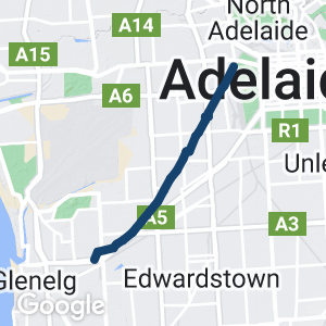
- an enjoyable flat ride from the City of Adelaide to the beachside suburbs
- well landscaped with significant recreation facilities close to the trail
- convenient and accessible, with ample parking
- provides good access to the beachside suburb of Glenelg by connecting with the Mike Turtur Rail Trail
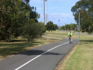
- well constructed and maintained, and well lit at night for most of its length
- crosses many streets, but most are quiet and occasional busy streets have controlled crossing points
Nearby Attractions
- convenient for access to the Sturt River Linear Park Trail and Mike Turtur Rail Trail
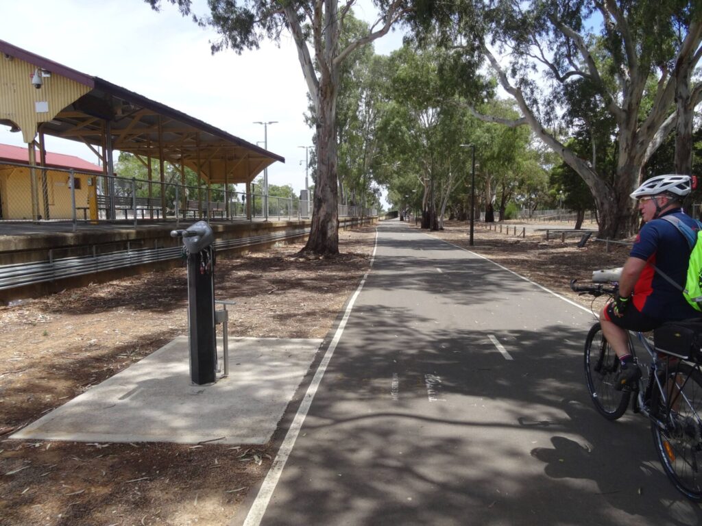
- recreation facilities, amenities and a cycle repair station on the trail
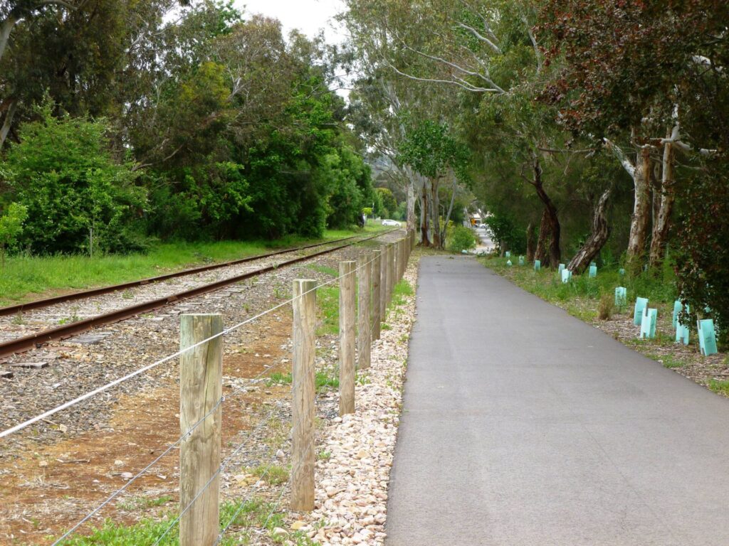
- a few remaining pieces of rail infrastructure
- popular with walkers and cyclists while providing commuter access to the city
- links with Adelaide City Parklands cycle trails (see a link to parklands trail map below)
Last updated: 22 July 2023
Overall description
The trail is divided into two sections; the first runs through inner metro areas and the second makes the most of a wider tree-lined rail corridor.
Section Guides
Adelaide to South Road (2 km)
- starts at Mile End Railway Station close to where the Holdfast Bay railway met the existing tracks from Adelaide Railway Station on North Tce
- runs besides busy James Congdon Dr, the original alignment of the railway line
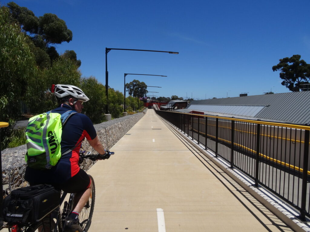
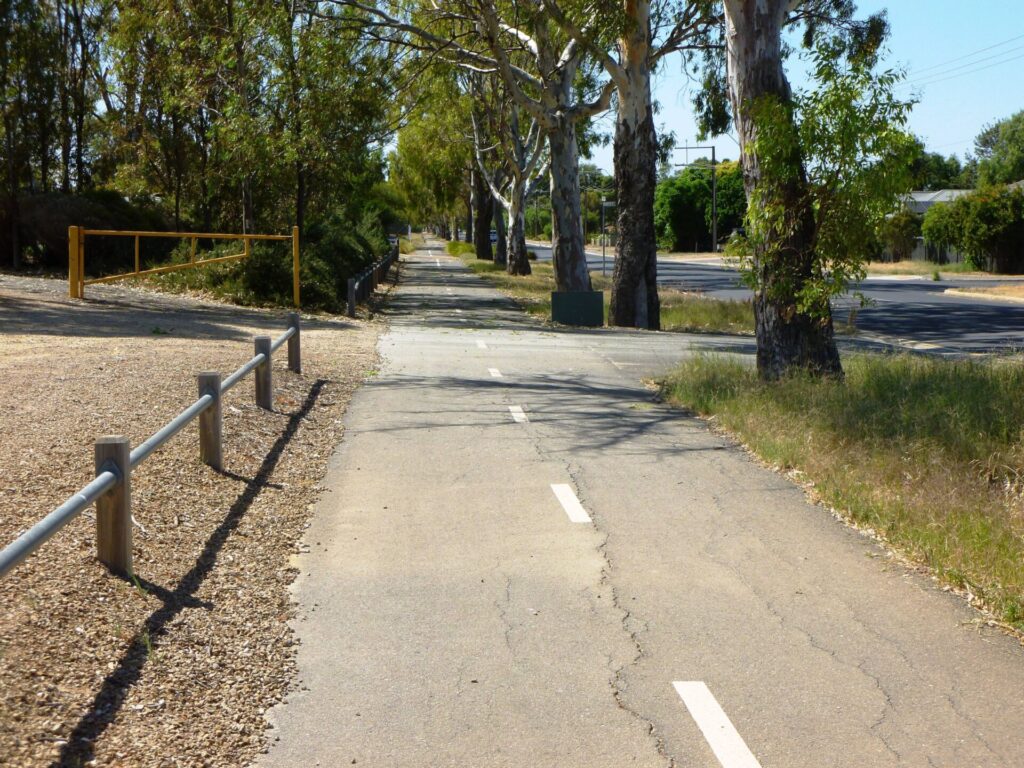
- the path is off-road, elevated and tree-lined
- after passing the SA Athletics Stadium on the left, the trail swings to the right and crosses Railway Tce and then James Congdon Dr at the traffic lights. The path continues for a short distance before crossing Sir Donald Bradman Dr at the traffic lights
- at the next set of traffic lights approaching South Rd, cross James Congdon Dr to the left, then turn right and proceed a short distance on the path to the pedestrian crossing and cross South Rd. The trail veers to the left; and once past the left turn slip lane you are on the Rail Trail
South Road to Anzac Highway (6 km)
- River Torrens Linear Park shared use path – Adelaide CBD
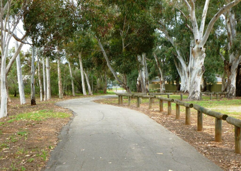
- follows the old railway line alignment and meanders along the landscaped rail reserve
- a bike repair station near the corner of Moss Ave and Tennyson St
- Wiegall Reserve on the left just past the Oval Tce roundabout has amenities and shelter
- as you approach Marion Rd, look for the remains of Plympton station platform to the right. There is a shelter and a cairn here
- Cross Marion Rd at the pedestrian crossing and continue southwest along the trail
- Cross Morphett Rd and pass Immanuel Primary School on your right just before entering Camden Oval in Morphettville
- follow the trail through the oval to a marked path beside Anzac Hwy. This is the last section of the original railway corridor; the remainder of the rail reserve has been used for housing and roadway
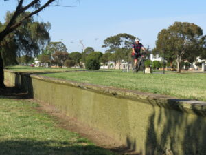
- Cross Anzac Hwy at the pedestrian crossing, turn right and then sharp left and follow the bike lane along the edge of the Sturt River culvert
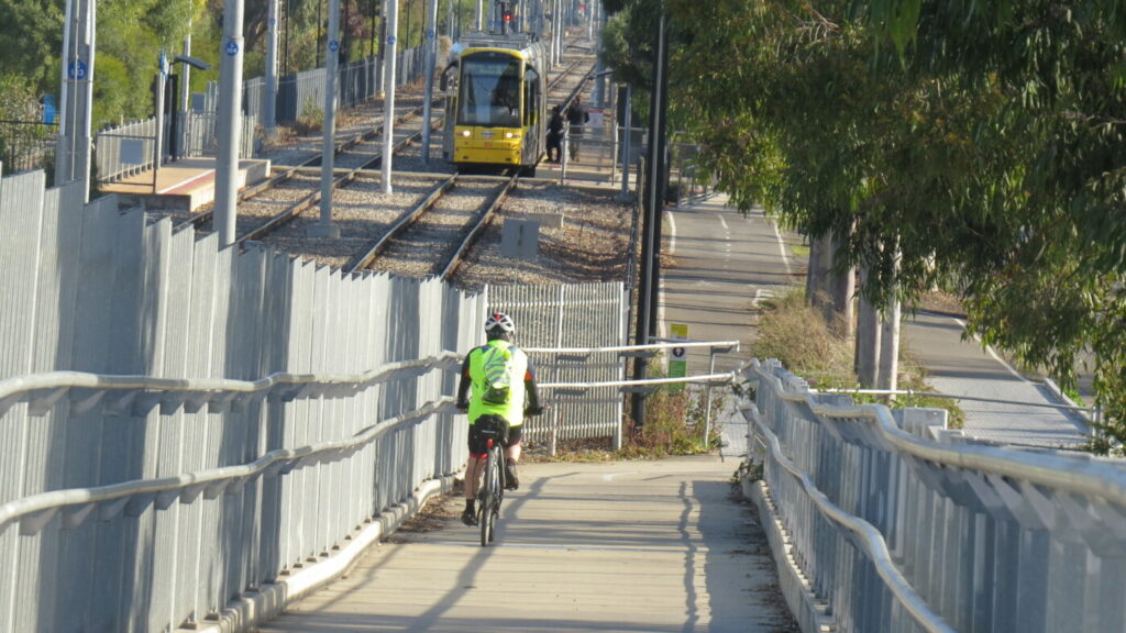
- cross the tram line and turn right on to Mike Turtur Bikeway – railside trail
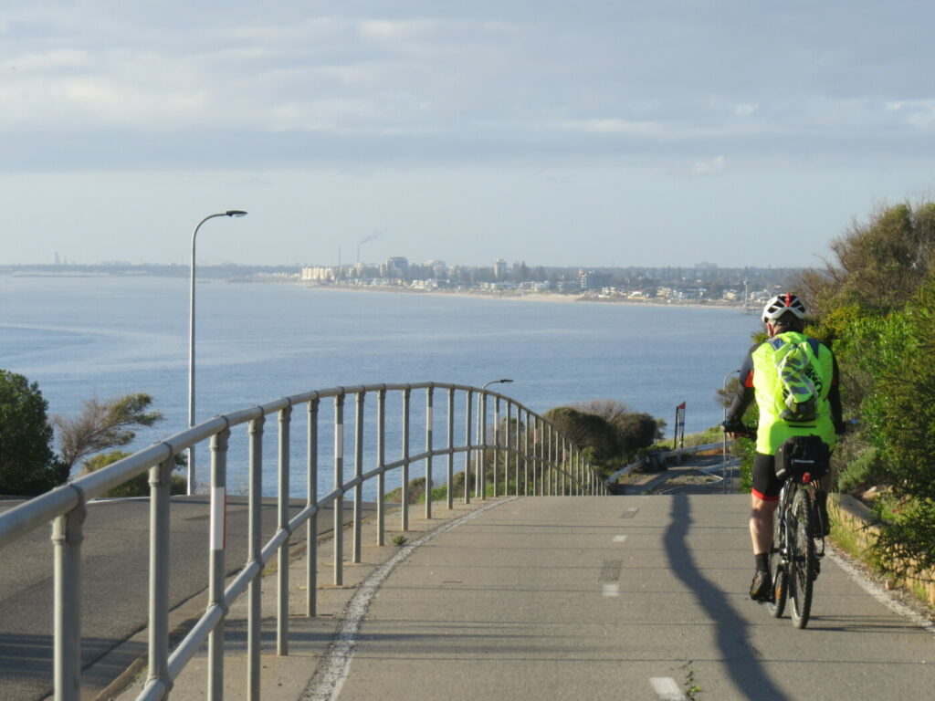
- Continue on the shared use path as it follows the tram line to Glenelg. Watch out for the giraffe beside the path
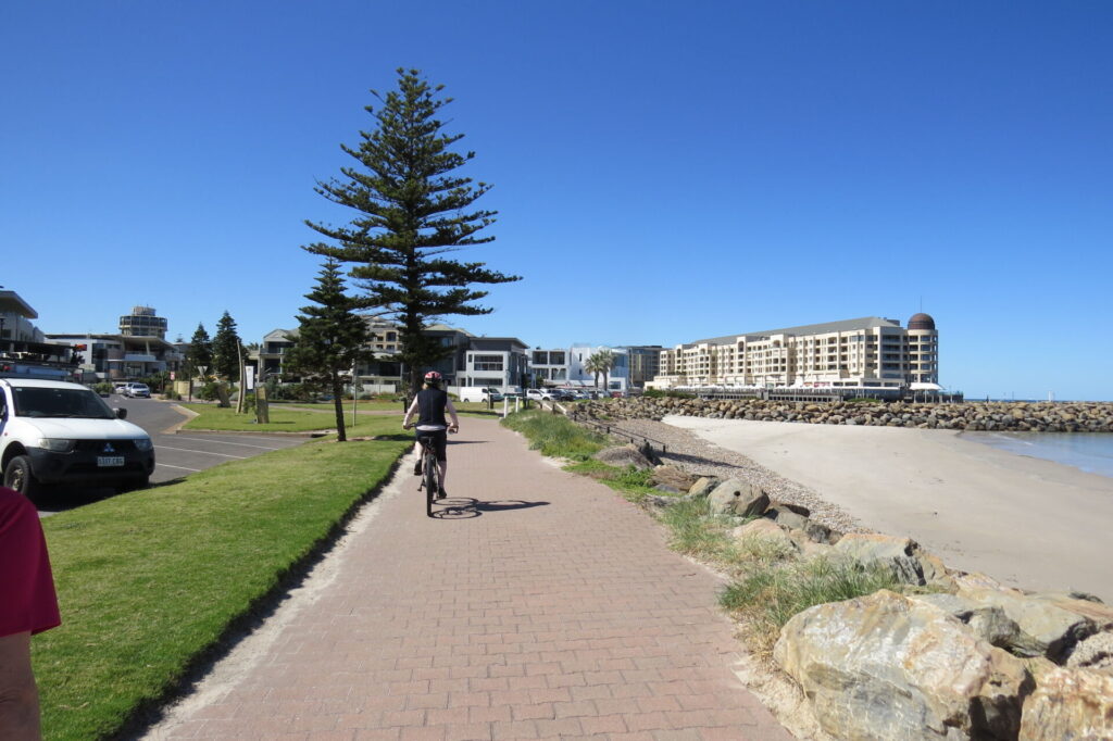
- The trail ends at Brighton Rd where you can use the pedestrian crossing to continue along Jetty Rd to the beach or if Jetty Rd is too busy, use Augusta St 200 m north
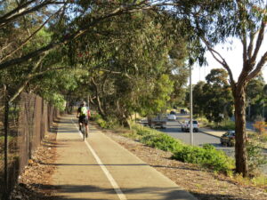
elevated trail along James Congden Drive - 2020

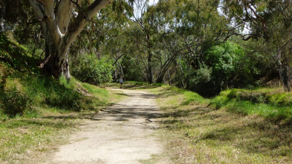
thick vegetation around the trail less than 1km from Adelaide - 2020
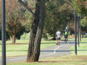
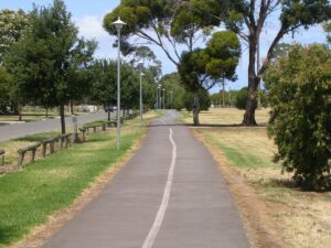
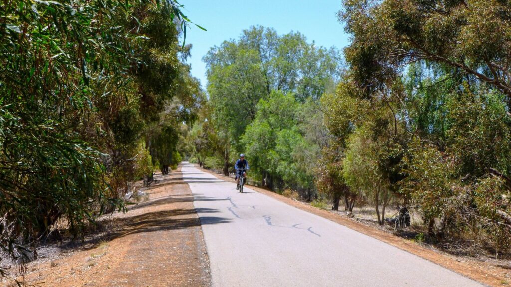
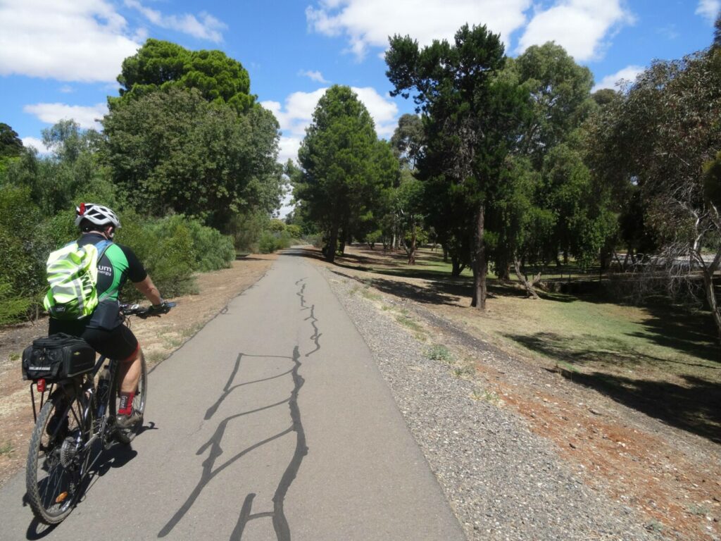
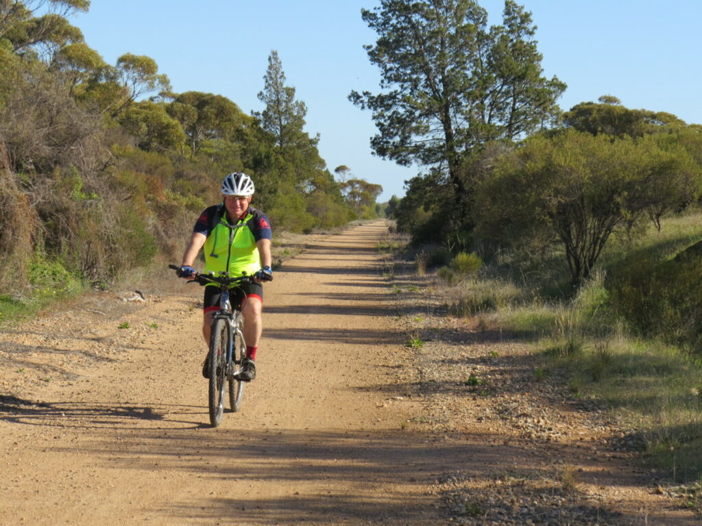
the trail meanders along the rail reserve 2020
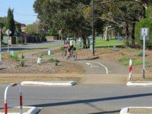
a typical crossing point at one of the minor roads - 2020
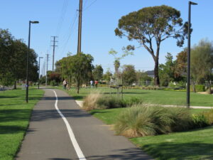
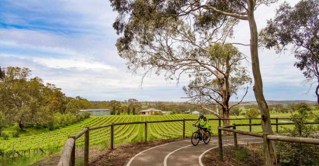
landscaped rail reserve near Wiegall Reserve - 2020
Glenelg to Adelaide (Nov 2011)
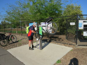
Moss Avenue bike repair station - 2020
Camden Station boarding platform near Marion Road 2020
Glenelg to Adelaide (2011)
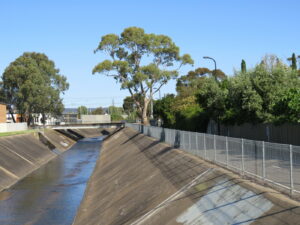
path along Sturt Creek. The bridge in the background in Mike Turtur rail trail 2020
Do you know of a bike hire or transportation service on this rail trail that should appear here? If so, let us know at admin@railtrails.org.au.
Information and Links
See Services tab above for links to services and businesses along this trail
For more information:
Glenelg Tourism Information – GlenelgSA
Glenelg Tourism Information – SADestinations
Adelaide City Council parklands trail map – Parklands Cycle Trails
To report problems contact
City of West Torrens 8416 6333 or csu@wtcc.sa.gov.au
Contact Rail Trails Australia
To contact us about this rail trail, email sa@railtrails.org.au
Background Information
Traditional owners
We acknowledge the Kaurna people, the traditional custodians of the land and waterways on which the rail trail is built.
Development and future of the rail trail
The trail has been fully developed, and links with the Adelaide City Parklands at its beginning and the River Sturt Linear Park Trail and Mike Turtur Rail Trail at its end. Council has continued to focus on developing and landscaping the wide railway corridor around the trail.
Railway history
The first railway from Adelaide to Glenelg opened in 1873 by the Adelaide, Glenelg, and Suburban Railway Company and ran from South Tce. Holdfast Bay Railway Company opened a competing line from North Tce to Glenelg (the Westside Bikeway alignment) seven years later. The companies amalgamated a few months later, and operated the railways until 1929 when the SA Government Municipal Tramways Trust took over both lines.
The Government proposed that both lines be converted from steam trains to electric trams and on the day electrification of the South Tce to Glenelg line (Mike Turtur Bikeway) was completed, the North Tce to Glenelg line (Westside Bikeway) closed. Minor works had been completed on the electrification of the North Tce to Glenelg line, but the onset of the Depression put an end to work and to the train line’s future. The South Tce to Glenelg line still operates as a tram line today. The two independent lines operated adjacent to each other, often at a loss, but today the lines support rail trails that join together halfway between Adelaide and Glenelg.
Westside Rail Trail Overpass to provide safety for cyclists
Posted: 22/07/23
The 10.5 km Torrens to Darlington upgrade of Main South Road in Adelaide will involve two ...
More...Nearby Trails
Mike Turtur Bikeway
Between Adelaide city and Glenelg
9 km


Coast Park Rail Trail
12 Km west of Adelaide CBD
34 km
Marino Rocks Rail Trail
Marino Rocks
16 km
Outer Harbour Rail Trail
Port Adelaide, 20km north west of Adelaide
23 km
Stockade Rail Trail
Pooraka, 11km north of Adelaide
2.6 km
Parafield Rail Trail
15km north of Adelaide
3 km
Coast to Vines Rail Trail
Southern Adelaide Suburbs
37 km

Penfield Rail Trail
Northern suburb of Adelaide
7 km
Mount Barker Rail Trail
33km southeast of Adelaide
5 km
Adelaide Hills Amy Gillett Rail Trail
Mount Lofty ranges, 49km east of Adelaide
16 km
Smithfield Magazine Rail Trail
Smithfield Plains, 33kms north of Adelaide
3.5 km
Barossa Rail Trail
Barossa Valley - between Gawler and Angaston
43 km
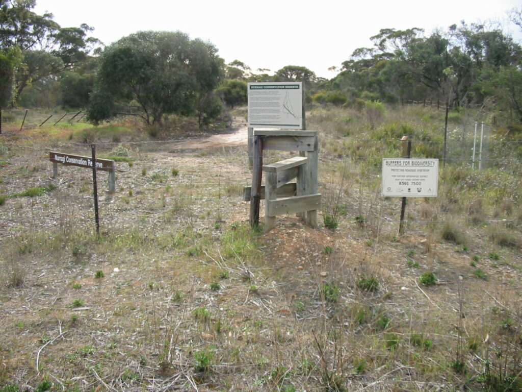
Nurragi Conservation Reserve
Milang approx 70km south east of Adelaide
12 km
Encounter Bikeway
Between Goolwa and Victor Harbour on the Fleurieu Peninsula 90km south of Adelaide
28 km
Kapunda Rail Trail
78km north of Adelaide
1 km
Eudunda Rail Trail
112km north of Adelaide
1 km
Copper Rail Trail
100km north of Adelaide
26 km
Riesling and Rattler Rail Trail
130km north of Adelaide
53 km
Shamus Liptrot Rail Trail
100km north of Adelaide
11 km

Nearby Trails
Mike Turtur Bikeway
Between Adelaide city and Glenelg
9 km
Coast Park Rail Trail
12 Km west of Adelaide CBD
34 km
Marino Rocks Rail Trail
Marino Rocks
16 km
Outer Harbour Rail Trail
Port Adelaide, 20km north west of Adelaide
23 km
Stockade Rail Trail
Pooraka, 11km north of Adelaide
2.6 km
Parafield Rail Trail
15km north of Adelaide
3 km
Coast to Vines Rail Trail
Southern Adelaide Suburbs
37 km
Penfield Rail Trail
Northern suburb of Adelaide
7 km
Mount Barker Rail Trail
33km southeast of Adelaide
5 km
Adelaide Hills Amy Gillett Rail Trail
Mount Lofty ranges, 49km east of Adelaide
16 km
Smithfield Magazine Rail Trail
Smithfield Plains, 33kms north of Adelaide
3.5 km
Barossa Rail Trail
Barossa Valley - between Gawler and Angaston
43 km
Nurragi Conservation Reserve
Milang approx 70km south east of Adelaide
12 km
Encounter Bikeway
Between Goolwa and Victor Harbour on the Fleurieu Peninsula 90km south of Adelaide
28 km
Kapunda Rail Trail
78km north of Adelaide
1 km
Eudunda Rail Trail
112km north of Adelaide
1 km
Copper Rail Trail
100km north of Adelaide
26 km
Riesling and Rattler Rail Trail
130km north of Adelaide
53 km
Shamus Liptrot Rail Trail
100km north of Adelaide
11 km
2 reviews of “Westside Bike Path”
I was on this trail today, and I would classify this as a trail for the surrounding communities rather than a journey trail. The trail surface is excellent and easy to follow, but there are a lot of road crossings, so many that it’s hard to get any speed up. Overall an okay trail, but not for tourists or trail riders.
I love rail trails, but I won’t be riding this one again. You have to stop every 100-200 metres to cross roads, or wait at lights and you are never far from the roads and cars. It finishes on Anzac Hwy, so you have to connect to the Mike Turter Bikeway if you want to get to Glenelg.
The Torrens River ride nearby is much better with less stopping and starting and much better scenery.