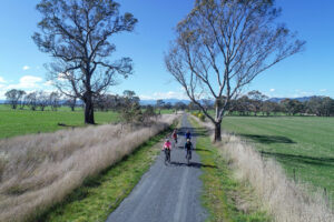
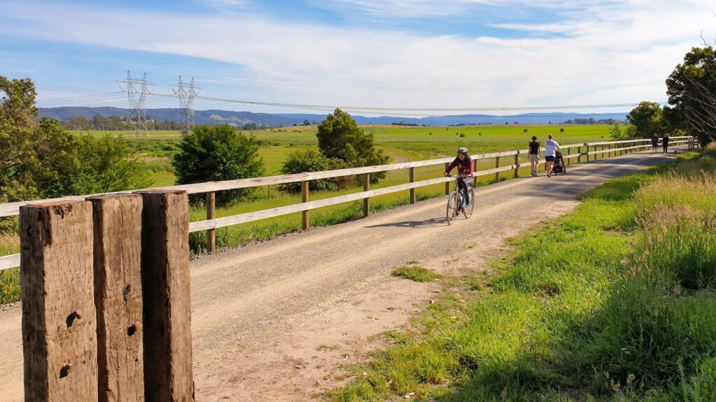
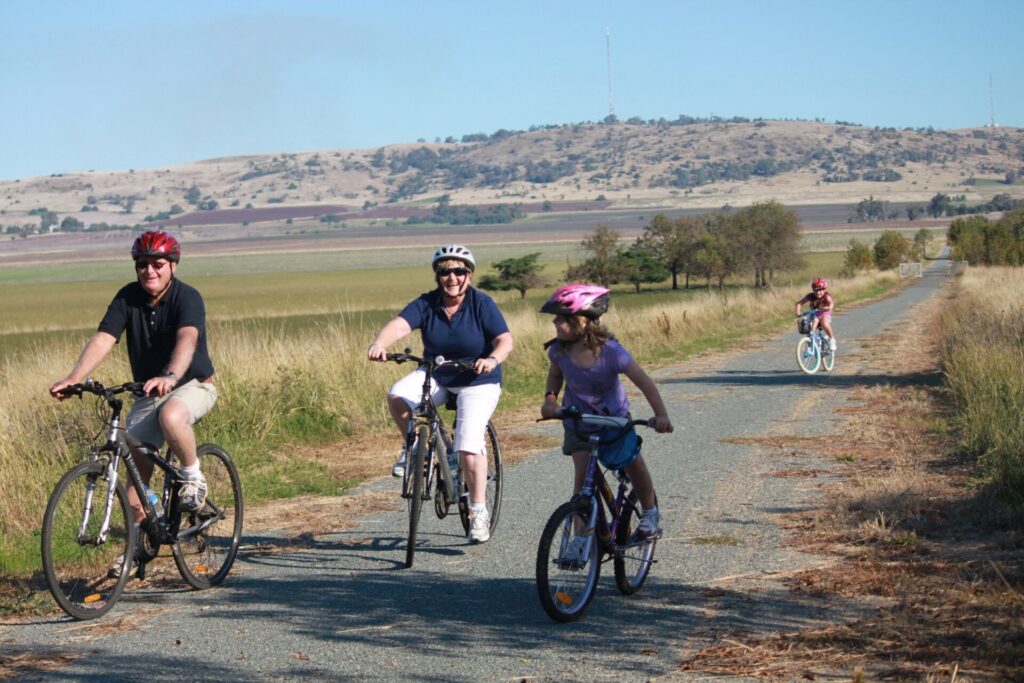
- Victoria’s longest rail trail traverses undulating farmland from the Goulburn River to the High Country at Mansfield
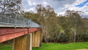
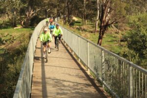
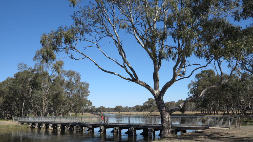
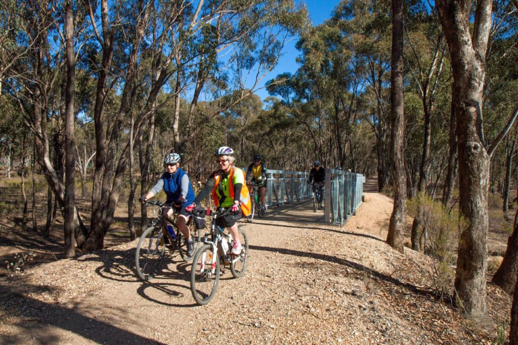
- A good standard trail with almost 5km of bridges from which to enjoy views; the few low-level crossings are easy
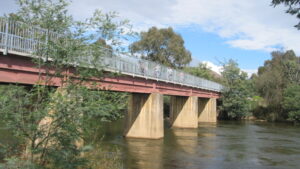
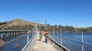
- Features the only tunnel on a rail trail in Victoria, and an impressive 385m bridge across Lake Eildon at Bonnie Doon
- Now has an art trail consisting of seven major and numerous minor art works
Nearby Attractions
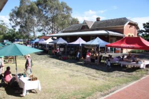
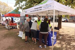
- Country markets in Yea, Tallarook, Alexandra, Yarck and Mansfield (monthly or bi-monthly)
- National Trust-listed Trawool Valley
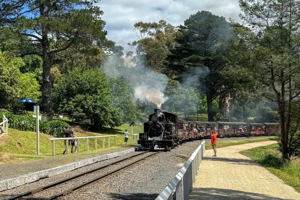
- Alexandra Timber Tramway and Museum
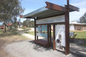
- Yea Railway Park
- Yea Wetlands and Mullum Wetlands in Mansfield
- Kerrisdale Mountain Railway between Trawool and Homewood
Last updated: 1 April 2024
The surface is either compacted gravel (chert) or granitic sand in sections that are shared by walkers, cyclists and horses. Signs mark the way for horses where there is a dedicated bridle path beside the gravel one
ESTA Emergency Markers are installed at 1km intervals along the trail. In an emergency, call 000 and quote the alphanumeric code on the marker post nearest to you, eg GVR22
There are several crossings of major rural highways but two have underpasses
Major towns with all services are Yea, Mansfield and Alexandra. Smaller towns are Tallarook, Molesworth, Yarck and Bonnie Doon
The main sections of the Great Victorian Rail Trail are:
- Tallarook to Yea is 38km, and follows the picturesque Trawool Valley
- Yea to Cathkin is 21km, and features the Cheviot Tunnel and Goulburn River floodplains
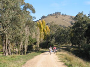
- Cathkin to Bonnie Doon is 40km, and includes the highest point on the trail
- Bonnie Doon to Mansfield is 22km, and features the impressive bridge over Lake Eildon and views of Mt Buller
- Cathkin to Yea is 13 km, and has picturesque views at the top of Eglington Gap
For public transport options scroll down to “Get Around” below and click on “Show More”.
Art Trail
Art On The GVRT, consisting of seven large art installations and 20 smaller works along the length of the trail, was launched in 2023. Scar trees can also be seen along the trail; more information can be found HERE.
Trail users are encouraged to stop and interact with each sculpture and learn more about the history and heritage of the region.
Section Guides
Tallarook to Yea (38 km)
Follows the Goulburn River up the Trawool Valley, classified by the National Trust for its scenic beauty
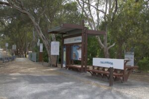
- Tallarook is on the Seymour railway line with regular train services. The start of the trail has a major information display. There is another car park about 1km down the trail.
- Mix of compacted gravel and granitic sand surface.
- Trawool is basically just a resort facility now. Homewood is just a former station site.
- From Homewood the rail trail passes through more open farming land and the surface is a firmer Chert type.
- The Yea railway station precinct has a great playground, picnic facilities and a skate park. The former station has been restored and now houses the Yea Family History Group. The goods shed has also been restored and is available for hire. The precinct comes alive on the first Saturday of each month with the Yea Country Market.
Tallarook is a small town with limited facilities
Yea is a medium regional town with a variety of food and accommodation
Yea to Cathkin (21 km)
Features the Cheviot Tunnel and lots of bridges across the Yea and Goulburn River floodplains.
- Compacted gravel surface
- From Yea the trail follows the highway then crosses the Yea River floodplains before climbing up past Cheviot to the Cheviot Tunnel.
- The 200m long Cheviot Tunnel is straight, but quite dark in the middle: use your headlight or dismount before entering
- The trail then descends to through a picturesque valley to Molesworth before numerous long bridges cross the Goulburn River flood plains.
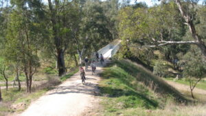
- The trail winds along more flood plains to Cathkin, which is just a former station site. After crossing the highway, go straight on to Yarck, Bonnie Doon and Mansfield or veer right for Alexandra
Molesworth is small town with a general store, caravan park, and a motel with wine bar and restaurant
Cathkin to Bonnie Doon (40 km)
Open farmland and a long climb up to the highest point, 397 m at Merton Gap
- Compacted gravel surface
Yarck is a vibrant town with refreshments and accommodation for cyclists
Merton is a small town with limited facilities.
Bonnie Doon has several food and accommodation options.
Bonnie Doon to Mansfield (22 km)
Open farmland and features the impressive bridge over Lake Eildon and views of Mt Buller
- Compacted gravel surface and no major climbs in this section
- Straight after leaving Bonnie Doon the 385 m long bridge over the Brankeet Arm of Lake Eildon is crossed, a real sight when there is water beneath it
- Approaching Mansfield on a clear day, Mt Buller is clearly visible; a very different sight when it is covered in snow
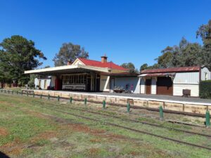
Mansfield is a major regional and tourist centre with many facilities. The station is used by the local historical society with some carriages, and a large tourist information centre next door
Cathkin to Alexandra (13 km)
A significant climb either way with panoramic views of the Cathedral Ranges at the top of the Eglington Gap
- Bituminised compacted gravel surface to the gap, granitic sand surface to Alexandra
- The former Alexandra Station site is now home to the Alexandra Timber Tramway.
Alexandra is a major regional centre with a variety of food and accommodation options.
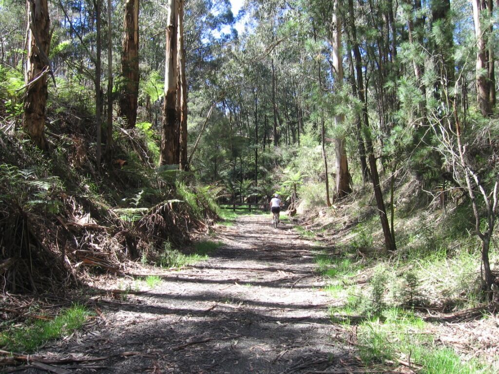
Start of the rail trail in Tallarook
![Cycling beside the Goulburn River on the way to Tallarook [2022]](https://www.railtrails.org.au/wp-content/uploads/2022/09/V43-058-GV-Hwy-and-Goulburn-River-2022-09-22_103753-300x169.jpg)
Cycling beside the Goulburn River on the way to Tallarook [2022]
![Typical scenery around Trawool [2022]](https://www.railtrails.org.au/wp-content/uploads/2022/09/V43-058-Approaching-Trawool-8831-300x200.jpg)
Typical scenery around Trawool [2022]
![Typical scenery around Trawool with wind turbines in the background [2022]](https://www.railtrails.org.au/wp-content/uploads/2022/09/V43-108-Trawool-8839-300x200.jpg)
Typical scenery around Trawool with wind turbines in the background [2022]
![Approaching Trawool from Granite, the rail trail passes through the Trawool Valley where it runs parallel with the scenic Goulburn River [Ross Vaughan 2019].](https://www.railtrails.org.au/wp-content/uploads/2021/11/V43-107-GVRT-Trawool_3203_2-2019-02-edit-300x200.jpg)
Approaching Trawool from Granite, the rail trail passes through the Trawool Valley where it runs parallel with the scenic Goulburn River [Ross Vaughan 2019].
![View from the Kerrisdale Mountain Railway between Trawool and Homewood with the rail trail down in the valley in the background [2022]](https://www.railtrails.org.au/wp-content/uploads/2022/09/V43-108-2022-09-22_123924-Kerrisdale-Mountain-Railway-300x169.jpg)
View from the Kerrisdale Mountain Railway between Trawool and Homewood with the rail trail down in the valley in the background [2022]
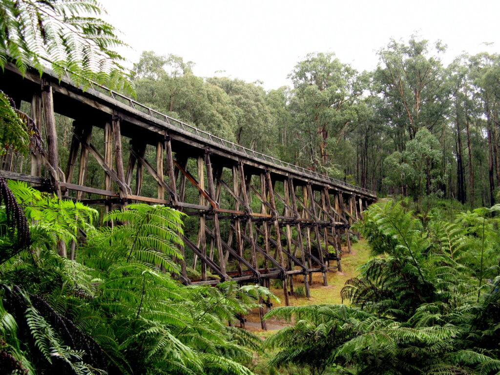
At 90 metres long and 12 metres above the creek, the King Parrot Creek bridge is the second highest on the rail trail
![A strongly flowing Goulburn River between Trawool and Homewood [2022]](https://www.railtrails.org.au/wp-content/uploads/2022/09/V43-108-King-Parrot-Creek-to-Homewood-2022-09-22_135749-300x169.jpg)
A strongly flowing Goulburn River between Trawool and Homewood [2022]
A reminder of days gone by at Homewood (2017)
![Imagine doing all this by hand, one of dozens of large cuttings between Trawool and Homewood. [2022]](https://www.railtrails.org.au/wp-content/uploads/2022/09/V43-157-Homewood-to-Yea-2022-09-22_144654-300x169.jpg)
Imagine doing all this by hand, one of dozens of large cuttings between Trawool and Homewood. [2022]
![Toilet facilities are provided at regular intervals, this one between Homewood and Yea [2022]](https://www.railtrails.org.au/wp-content/uploads/2022/09/V43-157-Homewood-to-Yea-2022-09-22_144806-300x169.jpg)
Toilet facilities are provided at regular intervals, this one between Homewood and Yea [2022]
Yea Country Market is held on the station precinct on the first Saturday of each month. The former station building now houses the Yea Family History Group (Ross Vaughan 2017).
The long bridges across the Yea River floodplains (2020 Ross Vaughan)
![Cruising down from the Cheviot Tunnel to Yea [2022]](https://www.railtrails.org.au/wp-content/uploads/2022/09/V43-212-Cheviot-to-tunnel-2022-09-22_164141-bridge-sign-300x169.jpg)
Cruising down from the Cheviot Tunnel to Yea [2022]
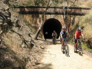
The only tunnel on a rail trail in Victoria, the 201m long Cheviot Tunnel completed in 1889 is a significant historical feature on the rail trail (2012 Norm Appleby)
Cruising down from Cheviot Tunnel to Molesworth (2012)
Crossing the Goulburn River at Molesworth. (2012)
![Mertons Gap is the highest point on the GVRT at 397m and gives an idea of how much earthwork was undertaken by hand in building the original railway line [Ron Ekkel 2023]](https://www.railtrails.org.au/wp-content/uploads/2023/03/V43-350-Mertons-Gap-the-highest-point-on-the-GVRT-gives-an-idea-of-how-much-earthworks-were-undertaken-by-hand-in-building-the-original-line0302_1-2023-01-300x169.jpg)
Mertons Gap is the highest point on the GVRT at 397m and gives an idea of how much earthwork was undertaken by hand in building the original railway line [Ron Ekkel 2023]
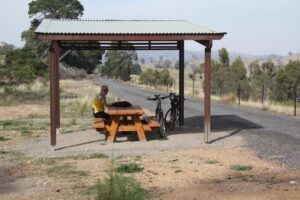
There are six shelters with picnic table at strategic locations along the rail trail, including this one near the top of Merton Gap (2012).
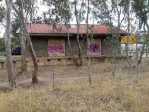
Woodfield Station precinct with toilet and shelter is easily accessible from the Maroondah Highway. Also contains the only stockyard still in existence on the rail corridor (2018)
'How's the Serenity' at the Bonnie Doon good shed. Perhaps a bit too much and looking forward to restoration (2021)
![The 385m rail trail bridge at Bonnie Doon makes a spectacular impression with Eildon Weir at 97% capacity [Alan Neander 2023]](https://www.railtrails.org.au/wp-content/uploads/2023/03/V43-400-Bonnie-Doon-rail-trail-bridge-makes-a-spectacular-impression-with-Eildon-Weir-at-97-capacity-0563_1-2023-03-300x169.jpg)
The 385m rail trail bridge at Bonnie Doon makes a spectacular impression with Eildon Weir at 97% capacity [Alan Neander 2023]
The view from on the bridge
Enjoy magnificent views across the valley towards Mt Buller approaching Mansfield (2018 Ross Vaughan)
This Interpretative sign at Mansfield Station precinct is one of four located at key entry points to the rail trail (2017)
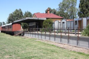
The last passenger train departed Mansfield in May 1977. The former station is now home for the Mansfield Historical Society.
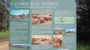
Cathkin was the junction of the spur line to Alexandra. In 2006, the Home/Spring Creek Landcare Group commenced revegetation of the old station site (2016)
In between Cathkin and Alexandra (2012).
![After the climb up to Eglington Gap above Alexandra, this shelter is a great place to take a break and enjoy the wonderful view [2012]](https://www.railtrails.org.au/wp-content/uploads/2021/11/V43-555-Koriella-to-Alexandra-2012-04-6168-300x225.jpg)
After the climb up to Eglington Gap above Alexandra, this shelter is a great place to take a break and enjoy the wonderful view [2012]
Alexandra station, which is now used by the Alexandra Timber Tramway (2021)
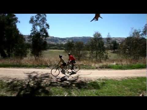
2012 Official promotional video
2012 Official opening of the GRHCRT in June 2012.
 Northern Rivers Bike Hire is a cycling business built on the success of Murwillumbah Cycles, which started in 2019. The business has significantly benefited from Cabarita Beach Cycles, established in 2007. In May 2022, the ‘Caba Bike Shop’ was merged into Murwillumbah Cycles with the aim to focus on the rail trail. The business is fully operational on the Northern Rivers Rail Trail, 20km south in Mooball.
 Bring and ride your own horse along the scenic Great Victorian Rail Trail. Stay in boutique accommodation, enjoy delicious meals, massages and fine wines while the sun sets.
 Ride the iconic Great Victorian Rail Trail at your own pace whilst Tour de Vines looks after all the logistics for you.
 We offer passenger/bicycle transfers and tour packages along the Great Victoria Rail Trail (GVRT). Whether doing short sections from town to town, or one long ride and your tired legs are needing a transfer home, the DBAlpine team are here to make your GVRT experience a great one.
 Experience the Camperdown to Timboon Rail Trail by bike. We have Ebikes, Mountain bikes, children’s bikes as well as a child and pet seat available for hire. Bike transport and shuttle service is available for pick up and departure from anywhere along the trail. Gourmet Rail Trail Ride and back pack sandwich lunches also available. Also private gourmet tours for two to eight people to experience the 12 Apostles Artisans Trail and other local farm gate producers by luxury vehicle.
 AllTrails Bicycle Tours
All Terrain Cycles – Providing bicycle sales, service and repairs plus bike hire ride around Mansfield plus the Great Victorian Rail Trail.
Public Transport
There are PTV trains from Melbourne and Seymour to Tallarook. There are PTV buses from Melbourne to Yea then towns along the way to Mansfield. As always bicycle carrying restrictions apply.
Refer to the PTV web page for map and timetables, or your navigation program of choice.
Do you know of a bike hire or transportation service on this rail trail that should appear here? If so, let us know at admin@railtrails.org.au.
Information and Links
Rail Trail Management and Inquiries
RTA endeavours to keep our rail trail information up to date but for any enquiries regarding management of the rail trail including the current state, or to report any issues, please contact the rail trail manager.
This rail trail is managed by the Shire Councils of Mansfield, Murrindindi and Mitchell.
Mansfield Visitor Information Centre acts as the support centre for the rail trail, issues can also be reported here.
Website: Great Victorian Rail Trail official website
Email: info@greatvictorianrailtrail.com.au
Phone: (03) 5775 7000 or 1800 787 245 (1800 RTRAIL)
Rail Trail Supporters
The Friends of the Great Victorian Rail Trail is a local volunteer group running events, participating in working groups and carrying out physical improvements on the rail trail.
Refer to Friends of the Great Victorian Rail Trail for further information and contact details as they welcome more involvement.
Further Information
Yea Visitor Information Centre (Y Water Discovery Centre): (03) 5797 2663
Alexandra Visitor Information Centre: 1800 652 298
Seymour Visitor Information Centre:(03) 5799 0233
Quick link to the Great Victorian Rail Trail official booklet.
Contact Rail Trails Australia
To contact us about this rail trail, email vic@railtrails.org.au
Background Information
Traditional owners
We acknowledge the Taungurong people, the traditional custodians of the land and waterways on which the rail trail is built.
Development and future of the rail trail
The Spring/Home Creek Landcare Group began re-vegetation of the rail reserve at Cathkin in 2006 to create a flora and fauna reserve.
In 2021 funding was obtained for some major art features to enhance the rail trail.
Apart from the Bonnie Doon bridge, which opened in 2000, the first stage of the rail trail opened in August 2010. The entire trail was opened by June 2012. In January 2014, branding as the Great Victorian Rail Trail was completed.
Railway history
A broad gauge branch line opened to Yea in 1883 and to Mansfield in 1891. A further branch from Cathkin reached Alexandra in 1909. The whole line closed in 1978, along with many other branch lines across Victoria.
New event on the GVRT targets women walkers
Posted: 01/04/24
Early bird registrations are open until April 12 for Lake High – ‘Walk for Autism’ on April 26, 2024 ...
More...Tour de Trail delivers a ride for fun and fitness
Posted: 11/03/24
Sunday, March 3 saw over 100 cyclists of various ages and abilities enjoy a bike ride under ...
More...Charity bike ride along the Great Victorian Rail Trail
Posted: 17/01/24
Cycle Dindi returns to the Great Victorian Rail Trail (GVRT) on Saturday, 16 March. This fully ...
More...Ride the Great Victorian Rail Trail for fun and fitness
Posted: 03/01/24
Tour de Trail returns in 2024. Cyclists of all ages are invited to ride the Great ...
More...Ultramarathon fundraiser for MS along the GVRT
Posted: 07/11/23
Running a marathon is a big enough challenge, but running three marathons in a day ...
More...Blazing the rail trail path around Victoria
Posted: 30/09/23
Paul Baker has cycled over 2,400 kilometers since the start of January. The 47-year-old set himself ...
More...Marathon along the GVRT draws strong turn-out
Posted: 08/06/23
Sunday, 4 June, saw the Mansfield Marathon along the Mansfield end of the Great Victorian Rail ...
More...Art Trail Launch on the Great Victorian Rail Trail
Posted: 26/05/23
GVRT art installation artists and project leads A ...
More...Art on the Great Victorian Rail Trail coming soon
Posted: 18/04/23
The Great Victorian Rail Trail (GVRT) Art Installation Project is on track to be completed ...
More...Tour de Trail delivers a ride for fun and fitness
Posted: 25/03/23
Over 130 cyclists of various ages and abilities enjoyed a bike ride in perfect conditions along ...
More...Charity bike ride along the Great Victorian Rail Trail
Posted: 16/02/23
Cycle Dindi returns to the Great Victorian Rail Trail (GVRT) on Saturday, April 1. Cyclists have ...
More...Great Victorian Rail Trail hosts family friendly bike ride
Posted: 26/01/23
Tour de Trail returns in 2023. Cyclists of all ages are invited to ride the Great ...
More...Great Victorian Rail Trail Promoted at Around the Bay
Posted: 25/10/22
Early October saw the return of the Around the Bay cycling event after being cancelled ...
More...Great Victorian Rail Trail benefits from facility improvements
Posted: 08/08/22
Ross Vaughan, Chair of Friends of the GVRT trying ...
More...Inaugural Marathon draws strong turnout
Posted: 16/06/22
Sunday, 29 May saw the inaugural Mansfield Marathon event along the Great Victorian Rail Trail (GVRT) ...
More...Mansfield marathon events on Great Victorian Rail Trail
Posted: 02/05/22
The last passenger train departed Mansfield in May 1977. The ...
More...Tour de Trail delivers a ride for fun and fitness
Posted: 20/03/22
The start/finish area of Tour de Trail with ...
More...‘Cycle Dindi’ on the Great Victorian Rail Trail returns for sixth year
Posted: 13/02/22
Cycle Dindi is returning to the Great Victorian Rail Trail (GVRT) on Saturday, 2 April. Organised ...
More...Tour de Trail ride along Great Victorian Rail Trail
Posted: 19/01/22
Oliver's Road section of the GVRT Returning in 2022, ...
More...Art Installations Project on Great Victorian Rail Trail
Posted: 04/12/21
Small scale art work is a feature of quite a few rail trails in South ...
More...Great Victorian Rail Trail benefits from multiple revegetation efforts
Posted: 09/08/20
The Great Victorian Rail Trail (GVRT) has recently benefited from the efforts of two Landcare ...
More...Great Victorian Rail Trail to benefit from new Development Plan
Posted: 14/07/20
The three councils responsible for the Great Victorian Rail Trail (GVRT) have engaged with Tourism ...
More...“Cycle Dindi” on the Great Victorian Rail Trail this April
Posted: 03/02/20
‘Cycle Dindi’ returns for fifth year Cycle Dindi 20 is a family friendly bike ride along ...
More...New Directions for Great Victorian Rail Trail
Posted: 24/01/20
Access to the Great Victorian Rail Trail (GVRT) has just become easier with the installation ...
More...$50K for a feasibility study towards linking Seymour with the Great Victorian Rail Trail
Posted: 13/11/19
An official Media Release from Mitchell Shire Council notes there is $50K included for a ...
More...Great Victorian Rail Trail (GVRT) has been listed as a “bucket-list-worthy” international rail trail destination
Posted: 30/09/19
Our Great Victorian Rail Trail (GVRT) has been listed by Rails-to-Trails Conservancy, a nonproft organisation ...
More...Goulburn River Rail Trail Wins Major Award
Posted: 09/03/13
Mansfield Shire Council has won a coveted award for construction of the 134km Goulburn River ...
More...Goulburn River High Country Rail Trail (VIC) Officially Opens
Posted: 30/05/12
Update It's been a long time coming but with a generous $13 million grant from the ...
More...Goulburn River High Country Rail Trail (Vic) – Flood Damage
Posted: 06/03/12
Damaged sections of the Goulburn River High Country Rail ...
More...Goulburn River High Country Rail Trail Management Plan Consultation Meetings (VIC)
Posted: 16/08/11
The Goulburn River High Country Rail Trail in North East Victoria is currently under rapid ...
More...Goulburn River High Country Rail Trail – Part Opening (VIC)
Posted: 21/02/11
Come and celebrate the opening the Maindample to Bonnie Doon section of the Goulburn River ...
More...Goulburn River High Country Rail Trail Community Meetings (VIC)
Posted: 17/11/10
Community forums have been arranged so the public can be informed on what is happening ...
More...First Stage of Goulburn River High Country Rail Trail (NE Victoria ) Opens
Posted: 07/08/10
L to R: Ray Watson, Dr Will Twycross (Chair ...
More...Goulburn River High Country Rail Trail to Help Revitalise Bushfire-Affected Communities
Posted: 05/08/09
The office of Anthony Albanese, Minister for Infrastructure, Regional Development and Local Government, provides this ...
More...$14 million Project Announced to Complete Goulburn River High Country Rail Trail (Vic)
Posted: 28/04/09
The federal government has announced $13m in funding to complete this 134km rail trail in ...
More...Goulburn River Rail Trail (NE Vic) Funding Announced
Posted: 18/01/09
State and local government funding has been announced to construct 12km of rail trail between ...
More...Goulburn River HC Rail Trail (Vic) given the go ahead by councils
Posted: 30/06/06
The Mitchell, Murrindindi and Mansfield Councils have now adopted the Concept Design and Business Plan ...
More...Goulburn River HC Rail Trail (Victoria) Draft Concept Design And Business Plan Released For Comment
Posted: 27/02/06
The councils of Mitchell, Murrindindi and Mansfield obtained a grant in 2005 to develop a Concept ...
More...Nearby Trails
Warburton Rail Trail/Yarra Valley Trail
Yarra Valley, 50 km east of Melbourne CBD
48 km


Murchison – Rushworth Rail Trail
Northern Victoria
10 km
Powelltown Tramways
Yarra Ranges, 80 km east of Melbourne
31 km
O’Keefe Rail Trail
East of Bendigo, 150km from Melbourne
50 km
Meadowlink Rail Trail
Broadmeadows, 20 km north of CBD
1.2 km
Dookie Rail Trail
North East Victoria, 220km from Melbourne
8 km


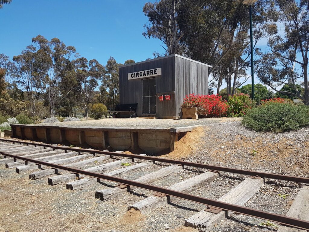
Girgarre Stanhope Rail Trail
200km north of Melbourne
5.5 km
Heathmont to Belgrave Trail
Eastern suburbs, 40 km from the CBD
16 km

Inner Circle Rail Trail
Inner suburbs, 5 km from the CBD
4.8 km
Outer Circle Rail Trail
Eastern suburbs, 6 km from Melbourne CBD
17 km
Hawthorn to Kew Rail Trail
Inner suburbs, 9 km east of Melbourne CBD
1 km
Eastern Dandenong Ranges Trail
Dandenongs, 50 km southeast of CBD
15 km
Noojee Trestle Bridge Rail Trail
100km east of Melbourne
3 km
Sandridge Railside Trail
Melbourne city, 1 km from GPO
4 km
Webb Dock Bridge
Docklands, 1 km from Melbourne CBD
0.2 km
Rosstown Rail Trail
Southern suburbs, 9 km from the CBD
8.8 km
Rokeby to Crossover Rail Trail
North of Warragul, 103km from Melbourne
5 km
Tyers Junction Rail Trail
Gippsland, 30km north of Moe, 160km from Melbourne
7 km
Nearby Trails
Warburton Rail Trail/Yarra Valley Trail
Yarra Valley, 50 km east of Melbourne CBD
48 km
Murchison – Rushworth Rail Trail
Northern Victoria
10 km
Powelltown Tramways
Yarra Ranges, 80 km east of Melbourne
31 km
O’Keefe Rail Trail
East of Bendigo, 150km from Melbourne
50 km
Meadowlink Rail Trail
Broadmeadows, 20 km north of CBD
1.2 km
Dookie Rail Trail
North East Victoria, 220km from Melbourne
8 km
Girgarre Stanhope Rail Trail
200km north of Melbourne
5.5 km
Heathmont to Belgrave Trail
Eastern suburbs, 40 km from the CBD
16 km
Inner Circle Rail Trail
Inner suburbs, 5 km from the CBD
4.8 km
Outer Circle Rail Trail
Eastern suburbs, 6 km from Melbourne CBD
17 km
Hawthorn to Kew Rail Trail
Inner suburbs, 9 km east of Melbourne CBD
1 km
Eastern Dandenong Ranges Trail
Dandenongs, 50 km southeast of CBD
15 km
Noojee Trestle Bridge Rail Trail
100km east of Melbourne
3 km
Sandridge Railside Trail
Melbourne city, 1 km from GPO
4 km
Webb Dock Bridge
Docklands, 1 km from Melbourne CBD
0.2 km
Rosstown Rail Trail
Southern suburbs, 9 km from the CBD
8.8 km
Rokeby to Crossover Rail Trail
North of Warragul, 103km from Melbourne
5 km
Tyers Junction Rail Trail
Gippsland, 30km north of Moe, 160km from Melbourne
7 km
81 reviews of “Great Victorian Rail Trail”
Absolutely loved this rail trail. Drove up from melbourne and parked outside the CFA in Tallarook. Then I rode from Tallarook to Mansfield on day 1. Stayed overnight at a motel in Mansfield and the next day I rode back to Tallarook (I also added on the additional stretch from Yea to Alexandra. The second day was a big day but I was glad to push myself. This made for around 270km of cycling over two days but with enough hydration and food it was possible.
One of the more enjoyable out and back rides I've done.
Bonnie Doon is spectacularly beautiful
I rode this over a weekend in late December.
Rode Yea to Alexandra to Merton Gap and Back to Yea. The New signage is great, well done, this is such a well maintained trail, congratulations to all (Friends of GVRT & local councils).
One reminder for all intending to ride, make sure you have enough water. There is no water available between towns and it can get very warm on the trail, always leave the bigger towns with enough water.
We recently did a self-guided Mansfield to Tallarook trail,including Alexandra. We loved it,it was hard at times (especially for 60+yr olds who don't cycle regularly!) but the scenery was beautiful, magpies a little too friendly and all the towns historic and interesting. Few minor issues – we travelled mid week so food options limited (especially when needing gluten free); up side not many people on trail; trail mostly well maintained with wide pathways and good signage except one spot where there was no sign on a corner – very easy to ride up someone's driveway!; and one short section of very narrow track close to main road. Overall a great experience we ticked off our bucket list. PS. Reported tree on track after underpass.
Twelve cyclists took a charter bus and trailer (arranged through Benalla Bus and Coach Lines) from Tallarook to Mansfield last Friday. We rode the trail over three days in glorious weather. The trail was in very good condition, apart from a short but heavily eroded section 2km from Merton (Mansfield side) and a very large tree down 3km east of the Cheviot Tunnel. We enjoyed meals at the Yarck Hotel and the Royal Standard Hotel in Yea. The pizzeria outside the Trawool Valley Resort was a picturesque spot for Sunday lunch.
Cycled the Merton-Mansfield section, return, with friends last year, staying in cabins at Mansfield caravan/holiday park and catching a fab performance of Black Adder by local amateur theatre company.
Pros: Lovely views (though less impressive than all the other rail trails I've done), mostly flat, excellent signage on the trail and driving to the trail, Mansfield town is a delight.
Cons: Noisier and less scenic that all the other rail trails I've done. A huge chunk of this rail trail is beside a road. It's far enough to be safe, with a strip of land between us and the traffic. But we had noise of cars and trucks for a lot of it, which changes the vibe and makes it harder to feel like we're "getting away from it all".
This review is based on the section between Tallarook and the Cheviot Tunnel, ridden (there and back) with a 5 year-old on a tagalong over 4 days in April 2023.
We chose to start at Tallarook as it is the only place on the trail served by rail. Unfortunately, there is no bicycle hire service in Tallarook, only at the other end in Mansfield. We were able to hire bikes in Melbourne and take them on the train.
The trail between Tallarook and Yea is mostly next to a noisy highway. The rural scenery is nice but there aren't any interesting places to stop along the way. There are limited accommodation options, including the overpriced Trawool Estate that doesn't provide secrure bike parking. Nice food though.
Yea is a lovely town with a great playground. We stayed at the caravan park.
The trail to the tunnel is much nicer and the tunnel itself a highlight.
Just returned from an entirely enjoyable three days completing the whole trail on a Dahon Mariner D8 folding bike! Around 150km with a few side trips around the towns. The track itself is like a good quality gravel road and the bike ate it up.
I had a 40L pack ratchet-strapped to the parcel rack. This included snacks, clothing, bike tools, first aid etc, plus lightweight camping gear for my planned camping second-night at the Yarck Rec Ground. Around 8kg all up and it worked beautifully. Accommodation on the first night in Yea and last night in Mansfield were at the historic local hotels. For meals I ate out at local establishments. I also felt it was my duty to sample (almost) every bakery on my way past!
After catching the Spirit overnight from Tassie to Geelong, and a ferry up to Melbourne, I took the Seymour V-Line train from Melbourne to start at Tallarook at around midday. At the finish, the beaut thing about the folding bike is that I could simply put it on the V-Line coach for the trip back to Melbourne from Mansfield. Train to Geelong then another overnight trip on the Spirit to home.
My standout favourite parts of the trail were the sections that deviated away from the main roads. Especially Yea-Molesworth, Cathkin-Alexandra and Yarck-Merton Gap. In the quiet autumn mornings with the fog rising, magpies, kookaburras and parrots galore singing, they were truly memorable moments. The new sculptures just installed along the way are a really nice feature, as are the covered rest stops and toilets.
Special mentions to the friendly volunteers who were happy to chat and offer information at the Alexandra and Mansfield visitor info centres. Thanks for the trail, it's a credit to everyone involved with building, maintaining and paying for it! I passed plenty of people using it.
We rode 3 sections over 3 days in early Dec 2022.
Quality of the trail surface was great. There were 2 sections with detours – a damaged bridge near Cathkin required 1km on road, and a 100m long puddle near Koriella required us to walk bikes along a path that had developed next to the trail.
We were on Dutch bikes with a pannier and even a basket. Took it easy, and had no problems on those bikes. Wouldn’t enjoy it on a road bike (gravel loose and large stones in places), but saw gravel bikes and MTBs moving along fine.
The uphill sections were easy enough – never more than 2%, but mostly around 1%.
Thought the Yarck – Yea section was the most scenic. The view of the Alexandra region from Eglington Gap was spectacular. Lots of water at Bonnie Doon made that section interesting.
Food highlights: Bucks pies at Yarck; dinner at the (newly renovated) Yarck pub; Calamari salad at Bonnie Doon pub; iced coffee at Essence Cafe in Alexandra.
Saw one snake, it heard us and was slithering off the trail as we approached. But was constantly looking ahead for “moving sticks”.
Overall, highly recommended!
We recently completed the GVRT using hybrid bikes with loaded panniers. We rode Tallarook to Yea on the first day – some parts were slippery due to the recent rain but not too bad. Great views down to the river. Enjoyed Frog Hollow and the pretty picnic grounds at Homewood Station. Today we rode Yea to Mansfield. Gravel surface was easier to ride, just had to avoid the horse poop. Highlights included Cheviot tunnel, Yarck for coffee and cake and the long bridge crossing at Bonnie Doon. Lots of birds all along the trail, good to see some fellow cyclists enjoying the trail too.
Last week we spent three days riding the GVRT, one was transported via an e-recumbent trike, the other an e-mtb.
Day One day was Mansfield to Merton and return;
Second day was Yea to Catkin + and return;
Final day was Yea to Tallarook and return.
We found the GVRT to be in excellent condition and suitable to almost any level of experience.
Also, on one day we didn’t get a flat tyre! How good was that?
7/27 Day 1 16/2/19 Longest Railtrail in Victoria. Today was Mansfield to Alexandra. This time I had 3 mates with me, in what was a weekend away to celebrate my 60th birthday. I chose this direction as there is more downhill this way. Warm all day and I was not feeling good so I actually didn’t think I would make it after only 30kms in. But telling myself ‘just 1 km at a time’ got me to Alexandra for my 60th birthday celebrations with my friends. 76km completed today, with the highlight the bridge at Bonnie Doon, and some lovely views.
Day 2 17/2/19 Today was Tallarook to Cathkin. I chose that way because the forecasted breeze was westerly, so having it on our backs helped a little. I was much better today (might have been due to the yummy wine at dinner last night). The day started with some lovely views over the Goulburn River for the 1st 5 kms. The rest of the day was pretty flat, except for the climb up to the Cheviot Tunnel, which is a stunning feature of the trail. 60km today and a total of 136kms in the 2 days.
This is a great trail with many highlights, and completes my 7th trail on my goal to ride every one in Victoria this year.
You can follow all my railtrail rides on FB Warwick Duncan – The 2nd Chance Man or Insta @warwick_rides
I think this is a great trail. Good surface all the way and in good condition. Over three days (3-5 Nov, 2018) I rode the trail both ways. Day 1 – Tallarook to Alexandra (75 km), Train from Melbourne to Tallarook arriving around midday. Alexandra is a great little place to stay. Just out of Alexandra there is a little climb but great view when you reach the top. Day 2 – Alexandra to Mansfield (75kms). Mansfield is another good place to overnight. Plenty of accommodation options. The trail has significantly more stone on the track in this section. I was on a Scott Speeder with 28mm tyres so I got a bit of vibration throughout the ride. I think a 32mm tyre would work well in all conditions on this trail. Day 3 – Mansfield to Tallarook (122km) this was a long day, not as enjoyable as the first two but just wanted to get the ride done. Just missed the 4.19pm train back to Melbourne, had to wait for 6.36pm. The only places I would overnight are Mansfield, Yeah and Alexandra. Another good place to stop for a coffee and food is Yarck. Whatever you do, do not stop in Molesworth!!! The pub is closed and the general store should be condemned. The pub in Tallarook is closed on Monday, which was disappointing as was hanging for a drink at the end of the ride.
Completed 2 day Bike Ride with my Grandson and his school friend’s in Grade 5 and 6 plus a couple of other local schools Grade 5 & 6’s, there was about 80 of us altogether, Students, Teachers, Parents, Support vehicles, etc.
Due to weather last week it was cut down from 3 days to 2 days, we started at Molesworth and rode to Alexandra for lunch, then back Yea for Dinner and over night stay at the Yea primary School. Next day we all rode to Trawool for lunch, then on to Tallarook. It was an excellent experience and something that I will treasure for ever, to have spent this time with him and his friends, I personally have done this Complete Trail Ride by myself a few times but this was the most rewarding and enjoyable. Very proud of all the kid’s they did a excellent job. The Trail was in good condition, the only issue (which is not really fixable) was the up hill section from Molesworth to Cheviot tunnel there was a lot of tree debris, etc on the actual trail, but that’s to be expected.
We completed this ride over 4 days, during the April School holidays. This rail trail is in great condition. We were very impressed by the quality of trail, the amount of shelter/shade along the majority of it and the facilities available. You do have to plan your food and water etc, but it’s not that hard.This was our 3rd rail trail, having already done the Murray to the Mountains and the East Gippsland Rail Trail. We are a family of 5, being 2 adults, an almost 5 year old (who was connected with a trail gator to my bike) and almost 3 yr old twins, in a double trailer connected to our 4 yrs old’s bike. Unlike the other trails, we didn’t ride this one from point to point each day, due to the slightly limited cheap accommodation options. Hence, we opted to stay at the Woodfield Shearers Quarters for the first 3 nights and then the Yea Caravan Park for 2 nights.
We travelled by car to the Shearers Quarters and stayed there on night 1. This place was just fantastic! Rustic, but had absolutely everything we could need. The kids loved it. It is fenced in, so you could just let the kids run around. Beautiful setting, fire pit, full kitchen, 2 bathrooms and even an outside bathtub which the kids loved. After the first night, I drove the car into Mansfield early the next morning and then returned to the Shearers Quarters. We then rode with the kids along to rail trail to Mansfield (~27km). There are multiple road crossings as other people have mentioned, and whilst the barriers can become a little tiresome to navigate (especially with the road train I had of a kids bike and a trailer), they really weren’t that bad. We had lunch in Maindample where there was a great little playground for the kids. This section had the easiest terrain. We stayed at the quarters again for a second night and the following morning I drove again in the other direction and left the car at Yarck, before driving back. We then rode with the kids to Yarck (~25km). It is a gradual climb until Merton (where we had a break in the park and an icecream from the servo) and then climbs a bit more steeply for the last few kms before Merton gap. The decent down the other side is brilliant and the countryside beautiful. We rolled into Yarck, where the kids had a play in the playground next to the oval and we had a coffee at the Cafe. There is a pub that apparently you can camp at, but the other accommodation was a little steep for us. We stayed at the Shearers Quarters for the last night and then packed up and headed to Yea the next morning. I dropped my wife and kids off at Yarck on the way and then rode back from Yea (~28km). From Yarck to Molesworth is easy riding but we didn’t go down to Alexandra. We had a break at the picnic benches on the edge of Molesworth, but only for 10min as the mozzies were horrendous! It may have been better actually in Molesworth, where there is a general store.
We then started the 8.5km climb to the Cheviot tunnel. This climb gets to 4% on many occasions but most of the way has great shade. The tunnel was great and the kids loved going through it, as it was very dark. You don;t need a torch though. Again, the decent on the other side was wonderful and we cruised into Yea to where we stayed in a villa at the Riverside Caravan Park. The 2 bedroom villa was beautiful, but quite expensive at $160/night. Yea has all the facilities you could need. The next day, we drove our car bikes and all to Tallarook and then rode back to Yea for our final day (~38km). The terrain was more mellow, with a few climbs here and there. There are no real facilities on the way, so you have to carry what you need. Again, there was great shade a lot of the way and beautiful scenery. I rode back out to Tallarook (for a night ride) to pick up the car. We stayed in Yea for our last night before returning home.
Overall, we thoroughly enjoyed this trail. Beautiful countryside, the shearers quarters we highly recommend, great shade, enough facilities and something interesting for the kids everyday. We’ll be back again.
Just finished a four day family ride from Mansfield to Tallarook with a range of ages, the youngest was 6 years old and he rode from Mansfield to Yarck over two days. It seems the trail surface has been significantly upgraded since we last rode it a couple of years ago. It is much smoother than previously. Camped at Woodfield Shearers Quarters which is nice but very expensive camping ($100 for a family of 4 but it includes breakfast), Yarck at the sports reserve behind the pub and then at Yea Riverside Caravan Park. This is an excellent introduction to longer distance family riding. The most annoying thing about this trail is the ‘gates’ before and after each road crossing, when you’re on a tandem towing a trailer it’s an absolute pain trying to get through these. There’s more information here for those who are interested https://afamilycyclist.wordpress.com/mansfield-to-tallarook-labour-day-long-weekend-2018/
I did this as a lone rider with camping gear over Easter weekend.
Left Tallarook rail station and rode to Yea for lunch, it was a beautiful day.
Rode thru Chevoit tunnel and a few km on realised tyre going flat…
Must have picked up a bit of wire somewhere, even Marathons are not immune it appears..
Kept riding through and had another bite at Bonnie Doon, you can smell the serenity but there is not much happening here.
Onwards ho, had not booked accom at Mansfield so had to ride out to Mansfield Lakeside Ski village. People were great but road out was narrow and hilly (it was now dark). If you end up here ask if you can pitch tent along drive as plot I had was muddy.
Next morning up and into Mansfield for Breckie, some good options for food.
Off I head to Alexandra, ride was not as pleasant as day before, may be I am getting older ;-).. It was not a bad ride, just day before was pretty.
Coming into Alexandra was great, view as you come in is beautiful.
Camped at caravan park, great people and nice site but price was a bit high at $37.00
Next morning was later start as had to let things dry out as plenty of condensation… Night was 7degrees but seemed colder.
Nice Beckie in town and off to Yea again for a bite, the ride from Yea to Tallarook is really nice and a great finish.
All up this is a great ride. I did this in 3 days on 29er steel framed tourer with panniers and it was doable. Doing without camping gear would allow a few more hours to look around… Might do that next time.
It is a great ride.
4 days on the trail from 16/3..19/3/17. We rode Electra Cruisers that I converted to electric front wheel hub with thumb throttle, (solarbike kits, I highly recommend). I towed a 2 wheeled trailer,(approx 40kg with all our gear), and got approx 50k’s easily on 1 battery, whereas sis didn’t run out of her battery on any day with our longest ride being 88k’s, we both carried our own spare batteries.
We had perfect weather for the 4 days, with wind and a threat of a thunderstorm on day 1 for about hr the only slight worry.
Day 1 we set off from Tallarook at noon. Stunning the Trawool valley and Goulburn river to Yea stretch. Up too Cheviot and rail tunnel, fantastic make sure u take it all in and climb to the top of tunnel on Molesworth end, before a fabulous downhill run. Branched of to head for Alexander for the stay in caravan park, excellent cabin. Great view of Alex and surrounding area. And good downhill run into town. 79k’s ridden for the day.
Day 2 left Alex for Mansfield, went off rail trail and turned right into Spring Creek rd at Koriella, 7k of bitumen then pretty good dirt rd, except, there is a horror hill about halfway, I doubt an experienced mtn biker would make this climb, we certainly didn’t and it was punishing ascending the last 200mt to the summit pushing bike and trailer, decent was as bad but shorter, for myself and trailer, too steep for me too ride with no weight over front wheel, I literally slid down on my feet whilst hanging on and braking, all good in the end, a great downhill and flat ride to Woodfield, road at some stage turns into Coles rd, Koriella to Woodfield 22k’s cutting of 12k’s going via rail trail. Turned right back onto rail trail and rode into Bonnie Doon then onto Mansfield. 62k’s for the day with the highlights being the bridge ova Eildon Lake, and the Angus cows on Coles rd that all,(at least 200 of em) stampeded into a corner of the paddock just too get a look at us, the mooing and shuffleing to get a front row spot was so funny, with heads craning from the back to get a look at us.
Stayed at the Mansfield Motel, excellent and clean room 50 mts from main st and Delatite Hotel, great meals, and 25mts to the coffee roasters cafe. Busy and beautiful town is Mansfield.
Day 3 brekky at coffee roasters, we recommend. We head back along trail for Yea, 88k’s for the day. Fairly steady climb past Woodfield on past Merton up to the highest point on the trail, then an easy ride down to Yarck, and we had lunch at Giddy Goat Cafe, very nice with other options as well in village. Onto Yea with the bridge ova the Goulburn river again a highlight as it was on day 1, very surprised at how fast and swirly this magnificent river flows and a beautiful colour. Stayed at the Tartan Motel, try elsewhere 1st! Fish and chips weren’t the best. Another picturesque town.
Day 4 an easy 38k’s back too Tallarook , found a spot on the Goulburn and soaked the feet while taking in all the beauty of the trip we were about to complete unfortunately.
The rail trail itself, apart from lots of leaf and bark and twigs in the parts where we were riding in the trees, was in good riding condition. Unless your up for some punishment don’t do the Spring Creek Rd – Coles rd section, having said that, we still loved this part of the ride and the cow stampede….lol.
To have stayed in the three major towns was great but unfortunately we didn’t have the time too fully explore each town. The Goulburn Valley is a truly iconic part of Oz we highly recommend for any body to do any way you want too.
The endless “tree lined tunnels” are great. We didn’t see any snakes, kangaroos or koalas, we did see 3 Echidnas each 1 bigger than the last with the last 1 being huge.
Sis and myself are in our early 60’s and would only do this trek on our elec bikes, we were never puffed and could really appreciate the countryside, riding side by side talking and taking in the beauty with ease. We had an epic trip and will do the Murray to Mtn’s trail in May. We rode a total of 267k’s at an average speed of 17kph, about 16hrs in the saddle ova 4 days.
Pls feel free to ask any Questions. Sue And Pete
flemop@optusnet.com.au
I took my 2 boys (15 and 12) to ride this on the school holidays 19th – 21st September, amidst much teenage grumbling. We got the Vline to Tallarook, I was worried about getting the bikes on the train as they don’t guarantee to take them, but there was hardly anyone on the 10.30am train so although we had to split between 2 carriages it was fine. It was a beautiful time of year to cycle, it has been so wet that everything was very green, the hills were covered in flowers and the fields full of lambs, calves and foals. The wet weather made the tracks a bit hard going in some places – like riding on sand but generally the condition of the track was good. Cycling a rail trail with full panniers was certainly harder work than cruising Beach Road, but we took our time and stopped in Yea, the first night, Alexandra the next and finished in Mansfield where thankfully my husband picked us up. I wouldn’t have been able to persuade the kids to cycle back to Tallarook thats for sure. It was great to cycle then get a hot shower and chill out watching TV before going to get some excellent pub meals. The highlights were the tunnel which was pretty cool, even better being followed by a fast down hill, the view over the hills just before you dropped down into Alexandra, the times when the trail went away from the road and you felt like you were away from it all and spending time with the kids even though a lot of that time was encouraging them to keep going. The trail itself is well served by small cafes to stop at and stock up, there are lots of toilets along the way, but no drinking water at all. You can buy drinking water at the cafe’s, but you would have to plan to carry extra if you are travelling at a hot time of year. It is a great trail and even the kids are enjoying it now they have been at home for a week. What next ……
I rode the entire length of this excellent Rail Trail twice (including the section to Alexandra) over 4 days and 3 nights over the Anzac day long weekend in April 2016. The weather was perfect with clear sunny days and hardly any wind. I rode a Mountain Bike with semi-slick touring tyres and carried panniers, some food and drinking water which is essential. I’m a regular cyclist (I usually ride between 50-100 kms per week) and I rode at a comfortable pace, averaging around 14-18kph with a 30-40 minute lunch break and some 5 to 10 minute rest stops every hour or so.
Day 1. Tallarook to Alexandra (78kms)
I parked my car in a designated Rail Trail car park just outside of Tallarook on the trail. This part of the trail surface alternated between smooth compacted sand and areas of compacted sandy gravel which contained stones. Yea is a good place to stop for lunch. Being a good sized city it has many food options and supplies as well as parks with picnic tables. The highlight for me was the Cheviot tunnel. It’s so strange to find such a large man made structure in the middle of nowhere without another person in sight. As the gradient map suggested this section of the trail involved more climbing than downhills. I don’t often ride 70+ kms in a day carrying baggage so I was pretty tired by the time I arrived. I stayed at the Commercial Hotel in Alexandra in a budget room. This is a pretty good hotel with free tea/coffee facilities for guests and friendly, helpful staff but I was disappointed that it lacked any proper undercover bicycle storage facilities. Alexandra has a quite a few pubs and restaurants as well as a large supermarket.
Day 2. Alexandra to Mansfield (79kms)
The trail surface was decidedly rougher in this section with compacted sandy, stony gravel. The gradient map indicated that there would be quite a few climbs and I prepared for the worst but fortunately it wasn’t as bad as I thought it would be. The spectacular views at Bonnie Doon were the highlight of this leg as well as sweeping views of valleys. I stayed at the Delatite Hotel in Mansfield in a budget room. This was a pretty good hotel with friendly, helpful staff and importantly with excellent, safe, undercover bicycle facilities. Mansfield is a good sized town with lots of food and accommodation options.
Day 3. Mansfield to Alexandra (79kms)
This ride involved quite a few downhill sections and was the easiest day’s riding of my trip. I again stayed at the Commercial Hotel in Alexandra and slept well.
Day 4. Alexandra to Tallarook (78kms)
Although there were a few downhill sections, my body and mind were beginning to fatigue. I was very happy to get back to my car after 4 days in the saddle.
I really enjoyed these 4 days and although I was pretty tired, I was always confident I would complete the ride in a reasonable amount of time. I found that taking even a 5 minute break is better than trying to force your way through difficult periods as you quickly regroup and get a second wind after a short break. It can get quite desolate out there on the trail often not seeing another rider for long periods. You definitely need to bring plenty of water and some food as well as wet weather gear. I was lucky enough not to have any bicycle issues such as a flat tyre but I would definitely recommend carrying tools, spare tubes and having some basic bike repair knowledge.
We cycled this rail trail over Easter and loved it. Went at a leisurely pace, spending a night each in Yea, Alexandra and Mansfield. We then had a transfer with our bikes and luggage back to Tallarook with a company called All Terrain Cycles. They were great to deal with and the transfer was $75 per person. Great cafe in Tallarook called Hock the Rubies-perfect place to fuel up before starting the ride.
I’d recommend doing the side trip to Alexandra. It’s a bit of a climb, but then you get a glorious view of the Cathedral ranges as you descend down into Alexandra. We stayed in a sweet room in the Commercial Hotel with a door onto a large verandah. Perfect spot for a post ride beer and a rest on the couch in the sun. Breakfast the next morning at the Alexandra hotel and cafe was great. Best coffee I’ve had in ages and lovely staff.
Other highlights were the wildlife (including a wombat, an echidna, a pelican and wedge tailed eagles), the Cheviot tunnel and the magnificent old eucalypts before arriving in Mansfield. Hope you enjoy it as much as we did.
Loved the tremendous bridges on this vary impressive railtrail – what a great Victorian jewel in the railtrail system. Thanks to all for getting this one up.
My wife and I have recently returned from cycling in Europe and the USA so a few days away cycle touring in Central Victoria along the Great Victorian Rail Trail from Tallarook to Mansfield was a way to reconnect with Australia ,, after an effortless train ride from Southern Cross station in Melbourne we arrived at Tallarook to begin our ride , on a sunny Sunday Morning the 29th of February , we marveled at the fast flowing Goulburn River bordered by beautiful lush l country , the Granite outcrops look like dinosaur eggs !
After day in paradise cycling the Great Victoria Rail Trail , we had a shady campsite at Molesworth Caravan park , only $10.00 ! It had been day for the birds ,so many birds ! Long beaked Corollas, Yellow tailed Black Cockatoos , Kookaburras , Sulphur Crested White Cockatoos , Crimson Rosellas, Pink Galahs, Lorikeets , King Parrots , as we cycled through open woodland of Box Eucalyptus, and ancient River red-gums, time for a cup of tea , lemon myrtle of course !
We woke to a clear blues sky for another day in paradise cycling the Great Victorian rail trail from Molesworth to Mansfield , mixed terrain , manna gums & wildlife , Kangaroos, Wombats , Sulphur crested Cockatoos and currawongs , the ancient majestic River Red guns are amazing , I would cycle this path again if only for the trees , life sure is good , camped in cycle friendly Mansfield $27.00 and had a relaxing drink at the Delatite Hotel
After Fresh Coffee and toast at the local bakery then we pushed off into another glorious day on the rail trail, a hot 85ks from Mansfield to Yea. We cycled through the traditional lands of the Taungurubg (Daung Wurrung). Tribal claand gns and groups lived here for thousands of years before white settlement. Their ancestors are still here, along with scar tree makings and rock art on the granite outcrops. It’s all very humbling
Our third nights camp was in Yea , where we took advantage of the swimming pool at the Caravan park $25.00 ! before an easy ride next morning back to Tallarook and our train home to Melbourne .
I would absolutely recommend this train to those seeking a easy few days away cycle touring , ideal for international guests to show them a slice of Australia.
At times the trail was difficult with loose gravely sand and Plenty of fallen branches and leaf litter across the trail . A few cyclists we spoke with complained about getting flat tyres , We ride 35mil Schwalbe Marathon plus which have proved bullet proof , however I think this trail is best suited to mountain bike tires .
All up a wonderful 4 days cycling, we will be back to do this one again !
We rode this rail trail in November 2013 and just this week we did Mansfield to Cathkin return one day and then Yea to Alexandra return on another. In my opinion, the track surface has improved as it has bedded in.
This is a wonderful Rail Trail (wish my home state of NSW had the same).
Only complaint is that the bollards at the road crossings towards the Mansfield end are a little difficult to manoeuvre with a Tandem bike! (Minor complaint).
Last weekend saw us complete the entire trail in both directions. This ride was the culmination of four different weekends as we chipped away at the entire journey.
I can recommend the way we chose to do it, namely to ride up and back from a given point. The last leg to be ridden was from Kanumbra to Bonnie Doon. For this leg, we parked the car at Kanumbra, rode to the Bonnie Doon Hotel for an excellent lunch and then back to the cars later in the day.
Overall this is a magnificent Rail Trail and heartiest “congratulations” to all who have worked so hard to see it completed.
About 15 years ago I attended a Rail Trails conference at Lilydale and remember being told that this RT would never become a reality. We were told there would be too many hurdles to overcome especially the fact that so much of the corridor had been taken over by private landholders who by then had assumed ownership of the land. Full credit then to all who have worked to achieve what can now rightly be called the GREAT Victorian Rail Trail.
Yesterday I completed the second part of “The Great Victorian Rail Trail” from Yarck to Seymour (which is home), took about 4 1/4 Hours with a lunch break in Yea. Completed Mansfield to Yarck week before, that took about 3 1/2 hours had a packed lunch at Merton. Just wanted a test before I try the whole ride in 1 day, when the weather is nicer and the days are longer.
Excellent Ride, some kind of rough patches but over all the trail is in excellent condition.
I would agree with other comments made about Cars (4×4’s I’m guessing) that use the track very noticeable on some parts.
My only small complaint would be that some of the barriers at the many road crossings are not realy required as they are driveways not actual roads.
I rode the section between Cathkin and Tallarook yesterday (20th February 2015). The highlight of this section has to be the Chevoit tunnel – I was very impressed. This is also the only climb of this section – either up from Molesworth or Yea. The trail surface in this part was good and suitable for hybrids. The section between Yea and Tallarook essentially follows the highway, with the trail in sections being poorer quality than around Yea – but still suitable for hybrids. Unfortunately, in sections there are ruts in the track (probably caused by riders going through in muddy conditions) that can cause problems if you get stuck in them. All in all, I think this trail is outstanding – just be aware that there are no places to get food or drink between Tallarook and Yea (avoid the Trawool resort unless you are desperate – that’s all I’m going to say about that place).
I rode this trail yesterday (31/1/15) – from Cathkin to Mansfield and back. It is a very nice trail, with good scenery and variety in the trail to keep it interesting. The climb up to Merton’s gap is the toughest part of this section – especially from Cathkin. The track surface is surprisingly good all of the way, with only some rough sections outside of Merton going parallel with the highway. Saw a few brown snakes on the trail between Merton and Bonnie Doon – so other users’ please be careful. It was a tough 120 km ride – one of the toughest I have done – but riding home with the late afternoon sunshine lightening up the countryside really made it worth it.
We had 17 riders do Tallarook to Alexandra 75km on Sat 17 Jan 2015, stay overnight and ride back to Tallarook on Sunday. Tallarook hotel did a lovely Sat breakfast for us (we arranged beforehand). For about 3km west of and 4km east of Cheviot Tunnel, the trail’s clay surface had been rutted by about 5 sets of tyre tracks when wet, and which now were cast hard. MTBs got by OK, and I managed fairly well with a 700c x 38mm cross front tyre with aggressive knobs, which could just get purchase to climb out of ruts. Those with 32mm or thinner road tyres had a hard time of it, and one such owner got turfed over. I slowed to about 15kmh for 2kms, to enable control as tyre ruts grabbed at my wheel; think riding Melb tram tracks. The narrower tyres were also prone to flatting easier generally, with us having 1 pinch flat and 2 regular flats. The bitumised gravel surface for much of the Yea-Alexandra component was very superior (eg didn’t rut much) to the clay parts, which I’d say are difficult in wet and leave ruts for hardening later.
It was quite a weekend of cycling, and we all made it back to Tallarook by 5pm, having left Alexandra at 10:30am, with lunch in a Yea cafe. Yea is the main cafe stop-off on the 75km route, and refill bidons there. The scenery is gorgeous and gradually changes along the route. I made the 75km on about 2.2L of water, plus a drink in Yea with 22-24 deg temps. Nice shelters and bush toilets dot the route every 10-15km. A challenging 160 km weekend but rewarding and satisfying. We saw 2 roos and 1 echidna; and some ibis, ducks, an eagle and white spoonbills around billabongs. Sometimes you’re up in the hills, and other times riding flat river valley floors. I took heaps of landscape snaps, with several memorable vistas after good hill climbs. Worth getting fit for. Overall, a well maintained 75km trail with a few kms of quirky rut obstacles demanding respect.
Rode this Trail over the New years break. While in Yea we stop at Marmalade’s and where extremely impressed with the service. They had a very nice courtyard at the back so we could take our bikes in and not leave them on the street with all our gear on them. The food was really quite impressive and we order a single big breakfast to share which was delivered on to plates. They also had a shower available to those riding the trial but they where no signs up you have to ask one of the staff. They also had decks of cards on the tables which impressed us as we are big 500 fans. Well worth the time we spent there and only wish that we had known about it on the way to Mansfield and not just not on the was back. The where also happy to fill up all our water bottles before we left. Well worth stopping at.
http://www.marmalades.com.au/
Hi Everyone, I have rode many rail trails in Victoria (almost all of them in fact) and this one has to be my favourite. The dry landscape and rolling hills are just vivid in this part of the world. A waring to all, i’m sure lots of you may know this already but i will say it anyway, Brings loads of water! If you have got all your gear on your bike I would say at least three litres for each person. You can fill up at caravan parks but not all the towns have town water, so expect to have to buy some. Snakes are commen on the trail so if you see one up ahead, i would suggest slowing down it will most likley get out the way of you. If the snake seems aggravated say in the same spot or back away slowly and the golden rule is no quick movements that will scare or aggravate the snake. I would suggest trying to set off as early as you can to beat the heat if you are riding in summer. One of the best bits about the trail is the bird fauna (as a bird watching tragic) you can see Willy wag tails, Wedge Tailed Eagles, all sorts of Robins, Sepurb Fairy Wren, and many other species. A great trail I’d recomend to anyone.
Chris
Highlight – the 20km descent at speeds on the way back to Tallarook from the peak just after Merton, all the way through to Cathkin. The quickest 20km I’ve ever done, even on a mountain bike, gravel track, 10kg backpack on and having to slow down for a number of gates. Exhilarating !!!!!!!!
Returned from the trail today. I rode from Tallarook to Mansfield yesterday, stayed overnight at the Delatite hotel in Mansfield and then returned to my parked car in Tallarook this afternoon. Tallarook to Mansfield took me 9.5 hours including a stop for lunch at Cathkin which is exactly half way and another stop for food in Bonnie Doon. The return trip from Mansfield to Tallarook which is predominantly down hill took about the same amount of time however there were more stops for breaks and a tyre puncture didn’t help. With all the purpose built bridges along the way, the trail would have cost in the millions to get it up to scratch. There are fairly new toilets and shaded picnic tables along the track approximately every 10kms or so and markers along the 120km from Tallarook to Mansfield indicate how far you’ve traveled. The gradient map on the great victorian rail trail website is fairly accurate and you can expect to steadily climb for about 20km from Cathkin. There is also a steady climb from Yea to the Cheviot tunnel and a long descent for about 7km once you come out of the tunnel. Watch out for swooping magpies, I was swooped on 3 separate occasions and look out for brown snakes on warmer days as I had 2 cross my path, one on each day. Only attempt the 2 day turn around if you’re reasonably fit and you’ve had a reasonable preparation as 240km in 2 days on a gravel track, battling headwinds at times can be a big ask. The only town with a decent range of eating choices along the way was in Yea, otherwise choices are limited at other towns on the track. The Delatite hotel in Mansfield offers a glorified backpacker type accommodation recently refurbished and I paid $60(1 person) booking direct for a double bed room which was clean and well presented, including television in room and free wireless internet and a lock up area for my bike and staff were very friendly and helpful. Mansfield itself offers plenty of eating options and has foodworks and IGA supermarkets for cheap groceries. The trip as a whole was a pleasant one and well worth doing at least once with views mainly of the Goulburn river in the early sections of the track followed by lots of green rolling hills and cattle and then the lakes and water ways of Bonnie Doon. There are plenty of trees offering shade along the track and I would think that about 2/5 ths of the track is shaded which on warmer days will offer respite from riding in the sun. I also noticed parking areas at different points all along the track so that you can pretty much start and finish where ever you choose. Hope this information helps on your trip.
A group of us – family and friends – rode yesterday with an initial meeting point at the car park next to Trawool Comfort Inn. This is listed as an access point on railtrails.org.au. Be warned: this establishment is NOT bike friendly. We had gone inside to buy some hot snack food (which they do not have), and yes did use the toilets, and were told in no uncertain terms “we are sick of being treated like offal” with you and your friends using the facilities here like they were public toilets!! Only 2 of our group of 11 had ventured inside so it was a shock to hear the tirade! A simple sign on the door explaining that there were public toilets in easy reach (but we had not seen them when we arrived) would have helped! We quickly changed our plans to come back there after the ride, and moved our cars further along the trail towards Yea never to go near the Comfort Inn again.
It was a cold winter’s day and only 2 of us rode the 27km towards Yea, and 7 (including 2 children) rode the 10km from Homewood to Yea. The track condition was very good and the scenery was lovely.
Unlike Trawool Comfort Inn, our group of 11 (9 riders plus a driver and 2 y.o.) was treated with great friendly service and food at Marmaldes’s cafe in Yea.
P.S. We have also ridden the stretch from Cheviot to Yarck back in mid-April and the surface was very soft with lots of ruts (it had been quite wet prior), so with that and coming across a red bellied black snake we had to be very wary. Also a good idea to remove sunglasses when going into the tunnel! 😉
I rode this trail in November 2014, out and back, Mansfield to Tallarook, Seymour and then back to Mansfield via Alexandria. Some of the comments have alluded to to the roughness of the trail around Merton and also the attitude of the proprietor of the Merton road house and I would agree with that. I did find the endless barriers at the many road crossings between Mansfield and Bonnie Doon a bit of a trial and probably pretty unnecessary considering they would mostly see traffic about once a day at the most. I was camping and so with a fully loaded bike I needed to slow almost to a stop every time I passed through them. I sense the dead hand of the Insurance companies.
However these are minor quibbles and as a NSW rider I am in awe of the Victorians for building these wonderful trails. One can only hope NSW will follow suite someday. I simply cannot understand the comments by M Lambert 10.10. 13 saying it is a dangerous trail. I am 66 yrs old, and fairly new to bike touring. I had a loaded bike with panniers fore and aft and didn’t have any problems at all. I loved the Cheviot tunnel, the Goulburn River was beautiful and the high point was Alexandra, the standout of the trip. I can recommend the caravan park at Seymour as a stopover, beautifully situated beside the river. There is nothing at Tallarook apart from a rather nice little cafe, and Seymour is only about 40 mins away ( At my pace..) an so it makes a good half way stay.
I stopped at Yea caravan park out and back and found it excellent, with nice pubs close at hand, most important.
All in all, congratulations to all concerned with getting the trail operating.
Completed this ride just before the really hot weather in December 2014. A great ride and a great contrast to the Murray-Mountains ride. The Alexander spur and the Goulburn river section a highlight.
Congratulations to all the stakeholders for producing such a great facility. Will be back to Victoria to try some more trails.
Hope the NSW effort to introduce rail trails is success.
Rode the Alexandra – Cathkin section early March 2014. Had a bit of trouble finding the start of the trail – I had a bit of trouble finding the station / museum at the start of it. Watch out for snakes in Summer / hot weather. I ran over one (no bite), and narrowly missed another – they looked very much like tree bark which was somewhat common on the trail! Has a lot of shade along it, so is a fairly good trail for sunny days if you wish to be out of the sun. Overall, great trail. A number of other people on the trail on the same day, so well known and well used.
My son and myself just completed the ride from Tallarook to Mansfield over two days. Molesworth is a tremendous half way point to camp and have a meal. The meals at the only hotel in town are tailored for hungry bike riders, reasonably priced and served by very friendly people. It is a fair dinkum no frills country pub with lovely cold beer to boot. The camp site is on the Goulbourn River, it is quiet, clean and well suited to the camping bike rider. It would be great if the trail could advertise the facilities available at Molesworth clearly on the trail as the place is a gem. The trail itself is something else. Pure Australiana at its best and no doubt as the word gets out will attract trail riders from all over Australia and the world. But it needs to ensure it gears itself for this future. Attitude to tourists is very important for all service providers. For example the attitude of the staff member at the Merton roadhouse when I asked for water was one of annoyance and bordering on rude. I was lectured on the scarcity of water at the roadhouse in a tone reminiscent of stern teacher. This type of attitude needs to shift but in the scheme of the ride was very rare indeed. Water is an issue and I suggest a visit to the chemist for those water purifier tablets may be of assistance as the toilet blocks do have water only the signs say not to drink the tank water there.I hope that the quality of the surface of the trail improves over time as it will be worth the investment. Carefully consider the type of bike you take. I had a hybrid and my son a mountain bike. I consider myself lucky I only got one puncture. The black gravel has some very nasty looking rocks which lie in wait for the hybrid rider. Compared to the Wangarratta to Bright trail it is the difference between a four wheel drive track and a super highway. Otherwise it is a great ride and one for the bucket list. I hope it only improves and is not allowed to deteriorate as it could be a huge tourist attraction in the very near future and for many years to come.
Be warned the Trawool Valley Resort is out of bounds to cyclists. Copped a lecture for sitting under a tree today. Otherwise the track was a pleasure to ride.
Its a great train, Done a bike ride from Yea to Boonie Doon and back in 6 HRS.54 MIn,
Even rode to the bridge in Bonnie Doon.
It just need some lights(even solar ll do) at the Chevoit tunnel and some sign when you get to Merton ,
you need to turn left and then right again.
Good work and well done
Cheers
Just wish to reiterate that this trail is very good. This trail is potentially a major financial bonus for the districts it travels through (and in fact was the sole reason we travelled from NSW to holiday in the area).
I hope that efforts are not made to highlight any of the poorer parts of this trail, as, on a whole it is great trail and hopefully will continue to help the area prosper.
Hi All, It’s good that you are all having a wonderful time riding this trail … but I still do stick to my comments (Oct 10). Maybe if I had been riding side saddle and a penny farthing the first fall would have finished my ride and I would not have seen the worst parts of the track. Maybe there has been an upgrade of the track since I rode it in October. I will do it again asap and report back .. with photos.
In the meantime be careful and have a great time riding you bikes with your families and friends.
Just rode the trail, tallarook to alexandra, alex to mansfield over 2 days. great ride, great trail.
Maybe MLambert ( Oct 10 comment) should try not riding sidesaddle and they would have found the trail easier. It’s not made for penny farthings. It’s a rail trail not the hume highway. We had a ball
I also disagree wit the comments on 10th Oct. I rode the trail 2-5 Nov 13 on a MTB tandem with my 7yold daughter and my wife on a separate mtb, and we did over 200kms over the 4 days. The trail was in very good condition, although there were signs there had been some water ruts (so maybe back on 10 Oct), but coming out of winter I would expect that on any gravel based trails. The trail having a variety of surfaces is a good thing, as if we wanted a perfect surface we would have to ride a concrete path – boring ! We loved the trail with it’s range of animals, scenery, towns, with good signage and very good toilet & rest stop facilities. We stayed in local accommodation at Bonne Doon, Yarck & Trawool and were all close to the trail. This is great trail, so highly recommend riding it, either the whole days or in shorter sections. One improvement that could be made would be local councils allowing more signage from local businesses re food, accommodation & activities as there are lots along the trail that could be supported more if riders knew what was where. Hope to be back soon !
The comment made on October 10th does not provide a correct appraisal of this great trail. We have just completed over 100km of this track and the track surface is very well compacted, firm, minimal ruts and therefore safe to ride. Not once did we encounter any section that could be considered dangerous. I should mention, we were riding a tandem with skinny cyclocross tyres which would be more sketchy than MTB tyres, so this indicates how good the track is.
Do not hesitate to ride this trail.
I consider this track as the most dangerous track I have ever ridden and would not recomend it to anyone. I started my ride at Cathkin and headed to Bonnie Doon. The track has ruts, both long and short ones, shale that will puncture a tyre, shale that is deep enough to grab your tyres and point you in any direction, farmer’s tracks that cross the path have deep car tyre marks (any where from 6″ deep and a 18″ wide) that will send you head of heels, magpies that seems to attack when you are going up a hill and the shale is in a bad condition .. try this with one hand steering. The soft shale makes the track harder to push through. It seems that the track was never graded before the black sharp shale was tossed onto it.The track is so dangerous that you do not get a chance to take in the lovely country side .. because if you take your eyes of the path, the ruts or the shales will direct you off the trail and most times down a gradient and into the larger rocks that run alongside the track in places. The black shale hides the unevenness of the track and the wide ruts that cross the path. I love to ride the trails but this was not fun. It’s like MYKI .. why re-invent the wheel. There are fabulous rides that have a lovely gravel top and a smooth surface. I understand that the weather does havoc to these paths but weather did not cause these issues … I ride to enjoy the country side and the view. I hope your third party liability insurance is paid up.
I am eleven years old and as of yesterday I have completed the whole rail trail from Mansfield to Tallarook (it took me three days) . It was pretty good considering the weather conditions.My favourite part of the three parts that we did was the section from Merton to Yea.The best experience for me was the Cheviot Tunnel it was amazing.In Yea we stooped over night at the caravan park with our 2-man tents. In yea we went out for dinner at the pub and it had a good range of food for adults and kids.
Just rode this trail from Tallarook to Mansfield over 3 days, but not the Cathkin – Alexandra section – what a great trail! Would recomment it to anyone. Merton Gap climb is a bit of an ordeal and would probably be fairly difficult for children. But the sense of achievement and the long coast downhill to Merton from the top was worth it.
Echo the comments about the magpies. They’re vicious. Also, do not cycle the train when it’s a little wet-you may as well be cycling in sand. Other than that a great trail
Beware the magpies….they are vicious at many points along the trail at the moment….!!!
We had a touring party of six over the Queens birthday long weekend. We headed from Yea to Bonnie Doon and stayed over night and then back to Yean again. We where very lucky with the weather for this time of the year and while it was very cold on the return ride on Sunday we all enjoyed the trail. For me the best parts where when the trail leaves the Hwy and meanders through the farmland. The trail condition was better than I expected after reading some comments here. We had lunch in Yarck at the Giddy Goat and while it was quite busy they did a great job managing customers, the only thing I would suggest is that the inside facilities need to be a little larger (but given the time of year) it probably suit all other times with very nice outside seating. Then on to Bonnie Doon, we got there around 4:30 after enjoying sun for most of the afternoon. Pub accommodation was good, Water for showers was a little on the cool side which was unfortunate. Dinner and bistro facilities where great.
Enjoyed the return journey as it felt a little more down hill back to Yea (other than the climb to the Tunnel) and where back in time for a ale in Yea.
In all very much enjoyed the parts of the trail we rode!
Hi all – family of four including 2 kids aged 13 and 11 did this great ride over 21-24 April. Two mountain and two hybrid bikes with panniers were able to handle the track easily. The track is as described by AndlJ so I won’t repeat. Thanks to Jarmin below – I used your suggestions and comments in planning and thought I’d add some of my own for anyone else organising a trip for their family from a distance. We went from Tallarook to Mansfield but I honestly think that unlike the Beachworth to Bright trail where I thought heading into the higher country gave better views, I don’t think it made much difference with this one. I was uncertain whether to bother with the spur to Alexandra, but we all (including the kids) thought it was one of the nicest parts of the trail and the views at the top a highlight. One thing we noticed is that a number of eating places were closed Tuesday and Wednesday so if you can plan to do it on Friday to Monday that would give you more options. Otherwise it is very well planned and in good condition other than the lack of toilets between Yarck and Merton.
We stayed overnight in Tallarook at the hotel – very friendly, clean, firm bed, good dinner, warm fire and breakfast made at the time we asked so we could leave early. The kids enjoyed the puppy Bonny and the 20 year old cockatoo farewelled us the next morning. We were able to leave our car off the street behind the pub and the trail starts 100 metres from there. We stopped for morning tea at Trawool as suggested by Jarmin and it was lovely. I noticed that only a little further on along the track we could have also stopped at the school cafe or the Trawool Country Resort which both back onto the track. We stopped at Yea and that was a good distance – we had lunch at the Marmalade Cafe which has an interesting history and good food, dinner at the hotel bistro which was very popular and it was lucky we booked. We stayed at the Yea motel in a family room which was clean, comfortable, had a separate room for the kids, shed to put the bikes and a walk to town. But it wasn’t much to look at and the pool was closed. We notice that on the same street (Millar) a B&B is opening which might be an option.
Next day we rode to Alexandra. We wanted to have a break along the way and didn’t realise until driving back that there was a small store in Molesworth which faced the road and hence had its back to the trail. There is absolutely nothing at Cathtkin other than toilets. At Alexandra we stayed at a lovely farm stay a couple of km before the town just off the trail: Fawcett cottages on Old Fawcett road. Private, cottage gardens, fireplace, full kitchen, views over the farm. Very cute. It is only worth staying if you have time to enjoy the animals. We got there by 2pm so the kids got to feed the chooks, ducks,pig, goat, donkey, shetland ponies, sheep, rabbit and guinea pigs. The owners were very friendly and we even got the chook eggs the kids collected for breakfast. Next day we went all the way to Bonny Doon. The kids were a bit daunted by the 50kms and the 393m hill before Merton. But it really is quite easy and well able to be done by intermittent, intermediate riders. We stopped at Yarck and also found the Giddy Gate cafe closed but the general store had nice home made morning tea options and we enjoyed the stop. There is a tearoom just 50m further on that is run by a Melbourne chef open on Weekends that is apparently really worthwhile. But we were there during the week. At Merton the general store does a good burger and there are picnic tables outside. We found Bonny Doon very disappointing, with only one pizza place that was closed Tuesday and Wednesday and a couple of service stations with eateries. We stayed at the caravan park which is right on the trail but if there was an alternative to Bonny Doon I’d go for it. Next day into Mansfield was lovely. The track stops at the information centre and is only 50 metres from the start of town. We used the services of Rail Trail Bike Tours to get back to our car. It takes an hour and half for the drive back. We found them good to deal with and punctual. This really was a lovely family trip and the kids enjoyed it.
March 2013 cycled Yarck-Alexandra. Wonderful. Started at Yarck both to make it a 20km trip, & to dine at the Wondrous Giddy Goat Cafe; forgot it is not open Mon/Tues/Wed. Good cuppa over road instead. Set off for Alex; surface relatively good, sandy bits firmed by recent rain but none of it wet. Had to avoid the ruts from the poor souls who did do it when wet! Nasty spot of loose gravel South of Yarck is now signposted, which is good. FANTASTIC viewing platform (2.8km South of Koriella Station – just after path leaves highway). Trail ends before Alexandra Station. Nice little track through park to main street. (Don’t go via back streets – there’s a Hill!) Lots of eateries. That gradient can look daunting, but even a wuss like me made it all the way up (still on the bike).
Hi all, This is a fantastic rail trail – the amount of work to get it to completion has been HUGE. Sure some of the track is still settling but 95% was wonderfull. It was dry and 32 degrees on the days we rode but you could see evidence of people riding when the trail was wet around Cathkin. I rode it with a mate over 2 days and stayed at Alexandra – 70km per day. Despite both being quite fit we only averaged 16 kmph so it turned into longer days than we had estimated. [Plus lunch, coffee and rest stops……] We put this down to the constant climbs [long but not steep] and the surface which sometimes required a degree of special care. The scenery, mountains, rivers and lake were great. We were fortunate to be dropped at Mansfield and trained it back to Melbourne from Tallarook. The descriptions on this website were a great help.
Hi Horserider. Official website may have been having a bad day but link is still correct.
We rode from Tallarook to Alexandra on the weekend overnighting at Yea. What a GREAT weekend. We did roughly 40km each day with our 7 and 9 yr old kids. We started at Tallarook, riding to Trawool for lunch. We ended up stopping at the “The Shed Cafe and Cottages for lunch” http://www.trawoolshed.com.au/. There was a small handpainted sign on the trail but unfortunately it was after we had already crossed the highway. So if you are coming from Tallarook it is just up a dirt driveway before you cross the Hwy for the 2nd time. We had a very nice lunch that hit the spot perfectly. We then rode on to Yea, overnighting at Wood duck cottage http://www.woodduckcottages.com.au/. It is a little way out of town but not too bad – either stock up on food before leaving town and cook in the great kitchen or come back in and eat in town. We ate at the Royal Mail – huge, yummy meals. The next day we set off to Alexandra. I packed a picnic lunch which I was glad I did as the only town you sort of pass is Molesworth – not much there. The only thing with a picnic lunch was that there wasn’t many places to stop and eat it. There were only 2 picnic tables – one just before Cheviot tunnel on the yea side and one at the top of the hill just before Alexandra. Both of them in beautiful spots but a few more would have been nice. In Alex we stayed at the Tourist Park http://www.alexandratouristpark.com/, OK accommodation but fairly noisy as it is right on the Maroondah Hwy. The surface was pretty good but as others of said just be careful of the rivets that form after rain. I rode on my commuter bike with fairly slick tyres and nearly came off a few times. But overall a great trail and can’t wait to get back there to ride the other half to Mansfield. PS must have been lucky as we didn’t have any swooping magpies!
Try out the school house cafe tea and banana cake at trawool. Great place for a stopover look for the blackboard with specials on the trail.
October 13, 2012 by Michael
In mid-September we rode the trail from Mansfield to Tallarook, overnighting at Alexandra. I agree with others that the new trail is a credit to all concerned – well constructed, generally well sign-posted, and traversing very attractive countryside.
Two comments are offered:
– Again, and as others have noted, two basic types of track surfacing have been used: a black metalic material which is excellent; and a loamy sand which is occasionally poor to terrible. Approaching Alexandra in late afternoon rain we hit a 5 km. section of sand – within minutes all the bikes moving parts were covered with a white slurry, track sections were so boggy as to halt progress and, at times, the surface was very unsafe. Next morning we choose the also unsafe highway before rejoining the metallic section of the trail;
– Being Spring, on a new track, magpies were plentiful. We encountered 30 – 40 aggressive birds, several of which got quite personal. A shock waiting for the uninitiated/unwary…
In summary, a great addition to the Victorian network. And the beer at Tallarook is highly recommended.
Completed the full Tallarook – Mansfield distance (and back) over 2 days this week in fine weather, with a mate. We both had hybrid bikes and covered the 120 km each way in about 10 hours including ample rest stops. Initial stage, from Tallarook to Yea, was sandy but, as dry, no issues although some of trail was hard due to rutted areas. Yea to Bonnie Doone and beyond was perfect – black granite was a perfect surface. Ideal rest stops were Yea, Molesworth, Bonnie Doone and finally overnight at Mansfield. I am not a seasoned rider but managed 240 km reasonably well but would encourage panniers as opposed to a backpack which accentuated ‘rear-end’ difficulties due to the extra weight. The trail is, overall, very well done and I will do again with extra time and the addition of a side trip to Alexandra. Hills were gradual and manageable by anyone reasonably fit.
September 27, 2012 by Kerry
We did the Trawool to Cheviot tunnel leg of the trail. The scenery was beautiful, lush green paddocks and all the dams and creeks were full. We all rode mountain bikes and found the first 6 kms of trail from Trawool very manageable. Yes I also met the magpie at Yea. This magpie gives Collingwood supporters a good name. As I tried to turn right into the main street he sat on my left shoulder for at least 20 seconds scratching and pecking me. If you have children be careful he is nasty! Cheviot tunnel is worth riding to but as you climb the grade that seems to go on forever remember on the way back is a lot of fun as you charge down the hill. I had my first close encounter on a bike with a brown snake about 1.5 metres long. All up had a great day loved the ride and I have a few stories to tell about my day.
My husband and I set off for our second try to get to Yea from Tallarook (and return) and despite seeing other riders with massive bushes attached to their helmets, we didnt have any problem with swooping magpies UNTIL – OMG beware of the one as you enter into the Yea township. Full contact and persistant attacks. Even went for us when we walked out of the pub and put our helmets on (yes – under the verandah!!!) . We took to the road between Trawool and Kerridale from our last week experience of the sandy boggy area. Overall this was a glorious way to spend the day 🙂
We rode from Tallarook to Trawool and found in some places vehicles were using the track which is quite annoying as the road is just there right next to it, but else it was fantastic and we are back this weekend to ride from Mansfield to Yarck as there is a cafe there who serves the best coffee the billy goat cafe.
September 15,2012 by dyoll
We set off from Southern Cross using V-Line and started riding the trail on touring bikes from Tallarook staying o/nite at Yea and then next day to Mansfield for the night. We returned via Alexandra (o’nite) to Tallarook catching the V-Line back to Melbourne.
Highlights of the 4 day trip were seeing a platypus swimming in the Goulburn River near Molesworth, the Cheviot Tunnel and the 1.5metre brown snake on the track near Yea. We enjoyed our lunch at the Yarck cafe so much on the second day, that we went there again on our return. While it rained one night we had perfect riding weather for the trip.Only problem (seasonal) was the swooping magpies. The track was very boggy in a few sections and needs an engineer to provide a better drainage system as we had to walk several stretches. If in doubt, do not try to ride through sections where you can’t see the track.
I am regularly riding between Tallarook and Molesworth and concerned about the number of cars that are obviously using the track particularly between Trawool and Kerrisdale and bogging up the surface in the wet conditions. I don’t know how to stop the culprits, but they are destroying this section of the track.
Rode the Tallarook to Yea section with kids this weekend. The sand/gravel surface is in very soft condition after all the recent rain. Parts of the trail are virtually unrideable with anything other than a MTB. I am also concerned that when the trails finally dries out it will be badly rutted. I guess parts of the trail will ‘bed down’ but at them moment it looks like the trail will rapidly become eroded.
Just a comment on nealrubins last addition to the comments section…there are 2 main surface types along the entire trail length…either a crushed rock surface (black gravel) OR a sand/clay surface. The crushed rock surface exists along many sections of the trail at various points, and is generally bedding down well (and best for all weather condidtions..ie wet weather)
The sand/gravel sections (one section that nealrubin refers to…..is the section just out of Alexandra towards Cathkin) are not good in wet weather, and as neal states “is like riding on the beach”…with all the rain lately, very soft, & these sections are deteriorating with use (many deep ruts from bikes/horses/vehicles!) and i have found that a few days after rain, most sand/clay sections are worth avoiding until they have a chance to dry out…..in other words, great in fine weather when dry, but hard work when wet…especially for kids..
I cant help thinking that if all the trail was surfaced with gravel, then the trail would be a far greater asset all year round….but ?
Did the whole trail, from Mansfield to Tallarook last weekend. Great trail, amazing scenery, the mountains along the route are breathtaking, especially early in the morning and late in the day. The trail is well constructed, with the numerous bridges a highlight. The bridge at Boney Doon is worth the stop and take in the view. Another highlight were all the bridges over the floodplain as you come out of Cathkin headed towards Yea. The Yea tunnel is a must see and worth the climb up the range. Everyone that I met were fabulous and very supportive of the trail and the business that they were getting from it. Lots of riders stayed overnite in Alexandria, the locals are loving it. Probably the only downside, and it didnt bother me that much, was that the crushed granite has not bedded down yet and it rained all the way as I came out of Alexandria and headed west. Because of the rain riding was like riding on the beach. I got to Tallarook completely blown. The CFA at Tallarook were most helpful in letting me hose my bike down. Thanks guys. Overall a fabulous ride on a fabulous trail. I am headed down to do East Gippsland in a couple of weeks. If its anywhere near the GRHCRT I will love it.
Great news! The official opening of the Goulburn River High Country Rail Trail will be on 1 June at Molesworth. We’ve already welcomed lots of cyclists along the trail in Yea and hope many more will explore this wonderful part of Victoria.
Correction, the last bridge works are between Woodfield and Bonnie Doon, NOT as I mentioned between Bonnie Doon and Mansfield. Sorry about that.
Just finished the entire trail over two days, thoughly enjoyed it. The surface at the moment is varied as mentioned and particular attention has to be given to it while riding which takes your eyes off the scenery which is disappointing. The worst section is the first 4.5K’s out of Tallarook, loose granite sand over the section that got washed away in the last heavy rains, just needs to be rolled, guess that will happen before the opening. Only one bridge to be completed and that is between Bonnie Doon and Mansfield, ride for about 2k’s on the road. Not a trail to be done unless a little bit bike fit, some long climbs in places.In warm weather take ample water as no drinking water available outside of towns. Great little toilets along the way, a few other trails could do with those. Congratulations to the 3 Shires involved and only hope the maintenance is kept up to the trail.
June 1 will see the official opening of the GRHCRT. The Hon Simon Crean MP will be officially opening the trail at Molesworth. Construction has included the rebuild or refurbishment of over 50 bridges, carparks, toilets, shelters and 134 kilometres of pathway. Over 60 companies, contractors and consultants were used with the majority of these residing in north or north east Victoria. The project team is very proud of this trail and hope that it is well used an enjoyed by all.
Congratulations and thank you to the Mansfield, Mitchell and Murrindindi Shires on this fantastic asset. Hats off also to the Federal and State politicians who had the vision to provide funding. Three friends and I rode the entire trail over four days. Two of us rode the length twice except for a shuttle bus in the rain and cold from Yea to Tallarook yesterday (thank you Mark). One of us battled on to do the whole trail return! I’d make an appeal to other riders who are using this forum to keep your comments tactful and in perspective. It’s a very long trail and two years ago there was almost nothing there (except Bonnie Doon – Mansfield). Let’s keep our comments constructive and motivating.
I had a great day on Saturday cycling the whole trail from Tallarook to Mansfield in fine weather.
There seams to be some dissagreament in this thread about the best type of surface. I guess that depends on what tyres you ride on. I’d agree with Hops that the worst sections were around Trawool and around the Cheviot Tunnel. These sections were relatively dangerous with deep gulleys cutting across them and the surface gravel washed away all together in places. I would strongly recommend against riding these sections two abreast and recommend careful focus on the path ahead at all times. With recent rains I suspect these sections are all but impassable on slippery clay except for mountain bikes.
East of the Alexandra turnoff at Cathkin there is well engineered rail on a solid compacted base of the bluestone mentioned. It is still a little loose in places but much safer than the poorly prepared sandy sections to the west. There are still several bridges unfinished (I thinkabout 7), one of which is in the middle of a gated paddock without path leading to it, but these are easily walked around.
A fantastic place for a trail. Thankyou all those people who hung in there and pushed this through over the years. Just a shame someone cut corners on sections of surfacing. Be careful and enjoy!
Have also just completed most of this new trail and agree with Hops that the variance in construction is frustrating. The surface from Tallarook to Molesworth is generally the best with a finely, crushed granite surface but most of the track from Molesworth to Alexandra and Molesworth to Bonnie Doon is a loose bluestone surface which is not the easiest of cycling surfaces. A fair section of the Bellarine Rail Trail had been completed with this surface, and after many complaints, the Council recently upgraded the track with a finer crushed surface. nnWe were under the impression the whole Trail was completed, but as Hops has highlighted, bridge works are still in progress and there needs to be more picnic tables and interpretive and kilometre signs which I presume will be forthcoming. nnCertainly the councils and organisations involved need to be congratulated on a fine effort but as Hops pointed out, the large variety and standard of surfaces is frustrating. n
Have just completed the entire trail (in both directions) this week…a few comments that might help..
1. The section from Mansfield to Bonnie Doon, which was the first section to be “officially” opened, has the best riding surface of the entire trail, and has been well designed and engineered.
2. The remainder of the trail…all of it…from Bonnie Doon to Tallarook (and the Cathkin to Alexandra section) has widely variable surface conditions ! The best is the section from Yea heading east towards Tallarook (almost like a bitumen surface !). The worst… a toss up between Molesworth-Cheviot Tunnel or Tallarook to Trawool ? (Although many other sections with only clay/sand surface are in poor shape since the heavy rains in early March 2012)
3. There are 4 bridges still to be constructed…2 between Yarck and Merton, and 2 (maybe only 1 now?) between Koriella and Cathkin..some works were happening there not so long ago, so at least one may be finished by now.
4. I really wish that the standards applied on the bridge constructions were also applied generally to the trail surface along the entire length ! Yes..i know $ constraints etc etc…!! but if this trail was sealed with bitumen (like the Beechworth-Bright trail) then it would be a far better riding experience, and would cost less in maintenance in the longer term.
5. Overall ? A great asset to the 3 shires involved, more work needs to be done before completion, huge variability in surface conditions disappointing…however a potential tourist boon for business along the route, and a great asset for locals..
6. All comments as of mid April 2012.
Rode the Yarck-Yea section of the trail (27km one way) on Sun 8 April 2012 (Easter Day) on a tandem. After leaving the delightful cafe at Yarck near the trail (well worth a coffee and a rest-stop) we found the trail at the old Yarck station. We assumed the work there was still being completed as it was not in good condition and had a creek crossing which wasn’t at the same level as the track. We soon picked up the properly formed track and generally found it in good condition for a gravel trail. The ride across the floodplain between Cathkin and Molesworth was a delight, with many new and solid bridges to ensure riders remain dry. The climb up to Cheviot Tunnel was steady, but just a little damaged in places due to the recent rain. The damage was not a problem to negotiate, although knowing it was there did slow us down on our return trip by moonlight (and headlight!). As with all the remains from the past rail days, the structure of Cheviot tunnel was amazing, and the sealed surface with reflective markers through it made it a highlight of the ride. After that 10km climb, the ride down and across the flats to Yea was also enjoyable, coming into Yea unexpectedly from the south instead of the east as the road does. Toilets and water stops seemed reasonably well placed along the way in this section. Now we are looking forward to tackling the rest of the trail.
Anyone using the path Tallarook to Kerrisdale the path has a poor surface that has lots of washouts.The surface has sand on it which has washed away.Parts of the path at Tallarook end have no sand at all.Who is responsible for this mess.
In mid-2011, I rode 25km from Mansfield to Bonnie Doon (+ 25km return) with about 20 MBTC riders. It was fairly new then, as there was an opening ceremony at Bonnie Doon for the latest 8km section. It had several bridges over creeks, and the surface was fine. One bridge was several hundred metres long over a northern arm of Lake Eildon, and a very impressive bit of bike infrastructure. One lady even towed her young child in a 2-wheeled bike trailer, although her sister took turns. We had a great days outing, and I don’t recall anything negative about this section.
On about 4 Mar ’12, I rode the Tallarook-Mansfield (Vic) rail trail for around 3km about 20km SE of Seymour and probably alongside the Goulburne River (a big river, at any rate). It rained about 20mm on the day and the trail was impossibly heavy/slow. It seemed to have a clay surface, which went very soft and sticky with rain. I was constantly expecting to bog and have to unclip and put my foot down, and was riding in my lowest gear (30 spd hybrid bike, 32mm cyclo-cross tyres). We were very happy to abandon it and return to the main road when the opportunity presented. We had 6 Melb Bicycle Touring Club (MBTC) riders, and did alright on 20km of gravel road SE of Tallarook earlier on. The rail trail’s surface was not suitable for all weather riding. We did cross a tributary bridge of 30-40m length, which was beautifully constructed. I imagine gravel on the trail’s surface might help, but clearly there’s scope for surface development. The poor surface was a yellowy colour, so probably clay. It might be alright in dry weather, but stay clear if it’s wet (at least until some gravel goes down) – referring to the Tallarook (new) end.
Hello Davicat, If you open the trail description page on this site, scroll to the bottom and you will see a link to the official web site for this trail, it has a contact page as well as the latest news. Cheers, Spokes.
Hi Davicat. We rode the Mansfield to Merton section last weekend (Feb 4/5). Mansfield to Bonnie Doon is fine and open. Bonnie Doon to Merton is not finished and not open but if you don’t mind lifting bikes over a fence and negotiating a creek or two it can be ridden. The track is there but bridge works need finishing. But no way it will be officially open by early March. There is one major bridge required that has not even been started yet. By Easter it might be but I wouldn’t bet on it.
Does anyone know definitively whether the parts scheduled to open early March will be opened by then? We’re planning to ride this trail at Easter and need to know status of the trail before we leave.
Does anyone have any suggestion of who to ask?