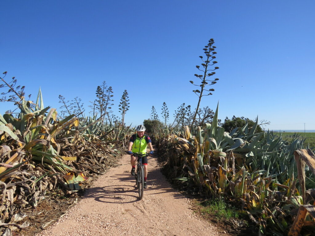
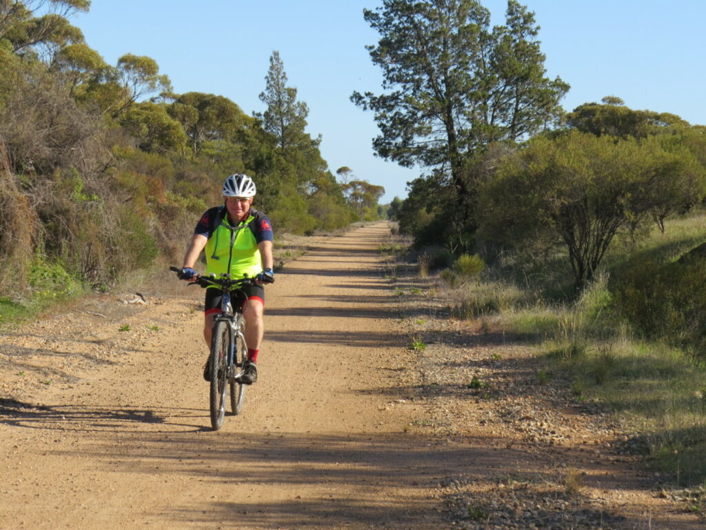
- The trail passes through several Adelaide Hills towns and beautiful rural scenery.
- The full length has a sealed surface with easy grades and is ideal for children and novice riders.
Nearby Attractions
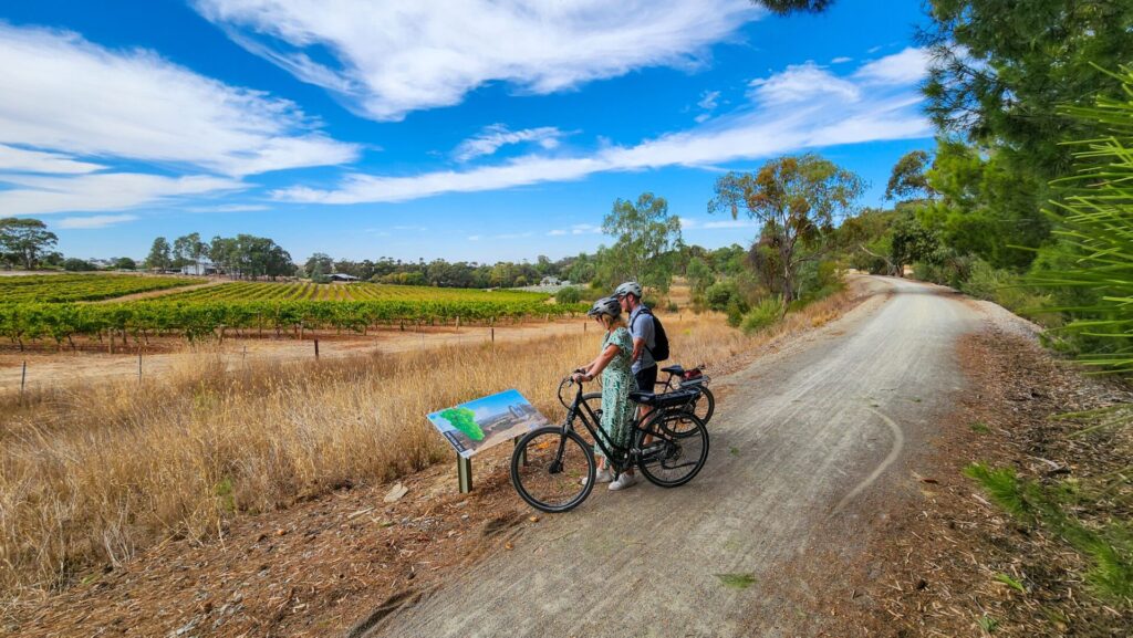
- Wine and food experiences
- Rural scenery
- National Motor Museum, Birdwood
- Hahndorf German heritage village
- Melbas chocolate factory on the trail at Woodside
- Steamranger depot, Mt Barker, for steam trains south
Last updated: 24 March 2024
This scenic shared use trail links the towns of Oakbank, Woodside, Charleston and Mt Torrens via the railway corridor, taking advantage of topography and panoramic views.
It is possible to enjoy a ride all the way from Oakbank to Mt Torrens almost entirely on traffic-free dedicated cycle paths. Take advantage of coffee shops, bakeries and restaurants in the larger towns.
There are toilets and picnic facilities at Woodside, Charleston and Mt Torrens.
Section Guides
Oakbank to Woodside (4.5 km)
This first stage of the trail starts at the end of Elizabeth St, Oakbank, where the old railway station once stood.
The first section is on-road on the busy Onkaparinga Valley Road for about 1 km toward Woodside. A safer option is to begin from the parking area on Gillman Road, about 500 m north of the start of the rail trail.
On the left is Oakbank racecourse, home of steeplechasing and jumping in SA, which combines with flat racing over the Easter weekend festival and includes the Great Eastern Steeplechase.
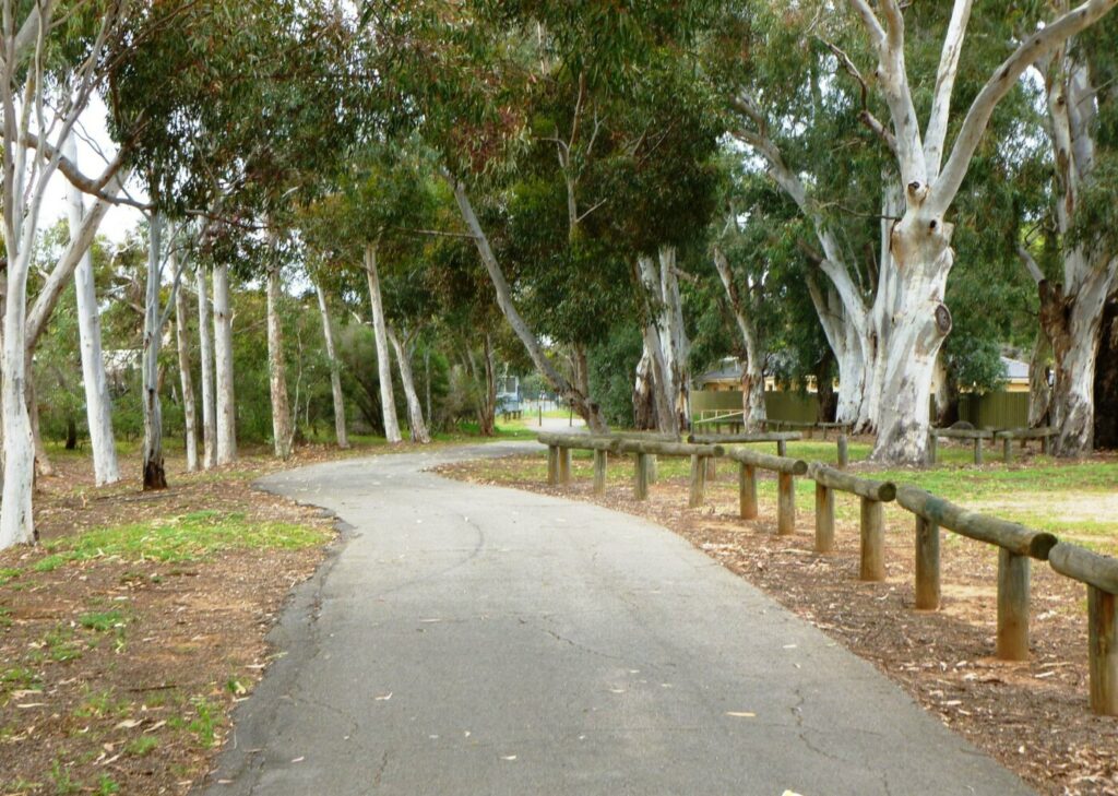
The trail is then a smooth sealed surface that follows the old rail alignment for 3.5 km.
At Woodside the trail crosses Onkaparinga Valley Rd and curves behind the shops. There are cafes and bakeries on Onkaparinga Valley Rd as well as a good bike shop.
Public toilets are in the sporting precinct near the road crossing.
The Woodside BMX/MTB track has been built on the site of the old Woodside station. It is landscaped and maintained by volunteers from the Love Woodside Group. The station’s well, used to supply water to steam trains and stock, has been restored at the northern end of the station precinct. There is ample parking near the BMX/MTB tracks, and picnic facilities and a bike maintenance stand.
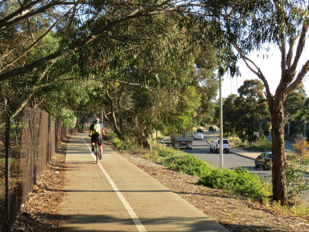
The trail is on-road along Station Rd and Langbein Ave.
From the end of Langbein Ave the trail becomes a rail trail again and passes through a picturesque, heavily wooded section of Woodside township. The trail passes Barristers Block Winery on the left before it again crosses Onkaparinga Valley Rd.
Melba’s Chocolates and Woodside Cheesewrights are signposted to the right just north of the road crossing.
Woodside to Charleston (5 km)
There are several road crossings along this section. At Charleston, the trail does a dog-leg to the right along Newmans Rd.
Shaded picnic facilities, including free BBQs and toilets are located off Newmans Rd near the intersection with Onkaparinga Valley Rd. Charleston Hotel does all-day meals on weekends.
Charleston to Mt Torrens (7 km)
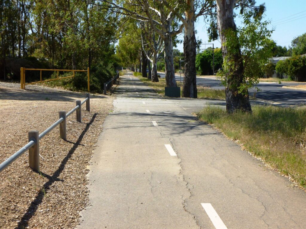
This section features scenic farmland and traverses deep, shady cuttings and high embankments. It is a steady climb from Charleston to the road crossing approaching Mt Torrens.
After a downhill run, the trail ends at Oval Rd on the northwest side of Mt Torrens; turn right on to unsealed Oval Rd for access to Mt Torrens township. Mt Torrens has a general store and hotel. Toilets are located at the oval.
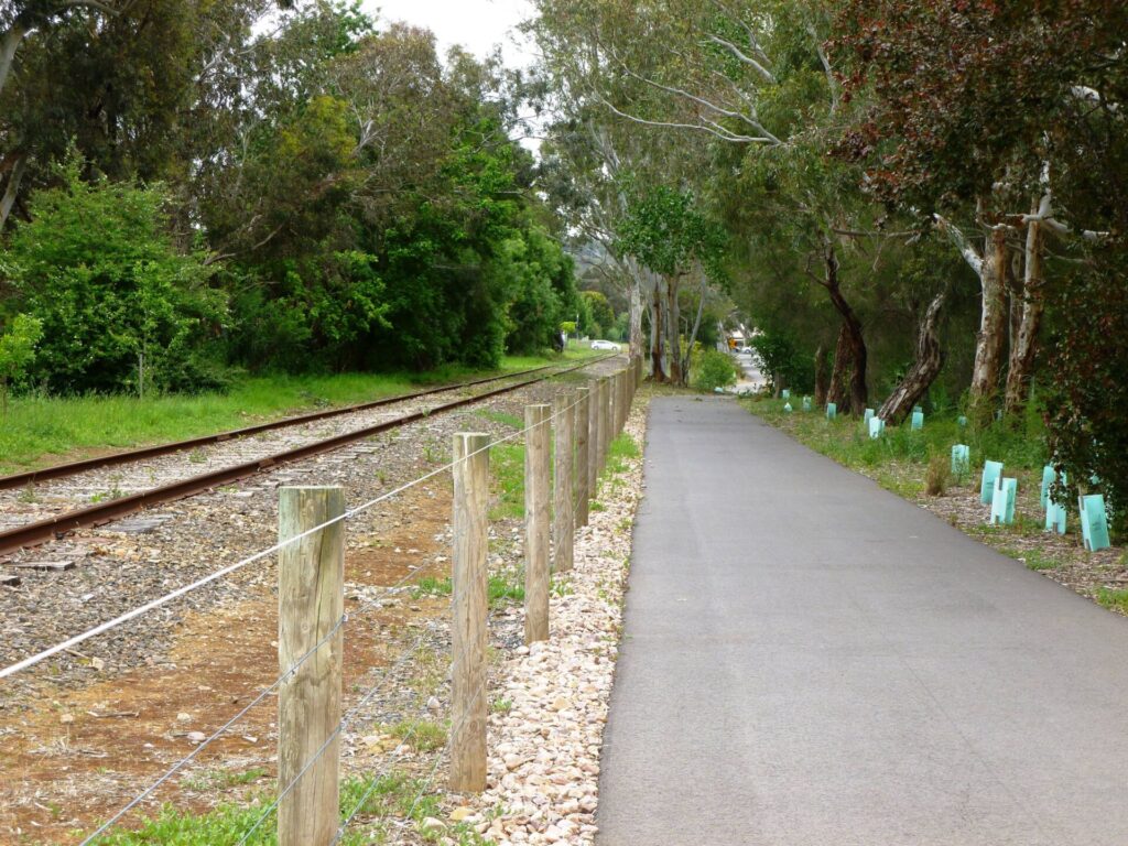
![Walkers at Woodside to Charleston start point [2011]](https://www.railtrails.org.au/wp-content/uploads/2023/01/S12-158-Woodside-to-Charleston-start-point-6-2011-11-Walker_crop-300x169.jpg)
Walkers at Woodside to Charleston start point [2011]
![Woodside to Charleston rest station [2011]](https://www.railtrails.org.au/wp-content/uploads/2023/01/S12-158-Woodside-to-Charleston-rest-station-1-2011-11_crop-300x169.jpg)
Woodside to Charleston rest station [2011]
![Charleston vineyards [2020]](https://www.railtrails.org.au/wp-content/uploads/2023/01/S12-159-Charleston-vineyard-2020-04-300x169.jpg)
Charleston vineyards [2020]
![Walkers at Woodside [2020]](https://www.railtrails.org.au/wp-content/uploads/2020/11/S12-159-013-Amy-Gillett-RT-Woodside-Walkers-2020-10-300x225.jpg)
Walkers at Woodside [2020]
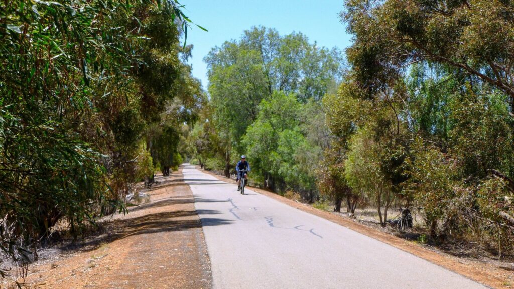
![Cruising through Woodside on the high quality rail trail [2022]](https://www.railtrails.org.au/wp-content/uploads/2023/01/S12-160-The-Adelaide-Hills-trail-was-built-to-a-high-standard-Woodside-2022-IMG_1344-300x169.jpg)
Cruising through Woodside on the high quality rail trail [2022]
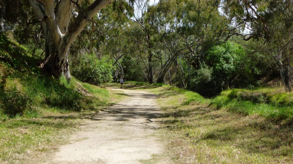
![Gliding through a cutting in Charleston [2020]](https://www.railtrails.org.au/wp-content/uploads/2020/11/S12-208-026-Amy-Gillett-RT-Charleston-Cutting-2020-10-300x225.jpg)
Gliding through a cutting in Charleston [2020]
![The scenery around Charleston [2020]](https://www.railtrails.org.au/wp-content/uploads/2023/01/S12-208-033-Amy-Gillett-RT-Charleston-Wooded-Cutting-2-2020-10-300x225.jpg)
The scenery around Charleston [2020]
![Mt Torrens vineyard [2020]](https://www.railtrails.org.au/wp-content/uploads/2021/07/S12-208-036-Amy-Gillett-RT-Mt-Torrens-Vineyard-2020-10-300x225.jpg)
Mt Torrens vineyard [2020]
![Passing some locals near Springhead Rd [2020]](https://www.railtrails.org.au/wp-content/uploads/2023/01/S12-208-29-more-Cows-between-Hartmann-Road-and-Springhead-Road-DSC05279-2020-10-300x225.jpg)
Passing some locals near Springhead Rd [2020]
![Rural view north of Springhead Rd [2020]](https://www.railtrails.org.au/wp-content/uploads/2021/07/S12-208-31-rural-views-north-of-Springhead-Road-DSC05281-2020-10-300x225.jpg)
Rural view north of Springhead Rd [2020]
![Vineyard on the approach to Onkaparinga Valley Road crossing [2020]](https://www.railtrails.org.au/wp-content/uploads/2023/01/S12-208-34-Vineyard-on-the-approach-to-Onkaparinga-Valley-Road-crossing-DSC05284-2020-10-2-300x156.jpg)
Vineyard on the approach to Onkaparinga Valley Road crossing [2020]
![Current end of the trail at Mt Torrens [2020]](https://www.railtrails.org.au/wp-content/uploads/2023/01/S12-258-037-Amy-Gillett-RT-Mt-Torrens-Trail-End-2020-10-300x225.jpg)
Current end of the trail at Mt Torrens [2020]
![Burfords Hill Road heritage listed rail bridge north of Mt Torrens [2020]](https://www.railtrails.org.au/wp-content/uploads/2023/01/S12-258-Burfords-Hill-Road-heritage-listed-rail-bridge-north-of-Mt-Torrens-DSC05285-2020-10-300x225.jpg)
Burfords Hill Road heritage listed rail bridge north of Mt Torrens [2020]
 Providing Adelaide, Adelaide Hills, Barossa Valley, Kangaroo Island & Flinders Ranges with the very finest in Cycling tours & Bike hire services.
Do you know of a bike hire or transportation service on this rail trail that should appear here? If so, let us know at admin@railtrails.org.au.
Information and Links
The trail is managed by Dept Planning, Transport and Infrastructure. To report any issues or problems contact www.transport.sa.gov.au or phone 1800 018 313
For further information go to:
Contact Rail Trails Australia
To contact us about this rail trail, email sa@railtrails.org.au
Background Information
Traditional owners
We acknowledge the Peramangk people, the traditional custodians of the land and waterways on which the rail trail is built.
Development and future of the rail trail
The trail is named in memory of Amy Gillett, a South Australian track cyclist and rower who represented Australia in both sports. She was killed when a driver crashed into the Australian cycling squad with which she was training in Germany in 2005.
The Friends of the Adelaide Hills Rail Trail was formed in 2007 to assist the development of the rail trail. The first stage of the trail from Oakbank to Woodside opened in January 2010. The Woodside to Charleston section was opened in June 2011. Charleston to Mt Torrens was opened in May 2014.
Funding was obtained in Oct 2020 for a 6 km extension from Mt Torrens to Birdwood. RTA believes the rail trail should be extend from Birdwood to the end of the line at Mt Pleasant, which would make the trail 32 km in total.
Rail line history
The railway line from Balhannah to Mt Pleasant opened in 1918, following some 60 years of meetings and negotiations, and ran as a freight and passenger service. The line had six stations – Oakbank, Woodside, Charleston, Mount Torrens, Birdwood, and Mount Pleasant – and seven halts located near level crossings at Mappinga, Riverview, Kayannie, Muralappie, Milkappa Rd, Crane Rd and Narcoonah. Up to 19 trains would serve the Easter Oakbank Races and most would be parked at Woodside until required for the return trip to Adelaide. Troops were carried to and from Woodside Army Camp’s Riverview siding.
The line was closed in March 1963, and most of the former corridor between Balhannah and Oakbank has returned to private ownership.
Amy Gillett Rail Trail extension project to go ahead after funding secured
Posted: 24/03/24
An extension to the Amy Gillett Rail Trail will go ahead after a funding agreement ...
More...Tour Down Under takes place soon in South Australia
Posted: 19/12/23
South Australia's iconic Tour Down Under international road cycling event is on again in January 2024 ...
More...Upgrade of directional signage and installation of bike repair stations on Amy Gillett Rail Trail
Posted: 24/10/23
A few small changes to the Amy Gillett Rail Trail in South Australia have occurred ...
More...Amy Gillett Rail Trail – extension from Mt Torrens to Birdwood
Posted: 07/09/23
In 2020 the Adelaide Hills Council was successful in securing $2.6m in funding from the Federal ...
More...Amy Gillett Rail Trail – the perfect location to stage a community event
Posted: 19/03/22
The Amy Gillett Rail Trail came alive for ‘Discover, Play, Bikeway!’ on Sunday 6 March. The ‘...
More...Amy Gillett Rail Trail – Discover, Play, Bikeway! 2022
Posted: 24/02/22
After a hugely successful inaugural event in 2021, the Adelaide Hills Council has organised Discover, Play, ...
More...Amy Gillet Rail Trail – A Koala friendly trail
Posted: 15/03/21
In December 2019 a bushfire spread through the hills and valleys around the Amy Gillett Rail ...
More...Amy Gillett Rail Trail helps to revive the Adelaide Hills
Posted: 15/03/21
In December 2019 a bushfire spread through the hills and valleys around the Amy Gillett Rail ...
More...‘Festival of the Hills’ Amy Gillet Bikeway
Posted: 07/02/21
As part of the ‘Festival of the Hills’, the Adelaide Hills Council is pleased to ...
More...$2.6m secured for Amy Gillett Bikeway Rail Trail in South Australia
Posted: 12/10/20
Adelaide Hills Council has received $2.6 million of Federal funding to complete stage 4 of the popular (...
More...Extension of Adelaide Hills Amy Gillett Rail Trail in South Australia
Posted: 29/04/20
The Adelaide Hills Council has identified an extension of the Adelaide Hills Amy Gillett Rail ...
More...Stage 3 of the Adelaide Hills Amy Gillet Rail Trail Opening
Posted: 04/05/14
The 7km Stage 3 section of the rail trail between Charleston and Mt Torrens will be ...
More...Adelaide Hills Rail Trail Link Open
Posted: 17/06/12
A 500 metre "missing link" behind the Woodside shops linking the Oakbank - Woodside and Woodside ...
More...Amy Gillett Rail Trail (Stage 1) Official Opening (SA)
Posted: 19/01/10
The official opening for Stage 1 of the Amy Gillett Rail Trail will be taking place ...
More...Funding for the Adelaide Hills Rail Trail Announced
Posted: 27/01/09
The South Australian state government has announced $1 million in funding to build the first stage ...
More...Adelaide Hills Rail Trail (SA) Committee Formation Meeting
Posted: 16/11/07
This proposed rail trail has been under consideration for many years now. An incorporated association ...
More...Nearby Trails
Mount Barker Rail Trail
33km southeast of Adelaide
5 km


Stockade Rail Trail
Pooraka, 11km north of Adelaide
2.6 km
Parafield Rail Trail
15km north of Adelaide
3 km
Penfield Rail Trail
Northern suburb of Adelaide
7 km
Westside Bike Path
2km West of Adelaide.
9 km
Mike Turtur Bikeway
Between Adelaide city and Glenelg
9 km
Smithfield Magazine Rail Trail
Smithfield Plains, 33kms north of Adelaide
3.5 km
Marino Rocks Rail Trail
Marino Rocks
16 km
Outer Harbour Rail Trail
Port Adelaide, 20km north west of Adelaide
23 km
Barossa Rail Trail
Barossa Valley - between Gawler and Angaston
43 km
Coast Park Rail Trail
12 Km west of Adelaide CBD
34 km
Coast to Vines Rail Trail
Southern Adelaide Suburbs
37 km

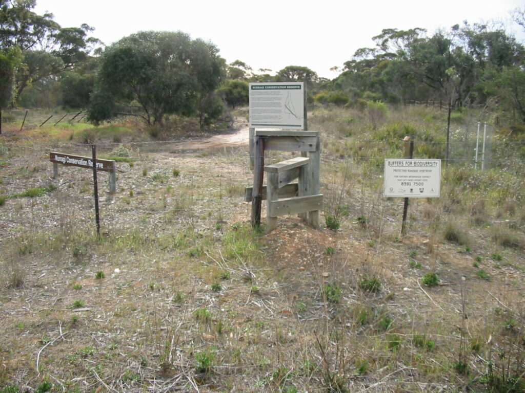
Nurragi Conservation Reserve
Milang approx 70km south east of Adelaide
12 km
Kapunda Rail Trail
78km north of Adelaide
1 km
Encounter Bikeway
Between Goolwa and Victor Harbour on the Fleurieu Peninsula 90km south of Adelaide
28 km
Eudunda Rail Trail
112km north of Adelaide
1 km
Riesling and Rattler Rail Trail
130km north of Adelaide
53 km
Copper Rail Trail
100km north of Adelaide
26 km
Shamus Liptrot Rail Trail
100km north of Adelaide
11 km

Nearby Trails
Mount Barker Rail Trail
33km southeast of Adelaide
5 km
Stockade Rail Trail
Pooraka, 11km north of Adelaide
2.6 km
Parafield Rail Trail
15km north of Adelaide
3 km
Penfield Rail Trail
Northern suburb of Adelaide
7 km
Westside Bike Path
2km West of Adelaide.
9 km
Mike Turtur Bikeway
Between Adelaide city and Glenelg
9 km
Smithfield Magazine Rail Trail
Smithfield Plains, 33kms north of Adelaide
3.5 km
Marino Rocks Rail Trail
Marino Rocks
16 km
Outer Harbour Rail Trail
Port Adelaide, 20km north west of Adelaide
23 km
Barossa Rail Trail
Barossa Valley - between Gawler and Angaston
43 km
Coast Park Rail Trail
12 Km west of Adelaide CBD
34 km
Coast to Vines Rail Trail
Southern Adelaide Suburbs
37 km
Nurragi Conservation Reserve
Milang approx 70km south east of Adelaide
12 km
Kapunda Rail Trail
78km north of Adelaide
1 km
Encounter Bikeway
Between Goolwa and Victor Harbour on the Fleurieu Peninsula 90km south of Adelaide
28 km
Eudunda Rail Trail
112km north of Adelaide
1 km
Riesling and Rattler Rail Trail
130km north of Adelaide
53 km
Copper Rail Trail
100km north of Adelaide
26 km
Shamus Liptrot Rail Trail
100km north of Adelaide
11 km
12 reviews of “Adelaide Hills Amy Gillett Rail Trail”
if starting from the Oatbank end, the best starting location is the Gillman st – great place to park and get organized. there is no evidence of the trail starting at Elizabeth St in Oatbank, the first actual sign on the main road is near the Gillman st corner.
We rode on this trail yesterday. We started off from Hahndorf and used the local roads to get to the start at Oakbank, about 8kms on fairly undulating roads.
Unfortunately there is little or no accommodation on the Rail Trail, so Hahndorf is the closest place to stay. Thank god for ebikes.
The trail itself is very nice, with a smooth sealed surface all the way to Mt Torrens. It is uphill all the way, albeit at railway grade. But it is a nice ride back. The trail goes out the back of Woodside, which has some shops and cafes for refreshment. There is also a cheese factory and chocolate factory on the northern end of Woodside, well worth a visit.
Unfortunately the trail finishes in the middle of nowhere, about 2km from the old pub at Mt Torrens. It would be great to see it continue on to Birdwood and Mt Pleasant where the railway terminated.
It would also be good if the trail was finished from Oakbank to Balhannah. The traffic on the road is very busy, especially on weekends.
We rode about half of this ride but began from Hahndorf and a rigorous hill or two to get to the starting point.
If riding just the trail from the Woodside end, it is recommended to use the Gillman or other cross streets to begin the ride. The actual starting point is difficult to get to from town on the shared path or busy road.
The trail starts off well enough but quickly becomes what I would label a shared path and wanders on and off streets and through parking lots and suburban developments as it makes its way. While there are advantages to having access to shops, it is unlike what many rail-trail enthusiasts might consider the peaceful rail-trail they may seek
Don't get me wrong, any rail trail is a good rail trail but some are more peaceful and rural and picturesque than others. This one is a mixed bag, great for locals but, personally, I would not go out of my way to do on a holiday.
I would also remark that motorists in the area are a lot less respectful of cyclists than we had assumed and even come to expect at home in NSW!
Hi Omar,
The ride from Hahndorf to the start of the trail just north of Oakbank is difficult as the roads are hilly and not suited to safe cycling. The best option is to start from Gillman Road where is is good parking. Once you pass through Woodside, the trail passes through open farmland all the way to Mt Torrens.
The Adelaide Hills Council is currently developing a Trails Strategy and improving the connectivity between townships will be a high priority.
Regards Mark
My partner and I did this trail in late one afternoon in September 2018. We stumbled on it after visiting Hahndorf. We managed to hire good bikes including an e-bike from the Eco Adventure Group behind the Bicycle Fix cycle store in the small town of Woodside. The picturesque scenery of the Mount Lofty Ranges and e-bike made this ride a highlight of the whole SA trip for her! There are wineries along this trail, as well as chocolatiers and historic features. The trail is also popular with locals, with many people out cycling, walking or running. There are options for side trips and we took an alternative route on return to Charleston.
Did this trail this Australia Day with our little one in tow in a trailer. Its a nice trail but is lacking in amenities/shady shelters and has a couple of annoying gaps. The trail surface is great and smooth the whole way but there are a couple of busy on road sections which get a bit scary when towing a baby in a trailer…. The trail also just ‘ends’ on the outskirts of Mount Torrens. My suggestions would be…
A nice little cafe/kiosk in Woodside next to the jumps park and rail trail – would be a little gold mine for whoever takes this on….
Some sort of sign at the end near Mount Torrens
A continuation of the trail through to Mount Pleasant!
Was a nice way to spend the day though 🙂
Found this trail while exploring the hills. As I came from NSW and had the bike in the vehicle. Asked at the local bike shop and the brochure I was given was out of date. Found it much longer than I thought had a great ride along length. Looks like it is about time this site was updated to show the current length of the ride. Some form of printed info available at shops and information centres would help those who are not locals.
Totally agree with you Greyhoundlover, I personally sound the bell on my bike when approaching other trail users regardless of what mode of transport they are using. Also looking forward to using the next section when it is complete.
I seem to be the only one offering comments, but here is a suggestion. At all access points to the trail, I would like to see a notice requesting cyclists to give some warning when approaching people on foot or horseback from behind. On that smooth surface it is impossible to hear bicycles coming. I am amazed there have been no accidents…. a startled dog or horse will swing around to face a perceived threat, could push its owner / rider into the path of bikes. Please give this some consideration.
Thanks for that, I was quite puzzled but think I have seen that sign. Will look for it next time. I’m looking forward to walking the new section when it’s finished, Great work!
The trail extension starts in Newman Road about 50 metres to the east of the existing trail. Look for a stobie pole with HANSON Lot 102 written on it. The driveway by the pole is the access road.
Love the trail! I live in Birdwood & often drive to Charleston to walk my greyhound on it. I see that work is underway for the Charleston to Mt Torrens section… lovely, I can’t wait! But I have been trying to workout where in Charleston that section starts & so far I can’t find it. Can anyone enlighten me?