It is a popular getaway for Brisbaneites, and accommodation types include luxury bed and breakfast (B&B), farm stays, camping, country hotels and motels.
The visitor experience on this rail trail could be enhanced by installing low key rail paraphernalia and better interpretation of the historical points of interest (especially the historic cemetery) and the view points along Pocock Road.
Today, Boonah is an attractive and busy town of about 2,500 people. It promotes itself as being “The Heart of the Scenic Rim”. The Scenic Rim being the arc of spectacular mountains that stretch north west from the New South Wales border towards Toowoomba.
Nearby Attractions
In the vicinity of Boonah there are popular and famous National Parks including some that are World Heritage listed. The Parks include:
- Mt Barney National Park
- Main Range National Park
- Moogerah Peaks National Park comprising Mt French; Mt Greville; Mt Edwards and Mt Moon.
Last updated: 23 November 2022
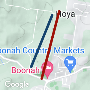
- Commencing at the carpark of the Boonah Visitor Information Centre the rail trails starts with a climb to the “Hollywood” style sign that overlooks the town and the VIC. From the town lookout the trail is to the west via a simple walking track. This section is signposted and has direction markers but the Rail trail is not evident. The Boonah Lookout can be access by local roads and there is ample parking in this locality, if the climb from the VIC to Athol Terrace is too hard.
- The walking track leads to the rail trail proper the junction being about 150 m north of the Boonah-Fassifern Road.
- The rail trail proper is easy to follow and traverse and extends for about 2km until the gate on Pocock Road. The small historic cemetery adjacent to the rail trail records the resting place for a number of the pioneers of the area. The cemetery can be accessed from Re Bridge Road and is an alternative parking area for easy access to the rail trail.
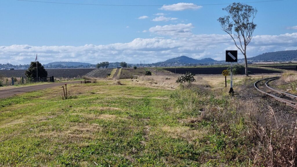
- The trail is located on the southern boundary of Pocock Road, this is a gravel surface along the fence line. At the top of the hill, about 300m from the gate, is asmall clump of trees where are some great views of the Scenic Rim including Mount French to the south west.
- The loop trail continues down the slope and south east about 400m along the unformed section of Hoya Road then follows the formed section of Hoya Road (on the eastern footpath) for about 1.4km to Springleigh Park, the site of the weekly Boonah markets.
- The trail route then follows the footpath on the southern side of the Ipswich-Boonah Road crossing back to the northern side of the road at the main roundabout (all up about 700m) back to the carpark.
- Many people, after reaching the lookout or the gate in Pocock Road reurn to the Tourist Information Centre along the old rail formation.
- There are sections of the old railway line still visible in the town proper. A section of the rail trail appears near Yeates Avenue (at Lions park) and is pedestrian friendly for about 600m to Mount French Road on the western side of Dugandan Park. This was the site of a mjor timber mill in the past. The “terminus” today is not far from the popular Dugandan Pub.
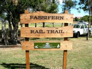
The Fassifern Rail Trail track head at the Boonah Tourist Information Centre
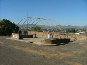
The Boonah Lookout, seemingly
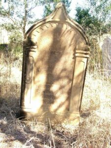
A grave in the historic cemetery
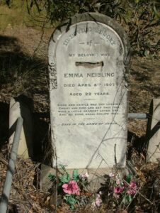
A grave in the historic cemetery
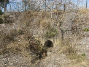
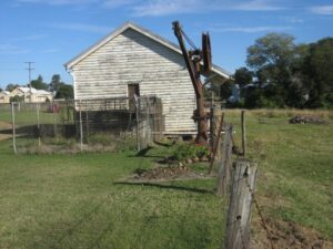
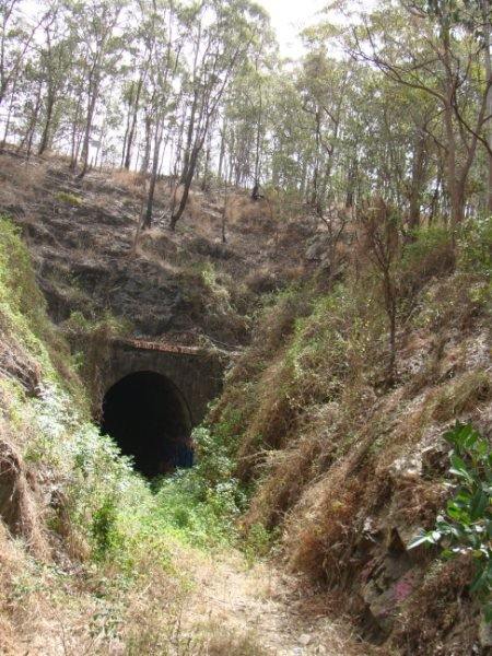
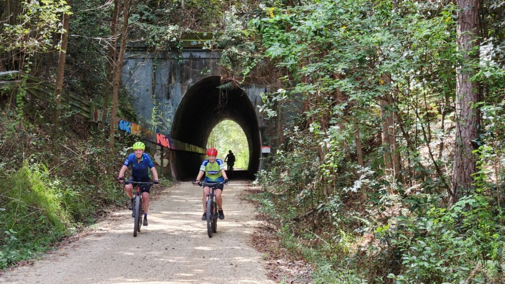
Old rail culvert, not much of the rail paraphernalia remains
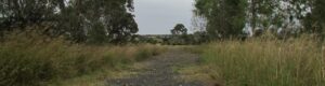
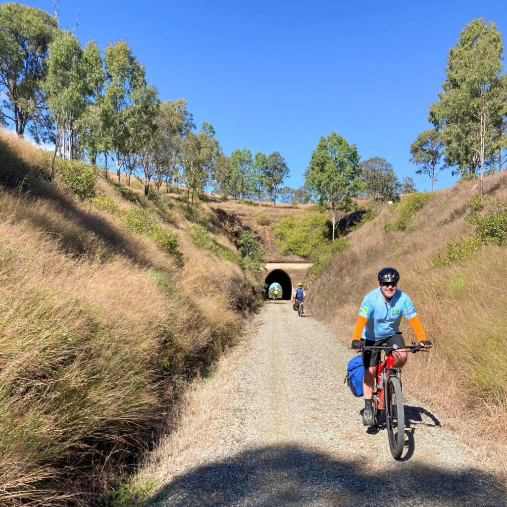
The formation and grade of the rail trail. It is easy to traverse, even if it is a bit short
The
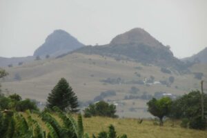
A sample of the view from Pocock road, the Scenic Rim is a majestic backdrop to the town of Boonah
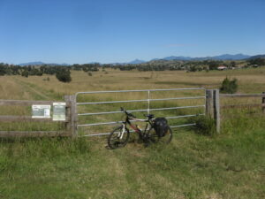
Northern end of the rail trail (ie Pocock Road)

The sometimes quirky Boonah town centre
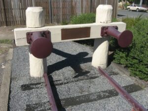
End of the line at the site of the former Boonah Railway Station
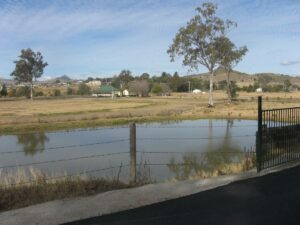
Dugandan Pond and the famous Pub
Harrisville Rail way Station (at Harrisville)
Do you know of a bike hire or transportation service on this rail trail that should appear here? If so, let us know at admin@railtrails.org.au.
Information and Links
Scenic Rim Tourism, http://www.boonahtourism.org.au/index.php?mobile=0
Scenic rim Regional Council, http://www.scenicrim.qld.gov.au/walking
To advertise your rail trail support business on this page, please click here.
To contact us about this trail, email or click here qld@railtrails.org.au
Contact Rail Trails Australia
To contact us about this rail trail, email qld@railtrails.org.au
Background Information
Traditional owners
We acknowledge the Bundjalung people, the traditional custodians of the land and waterways on which the trail is built.
Development and future
The Fassifern Rail Trail was one of the trails to be constructed under the South East Queensland Active Trails Strategy. It was to be part of 76 km Boonah to Ipswich Trail. Work on the the long distance trail was suspended in 2012.
Eventually the Boonah to Ipswich Trail will pass through an extensive, rugged and scenic landscapes including Flinders Peak, ridges forming the watershed between Purga Creek, Teviot Brook, Logan River and Bundamba and Deebing Creeks. It is to traverse Wyaralong Dam on Teviot Brook. High points along the Trail have views south and west to the Scenic Rim, east to the greater Brisbane area and Moreton Bay and north to the D’Aguilar Range. The trail was planned to support major urban developments catering for expected population growth in south East Queensland planned for the new cities known as Ripley, Flagstone and Springfield.
The Fassifern Rail Trail utilises a section of the disused railway line on the outskirts of the Boonah township. The Fassifern Rail Trail is being developed in partnership with Scenic Rim Regional Council and local community groups of the Fassifern Valley.
Rail Line History
The former rail line was known as the Dugandan railway line and linked Boonah to Ipswich about 50km to the north. This railway was reported to be the first branch line in Queensland and the first section (to Harrisville opened in 1882 and reached Dugandan in 1887. The line was closed in 1964.
Evidence of the railway between Boonah and Ipswich can still be seen in various locations along the former route, especially in the villages such as Harrisville and Peak Crossing.
The area still produces vegetables for the nearby Brisbane market notably carrots, potatoes, and cereal crops.
Nearby Trails
Bethania to Beaudesert Rail Trail
South of Brisbane, 40km from Brisbane
3.5 km


Wulkuraka – Brassall Rail Trail
41 km west of Brisbane.
3 km
Canungra Tramway Tunnel
Canungra, south of Brisbane, 80km from Brisbane
1 km
Ferny Grove Rail Trail
Samford Valley, north west of Brisbane, 16km from Brisbane
5 km

South Coast Rail Trail and Ernest Junction Tunnel
60 km from Brisbane
0.75 km
Westbrook to Wyreema Rail Trail
Toowoomba

Brisbane Valley Rail Trail
Wulkuraka is 46km southwest of Brisbane
161 km
Northern Rivers Rail Trail
North East NSW, via Murwillumbah and Casino
38 km

Caboolture – Wamuran & Loop Rail Trail
Caboolture, 47km north of Brisbane
10.5 km
Nearby Trails
Bethania to Beaudesert Rail Trail
South of Brisbane, 40km from Brisbane
3.5 km
Wulkuraka – Brassall Rail Trail
41 km west of Brisbane.
3 km
Canungra Tramway Tunnel
Canungra, south of Brisbane, 80km from Brisbane
1 km
Ferny Grove Rail Trail
Samford Valley, north west of Brisbane, 16km from Brisbane
5 km
South Coast Rail Trail and Ernest Junction Tunnel
60 km from Brisbane
0.75 km
Westbrook to Wyreema Rail Trail
Toowoomba
Brisbane Valley Rail Trail
Wulkuraka is 46km southwest of Brisbane
161 km
Northern Rivers Rail Trail
North East NSW, via Murwillumbah and Casino
38 km
Caboolture – Wamuran & Loop Rail Trail
Caboolture, 47km north of Brisbane
10.5 km
One review of “Fassifern Rail Trail”
A branch railway line use to terminate here and so a short 2 kilometre rail trail exists north of town. Along with an even shorter paved section just south of town
The Fassifern rail trail starts at the lookout above town, which allows a view of where the railway line went into town, which is now through a paddock. All that is left of where the station was in town, is a rail buffer with a plaque.
The actual rail formation is down a steep track and it's not the best surface as it overgrown with grass.
Near the end of the trail the surface is a little better due to a farm track using the rail formation.