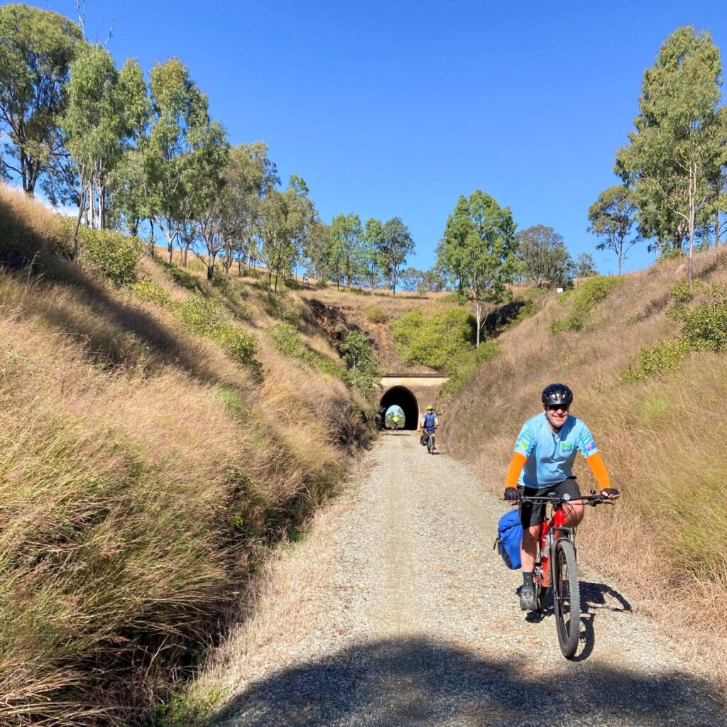
Walk part way through Queensland’s longest straight railway tunnel (287m). It is also quite high being 640m above sea level.
Now that trains don’t roar through it the tunnel is a seasonal home to a colony of bent winged bats.
A fence has been installed part way in from both entrances to protect the bat colony.
Nearby Attractions
- The trail to the tunnel is open, as is the park , shelters, and toilets.
- Queensland’s longest straight railway tunnel (287m).
- Height above sea level is 640m.
- Tunnel is home to a colony of bent winged bats.
Last updated: 23 November 2022
The tunnel is sign posted from the main road (access road is unsealed). The road takes you to a park that is actually on the ridge over the tunnel which is the crest of the Great Dividing Range.
The least distance of gravel is from the northern or Cooyar end where the tunnel is signposted off the road between Cooyar to Kulpi and Acland (which is off the New England Highway).
From the southern end the tunnel is sign posted from the Quinalow side of Peranga.
New stairs have been built at the tunnel entrance.
From the park there is a track to each end of the tunnel, both of which have long approach cuttings. It is a steep descent to the cutting at the Cooyar end, the recommended entry for one way traffic. The Oakey end is not as steep but the ground can be soggy here.
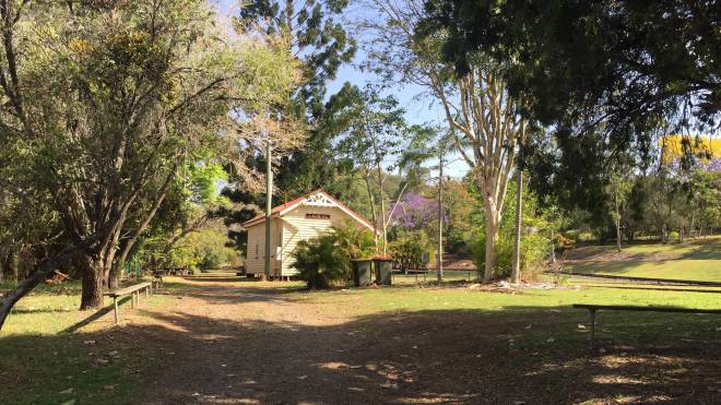
The reserve has a good picnic table but no water. It has a gas bbq and a waterless toilet. There is also a track which takes you past ruins from the camp in the construction days. There are good interpretative signs in the park, including descriptions on the history of the rail.
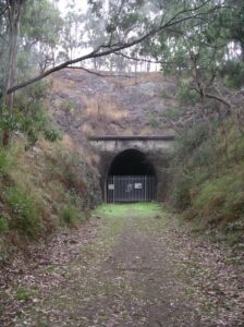
The northern portal of the tunnel (2010)
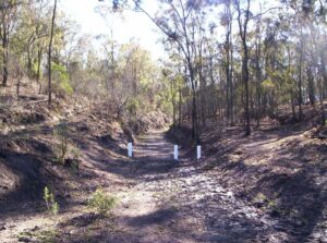
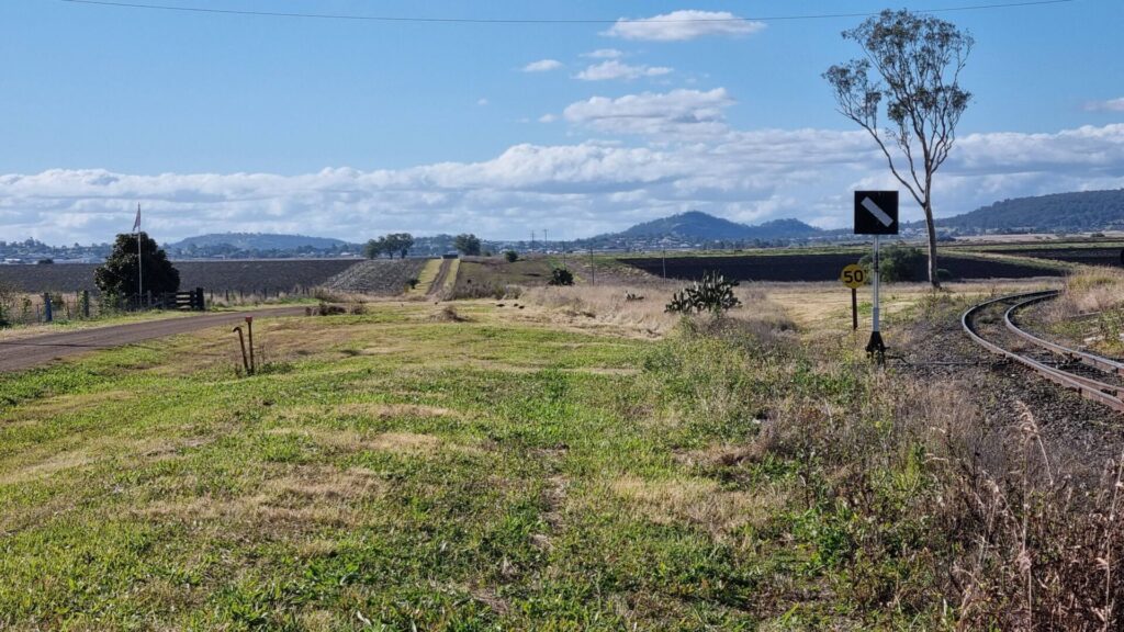
The formation near the tunnel (2007)
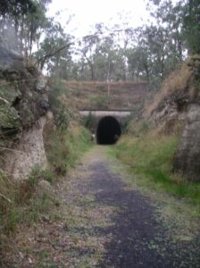
The southern portal of the tunnel (2010)
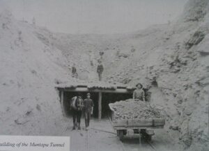
Construction of the tunnel was done the hard way!
Do you know of a bike hire or transportation service on this rail trail that should appear here? If so, let us know at admin@railtrails.org.au.
Information and Links
The trail reserve is managed by the Toowoomba Regional Council.
Toowoomba Regional Council Web Site and contact details
Contact Rail Trails Australia
To contact us about this rail trail, email qld@railtrails.org.au
Background Information
This tunnel was on the branch line that was opened from Oakey to Cooyar in 1913 and was closed in 1964.
Nearby Trails
Brisbane Valley Rail Trail
Wulkuraka is 46km southwest of Brisbane
161 km


Westbrook to Wyreema Rail Trail
Toowoomba

Kilkivan – Kingaroy Rail Trail
SE Qld, 225 km northwest of Brisbane
89 km


Caboolture – Wamuran & Loop Rail Trail
Caboolture, 47km north of Brisbane
10.5 km


Wulkuraka – Brassall Rail Trail
41 km west of Brisbane.
3 km
Mary Valley Rail Trail
158km north of Brisbane (via Caboolture), 167km via Gympie, 53km west of Noosa
5 km
Ferny Grove Rail Trail
Samford Valley, north west of Brisbane, 16km from Brisbane
5 km
Nearby Trails
Brisbane Valley Rail Trail
Wulkuraka is 46km southwest of Brisbane
161 km
Westbrook to Wyreema Rail Trail
Toowoomba
Kilkivan – Kingaroy Rail Trail
SE Qld, 225 km northwest of Brisbane
89 km
Caboolture – Wamuran & Loop Rail Trail
Caboolture, 47km north of Brisbane
10.5 km
Wulkuraka – Brassall Rail Trail
41 km west of Brisbane.
3 km
Mary Valley Rail Trail
158km north of Brisbane (via Caboolture), 167km via Gympie, 53km west of Noosa
5 km
Ferny Grove Rail Trail
Samford Valley, north west of Brisbane, 16km from Brisbane
5 km