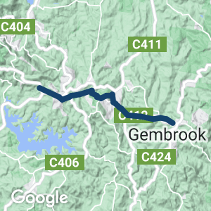
- The EDRT is a challenging 15km railside path that shadows the Puffing Billy Railway line in the Dandenong Ranges
- The terrain varies, from undulating to hilly, and so does the surface (asphalt, gravel, dirt) so it is most suitable for mountain bikes
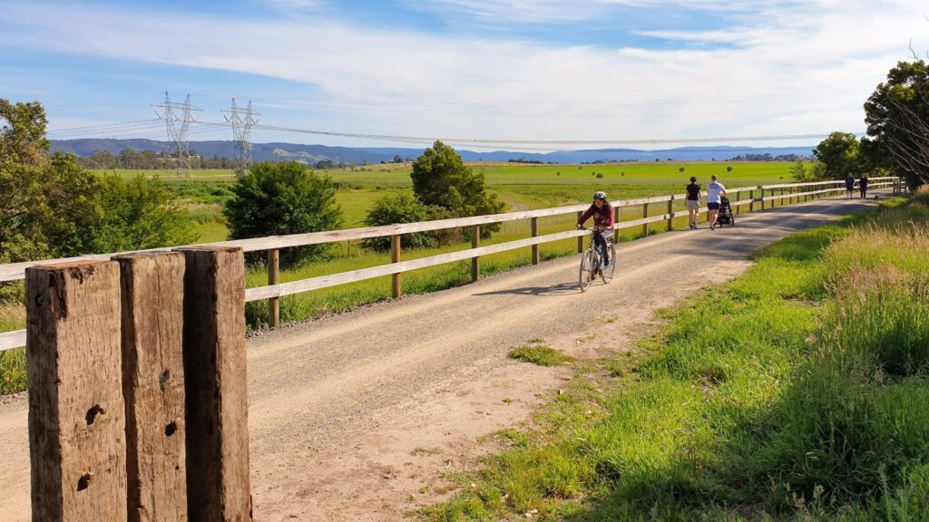
- The scenery is spectacular, changing regularly along the way with outstanding forests and lakes, farmland and villages
Nearby Attractions
- William Ricketts Sanctuary
- Heathmont to Belgrave Trail
- Mt Dandenong
- Menzies Creek Museum
- Emerald Lake Model Railway
Last updated: 9 April 2024
Emerald Lake Park is still closed. The rail trail is open from Clematis to Emerald and Wright to Gembrook.
- This trail runs through the Dandenong Ranges from Clematis to Gembrook
- While only 15km, it offers a full range of experiences – hills, forests, farms, rural villages, picnic areas and the heritage railway
- It diverges from the narrow-gauge line in some places and has steeper gradients than a rail trail
Access Points
- Clematis: Former station car park beside Paradise Valley Hotel
- Emerald, Cockatoo and Gembrook: On-street parking
- Emerald Lake: Several car parks and toilets
- Many other parking and entry points
Section Guides
Clematis to Emerald (3km)
- Trailhead is on Belgrave-Gembrook Rd, near the bottom of Menzies Rd. More parking near Paradise Valley Hotel, in the Clematis Station car park. Alternatively, you can catch Puffing Billy to Menzies Creek and walk from there
- Travel a short distance past the Clematis Station shelter before crossing the tracks and Edenmont Rd
- Trail parallels the north side of the tracks up Emerald Bank (if you’re lucky, you’ll see Puffing Billy working hard up this climb), before crossing Pinnocks Rd and the tracks
- Cross Belgrave-Gembrook Rd to enter Memorial Ave Reserve (southwest (right) side of tracks)
- There are many shops and eateries, including the famous Emerald Village Bakery, to your left
Emerald to Emerald Lake (3km)
- Cross railway line and Kilvington Drive. Trail resumes next to Gem Community Arts Centre
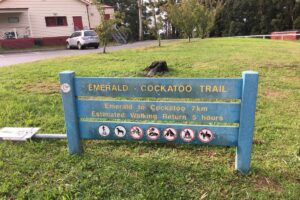
- Follow the blue recycled-plastic signs with yellow writing and arrows, which call the next section the Emerald-Cockatoo Trail
- After a short distance, cross into Pepi’s Land on the southern side of the tracks
- At Beaconsfield-Emerald Rd (C406), cross the tracks and road, taking care as it can be very busy
- Turn left on the shared path beside Princes Ave and then right past the Emerald Museum (see map).
- Follow main trail to Western Car Park and then Wombat Corner, home of a children’s camp
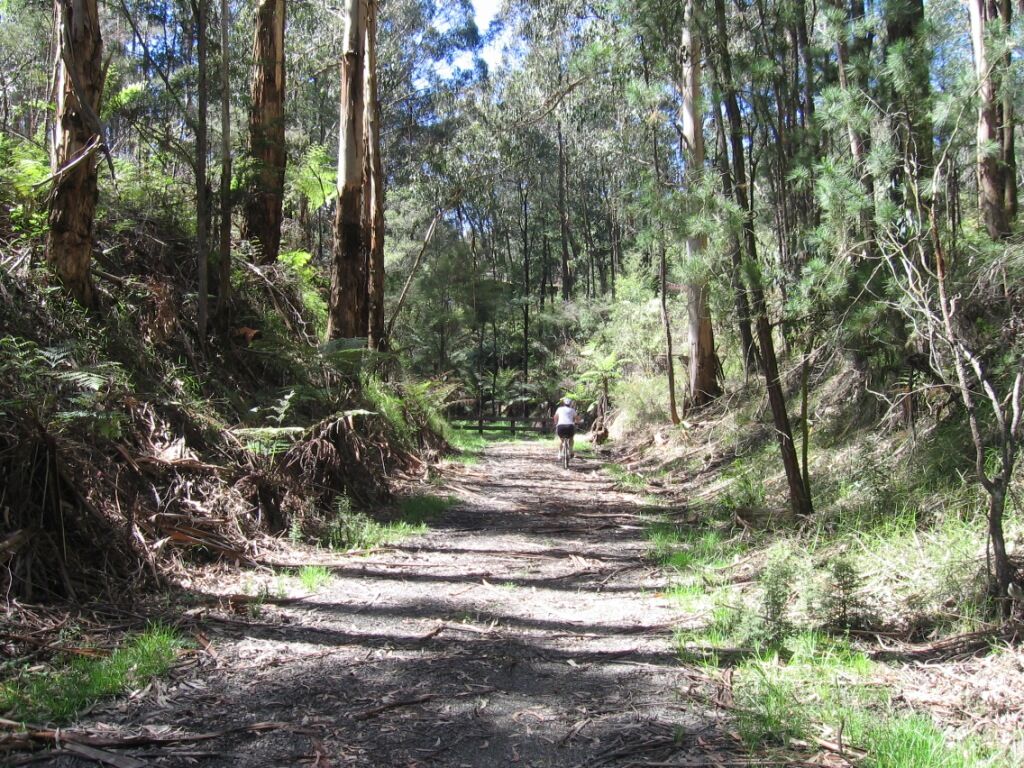
Emerald Lake to Cockatoo (5km)
- From Wombat Corner, pass beside the gate onto a beautiful, fern-lined trail that follows Wattle Creek, before crossing a sweeping shared bridge over it to arrive at Wright Rd
- Cross Wright Rd and follow the trail to the right until the railway is crossed again, this time near Wright Station
- Pass through the gates to the left and follow Wright Rd into Wright Forest
- Staying on Wright Rd, turn left before Baker St gate onto Boundary Tk and follow it down a steep decline
- Turn right, down another decline, to cross the shared bridge over Cockatoo Creek
- Continue on the trail into Cockatoo after crossing McBride St
- Continue up McBride St on the shared path crossing Healesville-Koo Wee Rup Rd (C411)
- Cockatoo has a good shopping precinct
Cockatoo to Gembrook (6km)
- The trail continues up Fairbridge Lane past a supermarket and turns right on Belgrave-Gembrook Rd, passing Cockatoo Primary School and going onto Old Gembrook Rd
- Continue along the trail until Doonaha Rd
- Cross the often-busy B-G Rd with care and continue on the trail beside Fielder Rd
- Another crossing of B-G Rd is needed at the intriguing Mapleridge Local Produce Centre
- The trail follows the railway corridor the rest of the way
- At the top of the hill, just after crossing Orchard Rd, is the Gembrook Sports Ground and your final track crossing chicane
- Continue on the trail and again cross B-G Rd on the outskirts of Gembrook
- Follow the trail along Station Rd to the end at Main St
- There are many shops and cafes in Gembrook, all on this thoroughfare
CONNECTING TRAIL
- For that immersive rail trail experience in Emerald Lake Park, walkers can follow Nobelius Tk and Nobelius Link Tk to stick closer to the curving railway line (see map)
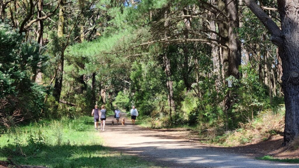
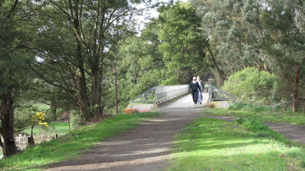
![Walkers and cyclists enjoying the trail near Clematis [2024]](https://www.railtrails.org.au/wp-content/uploads/2024/02/V09-250-Clematis-2024-01-26_171356_crop-300x169.jpg)
Walkers and cyclists enjoying the trail near Clematis [2024]
![The trail is now well identified, here at Clematis [2024]](https://www.railtrails.org.au/wp-content/uploads/2024/02/V09-250-Clematis-2024-01-26_171148-300x169.jpg)
The trail is now well identified, here at Clematis [2024]
![The trailhead in Clematis could use a raised shared crossing [2023]](https://www.railtrails.org.au/wp-content/uploads/2020/11/V09-250-Clematis-New-trail-crossing-of-Belgrave-Gembrook-Rd-62023-300x225.jpg)
The trailhead in Clematis could use a raised shared crossing [2023]
![The Clematis Book Exchange is on southern side of the line [2023]](https://www.railtrails.org.au/wp-content/uploads/2020/11/V09-250-Clematis-book-exchange-near-new-section-of-trail-2023-300x225.jpg)
The Clematis Book Exchange is on southern side of the line [2023]
![Puffing Billy at Clematis station [2023]](https://www.railtrails.org.au/wp-content/uploads/2024/01/V09-250-Clematis-train-2023-11-main-image-300x200.jpg)
Puffing Billy at Clematis station [2023]
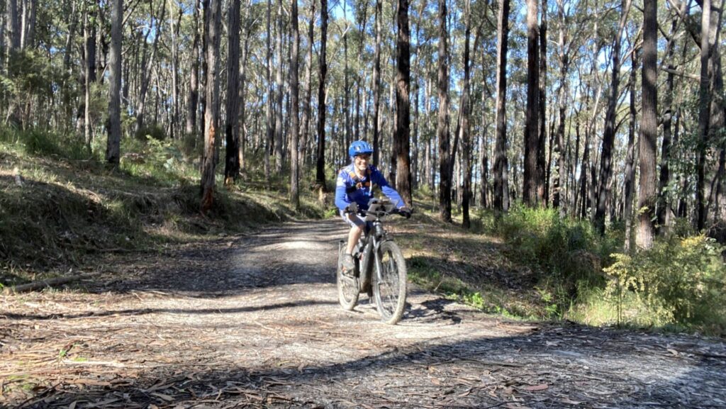
![Rider coming down Emerald Bank towards Clematis [2023]](https://www.railtrails.org.au/wp-content/uploads/2020/11/V09-250-Clematis-to-Emerald-rider-coming-down-from-Emerald-Bank-2023-225x300.jpg)
Rider coming down Emerald Bank towards Clematis [2023]
Sign at Emerald dates back to when the trail was a bit shorter (2020)
![Cruising along the trail through Pepi's Land east of Emerald [2020]](https://www.railtrails.org.au/wp-content/uploads/2021/04/8301619424025-300x225.jpg)
Cruising along the trail through Pepi's Land east of Emerald [2020]
![Paddle boats are a popular attraction at Emerald Lake Park [2023]](https://www.railtrails.org.au/wp-content/uploads/2020/11/V09-400-Lakeside-paddle-boats-2023-300x225.jpg)
Paddle boats are a popular attraction at Emerald Lake Park [2023]
![Trail users enjoy the serenity from Lakeside to Wombat Corner [2023]](https://www.railtrails.org.au/wp-content/uploads/2020/11/V09-400-Lakeside-to-Wombat-Corner-2023-300x225.jpg)
Trail users enjoy the serenity from Lakeside to Wombat Corner [2023]
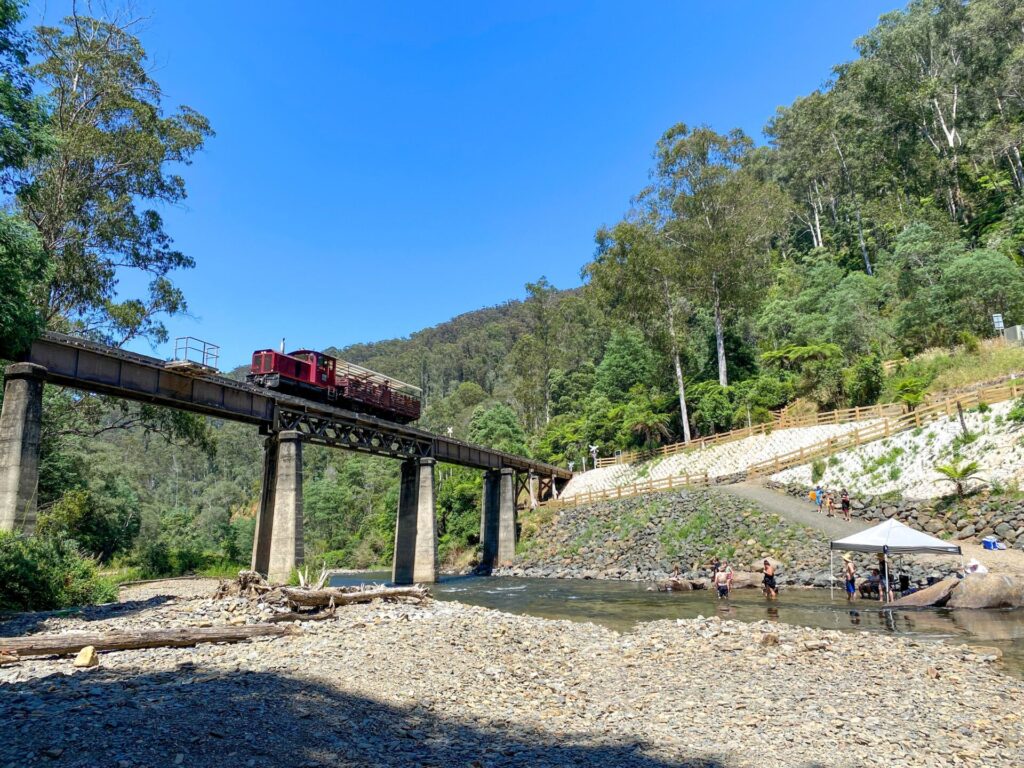
![Puffing Billy NA class 8A on the embankment before Gembrook [2023]](https://www.railtrails.org.au/wp-content/uploads/2023/07/V09-505-Cockatoo-to-Gembrook-2023-06-Enhanced_crop-300x237.jpg)
Puffing Billy NA class 8A on the embankment before Gembrook [2023]
![The last of many chicanes before the trail ends at Gembrook [2023]](https://www.railtrails.org.au/wp-content/uploads/2020/11/V09-500-Cockatoo-to-Gembrook-Last-chicane-before-town-2023-225x300.jpg)
The last of many chicanes before the trail ends at Gembrook [2023]
![Gembrook offers a wide range of services and even a small car museum [2023]](https://www.railtrails.org.au/wp-content/uploads/2021/04/5281619424025-300x225.jpg)
Gembrook offers a wide range of services and even a small car museum [2023]
![The Gembrook railyard is a popular spot for shunting photos [2023]](https://www.railtrails.org.au/wp-content/uploads/2020/11/V09-550-Gembrook-shunting-for-return-trip-2023-300x225.jpg)
The Gembrook railyard is a popular spot for shunting photos [2023]
![You can get bicycles carried back to Belgrave on the train [2023]](https://www.railtrails.org.au/wp-content/uploads/2020/11/V09-550-Gembrook-all-aboard-2023-300x225.jpg)
You can get bicycles carried back to Belgrave on the train [2023]
Public Transport
Only the 695 PTV bus service gets you from the Belgrave Railway Station to the start of this trail at Clematis, and these buses are not fitted with bike racks. Puffing Billy does take bikes but there’s an extra charge and you need to book by phone.
Refer to the PTV web page for map and timetables, or the navigation app of your choice.
Do you know of a bike hire or transportation service on this rail trail that should appear here? If so, let us know at admin@railtrails.org.au.
Information and Links
This trail is managed by Cardinia Shire Council. To report any issues please contact the council on 1300 787 624 or email mail@cardinia.vic.gov.au
Cardinia Shire’s information on the shared path is at Eastern Dandenong Ranges Trail
Other information can be found here:
Eastern Dandenong Ranges Business & Tourism
Public Transport: Bus 695 – route from Belgrave Station to Gembrook with stops at Clematis, Emerald and Cockatoo (no bikes carried)
To advertise your rail trail support business on this page, please click here
Contact Rail Trails Australia
To contact us about this rail trail, email vic@railtrails.org.au
Extension nearly done for Eastern Dandenong Ranges Trail
Posted: 03/05/23
The catchily-named Eastern Dandenong Ranges Trail will have its 800m extension from Edenmont Rd to ...
More...News update on Eastern Dandenong Ranges Trail
Posted: 22/02/23
The “Puffing Billy trail” is getting closer to the iconic Victorian steam train’s Belgrave ...
More...Nearby Trails
Heathmont to Belgrave Trail
Eastern suburbs, 40 km from the CBD
16 km


Warburton Rail Trail/Yarra Valley Trail
Yarra Valley, 50 km east of Melbourne CBD
48 km

Powelltown Tramways
Yarra Ranges, 80 km east of Melbourne
31 km
Outer Circle Rail Trail
Eastern suburbs, 6 km from Melbourne CBD
17 km
Rosstown Rail Trail
Southern suburbs, 9 km from the CBD
8.8 km
Rokeby to Crossover Rail Trail
North of Warragul, 103km from Melbourne
5 km
Hawthorn to Kew Rail Trail
Inner suburbs, 9 km east of Melbourne CBD
1 km
Noojee Trestle Bridge Rail Trail
100km east of Melbourne
3 km

Mornington Railside Trail
Mornington Peninsula, 60 km south of CBD
4 km

Inner Circle Rail Trail
Inner suburbs, 5 km from the CBD
4.8 km
Sandridge Railside Trail
Melbourne city, 1 km from GPO
4 km
Webb Dock Bridge
Docklands, 1 km from Melbourne CBD
0.2 km
Meadowlink Rail Trail
Broadmeadows, 20 km north of CBD
1.2 km
Red Hill Rail Trail
Mornington Peninsula, 90 km south of CBD
6.3 km
Bass Coast Rail Trail
130km south-east of Melbourne
23 km
Tyers Junction Rail Trail
Gippsland, 30km north of Moe, 160km from Melbourne
7 km
Moe – Yallourn Rail Trail
Latrobe Valley 130km east of Melbourne
7 km
Grand Ridge Rail Trail
Strzelecki Ranges, South Gippsland, Victoria, 160km from Melbourne
13 km
Walhalla Goldfields Rail Trail
165km east of Melbourne
7 km
Great Southern Rail Trail & Tarra Trail
South Gippsland, 130 km southeast of Melbourne
109 km
Bellarine Rail Trail
Bellarine Peninsula, 75 km southwest of Melbourne's CBD
35 km
Great Victorian Rail Trail
90 km north of Melbourne
134 km
Fyansford Rail Trail
North Geelong, 5 km from town centre
4.4 km
Gippsland Plains Rail Trail
Near Traralgon, Gippsland, 190km east of Melbourne
62 km
Nearby Trails
Heathmont to Belgrave Trail
Eastern suburbs, 40 km from the CBD
16 km
Warburton Rail Trail/Yarra Valley Trail
Yarra Valley, 50 km east of Melbourne CBD
48 km
Powelltown Tramways
Yarra Ranges, 80 km east of Melbourne
31 km
Outer Circle Rail Trail
Eastern suburbs, 6 km from Melbourne CBD
17 km
Rosstown Rail Trail
Southern suburbs, 9 km from the CBD
8.8 km
Rokeby to Crossover Rail Trail
North of Warragul, 103km from Melbourne
5 km
Hawthorn to Kew Rail Trail
Inner suburbs, 9 km east of Melbourne CBD
1 km
Noojee Trestle Bridge Rail Trail
100km east of Melbourne
3 km
Mornington Railside Trail
Mornington Peninsula, 60 km south of CBD
4 km
Inner Circle Rail Trail
Inner suburbs, 5 km from the CBD
4.8 km
Sandridge Railside Trail
Melbourne city, 1 km from GPO
4 km
Webb Dock Bridge
Docklands, 1 km from Melbourne CBD
0.2 km
Meadowlink Rail Trail
Broadmeadows, 20 km north of CBD
1.2 km
Red Hill Rail Trail
Mornington Peninsula, 90 km south of CBD
6.3 km
Bass Coast Rail Trail
130km south-east of Melbourne
23 km
Tyers Junction Rail Trail
Gippsland, 30km north of Moe, 160km from Melbourne
7 km
Moe – Yallourn Rail Trail
Latrobe Valley 130km east of Melbourne
7 km
Grand Ridge Rail Trail
Strzelecki Ranges, South Gippsland, Victoria, 160km from Melbourne
13 km
Walhalla Goldfields Rail Trail
165km east of Melbourne
7 km
Great Southern Rail Trail & Tarra Trail
South Gippsland, 130 km southeast of Melbourne
109 km
Bellarine Rail Trail
Bellarine Peninsula, 75 km southwest of Melbourne's CBD
35 km
Great Victorian Rail Trail
90 km north of Melbourne
134 km
Fyansford Rail Trail
North Geelong, 5 km from town centre
4.4 km
Gippsland Plains Rail Trail
Near Traralgon, Gippsland, 190km east of Melbourne
62 km
13 reviews of “Eastern Dandenong Ranges Trail”
We are busy touring Victoria riding all the rail trail – completed the 3 Northern ones – and as we are staying in Gembrook we rode the East Dandenong Ranges Rail trail from Gembrook and tried to get to Clematis – however we gave up at Emerald after many missed turns and total lack of signage. In all the trails we have ridden so far this has got to be the worst in terms of signage – in many cases there are just none. Trying to get from Emerald Lake back to the rail trail to get to Clematis was impossible. There is a great big sign announcing the trail but absolutely no sign saying where to go. Before Emerald there is a critical right hand turn that needs to be taken – but Jo signs lead you along Boundary Rd to nowhere.
It is a lovely ride but very very frustrating. Will try again as I have found a gps track I will try to follow.
Hi Richard,
You are not the only one who has struggled with the lack of signage on both sides of Emerald and the absence of a marked path through the town (see Graham Jennings' comments directly below). Cardinia Shire Council tells me they "are aware of the issue", which partly stems from the fact that the trail originally started on the eastern side of town and went only as far as Cockatoo (where the signage is also limited). Are you aware that RTA members can download the rides onto their phone? It will track your location on our map. We appreciate your determination
We rode this trail, Gembrook to Clematis and back, yesterday. We were on e-bikes but still spent time pushing bikes up steep tracks where there were washouts. We, like other reviewers, found that the lack of signage was a problem. This was particularly evident when we arrived at the top of Cockatoo's main street, at Emerald Lake Park, and at Emerald, where the lack of signage on arrival at Kilvington Drive had us dodging cars in main st.
Although we had to abandon our schedule after the first wrong turn it didn't detract from the overall enjoyment of a very picturesque ride, just a pity we didn't allow more time for a few rest and recovery breaks.
Hi Graham,
Thanks for leaving a review and sorry that the experience wasn't quite what you anticipated. We've seen people who've rented e-bikes at Lakes Station and struggled to get as far as McBride Rd in Cockatoo. With the 800m extension of the trail through Clematis you can see more rider-friendly “chicanes” at road crossings but there are still two crossings of busy Belgrave=Gembrook Rd (C412) on either side of Emerald without traffic controls and no clear route through the railyard. The Cardinia Shire council says it is "aware of the issue" but we understand the main road is administered by the Department of Transport. The shire council has done a great job on the new section and we would anticipate improved signage (including replacement of the old Emerald-Cockatoo Trail signs) in the near future.
We did this ride Clematis-Gembrook return on e-bikes. Other reviews mention the challenges, and we would largely concur. Our disappointment was that it doesn’t actually follow the train line very much at all. Not only is it not built on an old track, which is how I think of a rail trail, following a predictable gradient, most of the time the train is a long way from the bike trail and unseen. That said, the views across the valley between Cockatoo and Gembrook are lovely but it will be a while before we repeat this trail.
I rode this trail two days ago going both ways (Clematis-Gembrook-Clematis). I was on a hybrid bike and found it very tough going in parts where I had to walk the bike up hills (too tough for me to ride). Overall the signage was okay and the path in pretty good condition. Apart from a few steep or long hills which I had to walk, the only real problem was some very tight railway crossings. I came across one group (much younger than me) who gave up at the half way mark as they thought it too tough. Passes through some good scenery and lovely forested areas. It is hard to recommend this path as it is tough to do. But give it a go if you are reasonably fit and don't mind dismounting to negotiate crossings.
A bit of a disclaimer first, as I grew up around here my rating is probably biased.
The plan was to try and beat the train to Gembrook from Belgrave using as much dirt/gravel as possible. It failed early on the ~19% hill that the narrow gauge station is on and a bit of poor navigation however there were some great single track and quiet roads to get to the start of the route at Clematis. Highly recommended.
The track surface is fine for about 99% with a couple of washaways easily navigable however the path through Emerald lake has many tourists to be wary of on narrow paths if you are on your bike. There are a few steeper sections of the trail however these are small in length. The Highlight was definitely the forest section east of Emerald Lake to Cockatoo.
Due to time constraints, I locked the bike up at the Gembrook skate park and caught a frequent bus back to Belgrave to where the car was. I highly recommend doing the full length of the the current Puffing Billy if on a bike if you stay off the Belgrave-Gembrook Road as much as possible.
I rode this trail today (Clematis-Gembrook-Clematis) on a hybrid e-bike and agree with all the comments made by John Roth.
Biggest issues are the tight railway crossings, only a unicycle would make it through.
Busy road crossings would benefit with addition of refuge islands.
Who was the sadist who installed gates in Wrights Forest on a steep slope. Even with an e-bike I was forced to dismount and walk.
"Stay on Wright Tk until a gate – turn left onto Boundary Tk before the gate and follow it, past another couple of gates, down the steep incline to Baker St."
Take care at this junction easy to miss and end up on sealed road which actually may be a better idea.
Hi Daryl,
Trail Description has been modified regarding the left turn at Boundary Tk as some people do seem to go straight ahead onto Baker St. Have a look at the new crossing of Belgrave-Gembrook Rd at Clematis, near Menzies Rd, where the “chicane” is much easier to negotiate. Hopefully Cardinia Shire will modify some of the older ones.
Hard to recommend at present. Signage not always clear. Steep gravel tracks a challenge for us. Mountain bikes would be better. Other issue is tight crossings over Puffing Billy line and some roads force you to dismount several times. We plan to go back but would suit us more as a walking trail.
Rode it from Gembrook back to Emerald last weekend and its a bit rough and eroded in places after all the rain, plus there's roadworks at a few places that include the trail. Nothing insurmountable, but take it easy in the looser rutted sections
We rode the trail again today – what a fun experience. It is in the hills, not the valleys, so the expected climbs and descents are always a challenge.
I noticed that COG, of Warburton Trail fame, has opened up a hire store at Lakeside station – brilliant. And they're smart enough to hire eBikes to smooth out the terrain for those uninitiated.
Signage could be better. Gates through Wright Forest need to go! Lovely feed in Gembrook at either Spencer's Cafe or the Hairy Dog. All good!
I rode Emerald to Cockatoo and back on Sunday. It is rough in some parts so only MTB, hybrids or gravel bikes. It is quite steep in sections and being unfit I had to walk a few times on the way back to Emerald, but I was not in a rush.
Signage is poor going through Emerald Lake Park and I got lost a couple of times, but it is such a pretty place I actually think that was a bonus.
Seeing the Puffing Billy going past is always a delight.