- This is a bit of an adventure trail for walkers and mountain bikers wanting to do some exploring.
- The trail is relatively isolated, not used extensively and poorly sign posted. Riders must be self supported.
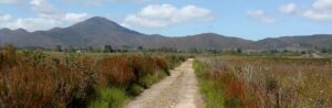
- Sections of this trail are excellent and located in a beautiful environment, particularly in summer.
- Has links to Montezuma Falls and Williamsford thereby extending the cycling experience.
Nearby Attractions
West Coast Pioneers Memorial Museum
Last updated: 6 December 2022
Access Points
Zeehan and Melba Flats
Section Guides
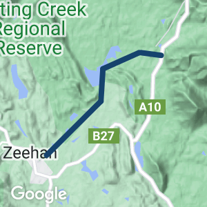
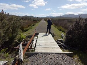
- From Zeehan, trails are accessible from the east end of Robinson Street. The trail to the north and west is slightly easier to find and has a reasonable timber bridge crossing of Parting Creek (some planks were missing). There is a low level rocky causeway crossing beside it too (conditions unknown after heavy rain; use caution with either route). The track to the south and east can be found by heading SE over a mound near the end of Robinson Street. It then sets off in an easterly direction before turning NE parallel to the other. However, near the start this trail is overgrown with gorse, and there is no good crossing of Parting Creek. There is a good connection point between the two trails NE of Parting Creek. It is recommended to start on the NW trail and then pick one beyond that. From there both trails continue straight and in close proximity for several kms.
- Near the middle of the trail, south of the Henty River, the lines turn north. This area was not inspected – however from Google Maps the western path appears overgrown, while the eastern path looks to be more easily passable.
- From the Melba Flats end, the North East Dundas Tramway can be picked up on the western side of the Murchison Highway, about 500m south of the sign for the tramway to Montezuma Falls (refer to Montezuma Falls Rail Trail description). The trail heads SW then turns NW. After around 900m it passes under a railway bridge (assumed to be that of the Emu Bay Railway). On the western side of the bridge a path can be found that takes the rider across a creek and up onto the Emu Bay Railway easement. From the junction it appears that either trail could be followed in a westerly direction to the middle of the trails described above. (The mountainbiking site above supports this view.)
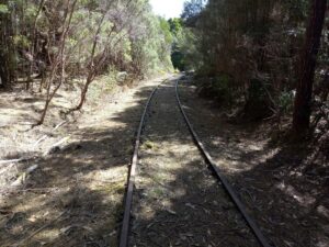
Zeehan end of NW trail (2019)
Minor Creek crossing SE trail, Zeehan end (2019)
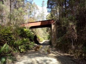
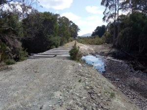
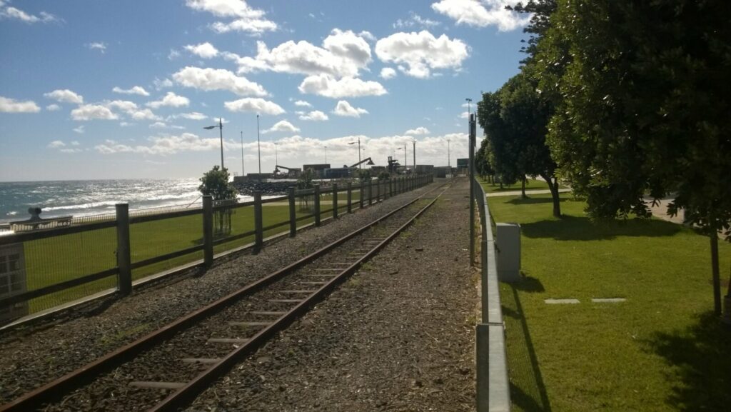
Emu Bay Rail & Dundas Tramway crossing, Melba end (2019)
Parting Creek crossing, NW trail, Zeehan end (2019)
Emu Bay Rail Melba Flats end (2019)
Do you know of a bike hire or transportation service on this rail trail that should appear here? If so, let us know at admin@railtrails.org.au.
Information and Links
Contact Rail Trails Australia
To contact us about this rail trail, email tas@railtrails.org.au
Background Information
Traditional Owners
We acknowledge the Toogee people, the traditional custodians of the land and waterways on which the rail trail is built.
Development and future of the trail
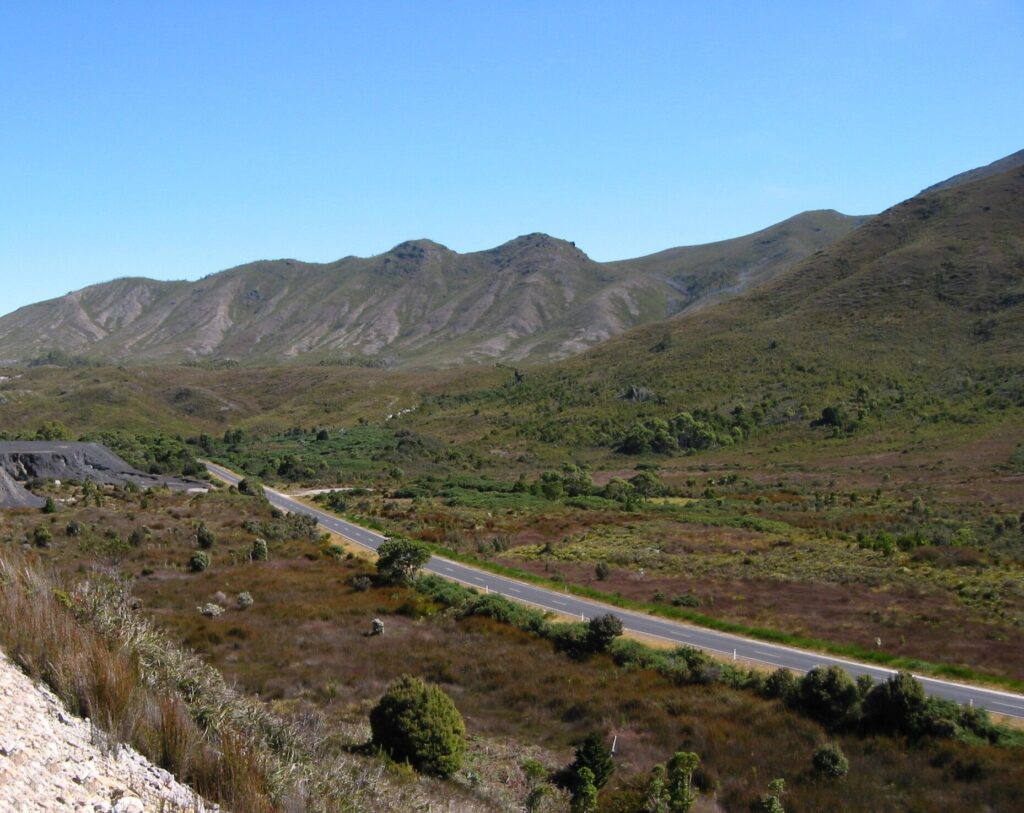
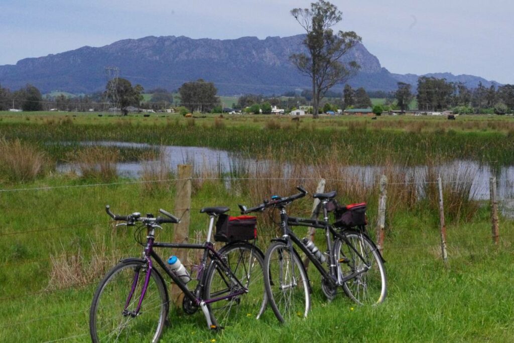
Two different railways used to run parallel and in close proximity to each other between Zeehan and Melba Flats. One was the 2 foot gauge government-owned North East Dundas Tramway which continued to Williamsford (believed to be to the north and west). The other was the 3ft 6in gauge railway to Burnie on the north coast, operated by the Emu Bay Railway Company (to the south and east). Today, the easements of these lines form an excellent walking and mountain bike trail which passes through open grasslands. Wildflowers are abundant in summer.
Trails were inspected from either end (not the middle) in December 2019. They appear to be passable with an element of exploration, and would be best suited to a mountain bike. The TassieTrails Mountain Biking in Tasmania website also describes use of these trails to get to Melba Flats and then beyond to Montezuma Falls and Williamsford – a great 56km return ride.
Rail line history
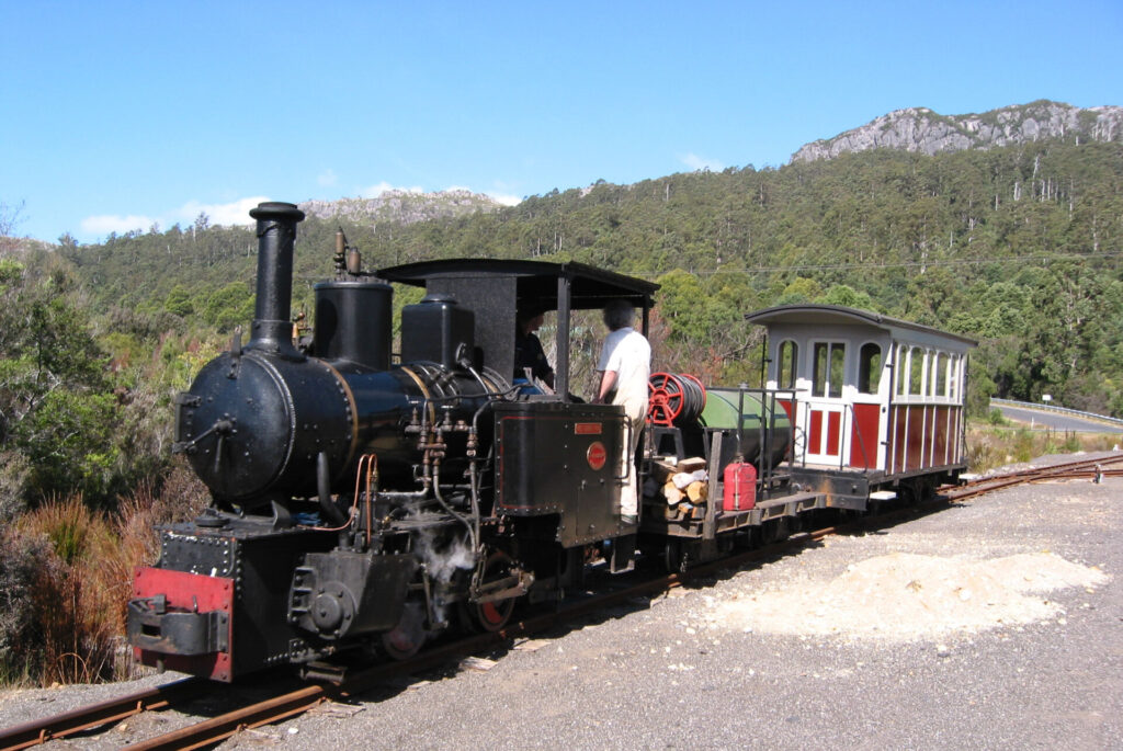
The initial surveying of the North East Dundas Tramway was initiated in 1895, and the first section was being used by 1897. The line was used to carry ore from the Williamsford mines to Zeehan. The official opening of the tramway from Zeehan to Williamsford (Where the car park area for Montezuma Falls is situated) took place in 1898.
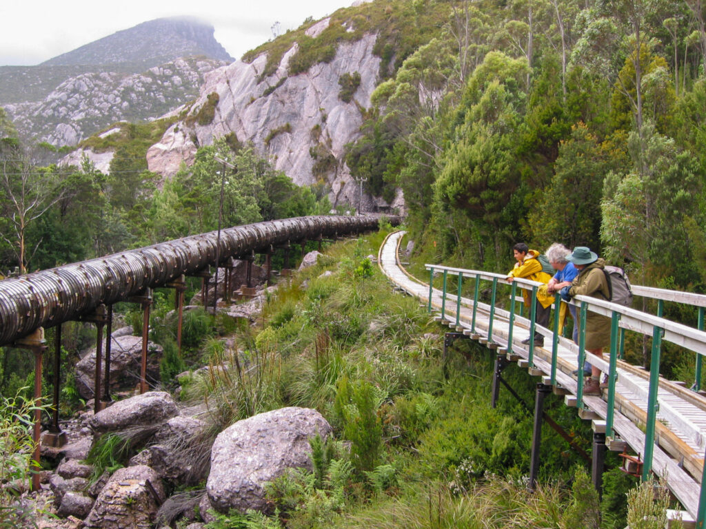
The tramway used a narrow gauge of rail, which is why it was regarded as a tram line, and not a rail line. The narrow-gauge (2 ft) was chosen because of the extremely difficult terrain that the railway crossed, requiring several big trestle bridges, including the 48 metre long one at the foot of Montezuma Falls. After heavy rain, the engine and carriages would get soaked by spray from the falls.
There was a break-of-gauge with the mainline 1,067 mm (3 ft 6 in) system at Zeehan. The railway was closed in 1932.
Nearby Trails
Montezuma Falls Rail Trail
Zeehan Area, 296km from Hobart
19 km


Spray Tunnel and Comstock Tramways
Zeehan Area, 296km from Hobart
6 km
Strahan to Zeehan Road
Zeehan to Strahan, 296km from Hobart
41.8 km

Lake Margaret Tramway Trail
Near Queenstown, 268km from Hobart
3.5 km
Wee Georgie Wood and the Tullah Tramway Trail
Tullah, 100km from Burnie, 310km from Hobart
1.5 km
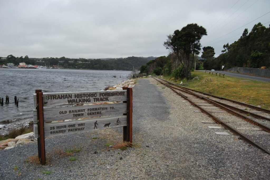
Strahan to Regatta Point Rail Trail
Strahan, 300km from Hobart
3 km


North Mount Lyell Rail Trail
South of Queenstown: through Lynchford and over Mt Jukes. , 290km from Hobart
12 km
Railton to Sheffield Rail Trail
Northern Tasmania near the Great Western Tiers and Mount Roland, 259km from Hobart
12 km
North West Tasmanian Coastal Cycleway
North coast of Tasmania
10 km
Don to Devonport Cycleway
Devonport area. 100 m west of Launceston.
11 km
Liffey Falls Rail Trail
Western Tiers, 25km south of Deloraine, 212km from Hobart
5 km
Nearby Trails
Montezuma Falls Rail Trail
Zeehan Area, 296km from Hobart
19 km
Spray Tunnel and Comstock Tramways
Zeehan Area, 296km from Hobart
6 km
Strahan to Zeehan Road
Zeehan to Strahan, 296km from Hobart
41.8 km
Lake Margaret Tramway Trail
Near Queenstown, 268km from Hobart
3.5 km
Wee Georgie Wood and the Tullah Tramway Trail
Tullah, 100km from Burnie, 310km from Hobart
1.5 km
Strahan to Regatta Point Rail Trail
Strahan, 300km from Hobart
3 km
North Mount Lyell Rail Trail
South of Queenstown: through Lynchford and over Mt Jukes. , 290km from Hobart
12 km
Railton to Sheffield Rail Trail
Northern Tasmania near the Great Western Tiers and Mount Roland, 259km from Hobart
12 km
North West Tasmanian Coastal Cycleway
North coast of Tasmania
10 km
Don to Devonport Cycleway
Devonport area. 100 m west of Launceston.
11 km
Liffey Falls Rail Trail
Western Tiers, 25km south of Deloraine, 212km from Hobart
5 km
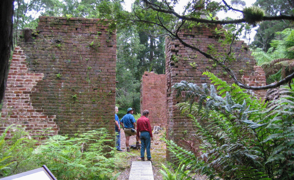
One review of “Melba Flats to Zeehan Rail Trail”
Walked parts of both ends of this trail in December 2019 as per the Details. The trail has limited signage and facilities after leaving Zeehan so does require a bit of exploration. However I had no trouble using Google Maps and had reception at both ends at least. Trail conditions are not as good as many, ie surface is earth/grass or alternatively the fine gravel beside the rails which are still in place in sections, and is not as well maintained as many. The rewards are extensive views across the grasslands to the surrounding hills, and some historic railway infrastructure along the way.