- A short rail trail in beautiful mountain country featuring mature forests and views of the mighty Thomson River
- Experience steep cuttings with many twists and turns along the old narrow-gauge formation where Puffing Billy spent its youth
Nearby Attractions
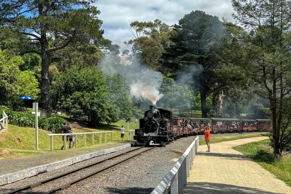
- The Walhalla Goldfields Railway is a narrow-gauge tourist service operating 3.2km of track between Thomson and Walhalla
- Walhalla was once one of Australia’s richest towns and home to over 4000 gold seekers. This lovely hamlet abounds in restored heritage buildings
- Walhalla Long Tunnel Extended Gold Mine is a genuine historic goldmine where over 13 tonnes of gold was mined from up to 1km underground … you don’t go that far on tours
- The Erica Mountain Bike Park features three intermediate-level tracks in its East Trails network near the rail trail
- Thomson Reservoir is the largest of Melbourne’s dams. It holds up to 60% of the city’s supply. A public road crosses the dam wall with views from a carpark halfway across
- Tyers Junction Rail Trail
Last updated: 1 October 2023
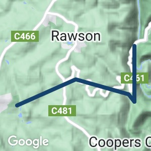
Access points
- Erica: Park at the Erica Recreation Reserve, which has play equipment, amenities and shelter. There is limited parking at the trailhead in Mill Park
- Knotts Siding: Near the junction of Tyers-Walhalla Rd (C481) and Walhalla Rd (C461)
- Platina: From Walhalla Rd turn onto Coopers Creek Rd and, after 200m, there is an access track to the Platina Station site
- Thomson: Improved car parking across the road from the railway station. To reach the rail trail, follow the service road between the station and river to an interpretive sign. A track at the back of the railyard climbs steeply to the old railway formation
Section Guides
Erica to Thomson (7km)
- From Erica Recreation Reserve, follow Station St past the holiday park and onto Henty St to Mill Park, where the trail begins from a small carpark
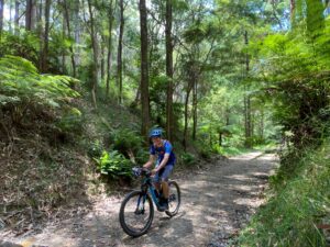
- Cross a low-level embankment over Jacobs Creek, where there once was a huge trestle bridge, and proceed to a cutting surrounded by mountain ash
- After 1.5km you come to Knotts Cutting (now filled in) and must follow a steep track to cross Tyers-Walhalla Rd and re-join the trail
- Follow the twists and turns alongside Nelson Creek to the famous horseshoe bend. This curve is so sharp that passengers at the back of the train could see the locomotive travelling in the opposite direction.
- A replica station shed has been built at Platina. After passing beneath the original road bridge there are great views of the Thomson River valley
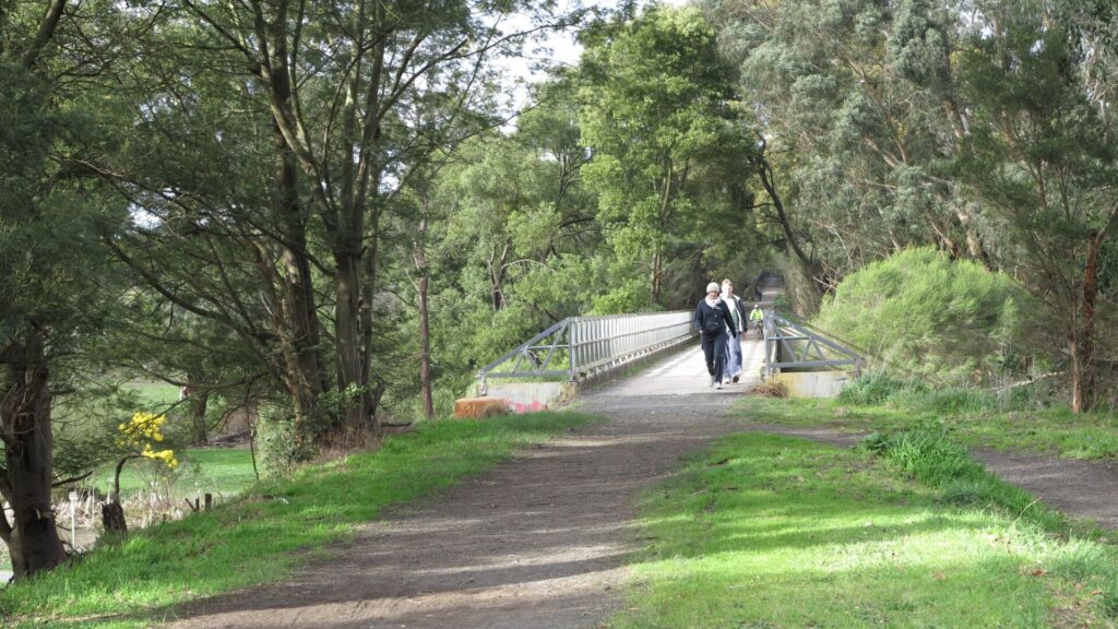
Note: Just before Thomson, detour around the remains of two trestle bridges. You may need to dismount – there are steep drop-offs.
Explorer Routes
- If the MTB park isn’t enough for you, you can attack a rough, 3.2km section of the former railway line heading towards Moe. It starts in front of the old St Thomas Church in Erica before plunging into what’s left of a railway cutting. At the gravel dump, cautiously follow the rail alignment across Moe-Walhalla Rd and chase it alongside the highway as far as Old Government Rd. A turn-off before then, with C4 sign, will take you back across the main road to the Tyers Junction Rail Trail. From Old Government Rd bear right on the railway corridor under the power lines to reach another cutting near Jacobs Creek Rd and the site of Watson Station. After this the rail alignment crosses the main road again and enters private land.
- At Moondarra Reservoir Rd, 17km from Moe and 12 from Erica, there is a 6.5km section of the former railway close to Moe-Walhalla Rd frequented by horse and dirtbike riders. Heading 3km north will get you close to where the rail easement disappears in the reservoir and 3.5km south will take you as far as Andersons Tk after crossing Crabhole Rd. Referred to in our guidebook as the Moondarra Rail Trail, this is only suitable for experienced mountain bike riders. It is rutted and sandy in places and overgrown in many. Long-sleeve tops and pants are recommended
![The Erica Railway Museum has closed but its worth a look from Henty St [2023]](https://www.railtrails.org.au/wp-content/uploads/2023/03/V29-100-Erica-1726-2023-01-300x225.jpg)
The Erica Railway Museum has closed but its worth a look from Henty St [2023]
![Erica trailhead, which also serves the MTB tracks, at Mill Park [2023]](https://www.railtrails.org.au/wp-content/uploads/2023/03/V29-100-Southern-trailhead-for-the-Erica-Thomson-Rail-Trail-at-the-end-of-Hewitt-St.-2023-1711-2-300x225.jpg)
Erica trailhead, which also serves the MTB tracks, at Mill Park [2023]
![The trail near the filled-in Knotts Cutting, which is another entry point [2006]](https://www.railtrails.org.au/wp-content/uploads/2020/11/1371605551403-300x225.jpg)
The trail near the filled-in Knotts Cutting, which is another entry point [2006]
![Replica station shed at Platina, which served Coopers Creek [2006]](https://www.railtrails.org.au/wp-content/uploads/2020/11/8801605551403-300x225.jpg)
Replica station shed at Platina, which served Coopers Creek [2006]
![The stretch from Platina to Thomson waiting for a mowing crew [2006]](https://www.railtrails.org.au/wp-content/uploads/2020/11/2851605551403-300x225.jpg)
The stretch from Platina to Thomson waiting for a mowing crew [2006]
![A bulldozer is also sometimes needed to keep the trail clear [2022]](https://www.railtrails.org.au/wp-content/uploads/2023/03/V29-150-A-bulldozer-is-required-to-clear-the-railway-reserve-in-this-steep-terrain-2022-1156-2-300x225.jpg)
A bulldozer is also sometimes needed to keep the trail clear [2022]
![The diversion around the remains of two bridges near Thomson [2006]](https://www.railtrails.org.au/wp-content/uploads/2021/12/V29-156-Platina-Thomson-2006-11-123-300x225.jpg)
The diversion around the remains of two bridges near Thomson [2006]
![Approaching Thomson with railway embankment on the left [2006]](https://www.railtrails.org.au/wp-content/uploads/2021/12/V29-206-Thomson-2006-11-124-300x225.jpg)
Approaching Thomson with railway embankment on the left [2006]
![Northern entrance to the railway reserve is steep and uninviting [2022]](https://www.railtrails.org.au/wp-content/uploads/2023/03/V29-200-Northern-entrance-to-the-railway-alignment-is-steep-and-uninviting.-Walhalla-Goldfields-Railway-holds-the-lease.-2022-1157-1-300x225.jpg)
Northern entrance to the railway reserve is steep and uninviting [2022]
![The road on the left of Thomson Station leads to the rail trail [2022]](https://www.railtrails.org.au/wp-content/uploads/2023/03/V29-200-Thomson-Station-2022-1164-1-300x225.jpg)
The road on the left of Thomson Station leads to the rail trail [2022]
![Holidaymakers avoiding sunburn but freezing in the Thomson River [2023]](https://www.railtrails.org.au/wp-content/uploads/2023/03/V29-200-Thomson-River-bridge-1749-2022-1-300x225.jpg)
Holidaymakers avoiding sunburn but freezing in the Thomson River [2023]
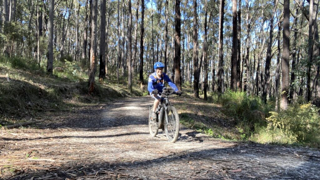
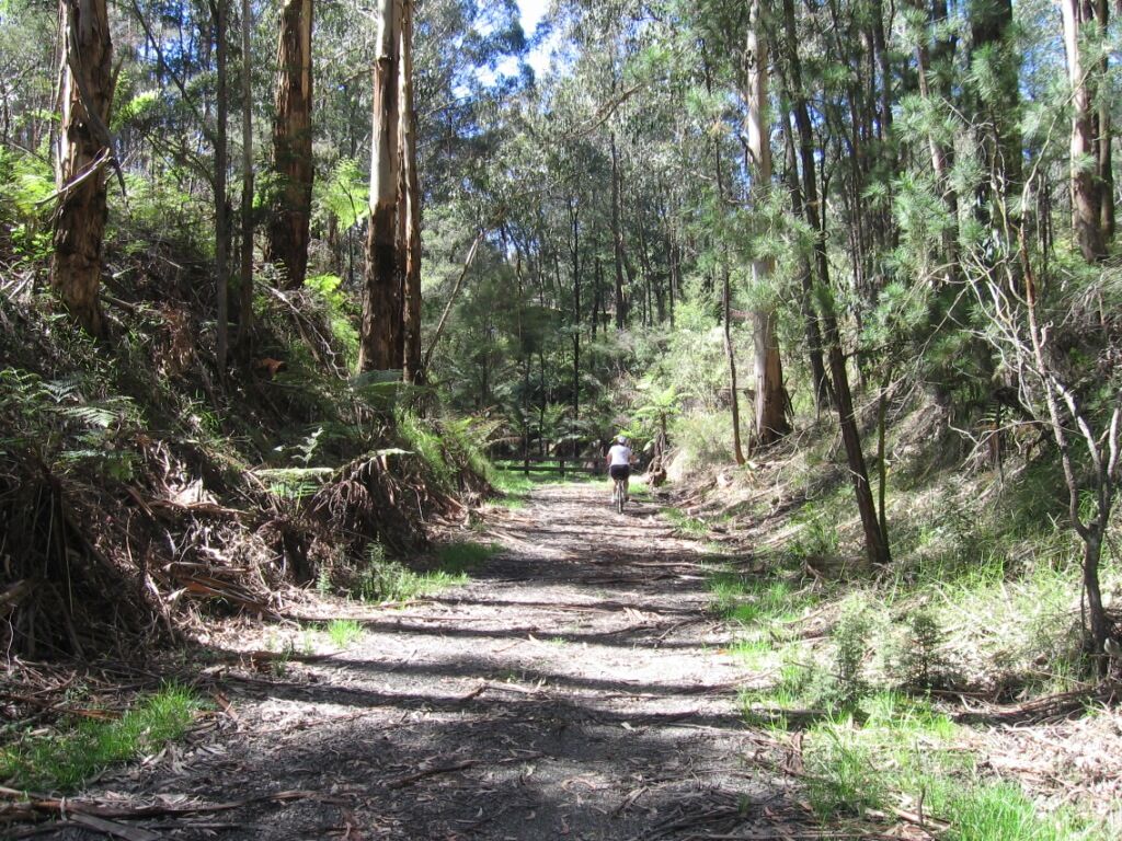
Approaching Erica through the last cutting before Jacobs Creek (2023)
Do you know of a bike hire or transportation service on this rail trail that should appear here? If so, let us know at admin@railtrails.org.au.
Information and Links
The rail reserve is managed by The Walhalla Goldfields Railway. They are currently not maintaining the reserve as a rail trail.
For visitor information, try Erica General Store 5156 3209
Walhalla Goldfields Railway 5126 4201 or www.walhallarail.com.au
Contact Rail Trails Australia
To contact us about this rail trail, email vic@railtrails.org.au
Background Information
Traditional owners
We acknowledge the Kurnai people, the traditional custodians of the land and waterways on which the rail trail is built.
Rail Trail History
The rail trail was developed by the Walhalla Goldfields Railway and opened in 1999.
The current Walhalla Goldfields Railway strategic plan for the railway reserve would see it developed as an extension of the railway from Walhalla to Erica.
Rail Line History
Gold was discovered at Walhalla in 1863, and created an impetus to build a railway. A campaign started in the 1880s, but it wasn’t until 1910 that a narrow-gauge line was opened from Moe to Walhalla. However, by the time the line was finished, the gold had started to peter out, and the miners used the railway to leave the area. The line was closed in stages, and the final section, from Moe to Erica, was closed in 1954. The wonderful concrete and steel bridge at Thomson was almost used by the army for demolition training, but a campaign by the Walhalla Goldfields Railway group finally succeeded in overturning that decision. The railway is open between Thomson and Walhalla with a collection of restored rolling stock, and bikes can be carried on board.
Nearby Trails
Tyers Junction Rail Trail
Gippsland, 30km north of Moe, 160km from Melbourne
7 km


Moe – Yallourn Rail Trail
Latrobe Valley 130km east of Melbourne
7 km

Gippsland Plains Rail Trail
Near Traralgon, Gippsland, 190km east of Melbourne
62 km
Noojee Trestle Bridge Rail Trail
100km east of Melbourne
3 km


Rokeby to Crossover Rail Trail
North of Warragul, 103km from Melbourne
5 km
Grand Ridge Rail Trail
Strzelecki Ranges, South Gippsland, Victoria, 160km from Melbourne
13 km
Powelltown Tramways
Yarra Ranges, 80 km east of Melbourne
31 km
Great Southern Rail Trail & Tarra Trail
South Gippsland, 130 km southeast of Melbourne
109 km
Eastern Dandenong Ranges Trail
Dandenongs, 50 km southeast of CBD
15 km
Warburton Rail Trail/Yarra Valley Trail
Yarra Valley, 50 km east of Melbourne CBD
48 km
Bass Coast Rail Trail
130km south-east of Melbourne
23 km
Heathmont to Belgrave Trail
Eastern suburbs, 40 km from the CBD
16 km


Mornington Railside Trail
Mornington Peninsula, 60 km south of CBD
4 km
Outer Circle Rail Trail
Eastern suburbs, 6 km from Melbourne CBD
17 km
Nearby Trails
Tyers Junction Rail Trail
Gippsland, 30km north of Moe, 160km from Melbourne
7 km
Moe – Yallourn Rail Trail
Latrobe Valley 130km east of Melbourne
7 km
Gippsland Plains Rail Trail
Near Traralgon, Gippsland, 190km east of Melbourne
62 km
Noojee Trestle Bridge Rail Trail
100km east of Melbourne
3 km
Rokeby to Crossover Rail Trail
North of Warragul, 103km from Melbourne
5 km
Grand Ridge Rail Trail
Strzelecki Ranges, South Gippsland, Victoria, 160km from Melbourne
13 km
Powelltown Tramways
Yarra Ranges, 80 km east of Melbourne
31 km
Great Southern Rail Trail & Tarra Trail
South Gippsland, 130 km southeast of Melbourne
109 km
Eastern Dandenong Ranges Trail
Dandenongs, 50 km southeast of CBD
15 km
Warburton Rail Trail/Yarra Valley Trail
Yarra Valley, 50 km east of Melbourne CBD
48 km
Bass Coast Rail Trail
130km south-east of Melbourne
23 km
Heathmont to Belgrave Trail
Eastern suburbs, 40 km from the CBD
16 km
Mornington Railside Trail
Mornington Peninsula, 60 km south of CBD
4 km
Outer Circle Rail Trail
Eastern suburbs, 6 km from Melbourne CBD
17 km
7 reviews of “Walhalla Goldfields Rail Trail”
Barely scrapes in as 3 stars. Needs maintenance.
The first 500 m from Thompson Bridge is a goat track which opens to a decent trail although littered with stones and wood. Gets better closer to Erica.
Done in dry conditions. Just note other reviews warning of the mud in the wet.
I rode this yesterday from Erica to Thomson and return. This trail is not in good condition. Lots of trees and branches down (some I was able to move, some unable). Had to climb over or go under quite a few. Got quite a few scratches from blackberries protruding onto the path. Would definitely not recommend in winter.
My wife and I have done a lot of rail trails in the last 12 months. This is the best. We took off from Erica and went to Thomson station. About 9.75 klm. You have to walk in a couple of spots. It's a bit rough, but not too bad. The scenery is spectacular. Untouched forests. Lots of birds. The trail would be best dry so I'd avoid winter. Autumn is probably best. We had no trouble with mud as it was almost completely dry. The trail markings could be better so be careful where you go. You can't really get too lost if you look at the map on google. 5 stars.
Friday 10 December 2021
I'm an adventurous 70 year-old while conceding there are plenty more intrepid 70-somethings than I am. Nonetheless the gravel bike and I had an adventure we weren't expecting. This is not like any other rail trail. Where to start? There's no 'surface', just mud. The notes suggest the trail is suitable for MTBs, touring bikes and hybrids. Maybe once upon a distant time, but not now. Maybe after three months without rain, highly unlikely in a rain forest. This is slip-and-slither stuff on any bike. You won't see any scenery because you'll be concentrating on picking a line and staying upright.
About 6kms in, high above the Thomson River, the track is blocked by fallen trees, rocks and landslides. I portaged around and over two trees before turning back at an impassable landslip. The trail will need major repairs before it's navigable by any wheeled vehicle in the foreseeable future. Which is a great shame because this could be a fantastic ride.
27/27. Dodging bushfires and high temps, I completed my challenge of riding every RT in Victoria in 2019 by doing the Walhalla Goldfields Rail Trail.on 30th Dec. This was another one I had to go back to after an attempt earlier this year failed due to track closure because of bushfire damage.
And in the nick of time too, as Walhalla is closed the next day because of the Total Fire Ban.
It’s a short trail starting in Erica. For the 1st 2 kms you can gets a bit lost due to poor signage, but once you cross the Tyers-Walhalla Rd, it is straight downhill and easy to follow except the part where it goes under a road (no signs to tell you where to go).
There are some lovely views over the Thomson River, but there is a large amount of forest debris on the track so you have to concentrate and slow down.
Unfortunately, the finish is a bit disappointing as it turns into a dangerous single-track to get past a missing bridge, which then opens up to the tourist train station.
So that’s it! All 27 railtrails completed this calendar year to promote organ donation and saying thank you to my donor. What ride it has been!
I rode this trail on 3rd December 2014, along with the Tyers Junction rail trail. This is clearly a mountain bike track – though possible on hybrids for most of the way, except around Thompson. Sadly, there aren’t any great viewing spots, though you are deep in the bush. The Erica end is signposted and easy to find, the Thompson end is more difficult. Around the maze of bike tracks – follow the red arrows.
Just did this trail and found it a bit disappointing for a ride with such great potential in spectacular country. Hard to find the start at the Thompson River end and not really ridable until you get past the old bridge deviation. Track surface quite rough and mountain bikes would have been better than our hybrids. Quite overgrown in places with some fallen trees needing to be cleared. Nowhere really possible to ride two abreast. Trail bike riders have churned up the steep access points and also in places where the track is muddy. Difficult to find our way throught the last bit of forest into Erica through the maze of trail bike tracks with no signposting to indicate the way for cycles.