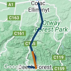
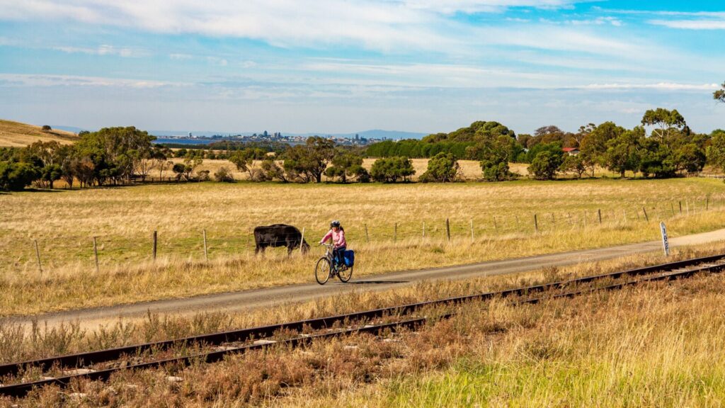
- Winds through scenic bush, pine forests, rich farmland and rolling hills as it travels from Colac south to Beech Forest and west to Ferguson
- The narrow-gauge (2’6″/762mm) railway to Crowes (beyond Ferguson) was one of four built in Victoria and the longest of that quartet
- It played a key role in opening the western Otways to settlement and many relics from that era remain
Nearby Attractions
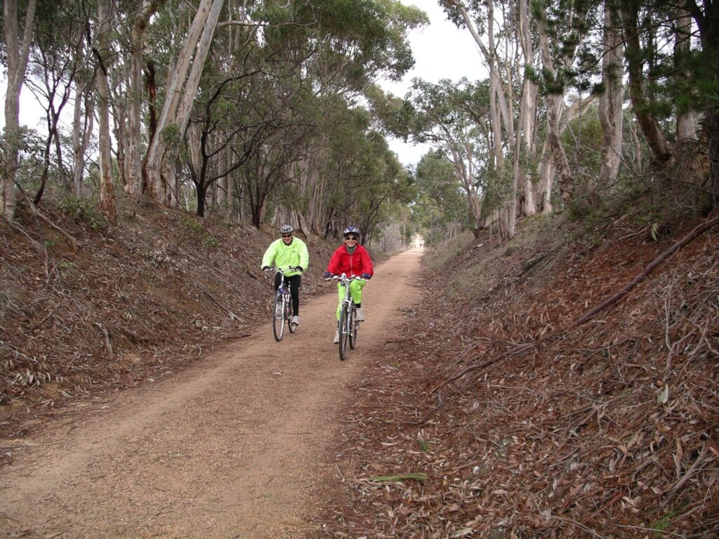
- Magnificent eucalypts and blackwoods, abundant birdlife
- Cape Otway
- Apollo Bay
- Tiger Rail Trail in Forrest
- Camperdown to Timboon Rail Trail
- Twelve Apostles Trail
- Waterfalls, wineries and art galleries
- The former home of famous ultra-marathon-running farmer Cliff Young
Last updated: 8 April 2024
Due to access issues and prolonged logging operations, the Old Beechy Rail Trail is officially closed for 12km from Banool to Beech Forest so the continuous section is only 33km (see Section Guides). If you have any queries, please contact Colac Otway Shire Council’s recreation and open space co-ordinator on (03) 5232 9400 or visit the shire’s website for more information: http://www.colacotway.vic.gov.au/Parks-Recreation/Old-Beechy-Rail-Trail
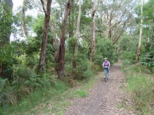
This rail trail is almost entirely uphill from Gellibrand to Beech Forest and is best suited to bushwalkers or those riding mountain, hybrid or cyclocross bikes (carry a puncture repair kit for the rocky sections). There are ESTA Emergency Markers and kilometre posts. In an emergency, call 000 and quote the alphanumeric code on the marker post nearest to you, eg OBR11
The major sections are:
Colac to Gellibrand is 27km, the first 11 of which are on-road. It then follows a combination of former railway easement and quiet country roads
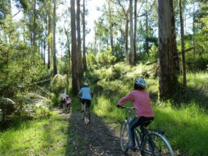
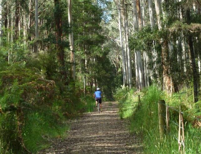
Gellibrand to Beech Forest is 18km and climbs steadily through scenic bush and timber plantations. Only the first 6km of rail trail is open, you can detour onto the gravel road, but this is not endorsed by the local council
Beech Forest to Ferguson is 4km, passing through dense rainforest and then farmland.
Trail users are asked to leave gates as they find them and to respect the landowners’ rights. Cyclists should slow while riding through private land.
Section Guides
Colac-Barongarook (11km)
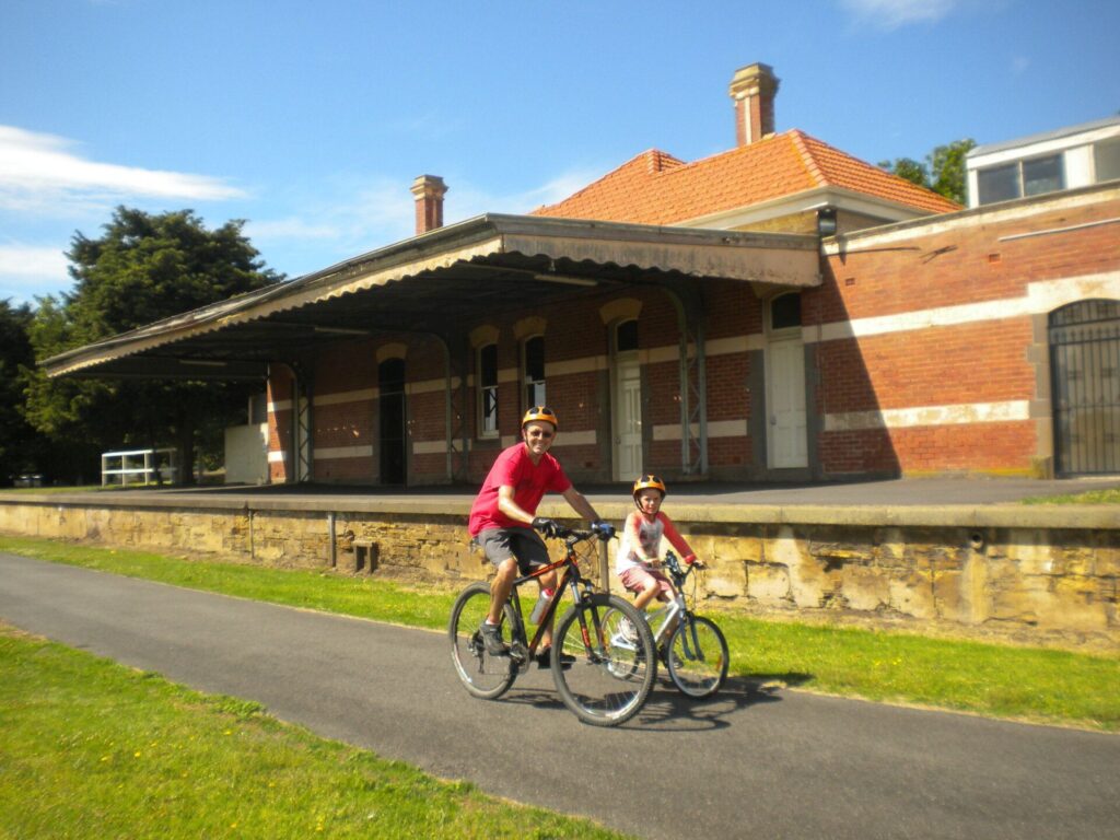
- This trail starts in Colac, which is a major town on the Princes Hwy (A1) with a wide range of services, accommodation and tourist attractions
- The railway station bus shelter, off Gellibrand St, acts as the trailhead and information centre. The disused locomotive turntable is on the far side of the car park
- The first 11km is on paths and roads, as the rail corridor was sold. There is an extended stretch of concrete shared path through town but some of the subsequent on-road sections are steep, with loose gravel (see alternative starting point at Barongarook, below). From the station, cross the footbridge and follow the signposted route via Wilson, Queen and Aireys streets, Woodrowvale Rd and Forest St
- Follow Forest St to the end (4km), then turn left onto Barongarook Rd and follow it for 2.3km, past the station site
- Turn right at Alford Rd for 1km, then left again onto Maggios Rd for 500m. The former rail corridor is on the right, but poorly marked
Barongarook-Birnam (6km)
- For walkers and less-experienced cyclists, Barongarook is a better place to start as this is where the trail joins the railway alignment. To get there, drive east on Barongarook Rd from Colac-Lavers Hill Rd (C155). There are restrooms and parking at the station site. Then it is less than 2km to the rail corridor via Alford and Maggios roads
- Watch for the 103-mile post on the left just after the start of this section, which has a good surface. The trail travels gently downhill, curving through beautiful bushland and along a high embankment over a huge culvert to Cashins Rd, Birnam, where it leaves the rail formation again. Turn left to visit the Burnam Station picnic area or right to start the next section
Birnam-Gellibrand (10km)
- To start in Birnam, drive east on Cashins Rd from Colac-Lavers Hill Rd for 1km to the picnic area for parking and a bush walk. The next section of the trail is back along Cashins Rd towards Colac-Lavers Hill Rd
- The trail goes uphill on the west on a power line easement, while the railway used to follow a gentle curve further east (see map)
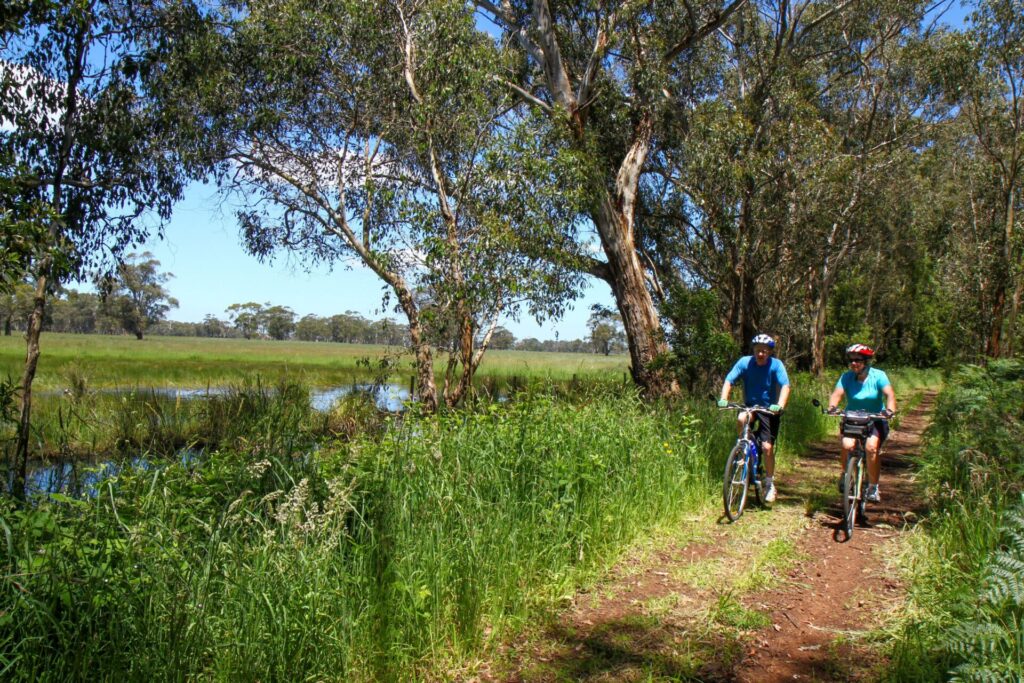
- Climb steeply through bushland and then descend again, entering farmland before returning to the railway alignment at the Kawarren Station site
- Kawarren has toilets near the station site and a picnic reserve.
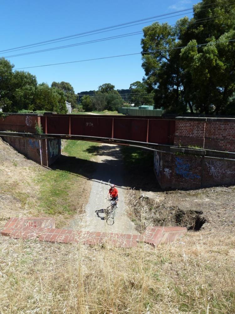
- From there the trail runs alongside Colac-Lavers Hill Rd, passing the 110-mile post. You must cross the highway just before Gellibrand, where the railway bridge was demolished to make way for a road one. A modern footbridge to the west carries the trail over the river and into the backyard of the Gellibrand River Hotel, from where the trail continues towards the general store
Gellibrand-Banool (6km)
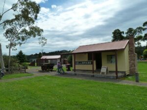
- Besides the hotel and general store/cafe, Gellibrand has an art gallery, holiday park and other accommodation. The original railway station building was recovered from private hands and restored on-site at Rex Norman Park, where it now houses an historical display about the Beechy
- This park, on the eastern side of Main Rd, is the trail hub for Gellibrand, with car parking, bathrooms and play equipment. There’s a nice gravel path alongside Old Beech Forest Rd that takes you around the back way to the rail trail via The Fernery.
- If you’re riding through town, the trail runs along the footpath and requires dismounting past the store. You cross Main Rd at the southern edge of town to re-join the railway formation.
- Entering farmland, the trail starts the climb to the site of Banool Station. After 2.5km, you’ll come to the remains of a wooden pile bridge gradually rotting away
Banool-Beech Forest (12km)
The trail is currently closed from Banool to Beech Forest due to timber harvesting. During this period, walkers and cyclists have to turn back or detour onto Old Beech Forest Rd (to the left) to reach Beech Forest. This road is not suitable for inexperienced riders or walkers. If you do take this detour, watch for logging operations and observe warning signs and other traffic control instructions
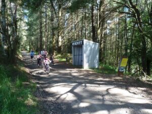
- The road crosses the trail at Wimba, where the recreated station shelter comes in handy when it rains
- At the Dinmont Station site the old water tank is still in use and there’s a steam boiler lying in state
- This section of the trail ends at the Beech Forest information centre, where there are bathrooms and a BBQ
Beech Forest-Ferguson (4km)
- Beech Forest has a hotel, art gallery/cafe and accommodation. There is free camping at Beauchamp Falls, 4km away
- Look for the site of the balloon (or return) loop used for turning the narrow-gauge locomotives for the trip back to Colac at the disused tennis courts on the eastern side of town
- The trail to Ferguson starts on the southern side of Beech Forest-Lavers Hill Rd (C159). Ride west from the information shelter and cross the road before Southern St. It runs west through dense rainforest and ferns and then moves close to the road for the rest of the way to Ferguson, where the cafe has closed.
CONNECTING TRAIL (25km)
You can avoid backtracking to Gellibrand by using Lardner Tk, which starts 5km east of Beech Forest off Mt Sabine Rd. It’s generally downhill on gravel and runs close to the Gellibrand River but is only suitable for experienced riders. It is best avoided if logging is in progress. There is free camping near the river at Dandos Campground.
Colac Railway Station with bus shelter/information centre in background [2011)
![Example of excellent signage on embankment before Birnam [2011]](https://www.railtrails.org.au/wp-content/uploads/2020/11/6821605531783-225x300.jpg)
Example of excellent signage on embankment before Birnam [2011]
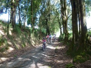
Beautiful forest between Barongarook and Birnam (2011)
Steep bypass of Birnam Station site on power easement (2011)
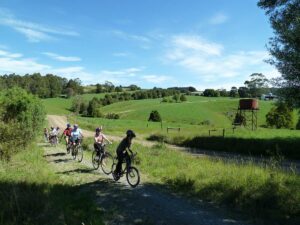
Between Kawarren and Gellibrand (2011)
Restored Gellibrand Station now serves as information centre (2011)
![Resting on the first hill after Gellibrand [2011]](https://www.railtrails.org.au/wp-content/uploads/2020/11/1451605531783-300x225.jpg)
Resting on the first hill after Gellibrand [2011]
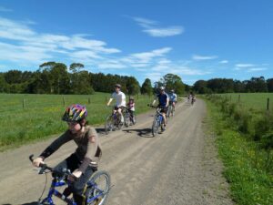
Between Gellibrand and Banool (2011)
The McDevitt Station site is on private land and now inaccessible (2011)
Between McDevitt and Dinmont (2011)
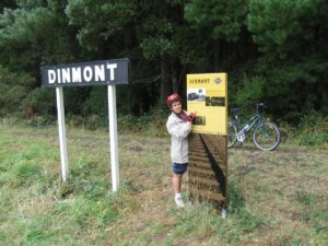
Example of detailed signage at Dinmont (2006)
Leaving Dinmont and its iconic water tank on the last climb before Beech Forest (2011)
Using the on-road detour between Dinmont and Ditchley (2011)
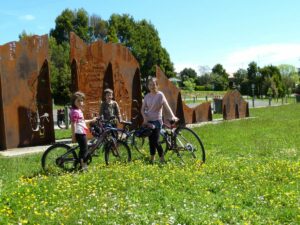
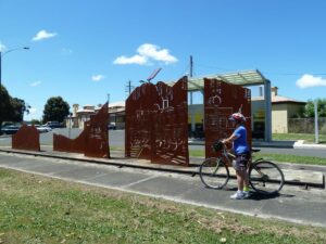
Beech Forest features another of the Corten steel sculptures (2011)

Do you know of a bike hire or transportation service on this rail trail that should appear here? If so, let us know at admin@railtrails.org.au.
Information and Links
The rail trail is managed by the Colac Otway Shire Council; contact them regarding maintenance issues on 5232 9400. The council’s website has more information about the Old Beechy and you can download a brochure at: http://www.colacotway.vic.gov.au/Parks-Recreation/Old-Beechy-Rail-Trail
Contact the Colac Visitor Information Centre on 1300 689 297
Visit the Friends of the Old Beechy Rail Trail’s website, Facebook page or contact them by email.
Contact Rail Trails Australia
To contact us about this rail trail, email vic@railtrails.org.au
Background Information
Traditional owners
We acknowledge the Eastern Maar people, the traditional custodians of the land and waterways on which the rail trail is built.
Development and future of the rail trail
After eight years of planning by local progress associations, volunteers and Colac Otway Shire, the concept of a rail trail became reality when it opened to the public in 2005. Large sections have since been closed while the shire resolves issues relating to trail safety, alignment and landholder access. Rail Trails Australia wrote to the Colac Otway Shire in 2020 to express concern about delays in reopening sections of the trail.
Rail trail users may wish to write to Colac Otway Shire to:
- Encourage the shire to reopen the closed sections of the trail
- Tell council how you would use the rail trail if it was fully open
Railway history
One of four narrow-gauge (2’6″) railways built in Victoria, the Beechy opened from Colac to Beech Forest in 1902 and was extended to Crowes in 1911. Many local sawmills built tramways in the forest. The sidings for them and the remains of some mills can still be seen from the rail trail. The line ran ‘mixed’ trains with passengers and timber, cattle, potatoes, cheese and other farm produce. Within 30 years, only one trip a week was being made and, by 1954, the end of the line had shifted back from Crowes to Weeaproinah. The rest closed in June, 1962, despite strong objections from many local people. The other three 2’6″ railways, Puffing Billy, Walhalla and Whitfield, have all gone on to feature rail trails or railside paths.
Steam locomotives travelled at a maximum speed of 32kmh (20mph) between Colac and Gellibrand and 16-24kmh (10-15 mph) on other sections. Parts of the railway corridor were sold when the line was closed. The rail trail committee has done an amazing job negotiating with landowners to allow so much of the trail to follow the original route.
Old Beechy Rail Trail
Posted: 25/07/16
There is a small detour and closure along the Old Beechy Rail Trail between the 42...
More...Old Beechy Rail Trail (Vic) Fun Run
Posted: 03/03/12
Discover the beauty of the Otways on the Old Beechy Rail Trail with a 16Km ...
More...Old Beechy Rail Trail User Survey (VIC)
Posted: 18/01/11
If you've recently used the Old Beechy Rail Trail here is your opportunity to tell ...
More...$750,000 To Upgrade The Old Beechy Rail Trail
Posted: 29/05/10
From the State Government Newsroom: The Old Beechy Rail Trail will become an iconic tourist ...
More...Opening of the Old Beechy Rail Trail (Vic) on October 22nd 2005
Posted: 01/10/05
The Old Beechy Rail Trail, 130km SE of Melbourne, will be officially opened on Saturday 22...
More...Old Beechy Rail Trail Officially Opened
Posted: 31/07/05
Colac railway Station......Premier Steve Bracks looking over the ...
More...Beechy Rail Trail Event, Sunday 28 November 2004
Posted: 24/11/04
On Sunday 28 November 2004, the Barongarook Hall Committee will hold a BBQ and car boot sale ...
More...Nearby Trails
Tiger Rail Trail
136 km south west of Melbourne
4.4 km


Camperdown-Timboon Rail Trail
160km south west of Melbourne
41 km


Fyansford Rail Trail
North Geelong, 5 km from town centre
4.4 km

Bellarine Rail Trail
Bellarine Peninsula, 75 km southwest of Melbourne's CBD
35 km

Ballarat-Skipton Rail Trail
110km north west of Melbourne
57 km
Port Fairy Rail Trail
260km south west of Melbourne
38 km

The Bunny Trail
110 km west of Melbourne
1.0 km
Nearby Trails
Tiger Rail Trail
136 km south west of Melbourne
4.4 km
Camperdown-Timboon Rail Trail
160km south west of Melbourne
41 km
Fyansford Rail Trail
North Geelong, 5 km from town centre
4.4 km
Bellarine Rail Trail
Bellarine Peninsula, 75 km southwest of Melbourne's CBD
35 km
Ballarat-Skipton Rail Trail
110km north west of Melbourne
57 km
Port Fairy Rail Trail
260km south west of Melbourne
38 km
The Bunny Trail
110 km west of Melbourne
1.0 km
17 reviews of “Old Beechy Rail Trail”
Last week I rode a couple of sections on the Old Beechy Rail Trail. Firstly I did the Beech Forest to Ferguson section. It starts off passing through some beautiful tree-fern lined glades before the path veers off the old railway and crosses up a steepish hill through private property to a track next to the road. It continues like this to Ferguson where the trail abruptly ends at an old tennis court near an abandonded cafe/museum. It is nice countryside and this section is fairly short.
I had read that the section between Beech Forest and Banool was closed, so I drove from Beech Forest to Gellibrand and then rode firstly towards Banool. This is on the old railway reservation and has numerous interesting information signs along the way. I rode a little past Banool, where the trail is supposedly closed due to logging activity, but there were no signs advising of this. The track suddenly makes a steep climb and after a short time I decided to turn around and head back towards Gellibrand. It is downhill all the way from Banool to Gellibrand, and once you cross the creek / river, it is uphill again. I rode to a bit past Kawarren, where once again the track departs from the rail reservation and, on the approach to Birnam, it is a steep climb on a pretty rough track. I was not in the mood to tackle that so I turned around for the mainly downhill run back to Gellibrand.
I enjoyed this trail. It was perfect weather for riding. The surface is fine for hybrid commuter style bikes. I have 28cm tyres on my bike and had no problems. It is a shame that parts of the original rail reservation are closed and rough and steep dirversions are needed to get around those.
I recommend you try this trail. It's a lovely part of Victoria.
Thanks for your comments, Brad. Glad you enjoyed the trail despite its obvious limitations.
A couple of days ago we cycled the Old Beechy Rail Trail on hybrid bikes with loaded panniers, from Gellibrand to Colac. From Gellibrand to Kawarren the trail had a mostly good surface and ran mainly beside the road. From Kawarren to Birnam the trail was sometimes loose gravel and there was a long challenging ascent, followed by a rewarding descent. Our favourite section was from Birnam to Barongarook which used the original rail route…we especially appreciated the culvert. Barongarook to Colac was on the road again, involving some stiff climbs and finally finishing at Colac station. We had a great day and hope that the trail can be extended to make all of it off road.
Sorry to be a downer, but hard to find the start at Beech Forest, trail starts quite rough. Even though I had a hybrid it was a bit dicey. Then at the cricket ground the trail disappears. Gravel roads, loose surface. I gave up.
Hi George, the rail trail is currently closed between Wimba and Beech Forest. This may be why you found it difficult to locate the trailhead. If you were trying to find the way to Ferguson, please respond further, as this should be accessible.
Hi , is this rail trail open all the way now? Just reading a review from Feb 2022 part of the trail was closed.
I tried out the Old Beechy on 2 Jan 2020 and the intended path was open to riding from Colac to Gellibrand. I started the ride on the road between Colac and Elliminyt using my hybrid. The first part towards Barangarook was fine until some parts on the dirt road section, it got a bit dicey with the sandy surface of the road (the track from Barangarook to Gellibrand was dry and the hybrid got through ok because it seemed mostly downhill). I stopped for all the well-designed information boards to read about the history of the line, including remnants of the old water tanks, the 103 mile post, the sidings and so on. I find rail history interesting and it was nice to imagine going back in time to when this railway was open. It is a forested area so there are plenty of sticks and other debris on the trail to watch out for. I only passed one rider (around Kawarren) who was going the opposite direction which was a decent incline for them. I decided to return to base via the main road as it would have been quite difficult returning on trail using the hybrid due to the incline and debris on the track.
I intend to do more of this trail if other sections open up. This trail is a great community asset.
26/27 With the Christmas festivities over it was time to work off at least some of the overindulgence and get back into finishing off my challenge of riding every RT in Victoria in 2019.
I tried to tackle the Old Beechy a few months ago but was thwarted by weather so bad I thought it would be dangerous. So on 29th Dec it was time to try again.
I met up with Darren, who was holidaying in the area and had done this trail a few times before. Thanks for the company, Darren. We started at Barongarook as I can’t see the point of riding on-road for so many kms from Colac.
The track was in fairly good nick, which was a pleasant surprise really. Darren did it on a roadie with wider tyres and got through ok, but I wouldn’t recommend it unless you were very experienced. I was on a MTB with narrower tyres which seemed a good set-up, so a hybrid would be fine. The trail is pretty well signposted, with a couple of exceptions.
Its such a pity this beautiful railtrail is blocked off at Gellibrand and reduced to only 16kms now. Darren says the best part is between Gellibrand and Beeches Forest.
I only hope the landowners and local council can sort out there differences and re-open this. I know I will return when it’s done.
1 trail to go!
It was a full-on days ride, taking about 5hrs on the rail trail Colac to Beech Forest, and 2.5hrs return on the road (gravel and paved). Total approx 90km. Beech Forest pub ‘closed’ for renovations until 28/5/17, but will have a pastry fridge and coffee once re-opened. We needed bike lights for 1.0-1.5hrs at rides end, as we arrived back at Colac 45 mins after sunset. Road was mostly gravel returning from Beech Forest to Gellibrand, so kept speed down to be safe amongst loose gravel lines. Road Gellibrand to Colac was paved with good road shoulder and fairly light traffic. Bitumen road much appreciated after the gravel grinding. A contiguous 80% of the rail trail route is lovely riding, just the southern-most 3-6km before Beech Forrest to treat with caution. Two old steam auxiliary engines sit at old station Dinmont. Clue, if riding S toward Beech Forest (approx 6km away) get off the rail trail here and take the dirt road instead. The trail is not on the original rail line alignment, the last 3km has steep muddy sections that don’t get much sun.
Good review @CycleAustralia2014.
I’ve noted your comments in an email to V/Line this morning. Hopefully they pull their socks up and realise the benefits of providing good facilities for cycle tourists.
Cheers
Cycle touring is a wonderful way to immerse yourself in the beauty of the Australian bush and Victoria has a number of spectacular rail trails that are easily accessible. We have been working our way through the magnificent trails savouring the varied environments flora and fauna feeling grateful for the experience. Everyday, cycling the trail is an adventure. The 3 day ANZAC day long weekend provided the perfect opportunity to explore the Old Beechy Rail Trail.
Our party of 3 had booked tickets on the 7am train from Southern Cross Station in Melbourne to Colac and the start of the trail. At Southern Cross Station we met a few other cyclists with the same plans. Pretty soon, the luggage car at the rear of the train was full and a rather officious Vline official was denying entry to a couple who had tickets, saying their was “No more room!” Despite the fact that you are able to travel with your bicycle, they are unable to guarantee a place on the train. It seems to be first come first served, even though a centre carriage on the train had plenty of room for additional bicycles. People were told that for “security reason” they were unable to allow their bicycles on.
The inexplicable reasoning of railways staff resulted in more cyclists at subsequent stations being left on the platform, except for one brave soul who literally forced his way on.
just after 9.30 am we sent off from Colac under clear sky’s , the trail was initially well signposted as we left Colac and passed through Barangarook , the surface changed to gravel along Forest road as we climbed towards the Otway ranges .
The trail often passed through private land , and through many gates which were cumbersome , the gradient wasn’t always steady as the path left what would have the original rail line with many sharp rises testing fully laden touring bikes as the surface was powdery and with 35mil tyres it was difficult to maintain traction , I would recommend a mountain bike and minimal gear for this trail .
The countryside was magnificent , we saw many beautiful Birds , Currawongs, Kookaburras and parrots of all description , we scanned the Manna Gums , Beech trees , Messmates , and peppermint eucalyptus for Koloa’s however they remained well camouflaged and elusive .
We stopped briefly at the beautiful friendly hamlet of Gellibrand River for good coffee before pushing on into the afternoon to Beech Forest .
Passing through a bourgeois landscape of black box , bracken and massive tree ferns , we stopped occasionally to enjoy the silence of the bush and catch our breath as the sharp rises on shifting ground were proving challenging , at times it was necessary to get of and push / drag the bikes up hill , at one point about 5 kms from Beech Forest itself the trail , which was no longer following the Old Beechy Trail became a muddy quagmire , it was arduous sweaty work getting ourselves and the bikes up and over the rises , leaches were plentiful , one of our party managed to extricate one from her shoe , while another cyclist we meant had to dig one out of his hand !
There’s no shop or campground in Beech forest , however the cozy Beech forest hotel puts on a good assortment of pub meals .
As the misty rain was closing in we decided to set up camp on the concrete floored information centre come toilet block on the edge of town , very rudimentary but free ! Later that evening we were joined by another couple of cyclist who had got lost on a poorly signposted section of the track and had struggled to find their way in the darkness.
Rather than take the same back back the following day , we chose the open road , with very little traffic and some exhilarating down hill runs we enjoyed the crisp early morning run down into Gellibrand River and a hot Breakfast at the cafe .
Cycling back into Colac was wonderful however on arriving at the station we found the train back to Melbourne didn’t leave until 6.48 pm again with no guarantee we would be accommodated .
A coach left Colac station at 2pm and e friendly bus driver allowed us to strip down our panniers and pack our bikes in the luggage compartment ! What an unexpected bonus ! , who would have thought. 3 touring bikes would be allowed on the bus , albeit hidden away in the luggage compartment . From Geelong we were able to get on board a sprinter train back to Melbourne .
Some observations and possible improvements
Don’t attempt this trail on your own especially if your inexperienced , The Old Beechy is best suited to Mountain Bikes , not fully laden touring bikes . Don’t cycle this trail in wet conditions Be mindful that if you are traveling by train your journey with your bike cannot be assured , even if you have paid previously.
Overall the Old Beechy was a great experience , despite the uncertainly inherent in cycle touring , the experience could be enhanced by improving and maintaining the trail surface and having a guaranteed rail service .
After driving to gellibrand I was really disappointed this trail is not open to horse riders from gellibrand to beech Forrest. . It is an amazing area for riding in Victoria and would love to see it inclusive for horses. Camping at nearby Dandos camping ground , the trail would be a terrific extension in a safe area. Many shared trails see cyclists, horses and pedestrians work together successfully. There is no reason the beech the rail trail needs to exclude horses.
Lots of good things said below, but I just want to add something a little different.
A couple of km’s on the Colac side of Gellibrand, a sign acknowledges the owners allowing public access to their land to continue on the RT. For this we were most grateful. However the same landowners are great artists !! For our amusement, scattered along their section of the RT are some fantastic wooden ‘sculptures’. Look out for the gorgeous wise old owl (blue wren looking on) reading a train timetable and for the life size guard/ticket collector as well as lots of other animals in, on and under trees. The highlight for us was the Holly Hobby girl holding her Bassett Hound on a real dog leash (we have a Bassett in the family). I’m sure there were other things we no doubt missed. Congratulations to the artist for this unique Rail Trail Art Gallery.
We camped at the Gellibrand Caravan Park and highly recommend it as a mid-way point in the ride. Whilst in Gellibrand check the wonderful community garden that envelopes the caravan park and then continues south along the Rail Trail for a hundred metres or so.
5 stars for this RT which no doubt as time and funds permit will become even better.
Six of us rode this trail 21-22 Mar 2015. It was a great weekend of trail riding. The weather was kind. Trail looks like it could have tricky patches after rain, especially on the shady side of hills. Accommodation at the Old Beachy Pub was comfortable ($120/room with double bunks and Queen bed), and a very decent dinner ($14-35) was had on Sat night. The rail trail was challenging but fair. In our group, 5 of 6 riders had MTBs which would be preferred ride for this track.
Consistent good signage along the trail, with a couple of spots requiring one to exercise judgement. At least one toilet block situated alongside the trail, and park facilities in Gellibrand. One big and many small bridges show considerable planning and effort has gone into making this a classic rail trail.
Considering that we’ve had 35 deg days and gale force winds in past week, tree branch litter on the trail was much less than I expected (eg not bad). I managed this ride on a 38mm (frnt)/35mm (rear) cross tyred rigid flat bar 27spd with V-pull brakes. Caught a branch under the rear mudguard, which needed a 4″ spanner to reset (10 min job). As stated below, Gellibrand to Beech Forest is a serious bit of trail requiring consistent climbing going south and good bike skills descending at 30kmh returning north. We copped 1 flat and 2 crashes. One crash was simply not unclipping in time coming off a bridge with a 90deg turn, and the second was hitting a 9cm diam x 35cm ‘log’ when distracted with a big gear shift at 22kmh. Grazed knee and managed the 17km ride out, so not bad. It is lovely forest up there. We were about 3’45” ride time going up to Beech Forest and 5.5hrs overall, and it’s easier coming back to Colac. Gellibrand Cafe (nice home made tucker & good coffee) is probably the only refreshment stop along the 45km trail, and Geliibrand Pub is closed.
About 4.5km west of Beech Forest (on a T-junction) was a nice ‘Otway NouriShed Cafe and General Store’. Comfy sofas, good coffee and food available.
Ride pics posted here: .
I rode this trail two days ago (3 rd Feb 2015). This is an awesome rail trail through some spectacular countryside – however this trail is for advanced riders only. The quality of the track, especially between Gellibrand and Beech Forest, is only good for mountain bikes and perhaps hybrids if you can handle the rough surface. The climb up to Beech Forest is difficult and can get confusing with the logging tracks – be aware of logging trucks! The views back towards Gellibrand are worth it. I would recommend this trail to anyone wanting a good mountain bike ride. Only negative for the whole day is the cafe in Gellibrand – it’s clear that if you’re not a local they are not interested in you – go somewhere else.
We did this trail this long weekend. We had 2 kids aged 8 and 10. We parked the first day at Barongarook and rode the 17 km to Gellibrand. This is a nice easy ride mostly downhill, then one adult rode back from Gellibrand to the car, much harder going back. We overnighted at the Otways Tourist Park, which is quite large and well equipped. The next day we rode up to Beech Forest, the kids found the constant climb quite tough and it took us about 4.5 hours to get up, but the ride down took a quarter of that! It is a great trail with some beautiful areas of native forest. The interpretive signs along the way are great. The real pity is that there is 2 on-road stretches at the start and the end. Hopefully they can one day restore the 4.5km section from Dinmont to Beech Forest and build an off road stretch from Colac to Barongarook. I would also love to see them complete the trail all the way to Lavers Hill. A beautiful, challenging and historically interesting rail trail.
Have only travelled the section from Gellibrand to Beech Forrest so far and I am looking at it from a beginners point of view. Starting from Gellibrand you are riding up a slight grade all the time. In the 20 klm stretch you rise 358 meters. The track itself winds its way through the range from native forrest, plantations to farm land. The gradient, although slight is consistent and wide enough in most places for 2 bikes to ride side by side. Track condition is reasonable for mountain bikes with compacted clay to gravel in some places. There are a couple of detours off the rail trail and theses are quite steep.
The return trip from Beech Forrest to Gellibrand is a buzz, nearly all down hill and makes the slog up worthwhile. Quite easy to sit in the 20s with very little peddling. Times 2.1/2 to 3 going up 1 hour coming down. Plenty to see good bush ride