- For those staying at Halls Gap or Stawell, a lovely way to experience the local terrain along an easy, flat trail
- Links with quiet country roads provide a route around Lake Lonsdale, a popular tourist destination near Halls Gap, avoiding the busy Grampians road
- Part of a mainly off-road route between Halls Gap and Stawell
Nearby Attractions
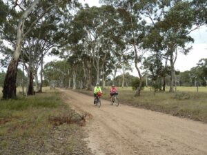
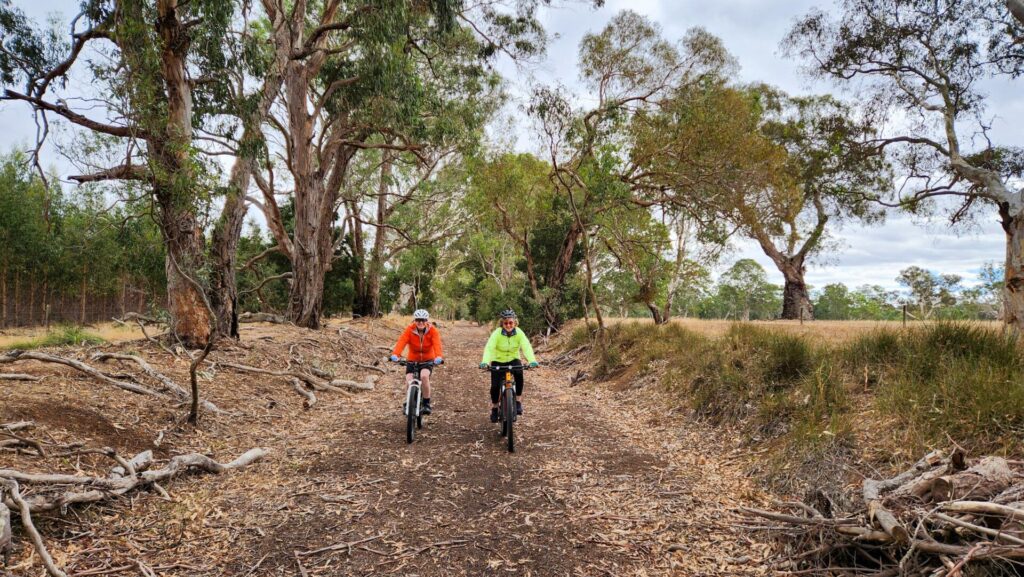
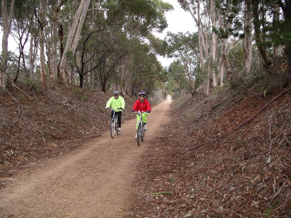
- Most of the trail is through beautiful bushland, with abundant wildflowers in spring
- At Heatherlie Quarry, accessible from Mt Zero Rd, a short section of trail is walkable. Several quarry buildings are still standing and there is plenty of interesting mining equipment to explore
- Lake Lonsdale to the north is a popular tourist destination
Last updated: 12 October 2023
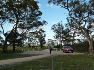
At Stawell West, the trail starts at a small carpark on the Grampians road, 700m south of Western Hwy.
The trail heads west toward the Grampians with the first 2.5km on a path south of the original easement. The rest of the trail (about 9km) travels along the old rail alignment parallel to the Grampians road, then Mt Dryden Rd and close to Lake Lonsdale. Bridges have been built by students at Stawell Secondary School and an 800m boardwalk has been installed. The trail continues on to a carpark at Mt Dryden Rd.
ESTA Emergency Markers are installed along the trail. In an emergency, call 000 and quote the alphanumeric code on the marker post closest to you, eg SHG1
![At Codds Flat Rd. Alex Thompson [2014]](https://www.railtrails.org.au/wp-content/uploads/2020/11/5031605543483-e1697089029547-300x91.jpg)
At Codds Flat Rd. Alex Thompson [2014]
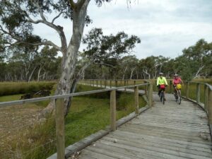
Boardwalk (2011)
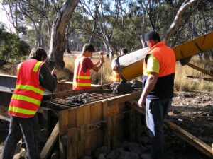
Students assisting with bridge construction (2005)
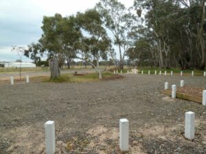
Carpark on Grampians Rd at start of trail at Stawell West
![Heatherlie Quarry, the destination of the original train. Alex Thompson [2014]](https://www.railtrails.org.au/wp-content/uploads/2020/11/9871605543483-300x200.jpg)
Heatherlie Quarry, the destination of the original train. Alex Thompson [2014]
![Heatherlie Quarry, the destination of the original train line. Alex Thompson [2014]](https://www.railtrails.org.au/wp-content/uploads/2020/11/2721605543483-200x300.jpg)
Heatherlie Quarry, the destination of the original train line. Alex Thompson [2014]
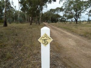
Trail marker sign
Bulloaks along the trail
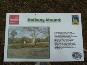
History signage board
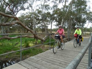
Bridge crossing
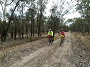
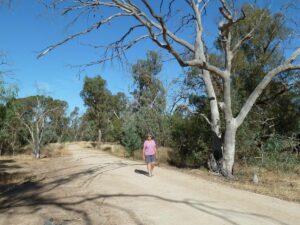
On the trail
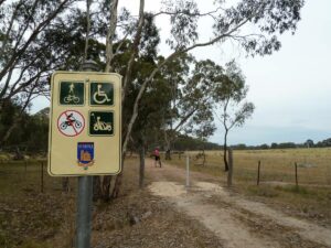
Trail user sign
New trail surface (2013)
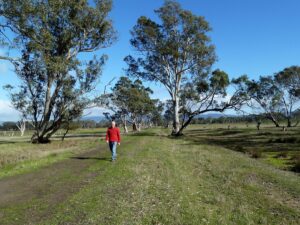
Looking towards Mt Dryden Rd with Grampians in background (2014)
Carpark at Mt Dryden Rd. End of trail (2014)
Do you know of a bike hire or transportation service on this rail trail that should appear here? If so, let us know at admin@railtrails.org.au.
Information and Links
This trail is entirely managed and run by the Friends of Grampians Rail Trail community group, and will be officially opened in the near future.
Rail Trail manager – John Pye 0432 867 387
Download a detailed scale map of the Grampians Rail Trail here.
Download a map for the connection from Halls Gap to the start of the Grampians Rail Trail – essential for the connection to Halls Gap. While this is not part of the Grampians Rail Trail, it is planned to have this signposted in the future and Parks Victoria is considering extension of the trail.
Contact Rail Trails Australia
To contact us about this rail trail, email vic@railtrails.org.au
Background Information
Traditional owners
We acknowledge the Djab Wurrung and Jardwadjali people, the traditional custodians of the land and waterways on which the rail trail is built. Grampians National Park is known as Gariwerd, and is a very spiritual place for these people.
Development and future of the rail trail
Parks Victoria has indicated an interest in continuing the trail to Halls Gap and possibly Heatherlie Quarry.
Rail line history
The rail line ran from Stawell to a stone quarry at Heatherlie at the base of the Grampians from 1882 to 1949.
The quarry supplied stone for many of Melbourne’s public buildings, including Parliament House and the State Library.
Grampians Rail Trail receives funding from Stawell Gold Mines to support flood damage restoration and reinforcement
Posted: 02/10/23
Almost 12 months ago parts of Central Victoria were significantly impacted by flood events that caused ...
More...Nearby Trails
Hamilton to Coleraine Rail Trail
286 km west of Melbourne
22 km


Ballarat-Skipton Rail Trail
110km north west of Melbourne
57 km


Nearby Trails
Hamilton to Coleraine Rail Trail
286 km west of Melbourne
22 km
Ballarat-Skipton Rail Trail
110km north west of Melbourne
57 km
11 reviews of “Grampians Rail Trail”
Vic Trail #37 ridden from Stawell on Easter 2024.
This is a fantastic family trail, flat as a tack through flood plains with a number of options to exit the route to go and pick the car up if the kids are getting tired. The route traverses a number of creeks with newly created bridges (well done trail fairies) and the track is fast, not immaculate, but easy to manage on most bikes. Some small sections of single track are at the start. Excellent signposting and lots of information.
If you do this, please try and visit the end of the line at Heatherlie (which is worth an hour exploring the quarry workings which is best by car as the tracks are very sandy/corrugated to get there and the there is no chance of following the railway due to the scrub build up from the 2006(?) fires which also destroyed the original bridges. Another great stop is Lake Fyans south of the trail
There is no sign of the railway between Stawell station and the start of the trail and very little railway architecture other than info boards on the trail. Where the trail stops the bush starts and only a small section near Pines Road and Heatherlie Track to the west can be found other than at the Quarry. Probably not a trail for the gunzels.
To get to the start, I took the Overland train purchased via Vline for about $7:60. The train has little room for bikes .. or baggage… so you may or may not get your bike on board. I was told there was a $50 cost but not certain about the accuracy of this. I rode via Lake Fyans to Ararat and stayed the night in this delightful town full of options before riding to Hamilton for rail trail #38 the following day. You might be able to get the last vline from Ararat (~5:17pm) and make it a one day but enjoy the weekend up there.
Had the pleasure of riding this trail today and absolutely loved it. Well maintained, well signed with lots of information boards along the way about bridges, wetlands and flora. Track is easy to ride and due to flood mitigation works it is relatively even and has not been impacted by recent rain events in early January. Great to see other families riding and walking the trail and it would be amazing if it could continue further towards Halls Gap. The scenery is stunning, the trail is wide enough for most of the ride for two riders abreast. Very accessible for all abilities and the new boardwalk is quite a feature. Recommend this trail and look forward to coming back again in the future.
Joined the trail at MT Dryden Rd and ride to Stawell. Surface ok, a little muddy and slippery in places but generally pretty good. Really enjoyed the trail. No other cyclists on the trail, Tuesday 11.30 am.
We rode from Halls Gap to Stawell, return in November 2021, with a café stop in Stawell. It’s a great ride through cleared and remnant forest. The trail was in good condition and was fine for our flat-bar racers (no suspension; 32 to 40mm tyres). For future development, it would be great for the trail at the Stawell end to extend to the Lions path, a couple of hundred metres down the road, and for the Grampians side to be extended to the Lake.
We also enjoyed the ‘on road’ section of the trip – the unsealed sections are smooth and the sealed sections are not too busy. Our one misstep was that we were riding on Red Gum Lease Track and inadvertently ended up on Jack Road (we missed the ‘turn-off’ just after the golf course). You might also want to have lights or hi-vis for the day-time riding on Fyans Creek Road.
We rode this track recently, some parts were great and other parts a little soft. The track is hard to find where it starts, but if you use your maps you’ll find it. A little more work would make this a great track, especially if they could extend to Lake Lonsdale, they were working on the bridges and it looks the last section had been upgraded, but was soft. Scenic ride with bush land and farm land all round.
The track is now in good condition in some places and just fair in others.It is another case of having to know what you are looking for to find the start of the track is there is a complete lack of signage. All pretty flat and a nice wander through the countryside. You would want over 30 mm tyres to ride the track comfortably.
Visited today. A lovely Saturday afternoon. A nice rail trail to do with the Children. 20km, flat and in generally good repair. It is apparently supposed to be closed, because council can’t work out a fence/gate… but you can ride the length easily, two temporary gates to maneuver.
Start is approximately 700m towards Halls Gap from the intersection of Western Hwy and Grampians Road. A small car park on the right with some white bollards.
Really disappointed by the lack of current communication about this rail trail. On Saturday I looked on this site for an update, checked the North Grampians Shire website and Facebook group. No updates in one and a half years. I sent a message to the shire and asked them to let us know if the trail was opened or closed. As we were staying in Dunkeld, we dropped into the information centre. The lady there had never heard of a rail trail in the Grampians. She tried to ring Halls Gap information, they didn’t answer. So we decided to risk it and go for it. On Sunday we drove to Stawell (a 3 hour return trip) to try to find the trail. We could see part of it but there was no signage. We went to Stawell information. They were out of brochures but the lady there told us to go to Federation Park for the trail head. It was raining all day, so in Monday afternoon we returned, but there was no signage, no indication of a trail head. We rang the shire. They advised to cross the road and continue further down. I told the lady who answered my story and asked for the person responsible to return my call (haven’t received a call back as yet). We soon found it and enjoyed the 11km immensely. Sad to see others don’t seem to be doing it but I can see why! Get your act together North Grampians Shire Council. Get the trail revitalised and we will come! Finalise your negotiations with the sheep farmer! Communicate with Stawell, Halls Gap and Dunkeld information centres! Please facilitate this railtrails.org.au. Thank you
I rode this trail yesterday (15/1/15) and found it okay but short. The track surface is fine for mountain and hybrid – though gets a bit rough on the western end given that part of the track has seen less use. The main issue with this trail is that it does not have any standout features – there are no great views of the Grampians, or river vistas. The only interesting sites are the wastewater ponds and the cattle farm. I saw no evidence of any washed out sections – the track has been maintained, and well done to the high school students who built the bridges – good job.
My wife and I attempted the Stawell section around the middle of 2012 and found it in need of maintenance. We were wondering if it has been repaired after the floods destroyed sections of it?
Rough track. Lost the track at the Heatherlie Quarry end and used a 4WD tack to get onto Pines Rd. The Heatherlie Quarry end is only recommended for the hardy. Rains in late 2011 have damaged the trail at the Stawell end. Some sections have been washed away and a lot of debris lies on the trail.
link to GPS tracklog:-
http://www.wikiloc.com/wikiloc/spatialArtifacts.do?event=setCurrentSpatialArtifact&id=2351062
alternatively
http://www.gpsies.com/map.do?fileId=odkiaqxtzlhldohc
May the road rise with you.