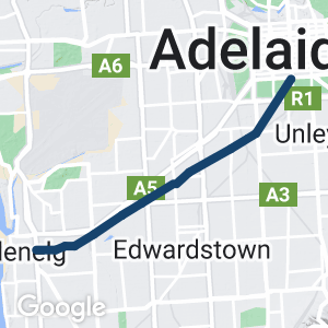
- A short trail for all the family that follows the tram line from Adelaide to the coastal beach area of Glenelg
- The trail moves through suburban Adelaide but avoids most main roads and busy areas.
- Main road crossings are controlled by traffic lights
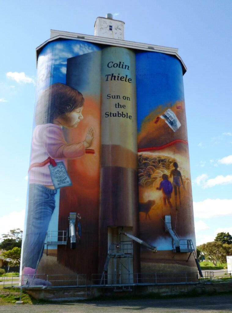
- Interesting artwork
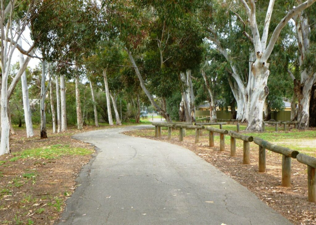
- Flat with the exception of street overpasses that are easy to climb
- Adelaide’s busiest cycle route; as used as a commuter route in mornings and evenings
Nearby Attractions
- Starts in Adelaide’s parklands and ends on coastal beaches
- Beachside suburb of Glenelg has a great range of eateries
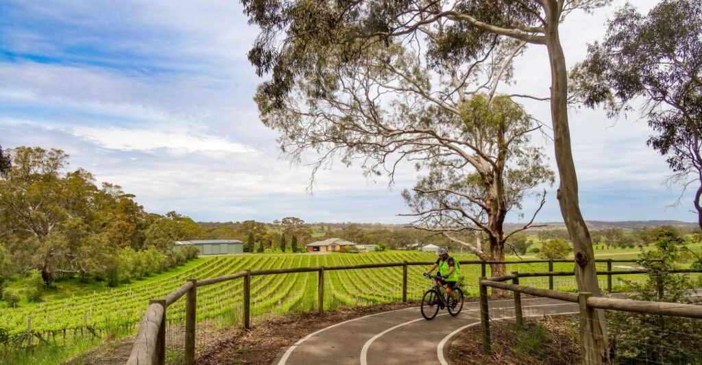
- 8 km from Adelaide CBD the trail intersects with the Sturt River Linear Park Trail, which heads south to for 12 km to link with the Patrick Jonker Veloway
- At the junction with the Sturt River Linear Park Trail you can travel north over Anzac Highway to join the Westside Rail Trail, which leads back to Adelaide CBD
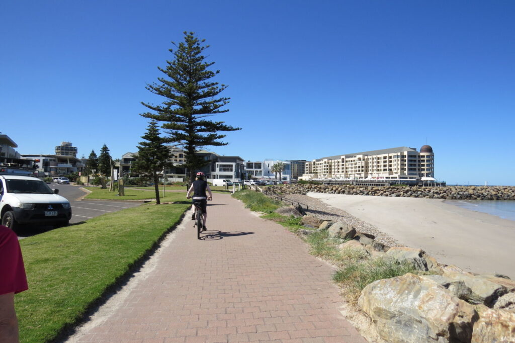
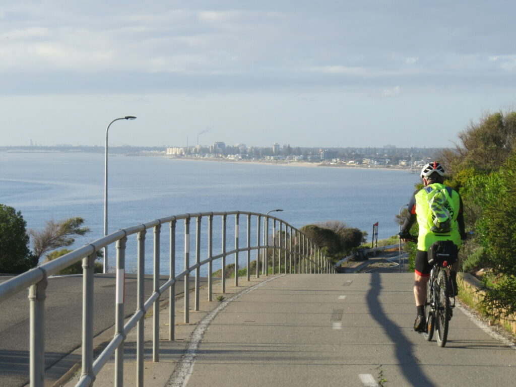
- Ends at Glenelg Beach, where it joins the coast park, a 28 km trail along Adelaide’s beach frontage
Last updated: 4 March 2024
Overall description
The trail has two sections and crosses several busy roads, either through controlled crossings or by overpasses. It is an enjoyable ride that links cyclists with several other trails and ultimately with Adelaide’s coastline.
Section Guides
South Terrace (Adelaide Parklands) to South Road Overpass (4km)
- From South Tce the trail runs between the tram line and Peacock Rd to Greenhill Rd; crossed at traffic lights to the western side of King William Rd
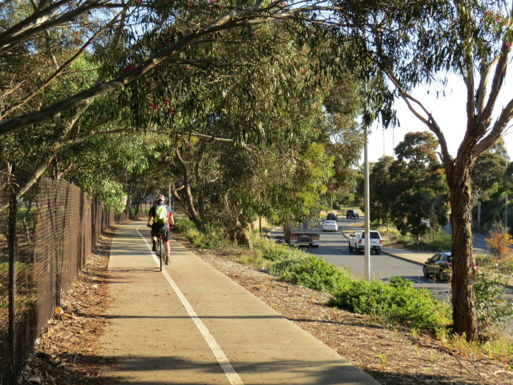
- Continues on the footpath for a short distance before moving away from the road to following the tram line as a dedicated shared-use path.
- The trail follows the tramline through to Goodwood Rd which can be crossed at the pedestrian crossing to Railway Tce
- The 900 m section of the trail from Greenhill Rd to Musgrave St is being upgraded and widened
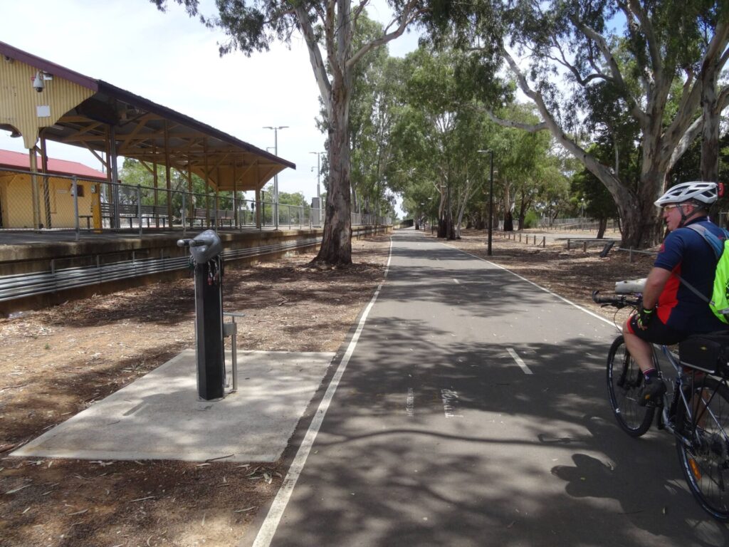
- The trail follows Railway Tce until it turns left and becomes Devon St; turn right and ride through the tunnel beneath the tram overpass, then turn immediately left and ride a short distance to the end of the street where you turn right and walk your bike to the Railway Station subway beneath the train line to the reserve. Turn left to the tram overpass and veer right, following the path to Ethel St/Norman Tce to the pedestrian crossing on Leah St.
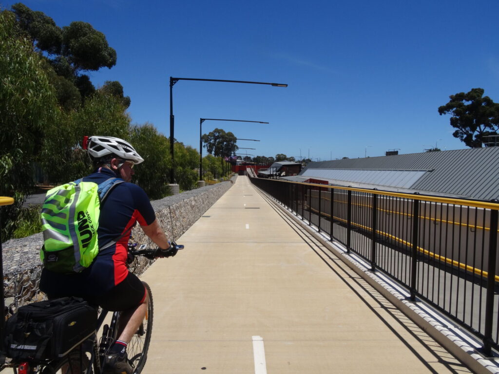
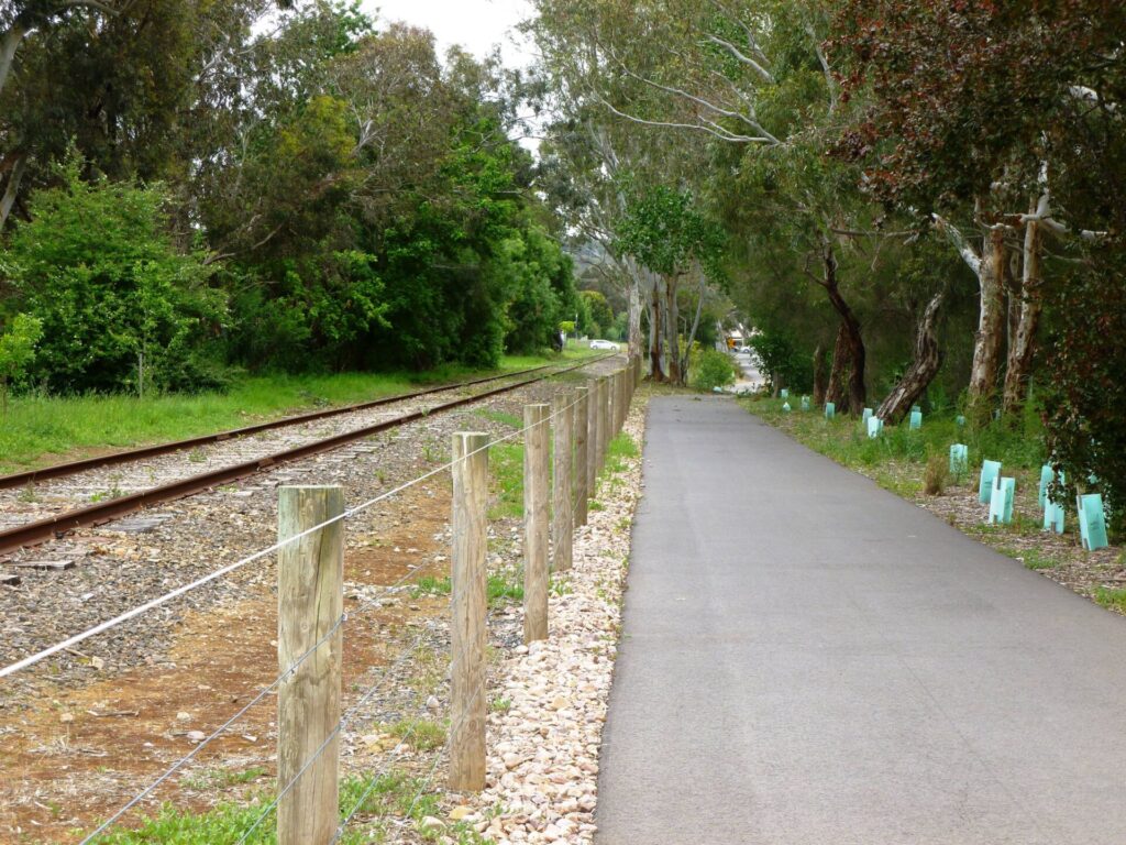
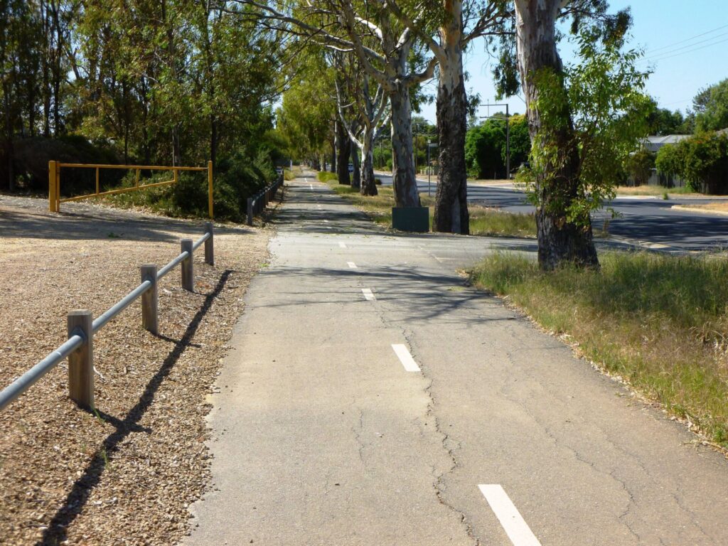
- The trail is then a well-defined shared use path along the edge of the tram line. After a short distance, the South Rd overpass provides good views of the city
South Road Overpass to Brighton Road, Glenelg ( 6km)
- About 500 m from the South Rd overpass, cross the tram line at the pedestrian crossing at stop 7 Glandore. Walk your bike and look out for trams
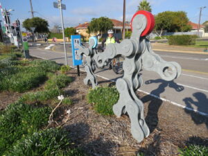
- The trail continues as a shared-use path to the pedestrian crossing on Marion Rd and the pedestrian crossing at Cross Rd.. Watch out for the ‘bike chain people’ artwork
- Over the Morphett Rd pedestrian crossing point you will see the Sturt River concrete channel. On the other side of this the path continues along the tram line but there is also a bike path to the right that takes cyclists over the tram line to Anzac Highway and then on to the Westside Rail Trail back to the city. The bike path on the left is the 12 km Sturt River Cycle Path, which extends to the Southern Expressway and the Patrick Jonker Veloway
- Continue on the shared use path as it follows the tram line to Glenelg. Watch out for the giraffe beside the path!
- The trail ends at Brighton Rd, where you use the pedestrian crossing to continue along Jetty Rd to the beach or, if Jetty Rd is too busy, Augusta St 200m to the north.
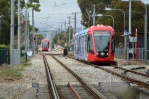
Trams between Adelaide and Glenelg
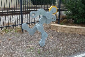
Sculptures along the trail
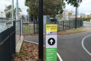
Typical signage on the trail
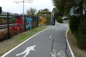
Trail with sculptures in the Plympton area
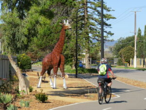
a giraffe on the trail?? 2020
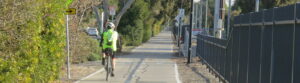
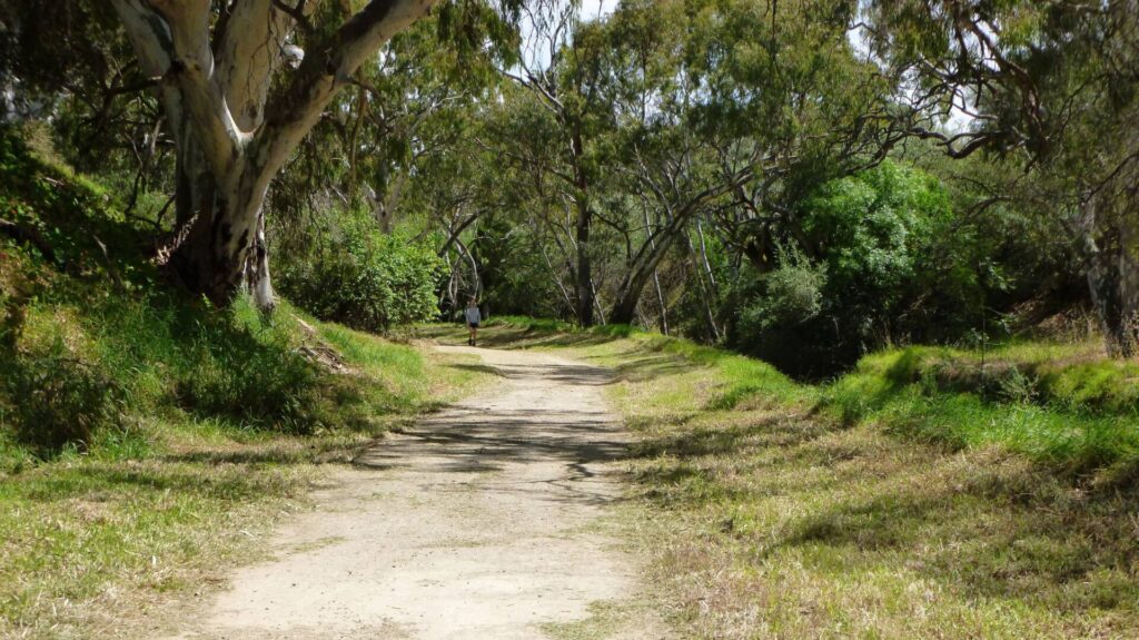
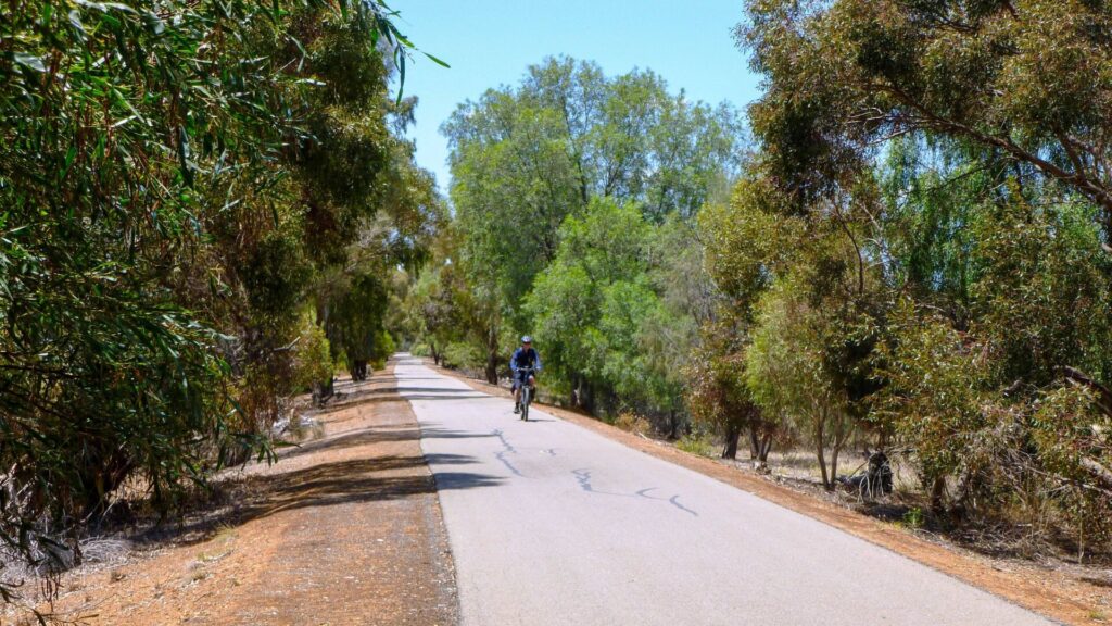
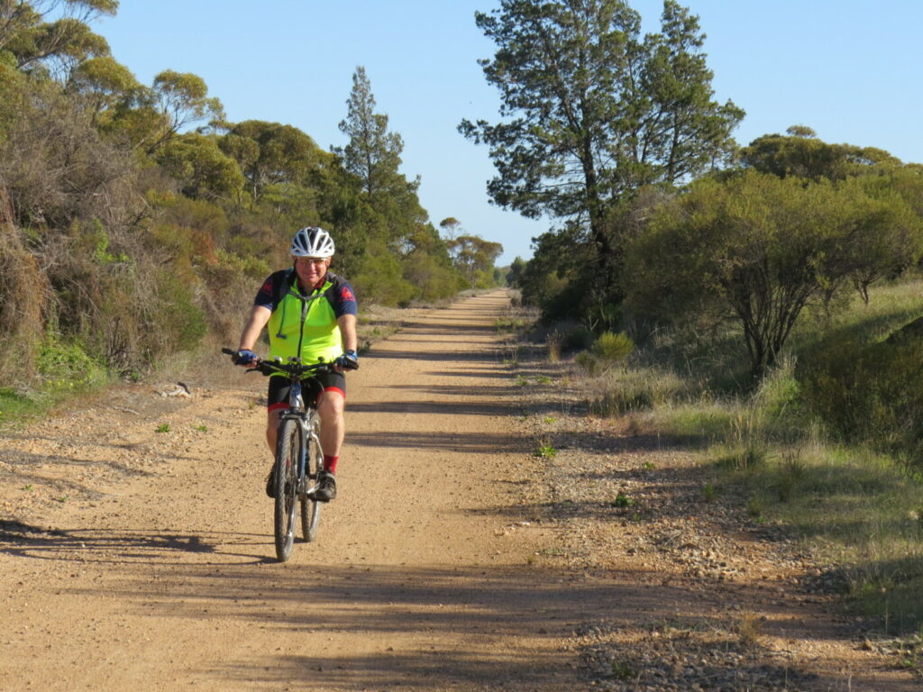
the trail follows the tram line and is well vegetated 2020
meet the COG family walking on the trail 2020
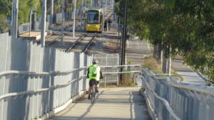
South Road overpass provides good views on the city 2020
Do you know of a bike hire or transportation service on this rail trail that should appear here? If so, let us know at admin@railtrails.org.au.
Information and Links
See Services tab above for links to services and businesses along this trail
For further information go to:
Glenelg Tourism Information GlenelgSA
Glenelg Tourism Information SADestinations
Adelaide City Council parklands trail map Parklands Cycle Trails
To report any issues or problems contact
Adelaide City Council 8203 7203
Unley City Council 8372 5111
Marion City Council 8375 6600
Holdfast Bay City Council 8229 9999
Contact Rail Trails Australia
To contact us about this rail trail, email sa@railtrails.org.au
Background Information
Traditional owners
We acknowledge the Kaurna people, the traditional custodians of the land and waterways on which the rail trail is built.
Development and future of the rail trail
The trail is continually being redeveloped and refined. The most recent works involve the reconstruction of a 900 m section of the trail from South Tce (City Parklands edge) southward along the tram line.
Future planned works involve a cycle and pedestrian overpass above Goodwood Railway Station, expected to begin in 2021-22.
Railway history
In August 1873 the Adelaide, Glenelg and Suburban Railway Company opened a line between Adelaide and Glenelg, on the route of the present tramway.
In May 1880, the private company ‘Holdfast Railway Company opened the Holdfast Bay Line from Adelaide Railway Station to Glenelg. The two rail lines ran parallel with each other, separated by a few suburbs. Both lines were soon in financial trouble and merged to form the Glenelg Railway Company on 11 May 1882.
The two lines were now almost viable as they were able to rationalise and share rolling stock.
In December 1899, the ‘Glenelg Railway Company’ was acquired by the South Australian Railways, which continued to operate the Adelaide to Glenelg line as a steam railway until 1929 when the tracks were rebuilt and electrified for tram operation. The Adelaide Railway Station to Glenelg line was removed in 1929.
Growth in the number of buses resulted in a decline in patronage and growing losses for the tram line. By the 1950s Adelaide’s network of trams had disappeared with the exception of the Adelaide to Glenelg line, primarily due to the line being constructed on its own rail reserve, providing faster travelling times and minimal interference with road traffic.
The Adelaide to Glenelg tram is operational today and the Adelaide tram network is beginning to grow again.
Naming of the Trail
The Mike Turtur Trail was named after local cyclist Michael Turtur, who competed in the Olympic Games and three Commonwealth Games, winning a total of five medals. He was race director for the Tour Down Under from inception in 1999 to 2020 and in In 2018 Mr Turtur was made an Officer of the Order of Australia (AO) for distinguished service to cycling, particularly through the development and promotion of world-class road cycling events, and to the community of South Australia.
Goodwood Railway Station cyclist overpass has been scrapped
Posted: 04/03/24
The proposed bike overpass, which would ensure cyclists and pedestrians could safely travel over the ...
More...Westside Rail Trail Overpass to provide safety for cyclists
Posted: 22/07/23
The 10.5 km Torrens to Darlington upgrade of Main South Road in Adelaide will involve two ...
More...More Overpasses for Mike Turtur Rail Trail
Posted: 20/04/23
The Australian and South Australian governments have jointly (50:50) funded $400m for the removal of level ...
More...SA State Budget Funding for Mike Turtur Bikeway Overpass
Posted: 10/06/22
The 2022 South Australia State budget found an extra $10m for the much vaunted (and delayed) ...
More...Mike Turtur Rail Trail Overpass on hold
Posted: 19/03/22
The $25m Goodwood Overpass Project, which will substantially improve access along the Mike Turtur rail ...
More...Mike Turtur Rail Trail – Unley upgrade delayed
Posted: 19/03/22
The construction work to upgrade an 850m section of the Mike Turtur rail trail immediately ...
More...Mike Turtur Bikeway in South Australia receives a $28m boost to improve safety
Posted: 06/07/21
The State Government has announced that a bridge for cyclists and pedestrians will be constructed ...
More...Mike Turtur Bikeway Rail Side Trail Upgrade (South Australia)
Posted: 16/10/20
South Australia's Department of Planning, Transport and Infrastructure in partnership with the City of Unley ...
More...Nearby Trails
Westside Bike Path
2km West of Adelaide.
9 km


Marino Rocks Rail Trail
Marino Rocks
16 km
Coast Park Rail Trail
12 Km west of Adelaide CBD
34 km
Outer Harbour Rail Trail
Port Adelaide, 20km north west of Adelaide
23 km
Stockade Rail Trail
Pooraka, 11km north of Adelaide
2.6 km
Parafield Rail Trail
15km north of Adelaide
3 km
Coast to Vines Rail Trail
Southern Adelaide Suburbs
37 km

Penfield Rail Trail
Northern suburb of Adelaide
7 km
Mount Barker Rail Trail
33km southeast of Adelaide
5 km
Adelaide Hills Amy Gillett Rail Trail
Mount Lofty ranges, 49km east of Adelaide
16 km
Smithfield Magazine Rail Trail
Smithfield Plains, 33kms north of Adelaide
3.5 km
Barossa Rail Trail
Barossa Valley - between Gawler and Angaston
43 km
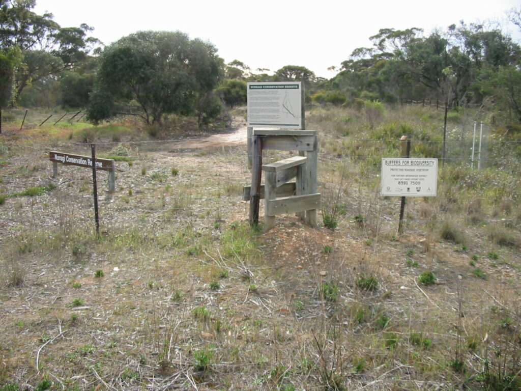
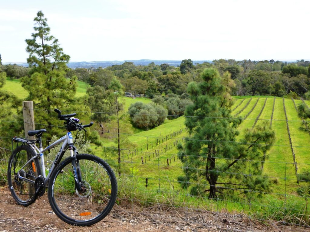
Nurragi Conservation Reserve
Milang approx 70km south east of Adelaide
12 km
Encounter Bikeway
Between Goolwa and Victor Harbour on the Fleurieu Peninsula 90km south of Adelaide
28 km
Kapunda Rail Trail
78km north of Adelaide
1 km
Eudunda Rail Trail
112km north of Adelaide
1 km
Copper Rail Trail
100km north of Adelaide
26 km
Riesling and Rattler Rail Trail
130km north of Adelaide
53 km
Shamus Liptrot Rail Trail
100km north of Adelaide
11 km

Nearby Trails
Westside Bike Path
2km West of Adelaide.
9 km
Marino Rocks Rail Trail
Marino Rocks
16 km
Coast Park Rail Trail
12 Km west of Adelaide CBD
34 km
Outer Harbour Rail Trail
Port Adelaide, 20km north west of Adelaide
23 km
Stockade Rail Trail
Pooraka, 11km north of Adelaide
2.6 km
Parafield Rail Trail
15km north of Adelaide
3 km
Coast to Vines Rail Trail
Southern Adelaide Suburbs
37 km
Penfield Rail Trail
Northern suburb of Adelaide
7 km
Mount Barker Rail Trail
33km southeast of Adelaide
5 km
Adelaide Hills Amy Gillett Rail Trail
Mount Lofty ranges, 49km east of Adelaide
16 km
Smithfield Magazine Rail Trail
Smithfield Plains, 33kms north of Adelaide
3.5 km
Barossa Rail Trail
Barossa Valley - between Gawler and Angaston
43 km
Nurragi Conservation Reserve
Milang approx 70km south east of Adelaide
12 km
Encounter Bikeway
Between Goolwa and Victor Harbour on the Fleurieu Peninsula 90km south of Adelaide
28 km
Kapunda Rail Trail
78km north of Adelaide
1 km
Eudunda Rail Trail
112km north of Adelaide
1 km
Copper Rail Trail
100km north of Adelaide
26 km
Riesling and Rattler Rail Trail
130km north of Adelaide
53 km
Shamus Liptrot Rail Trail
100km north of Adelaide
11 km
One review of “Mike Turtur Bikeway”
I did this trail today and found it a nice easy journey. It follows the tram line and is essentially flat and sealed the whole way, plus the regular stations mean if you tire you can easily get the tram back. There are a number of road crossings that will slow you down, but overall it is a good as any other rail trail. The only difficulty was crossing the metro line and the confusion on where the path goes. Enjoy.