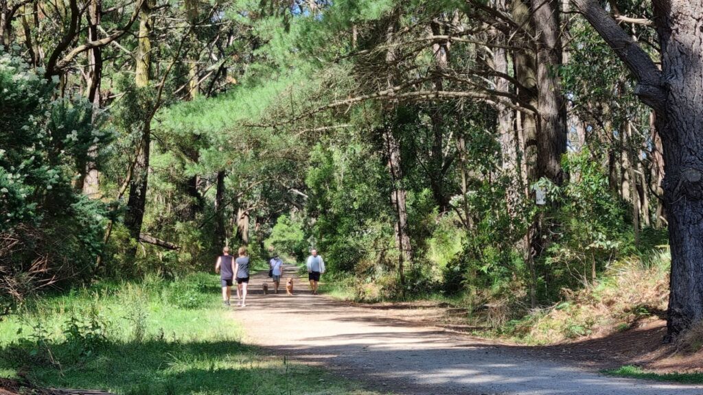
- A high standard rail trail with interpretive signs at station sites. It winds through a variety of suburbs and urban parkland
- From Kew to East Malvern it is also known as the Anniversary Trail
- Between East Camberwell and Alamein it runs beside the Alamein line, the only section of the Outer Circle to remain in use. There are many busy road crossings, but most have lights
- It is possible to access most sections using public transport
Nearby Attractions
- Numerous locations to refresh with drinks and food
- Djerring Trail beneath Sky Rail from Caulfield
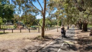
- Riversdale Park, Camberwell, has play equipment and facilities
- Hartwell’s station building came from Walhalla. Walhalla now has a replica for its heritage railway!
- Ferndale Trail runs west from Ashburton to the Gardiners Creek Trail
Last updated: 1 April 2024
The trail can be enjoyed in various bite-sized pieces. Car parking can be limited and generally requires using side streets or railway station parking. There are water fountains, toilets and bike repair stations at regular intervals.
For public transport options go to ‘GET AROUND’ below
Section Guides
This description covers the trail travelling southwards, away from the inner suburbs.
Fairfield to East Camberwell (8km)
- The railway corridor starts east of Fairfield Railway Station, which is on the Hurstbridge line. There is a short section of concrete path along Railway Place, but that soon peters out as this section is yet to be re-developed. From Heidelberg Rd, the rail trail proper starts beside the Chandler Hwy. Between here and the Yarra River is the former Australian Paper Mills site, which once used a section of the Outer Circle track as a siding. Here alot of medium-density residential development is underway.
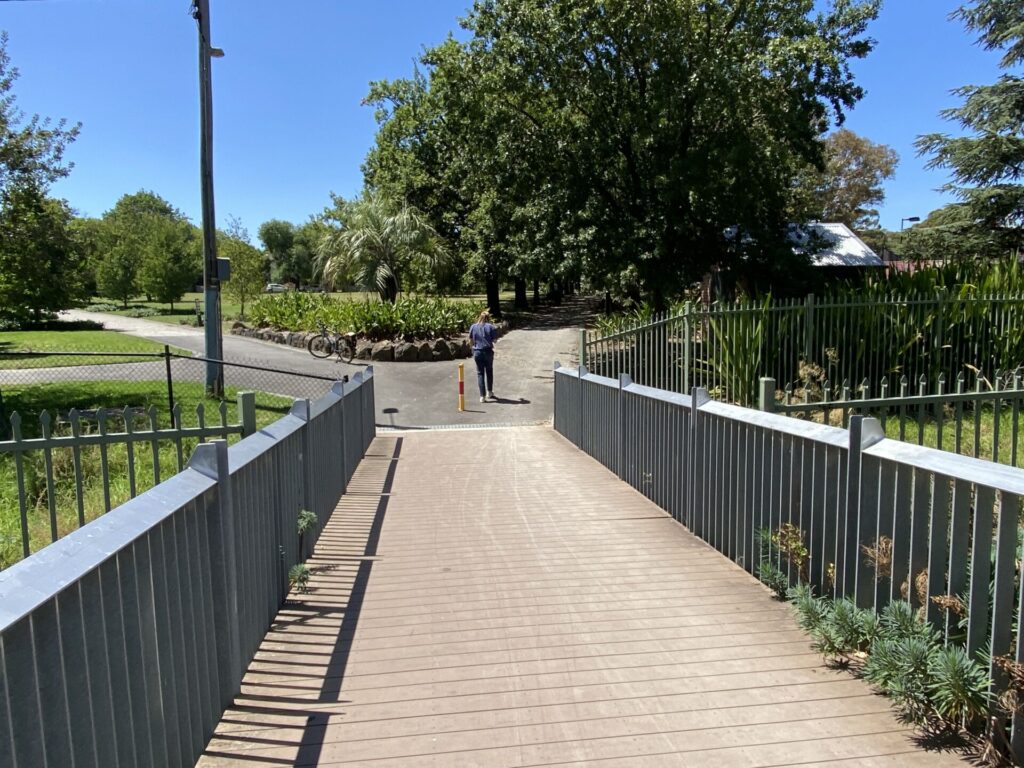
- The Yarra River Railway Bridge is a real feature. Completed under the supervision of Sir John Monash, the structure was converted into a two-lane road bridge after the railway closed and went on to become one of Melbourne’s most congested arterials. A six-lane concrete bridge opened next to it in 2020 and the 130-year-old iron box-girder bridge became the rail trail bridge. It has many interesting architectural features, including portholes to view the river below. At the eastern end of this bridge are connections to the Main Yarra Trail heading north and south.
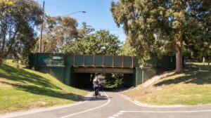
- The rail trail uses a narrow and noisy shared path over the Eastern Fwy to reach the start of the “Anniversary Trail” section. It’s a long ascent next to the former embankment (minus trestle bridge) up to High St, Kew East. Cross at the lights to get through busy Harp Junction, where the train underpass has been filled in. The trail is now a “proper” rail trail again, on the alignment of the railway. Until it passes under Canterbury Rd, the trail is in a deep cutting for 1km – a somewhat hidden zone of tranquillity in the eastern suburbs. This section has solar lighting but is particularly busy before and after school, so don’t expect tranquillity at those times.
East Camberwell to East Malvern (7km)
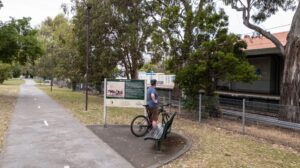
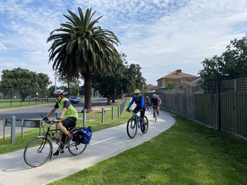
- The trail passes through a substandard section in Boorondara Park and then goes under the Belgrave/Lilydale Line near East Camberwell Station. From here the trail is well away from the rail alignment for a while and, at Prospect Hill Rd, it even winds around a hockey stadium. It then heads past the working Riversdale, Willison and Hartwell stations. It runs beside what is now the Alamein line but undulates. The next crossing, at Toorak Rd, can be very busy, and has an extremely steep (but fortunately short) descent. Cafes here, or at High St, are a good place to stop for refreshment.
- The end of the working line is reached at Alamein Station and a very picturesque stretch starts with old railway catenary poles now carrying high-voltage wires to feed the suburban network, although there were never electric trains running on this section! The Anniversary Trail section ends at the Gardiners Creek Trail intersection. Once a long timber trestle bridge crossed the creek’s floodplain at this point. After crossing Gardiners Creek, the trail runs through Malvern Valley Public Golf Course.
- Stick carefully to the trail and, at the golf tees, head south to get back on the original alignment (the Gardiners Creek Trail heads towards the CBD here). Use the shared-use bridge to cross the Monash Fwy and Glen Waverley line. The Outer Circle meets the Scotchmans Creek Trail here, which you could follow east all the way to Jells Park.
East Malvern to Hughesdale (2km)
- Make your way carefully through the East Malvern Station carpark and cross Waverley Rd. After Waverley Rd the trail passes through the Urban Forest (enter from the carpark on the left or stay on the bitumen trail to the right), once the site of Waverley Rd Station. This is a beautiful, native-bush park with several paths running in parallel and features the only unsealed section of the Outer Circle. Keep an eye out for Pobblebonk frogs.
- Head south to busy Dandenong Rd/Princes Hwy. Head west 200m to cross at pedestrian lights then follow the service lane to the east for 200m to rejoin the rail trail and wonder why the pedestrian crossing is so far away. The trail passes through Boyd Park before ending at impressive Hughesdale Station, on the Dandenong line’s sky rail section with Djerring Trail underneath. You can start from this end of the Outer Circle (look for the Boyd Park sign) and head towards town, a very popular option.
CONNECTING TRAILS
- You can cycle all the way from Kew to Elsternwick by combining the Outer Circle and Rosstown rail trails for a total distance of 25km.
- Gardiners Creek Trail heads east from near Alamein Station or north from near the Malvern Valley Public Golf Course
- Scotchmans Creek Trail heads to beautiful Jells Park from near East Malvern Station
![Yarra River Railway Bridge looking east, a real feature of the trail [2022]](https://www.railtrails.org.au/wp-content/uploads/2022/12/V02-059-Yarra-River-bridge-2022-11-IMG_0122-300x225.jpg)
Yarra River Railway Bridge looking east, a real feature of the trail [2022]
![The Outer Circle connects to city-bound Yarra Trail via this underpass [2020]](https://www.railtrails.org.au/wp-content/uploads/2022/12/V02-058-Yarra-River-Bridge-2020-11-19_091809-300x168.jpg)
The Outer Circle connects to city-bound Yarra Trail via this underpass [2020]
![The paper mill chimney in the background has since been demolished [2020]](https://www.railtrails.org.au/wp-content/uploads/2022/12/V02-058-Yarra-River-Bridge-2020-11-19_091552_crop-300x169.jpg)
The paper mill chimney in the background has since been demolished [2020]
![The rail corridor from Fairfield Station needs a proper path [2022]](https://www.railtrails.org.au/wp-content/uploads/2022/12/V02-059-Substation-and-community-garden-on-corridor-near-Fairfield-2022-12-300x169.jpg)
The rail corridor from Fairfield Station needs a proper path [2022]
![Typical parkland along the way, here the Outer Circle Linear Park in Kew [2020]](https://www.railtrails.org.au/wp-content/uploads/2022/12/V02-109-2020-11-19_085201-near-Campbell-St-300x168.jpg)
Typical parkland along the way, here the Outer Circle Linear Park in Kew [2020]
![This community garden is near the site of Willesmere Station [2020]](https://www.railtrails.org.au/wp-content/uploads/2022/12/V02-109-2020-11-19_090515-300x168.jpg)
This community garden is near the site of Willesmere Station [2020]
![The trail south of Whitehorse Rd, Deepdene, going into cutting [2022]](https://www.railtrails.org.au/wp-content/uploads/2022/12/V02-110-The-rail-trail-south-of-Whitehorse-Rd-Deepdene-2022-12-IMG_1468-300x199.jpg)
The trail south of Whitehorse Rd, Deepdene, going into cutting [2022]
![Near Mont Albert Rd, the cutting is a good place to beat the heat [2020]](https://www.railtrails.org.au/wp-content/uploads/2022/12/V02-109-2020-11-19_084355-near-Mont-Albert-Rd-_crop-300x169.jpg)
Near Mont Albert Rd, the cutting is a good place to beat the heat [2020]
![Near Roystead Station site, with Canterbury Rd 500m to the south [2022]](https://www.railtrails.org.au/wp-content/uploads/2022/12/V02-110-Near-Shenley-Station-site-near-Canterbury-Rd-300m-further-south-2022-12-IMG_1492-300x225.jpg)
Near Roystead Station site, with Canterbury Rd 500m to the south [2022]
![End of the deep cutting at Rubens Grove, before Shenley station site [2022]](https://www.railtrails.org.au/wp-content/uploads/2022/12/V02-110-End-of-the-deep-cutting-section-at-Rubens-Grove.-The-Shenley-Station-site-in-the-background-was-partly-filled-in-and-is-now-home-to-tennis-courts-2022-12-IMG_1483-300x169.jpg)
End of the deep cutting at Rubens Grove, before Shenley station site [2022]
Passing under Canterbury Rd, where cutting was partially filled in (2020)
Watch the kerbs on the path in Boroondara Park, East Camberwell (2020)
![Street section between East Camberwell and Hartwell stations [2020]](https://www.railtrails.org.au/wp-content/uploads/2022/12/V02-157-East-Camberwell-2020-11-21_135207-300x169.jpg)
Street section between East Camberwell and Hartwell stations [2020]
The Hartwell Railway Station was transported from Walhalla (2020)
![Having a break opposite Burwood station, a good spot to start [2020]](https://www.railtrails.org.au/wp-content/uploads/2022/12/V02-206-Burwood-2020-11-21_142235-300x168.jpg)
Having a break opposite Burwood station, a good spot to start [2020]
![The trail near Ashburton undulates as it shadows the operational line [2020]](https://www.railtrails.org.au/wp-content/uploads/2022/12/V02-206-Burwood-to-Ashburton-0781-2020-11-300x169.jpg)
The trail near Ashburton undulates as it shadows the operational line [2020]
![At Ashburton Railway Station, you mix it with the commuters [2020]](https://www.railtrails.org.au/wp-content/uploads/2022/12/V02-206-Ashburton-2020-11-21_164821-300x168.jpg)
At Ashburton Railway Station, you mix it with the commuters [2020]
![The Alamein to Gardiners Creek section still has overheads in use [2022]](https://www.railtrails.org.au/wp-content/uploads/2023/03/V02-260-Alamein-0784-2020-11-300x169.jpg)
The Alamein to Gardiners Creek section still has overheads in use [2022]
![The Black Bridge over the Gardiners Creek floodplain [a long time ago]](https://www.railtrails.org.au/wp-content/uploads/2022/12/V02-301-Black_Bridge-HISTORY-300x191.jpg)
The Black Bridge over the Gardiners Creek floodplain [a long time ago]
![The Urban Forest in East Malvern was once a goods yard on the line [2023]](https://www.railtrails.org.au/wp-content/uploads/2023/03/V02-300-Urban-Forest-2.2023-1871-225x300.jpg)
The Urban Forest in East Malvern was once a goods yard on the line [2023]
![There are at least three bicycle repair stations along the rail trail [2020]](https://www.railtrails.org.au/wp-content/uploads/2022/12/V02-307-Boyd-Park-2020-11-21_161939-bike-repair-station-300x168.jpg)
There are at least three bicycle repair stations along the rail trail [2020]
![Near Hughesdale station, Boyd Park has play equipment [2020]](https://www.railtrails.org.au/wp-content/uploads/2022/12/V02-307-Boyd-Park-2020-11-21_151709-300x168.jpg)
Near Hughesdale station, Boyd Park has play equipment [2020]
![The rail trail connects to the Djerring Trail at Hughesdale station [2020]](https://www.railtrails.org.au/wp-content/uploads/2022/12/V02-357-Hughesdale-Djerring-Trail-2020-11-21_160151-300x168.jpg)
The rail trail connects to the Djerring Trail at Hughesdale station [2020]
![The impressive Hughesdale station at the end of the rail trail [2020]](https://www.railtrails.org.au/wp-content/uploads/2022/12/V02-357-Hughesdale-station-2020-11-21_152202-300x168.jpg)
The impressive Hughesdale station at the end of the rail trail [2020]
Public Transport
Fairfield Station is on Metro’s Hurstbridge train line, near the start of the trail and offers regular services. If you make it to the other end or want to start at the southern end of the trail, you can catch the train at Hughesdale on the Cranbourne/Pakenham lines. If you are walking, there are many opportunities for shorter outings using tram services. As always, bicycle carrying restrictions apply.
Refer to the PTV web page for map and timetables, or use the navigation app of your choice.
Do you know of a bike hire or transportation service on this rail trail that should appear here? If so, let us know at admin@railtrails.org.au.
Information and Links
Some interesting links are:
Contact Rail Trails Australia
To contact us about this rail trail, email vic@railtrails.org.au
Background Information
Traditional Owners
We acknowledge the Woiworung people, the traditional custodians of the land and waterways on which the rail trail is built.
Railway history
In the late 1880s land boom, a railway line was built through the then outer eastern suburbs. It was supposed to link the Gippsland line with Spencer St (now Southern Cross) station before the construction of the viaduct between Flinders and Spencer street stations.
The Outer Circle line was opened in 1890. It operated in its entirety for only three years, being closed in stages between 1893 and 1895 as a result of the depression. The southern section was reopened as far as Ashburton in 1898 and was extended to Alamein in 1948. The section from East Camberwell to East Kew was reopened in 1900. The passenger service on this section was known as the Deepdene Dasher and was operated by a steam locomotive and two carriages. It closed again in 1943.
The City of Boroondara offers a very comprehensive history of the Outer Circle Railway here.
A more recent history of this railway is in a City of Glen Eira news item (Nov 2020).
Outer Circle Bridge Plan
Posted: 19/12/22
A proposal to bridge Toorak Rd for the Outer Circle Rail Trail is back on ...
More...Pedestrian Bridge Over Gardiner’s Creek Re-opened
Posted: 24/06/07
The pedestrian bridge across Gardiner's Creek on the Outer Circle Rail Trail has been closed ...
More...Nearby Trails
Hawthorn to Kew Rail Trail
Inner suburbs, 9 km east of Melbourne CBD
1 km


Rosstown Rail Trail
Southern suburbs, 9 km from the CBD
8.8 km

Inner Circle Rail Trail
Inner suburbs, 5 km from the CBD
4.8 km
Sandridge Railside Trail
Melbourne city, 1 km from GPO
4 km
Webb Dock Bridge
Docklands, 1 km from Melbourne CBD
0.2 km
Meadowlink Rail Trail
Broadmeadows, 20 km north of CBD
1.2 km
Heathmont to Belgrave Trail
Eastern suburbs, 40 km from the CBD
16 km
Warburton Rail Trail/Yarra Valley Trail
Yarra Valley, 50 km east of Melbourne CBD
48 km

Eastern Dandenong Ranges Trail
Dandenongs, 50 km southeast of CBD
15 km

Mornington Railside Trail
Mornington Peninsula, 60 km south of CBD
4 km
Red Hill Rail Trail
Mornington Peninsula, 90 km south of CBD
6.3 km
Bellarine Rail Trail
Bellarine Peninsula, 75 km southwest of Melbourne's CBD
35 km
Powelltown Tramways
Yarra Ranges, 80 km east of Melbourne
31 km
Fyansford Rail Trail
North Geelong, 5 km from town centre
4.4 km
Rokeby to Crossover Rail Trail
North of Warragul, 103km from Melbourne
5 km
Noojee Trestle Bridge Rail Trail
100km east of Melbourne
3 km
Bass Coast Rail Trail
130km south-east of Melbourne
23 km
Woodend to Daylesford (incl Domino) Rail Trail
85km north west of Melbourne
5 km
Great Victorian Rail Trail
90 km north of Melbourne
134 km
O’Keefe Rail Trail
East of Bendigo, 150km from Melbourne
50 km
The Bunny Trail
110 km west of Melbourne
1.0 km
Tyers Junction Rail Trail
Gippsland, 30km north of Moe, 160km from Melbourne
7 km
Great Southern Rail Trail & Tarra Trail
South Gippsland, 130 km southeast of Melbourne
109 km
Moe – Yallourn Rail Trail
Latrobe Valley 130km east of Melbourne
7 km
Grand Ridge Rail Trail
Strzelecki Ranges, South Gippsland, Victoria, 160km from Melbourne
13 km
Walhalla Goldfields Rail Trail
165km east of Melbourne
7 km
Nearby Trails
Hawthorn to Kew Rail Trail
Inner suburbs, 9 km east of Melbourne CBD
1 km
Rosstown Rail Trail
Southern suburbs, 9 km from the CBD
8.8 km
Inner Circle Rail Trail
Inner suburbs, 5 km from the CBD
4.8 km
Sandridge Railside Trail
Melbourne city, 1 km from GPO
4 km
Webb Dock Bridge
Docklands, 1 km from Melbourne CBD
0.2 km
Meadowlink Rail Trail
Broadmeadows, 20 km north of CBD
1.2 km
Heathmont to Belgrave Trail
Eastern suburbs, 40 km from the CBD
16 km
Warburton Rail Trail/Yarra Valley Trail
Yarra Valley, 50 km east of Melbourne CBD
48 km
Eastern Dandenong Ranges Trail
Dandenongs, 50 km southeast of CBD
15 km
Mornington Railside Trail
Mornington Peninsula, 60 km south of CBD
4 km
Red Hill Rail Trail
Mornington Peninsula, 90 km south of CBD
6.3 km
Bellarine Rail Trail
Bellarine Peninsula, 75 km southwest of Melbourne's CBD
35 km
Powelltown Tramways
Yarra Ranges, 80 km east of Melbourne
31 km
Fyansford Rail Trail
North Geelong, 5 km from town centre
4.4 km
Rokeby to Crossover Rail Trail
North of Warragul, 103km from Melbourne
5 km
Noojee Trestle Bridge Rail Trail
100km east of Melbourne
3 km
Bass Coast Rail Trail
130km south-east of Melbourne
23 km
Woodend to Daylesford (incl Domino) Rail Trail
85km north west of Melbourne
5 km
Great Victorian Rail Trail
90 km north of Melbourne
134 km
O’Keefe Rail Trail
East of Bendigo, 150km from Melbourne
50 km
The Bunny Trail
110 km west of Melbourne
1.0 km
Tyers Junction Rail Trail
Gippsland, 30km north of Moe, 160km from Melbourne
7 km
Great Southern Rail Trail & Tarra Trail
South Gippsland, 130 km southeast of Melbourne
109 km
Moe – Yallourn Rail Trail
Latrobe Valley 130km east of Melbourne
7 km
Grand Ridge Rail Trail
Strzelecki Ranges, South Gippsland, Victoria, 160km from Melbourne
13 km
Walhalla Goldfields Rail Trail
165km east of Melbourne
7 km
4 reviews of “Outer Circle Rail Trail”
Always a nice one to come home to. I commuted this way for several years … still waiting for the bridge at Toorak Rd.
What Warwick said below. An awesome, long trail in the heart of Melbourne with many options for a coffee along the way. A few more signs would be helpful in places, however it is easy to navigate and not get too lost.
20/27. This is an old friend, having ridden along here for many years. As usual, we did this trail (AKA The Anniversary Trail) as part of a longer loop starting at Kew, crossing the Yarra at Fairfield, down the Merri Creek path, along the Main Yarra Trail to Gardiners Creek Trail, which then meets the end of the Outer Circle at Alamein.
It’s fully sealed, but has a few major road crossings. I love it as you ride through some of Melbourne’s most beautiful and expensive suburbs, and there’s plenty of cafe options along the way.
Twenty trails now completed, only seven to go as part of my challenge to ride every rail trail in Victoria this year to promote organ donation. You can follow my rail trail exploits on FB Warwick Duncan – The 2nd Chance Man or Insta @warwick_rides.
I rode this trail yesterday (7th April, 2015) – and it is a gem of a rail trail. Though the trail passes through some of Melbourne’s denser suburbs, you don’t realise it given the quality of the parkland along the trail. Highlights for me were the Urban Forest in Malvern and the deep cutting through Canterbury. The trail is bitumen or concrete the entire way, and there are a lot of people enjoying the parks – so it’s definitely for a leisurely ride, and not for racing. I was planning to incorporate the ride with the Rosstown Rail Trail – but a change in the weather meant that wasn’t possible, and will have to wait for another day. All in all a great rail trail.