
- Discontinuous sections of trail through a mix of tall karri forest, wildflower-filled swampy plains and picturesque farmland
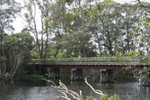
- Highlights include a series of wooden rail bridges and views of the Denmark and Hay Rivers
Nearby Attractions
- The popular tourist town of Denmark
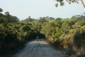
- Riding through karri forest near the Valley of the Giants
- Spectacular red blooms of swamp bottlebrush and other wildflowers through the wetlands and remnant bushland
- Picturesque farmland and hills
- Four wooden rail bridges from the historic railway line
- Birdwatching hides on the Wilson Inlet
Last updated: 9 December 2022
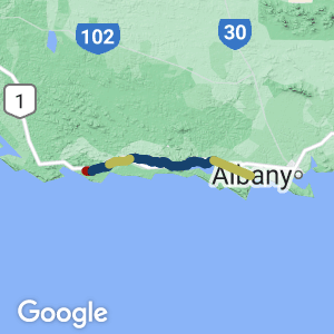
The Denmark-Nornalup Heritage Rail Trail consists of three open sections, starting at the eastern boundary of the Shire of Denmark on the banks of the Hay River (11 km east of Denmark itself), while its western terminus is just outside the small settlement of Nornalup on the Frankland River. A fourth section between Parker Rd and Peaceful Bay Rd is incomplete and requires 14 km of road riding to bridge the missing section.
Section Guides
Hay River to Denmark River mouth (12 km)
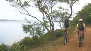
The trail starts at Hay River, providing views of the remnant pilings for the old rail bridge across the river. Running through remnant bushland and farmland, the rail traverses the edge of Wilson Inlet and includes bird hides and picnic shelters before crossing the Denmark River over a substantial refurbished rail bridge. This section is for walkers and cyclists only, with the Wilson Inlet section being accessible for wheelchairs and prams.
Denmark River mouth to Parker Rd (33 km)
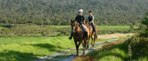
This longer section leaves the Denmark River via a small railway heritage display with old rail cars and an intact section of the old line. Leaving town through remnant bushland and farmland, the trail runs with the Munda Biddi Trail before branching off and crossing several old rail bridges. The section ends abruptly at Parker Rd and can be used by walkers, cyclists and equestrians, with the section close to Denmark being wheelchair and pram accessible.
Peaceful Bay Rd to Station Rd (16 km)
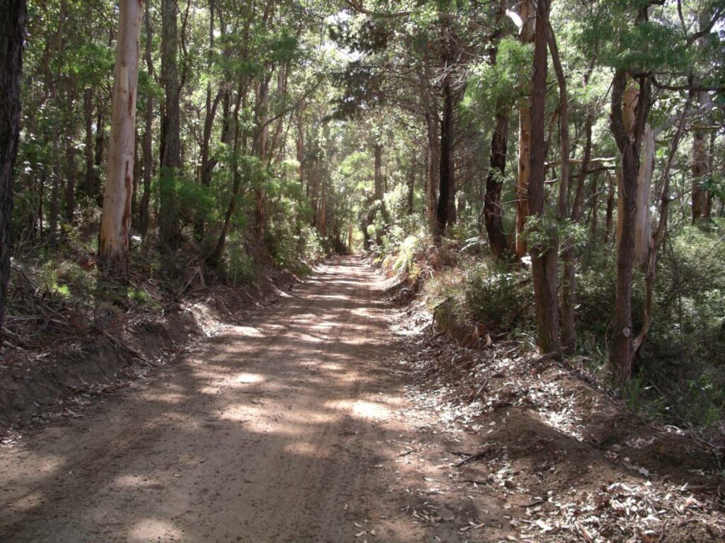
The trail begins again at Peaceful Bay Rd and is dominated by the tall karri forest that is a feature of the region, as well as open plains. The trail ends at the site of the old Nornalup Station, which is marked by a commemorative plaque.
The Denmark end of the trail is at the Denmark River on the old railway bridge at the mouth of the river
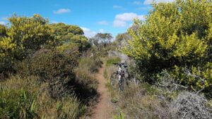
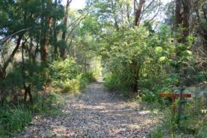
Typical scenery between Ocean Beach Rd and Wentworth Rd
Typical scenery on the Wilson Inlet section. (2006)
Typical scenery near Youngs Siding east of Wilsons Inlet (Garry Long 2018)
Typical scenery near Younds Siding east of Wilsons Inlet (Garry Long 2018)
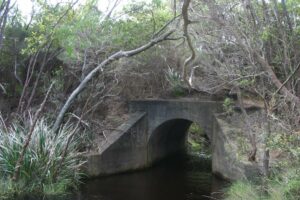
One of the old railway culverts along Wilsons Inlet(2006)
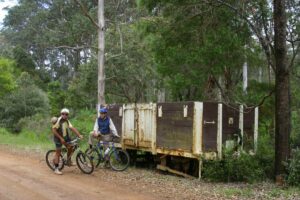
Old railway wagon at the site of the former Denmark Station next to the river
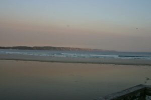
The Ocean Beach at Denmark at dusk
Kordabup
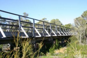
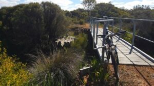
Bridge at Kordabup (2006)
The trail at Bow River (2006)
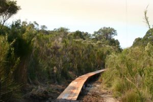
Board walk in the section near Nut Rd, near Nornalup. (2006)
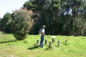
The Rail Trail Terminus at Nornalup (2006)
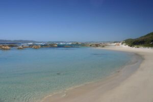
Green's Pool near Denmark is another attraction
Do you know of a bike hire or transportation service on this rail trail that should appear here? If so, let us know at admin@railtrails.org.au.
Information and Links
See Services tab above for links to services and businesses along this trail
For further information go to:
- Shire of Denmark
- The Long Way’s Better for a detailed write up of the trail experience
The trail is mostly on land managed by the Shire of Denmark
To report issues or problems please contact the Shire of Denmark at enquiries@denmark.wa.gov.au or 9848 0300
Contact Rail Trails Australia
To contact us about this rail trail, email wa@railtrails.org.au
Background Information
Traditional owners
We acknowledge the Minang people, the traditional custodians of the land and waterways on which the rail trail is built.
Development and future of the rail trail
The missing section from Parker Road to Peaceful Bay Rd has not been constructed because two bridges have to be replaced. This is not expected to be completed for several years.
Rail line history
Work on the Denmark to Nornalup line began in 1926, employed 300 men and took nearly three years to complete. The distance was only 55 km but the country was rugged and presented many engineering problems. Deep gullies had to be filled, rivers and creeks were bridged, and huge cuttings were carved out of the hillsides. The grade on the whole line needed to be 1 in 60.
The work was carried out with picks and shovels, axes, cross-cut saws and gunpowder; no bulldozers, backhoes or chainsaws were available, just a ‘steam navy’ to excavate some of the bigger cuttings, and hard work by the men and their horses. Despite the hazards, the project was accident free.
The men worked a 44-hour week; a typical day for the supporting train crews began at 5 am and did not finish until 10 pm.
The line served 900 people on 15 settlements and played a central role in the lives of the settlers. Two trains a week carried passengers, collected farm produce and delivered goods and supplies, including cattle for the settlers’ farms.
The Denmark to Nornalup railway line closed on economic grounds in September 1957, despite protests from Denmark residents.
In the 14km section between Parker Rd and Bow Bridge some parts are being gradually developed. It is hoped this will be opened in the future, perhaps when it becomes part of the Munda Biddi trail when that trail is extended to Albany.
Nearby Trails
Torbay to Elleker Rail Trail
15 km west of Albany
8 km


Nearby Trails
Torbay to Elleker Rail Trail
15 km west of Albany
8 km
2 reviews of “Denmark – Nornalup Heritage Rail Trail”
My sister and I recently completed this as a hike over 4 consecutive days late November. Our activity apps measured approx 61 km in total. We chose to skip the incomplete section between Peaceful Bay Road to Parker Road as we did not feel comfortable walking along the highway for 14km.
We had accommodation in Denmark that we returned to each afternoon, getting picked up by support crew (thanks Dad) at the end of each leg. From there we chose a venue close to the pick up point for a late lunch eg, Peaceful Bay fish and chips, Boston Brewing Co. The trail passes right by the newly opened The Dam, so this was lunch mid-hike on day 3.
An easy trail, nothing difficult about it, a good one to test yourself for multiday hikes, see how your feet cope, if you haven't done multiday before.
A couple of sloshy sections need careful navigating, sunk a little in the peat and mud at times but nothing the merrels couldn't handle.
Overall very enjoyable, we were spoilt with wildflowers almost the entire way, great variety of scenery, farmland, karri forest, sheoak stands, swamps, inlet, and passing only a few other users, it was the perfect way to lose your mind and find your soul. The incredible feeling of roaming free in the countryside, just putting one foot in front of the other.
As said by Donovan de Dousa (The Long Ways Better) in his very detailed blog, this trail has a lot of potential.
More interpretive plaques, signs etc would add to the experience, would love to know more about the sidings/settlements along the way.
There was only one section I didn't like and that was the long grass along a farm fence with no distinct trail- as in no visibility for snake spotting. We opted to walk along the open dirt road which paralleled the trail only 20mtrs apart. Was only a short section, then rejoined the trail after crossing Crusoe Beach Road.
Mostly well signed, the "show my location" function came in handy.
I will do this again, preferably mid October for more wildflowers, cooler temps and less flies. And would love to see the incomplete section finished.
Day 1: Nornalup Terminus on Station Road to Peaceful Bay Road. 13.6km
Day 2: Parker Road to Happy Valley Road. 16.6km
Day 3: Happy Valley Road to Ocean Beach Road. 17km
Day 4: Ocean Beach Road to Hay River. 13.3km
A great scenic trail using Denmark as start point .
Bitmuddy in places during rain but great scenery