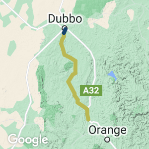
This trail is not opened or developed. It is one of 17 potential rail trails in NSW
- The trail would be almost 130 km long, making it ideal for a one-day ride for the enthusiast or a multi-day tour for the touring cyclist.
- There are major towns at the start and finish, with delightful villages between
- Dubbo and Molong are well served by public transport, with plenty of accommodation and places to eat
- The villages of Yeoval and Cumnock offer accommodation and meals
- The trail passes through rolling countryside and has many embankments, cuttings, and bridges for railway enthusiasts to enjoy
- Artwork displays of ‘Animals on Bikes’ at various locations between Dubbo and Molong
- Some station buildings and railway infrastructure survive at Dubbo, Yeoval, Cumnock and Molong
Nearby Attractions
- Dubbo, a five-hour drive from Sydney, is a major transport hub in the Central West and is well served by air and rail transport. It is at the junction of the Newell and Great Western Highways.
- Dubbo has many tourist attractions, including Western Plains Zoo.
- Molong is 30 km from the large city of Orange, which has many tourist attractions, accommodation and restaurants.
- Both Dubbo and Orange have bike shops as well as large shopping malls.
Last updated: 24 November 2022
This trail would begin near Dubbo city centre and cross the Macquarie River to Dundullimal historic homestead. From Dundullimal there is a cycleway link to the popular Western Plains Zoo, connecting with an existing cycleway back to town.
The trail would continue through undulating rural countryside and pass through a couple of old railway station sites to the small village of Yeoval (the birthplace of Banjo Paterson), which offers food and accommodation. Banjo Paterson Park has a large bronze statue of the man in his army uniform.
The small village of Cumnock is 25 km further, and rail trail users could obtain food and stay at the Royal Hotel.
The next 30 km are the most scenic part of the trail, passing through deep cuttings and beautiful hilly countryside to Molong – a large country town with food and accommodation options.
The old line criss-crosses the countryside and there are six crossings of the Dubbo to Molong road. The many ‘Animals on Bikes’ artworks along the way use metal and other materials to produce fascinating sculptures.
Section Guides
Dubbo to Toongi Station Site (27 km)
- The cycle path from the Dubbo showgrounds heads south and crosses the Macquarie River before travelling through beautiful rural countryside to Toongi
- Two road crossings on this section
- Cumboogle station site at around 9 km
- There is nothing left at Toongi apart from a disused wheat storage area
Toongi to Yeoval (47 km)
- Two old station sites of Arthurville at 23 km and Walmer 12 km further
- A large concrete and steel bridge over the Little River
- Yeoval has large wheat silos at the station site
Yeoval to Cumnock (26 km)
- three road crossings in this section as the old line follows Banjo Paterson Way
- Cumnock has large wheat silos and a small wooden station building and platform
Cumnock to Molong (29 km)
- Larras Lee locality was once a station site
- Two road crossings
- Molong still has a working railway line that goes from Sydney to Broken Hill, though there are no passenger trains to Molong
- Molong’s beautifully kept railway station building is used as the Community Library
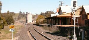
Molong Railway Station (2011)
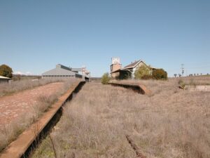
Cumnock (2011)
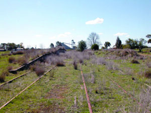
Yeoval (2011)
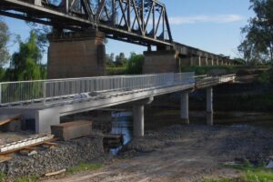
New bridge at Dubbo (2011)
Do you know of a bike hire or transportation service on this rail trail that should appear here? If so, let us know at admin@railtrails.org.au.
Information and Links
This Trail is a proposed Rail Trail only at this stage. It is not yet constructed or open.
The railway corridor is owned by the NSW State Government, and trespassing is prohibited.
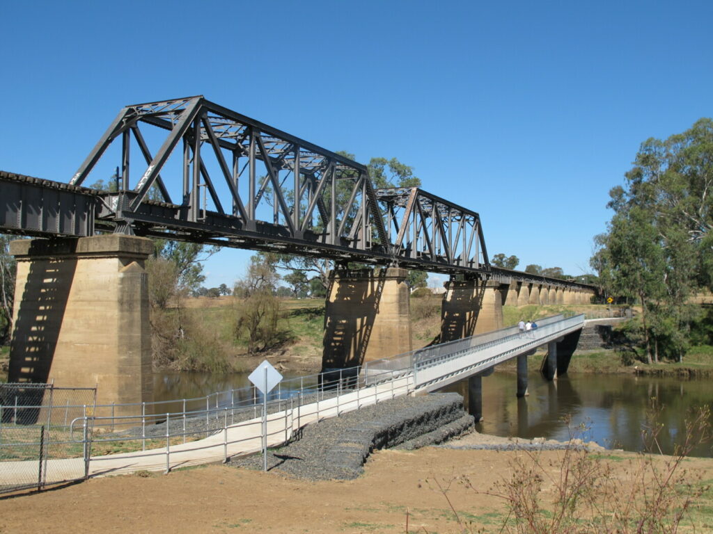
The railway bridge on the Macquarie River floodplains is 400 m long. A mining company has indicated it may want to use the railway and the bridge in the future, but Dubbo City Council has built a new cycle bridge next to the railway bridge, providing access from Dundullimal to Macquarie Street, South Dubbo. There is also a view of the old railway bridge as you cross the river.
Contact Rail Trails Australia
To contact us about this rail trail, email nsw@railtrails.org.au
Background Information
Traditional Owners
We acknowledge the Wiradjuri people, the traditional custodians of the land and waterways on which the rail trail will be built.
Development and future of the rail trail
As of June 2021 there is no active committee trying to lobby for the construction of a rail trail on this disused corridor. Rail Trails Australia views this as a viable potential rail trail, and would be keen to support any person or group to lobby for its construction.
If you are interested, contact us at
ns*@ra********.au
Rail Line History
This 129 km railway from Molong to Dubbo opened in 1925 and paralleled the main Orange-Dubbo railway while serving communities along the way. Operations ceased in 1991 except for 2 km at Molong, used for a passing siding on the main western line to Broken Hill.
The Molong- Dubbo line left the Broken Hill line at Molong and rejoined it at Dubbo. The line was designed with gentler grades than the steeper section of the Main Western line via Wellington, but this resulted in it taking a meandering course (131 km for a point-to point distance of 85 km).
The line is scenic and includes several steel bridges and significant engineering works.
Passenger services were operated by rail motors from 1932 to 1974, with the occasional diversion of other mainline trains over the line. The rail motor was withdrawn in September 1974, with the remainder officially closed in 1993.
Dubbo Tracker Riley Cyclepath extension
Posted: 25/06/12
The opening ceremony was held at Dundullimal homestead due to wet weather on the day. ...
More...Nearby Trails
Dubbo Tracker Riley Cyclepath extension
390 km north west of Sydney
3.5 km


Sandy Hollow to Merriwa
100 km north west of Newcastle


 Leaders in Rail Trail Bicycle and E-Bike Hire in the Yarra Valley and Yarra Ranges. Customise your own riding adventure and help us support local businesses along the way. Family run and owned with extensive local knowledge, bike hire has never been so easy.
2 reviews of “Dubbo to Molong Rail Trail”
Another great potential rail trail. So many opportunities for the region if this trail was constructed. Yeoval and Cumnock would benefit so much. The rural countryside on this trail is very scenic, especially in spring and early summer with the many wheat and canola crops on display.
Looking to do this ride with a group in Jan 2013. I’m assuming that Alkane aren’t yet using the line. Would there be any reason that we wouldn’t be able to ride along this stretch from Molong to Dubbo? Are there any areas that are off limits or dangerous that anyone is aware of? Has anyone done the ride?