- A high quality trail of 7.5km in length that passes through the regional centre of Mount Gambier
- An additional 3km trail branches off along the old Millicent line
- Links tourist attractions and facilities
- Commercial centre is 400 m from the trail
- Flat with easy street crossings
Nearby Attractions
- Many tourist features, including Umpherston Sinkhole, Cave Garden and Engelbrecht Cave.
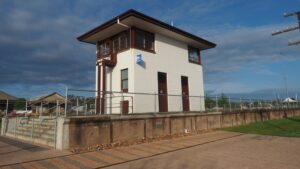
- Old rail yards have been converted into a landscaped civic centre where community events and markets are held regularly.
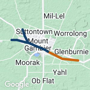
- The railway station has been restored and is used for community activities.
- The extinct volcanic region of Mount Gambier is less than 2 km south of the trail. The crater region contains Blue Lake, Valley Lake, a playground, walking trails and a caravan park.
Last updated: 12 May 2023
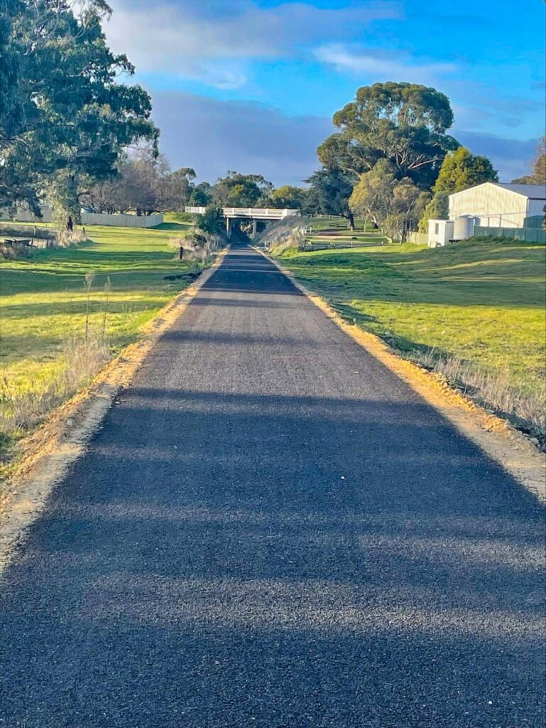
The trail runs east-west through the city of Mount Gambier with its focal point being the former rail yards and railway station, which have been transformed into parklands and play areas while retaining much railway memorabilia.
A side trail begins at the Blue Lake Sports Park, passes Umpherston Sinkhole and then joins the rail trail and progresses to the centre of the city and the railway station precinct.
West of the city, the rail trail splits into two at a junction, one following the Adelaide line for a further 3km, whilst the other follows the Millicent line for 3km.
Section Guides
Telford St to White Ave (4.5km)
This section commences at the eastern end of Telford St and passes behind the Mount Gambier Showgrounds and Harness Racing Club.
The rail reserve is a wide linear park with housing at some distance from the trail.
At the Pick Ave crossing, a roadside cyclepath heads north to join the Princes Highway path, or south toward Blue Lake. A bakery is a few doors north of the trail.
At most road crossings, shops, cafes and hotels are easily accessible.
At the Riddoch Highway/Bay Road crossing, Cave Gardens are just 300m north.
Between Riddoch Hwy/Bay Road and Wehl St are the Mount Gambier Railway Lands, a wide landscaped public facility with artworks and restored railway buildings. A shopping mall with food court is opposite the railway station building.
Access to Engelbrecht Cave is via Bertha St and Victoria Tce (approx. 1km).
West of Bertha St the trail passes through the old railway yards with the remains of a turntable and other lines and buildings on its southern side. West of the turntable is the footprint of the old engine roundhouse.
South and west of the turntable/roundhouse is a large park with BMX and Pump Tracks.
There are no steep or dangerous sections, but take care at road crossings.
Picnic facilities and toilets are located within the Railway Lands precinct.
Side Trail – Telford St to Umpherston Sinkhole (1.2km)
From the eastern end of the rail trail, head north on the sealed cyclepath to the Princes Highway. Turn right onto the roadside cyclepath and proceed east for approximately 400m to Umpherston sinkhole.
A kiosk, picnic facilities and toilets are located within the Umpherston park.
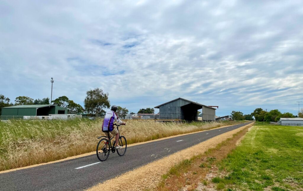
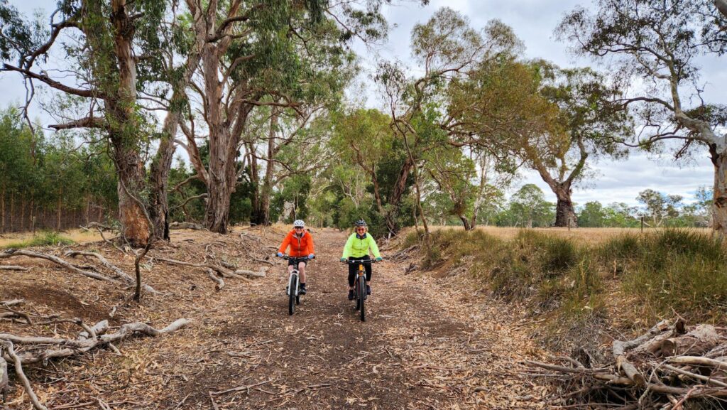
White Ave to Wandilo Rd (3km)
After crossing White Avenue and passing the old signal box, the trail curves to the right following the old Adelaide line, passing through a mainly light industrial area before terminating at Wandilo Road in a semi-rural environment with some new housing estates.
Exercise caution at road crossings, particularly the busy Princes Highway.
White Ave to Cafpirco Rd (3km)
After crossing White Avenue and passing the old signal box, the trail also follows the old Millicent line straight ahead, passing through a light industrial area and some new suburban developments, then rural area before terminating at Cafpirco Road near the site of the old Compton siding.
Exercise caution at road crossings.
![An aerial view of the rail trail east of the railway station and how maintains a green corridor through the city [2023 City of Mt Gambier]](https://www.railtrails.org.au/wp-content/uploads/2023/05/S16-600-Aerial-Rail-Lands-east-Mount-Gambier-Drone-07112022_0022-300x200.jpg)
An aerial view of the rail trail east of the railway station and how maintains a green corridor through the city [2023 City of Mt Gambier]
![Plenty of recreation space in the Railway Lands old station area [John Masson 2015]](https://www.railtrails.org.au/wp-content/uploads/2022/09/S16-605-Mt-Gambier-opening-2015-11-station-area-02-Enhanced-300x169.jpg)
Plenty of recreation space in the Railway Lands old station area [John Masson 2015]
The station signal box has been restored and the lower section is a public toilet (2019)
Wetlands have been created in the old station area (2019)
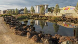
One of the historical buildings in the station area. (2019)
There are lots of things to see in the Railway Lands area.
![Enjoying a stroll through the Railway Lands, the former Mt Gambier station [2019]](https://www.railtrails.org.au/wp-content/uploads/2022/09/S16-606-Mt-Gambier-PA078485-Station-area-2019-10-300x169.jpg)
Enjoying a stroll through the Railway Lands, the former Mt Gambier station [2019]

There was a large locomotive depot, only the turntable remains now (2019)
The railway yard in 2019 is very different from the next photo taken in a similar location.
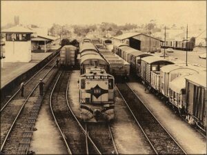
The railway yard was very busy in the early 1980s (Morris Broad)
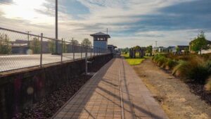
![The current eastern extent of the rail trail [2022]](https://www.railtrails.org.au/wp-content/uploads/2022/09/S16-607-005-Mount-Gambier-Trail-StaSep-22-300x225.jpg)
The current eastern extent of the rail trail [2022]
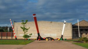
![Art work and interconnections east of Mt Gambier station [2022]](https://www.railtrails.org.au/wp-content/uploads/2022/09/S16-607-007-Mount-Gambier-Sep-22-300x225.jpg)
Art work and interconnections east of Mt Gambier station [2022]
Between White Avenue and the station, where the 'New Goods Yard' used to be. (2019)
The rail trail is well connected to the city's streets. (2019)
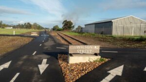
![The junction signal box at White Avenue still remains. The branchline to Millicent used to go straight ahead while the main line to Adelaide curves to the right, both now rail trail [2022]](https://www.railtrails.org.au/wp-content/uploads/2022/09/S16-607-023-Mount-Gambier-White-Ave-Signal-Box-Sep-22-300x225.jpg)
The junction signal box at White Avenue still remains. The branchline to Millicent used to go straight ahead while the main line to Adelaide curves to the right, both now rail trail [2022]
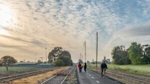
![Walking on the former "main line" to Adelaide [2019]](https://www.railtrails.org.au/wp-content/uploads/2020/11/2671605556622-300x169.jpg)
Walking on the former "main line" to Adelaide [2019]
![Looking south from Wandilo Rd at the end of the Adelaide line section [2022]](https://www.railtrails.org.au/wp-content/uploads/2022/09/S16-607-029-Mount-Gambier-South-from-Wandilo-Rd-Adelaide-Line-Sep-22-300x225.jpg)
Looking south from Wandilo Rd at the end of the Adelaide line section [2022]
![Western Trail End Cafpirco Rd - Millicent Line section [2022]](https://www.railtrails.org.au/wp-content/uploads/2022/09/S16-607-035-Mount-Gambier-Western-Trail-End-Cafpirco-Rd-Millicent-Line-Sep-22-300x225.jpg)
Western Trail End Cafpirco Rd - Millicent Line section [2022]
![The remarkable Umpherston Sinkhole at Mt Gambier, accessible by cycle path less than 1km from the eastern end of the rail trail. [2022]](https://www.railtrails.org.au/wp-content/uploads/2022/09/S16-607-001-Mount-Gambier-Umpherston-Sinkhole-Sep-22-300x225.jpg)
The remarkable Umpherston Sinkhole at Mt Gambier, accessible by cycle path less than 1km from the eastern end of the rail trail. [2022]
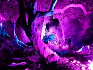
The Cave Gardens illumination is alongside the main north-south street, just a few hundred metres from the Railway Lands.
Do you know of a bike hire or transportation service on this rail trail that should appear here? If so, let us know at admin@railtrails.org.au.
Information and Links
The rail trail is managed by the City of Mount Gambier
Walking SA have more photos of the trail click HERE.
For a very detailed history of the railway station click HERE
Discover Mount Gambier tourist information click HERE
Engelbrecht Cave information click HERE
Contact Rail Trails Australia
To contact us about this rail trail, email sa@railtrails.org.au
Background Information
Traditional owners
We acknowledge the Buandig people, the traditional custodians of the land and waterways on which the rail trail is built.
Development and future of the rail trail
A 3.1km path from Pick Avenue to Whites Avenue was opened early in 2017. Construction started on a further 2.3km section west from White Avenue to Jubilee Highway West late in 2017. More recently the trail has been extended further east from Pick Avenue to link up with the existing Jubilee Highway path leading to Umpherston Sinkhole and Blue Lake Sports Park. The rail trail has also been extended north from Jubilee Hwy West to Wandilo Rd where it is intended to link with a roadside cyclepath to the University SA and TAFE campuses on Wireless Rd West. Another linked trail has been constructed west from White Ave to Cafpirco Rd along the old Millicent line. Some central sections now have lighting.
Rail line history
The railway line to Mount Gambier was originally part of South Australian Railways (SAR) narrow gauge network. Opened in stages from 1881, it reached Mount Gambier in 1887 and connected with the broad-gauge Adelaide-Melbourne line at Wolseley. It was also a junction for the line to Millicent and Beachport.
The SAR line to Mount Gambier and Millicent was converted to broad gauge in the 1950s.
Mount Gambier also had a broad-gauge connection with Heywood, Victoria, which opened in 1917. Mount Gambier had two goods yards and a locomotive depot and roundhouse. Passenger services to Adelaide ended in December 1990, and the line officially closed in April 1995. Some of the line was used by the Limestone Coast Railway tourist service, but this ceased operations in June 2006.
When the land was given to the community by the SA Government, the City of Mount Gambier repurposed the site into a public green space.
Mount Gambier Rail Trail will see the light
Posted: 16/04/21
The Mount Gambier Rail Trail in South Australia is unique with its 8km length traversing ...
More...Mount Gambier’s rail trail is a blooming success
Posted: 15/03/21
Over the past decade the City of Mount Gambier in South Australia, with assistance from ...
More...Nearby Trails
Dartmoor Rail Trail
Western Victoria, 365 km west of Melbourne
1.3 km


Coonawarra Rail Trail
360km south east of Adelaide
19 km
Casterton to Branxholme Rail Trail
South Western Victoria in the vicinity of Hamilton

Hamilton to Coleraine Rail Trail
286 km west of Melbourne
22 km
Nearby Trails
Dartmoor Rail Trail
Western Victoria, 365 km west of Melbourne
1.3 km
Coonawarra Rail Trail
360km south east of Adelaide
19 km
Casterton to Branxholme Rail Trail
South Western Victoria in the vicinity of Hamilton
Hamilton to Coleraine Rail Trail
286 km west of Melbourne
22 km
One review of “Mount Gambier Rail Trail”
This trail has an excellent paved surface and the former Mount Gambier railway station sites has been well developed as a community asset.
However, the trail doesn't actually lead anywhere, instead it just ends at the end of suburban parts of Mount Gambier. Hopefully one day it can be extended north up to Penola or west to Millicent.