
 Location:
 Length:
 Surface:
 Start / End:
 Public Transport:
 Suitable for: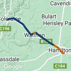
- The Hamilton to Wannon section runs through attractive red gum country, while the Wannon to Coleraine section passes rolling hills, wetlands and low native shrubs
- Wannon and Nigretta Falls can be visited using a local road
- The adventurous can join the two sections on foot or mountain bikes using a 2km temporary trail
- The conservation value and trail quality is steadily being improved and will be 36km when fully complete.
Nearby Attractions
- Hamilton’s botanic gardens, art gallery and Sir Reginald Ansett Transport Museum
- Explore Wannon and Nigretta Falls. Free camping is allowed at the falls
- Visit Coleraine’s Classic Cars museum, Points Arboretum (the largest collection of eucalypts in the Southern Hemisphere), chocolate factory and restored railway station (now the visitor iformation centre)
Last updated: 14 April 2024
The voluntary rail trail committee is dedicated to improving the environment of the corridor and the trail experience and completing the full length from Hamilton to Coleraine. The current situation is
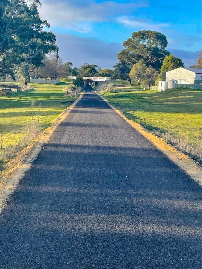
- Hamilton to Wannon-Nigretta Falls Rd is 11km and meanders through red gum country and past operating farms.
- Wannon-Nigretta Falls Rd to Glenelg Hwy is 2km and is partially an “other trail” that follows the Wannon River rather than the original rail trail alignment. This section is only fit for walkers and adventurous mountain bike riders.
- Glenelg Hwy to Glenelg Hwy is 5.5km and is under development. This section is subject to flooding and is only fit for walkers and adventurous mountain bike riders.
- Wannon to Coleraine is 11km and provides open vistas through a linear nature reserve with wetlands.
The major town of Hamilton has a wide range of facilities while Coleraine provides basic food and accommodation.
Section Guides
Hamilton to Wannon-Nigretta Road (11km)
- This section of the trail begins about 2km northwest of Hamilton on Balkins Rd
- This section finishes at the Wannon-Nigretta Falls road.
If you do not wish to undertake the next two sections, to rejoin the trail, follow the road 1.1 km south to Wannon Falls and ride along Glenelg Hwy about 3 km west towards Coleraine; the trail is on the right at a gate marked “Grasslands Trail”. Please beware of traffic on the highway as there is not much shoulder.
- Free camping is available at Wannon Falls
Wannon-Nigretta Falls Rd to Glenelg Hwy (2km)
- This section of the trail is only suitable for walkers and mountain bike riders who enjoy an adventure. Please note the trail is in close proximity of the Wannon River and children should be closely supervised in this area.
- Join the trail on Wannon-Nigretta Falls Road, 1.1km north of the Glenelg Highway (near the Wannon Falls reserve)
- 500 metres west along the trail, you will find the Wannon River Rail Bridge. At this point the trail leaves the original rail alignment on the left hand side of the bridge and follows the Wannon River bank for approximately 1km to Quigley’s Road.
- At Quigley’s Road, cross the Wannon Bridge 1917 designed by Sir John Monash.
- After 200 metres, turn left to rejoin the original rail alignment past the Scout Camp. You will meet the Glenelg Highway after another 200 metres.
Glenelg Hwy to Glenelg Hwy (5.5km)
- This section of the trail is only suitable for walkers and mountain bike riders who enjoy an adventure. It is subject to flooding.
- Cross the Glenelg Highway and follow the rail trail alignment (that follows a “hockey stick” alignment) for approximately 5.5km to meet the Glenelg Highway again.
Glenelg Hwy to Coleraine (11 km)
- This section of the trail begins about 3 km west of Wannon, and finishes on the eastern outskirts of the township of Coleraine opposite East Park on the Glenelg Highway.
- The trail features extensive valley views, native grasslands and wetlands.
![Hamilton railway station still sees freight trains and is where to catch the VLine bus [2024]](https://www.railtrails.org.au/wp-content/uploads/2024/04/V70-050-Hamilton-station-2024-04-03_184002-300x169.jpg)
Hamilton railway station still sees freight trains and is where to catch the VLine bus [2024]
![A low level crossing is planned to go around the Grange Burn Creek bridge on the outskirts of Hamilton. [2011]](https://www.railtrails.org.au/wp-content/uploads/2024/04/V70-055-Grange-Burn-Creek-bridge-Hamilton-2011-10-7167-300x225.jpg)
A low level crossing is planned to go around the Grange Burn Creek bridge on the outskirts of Hamilton. [2011]
![The current start of the rail trail at Balkins Rd a few kilometres out of Hamilton [2024]](https://www.railtrails.org.au/wp-content/uploads/2024/04/V70-060-Balkins-Rd-start-Hamilton-2024-04-04_143403-300x169.jpg)
The current start of the rail trail at Balkins Rd a few kilometres out of Hamilton [2024]
![Also at Balkins Rd is a unique piece of Victoria's surveying history [2024]](https://www.railtrails.org.au/wp-content/uploads/2024/04/V70-060-Balkins-Rd-start-Hamilton-2024-04-04_143650-300x169.jpg)
Also at Balkins Rd is a unique piece of Victoria's surveying history [2024]
![Cycling past the source of the region and Victoria's early wealth, wool, at McKinnons Creek [2024]](https://www.railtrails.org.au/wp-content/uploads/2024/04/V70-070-McKinnon-Creek-area-2024-04-04_133009-300x169.jpg)
Cycling past the source of the region and Victoria's early wealth, wool, at McKinnons Creek [2024]
![Typical scenery between Hamilton and Wannon [2024]](https://www.railtrails.org.au/wp-content/uploads/2024/04/V70-070-McKinnon-Creek-area-2024-04-04_134317-300x169.jpg)
Typical scenery between Hamilton and Wannon [2024]
![Taking in one of the old timber bridges between Mckinnons Creek and Wannon [2024]](https://www.railtrails.org.au/wp-content/uploads/2024/04/V70-080-McKinnon-Creek-to-Wannon-2024-04-04_130757-300x169.jpg)
Taking in one of the old timber bridges between Mckinnons Creek and Wannon [2024]
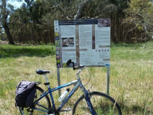
Information signage on the Hamilton to Wannon section of the trail.
![Cruising along between McKinnons Creek and Wannon. One of the primary purposes of the rail trail is to be a conservation reserve and the corridor is gradually being rehabilitated [2024]](https://www.railtrails.org.au/wp-content/uploads/2024/04/V70-080-McKinnon-Creek-to-Wannon-2024-04-04_131702-300x169.jpg)
Cruising along between McKinnons Creek and Wannon. One of the primary purposes of the rail trail is to be a conservation reserve and the corridor is gradually being rehabilitated [2024]
![The long timber bridge over the Wannon River at Wannon will not be restored for trail users but hopefully it can be preserved [2024]](https://www.railtrails.org.au/wp-content/uploads/2024/04/V70-105-5-Wannon-River-rail-bridge-west-of-Wannon-Nigretta-Falls-Road-2022-11-300x225.jpg)
The long timber bridge over the Wannon River at Wannon will not be restored for trail users but hopefully it can be preserved [2024]
![Wannon Falls are an impressive site with any rain [2019]](https://www.railtrails.org.au/wp-content/uploads/2024/04/V70-105-Wannon-Falls-2019-10-PA088576-300x200.jpg)
Wannon Falls are an impressive site with any rain [2019]
![Leaving Quigley's Road to rejoin rail trail heading west {2022]](https://www.railtrails.org.au/wp-content/uploads/2022/12/V70-108-10-Leaving-Quigleys-Road-to-rejoin-rail-trail-heading-west-2022-11-300x169.jpg)
Leaving Quigley's Road to rejoin rail trail heading west {2022]
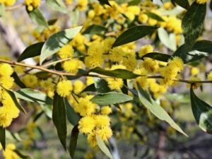
The Casterton Wattle (Acacia exudans) is found only at some local sites and is regenerating on the rail trail. (Coralie Coulson 2019)
![The scenery on the way down from Mt Koroite to Coleraine [2020]](https://www.railtrails.org.au/wp-content/uploads/2024/04/V70-120-Mt-Koroite-Decline-to-Coleraine-2020-11-24_113238626-300x169.jpg)
The scenery on the way down from Mt Koroite to Coleraine [2020]
![An almost conical hill on the outskirts of Coleraine [2024]](https://www.railtrails.org.au/wp-content/uploads/2024/04/V70-120-Koroite-Decline-2024-04-_DSF5759-300x169.jpg)
An almost conical hill on the outskirts of Coleraine [2024]
![The start of the rail trail at Coleraine with its railway themed gates. There is no formal car park or link to the station at this stage so take care at the highway. [2024]](https://www.railtrails.org.au/wp-content/uploads/2024/04/V70-150-Coleraine-2024-04-04_101059-300x169.jpg)
The start of the rail trail at Coleraine with its railway themed gates. There is no formal car park or link to the station at this stage so take care at the highway. [2024]
![Coleraine Station looks great and is now a tourist information centre [2019]](https://www.railtrails.org.au/wp-content/uploads/2024/04/V70-150-Coleraine-Station-2019-10-PA088560-300x184.jpg)
Coleraine Station looks great and is now a tourist information centre [2019]
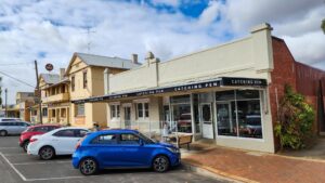
Coleraine's hospitality industry is making a comback in 2024 after the tough covid years. The shearer in the background is one of many artworks around town.
Do you know of a bike hire or transportation service on this rail trail that should appear here? If so, let us know at admin@railtrails.org.au.
Information and Links
The rail trail is managed by the Hamilton Coleraine Railway Reserve Committee of Management. For any issues with the rail trail please contact the secretary of the Committee of Management secretary@redgumtrack.net.au.
The Committee’s website is www.redgumtrack.net.au
The Friends of the Hamilton to Coleraine Rail Trail have a Facebook page.
Download a brochure and map of the Hamilton-Wannon section of the rail trail here
Hamilton Visitor Information Centre 5573 0280
Coleraine Visitor Information Centre 5575 2733
Contact Rail Trails Australia
To contact us about this rail trail, email vic@railtrails.org.au
Background Information
Traditional owners
We acknowledge the Gunditjmara people, the traditional custodians of the land and waterways on which the rail trail is built.
Development and future of the rail trail
The rail trail will be around 34 km long when it is finished. Stage One, from Balkins Rd on the outskirts of Hamilton to Bochara Railway Station was developed in 2013 following a grant from the Southern Grampians Shire and the Wannon Conservation Society. There are currently a number of gates to close along the way, but the Committee of Management is working on a project to reconfigure problem crossings.
Stage Two from Wannon to Coleraine opened in September 2021.
The missing link in the trail features the Wannon River railway bridge, which will require further investment to bring up to a standard for safe carrying riders and pedestrians. For now, there is a temporary trail connecting existing the sections of rail trail.
The Committee of Management regularly slashes the trail to keep weeds under control and with the help of locals and organisations has planted many trees over the past 20 years.
Rail Trails Australia has written to Southern Grampians Shire asking it support the trail by improvements such as signs on main roads, carparks at trailheads and a maintenance budget to support the Committee of Management.
Railway history
The line opened in 1888, initially with two trains a day carrying wool, skins, butter and passengers. Stations were at Bochara, Wannon, Hilgay (later Parkwood) and Coleraine.
The main reason for its construction was to bring more railway traffic to Hamilton, where it deviated off the main line. It has been said Hamiltonians were bitter about the Casterton line and that its junction faced south toward Portland so that a southbound train to Casterton would have to turn at Branxholme. This junction began as a simple one with one line branching off, but later grew with the opening of the Warrnambool line in 1890 and then the Locomotive Depot in 1929. In 1961 Hamilton Saleyards also received a siding.
In 1893 all the stations on the line excluding Coleraine became whistle stops.
Mixed passenger-goods trains to Coleraine ceased in 1952 and the line closed in 1977.
Temporary route now connects Hamilton to Coleraine Rail Trail
Posted: 16/01/23
Wannon Bridge at Quigley's Road (2022) A temporary trail ...
More...Hamilton-Coleraine Rail Trail Velo Rally
Posted: 22/06/22
An impressive turnout of riders came together to ride the Hamilton - Coleraine Rail Trail. ...
More...Hamilton to Coleraine Rail Trail (in Victoria) needs your support!
Posted: 27/12/21
Please show your support for this picturesque rail trail[/...
More...Celebrating the improvements to the Hamilton-Coleraine Rail Reserve in Western Victoria
Posted: 18/10/19
Improvements to the Rail Reserve leading down the hill to Coleraine will be celebrated via ...
More...A Day on the Hamilton to Coleraine Rail Trail (VIC)
Posted: 04/02/13
A DAY ON THE RAIL RESERVE EVENT: cycling and walking between Hamilton & Wannon on ...
More...Nearby Trails
Casterton to Branxholme Rail Trail
South Western Victoria in the vicinity of Hamilton

Dartmoor Rail Trail
Western Victoria, 365 km west of Melbourne
1.3 km






Port Fairy Rail Trail
260km south west of Melbourne
38 km


Mount Gambier Rail Trail
435 km south east of Adelaide
10.5 km
Grampians Rail Trail
233km north west of Melbourne
11 km
Coonawarra Rail Trail
360km south east of Adelaide
19 km
Nearby Trails
Casterton to Branxholme Rail Trail
South Western Victoria in the vicinity of Hamilton
Dartmoor Rail Trail
Western Victoria, 365 km west of Melbourne
1.3 km
Port Fairy Rail Trail
260km south west of Melbourne
38 km
Mount Gambier Rail Trail
435 km south east of Adelaide
10.5 km
Grampians Rail Trail
233km north west of Melbourne
11 km
Coonawarra Rail Trail
360km south east of Adelaide
19 km
27 reviews of “Hamilton to Coleraine Rail Trail”
It is definitely worth a visit for the beautiful landscape, trestle bridges and birdlife. You will really feel immersed in nature if you stop and soak it all in. A huge thanks to the volunteers for maintaining the trail. I wondered if some of the trestle bridges could have their life extended by removing the old railway ballast (stones)and a new boardwalk made, maybe by recycling the timbers holding up the ballast. Some parts of the track are easy to cycle on and relatively smooth but other parts are quite rough with large stones which make cycling hard work and very bumpy. The section from near Bunning into Hamilton was quite overgrown with long grass so we missed that out. Grass so long it would be impossible to see any snakes that might be on the path. Still worth a visit.
I spent two days, trying out some sections of the Hamilton to Coleraine Rail Trail.
Only some sections are opened and of those it's a mixed bag in terms of trail surface. Some sections are a nice ride, others grassy and some bumpy. Which is understandable as clearly this trail is still developing.
The climb from Coleraine heading east is a nice gradual climb which with some surface works could become like the climb out of Alexandra or as you head west of Boonie Doon.
Still there are some information boards, it's well fenced and there are many native trees to admire. While for me the highlight is hearing and seeing all the birds, despite a few swooping magpies.
Hopefully over time it improves and they can get some bridges rebuilt.
Our group of four – two hybrids and 2 e-bikes rode the first 11 km out of Hamilton a few days ago. The track is a mix of packed earth, medium to coarse gravel, and soft patches of leaf litter but was OK for our bikes, and the scenery pretty. The track was essentially not existent after the 11 km section.
Hi Caroline, the locals have set up a rough trail (initially along the Wannon river) connecting the two 11kms section of rail trail. Lovely to walk, but only fit for mountain bikers to ride.
I rode this today from Hamilton to Coleraine and return. Like others I misread the info and thought it was 22 kms (as stated on the intro page of this website) In fact it is 30 kms each way which is explained in the trail guide section. I only just got the return trip finished before dark. Make sure you read the trail guide thoroughly. It is by far the toughest trail I have ridden (I have done 27 of Victoria's 47). Mud, mud, more mud. Corrugation after corrugation. A absolute bone shaker in parts. In parts you really need a mountain bike. I did it with a hybrid which meant I had to walk my bike through quite a few sections. By the time I got back to my accom in Hamilton I was buggered. But the views were good and on the way back to Hamilton I saw at least 70 roos and one wallaby.
Hi John, thanks for your review. The reason that we list the rail trail as 22kms on the trail's home page is that the additional 8km is an informal route and not officially open as a rail trail as it does not follow the original rail alignment.
This trail is not 22km. More like 38 or 39. The section from "Glenelg Highway to Glenelg Highway" is horrid. It just needs a day's worth of bulldozing to sort it out. The misinformation about the distance – and us not reading the fine print, meant we were unable to complete the return trip.
Hi Andrew, thanks for your feedback. The reason we state the rail trail is 22km is because the other sections are either under development or follow alternative routes to the original alignment. While in my view the section guides adequately spell this out, I will improve the wording of the summary to make this even clearer.
We rode this trail on 22nd Feb 2023 and had the exactly the same problem as we miss read the information. One of our fellow riders ended up riding back to Hamilton on the road from Coleraine to pick up the car to bring the rest of us back to save us all riding back. I have ridden quite a few rail trails and this was the hardest trail I have ever ridden.
Disappointed! We tried to start the trail from Colerain. The only thing we found is the first fence with nothing that looks like a rail trail behind it. Tried to find access to the trail at various places by road but without success. There is also no trail visible on Google maps. Please adjust the information to the actual situation to avoid disappointments.
Hi Bert, sorry to hear you had a bad experience. If you use the map on our website it is quite accurate in showing where the rail trail meets the Glenelg Highway. The Committee of Management is aware that signage needs to be improved. As always, this is subject to available funding.
G'day Bert
google map link via – https://linktr.ee/HamiltonColeraineRailTrail
look for the railway station at Coleraine for the start of the Rail Trail, can't miss it, big red brick building with helpful visitor info staff inside. Sign post on the main street thru Colearaine directing visitors thru to the railway station.
pedal on!
there is also other outdoor activity & recreation map app options all showing the rail trail at Coleraine
www.alltrails.com
ridewithgps.com
www.strava.com/routes
Rode the Redgum Track Velo Rally 30 April 2022 from Bunnings in Hamilton along Balkins Road onto the Rail Trail and then to Coleraine on the rail trail. All gates were open, fab ride with about 60 other cyclists on a range of bikes, Hybrid, MTB, and rigid gravel. Fab day out. My son did a youtube – https://youtu.be/T6Kn_eu4SeI
Track condition update April 2022
I cycled the trail on a 29er MTB from Balkins Rd to Coleraine on 5 April 2022. Very enjoyable and a wonderful trail.
The trail is an 'adventure trail' and you will encounter varied surface conditions. These include—gravel, loose gravel, loam, grass, corrugations, sand, single track and some pugged ground. The trail is clear of vegetation right through following recent mowing and track clearing works by volunteers. The complete trip along the trail is recorded with a GoPro and can be viewed here (including animated map fly over)—
https://youtube.com/playlist?list=PLART1UfIzloP3UkO1GFWpM10_H-9yIhKs
Disappointed! We tried to start the trail from Colerain. The only thing we found is the first fence with nothing that looks like a rail trail behind it. Tried to find access to the trail at various places by road but without success. There is also no trail visible on Google maps. Please adjust the information to the actual situation to avoid disappointments.
We went looking for the track near Wannon, but couldn’t find it so gave up. Very disappointing.
for trail access and directions, see google map pinned to https://www.facebook.com/HamiltonColeraineRailTrail
For cyclists this track is at present a story of the good, the bad and the ugly. I rode this trail on Sunday and was disappointed to not see one other person on the trail. This may be because at the more populated Hamilton end it starts in the middle of nowhere and you really have to know what you are looking for. The other issue with all sections of this track for a cyclist is that there are probably at least 25 gates on the Hamilton end and 15 on the Coleraine end.
From the end in a small country road outside Hamilton to just short of Wannon the track is in generally good condition although there are quite a lot of branches and a few downed trees across the trail.The trail ends as the bridge outside Wannon has not yet been restored.
You can take the road in to Wannon and look ride back up the track towards the bridge if you have have a mountain bike. It is undeveloped but rideable.
The next section short between Wannon and Coleraine is a loop West of the Glenelg highway. It is undeveloped and to all intents and purposes cannot be ridden due to large amounts of prickle bushes.
Probably OK for a hiker with the right clothes including high boots and gaiters.
The section form Coleraine back towards Wannon is best tackled from the Coleraine end and is definitely Mountain Bike territory. The reason is when riding out of coleraine the grader has braken through the base at various points creating deep rutting. From Toolang Rd back to the Glenelg Hwy you are riding on basically an old railway bed that has not yet been developed. Worth riding if you dont mind a few bumps.
If the committee could get some more funding to fully develop this track right in to Hamilton it would be a great tourist attraction as the countryside in the area is beautiful particularly the drop off the plateau in to Coleraine.
By the way – the track is not closed – even if its status is recorded as that on this site – it is just under development with some sections easily managed and others requiring a little bit of patience. Fortunately there is a new committee of management whose members are committed to progressing this trail. It is truly a beautiful part of the world offering a variety of vistas and ought to be enjoyed by lovers of the natural as well as the agricultural landscape. I understand there is to soon be a dedicated website for this trail detailing specific information for each section.
I love this section of Australia’s volcanic plains with the red gum trees, native grasses, and the rich flora and fauna along the trail. Although I have cycled the complete trail between Balkins Rd to the Wannon Falls in November and in February to enjoy the birds and the native plants in flower, my preferred way of enjoying the trail is to visit various specific sections for what they offer. I particularly enjoy walking the sections east and west of S Reeds Rd between Hamilton and the Wannon. As a local I can enjoy multiple visits, but would suggest that visitors either camp at the Wannon (or in Hamilton) for a few days and make small trips to the different sections. And then go to Coleraine to explore the section of track that Coleraine residents have been working over the past few years – they have done a marvellous job to make the track accessible for walkers and cyclists for great views down over the valley – then settle into Coleraine to enjoy the hospitality at the new cafe The Catching Pen
Section 4 of this trail from Russels Rd to South Reeds Rd is in reasonably good nick but there are three locations where sizeable trees fave fallen across the track, The bridge over the Sandy Creek is signed “No Access” but was the only way over because the creek was high. From South Reeds Rd (Section 5) the surface of the track becomes bumpy and overgrown but I was able to ride the entire length by following kangaroo/wallaby runs. There is one fence without proper gate access. You can walk from the Wannon-Nigretta Falls Rd to the rail bridge over the Wannon. I wouldn’t try biking it because the track is very rough and overgrown with thorny wattle. The bridge is worth a look but is signed “Strictly No Access” with good reason. I took a few photos you can access at https://www.flickr.com/gp/152590260@N04/62uJfM. All in all this is a lovely ride through gorgeous country. Some minor maintenance on stages 4 and 5 of the track would improve it greatly for bike riding.
Rode this trail from Balkins Rd crossing to Russells Rd crossing on Sept 28. The track is in excellent condition; ideal for mountain or hybrid type bicycles. There is a boardwalk crossing over McKinnon Creek. The countryside is beautiful with large redgums a prominent feature. Pity one cannot stop to boil a billy as campfires are prohibited on the reserve. Saw a large mob of eastern greys with some males of imposing stature. Birdlife is plentiful with sulphur crested cockatoos and crimson rosellas the most numerous. Looking forward to completing the next section of the trail from Russells Rd to Wannon in the near future.
Rode my mountain bike from Hamilton to Wannon-Nigretta Falls Rd Oct 2014. Just so long as you are happy to go through some gates and put the bike over the fence a couple of times it is a good ride. There is one point where you have to walk through a short section of marshy ground but otherwise the trail is mostly well graded gravel. I tried to go past the Nigretta rd and it is bone-shakingly rough (sleepers removed, not graded) and dont even think about crossing the very dangerous bridge. Turned back and took the opportunity to ride to Nigretta falls. All in all great fun.
I am looking forward to the development of this local rail trail, an asset that is sadly missing in our community. Look forward to helping. thanks and keep up the good work
Anyone interested in walking sections of this 34km trail, can contact Secretary 0427 752 246, minilya9@bigpond.net.au for advice. We now have a ride-on slasher and have slashed quite a bit of the trail – wherever the introduced grasses were a nuisance. This will happen more regularly now that we have our own equipment.
This is a high conservation reserve, and we do ask you to leave dogs at home – this is also an area of concern for adjacent landholders with sheep. Also, on fire-ban days, we would not encourage walkers – apart from fire danger concerns, it would be unpleasantly hot.
Apart from those two matters, if you are up for a walk on a less developed track, go for it – fantastic views, lots of cross-roads where you can leave a vehicle, etc. We can email a pdf of our Management Plan – it has maps and track description.
Coralie Coulson, Secretary, Hamilton-Coleraine Rail Reserve Committee Inc.
Although still under development there are some very pleasant walks to be had along sections of this rail trail. Some great geocaches to be found too.
Keep up the great work guys.