- Outstanding dry savannah landscapes with panoramic views and interesting vegetation
- Impressive rock cuttings, stone bridges and culverts
- Remnants of mining history
- Small museum and pub at Lappa Junction. Pub no longer open.
Nearby Attractions
- Remote trail for highly independent travel
- Safe cycling with very limited traffic
- Part of an increasingly popular multi-day savannah cycling journey
- Opportunity to extend the adventure on the weekly Savannahlander train at Lappa – see link here
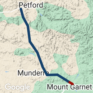
The Lappa Trail runs through remote pastoral country. There are no services or habitations and limited or no mobile reception beyond Mt Garnet. The only health services are at Mt Garnet at the southern end of the trail and at Dimbulah, 32km east of Lappa. Cyclists and support vehicles should carry extra water, a 1:50,000 Lappa topographical map, first aid, food/fuel and viable communication systems. California Creek may be impassable in the wet season; seek advice from Mt Garnet police on (07) 4097 9120 8 am to 4 pm.
Last updated: 21 November 2022
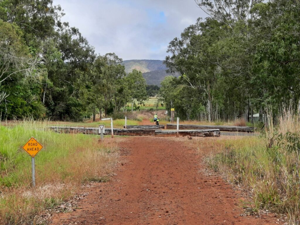
This old railway route is now used as a public roadway. You may encounter the odd vehicle on the trail.
The trail may be traversed in either direction but the generally downhill south to north ride is more appealing.
Accommodation is available at the Travellers Rest caravan park/campground at Mount Garnet which is ideal for overnight stays – see link here
There is no accommodation available at Lappa Junction. However accommodation is available at Almaden, which is a further 23 km away on a good well formed highway.
Section Guides
The trail meanders along and beside the original alignment through remote landscape with sweeping views of the Featherbed Ranges. There is very limited habitation apart from a few operational mines and Sunnymount cattle station close to Lappa.
The track can be quite rough and washed out in some sections. The part of the trail on the Nymbool Road section can be very sandy, and care needs to be taken.
Frangipani and mango trees mark the site of old mines and homesteads, and a few holding dams are now used by cattle and wildlife.
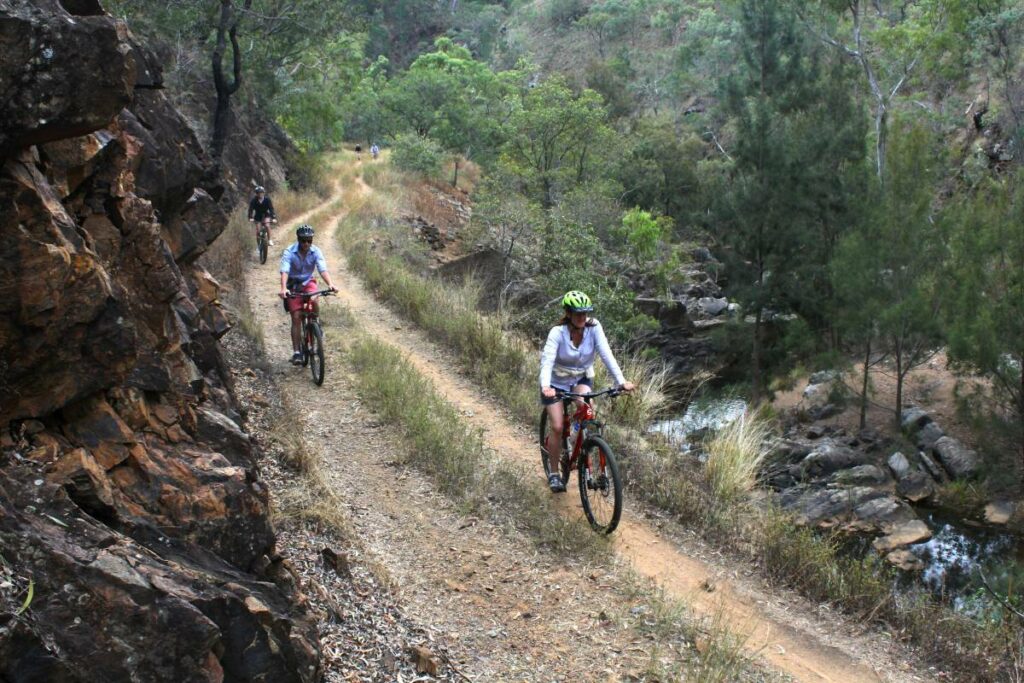
Remnant heritage items include narrow rock cuttings from around 1902 and good examples of cut and fill engineering, stone bridges and culverts, and a few sleepers.
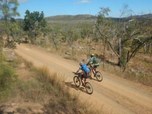
Outback cycling to Mt Garnet
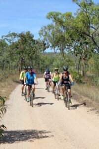
Safe group riding on alignment, now used as station road 2015
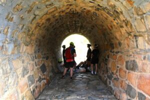
Circa 1902 culverts on alignment 2016
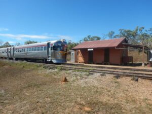
Lappa station Savannahlander circa 2016
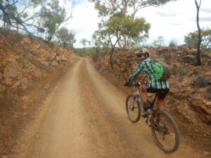
Cuttings through Featherbed ranges circa 2016
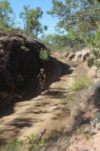
Original alignment cuttings in the Featherbed Ranges 2014
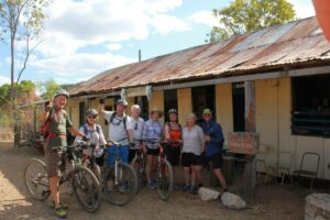
Happy cycle group in front of Hotel Espanol
Do you know of a bike hire or transportation service on this rail trail that should appear here? If so, let us know at admin@railtrails.org.au.
Information and Links
Mt Garnet accommodation information is available here
Mt Garnet Visitor Centre contact – (07) 4097 9230
Contact Rail Trails Australia
To contact us about this rail trail, email qld@railtrails.org.au
Background Information
Traditional owners
We acknowledge the Mbarbaram people, the traditional custodians of the land and waterways on which the rail trail is built.
Railway History
The railway line was privately built in 1902 and was a major conduit for the emergent mining industry of the Far North Queensland hinterland.
It was taken over by Queensland Railways in 1914 and closed in 1960. The infrastructure was removed and the trail corridor is now used as a public/station road. Lappa Junction is situated on the Cairns to Forsayth line, which is traversed weekly from March to September by the Savannahlander.
Interesting historical information on Lappa and Mt Garnet is available from: Lappa and https://en.wikipedia.org/wiki/Mount_Garnet,_Queensland
Nearby Trails
Irvinebank to Boonmoo Rail Trail
Approx.140 km south west of Cairns and 1,370km from Brisbane
43 km


Atherton Tablelands Rail Trail
Atherton, 88km south west of Cairns, 1730km from Brisbane
20 km


Irwin Track Rail Trail
Millaa Millaa, Atherton Tablelands, 1350km from Brisbane


3 reviews of “Mt Garnet to Lappa Junction”
My wife and I rode this trail in July 2021. We stayed at Mt Garnet Caravan Park and left our vehicle there for our two day ride. It is 55km from Mt Garnet to Lappa Junction, and there is no accommodation available. So we rode on another 24km to Almadan, and stayed the night in the caravan Park. We had meals at the hotel.
The first part of this trail out of Mt Garnet is fairly rough and overgrown in places. The trail goes through a very rough gully before you reach Nymbool Road, and it is hard to see where the trail goes. Nymbool Road has very deep sand sections for about 4km, and we found it easier to walk. The rest of the trail is a public road, but hardly any traffic, and it is very remote. This trail is for the adventurous and experienced riders.
Just a question, I have distant relatives that worked on the rail lines and I’m trying to find out information of the Ord Siding that I believe wasn’t that far from Lappa. Any information would be greatly appreciated.
Thanks Mick
I have ridden this rail trail 5 times over the past 18 years. It Has gradually become more of a dirt road and less of a rail trail adventure over that time. Each trip was part of a month long Cape York ride and made up part of a bigger day’s ride from Mt Garnet to Almaden or Emu Creek. . It is still enjoyable for its scenery, cuttings and occasional remnant culvert. There may or may not be water in a couple of creeks along the way. The historic Lappa pub at the northern end is worth a visit . There is no habitation along the way and gives a wonderful feeling of remoteness and solitude as there is little likelihood of much traffic- maybe a couple of 4 wheel drives. The scenic qualities and remoteness make it more attractive to me than the Brisbane Valley Rail Trail but of course accessibility is much more limited. For day trippers, drop off and pick up at the ends would need some arranging or a 4 we can accompany you. Leave the Corolla at home as it can be rough in places. A local guided tour adventure company does a great supported multi day trip including this trail ( we met them).
Good enough to keep me coming back every few years.