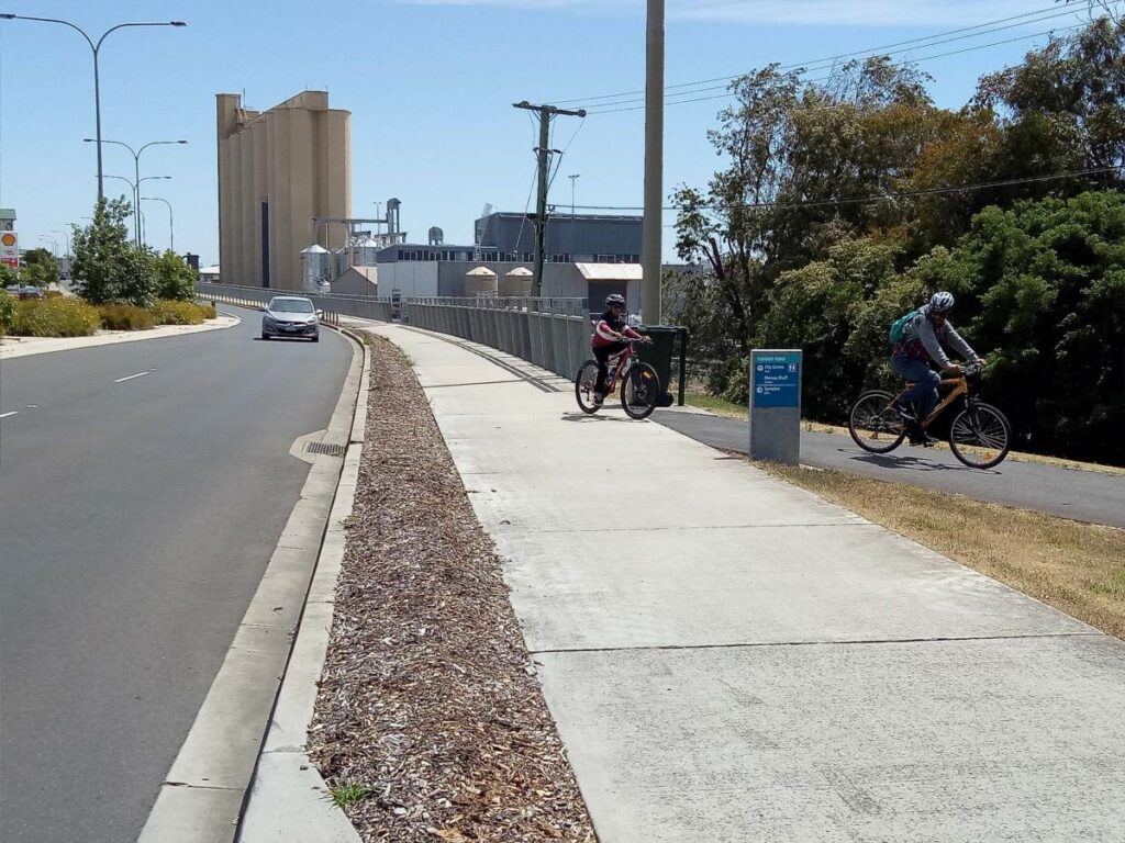
- Ongoing construction of high quality cycling/walking paths to link up existing pathways.
- All new sections are suitable for all types of cycles and people using mobility aids.
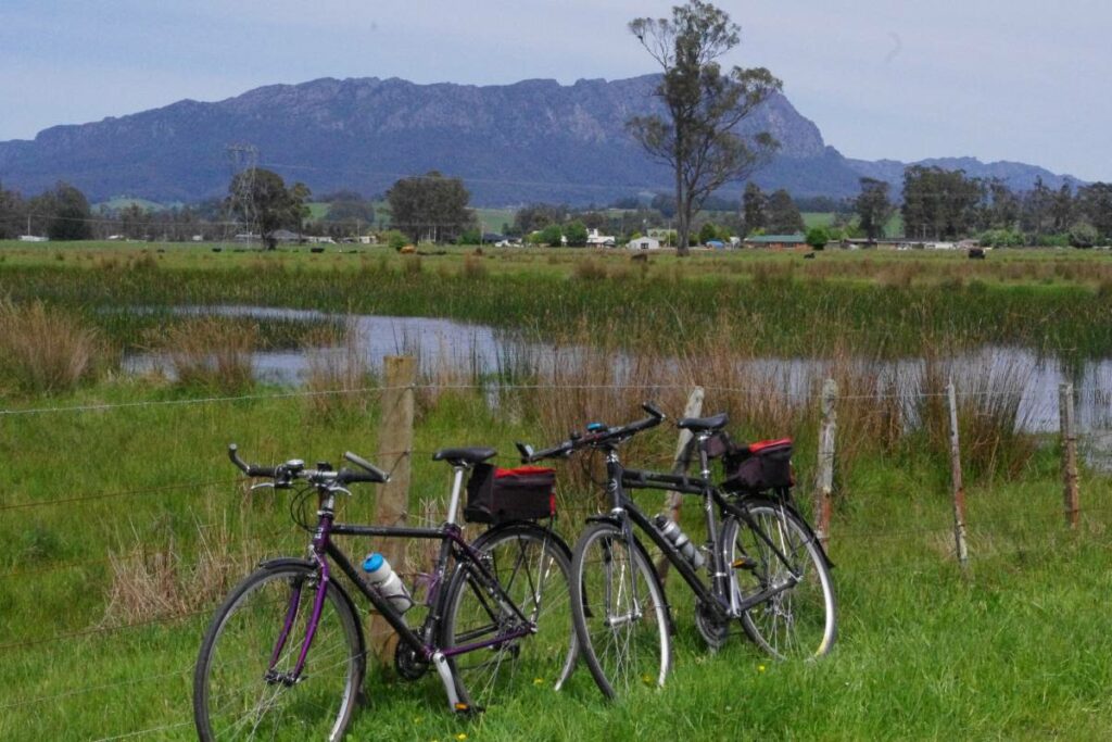
- Beautiful riverside and coastal scenery along the edge of Bass Strait
- Crossing eight rivers including historic railway swing bridge over the Forth River
- Numerous accommodation, eating and coffee options in the small towns and larger centres of Devonport and Burnie – many of these immediately adjacent to the pathway.
- Numerous easily cyclable side trips available to other attractions and scenic parts of the north west coast including new mountain bike trails at Latrobe and Penguin
Nearby Attractions
- Platypuses in the wild at the Warrawee reserve on the Mersey River at Latrobe and Fernglade reserve on the Emu River in Burnie
- The Bass Strait Maritime Museum and the Tiagarra Aboriginal Cultural Centre in Devonport
- Fairy Penguins come ashore on summer nights at the viewing centres at Lillico and Burnie main beach or watch the burrow cams at the Burnie Penguin Observation Centre year-round.
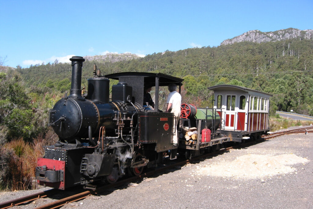
- Ride a real steam train at the Don River Railway
- Safe swimming at patrolled beaches at Mersey Bluff, Ulverstone, Preservation Bay, Burnie Main Beach and Somerset.
- Pick your own berries in summer at Turners Beach Berry Patch.
- Read the interpretations along the Paper Trail that celebrate Burnie’s papermaking and manufacturing history. Take a comfort break at the Burnie Waterfront facilities.
Last updated: 17 June 2023
The complete trail is a mixture of cycle paths, roads and rail trails.
Please read each section carefully so you are fully aware of the route.
Please take care on the roadways.
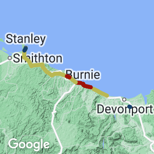
Access Points
- Latrobe
- Devonport
- Don
- Turners Beach
- Ulverstone
- Penguin
- Burnie
- Wynyard
Section Guides
Latrobe to Devonport (10km)
- Mostly dedicated separate cycle/walking path. Short on-road section (vehicle speed limit 60 km/hr) with marked cycle way.
- There are public toilets at the beginning and end of this section as well as at Bells Parade park.
- From Station Square in Latrobe (site of the old Railway Station), cross Gilbert St and follow the Sheean Walk on the formation of the old rail line heading west towards Bells Parade and the Mersey River. This walk commemorates the bravery of local lad Ordinary Seaman “Teddy” Sheean who died defending his mates on the sinking HMAS Armidale when under attack by Japanese aircraft in 1942. 68 years later he was awarded a posthumous Victoria Cross.
Side trip: From Latrobe, follow the eastern side of the Mersey River 3 km upstream on Shale Rd to the newly opened Wild Mersey Mountain Bike park and to see platypuses in the wild at Warrawee reserve.
- From the Sheean walk, follow the path through Bells Parade park to the start of the beautiful new path that runs along the eastern side of the Mersey River and adjacent to River Rd all the way to Devonport. The last kilometre through the suburb of Ambleside is on a marked cycle lane on the edge of River Rd. Beware of parked cars obstructing the bike lane. It may be safer to ride on the footpath (legal in Tasmania unless signed otherwise).
- When you get to the highway bridge over the river turn left up the slip path onto the bridge and cross the river via the pedestrian footpath which then joins the Devonport – Don cycleway into the CBD on the western side of the river.
Side trip: After crossing the Mersey river, turn left on to the link path to Spreyton. This path follows the west bank of the Mersey River a further 3 km adjacent to the working freight railway to a lovely picnic spot at the Horsehead Creek park.
Alternate route to Devonport CBD: Instead of crossing the Mersey River on the highway pedestrian footpath, ignore the slip path and continue under the highway overpass and through parkland and an on-road bike lane to the cross river ferry terminal near the East Devonport shopping centre. Cross the river on the cute little ferry “Spirit of Devonport” – the tiny relative to the large Bass Strait ferry “Spirit of Tasmania”. You can take your bike on the little ferry at no cost. Re-join the Devonport – Don cycleway at the Harbourmasters café.
Devonport to Don (8 km)
- Separate dedicated cycle/walking path.
- Public toilets at the beginning and end of this section as well as at Coles Beach.
- Follow the Devonport to Don cycleway along the parklands on the Mersey River bank and Bass Strait coast then through the Don reserve as far as the Devonport Aquatic centre. (See elsewhere in this publication for a full description of this section).
Don to Turners Beach (11 km)
The route of the Coastal Pathway on this section is yet to be confirmed. The following description describes the most direct route on existing roads. Highway speed limit 110/km/hr. Other roads 60 – 80 km/hr.
- There are public toilets at the beginning and end of this section and in the park at Forth Village.
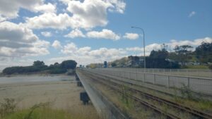
- Turn right off the Devonport – Don cycleway just past the Devonport Aquatic Centre and descend steeply on the track marked to the Sawdust Bridge. Cross the railway line (look out for trains – this line is used regularly by rail motor and steam trains of the heritage Don River Railway) and then cross the Don River on the new “Sawdust Bridge”
- Turn right after crossing the Sawdust bridge on to the old tramway formation which continues as Waverly Rd up the Don Hill to where it meets the busy Bass Highway.
- Take extreme care crossing this busy four lane highway and continue your ride on the reasonably wide shoulder of the highway with Bass Strait on your right all the way to the Turners Beach turn off.
- On the way you will pass the Penguin viewing area on your right at the start of the Lillico straight. This is a good place to come on a summer evening and watch the fairy penguins come ashore.
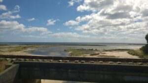
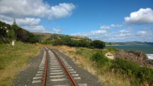
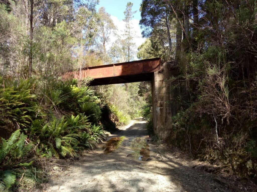
- Shortly before the turn off to Turners Beach you will cross the Forth River. On your right you will see the old rail bridge over the Forth River which is a rare swing bridge that could rotate to allow small ships to travel up the river. The bridge has been preserved and will carry the new cycleway over the river as part of the Coastal Pathway development connecting Turners Beach and Leith.
- Take the slip road off to the left at the Turners Beach turn off, then cross the highway overpass and the level crossing of the working freight railway line. There are good coffee options in Turners beach and the Berry Patch is a great place to go for an ice cream and pick your own strawberries in summer.
Alternative route from Don to Turners Beach: This is a slightly longer but much quieter route on Forth Rd (B19). Ignore the turn off to the Sawdust Bridge at the Devonport Aquatic centre and instead continue on to the Don River Railway complex. Cross the Don River at this point and continue under the highway along Forth Rd. This goes through rolling farmlands with lovely views to the coast. At about the 6 km mark, you can turn right onto Braddons Lookout Rd for an even better view of the northwest coast. At about 8 km from Don, the route descends to the small village of Forth and crosses the river at this point. There is a general store, coffee shop and a great pub here. A further 3 km along B19 takes you to Turners Beach crossing the highway via an overpass and re-join the Coastal pathway.
Turners Beach to Ulverstone (6 km)
- Mostly separate dedicated cycle/walking paths.
- There are public toilets at the beginning and end of this section as well as at the Ulverstone Surf Club
- Bike hire is available at the Beach Shack café.
- From the rail crossing on the road into Turners Beach, turn west onto the new concrete path that runs parallel with the working freight railway line.
- At the 3.5 km mark, cross the rail line and onto Beach Rd which continues to parallel the railway line. This is a “No through Road” to vehicles and has numerous speed bumps. The few vehicles you might encounter will be traveling very slowly.
- At the Beach Shack cafe, leave Beach Rd and continue along the path through Bicentennial Park. This is an older rather narrow bitumen path and very popular with dog walkers, young children and people with mobility aids. Please take care.
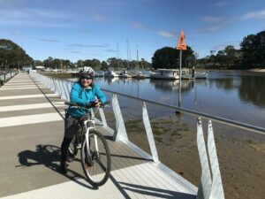
- This path turns into a new wide concrete path for the last part of the ride, finishing at the Wharf Precinct on the Leven River. There is a Farmers Market here on Sundays.
- Ulverstone is a large town with a range of accommodation, food and coffee options. There is a cycle shop at the southern end of King Edward St and helpful folk at the Information Centre in Alexandra Rd next to the railway line.
Ulverstone to Penguin (12 km)
- Partly separate dedicated cycle/walking path. Partly on-road section with speed limit 60-70 km/hr.
- There are public toilets at the beginning and end of this section
- Continue from the Ulverstone Wharf Precinct on the new wide concrete path over the Leven River. Take care here as there is no barrier between the raised Pedestrian/Cycle path and the roadway.
- Turn right after coming off the bridge and follow the concrete path along the west bank of the Leven River towards the river mouth.
- Near the Tennis Club, the path changes to an old and somewhat uneven cobbled pathway then crosses the railway line at a very tight chicane. It is better to dismount and walk through this crossing.
- After crossing the railway line, turn right onto Queen St that then becomes Penguin Rd. You and the railway line will hug the coast all the way to Penguin.
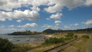
- At about the 5km mark, there is a short, winding hill section around the Three Sisters – Goat Island reserve. The road and railway are squeezed into a tight space between the hillside and the coast line. Take care especially on weekends as this very scenic route is very popular with tourists and serious road cyclists.
- Finish at the “Big Penguin” overlooking the beach in the charming little town of Penguin. There are six cafes here and some seriously good coffee. A very popular place with the local cyclists. Opposite the Big Penguin is a small Information Centre staffed by friendly volunteers.
Side trip: Follow Ironcliffe Rd for a short distance south out of Penguin, over the highway overpass and just past the school to the awesome Penguin Mountain Bike park. There are numerous trails in and around the Dial Range reserve that cater for all levels of MTB riders.
Penguin to Burnie (16 km)
- Partly on-road section with speed limit of 70 km/hr, a short section of highway with speed limit 110 km/hr, and partly on separate dedicated cycle/walking path. Funding has been allocated and construction is due to start soon on a high quality cycle/walking path on the section from Penguin to Sulphur Creek.
- There are public toilets at the beginning and end of this section and also at the Penguin Surf Club at Preservation Bay.
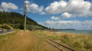
- From the “Big Penguin”, head west and turn right at the traffic light onto Preservation Drive. This is a popular tourist and cycle route with a reasonable road shoulder for cyclists. Speed limit for cars is 70 km/hr. The working rail line and coast line will be on your right almost all the way to Burnie.
- At the 6km mark at Sulphur Creek, turn left onto Zig Zag Rd, go under the highway overpass and immediately turn right onto the dedicated cycle/walking path which runs adjacent to the highway. This is an older bitumen path and a bit narrow.
- Follow this path all the way to the Heybridge roundabout at the 9km mark.
- The route from Heybridge around Round Hill to Wivenhoe on the outskirts of Burnie is yet to be confirmed. At the time of writing, the most direct route is to continue on the reasonably wide shoulder of the highway. Note: this section of highway is 4 lane with a speed limit of 100 km/hr.
Alternative route: A longer and somewhat hilly route through farmland will avoid the highway. Leave the highway just after crossing the Blythe River and head south on Minna Rd (C113) for 7km. Turn right on to Stowport Rd (C102) for about 6 km heading north rejoining the main road at Wivenhoe.
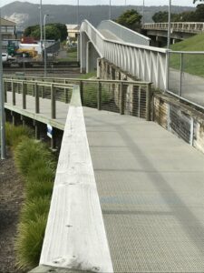
- At Wivenhoe, cross the Emu River then cross the highway at the traffic lights and onto the wide concrete cycle/walking path which will take you into the Burnie CBD avoiding any further road traffic.
- Finish this section at the Burnie Surf Life Saving Club on Main Beach. Burnie is a major regional centre with a large range of accommodation, eating and coffee options.
Side trip: At the Wivenhoe traffic lights, turn left into Old Surrey Rd, then left again on a new dedicated cycle/walking path beside the Emu River for about 1 km to the beautiful Fernglade Reserve where platypuses can be seen in the wild.
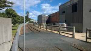
Burnie to Wynyard (18 km)
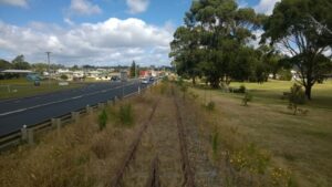
- Dedicated walking/cycle path as far as Cooee. On road cycle lanes as far as Somerset then on road sections with varying speed limits up to 100km/hr.
- There are public toilets at the beginning and end of this section and also at the Cam River reserve at Somerset.
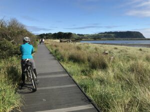
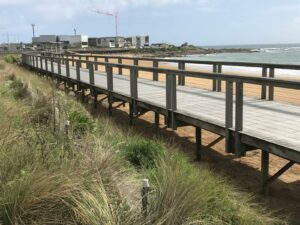
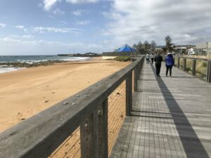
- From the Surf Club, continue west on the Beach boardwalk adjacent to the (disused) rail line and around the headland past the Penguin Viewing Centre next to the pathway. The little fairy penguins can be seen here from the burrow cams or at dusk in summer returning to their nests amongst the rocks.
- The wide concrete pathway continues next to the rail line as far as Cooee and ends rather abruptly at the 2.5 km mark at the Brickport Rd intersection.
- From this point to Wynyard, the only current option is to continue on the main road. There is a narrow on road cycle lane marked as far as Somerset.
- Just past Doctors Rocks, turn right off the Bass highway on to the Old Highway (C240) which continues adjacent to the disused railway line. A footpath starts on the southern side of the road as you get into town, then, at Nurses Retreat crosses over to the ocean side, past the Sunday Markets site, then turns into a boardwalk before going around the yacht club building to become a River Walk that ends at Gutteridge Gardens at the bottom of town.
- Funding has recently been announced to lift the rails on the disused line which hugs the coast all the way to Wynyard and build the long-awaited high quality cycle/walking rail trail linking Burnie and Wynyard.
- Wynyard is a sizable town with a good range of accommodation, eating and coffee options. It is the home of the annual Tulip Festival in October. The disused rail line actually passes through the regional airport grounds and crosses the actual aircraft runway for many years until the runway was realigned to avoid a possible train – plane collision!
- Finish your trip in the lovely Gutteridge Gardens on the banks of the Inglis River.
Side trip: There is a lovely riverbank loop walk/ride starting in Gutteridge gardens and follows the Inglis river up stream to a new bridge crossing adjacent to the highway bridge. You then return to Wynyard on the opposite bank. About 12 km in total if you extend the walk/ride to the Fossil Cliffs.
Inglis River Walk
Inglis River Section
Wynyard 2017
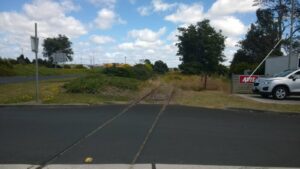
Wynyard level crossing
Wynyard
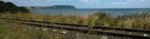
Seaside view at Wynyard
Rail at Wynyard
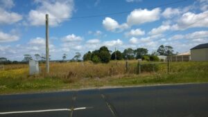
Camdale to Wynyard
Bridge near Wynyard
Camdale to Wynyard view
Camdale
Camdale River
Boardwalk
Boardwalk at Burnie
Railway overpass at Burnie
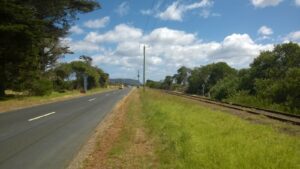
Burnie to Cooee
Burnie
Burnie Rail yards 2017
Stanley Railway station 1970
Do you know of a bike hire or transportation service on this rail trail that should appear here? If so, let us know at admin@railtrails.org.au.
Information and Links
North West Coastal Pathway Plan
Burnie Shared Paths, Walking Tracks and Trails
To advertise your rail trail support business on this page, please click here
To contact us about this trail, email or click here tas@railtrails.org.au
Contact Rail Trails Australia
To contact us about this rail trail, email tas@railtrails.org.au
Background Information
Traditional Owners
We acknowledge the Tommeginne people, the traditional custodians of the land and waterways on which the rail trail is built.
Development and future of the trail
There is potential to extend the rail trail on the abandoned rail corridor from Wynyard a further 50 km west to the quaint little town of Stanley under the famous “Nut”. This section of line veers away from the coast and passes through rich farming country and forest before meeting the coast again for the final 1 kilometre into Stanley. This final part of the old rail corridor has been developed by the local council into a popular walking track.
Rail line history
The railway line west from Burnie was developed in various stages ultimately linking Stanley (then an important port) to Burnie around 1920. The line was principally to support farming and forestry industries in the far north-west of Tasmania.
Dwindling freight on the line saw the progressive closure of sections in the late 1980s resulting in the closure of the entire line by 1996. In 1999, the line was briefly re-opened to support fertiliser and log transport from Wiltshire Junction to and from Burnie. This was not financially viable and was plagued with line maintenance issues particularly on the section between Burnie and Wynyard due to sand dune movement over the line and shoreline erosion from heavy storms. The line closed again in 2003 and despite intermittent interest in re-opening the line, the general consensus has been that the cost of bringing the line up to railway safety standards and maintaining the infrastructure would be prohibitive.
Ever since the closure of the line west from Burnie, there have been calls to “re-purpose” this rail corridor for commuter and recreational use. Over the last 10 years, this has developed into a broader concept of building a long Coastal Pathway across the entire north west coast of Tasmania that would incorporate the disused rail corridor as well as linking up a number of small sections of shared pathways that had been developed largely by local councils using funds from a variety of government programs at local, state and federal level.
Delays have arisen due to the complexities of engaging with and reaching consensus with six different local councils as well as changing state governments and the necessary legislation to gain access to the old rail corridor. Additionally, resolving the responsibility for ongoing maintenance particularly in areas prone to erosion and storm damage has been a significant barrier to overcome. These issues appear to have been largely resolved with construction now started on a number of the missing links, upgrading some older sections of pathway and commencement of the rail trail extending the Coastal pathway to Wynyard.
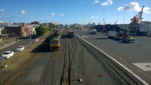
The rail line east from Burnie to Devonport remains in active use particularly in relation to container transport to and from the Port of Burnie. Safety regulations for narrow rail and road corridors in active use (particularly around Round Hill and Penguin) and how the Coastal pathway can be accommodated in that space are yet to be resolved.
Nearby Trails
Don to Devonport Cycleway
Devonport area. 100 m west of Launceston.
11 km


Railton to Sheffield Rail Trail
Northern Tasmania near the Great Western Tiers and Mount Roland, 259km from Hobart
12 km
Wee Georgie Wood and the Tullah Tramway Trail
Tullah, 100km from Burnie, 310km from Hobart
1.5 km
Montezuma Falls Rail Trail
Zeehan Area, 296km from Hobart
19 km
Melba Flats to Zeehan Rail Trail
Zeehan Area, 296km from Hobart
9 km
Spray Tunnel and Comstock Tramways
Zeehan Area, 296km from Hobart
6 km
Lake Margaret Tramway Trail
Near Queenstown, 268km from Hobart
3.5 km
Strahan to Zeehan Road
Zeehan to Strahan, 296km from Hobart
41.8 km
Nearby Trails
Don to Devonport Cycleway
Devonport area. 100 m west of Launceston.
11 km
Railton to Sheffield Rail Trail
Northern Tasmania near the Great Western Tiers and Mount Roland, 259km from Hobart
12 km
Wee Georgie Wood and the Tullah Tramway Trail
Tullah, 100km from Burnie, 310km from Hobart
1.5 km
Montezuma Falls Rail Trail
Zeehan Area, 296km from Hobart
19 km
Melba Flats to Zeehan Rail Trail
Zeehan Area, 296km from Hobart
9 km
Spray Tunnel and Comstock Tramways
Zeehan Area, 296km from Hobart
6 km
Lake Margaret Tramway Trail
Near Queenstown, 268km from Hobart
3.5 km
Strahan to Zeehan Road
Zeehan to Strahan, 296km from Hobart
41.8 km
2 reviews of “North West Tasmanian Coastal Cycleway”
I rode from Latrobe to Devonport following the cycleway along the Mersey river, through Devonport along the edge of the harbour and beaches, up to the Mersey Bluff lighthouse, along the coast past Coles beach, down to Don river railway museum, along the Don river tramway track, across the top of Devonport, then back to Latrobe.
I did this loop just shy of 40km in 4 hours at a very causal pace.
If you love a relatively flat and ver scenic ride, I highly recommend this loop. The little caravan park at Latrobe is pretty decent, and makes for a good start/finish point for this loop.
It is still very bitsy with lots of on road riding (which we don't like). There is work being done but there is a long way to go.
Having said that, there were some nice bits.
My advice is to read the Section Guides thoroughly and pick out the bits you want to do.