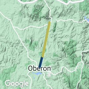
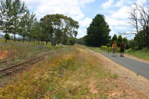
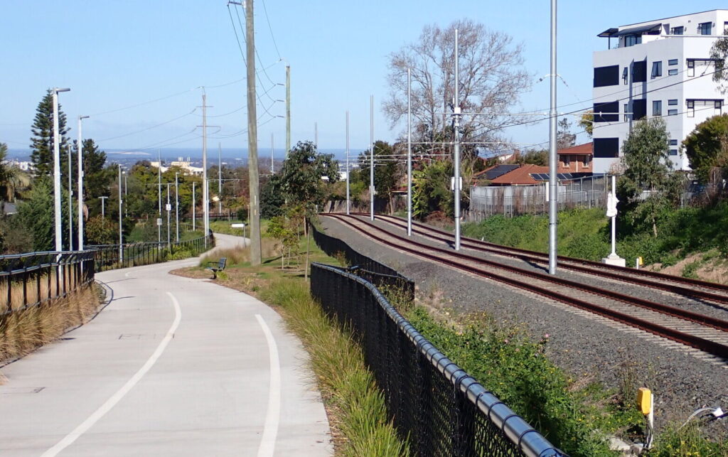
This trail is a rail-side path next to an old government rail corridor, and passes through beautiful sub-alpine countryside and farmland
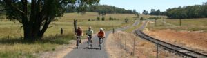
The trail is fully sealed and family friendly, suitable for all kinds of bicycles, scooters, mobility scooters and prams. Interpretive signs explain the history of the rail line and the region
Nearby Attractions
- Oberon Railway Museum
- Vineyard cellar doors
- A short drive to Jenolan Caves
- Visit the spectacular Mayfield Gardens
Last updated: 18 April 2023
The gradient is gentle, and only extends for 6 km from Oberon. The Oberon Tarana Heritage Railway is proposing to run trains once again on the rail line.
Section Guides
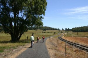
Oberon to Hazelgrove (6 km)
The trail meanders through the farmlands of the Oberon tableland between Oberon and Hazelgrove. It begins at Oberon Station (now a museum) in North St and finishes at the site of the former Hazelgrove station, where the trail crosses the Lowes-Hazelgrove Road..
Hazelgrove to Oberon (2009)
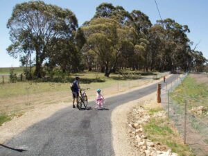
Children at play (2006)
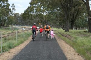
User group following opening of the trail in March 2008
Along the trail
Enjoy the walk (2009)
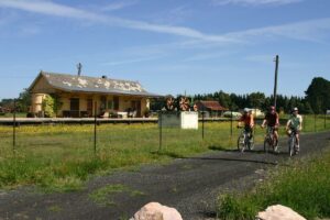
Oberon Station
 Leaders in Rail Trail Bicycle and E-Bike Hire in the Yarra Valley and Yarra Ranges. Customise your own riding adventure and help us support local businesses along the way. Family run and owned with extensive local knowledge, bike hire has never been so easy.
Do you know of a bike hire or transportation service on this rail trail that should appear here? If so, let us know at admin@railtrails.org.au.
Information and Links
Contact Rail Trails Australia
To contact us about this rail trail, email nsw@railtrails.org.au
Background Information
Traditional Owners
We acknowledge the Wiradjuri people, the traditional custodians of the land and waterways on which the rail trail is built.
Rail Trail development
The Oberon Council established the Oberon- Tarana Rail Corridor Committee to oversee the development of an overall plan for the railway and ensure all stakeholders are involved.
The council is also well advanced in the planning and construction of additional cycleways around the town, including a 20 km cycling/walking loop that connects with Hazelgrove Station, and through the Blenheim Forest and back to Oberon via Hazelgrove Road.
Railway history
This 6 km section is part of a 24 km branch line that climbs from the main western railway at Tarana to Oberon, 1,100m above sea level. It was opened in 1923 and ceased operation in 1979.
Due to the line’s steep grades and numerous curves it was reportedly infamous for being the slowest rail line in NSW, but these features make for a great short rail trail. Hazelgrove is at the top of the steep grade down to Tarana.
Nearby Trails
Wolgan Valley Rail Trail
Newnes is 190 km West of Sydney
11 km


Lapstone Knapsack Viaduct and Zig-Zag
60 km west of Sydney
1.5 km


Box Vale Tramway Trail
110 km south-west of Sydney, in the Southern Highlands
5 km
Goulburn to Crookwell Rail Trail
195km southwest of Sydney, in the Southern Tablelands

Parramatta to Liverpool Railside Trail
25 km west of Sydney CBD
17 km


Rosehill to Carlingford Railside Trail
Western Sydney, 23km from Sydney CBD
5 km
Pippita Rail Trail
19 km west of Sydney, near Sydney Olympic Park
Meadowbank Railway Bridge
15 km west of Sydney
0.5 km
Como Bridge
20 km south of Sydney
2 km
Nearby Trails
Wolgan Valley Rail Trail
Newnes is 190 km West of Sydney
11 km
Lapstone Knapsack Viaduct and Zig-Zag
60 km west of Sydney
1.5 km
Box Vale Tramway Trail
110 km south-west of Sydney, in the Southern Highlands
5 km
Goulburn to Crookwell Rail Trail
195km southwest of Sydney, in the Southern Tablelands
Parramatta to Liverpool Railside Trail
25 km west of Sydney CBD
17 km
Rosehill to Carlingford Railside Trail
Western Sydney, 23km from Sydney CBD
5 km
Pippita Rail Trail
19 km west of Sydney, near Sydney Olympic Park
Meadowbank Railway Bridge
15 km west of Sydney
0.5 km
Como Bridge
20 km south of Sydney
2 km

3 reviews of “Pioneer Rail Trail Oberon”
I rode the PIONEER RAIL TRAIL OBERON on the 21st of July.
As mentioned below in the other comments, the condition of the trail is now not the same as indicated in the pictures although still easily rideable with no problems.
Oberon Council (or whom ever is responsible for the trail) should put some TLC into this with some scheduled inspection and maintenance events.
A concrete pathway begins at the Oberon Rugby Leagues Football Club and this continues onto the rest of the trail but the pathway and signage is poor from the Oberon Station prescient to the Leagues Club.
It is not as if you could get lost but certainly could be better done.
The pathway from the Old Oberon Station is gravel overgrown with grass.
I found the old signal house and some greats photo's taken.
If you are around Oberon, certainly have fun on the shortish ride.
Rode along the trail today, 27/4/23. Pleasant ride through the countryside. Great photo opportunity at the old signal house.
Obviously the trail is not well used or maintained. It looked nothing like the photos from 2008/09, and has a bush trail feel to it with a lot of grass growing through the bitumen and tree debri. Still a fun ride and we got to the end all too quickly.
It was hard to determine where the trail actually started in Oberon. In the end we figured it starts at the concrete path on the opposite side of the road to the old railway station. There’s a new concrete pathway for the first km past Borg complex then it’s the original bitumen path.
Lots of riding around Oberon township and out to lake etc. to extend the kms ridden.
I walked this trail this afternoon (28/3/16) – it is a nice trail through the surrounding farmland. The trail surface is sealed the whole way, but in poorer quality the closer you are to the Hazelgrove station. There were a few other people on the trail, and it’s clear that horses use the path. It was a good day out, I found the best part being away from the roadside, pity the trail isn’t longer.