
This trail was temporarily closed in 2022 and 2023. Bushwalking websites are reporting that the trail has re-opened. Please observe all advisory signs and directions at the trail head.
This former railway line was used to transport coal from the Nattai Region to the main southern line at Mittagong. The rail corridor is now a very good bushwalk through the Southern Highlands, and the walk includes an 84m tunnel near the end of the trail.
Walking the trail will take three to four hours for the return trip. The trail is clearly formed and has good signposts but is quite rough in places. It will also be muddy after rain.
The tramway (railway) and its bridges are long gone, but the cuttings, embankments and the 84 m tunnel remain. The trail is in the scenic Nattai River Valley and features cuttings, a tunnel and an old dam. There is also a linked path back to Mittagong township.
Many of the original railway formations have been overrun but it remains a very interesting 10km round trip walk. At the end of the track are picnic tables and a superb lookout over the Nattai River. Return is via the same path. Suitable in all seasons but best in autumn and spring.
The trail is best suited for walking – mountain bikes could be used but only by very experienced riders, and even then there will sections where bikes will need to be carried.
Nearby Attractions
The Mittagong and Southern Highlands region offers a wide range of tourist experiences and is easily accessible from Sydney by public transport or car.
Last updated: 27 May 2024
The Box Vale Tramway Track is in one section, from the Mittagong end to the historic Box Vale Incline. There is no intermediate access.
How to reach the trail by road:
From the north, turn left off the F6 Hume Freeway at Mittagong (110 km south of Sydney), drive through the township, bear right along the old Hume Highway and follow it to cross the Hume Freeway at Welby. Turn right almost immediately onto Boxvale Road. After 100 m, bear left at a small roadway entrance marked Box Vale Walking Track. There is a clearly marked car parking area at the trailhead in Mt Alexander Reserve.
From the south, turn off the F6 Hume Freeway at Mittagong and follow the old Hume Highway to Welby. Turn left onto Boxvale Road. After 100 m, bear left at a small roadway entrance marked Box Vale Walking Track. There is a clearly marked car parking area at the trailhead in Mt Alexander Reserve.
Section Guides
Trailhead to Box Vale Incline (5 km)
From the trailhead, the track descends along a bush path before meeting the old rail corridor. From there, the trail runs through bushland with some creek crossings and cuttings. There are rock falls in the cuttings so some clambering is needed in places.
There is plenty of car parking at the trailhead.

On the embankment approaching the tunnel (Feb 2018)
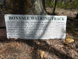
Information sign at trailhead (Feb 2018)
Creek crossing at start of Trail. Railway bridge is missing. (Feb 2018)
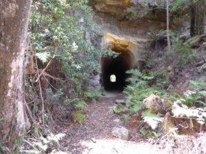
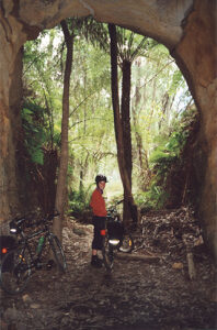
Approaching the tunnel (Feb 2018)
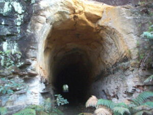
The Tunnel
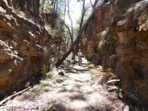
The Casuarina Cutting (Feb 2018)
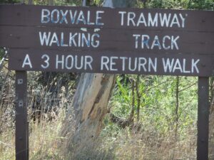
Sign at Trail Head
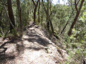
One of the many embankments (Feb 2018)
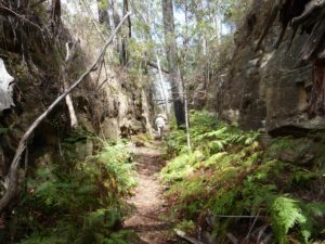
The Tree Fern Cutting (Feb 2018)
The Tunnel
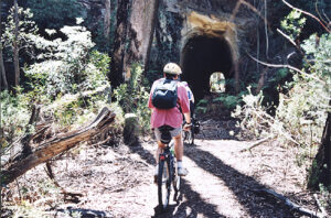
Tunnel on the Box Vale tramway track
Old Formation
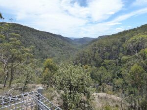
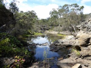
View from Nattai Gorge Lookout (Feb 2018)
Do you know of a bike hire or transportation service on this rail trail that should appear here? If so, let us know at admin@railtrails.org.au.
Information and Links
For more information:
https://www.visitsouthernhighlands.com.au/operator/box-vale-walk/
The trail is managed by Wingecarribee Shire Council.
Contact Rail Trails Australia
To contact us about this rail trail, email nsw@railtrails.org.au
Background Information
Traditional owners
We acknowledge the Gundungarra people, the traditional custodians of the land and waterways on which this rail trail is built.
Rail line history
The original standard gauge line was built in 1888 to carry coal from the Nattai Gorge 7 km to the main southern line at Mittagong. The line passes through several cuttings and includes an 84 m tunnel. It ends at the historic incline by which coal was brought up from the Gorge.
The colliery probably had its heyday in 1888, when 100 tons of coal a week were shipped to Melbourne during a coal strike. The colliery closed in 1896 and the tramway (railway) was abandoned. The last part of the line was opened as a walking track, designed and financed by the Nowra Lands Office, in 1996.
Construction was done by wards of the State from Toombong School, the Mount Alexandra Committee and people employed under the Community Employment Program.
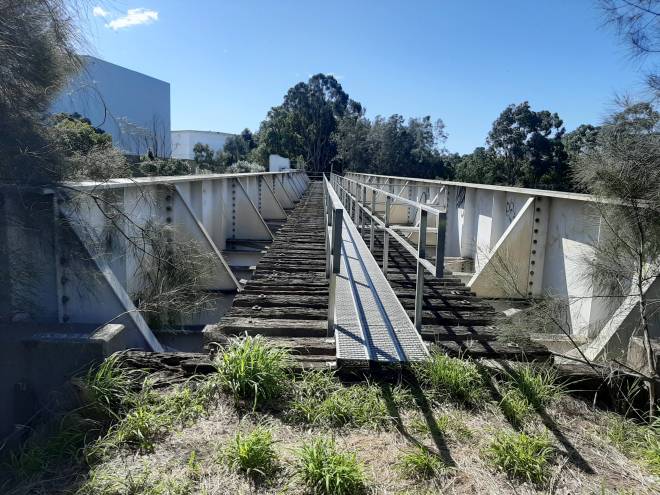
Nearby Trails

Mt Kembla Memorial Pathway
100 km south of Sydney
2 km


Goulburn to Crookwell Rail Trail
195km southwest of Sydney, in the Southern Tablelands

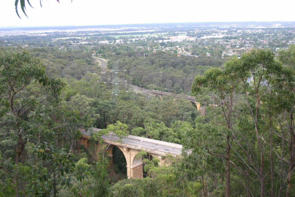
Lapstone Knapsack Viaduct and Zig-Zag
60 km west of Sydney
1.5 km
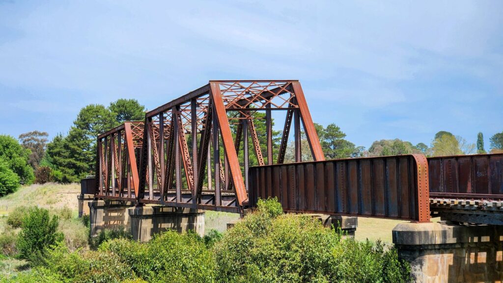
Como Bridge
20 km south of Sydney
2 km
Parramatta to Liverpool Railside Trail
25 km west of Sydney CBD
17 km
Pippita Rail Trail
19 km west of Sydney, near Sydney Olympic Park
Rosehill to Carlingford Railside Trail
Western Sydney, 23km from Sydney CBD
5 km
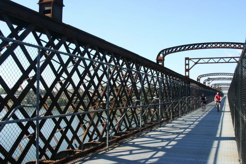
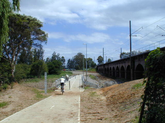
Meadowbank Railway Bridge
15 km west of Sydney
0.5 km
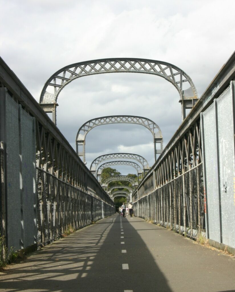
The Goods Line
2 km from the Sydney GPO
1 km

Lavender Bay “High Line”
Milsons Point to Waverton
Pioneer Rail Trail Oberon
180 km west of Sydney
6 km
Nearby Trails
Mt Kembla Memorial Pathway
100 km south of Sydney
2 km
Goulburn to Crookwell Rail Trail
195km southwest of Sydney, in the Southern Tablelands
Lapstone Knapsack Viaduct and Zig-Zag
60 km west of Sydney
1.5 km
Como Bridge
20 km south of Sydney
2 km
Parramatta to Liverpool Railside Trail
25 km west of Sydney CBD
17 km
Pippita Rail Trail
19 km west of Sydney, near Sydney Olympic Park
Rosehill to Carlingford Railside Trail
Western Sydney, 23km from Sydney CBD
5 km
Meadowbank Railway Bridge
15 km west of Sydney
0.5 km
The Goods Line
2 km from the Sydney GPO
1 km
Lavender Bay “High Line”
Milsons Point to Waverton
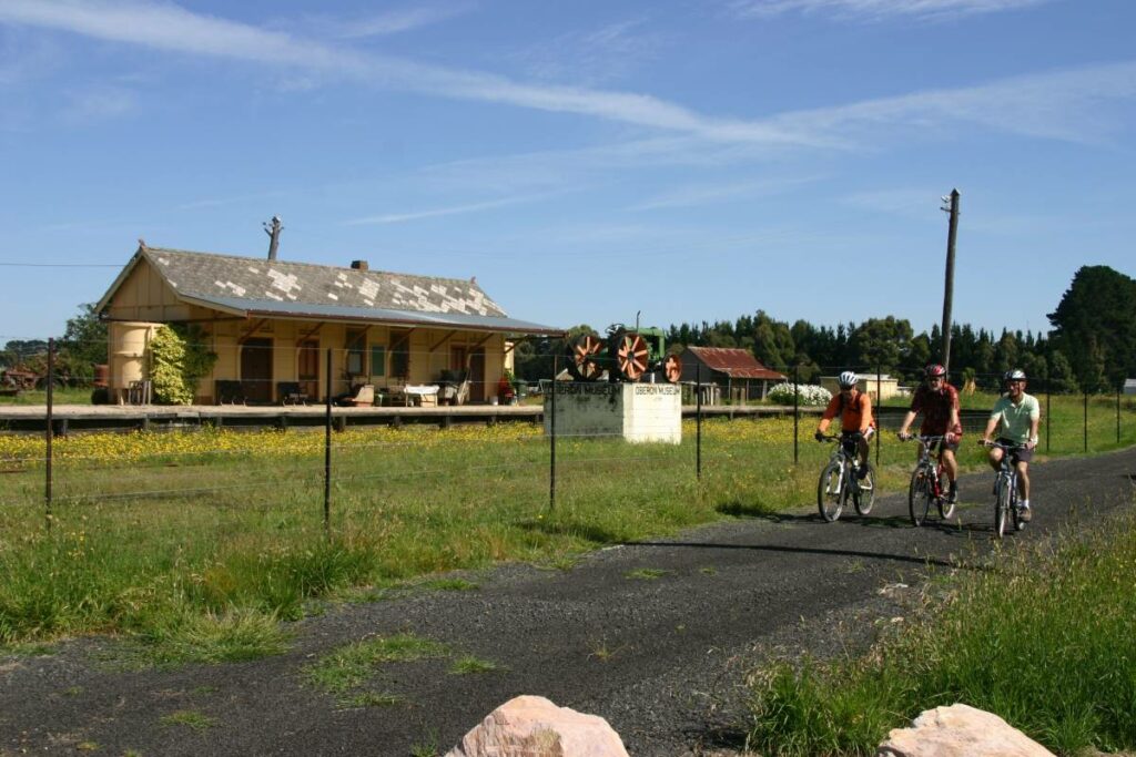
Pioneer Rail Trail Oberon
180 km west of Sydney
6 km

2 reviews of “Box Vale Tramway Trail”
We walked on this rail trail in early October 2020. It makes a great bushwalk, with changing scenery, the tunnel and the Nattai lookout at the Incline. The path is easy to follow. Plenty of carparking is available at the trailhead.
I was on this trail this morning (Wednesday 11th 2015) – firstly it is walking trail for hikers. You can mountain bike it – but the first section to actually get to the tramway is not suited to anyone who isn’t an excellent mountain bike rider with a lot of experience. The trail is actually one of the most interesting rail trails I have been on, because of the cuttings and tunnel you pass through – so far none of the other trails I have done come close to depth of the cuttings and the tunnel. The view at the end is reasonable, but the trail is almost over grown in parts and sometimes it is difficult to distinguish the overgrown trail from the dirt roads where they cross. If you go early morning before anyone else, watch out for spider webs.