Sydney’s newest rail-side trail: a high standard active pathway between Carlingford and Rosehill racecourse in the western suburbs of Sydney.
The trail follows the northern section of the now-closed Clyde to Carlingford suburban rail line.
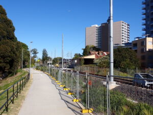
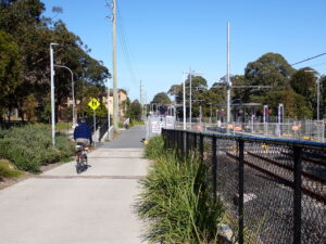
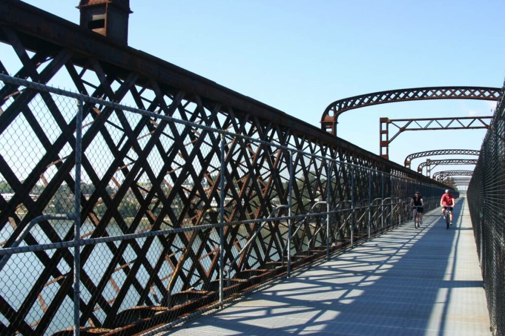
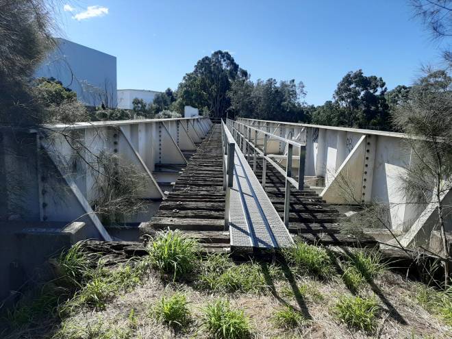
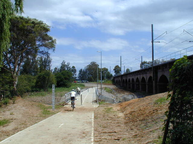
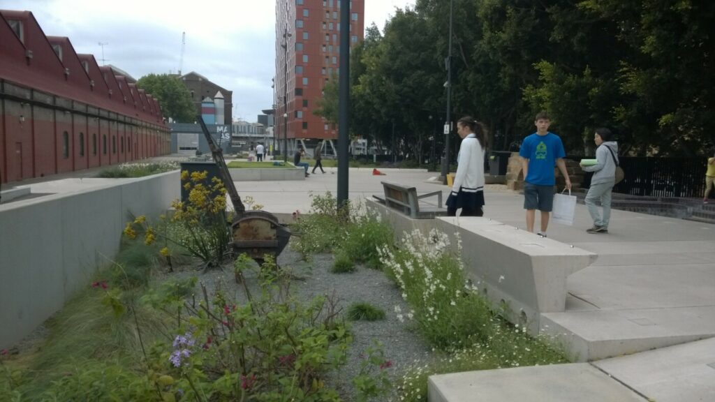
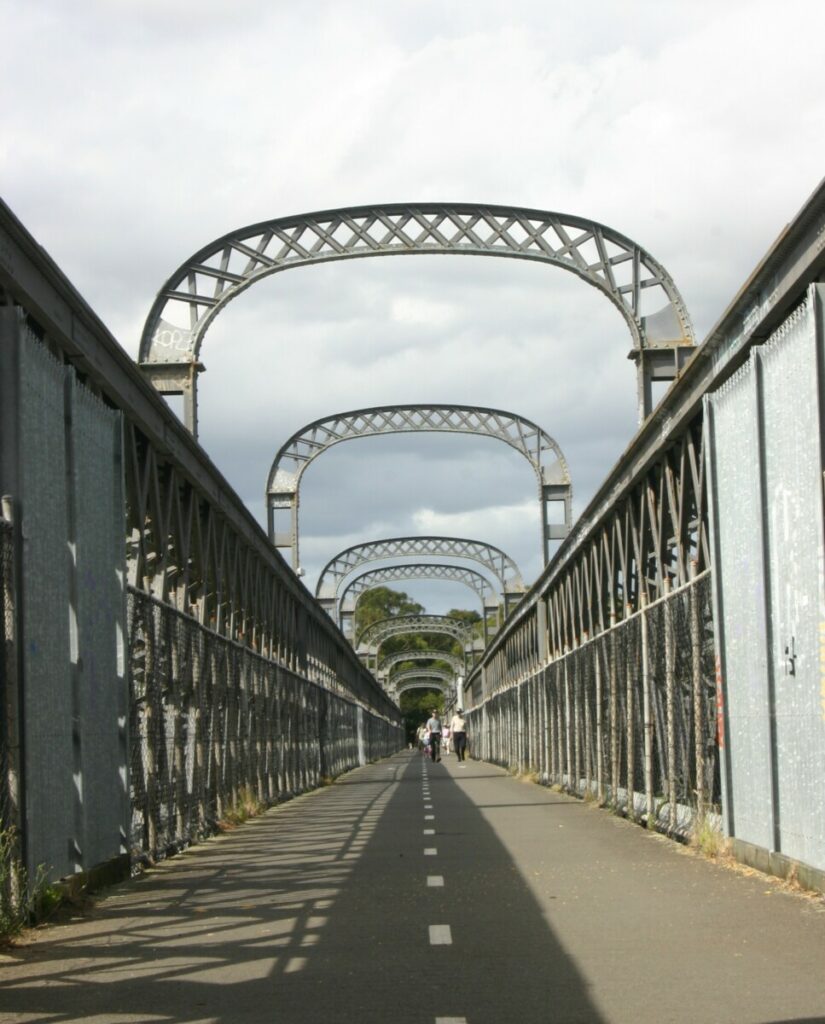
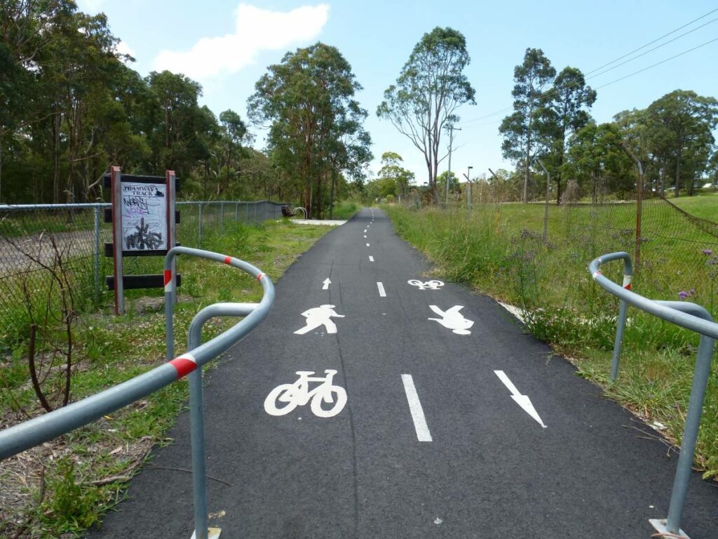
This trail is fully paved and suitable for all types of users. It is near the vibrant centre of Parramatta, and is easily accessible from Parramatta River trails and local streets. There are two large bridges on the trail, one over Parramatta River and the other over James Ruse Drive.
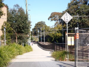
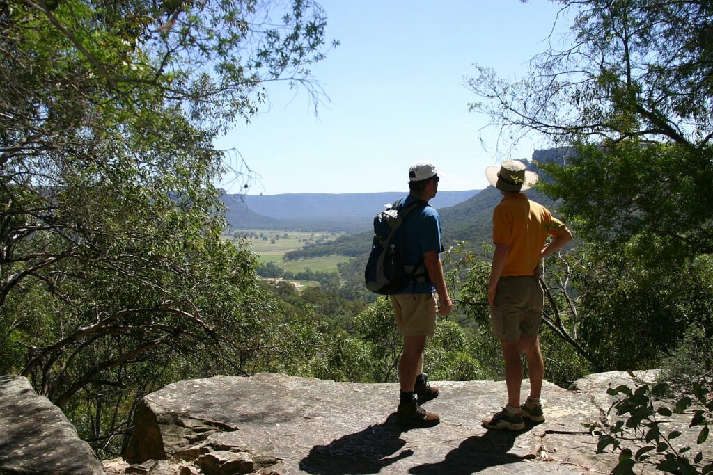
From the Carlingford end of the trail, there are great district views to the south.
The trail follows the route of the light rail line that will link Westmead and Carlingford via Parramatta. Light rail services are expected to begin in winter 2024.
Important note: the trail is subject to occasional closures or minor diversions for final light rail construction work. Also testing of light rail vehicles has begun. Click here for Parramatta Light Rail shared path updates.
Nearby Attractions
Parramatta is the centre of western Sydney and has a scenic location on the Parramatta River. There are many historic sites around Parramatta.
This rail-side trail is suitable for all types of bicycles and wheeled vehicles, as well as walkers and runners. Dogs on leashes are allowed.
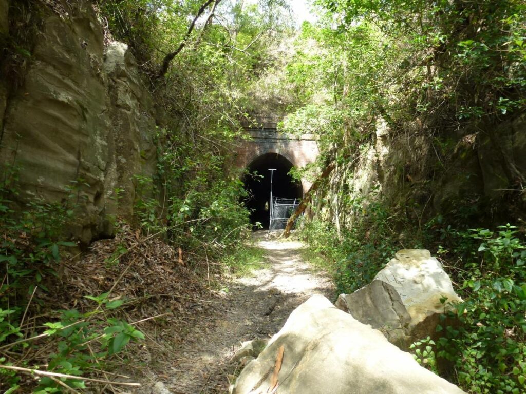
At Dundas, the station building has been preserved. There are also interpretive signs in other locations.
Last updated: 25 March 2024
The trail is easily accessible. From Parramatta, the best access point is the Tramway Avenue light rail stop to the east of the Parramatta CBD. From Clyde railway station, follow James Ruse Drive north to Rosehill Racecourse.
There are many street access points along the trail north of the Parramatta River.
The trail heads north-east from the Parramatta River bridge, and is generally a moderate uphill grade through to Carlingford.
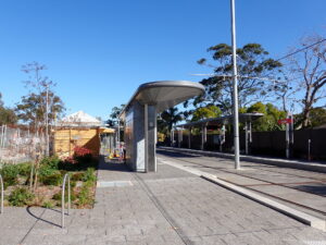
There are water bubblers at each of the light rail stops along the trail. Toilet facilities are available at Parramatta and Rydalmere ferry wharf.
There are cafes and shops along the trail.
Section Guides
The trail is 5km long, from Rosehill Gardens light rail stop north to Carlingford.
From Rosehill Gardens, the active pathway also runs west over James Ruse Drive to the Tramway Avenue light rail stop.
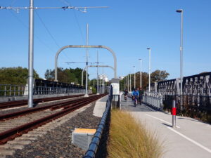
Parramatta River bridge, Carlingford railside trail
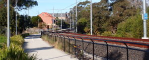
Carlingford railside trail
Telopea, on the Carlingford trail
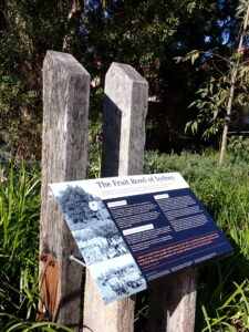
History marker on the trail
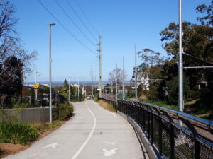
Great views to the south from the Carlingford end of the railside trail.
Carlingford light rail stop under construction
Dundas station precinct
Telopea light rail stop under construction, July 2023.
Public Transport
Recommended access is by Sydney Trains, to either Parramatta or Clyde stations.
Parramatta is the easier of these: exit to the north from the station and find George Street. Follow the Light Rail route to Tramway Avenue.
From Clyde or Granville stations, the recommended access is to travel north on Alfred Street for about 1.5km until it meets the Light Rail route at Tramway Avenue.
Bicycles are permitted on Sydney Trains in the Sydney suburban area. Restrictions apply on regional trains.
Do you know of a bike hire or transportation service on this rail trail that should appear here? If so, let us know at admin@railtrails.org.au.
Information and Links
To report rubbish, damage or hazards on this trail, please call the 24-hour community information line at Parramatta Council on 1800 139 389 or email parramattalightrail@transport.nsw.gov.au.
Contact Rail Trails Australia
To contact us about this rail trail, email nsw@railtrails.org.au
Background Information
The suburban railway line that ran from Clyde on the main western line to Carlingford to the north was closed in January 2020, in preparation for the conversion of the section from Rosehill to light rail use. By time of its closure, the Carlingford line was operated as a branch line only.
The railside trail is located within Parramatta Council boundaries.
Sydney’s latest railside trail is open
Posted: 09/07/23
Sydney has a new railside trail, situated in the centre of the western suburbs. The ...
More...Nearby Trails
Meadowbank Railway Bridge
15 km west of Sydney
0.5 km


Pippita Rail Trail
19 km west of Sydney, near Sydney Olympic Park

Parramatta to Liverpool Railside Trail
25 km west of Sydney CBD
17 km
The Goods Line
2 km from the Sydney GPO
1 km
Como Bridge
20 km south of Sydney
2 km
Lapstone Knapsack Viaduct and Zig-Zag
60 km west of Sydney
1.5 km

Mt Kembla Memorial Pathway
100 km south of Sydney
2 km
Box Vale Tramway Trail
110 km south-west of Sydney, in the Southern Highlands
5 km
Wolgan Valley Rail Trail
Newnes is 190 km West of Sydney
11 km
Awaba – Wangi Wangi Rail Trail
130 km north of Sydney

Fassifern to Toronto Greenway Track
26 km from Newcastle
4 km
Pioneer Rail Trail Oberon
180 km west of Sydney
6 km
Fernleigh Track
135 km north of Sydney, 5km from Newcastle city centre
16 km
Richmond Vale Rail Trail
160 km north of Sydney, 12 km northwest of Newcastle
Glendale to Wallsend Tramway Track
13 km from Newcastle City
8.5 km
Nearby Trails
Meadowbank Railway Bridge
15 km west of Sydney
0.5 km
Pippita Rail Trail
19 km west of Sydney, near Sydney Olympic Park
Parramatta to Liverpool Railside Trail
25 km west of Sydney CBD
17 km
The Goods Line
2 km from the Sydney GPO
1 km
Como Bridge
20 km south of Sydney
2 km
Lapstone Knapsack Viaduct and Zig-Zag
60 km west of Sydney
1.5 km
Mt Kembla Memorial Pathway
100 km south of Sydney
2 km
Box Vale Tramway Trail
110 km south-west of Sydney, in the Southern Highlands
5 km
Wolgan Valley Rail Trail
Newnes is 190 km West of Sydney
11 km
Awaba – Wangi Wangi Rail Trail
130 km north of Sydney
Fassifern to Toronto Greenway Track
26 km from Newcastle
4 km
Pioneer Rail Trail Oberon
180 km west of Sydney
6 km
Fernleigh Track
135 km north of Sydney, 5km from Newcastle city centre
16 km
Richmond Vale Rail Trail
160 km north of Sydney, 12 km northwest of Newcastle
Glendale to Wallsend Tramway Track
13 km from Newcastle City
8.5 km
2 reviews of “Rosehill to Carlingford Railside Trail”
A wide, generous, enjoyable trail!
Will be a huge asset to local community particularly in conjunction with the Albert, diagonal-beam, cyclist/pedestrian bridge over the Parramatta River, which opened this week (31 October 2023) to which this rail trail connects at the southern end.
This trail has only recently opened – it is relatively short at 5km but is high quality throughout. There is plenty of trail width for cyclists and walkers, and good to see water fountains provided at each light rail station.
There are nice district views from the northern end, and plenty of coffee shops along the way. I rode the trail on 2 July 2023, good to see plenty of others enjoying this new pathway.