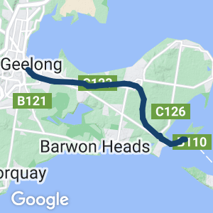
- A great one-day or weekend excursion close to Melbourne and Geelong, with scenery ranging from suburban to rolling farmland and picturesque Swan Bay
- Geelong and Queenscliff offer good shopping and dining options
- Easily accessible from Melbourne using V/Line’s Waurn Pond services (bikes carried subject to available luggage space), alighting at South Geelong Station
- From Drysdale to Queenscliff, the trail runs beside The Q Train restaurant (Friday-Sunday)
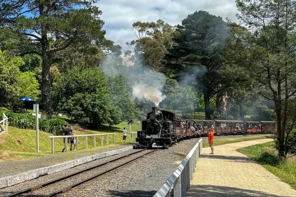
- Bellarine Railway’s heritage service is only running from Queenscliff to Lakers Siding but the volunteers are working towards resuming services the rest of the way to Drysdale
Nearby Attractions
- Victoria’s second largest city, Geelong has an interesting seafront with colourful bollards
- The Bellarine Peninsula has great wineries, beaches and landscapes
- Queenscliff is one of Victoria’s most picturesque coastal towns, with many historic buildings. It looks out over The Rip, where ships enter Port Phillip Bay
- The Searoad Ferry, which sails from Queenscliff to Sorrento, on the Mornington Peninsula
- The Fyansford Rail Trail (starting in North Geelong)
- The Bellarine Railway operates tourist services with heritage trains from Queenscliff to Lakers Siding
- The Q Train is an award-winning restaurant service from Drysdale to Queenscliff and return
Last updated: 9 April 2024
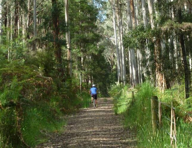
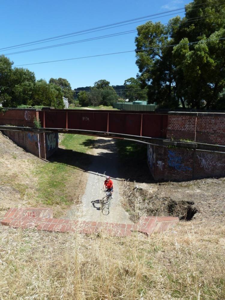
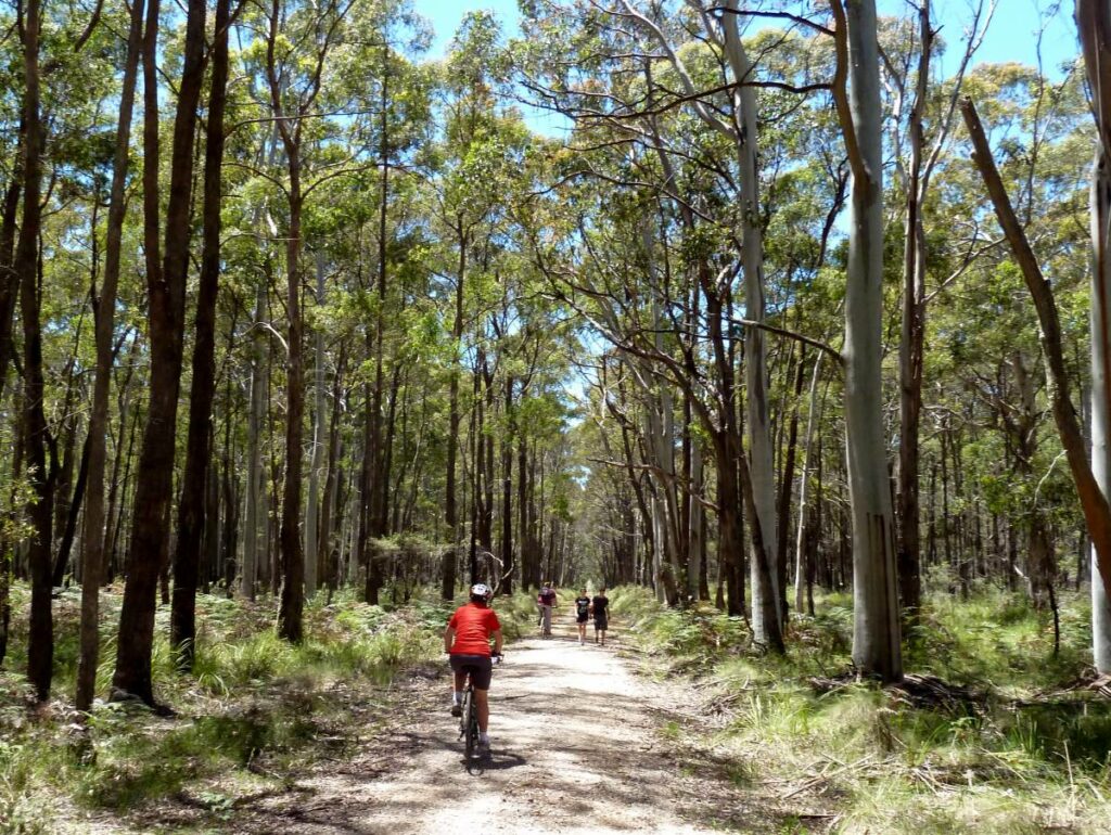
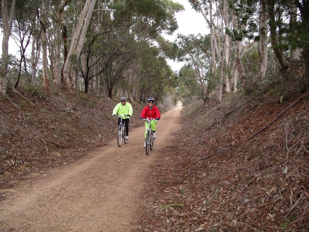
The Bellarine Rail Trail opened in 2000. It has two distinct sections, with the 18km from South Geelong to Drysdale being asphalt on or near the railway alignment. The other 17km runs next to the heritage trains, predominantly on crushed granite. From Drysdale, it runs next to the restaurant train service and, from Lakers Siding, the Bellarine Railway as well, but it uses some quiet streets at the Queenscliff end. ESTA Emergency Markers are installed along the trail. In an emergency, call 000 and quote the code on the marker post nearest to you, eg BRT22. There are some crossings of major roads to watch out for. Major towns with all services include Geelong, Leopold, Drysdale and Queenscliff.
For public transport options go to ‘GET AROUND’ below and click on ‘SHOW MORE’
Section Guides
South Geelong to Drysdale (18km)
- At South Geelong Station, the shared path along Carr St has been removed to allow for track duplication works
- The railside trail is also closed between Strong St and the Fyans St/Carr St roundabout to allow for the construction of a rail bridge and removal of the dangerous roundabout and level crossing. This project will include the building of a concrete shared path next to Carr St with direct access from South Geelong Station’s new outbound platform in 2024
- In the meantime, the best place to start is on the eastern side of the Carr St – Breakwater Rd roundabout, near the Geelong Showgrounds, where there is some off-street parking but no facilities
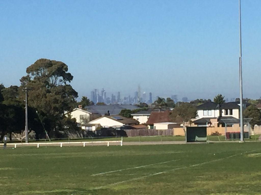
- The trail climbs gently to Leopold with sweeping views back to Geelong
- From Leopold, the trail traverses farmland with views of Corio Bay and the You Yangs. This section was built beside the railway formation and the tracks are still visible in places
- At Curlewis Rd, turn left, away from the old trail and carpark, cross that busy road at the signalised pedestrian crossing and then the Portarlington Rd (C123) crossing to get back on the railway alignment
- The restored Drysdale Railway Station has a museum which is currently only open when The Q Train is running. There’s also a goods shed, locomotive turntable, BBQ shelter and historic cottage
- A coffee van operates in the carpark from 6am to noon every day
- Drysdale shopping centre is about 1km north of the station
Drysdale to Queenscliff (17km)
- The asphalt ends at Princess St and the trail reaches its highest point at Andersons Rd, just after leaving the tunnel under the Drysdale Bypass (B110). There is some car parking here and it is downhill the rest of the way to Queenscliff
- Leave the rail reserve briefly at Lakers Siding and follow the markers
- From Fellows Rd, the trail is on-street (Murray Rd) for 1km before joining a path beside the Bellarine Hwy
- At King St the trail returns to the railway reserve for the rest of the way
- Cross the railway line about 600m before Queenscliff Station and travel beside Swan Bay to the end of the trail
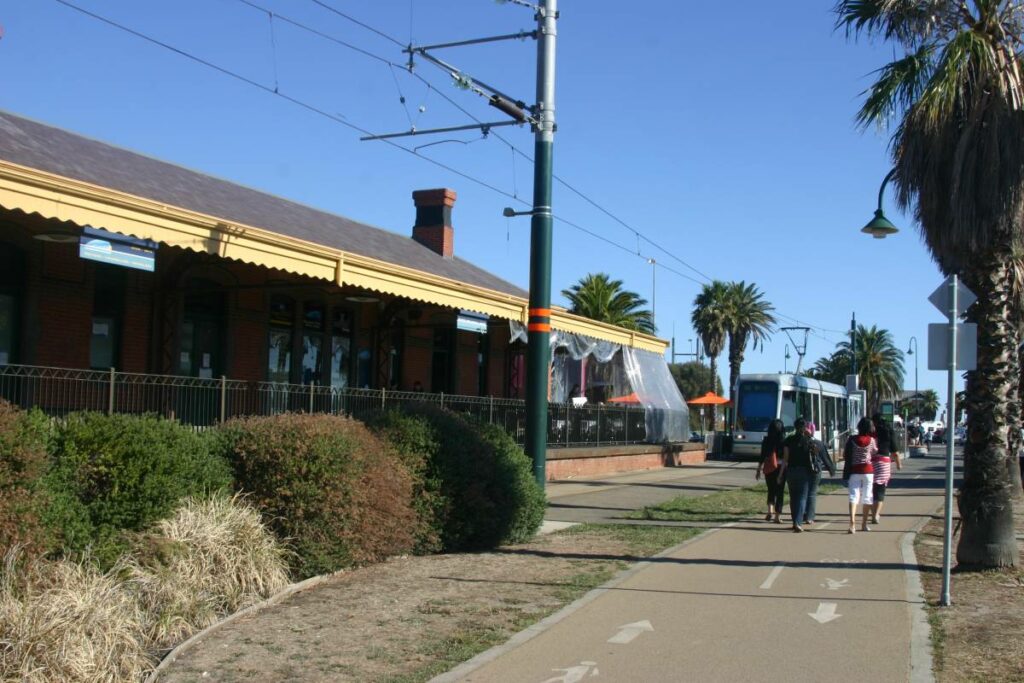
![South Geelong Station doesn't look like this any more [2021]](https://www.railtrails.org.au/wp-content/uploads/2021/12/V12-058-South-Geelong-2021-05-02_145909-300x169.jpg)
South Geelong Station doesn't look like this any more [2021]
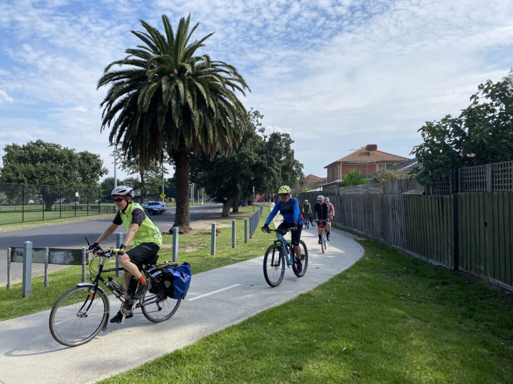
![The rail trail is popular with locals in the South Geelong area [2021]](https://www.railtrails.org.au/wp-content/uploads/2021/12/V12-058-South-Geelong-2021-05-0894-300x169.jpg)
The rail trail is popular with locals in the South Geelong area [2021]
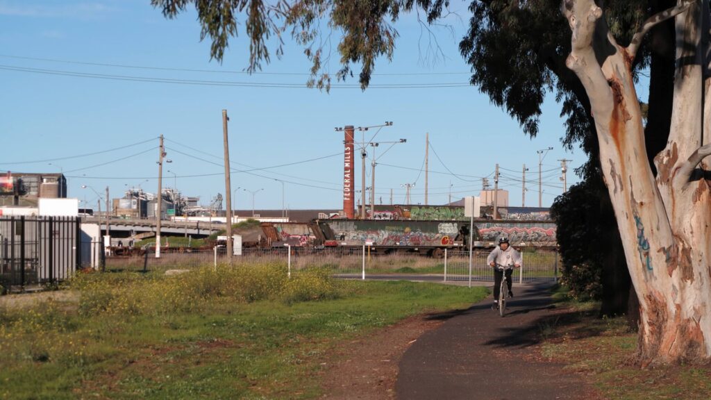
![Suburbia gives way to countryside at Moolap, after about 5km [2019]](https://www.railtrails.org.au/wp-content/uploads/2021/12/V12-106-Moolap-Leopold-Upgrade-2019-05-3-300x169.jpg)
Suburbia gives way to countryside at Moolap, after about 5km [2019]
![A shelter at the Moolap Station site, where there is plenty of parking [2021]](https://www.railtrails.org.au/wp-content/uploads/2021/12/V12-108-Moolap-2021-05-02_142613-300x169.jpg)
A shelter at the Moolap Station site, where there is plenty of parking [2021]
![Enjoying the sunshine near Clifton Ave on the way to Leopold [2023]](https://www.railtrails.org.au/wp-content/uploads/2020/11/V12-100-Clifton-Ave-Moolap-2023-1-300x225.jpg)
Enjoying the sunshine near Clifton Ave on the way to Leopold [2023]
![The trail is a transport link for residents of newer housing estates [2021]](https://www.railtrails.org.au/wp-content/uploads/2021/12/V12-161-Curlewis-Park-2021-05-01_152107-300x168.jpg)
The trail is a transport link for residents of newer housing estates [2021]
![Drysdale Railway Station (left) and Lake Lorne border the trail [2021]](https://www.railtrails.org.au/wp-content/uploads/2021/12/V12-218-Drysdale-2021-05-02_133951-300x169.jpg)
Drysdale Railway Station (left) and Lake Lorne border the trail [2021]
![The Q Train dining service returning to its terminus at Drysdale [2021]](https://www.railtrails.org.au/wp-content/uploads/2021/12/V12-218-Drysdale-train-2021-05-0896-300x169.jpg)
The Q Train dining service returning to its terminus at Drysdale [2021]
![Drysdale Bypass goes over the trail and railway before Andersons Rd [2021]](https://www.railtrails.org.au/wp-content/uploads/2021/12/V12-218-Drysdale-2021-05-01_153903-300x168.jpg)
Drysdale Bypass goes over the trail and railway before Andersons Rd [2021]
![There are some undulations beside the railway [Reg Quelch 2016]](https://www.railtrails.org.au/wp-content/uploads/2021/12/V12-212-Mannerim-new-trail-surface-2016-11-3-300x169.jpg)
There are some undulations beside the railway [Reg Quelch 2016]
![Spring at Mannerim with a canola crop in flower [Reg Quelch 2020]](https://www.railtrails.org.au/wp-content/uploads/2021/12/V12-217-Mannerim-Canola-colour-2020-09-4-300x169.jpg)
Spring at Mannerim with a canola crop in flower [Reg Quelch 2020]
![Mannerim Station opened in 1883 as Marcus Hill but was renamed [2021]](https://www.railtrails.org.au/wp-content/uploads/2021/12/V12-218-Mannerim-2021-05-01_155126-300x168.jpg)
Mannerim Station opened in 1883 as Marcus Hill but was renamed [2021]
![The leisurely pace of The Q Train allows plenty of time to wave [2021]](https://www.railtrails.org.au/wp-content/uploads/2021/12/V12-218-Mannerim-train-2021-05-02_125553-300x169.jpg)
The leisurely pace of The Q Train allows plenty of time to wave [2021]
![A recent addition, Suma Park has a shelter and facilities [2021]](https://www.railtrails.org.au/wp-content/uploads/2021/12/V12-258-Suma-Park-2021-05-02_124357-300x169.jpg)
A recent addition, Suma Park has a shelter and facilities [2021]
![Between Suma Park and Lakers Siding with Swan Bay in background [2021]](https://www.railtrails.org.au/wp-content/uploads/2021/12/V12-258-Suma-Park-2021-05-0936-300x169.jpg)
Between Suma Park and Lakers Siding with Swan Bay in background [2021]
![A Bellarine Railway train departing Lakers Siding for Queenscliff [2021]](https://www.railtrails.org.au/wp-content/uploads/2021/12/V12-308-Lakers-Siding-2021-05-0932-300x169.jpg)
A Bellarine Railway train departing Lakers Siding for Queenscliff [2021]
![On-road section along Murray Rd between Lakers and Queenscliff [2009]](https://www.railtrails.org.au/wp-content/uploads/2021/12/V12-306-Lakers-Siding-2009-10-4720-300x200.jpg)
On-road section along Murray Rd between Lakers and Queenscliff [2009]
![The rail trail skirts Swan Bay as it approaches Queenscliff [2021]](https://www.railtrails.org.au/wp-content/uploads/2021/12/V12-358-Queenscliff-2021-05-0911-300x169.jpg)
The rail trail skirts Swan Bay as it approaches Queenscliff [2021]
![Riders pass Thomas the Tank Engine at Queenscliff [Simon Birrell 2023]](https://www.railtrails.org.au/wp-content/uploads/2020/11/V12-350-Riders-pass-Thomas-the-Tank-Engine-at-Queenscliff-2023-300x169.jpg)
Riders pass Thomas the Tank Engine at Queenscliff [Simon Birrell 2023]
![The Queenscliff trailhead, near the old station and Bridge St [2021]](https://www.railtrails.org.au/wp-content/uploads/2021/12/V12-358-Queenscliff-2021-05-01_164353-300x168.jpg)
The Queenscliff trailhead, near the old station and Bridge St [2021]
![Typical accommodation and dining in the seaside resort town [2021]](https://www.railtrails.org.au/wp-content/uploads/2021/12/V12-359-2021-05-02_091019-Queenscliff-ride-300x169.jpg)
Typical accommodation and dining in the seaside resort town [2021]
![Views of Queenscliffe Port and the bay from the lookout tower [2021]](https://www.railtrails.org.au/wp-content/uploads/2021/12/V12-358-Queenscliff-Port-2020ish-300x225.jpg)
Views of Queenscliffe Port and the bay from the lookout tower [2021]
The Bellarine Railway is happy to take bicycles on their trains free of charge if you don’t want to ride in one (or both!) directions. Groups of six or more are welcome to call 5258 2069 and book to ensure enough space can be provided. On train running days the Queenscliff and Drysdale stations have a kiosk, gift shop, museum and local tourist information.
Public Transport
This trail normally starts at V/Lines’ South Geelong Station but this area is currently subject to track duplication and level-crossing removal works and cyclists may need to ride on footpaths (see SECTION GUIDES for details). Refer to the PTV web page for map and timetables, or use the navigation app of your choice.
Do you know of a bike hire or transportation service on this rail trail that should appear here? If so, let us know at admin@railtrails.org.au.
Information and Links
The rail trail is managed by the City of Greater Geelong, Ph: 5272 5272. Please report any issues with the rail trail to council. The Drysdale to Queenscliff section is mostly on the corridor of the Bellarine Railway.
The Friends of the Bellarine Peninsula Rail Trail have done a great job of improving the amenity of the entire shared path.
When trains are running, Queenscliff and Drysdale stations have a kiosk, gift shop and local tourist information. Drysdale also has a museum.
Visitor Information Centre locations and contact details here.
Contact Rail Trails Australia
To contact us about this rail trail, email vic@railtrails.org.au
Background Information
Traditional owners
We acknowledge the Wadawurrung people, the traditional custodians of the land and waterways on which the rail trail is built.
Railway history
The line opened from Geelong to Queenscliff in 1879 to carry soldiers and materials to help defend Port Phillip Bay from possible attack by Russia. It also carried holidaymakers to the popular seaside resort of Queenscliff. The line closed in 1976, but the section from Drysdale to Queenscliff reopened as a tourist railway in 1981 after being regauged from 5’3″ to 3’6″ to use locomotives donated by the Australian Portland Cement Company from its quarries at Fyansford and beyond.
Drysdale underpass on Bellarine Rail Trail now open
Posted: 20/07/20
Users of the Bellarine Rail Trail in Victoria are relieved to see the completion of ...
More...Upgrade for Bellarine Rail Trail
Posted: 28/06/19
The new trail surface (Reg Quelch) The Bellarine ...
More...Steam to the Bellarine Rail Trail
Posted: 25/05/13
What could be better than combining a steam train and a rail trail. 707 Operations Inc ...
More...Nearby Trails
Fyansford Rail Trail
North Geelong, 5 km from town centre
4.4 km


Mornington Railside Trail
Mornington Peninsula, 60 km south of CBD
4 km


Red Hill Rail Trail
Mornington Peninsula, 90 km south of CBD
6.3 km

Webb Dock Bridge
Docklands, 1 km from Melbourne CBD
0.2 km
Sandridge Railside Trail
Melbourne city, 1 km from GPO
4 km
Rosstown Rail Trail
Southern suburbs, 9 km from the CBD
8.8 km

Inner Circle Rail Trail
Inner suburbs, 5 km from the CBD
4.8 km
Hawthorn to Kew Rail Trail
Inner suburbs, 9 km east of Melbourne CBD
1 km
Outer Circle Rail Trail
Eastern suburbs, 6 km from Melbourne CBD
17 km
Meadowlink Rail Trail
Broadmeadows, 20 km north of CBD
1.2 km
Tiger Rail Trail
136 km south west of Melbourne
4.4 km
Heathmont to Belgrave Trail
Eastern suburbs, 40 km from the CBD
16 km
Eastern Dandenong Ranges Trail
Dandenongs, 50 km southeast of CBD
15 km
The Bunny Trail
110 km west of Melbourne
1.0 km
Bass Coast Rail Trail
130km south-east of Melbourne
23 km

Old Beechy Rail Trail
Otway Ranges, 152 km south west of Melbourne
37 km
Warburton Rail Trail/Yarra Valley Trail
Yarra Valley, 50 km east of Melbourne CBD
48 km
Woodend to Daylesford (incl Domino) Rail Trail
85km north west of Melbourne
5 km
Ballarat-Skipton Rail Trail
110km north west of Melbourne
57 km
Powelltown Tramways
Yarra Ranges, 80 km east of Melbourne
31 km
Nearby Trails
Fyansford Rail Trail
North Geelong, 5 km from town centre
4.4 km
Mornington Railside Trail
Mornington Peninsula, 60 km south of CBD
4 km
Red Hill Rail Trail
Mornington Peninsula, 90 km south of CBD
6.3 km
Webb Dock Bridge
Docklands, 1 km from Melbourne CBD
0.2 km
Sandridge Railside Trail
Melbourne city, 1 km from GPO
4 km
Rosstown Rail Trail
Southern suburbs, 9 km from the CBD
8.8 km
Inner Circle Rail Trail
Inner suburbs, 5 km from the CBD
4.8 km
Hawthorn to Kew Rail Trail
Inner suburbs, 9 km east of Melbourne CBD
1 km
Outer Circle Rail Trail
Eastern suburbs, 6 km from Melbourne CBD
17 km
Meadowlink Rail Trail
Broadmeadows, 20 km north of CBD
1.2 km
Tiger Rail Trail
136 km south west of Melbourne
4.4 km
Heathmont to Belgrave Trail
Eastern suburbs, 40 km from the CBD
16 km
Eastern Dandenong Ranges Trail
Dandenongs, 50 km southeast of CBD
15 km
The Bunny Trail
110 km west of Melbourne
1.0 km
Bass Coast Rail Trail
130km south-east of Melbourne
23 km
Old Beechy Rail Trail
Otway Ranges, 152 km south west of Melbourne
37 km
Warburton Rail Trail/Yarra Valley Trail
Yarra Valley, 50 km east of Melbourne CBD
48 km
Woodend to Daylesford (incl Domino) Rail Trail
85km north west of Melbourne
5 km
Ballarat-Skipton Rail Trail
110km north west of Melbourne
57 km
Powelltown Tramways
Yarra Ranges, 80 km east of Melbourne
31 km
23 reviews of “Bellarine Rail Trail”
Having a beach house on the Bellarine Peninsular I've been on this trail many times. Now I use an eBike. On January 4, 2024 took my 10 year old grandson from Drysdale to Queenscliff and return. This is an easy and varied ride in very good condition. The steam train tooted hello to us as it passed, much to grandson's delight. It's really great when grandchildren get old enough to be good biking companions. The only downside is that he does not know the meaning of "slow down". I think we set a record for this ride.
Can you do the Bellarine trail in a da and get back to Melbourne by 6pm without a car??? Yes, you sure can. I decided on the 9:30am ferry from the docklands given that there are more trains than ferries so I didn't need to worry too much about timing so much.
From Portarlington, I had the option of straight down to Queenscliff (22km on a straight road) or 33km around the coast. I chose the coast but ignored the fine gravel path beside the road that runs most of the route as the road was fairly quiet on a Friday and that time was against me. I wouldn't use the ferry if you are taking the kids due to the amount of onroad travel and distance involved but it's not too much of an issue for experienced cyclists.
Queenscliff was lunch time with a curried scallop pie at the pie shop – highly recommended and this is the end of any edible food on the trail until Geelong, so top up the engine there.
Once you leave Queenscliff, the wetlands are a delight to behold and then you head into farmland and native vegetation on a predominantly flat trail. The shops in Drysdale are 2km away from the rail trail and most cafes will be closing up by the time you get there.
The last stage heads into Geelong. With some sort of Big Build going on, the last one or two km are currently on road and are a bit of a cluster after a big day.
Overall, the first section out of Queenscliff is the highlight and I am giving an extra star because of the effort to maintain the corridor however the Skipton- Ballarat and many other trails offer much more, however with fewer chances of having an epic pie.
The work on the trail around Drysdale station is now finished and we can enjoy an extra km or so of well-sealed surface. The sealed section from Geelong is great to go a bit faster and get more of a workout, then the unsealed section to Queenscliff is more scenic – the surface is pretty good, some loose gravel and sand in places. The highlight is Queenscliff, which has a lot for visitors, and the ferry to Mornington Peninsula. There's also an option to get a ferry back to Melbourne from Portarlington, but that involves some road riding, on roads that are not busy but traffic is too fast for the road width.
After the wet weather in spring, the City of Greater Geelong has done an excellent job of restoring the trail (well I've only ridden the Drysdale-Queenscliff end but it was great). If you like quiet trails in the country with farmland, towns and seaside this is the one for you.
PS The Geelong end is more urban but with lots of plantings.
This is the most boring rail trail we've ever ridden. Our advice would be, start at Queenscliff and stop after 2km. There is nothing else much worth looking at. Your day will be much better spent riding the Warburton Rail Trial.
The surface is nice to ride on, that is it's saving grace.
Here is a fantastic itinerary that includes the Bellarine Rail Trail which I did with a friend today. Make your way to Southern Cross Station and take the Geelong train to South Geelong. From there, follow the excellent Trail Guide above for the Bellarine Rail Trail (stopping for a coffee at Drysdale) and lunch at Queenscliff (and allow for some time to explore the area including a visit to the lookout tower at the ferry terminal!) On the return journey, after about 5-6km, branch off to the right along the C126 to Portarlington. After about 8.8km, turn right onto the C125 and after another 3km turn right along Bluff Rd (take care crossing this one). At the end of Bluff Rd you will find the Coastal Path, a sandy off-road track that winds along the shore with spectacular views across the bay, to end at Portarlington. Enjoy afternoon tea and sightseeing there before cycling to the pier to take the ferry to Docklands (you should pre-book and let them know if you have a bike – it goes free!) The final leg is a short ride from the ferry to Collins St, where you turn left to reach Southern Cross Station for your return train home. This is a full day's adventure but well worth the effort.
My two friends and I rode this trail this week. We were advised by the local Friends group to be careful on the gravel section near Suma Park due to recent repairs by the local council, but my flat-barred road bike had no troubles on this section. We were very impressed with the condition of the whole trail and the growth in the vegetation since the last time I rode it provided good shade most of the time.
Virus restrictions easing so lots of people cycling and walking in the glorious winter sun. I rode return from South Geelong and was very impressed with the many seats along the trail and covered picnic station with toilets. Southern section had many puddles and mud which could be a problem after rain if you don’t have mudguards. I didn’t like the trail going on a road with cars at Queenscliff and I hope there are plans to build a seperate bike path. Next time I will book a cabin in Queenscliff, so I can add a return ferry trip to Sorrento and ride to Pt Nepean and back
I did this track both ways over two days. Highlights of this rail trail are the Bellarine bush and fauna. Views of Corio Bay as mentioned in the notes and Swan Bay at Queenscliff. Historic stations and track. With half the path asphalted, from South Geelong to Drysdale, this track is better than many rail trails I have ridden and makes for easy riding. The entry point at South Geelong Station is also well signed from the car park. The inclines are mostly gentle and easy to ride. There are lots of seats along the trail and even shelters. A bonus is you can also get the ferry to Sorrento from Queenscliff if you want to extend the journey like I did. A word of warning – however – check the weather forecast before riding. On my return it had rained and the track from Queenscliff to Drysdale was sloshy and there was a 45kmh headwind which made riding hard and unpleasant. Note also outside of Drysdale there is currently works which means a 1km or more detour up a steep hill. But overall a good ride. Some of the signs are weathered and graffitied – sometimes also there are side tracks which are unsigned but if you get lost follow the railway line! It is a rail trail after all.
Rode Drysdale-Queenscliff return January 2020. As a setting for a ride it is an excellent spot and well worth the visit. Your arrival in Swan Bay makes the trip down to Queenscliff wonderful. Was disappointed to not have the time to do the full trip from Geelong. Unfortunately after some showers in the morning of my ride the trail was very soft and slippery with some sections rough with erosion. There’s a catch 22 inasmuch as with the railway line still in use for tourist trains the riding/walking track has to snake around and not benefit (as on other trails) from the engineered embankment where the rail line goes; but if the line wasn’t in use you’d then not have the always thrilling moment of seeing a train go past!
Would be good to see the trail get some money spent on firming up and protecting the surfaces, avoiding road sections and updating signage.
Rode it from South Geelong to Queenscliff on Saturday and was pleased to see that many of the bike-unfriendly (and especially tandem-unfriendly) chicane gates have been removed. Still a few places where we had to get off and manhandle the bikes around them. Nicely resurfaced with hotmix asphalt for most of the length too, except a very muddy bit of singletrack approaching Queenscliff. We ignored the signs telling us that the path was closed at Drysdale and only had to make a minor detour up and over the new highway, seemed a better choice than the lengthy on-road diversion according to the signs. Got caught in a thunderstorm and sheltered under a bush!
1/27. New Years Day 2019, and the 1st trail on my quest to ride every Rail Trail in Victoria in 2019. Had to blow out a few cobwebs from last night, and blow away an over zealous official at the Drysdale Station of the Bellarine Railway who said “Unauthorised vehicles are not permitted in prohibited areas” – I had parked my bike to take a photo less than 1 metre from the track!
38kms, including a little extra to meet the support crew at Geelong waterfront.
You can follow my exploits on my FB Page Warwick Duncan – The 2nd Chance Man or Insta @warwick_rides
In April, ’17 we had a weekend in Queenscliff with a group led by Dookie (11/3/17). Together we rode to Drysdale for lunch and back. The following day we rode another nice track around the Barwon River. In Oct. ’17 we again stayed in Queenscliff and rode this section again. The Friends of the Rail Trail have done a wonderful job of the gardens at the Suma Park Station. We recently stayed at Port Arlington and did the Drysdale to Geelong outskirts of this Trail. The hot mix surface (from Drysdale to Leopold) is easy to ride on and the Friends of the Rail trail have done a fabulous job of the revegetation. We loved the Curlewis station site, with its shelter, drinking fountain, notice board, Lone Pine tree and especially the Avenue of Honour. We agree with Dookie, this is a 5 star Rail Trail and it was wonderful to see so many people making good use of it – locals and tourists. .
Midweek meander: Cycling the Bellarine Rail Trail
The weather forecast said our unseasonal run of warm dry weather is about to come to a chilling end, time for one last rail trail before winter sets in.
We were are greeted by a crisp clear early morning as I cycle off the few kilometres to the aptly named Sunshine railway station.Traveling against the flow of commuter traffic its easy to find a cosy space on the 7.22 am limited express to Geelong where I will begin my ride.
Rattling quickly through nursery suburbs out across those seemingly flat basalt plains, a rising sun throws down a brilliant incandescent light across an undulating landscape, penetrating carriages then illuminating in gold relief the tired faces of passengers.
By 8.30 am I’m cycling through Geelong City down to Eastern Beach following a route to South Geelong where a big green signposted arrow points to the Bellarine Rail Trail.
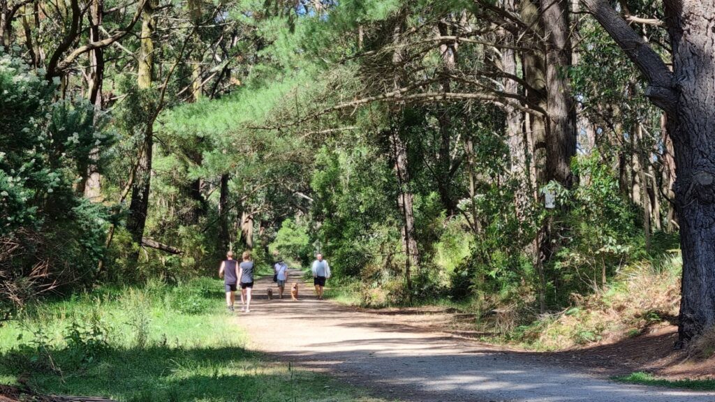
Rolling along on a good surface of crushed rock it’s easy riding with only a few minor local road crossings. There has been significant planting of native vegetation either side of the trail which makes an ideal environment for native bird life, a bonus for those of us that enjoy a little twitching with their cycling, falcons, kites, parrots, wrens, butcher birds and herons accompany me most of the way.
About 10 kilometres in, at Leopold the pathed surface rises slightly, so I can peer into people’s backyards. I could be atop a dyke in Holland!
Most of the trail passes beside open farmland, alongside new housing developments and a golf course. In Drysdale where the trail meets the highway I’m greeted with a delicious unexpected surprise cake and coffee delivered from a mobile man with a van.
A weekend tourist railway still operates between Drysdale and Queenscliff so the track is well maintained with covered shelters, toilets and rest stops. Queenscliff is an historical fishing town that offers many options for the inquisitive traveler. Various accommodation types, fishing, a ferry service, museums, cafes, bookshops but no bicycle shop, so make sure your bicycle is well maintained, carry a pump, spare tube, some basic tools and know how to use them.
After chatting with some sheepish local fishermen on the Queenscliff Pier, we cycled back to South Geelong in overcast conditions into a building headwind just in time to make the 3pm train from South Geelong to Melbourne
All up 75 kilometres of easy cycling out and back on a comfortable well used trail that’s suitable for almost everybody.
Just spent two days on this RT. Day 1: Queenscliff to Drysdale/return. Day 2 Geelong to Drysdale/return. Perfect warm sunshine and zero wind meant we had everything in our favour and we were not disappointed. As bird lovers, we found day 1 to be very rewarding. Blue Wrens were there in big numbers and we were rewarded with a siting of a large flock of Red-browed Firetails too. Many Magpies have made this section their home and their Autumnal chorraling was very sweet.
A lot of work has been done on the Queenscliff-Drysdale section and despite the sign telling us of “erosion following heavy rains”, we didn’t find it too bad at all. The ‘big dip’ outside Drysdale has been hot-mixed and is a pleasure to ride in both directions. At about the halfway mark a drinking fountain has been installed..a very nice gesture. Lots of seating for those requiring a rest or relax.
Day 2: We started at the Geelong Showgrounds and loved the sealed surface from there. Disappointing lot of spray-paint-vandalism for the first few kms in East Geelong. High praise for all the revegetation work that has been done all the way to Drysdale. A lot of hard work to make the RT that much more enjoyable. Major road works happening at the Drysdale Station crossing. Hopefully traffic lights will be installed at what is a very dangerous road to cross. All the other crossings on major roads out of Geelong are traffic light controlled and work well. Great coffee van at the Drysdale Station, but be warned it closes right on 12 midday.
Thoroughly enjoyed this RT, hence 5 stars from us. Congrats to all the ‘Friends’ group for all the great work they have done.
Did the Bellarine Trail on November 2nd 2014 – with a group of friends. Very enjoyable – good upgrade to the track for most of the way between Geelong and Drysdale. The Drysdale to Queenscliff path needs improving in places – especially the big dip outside of Drysdale. Always great views of Swan Bay.
This was our first rail trail ride as we are new to this sport, we absolutely loved the ride fantastic tracks and great facilities along the way. Started at geelong rode to queenscliff and back, will be back and do this again and are already planning another rail trail ride.
Rode with a 2 seater croozer towing the kids. First 5km starting from Geelong South was terrible. Why do all these bike paths have to put in bollards/chicanes. Make it impossible to ride through them with a bike trailer. Rest of the ride was pretty good. One more tight rail crossing at the Queenscliff end as well.
Shelton,
The section between Geelong and Drysdale will be ok for a cargo bike, and if it has not been raining for a few days the section between Drysdale and Point Lonsdale will passable but in the section between Swan Bay road and Banks road you may have to walk it a bit through sections of soft gravel. Then from Point Lonsdale to Queenscliff is ok except turn left onto Queensclif-/Portarlington road for about 500m, there is a new verge to ride on, turn right into Yarram road( becomes the trail) because the short sectionof trail that joins Queenscliff-Portarlington to Yarram road is flooded. Hopes this helps. Spokes. P.S. saw a cargo bike on the trail on Sunday 5th August, maybe that was already you. If it was, windy ah.
Can anybody give me an update on the state of this railtrail. I’m really wanting to try a cargo-bike holiday with my two little people…. but cargo bike portage is not really a winning proposition.
Well all the re-surfacing on the trail between Portarlington Rd and Drysdale has been undone by the rain, but mainly because no drainage! Improper contouring and grass verges higher than the track have allowed the water to flow straight down the track like a river. Have a video to prove. Needs a lot of work to get it back to a standard to make it user friendly. So give it a big miss if you are thinking of riding it. Between Curlewis and Geelong is still OK.
Being a frequent user of this rail trail I am delighted that the track is getting some much needed attention. Plus I have to totally agree with dogbait ( been bitten by a dog or two have we) that a tunnel under Geelong Rd, Drysdale has to go into the urgent tray before someone gets hit and killed.
February 2012. After much complaint, the Council is now in the process of re-surfacing 11k’s of the trail between Portarlington Rd and Drysdale. They are removing all the loose large bluestones and replacing it with a hard, packed base topped with fine bluestones. A great improvement!
This, and the new shelter at Mannerim and the shelter and toilet at Suma Park along with the newly installed kilometre markers and the Bellarine Rail Trail is finally getting up to First Class standard.
Now we just need to convince VicRoads of the urgency of a tunnel crossing at the horrendously dangerous and difficult crossing at Geelong Rd, Drysdale.