As the Victorian gold rush waned, diggers turned their attention to forestry. In the Yarra Ranges, tramways were built to open up the area for logging. When trucks took over hauling the logs, those tramways gradually became redundant, with the Department of Sustainability and Environment (now DEECA) developing them into a variety of walks in the 1970s. These take from a few hours for the Reids Tramline and Richards Tramline ones, to a couple of days for the 36km Powelltown Tramways walk. More recently, many of the tracks have been cleaned up by Forest Fire Management Victoria. Along the tracks are tree ferns and dark-green myrtle beech trees in moist gullies, majestic mountain ash forests on the slopes and brown and messmate stringybark and mountain ash at lower levels.
Nearby Attractions
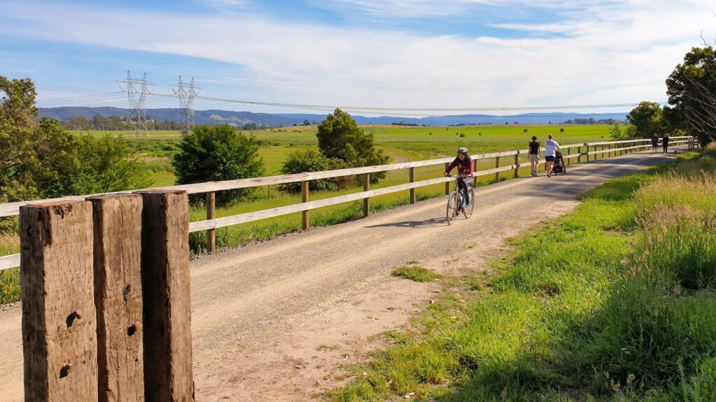
- Warburton Rail Trail
- Yarra Valley Trail
- Yarra Valley vineyards
- Warburton
- Yarra Valley Chocolaterie and Ice Creamery
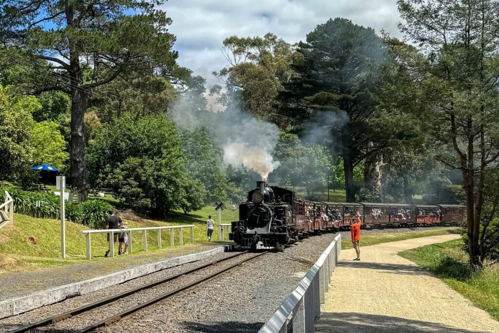
- Yarra Valley Railway
- Redwood Forest, East Warburton
Last updated: 26 April 2024
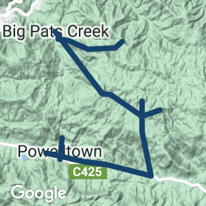
Also known as Walk Into History, this trail runs along sections of the former Powelltown Tramway east to Nayook West, north over Dowey Spur and then northwest on the Federal Tramway route to Big Pats Creek near Warburton. It can be steep, muddy and hard going. It is not suitable for novice bushwalkers, especially in winter. Signage can be an issue and even experienced bushwalkers should carry maps. The remnant bridges of the tramway are unsafe. Let them rot in peace and follow the walking tracks through the gullies, but be prepared for leeches in the wet conditions – wear long trousers or gaiters. If you are looking for more family-friendly adventures, see the CONNECTING TRAILS section.
Access Points
- Powelltown: Picnic reserve on Yarra Junction-Noojee Rd (C425) has toilets and picnic tables
- Nayook West: The Bump Tunnel roadside parking area on C425, 7km east of Powelltown at bottom of Big Creek Rd. Watch for Ada Tree sign.
- High Lead car park on Powelltown-Noojee Rd, 11km east of Powelltown on C425
- Dowey Spur Rd off Big Creek Rd
- Starlings Gap: Big Creek Rd will also take you to this camping area
- East Warburton: The trailhead is at Big Pats Recreation Area off Burns Rd
For public transport options go to GET AROUND below
Section Guides
Powelltown to The Bump (6.3km, 1.5-2hr)
- Start in the Powelltown Picnic Area at the western end of town, opposite the DEECA depot. This point is also a trailhead for the Reids Tramline Loop Walk. Follow the main drag (Yarra Junction-Noojee Rd) east for 1km, past the sawmill and Powelly Pub, and turn right into Blake St. After 75m, turn east into Surrey Rd, which follows the old tramline formation, passing an easier entrance to the Reid Tramline walk, to the far end of town.
- At Boys Camp Creek, the Big Bridge crossed a 13m deep gully but you’ll have to use a very humble one and then cross the highway and walk up Mackley Creek Rd, mostly following the tramline formation, for nearly 1km. The unmarked tramway then leaves that road on the right and begins to follow the Little Yarra River.
- Near this point the tramway builders took advantage of an unusual geological feature, called a natural bridge, where the river disappears underground for a short distance. By laying the tracks over this formation, they saved themselves the trouble of building another trestle bridge.
- The trail then follows the river for 3.3km and meets Powelltown-Noojee Rd again at The Bump.
- The Bump was so named because, for many years, it prevented easy travel from the Little Yarra Valley to the LaTrobe River Valley in Gippsland. Initial access was via The Bump, with the log bogies being winched up the steep western side and lowered down the other one by winch. Steam engines were also used on the gentler eastern side. In 1925-26, the Victorian Hardwood Company realigned the tracks for 2.7km, mainly on the Powelltown side, and excavated a 313m tunnel. The Bump Tunnel was about 2.8m wide, 4m high, timber-lined and had a vent shaft to carry smoke from the locos, which is near Powelltown-Noojee Rd. The tunnel entrances were blasted after World War II but the portal approaches are still visible.
The Bump to High Lead carpark (4.2km, 1.5hr)
- The track winds down towards the LaTrobe Valley and then crosses the LaTrobe River for the first time. Immediately beyond the river is the site of Nayook West, the only evidence of which is a sawdust heap. From about 1915 to 1934, the only access was via the Powelltown Tramway, with passengers having to ride on the locomotive or trucks. A school opened in 1920 and a post office in 1926, which might have been part of the general store. There was no electricity
- The track continues east close to the river, crossing it six times before emerging at the High Lead carpark on Powelltown-Noojee Rd.
High Lead carpark to Dowey Spur (4.6km, 1.5-2hr)
- From this carpark, the track again crosses the LaTrobe River, follows it north for about 1km and then crosses and follows Big Creek, with its fine specimens of myrtle beech, north-westwards for 1.4km to the start of the High Lead incline.
- The High Lead is the most difficult section of the walk. The track rises 415m in 1600m, a grade of almost one in four, to the site of a winch station on top of Dowey Spur. From here it is a short walk down to Dowey Spur Rd, a potential car shuffle spot after that steep climb.
- The trail is flanked by mountain ash forest that has regrown since the 1983 Ash Wednesday bushfires. An intensive salvage operation obtained logs and pulpwood from the fire-killed trees.
Dowey Spur to Starlings Gap (8km, 2.25-2.75hr)
- From Dowey Spur Rd, the High Lead track continues dropping sharply to the Ada River. Immediately across the river is the Ada No. 2 sawmill. Some relics have remained since the 1939 fires, including a boiler.
- Just beyond the mill, the track crosses a small stream and climbs to “Federal Crossing” where the Federal Tramway and Victorian Hardwood Company lines intersected. This point is the start of two short walks, to the sites of the New Federal and New Ada mills (see CONNECTING TRAILS below).
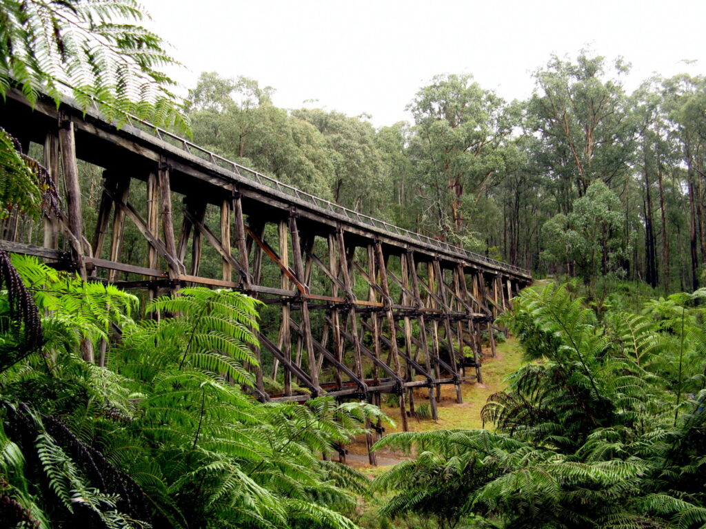
- From Federal Crossing, what was the Federal Tramway winds its way northwest up the Ada River valley to Starlings Gap. Across the valley you may glimpse the remains of some fine trestle bridges on what was part of the Powelltown Tramway. The trail emerges at the picnic area at Starlings Gap, 740m above sea level. There are toilets, camping platforms, firepits and the remains of a winch and boiler from the sawmill that operated here under several names until 1927.
Starlings Gap to Big Pats Creek (9km, 4-5hr)
- On the other side of Big Creek Rd, the trail resumes on the Federal Tramway alignment. There is a huge sawdust heap on the left. The line continues down the northern side of the Mortimore Creek valley for 7km to Burns Rd, crossing an old fireline on the way. A short distance before that fireline, another sawdust heap marks the site of Ezards mill.
- The trail descends at a grade of 1:12, which was fairly steep for tramways. Coming down from the Gap, the locomotives were coupled to the rear of the train for safety reasons. If the loco’s engine or brakes failed, the train of logs would take off but the engine driver had a chance to jump clear.
- Shortly after crossing Burns Rd, the line meets Big Pats Creek and follows it down to the Big Pats Recreation Area, which is close to that road.
CONNECTING TRAILS
Reids Mill Tramway Loop (6km)
This gently climbing trail follows a tramway route up Blackwood Gully to the site of Reids Sawmill, which was in use from 1920 to 1930. The starting point is a parking area on the left side of Powelltown-Noojee Rd, about 500m east of Powelltown, past Messmate Close. The trail runs through magnificent tree ferns and tall mountain ash before entering drier stringybark forest. Care should be taken when crossing the bridges over several small streams. A few relics of the mill can still be seen at the top of the trail. A return loop takes you up to Big Bertha Tk and then down sharply to the Powelltown Picnic Area and east along the road on the Walk Into History route before hitting the tramway. We recommend just going up and back on the tramway, especially in hot weather.
New Federal Mill (4km return or 7km with Ada Tree)
Walking east from the Federal Crossing, or Crossroads, the New Federal Mill site is 2km away, with an impressive collapsed tramway bridge along the way. The New Federal operated for 15 years until 1949, ending the tramway era. A 1.4km walking track links the mill to the Ada Tree, a giant mountain ash believed to be 300 years old for those doing the Walk Into History who want to have a quick look. A further 1.8km along Federal Rd is the Ada Tree Reserve car park, if you are looking for an exit point. The gated entry can also be used for disabled access to the tree walkway, but a key is required.
New Ada Mill (3km return)
This one heads north from Crossroads on the High Lead. There are a few relics at the mill site, which operated from 1931-42.
Richards Tramway Walk (21km return)
William Richards had three goes at building this tramway to his timber mill on Starvation Creek from a narrow block at Big Pats Creek. The first attempt used part of a neighbouring property, generating expensive access rights, the second was too steep and the third had lots of bends to make it up the hill from Burns Rd. You’ll see evidence of the previous efforts as you go up the hill. The trail can be overgrown and muddy and is rated moderate to difficult. You can take an early shower by heading back at Mississippi Fireline (4km), take the link track to Mississippi Creek Rd and walk down that way (15km) or compromise by doing a car shuffle to the junction of Oat Patch Tk and Brahams Rd (11.3km).
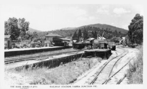
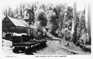
Tramway train (right) being unloaded at the Yarra Junction sidings.
![Nothing left of the tramway but it is remembered in the museum [2024]](https://www.railtrails.org.au/wp-content/uploads/2020/11/V15-050-Nothing-remains-of-the-Powelltown-Tramway-sidings-at-Yarra-Junction-Station-but-it-is-remembered-in-the-museum-2024-300x225.jpg)
Nothing left of the tramway but it is remembered in the museum [2024]
![Powelltown Tramway trailhead on the western side of town [2024]](https://www.railtrails.org.au/wp-content/uploads/2020/11/V15-250-Powelltown-Tramway-trailhead-in-Powelltown-2024-2-300x200.jpg)
Powelltown Tramway trailhead on the western side of town [2024]
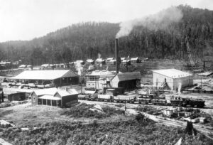
Powelltown in its heyday with the mill office in the foreground
![A sawmill remains in the town but it's a pretty quiet hamlet these days [2024]](https://www.railtrails.org.au/wp-content/uploads/2020/11/V15-250-Powelltown-2024-300x200.jpg)
A sawmill remains in the town but it's a pretty quiet hamlet these days [2024]
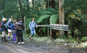
Reids Tramline trailhead near the Powelltown-Noojee Rd east of town
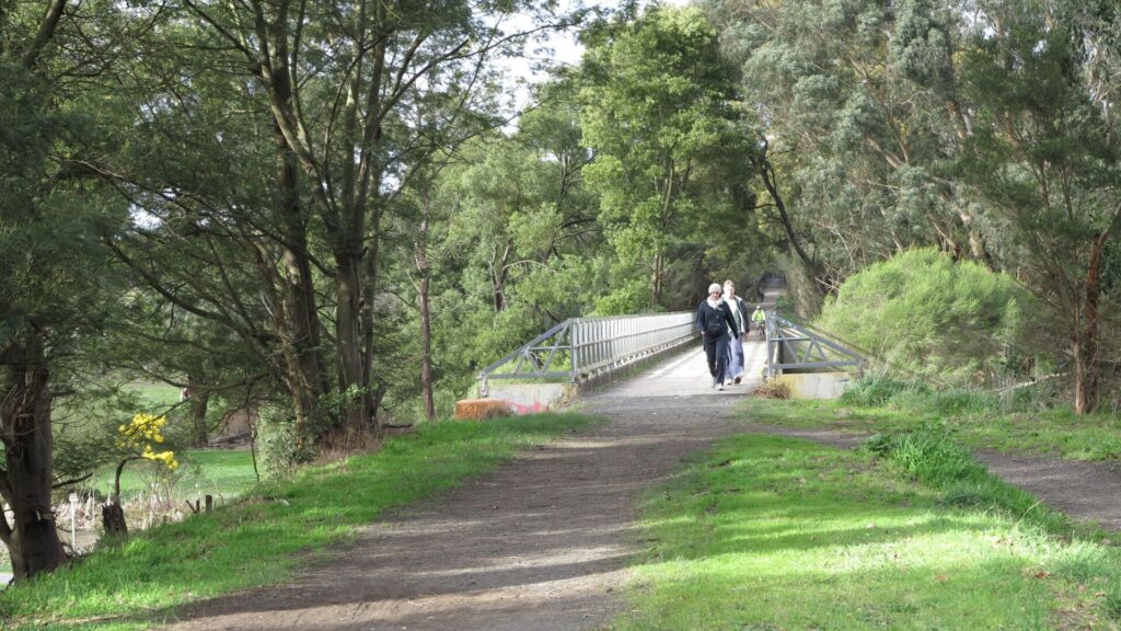
![The trail emerges from the bush approaching the site of The Big Bridge [2024]](https://www.railtrails.org.au/wp-content/uploads/2020/11/V15-300-The-trail-emerges-from-the-bush-approaching-the-site-of-The-Big-Bridge-2024-300x200.jpg)
The trail emerges from the bush approaching the site of The Big Bridge [2024]
![Winching a load down the western side of The Bump incline [Rev. Benton, circa 1918, courtesy LRRSA]](https://www.railtrails.org.au/wp-content/uploads/2020/11/V15-300-Winching-a-load-down-the-western-side-of-The-Bump-incline-Rev.-Benton-circa-1918-courtesy-LRRSA-1-225x300.jpg)
Winching a load down the western side of The Bump incline [Rev. Benton, circa 1918, courtesy LRRSA]
![Western end of 317m Bump Tunnel, which operated from 1926-49 [Andrew Lyell, 1937, courtesy LRRSA]](https://www.railtrails.org.au/wp-content/uploads/2020/11/V15-300-Western-Powelltown-end-of-317m-Bump-Tunnel-which-operated-from-1926-49-Andrew-Lyell-1937-courtesy-LRRSA-300x230.jpg)
Western end of 317m Bump Tunnel, which operated from 1926-49 [Andrew Lyell, 1937, courtesy LRRSA]
![The site of the Bump Tunnel looking west towards Powelltown-Noojee Rd. The incline was further north [2024]](https://www.railtrails.org.au/wp-content/uploads/2020/11/V15-301-The-site-of-the-Bump-Tunnel-looking-west-towards-Powelltown-Noojee-Rd.-The-original-Bump-incline-was-located-further-north-near-the-Little-Yarra-River-2024--225x300.jpg)
The site of the Bump Tunnel looking west towards Powelltown-Noojee Rd. The incline was further north [2024]
![Bushwalkers heading up the High Lead incline, with the passing loop just ahead of the lead walker [Frank Hosking, courtesy LRRSA]](https://www.railtrails.org.au/wp-content/uploads/2020/11/V15-350-Bushwalkers-heading-up-the-High-Lead-incline-with-the-midway-passing-loop-just-ahead-of-the-lead-walker-Frank-Hosking-courtesy-LRRSA-187x300.jpg)
Bushwalkers heading up the High Lead incline, with the passing loop just ahead of the lead walker [Frank Hosking, courtesy LRRSA]
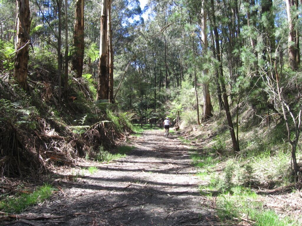
![Heading along the Federal Tramway section of the Walk Into History southeast from Starlings Gap [2024]](https://www.railtrails.org.au/wp-content/uploads/2020/11/V15-500-Heading-along-the-Federal-Tramway-section-of-the-Walk-Into-History-southeast-from-Starlings-Gap-2024-300x225.jpg)
Heading along the Federal Tramway section of the Walk Into History southeast from Starlings Gap [2024]
Log bogies and exhausted horses near the stables at Big Pats Creek
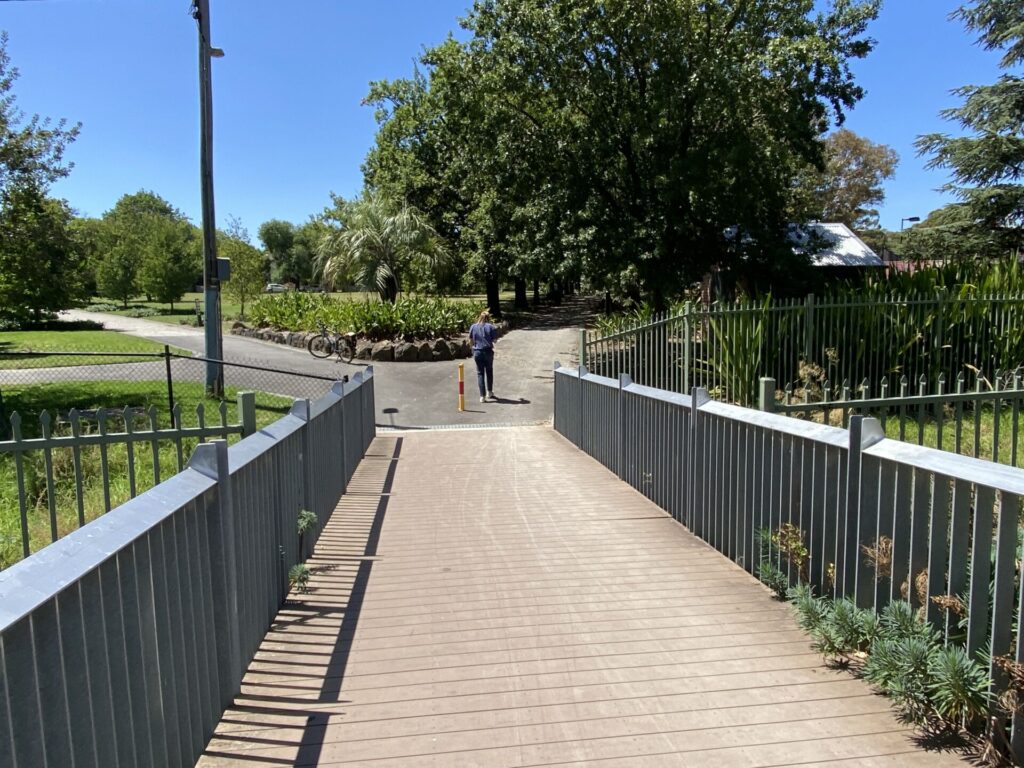
![Emerging from the walk at the Big Pats Creek camping area [2024]](https://www.railtrails.org.au/wp-content/uploads/2020/11/V15-550-Trail-head-near-Big-Pats-Creek-2024-24-01_3429-300x225.jpg)
Emerging from the walk at the Big Pats Creek camping area [2024]
![La La Sidings on left, Sanitarium factory centre, tramway from Big Pats Creek coming in across road [1930s]](https://www.railtrails.org.au/wp-content/uploads/2020/11/V15-600-La-La-Sidings-on-left-Sanitarium-factory-centre-tramway-from-Big-Pats-Creek-coming-in-across-road-just-beyond-Yarra-River-bridge-1930s-300x247.jpg)
La La Sidings on left, Sanitarium factory centre, tramway from Big Pats Creek coming in across road [1930s]
Public Transport
Martyrs Bus Service operates regular #683 services from Lilydale Railway Station on the Metro network to Yarra Junction and on through Warburton to Rupert Rd, East Warburton, near Big Pats Creek Rd. It is a 4.5km walk from there to the Walk Into History trailhead and camping area. There are no bus services from Yarra Junction to Powelltown.
Do you know of a bike hire or transportation service on this rail trail that should appear here? If so, let us know at admin@railtrails.org.au.
Information and Links
The Department of Energy, Environment and Climate Action (DEECA) recommends doing the walk from the East Warburton end Walk-into-history
To advertise your rail trail-support business on this page, please click here
To contact us about this trail, Email or click here: melbourne@railtrails.org.au
Contact Rail Trails Australia
To contact us about this rail trail, email vic@railtrails.org.au
Background Information
Traditional Owners
We acknowledge the Woiworung people, the traditional custodians of the land and waterways on which this rail trail was built.
Railway history
In the early 1900s, the area around Powelltown was opened up by a network of tramways which carried logs from the mountains of the Upper Yarra and LaTrobe valleys. The largest mill in the area, from which Powelltown takes its name, was initially operated by the Victorian Powell Wood Process Company. The companywas formed in 1912 to exploit the new, but ultimately unsuccessful, “Powell” method of wood preservation. Flush with gold-rush investors’ cash, VPWPC built a high-standard 3ft (914mm)-gauge tramway from Yarra Junction east to Mackley Creek. Subsequent operators extended this Powelltown Tramway north over Downey Spur and northwest up the Ada River valley to Starling Gap. The Federal Tramway ran up the northern side of the Ada valley and through to La La Sidings near Warburton.
The tramways kept close to creeks so they could maintain an even grade and there were many bridges. Sawn wooden rails were used on the earlier, lighter lines and, in one place, a tunnel cut though a ridgeline. The forest trees were felled with axes and cross-cut saws then dragged onto the tramway with steam-powered winches set up beside the tracks. The tramlines declined in the 1930s Depression before the 1939 bushfires devastated the area and meant sawmills had to relocate to the edge of the forest. This, combined with improved roads and increased truck traffic, caused the tramways’ demise. The 1983 Ash Wednesday fires again devastated the area.
The book Powelltown Tramway Centenary 1913-2013 produced by the Light Railway Research Society of Australia is out of print but available free of charge in PDF form here: https://shop.lrrsa.org.au/product/powelltown-tramway-centenary-1913-2013/
Nearby Trails
Noojee Trestle Bridge Rail Trail
100km east of Melbourne
3 km


Rokeby to Crossover Rail Trail
North of Warragul, 103km from Melbourne
5 km
Warburton Rail Trail/Yarra Valley Trail
Yarra Valley, 50 km east of Melbourne CBD
48 km
Eastern Dandenong Ranges Trail
Dandenongs, 50 km southeast of CBD
15 km
Heathmont to Belgrave Trail
Eastern suburbs, 40 km from the CBD
16 km

Tyers Junction Rail Trail
Gippsland, 30km north of Moe, 160km from Melbourne
7 km
Walhalla Goldfields Rail Trail
165km east of Melbourne
7 km
Moe – Yallourn Rail Trail
Latrobe Valley 130km east of Melbourne
7 km
Outer Circle Rail Trail
Eastern suburbs, 6 km from Melbourne CBD
17 km
Rosstown Rail Trail
Southern suburbs, 9 km from the CBD
8.8 km
Hawthorn to Kew Rail Trail
Inner suburbs, 9 km east of Melbourne CBD
1 km

Inner Circle Rail Trail
Inner suburbs, 5 km from the CBD
4.8 km

Mornington Railside Trail
Mornington Peninsula, 60 km south of CBD
4 km
Sandridge Railside Trail
Melbourne city, 1 km from GPO
4 km
Grand Ridge Rail Trail
Strzelecki Ranges, South Gippsland, Victoria, 160km from Melbourne
13 km
Webb Dock Bridge
Docklands, 1 km from Melbourne CBD
0.2 km
Meadowlink Rail Trail
Broadmeadows, 20 km north of CBD
1.2 km
Bass Coast Rail Trail
130km south-east of Melbourne
23 km
Great Victorian Rail Trail
90 km north of Melbourne
134 km
Great Southern Rail Trail & Tarra Trail
South Gippsland, 130 km southeast of Melbourne
109 km
Red Hill Rail Trail
Mornington Peninsula, 90 km south of CBD
6.3 km
Gippsland Plains Rail Trail
Near Traralgon, Gippsland, 190km east of Melbourne
62 km
Bellarine Rail Trail
Bellarine Peninsula, 75 km southwest of Melbourne's CBD
35 km
Nearby Trails
Noojee Trestle Bridge Rail Trail
100km east of Melbourne
3 km
Rokeby to Crossover Rail Trail
North of Warragul, 103km from Melbourne
5 km
Warburton Rail Trail/Yarra Valley Trail
Yarra Valley, 50 km east of Melbourne CBD
48 km
Eastern Dandenong Ranges Trail
Dandenongs, 50 km southeast of CBD
15 km
Heathmont to Belgrave Trail
Eastern suburbs, 40 km from the CBD
16 km
Tyers Junction Rail Trail
Gippsland, 30km north of Moe, 160km from Melbourne
7 km
Walhalla Goldfields Rail Trail
165km east of Melbourne
7 km
Moe – Yallourn Rail Trail
Latrobe Valley 130km east of Melbourne
7 km
Outer Circle Rail Trail
Eastern suburbs, 6 km from Melbourne CBD
17 km
Rosstown Rail Trail
Southern suburbs, 9 km from the CBD
8.8 km
Hawthorn to Kew Rail Trail
Inner suburbs, 9 km east of Melbourne CBD
1 km
Inner Circle Rail Trail
Inner suburbs, 5 km from the CBD
4.8 km
Mornington Railside Trail
Mornington Peninsula, 60 km south of CBD
4 km
Sandridge Railside Trail
Melbourne city, 1 km from GPO
4 km
Grand Ridge Rail Trail
Strzelecki Ranges, South Gippsland, Victoria, 160km from Melbourne
13 km
Webb Dock Bridge
Docklands, 1 km from Melbourne CBD
0.2 km
Meadowlink Rail Trail
Broadmeadows, 20 km north of CBD
1.2 km
Bass Coast Rail Trail
130km south-east of Melbourne
23 km
Great Victorian Rail Trail
90 km north of Melbourne
134 km
Great Southern Rail Trail & Tarra Trail
South Gippsland, 130 km southeast of Melbourne
109 km
Red Hill Rail Trail
Mornington Peninsula, 90 km south of CBD
6.3 km
Gippsland Plains Rail Trail
Near Traralgon, Gippsland, 190km east of Melbourne
62 km
Bellarine Rail Trail
Bellarine Peninsula, 75 km southwest of Melbourne's CBD
35 km
9 reviews of “Powelltown Tramways”
Tried this tramway trail again yesterday (10/1/16) with my brother and his wife, walking the Starling Gap to East Warburton section. This is by far the easiest part of the network, as you are walking down into the Yarra Valley. The majority of it is very easy walking – just two major problems. At Starling Gap, the trail is overgrown with blackberry bushes – clearly not many hikers come through here; and just before Ezards Mill site there were two very large fallen trees across the trail – a bit of an obstacle that requires some effort to go over (or under). Un-experienced hikers will have some difficulty getting through this. It was an excellent day out. With this section of the Powelltown Tramway done, I’ve now completed all the rail trails in Victoria!
I hiked the section between High Lead carpark and Starling Gap yesterday (12th April 2015) with my brother and his wife. The walk to the start of the climb is great – with a log/bridge crossing the Latrobe river. The climb up to high lead is challenging – it is far too steep for riding or horses, and took us sometime to climb to the top. From there the trail is relatively flat all of the way to Starling Gap. Across the Ada river is a good quality board walk – so it saves you from getting muddy, and the Ada No 2 sawmill site is really interesting. All in all, these sections of the trail are much better quality than what we have done previously (see other post) – and it was a good day out.
I hiked the section between High Lead Carpark and Powelltown yesterday (15th March 2015) with my brother and his wife. We were expecting a lot of bush bashing – I am happy to say that it was completely the opposite. The trail is clearly marked with large wooden signs and while there is plenty of vegetation, the trail can easily be walked. There are a number of river/creek crossings – with good wooden bridges crossing all but one of them (recently built?). The one crossing exception can be crossed on stepping stones. There are a number of fallen trees over the trail, and the dense tree material underfoot at times makes the trail all but impossible for even the best mountain bike rider – but a hiker will have no problems. The only issue we had was every time we crossed the Yarra Junction – Noojee road heading south we couldn’t find the trail head. This is especially annoying on the east side of the Bump, and meant we had to walk on the road up to the Bump. The north side of the road – there was no issue in finding the trail head. Also, take a better map than what this website provides.
Today I tackled Section 3 with a friend who is a experienced bush walker. We started at Dowey Spur Rd. We decided to do a car shuffle. Initially we tried to get to Dowey Spur Rd via Big Creek Rd. Big creek rd is fine for cars for a couple of KM but then degenerates into a narrow bush track only suitable for trail bikes. Change of plan and we got to Dowey spur via the Ada River Rd. The start of the trail is 10k from the start of Ada River Rd. The trail is well defined and easy to walk. Most of the growth around the track is from 1983, but there are some magnificent trees adjoining the track. I suggest that if you intend to start from the High Lead car park you will need to be VERY FIT. The walk down hill was tiring, to go up hill would be gut busting. A couple 100 metres into the track fom Dowey spur there is a large piece of what i presume to be part of the winching gear. Pieces of Rail are common. A couple of the bridges are using the foundation from the Tram line. The other crossings were scramble over logs and one muddy foot. No Leaches, 3 Lyrebirds. another good walk and thanks for the company Sue
Today I walked from the Bump to wards the High Lead car park to cover the ground I missed on my last trip. When you enter the track on the opposite side of the road to the Ada tree turn off the track is not well defined but easy enough to follow. The description mentions a large sawdust pile but i did not see it. Must be covered by leaf litter etc. Also i was unable to find any thing denoting the location of the township in the description. About 25m from the road is a large hole int he ground, is the the air shaft that was 1/2 way thru the tunnel?.The first river crossing is via a well constructed foot bridge. the tram way is then well defined and an easy walk although there are couple of trees you have to scramble over. The fist part of the track leads to the Pioneer Fire line and there is about a 70M walk to the Noojee Rd where cross over and continue on the tramline. This part of the walk is again easy but with one large tree over the track. The second river crossing is via a fallen tree but easy done.
I could not help but note the comment at the start of the description. The tramway would not be visible from the air. The large trees and ferns provide a shady walk on the hottest days there are signs that some one has made some half hearted attempts to do some maintenance some time ago. I cannot wonder, if you you tell people the rail is unusable (which so far i believe to be untrue) does this give you the excuse to stop doing any maintenance because the track is not being used.
High lead car park to the Bump
Very easy walk except for some of the creek crossings. As mentioned before the lack of foot bridges is a concern when carrying cameras. I only went about half way and turned back. Found some loverly photographic opportunities along the river and it was quite relaxing with burble of the water nearby. Leaches were a big problem , no snakes. Would like some one to join me, Perhaps we could do a car shuttle. at the moment i am walking both ways. cheers Cootta
i have photos of my walks so far but cannot work out how to get them into the Gallery
Walked from Mackley Rd to the Bump. Another very nice walk on a gentle uphill gradient. The track is badly maintained being nearly overgrown by Tree Ferns/ Bracken in a couple of places and the foot bridges over 2 creeks are broken and need replacing. You can cross the creeks easily if you are prepared to get your feet wet but it is a concern when you are carrying expensive cameras. There are some good photo ops and the country is very attractive. Saw 3 Lyrebirds one snake and leeches were not a problem
Hi all
I had a couple of trips to Powelltown and walked the following tracks
REIDS MILL
The directions you get tell you to start at the Yarra junction end of town. I found the walk thru town a bit of a waste of time, The actual start of the track is about 300m on the Warragul side of the Town, The walk it self is very easy (i’m in my 60’s and smoke) and i found it a very pleasant walk. It took about 60 minutes up and 40 back and that included several Photo stops