
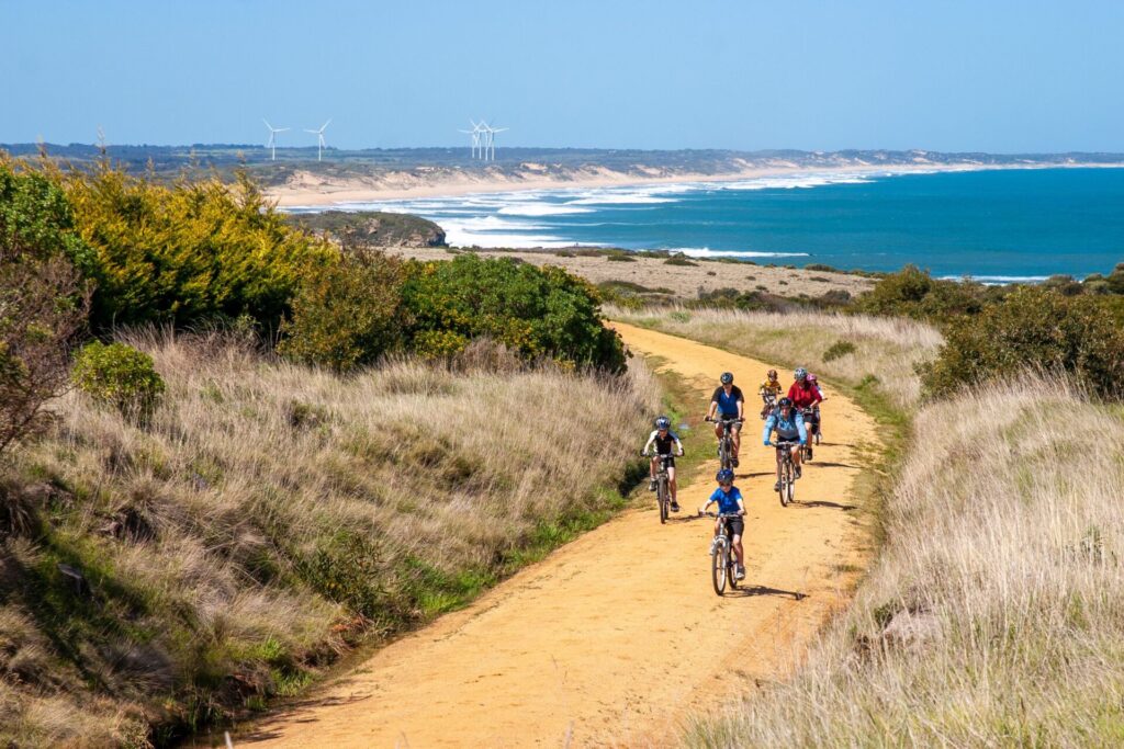
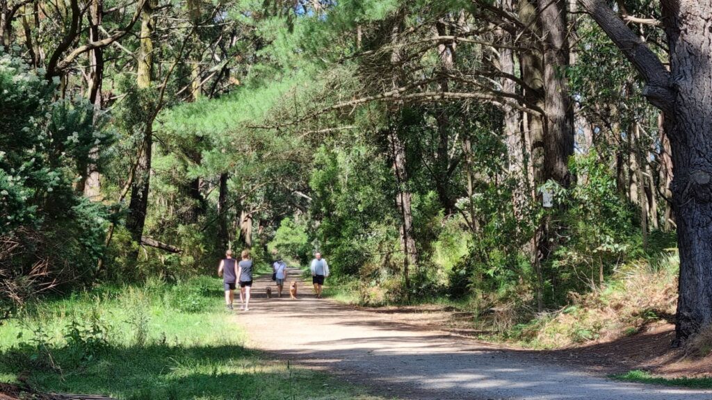
- The trail traverses open countryside and bushy areas while packing in views of Lake Narracan, the Haunted Hills and Yallourn Power Station
- It passes the manicured Moe Botanic Gardens and crosses Narracan Creek. There are access ramps to visit both from the trail
- After crossing the creek flats, the route passes Newborough
- A loop via Halls Bay Link and Sullivans Tk to Lake Narracan is well worthwhile for a picnic, a swim or as an alternative to the rail trail
- Riding or walking the trail can be combined with a drive to discover the Latrobe Valley’s history as Victoria’s powerhouse
Nearby Attractions
- Moe Botanic Gardens
- The Yallourn W Power Station, due to close in 2028
- Lake Narracan
- Yallourn Mine Lookout
- Old Brown Coal Mine Museum
- Haunted Hills MTB Park, Morwell
- Gippsland Heritage Park, Moe
Last updated: 12 October 2023
The trail traverses open countryside and bushy areas while packing in views of Lake Narracan, the Haunted Hills and Yallourn Power Station
ESTA Emergency Markers are installed along the trail. In an emergency, call 000 and quote the code on the marker post nearest to you, eg MYT10
Access Points
- Moe: Bennett St, on a gravel driveway near the corner of Narracan Drive (C103) to the right of 1 Bennett St. Nearby Albert St also offers access
- Newborough: Old Sale Road near Lowanna College
- Yallourn: Graeme Edwards Memorial Garden on Eastern Rd, off John Field Drive, has an electric BBQ, bike rack, water fountain, shelter and ample parking
Note: The surface is predominantly crushed rock but recent works have resulted in some sections with a rough, stony surface that needs to be taken slowly on a bike. Vehicular access near the power station has also caused some unevenness of the trail, which is relatively narrow.
Section Guides
Moe to Yallourn (7.2km)
- From Bennett St the trail passes the Moe Botanic Gardens and crosses Narracan Ck.
- At Old Sale Rd, you can detour to Newborough for supplies, or coffee if desperate.
- Detour at Sullivans Tk to gain access to Lake Narracan, where you can loop around via Southern Shore Rd and Halls Bay Link back to the rail trail. The link itself is more suited to mountain or cyclecross bikes. Picnics are allowed at the lake from the last Friday in October to the first Monday in May.
- Continue to Petits Tk and then pass under John Field Drive.
- The trail finishes at Graeme Edwards Memorial Garden on Eastern Rd just outside the power station.
- Return to Moe via the rail trail, Halls Bay Loop or John Field Drive.
![The trailhead at Bennett St, Moe is popular with walkers [2022]](https://www.railtrails.org.au/wp-content/uploads/2022/11/V26-059-The-trailhead-at-Bennett-St-Moe-2022-10-IMG_1097-300x225.jpg)
The trailhead at Bennett St, Moe is popular with walkers [2022]
![Narracan Creek bridge in Moe Botanic Gardens [2013]](https://www.railtrails.org.au/wp-content/uploads/2022/11/V26-058-Moe-2013-08-0867-300x169.jpg)
Narracan Creek bridge in Moe Botanic Gardens [2013]
![Narracan Creek bridge and surrounding gardens are a feature of the trail [2013]](https://www.railtrails.org.au/wp-content/uploads/2022/11/V26-058-Moe-2013-08-0869-300x169.jpg)
Narracan Creek bridge and surrounding gardens are a feature of the trail [2013]
![The foundations that supported the overhead wires are a clear reminder of the line's history [2013]](https://www.railtrails.org.au/wp-content/uploads/2022/11/V26-058-Moe-2013-08-0866-300x169.jpg)
The foundations that supported the overhead wires are a clear reminder of the line's history [2013]
![A big community effort on the signs, here at Newborough [2016]](https://www.railtrails.org.au/wp-content/uploads/2022/11/V26-010-Signs-2016-11-IMG_8647-300x200.jpg)
A big community effort on the signs, here at Newborough [2016]
![The trail near Newborough [2013]](https://www.railtrails.org.au/wp-content/uploads/2022/11/V26-107-Newborough-to-Yallourn-2013-08-0871-300x169.jpg)
The trail near Newborough [2013]
![Pacing it out on the trail viewed from the Sullivans Tk bridge [2022]](https://www.railtrails.org.au/wp-content/uploads/2022/11/V26-158-Pacing-it-out-on-The-Moe-Yallour-Raail-Trail-at-Sullivans-Tk-2022-10-IMG_1105-300x225.jpg)
Pacing it out on the trail viewed from the Sullivans Tk bridge [2022]
![The imposing Yallourn W power station at the end of the rail trail [2013]](https://www.railtrails.org.au/wp-content/uploads/2022/11/V26-156-Yallourn-2013-08-0876-300x169.jpg)
The imposing Yallourn W power station at the end of the rail trail [2013]
![There are three cooling towers at Yallourn W but four coal-fire boilers [2022]](https://www.railtrails.org.au/wp-content/uploads/2022/11/V26-158-There-are-three-cooling-towers-at-Yallourn-W-but-four-coal-fire-boilers-2022-IMG_1100-225x300.jpg)
There are three cooling towers at Yallourn W but four coal-fire boilers [2022]
![View across the valley from Yallourn [2006]](https://www.railtrails.org.au/wp-content/uploads/2022/11/V26-156-Yallourn-2006-04-4-300x200.jpg)
View across the valley from Yallourn [2006]
![The Halls Bay Link follows the shore of Lake Narracan's southern arm [2022]](https://www.railtrails.org.au/wp-content/uploads/2022/11/V26-158-The-Halls-Bay-Link-takes-you-along-the-shore-of-Lake-Narracans-southern-arm-2022-10-IMG_1104-300x225.jpg)
The Halls Bay Link follows the shore of Lake Narracan's southern arm [2022]
Do you know of a bike hire or transportation service on this rail trail that should appear here? If so, let us know at admin@railtrails.org.au.
Information and Links
For further information contact The Secretary, Moe Rail Trail Committee of Management at Latrobe City Council on Ph: 1300 367 700
Contact Rail Trails Australia
To contact us about this rail trail, email vic@railtrails.org.au
Background Information
Traditional Owners
We acknowledge the Boonwurrung people, the traditional custodians of the land and waterways on which the rail trail is built.
Rail Line History
The railway from Moe to Yallourn was constructed in the 1950’s to replace the original branch line, which joined the main line between Moe and Morwell. The new line meant that heavy coal trains didn’t have to climb through the Haunted Hills. The new line was subsequently closed in 1986, when briquette production was moved to Morwell.
Nearby Trails
Tyers Junction Rail Trail
Gippsland, 30km north of Moe, 160km from Melbourne
7 km


Walhalla Goldfields Rail Trail
165km east of Melbourne
7 km
Grand Ridge Rail Trail
Strzelecki Ranges, South Gippsland, Victoria, 160km from Melbourne
13 km

Rokeby to Crossover Rail Trail
North of Warragul, 103km from Melbourne
5 km
Noojee Trestle Bridge Rail Trail
100km east of Melbourne
3 km


Great Southern Rail Trail & Tarra Trail
South Gippsland, 130 km southeast of Melbourne
109 km
Gippsland Plains Rail Trail
Near Traralgon, Gippsland, 190km east of Melbourne
62 km
Powelltown Tramways
Yarra Ranges, 80 km east of Melbourne
31 km
Bass Coast Rail Trail
130km south-east of Melbourne
23 km
Eastern Dandenong Ranges Trail
Dandenongs, 50 km southeast of CBD
15 km
Warburton Rail Trail/Yarra Valley Trail
Yarra Valley, 50 km east of Melbourne CBD
48 km
Heathmont to Belgrave Trail
Eastern suburbs, 40 km from the CBD
16 km


Mornington Railside Trail
Mornington Peninsula, 60 km south of CBD
4 km
Red Hill Rail Trail
Mornington Peninsula, 90 km south of CBD
6.3 km
Outer Circle Rail Trail
Eastern suburbs, 6 km from Melbourne CBD
17 km
Rosstown Rail Trail
Southern suburbs, 9 km from the CBD
8.8 km
Hawthorn to Kew Rail Trail
Inner suburbs, 9 km east of Melbourne CBD
1 km
Nearby Trails
Tyers Junction Rail Trail
Gippsland, 30km north of Moe, 160km from Melbourne
7 km
Walhalla Goldfields Rail Trail
165km east of Melbourne
7 km
Grand Ridge Rail Trail
Strzelecki Ranges, South Gippsland, Victoria, 160km from Melbourne
13 km
Rokeby to Crossover Rail Trail
North of Warragul, 103km from Melbourne
5 km
Noojee Trestle Bridge Rail Trail
100km east of Melbourne
3 km
Great Southern Rail Trail & Tarra Trail
South Gippsland, 130 km southeast of Melbourne
109 km
Gippsland Plains Rail Trail
Near Traralgon, Gippsland, 190km east of Melbourne
62 km
Powelltown Tramways
Yarra Ranges, 80 km east of Melbourne
31 km
Bass Coast Rail Trail
130km south-east of Melbourne
23 km
Eastern Dandenong Ranges Trail
Dandenongs, 50 km southeast of CBD
15 km
Warburton Rail Trail/Yarra Valley Trail
Yarra Valley, 50 km east of Melbourne CBD
48 km
Heathmont to Belgrave Trail
Eastern suburbs, 40 km from the CBD
16 km
Mornington Railside Trail
Mornington Peninsula, 60 km south of CBD
4 km
Red Hill Rail Trail
Mornington Peninsula, 90 km south of CBD
6.3 km
Outer Circle Rail Trail
Eastern suburbs, 6 km from Melbourne CBD
17 km
Rosstown Rail Trail
Southern suburbs, 9 km from the CBD
8.8 km
Hawthorn to Kew Rail Trail
Inner suburbs, 9 km east of Melbourne CBD
1 km
10 reviews of “Moe – Yallourn Rail Trail”
Rode this today 14 January 2024. First 5km from Moe was fine, but the trail was closed near Yallourn power station due to several landslips. Can detour via Sullivans Track and Lake Narracan. Adds another 2km to the route to Yallourn. Hopefully the path repaired soon.
A very easy ride, starting from Yallourn and going to Moe and then return. Good surface for all types of bikes.
A great Rail Trail for walk. It is hard to imagine an electrified passenger train service running to Yallourn. The size of Yallourn W power station still amazes me. On the way back we walked down to the picturesque waters of Narracan Lake on the Latrobe river, a very nice place for a picnic.
This was the second of 3 short trails done over a 3 day weekend (Rokeby to Neerim Sth and Grand Ridge Trail the others). Signage to the start of the trail in Moe could be more prominent. The surface was in good condition and flat all the way to the Power Station at the end – quite a striking feature to arrive at. We took the Halls (?) loop deviation on the way back which was a nice way to enjoy views of Lake Narracan and experience a few undulations – returning to the main trail along Sullivan’s Track was on a quiet road with a gentle climb.
5/27. Moe to Yallourn #railtrail completed 9/2/19. 5 trails now completed for my 2019 challenge to ride every railtrail in Victoria this year. Cold and wet conditions but we need the rain and it’s very short so I didn’t mind at all. The rain however meant that I didn’t take any of the side tracks and appreciate the scenery. Yallourn Power Station is a highlight at the end. I had to do the track there & back.
You can follow me on FB Warwick Duncan – The 2nd Chance Man or Insta @warwick_rides
Went out on the trail this morning and found it to be a pleasant walk, I only have a couple of criticisms. It’s an 8k walk and there was only one seat to rest on, and another one would be there are no sign posts saying how far you’ve gone and how far you have left. Aside from that we all had a good 16k walk and were back to Moe for lunch.
Rode the Moe – Yallourn trail on November 5th 2014. Not a great rail trail – the quality of the track as you left Moe was poor and would only recommend for mountain bikes. Riding around the base of the Power Station to the picnic ground was the best part of the whole trail and should be better signposted on the trail.
Rode the Trail today in Sunshine after several wet weeks. The trail was dry enough with only a few wet patches. Blackberries will require attention before long as they are starting to grow onto the trail. This trail is very accessible from Melbourne by train with regular services to and from Moe. Unfortunately as for many of our trails, there is very little written history of the former railway. No one else around so I had the trail to myself. I agree with bnicho 5 Jul 13, and keep going to the picnic area at the end. It is well worth the extra few hundred metres. Hard to realise the height of the cooling towers at the Power Station. Highly recommended.
A heap of work is currently underway to add road base and improve the drainage. The main problem areas are done already (although they could still use a bit of compaction). And if you get out there soon on a workday the friendly digger driver loves a chat…
At the end remember to keep going on past the stop sign and along the footpathy bit to find the beautiful park for lunch.
Just did it on unicycles from Yallourn up five kilometres and back five. The track was soaked, giant puddles were everywhere and there were at least four fallen trees. Definitely a dry day trail.