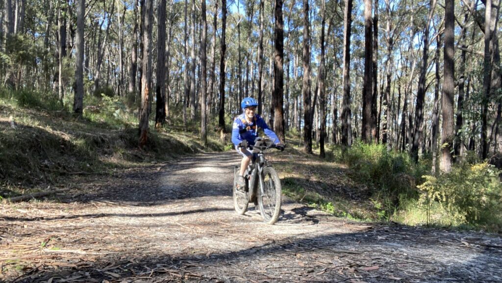
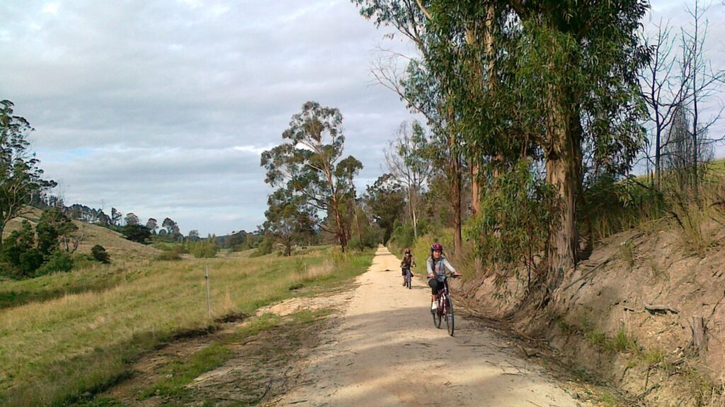
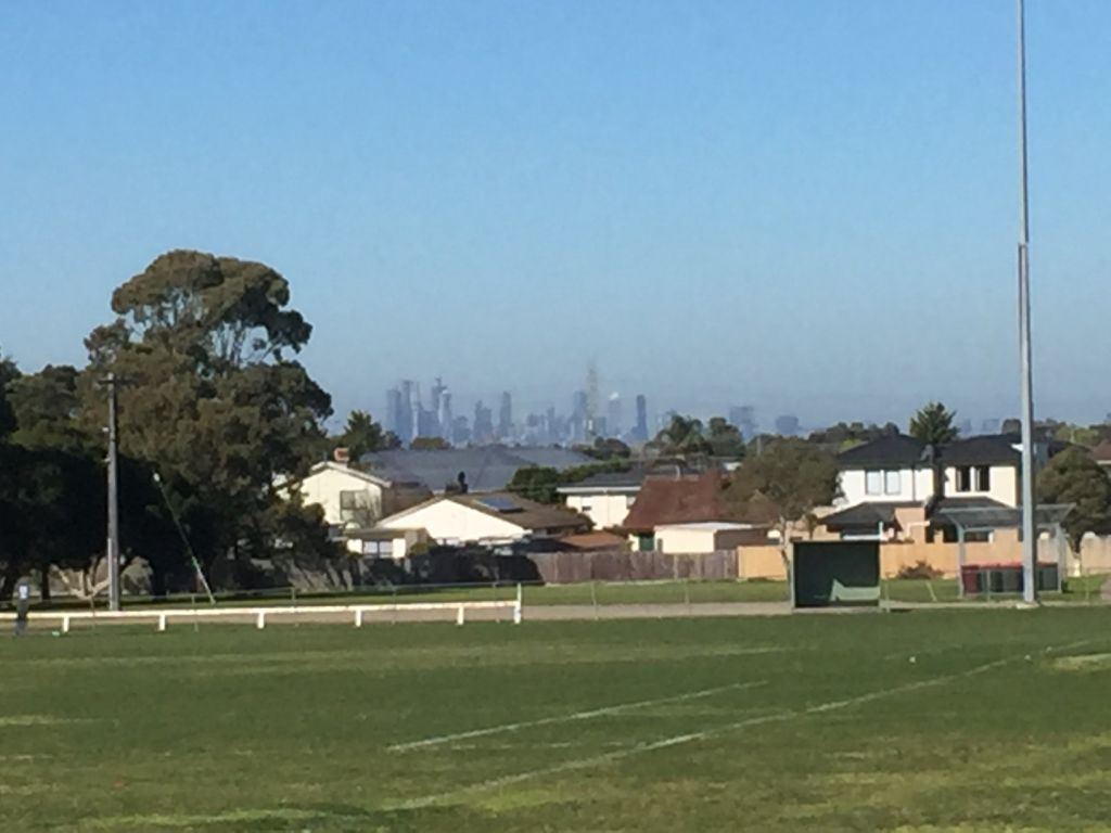
- Significant native forest, including mountain grey gums, standing straight and tall in the 360ha Crossover Regional Park
- Wombats, spiny anteaters, wallabies, sambar deer and birds including black-faced monarchs, olive whistlers and Superb lyrebirds hiding in the ferny gullies
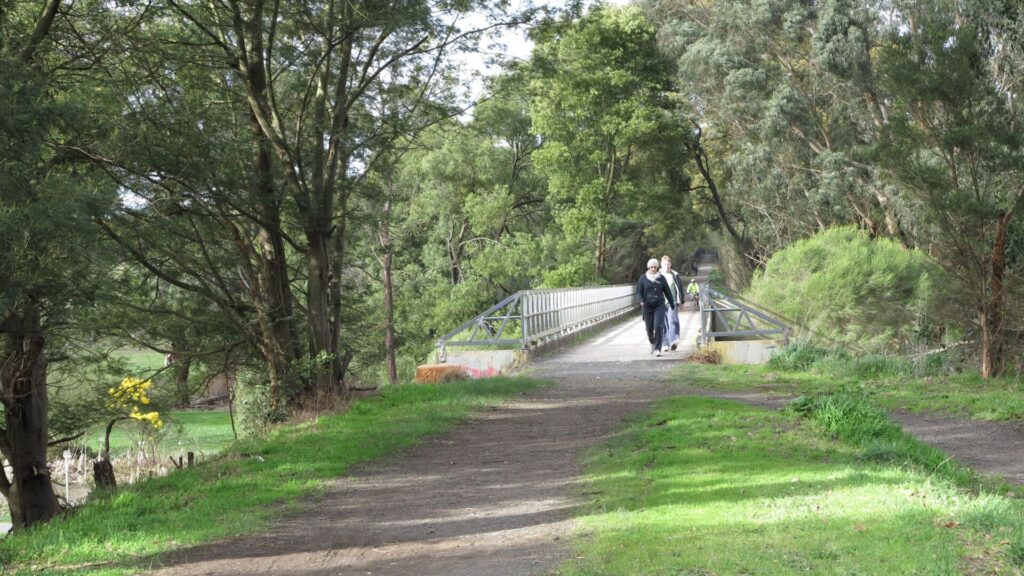
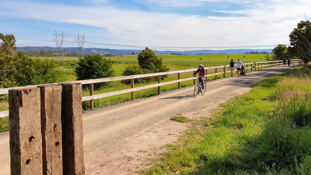
- A good all-weather trail with many facilities, including a shelter
- Interpretive signs at regular intervals to break the journey
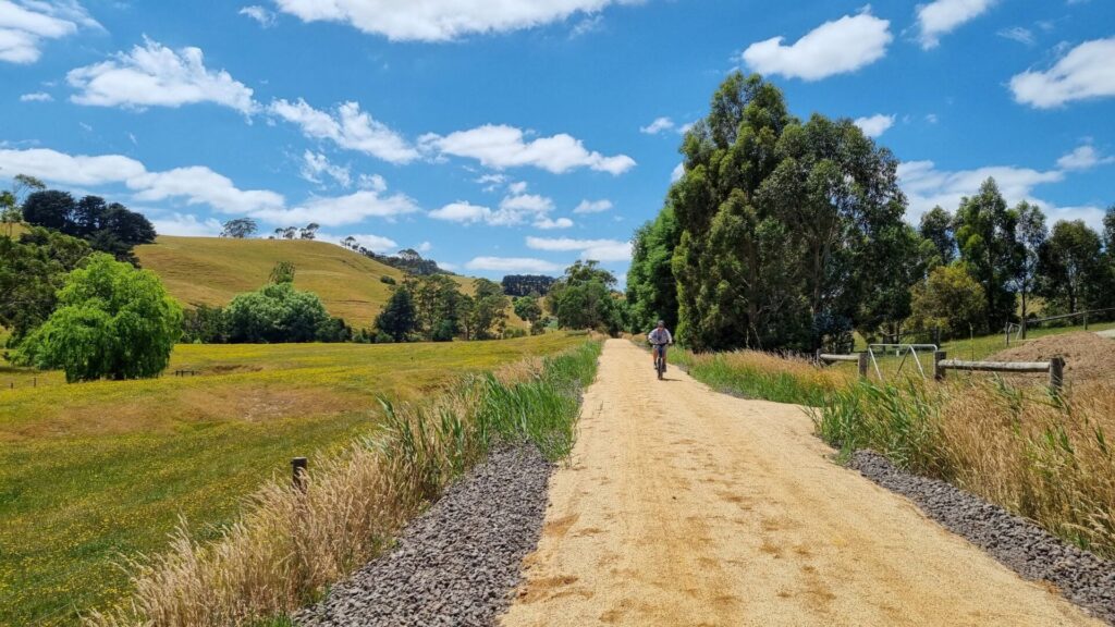
- Stunning views of prime, high-country farms if you continue climbing on the Rokeby to Neerim Trail
Nearby Attractions
- Noojee Heritage Centre explains some of the history of the area
- Noojee Trestle Bridge Rail Trail
- Crossover Mountain Bike Park with 22km of trails
- Tarago Reservoir
- Mt Baw Baw
- Bush camping areas
Last updated: 22 April 2023
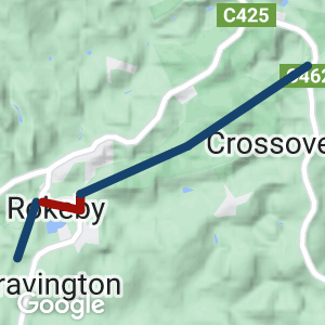
This little gem is in two parts, separated by a short, on-road section through Rokeby. It was part of the Warragul to Noojee branch line that featured the tallest trestle bridges in the Southern Hemisphere, of which the impressive Noojee Trestle is the sole survivor.
There are distance markers along the trail. In an emergency, call 000 and quote the figures on the emergency marker closest to your location
This remarkable countryside of tall trees, rolling hills and scenic views is only a short drive from the eastern suburbs of Melbourne.
Access Points
- Rokeby south: Limited parking on Old Telegraph Rd West, outside Rokeby Flora and Fauna Reserve
- Rokeby: Carpark at end of Lavinia St is southern end of Crossover Regional Park, toilets in recreation reserve hall
- Crossover carpark on Bloomfield Rd is 600m from the trail and another 200m from the trestle bridge
Section Guides
South Rokeby to Rokeby (1.5km)
- Enter the flora and fauna reserve, established in the 1960s, from Old Telegraph Rd West. Here you will find a number of endangered native plants.
- A short side path on the left leads to the Tarago River picnic area, a grassy spot with a picnic table, seats and good fishing.
- Sadly, someone filled in the cutting at Brandy Creek Rd, so you have to turn hard right and climb up that road to Rokeby Recreation Reserve. There’s a narrow path most of the way that takes you past the hall to Lavinia St and the start of the next section.
- Rokeby has a substantial market on the second Saturday of the month.
Rokeby to Crossover Trestle Bridge (3.8km)
- This stretch climbs on a 1-in-40 grade, which was the steepest continuous ascent on the line between Warragul and Noojee.
- Watch for the interpretive signs in a shelter and mountain bike tracks in the bush, built with the blessing of Parks Victoria.
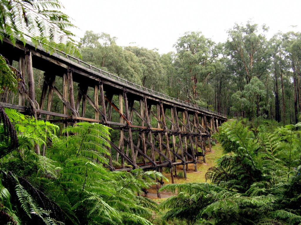
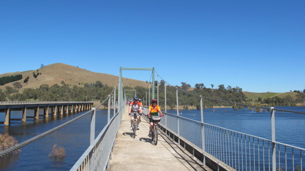
- At the top end of this section is the heritage-listed Crossover Trestle Bridge, built by the railway contractor in 1891 as a road bridge for traffic to pass over the railway line’s deep cutting.
BONUS TRACK
Rokeby to Neerim Trail (13km)
- Much of the rail corridor between Warragul and Noojee is now in private hands, but you can get an idea of what the train trip was like by travelling along the Rokeby to Noojee Trail.
- The first part of this journey is as described above, travelling via the rail trail through the Crossover Regional Park to the trestle bridge.
- Just before that bridge, the trail climbs to the west from the railway alignment to Bridge Rd and then follows the road reserve to Neerim South.
- The main street of this town has the former railway station’s turntable cone on display.
- The trail re-joins the rail corridor about 5km north of Neerim South (see map) for some spectacular mountain views at Apex Picnic Area Lookout.
- It ends on the outskirts of Neerim at Elton Rd, but planning is already underway to extend this shared-user path towards Noojee.
- Neerim South has shops, picnic tables, cafes and accommodation.
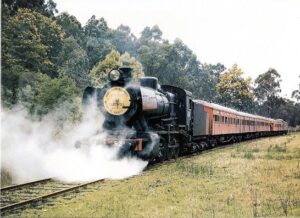
J521 on last pass train at Crossover 1958 HISTORY
![Riders near the Crossover Trestle Bridge [2023]](https://www.railtrails.org.au/wp-content/uploads/2023/03/V27-150-Riders-near-the-Crossover-Trestle-Bridge-2023-1590-225x300.jpg)
Riders near the Crossover Trestle Bridge [2023]
![Crossover Bridge [2009]](https://www.railtrails.org.au/wp-content/uploads/2020/11/5251605552122-300x225.jpg)
Crossover Bridge [2009]
![Exit from the rail trail near the Crossover Trestle, onto Bridge Rd and start of shared path to Neerim [2023]](https://www.railtrails.org.au/wp-content/uploads/2023/03/V27-150-Exit-from-the-rail-trail-near-the-Crossover-Trestle-onto-Bridge-Rd-and-start-of-shared-path-to-Neerim-2023-1585-300x225.jpg)
Exit from the rail trail near the Crossover Trestle, onto Bridge Rd and start of shared path to Neerim [2023]
![The Neerim Bower sculpture dominates the entrance to Neerim South on the Rokeby to Neerim Trail [2023]](https://www.railtrails.org.au/wp-content/uploads/2023/03/V27-200-The-Neerim-Bower-sculpture-dominates-the-entrance-to-Neerim-South-on-the-Rokeby-to-Neerim-Trail-2023-1584-300x225.jpg)
The Neerim Bower sculpture dominates the entrance to Neerim South on the Rokeby to Neerim Trail [2023]
Do you know of a bike hire or transportation service on this rail trail that should appear here? If so, let us know at admin@railtrails.org.au.
Information and Links
The Rokeby and Crossover Friends Group Inc. was formed in late 2003 by a mix of local people who share the same common interests in our beautiful slice of bush land. Our aim is to protect and maintain this land so it can remain a clean and safe home for wildlife and be enjoyed by the various user groups who visit the area.
For Further information about this trail click here The Friends of Rokeby and Crossover
Rokeby Neerim Rail Trail is managed by Baw Baw Shire Council and Parks Victoria.
Information on tourism services is available from the Visit Baw Baw website or by calling Baw Baw Shire 1300 BAW BAW (1300 229 229) or 5624 2411.
https://www.visitbawbaw.com.au/discover/explore/rokeby-to-neerim-trail/
Contact Rail Trails Australia
To contact us about this rail trail, email vic@railtrails.org.au
Background Information
Traditional owners
We acknowledge the Kurnai people, the traditional custodians of the land and waterways on which the rail trail is built.
Development and future of the rail trail
Baw Baw Shire is planning to extend the trail to include the Noojee trestle bridge to Noojee Station Museum rail trail.
Railway history
The Noojee line was opened in sections from 1890 to 1919 and closed between 1954 and 1958. Many sections have since been sold off.
The railway was built in 1890-91 as part of a Victorian Government plan to open access to regional Victoria. It was a branch line from Warragul to Neerim south for passengers, timber and agricultural equipment and produce. In 1917-19 the railway line was extended to Noojee, but in 1926 bushfires around Noojee burned out bridges and a large amount of line. The railway also sustained huge losses in the 1939 Black Friday bushfires,. By the 1950s the railway was finding it hard to compete with road transport and began closing in stages, until it finally closed in 1958.
Since the rail closure, the Crossover bridge has been in gentle decline due to neglect and lack of maintenance. Many of the decking timbers are rotting, yet many of the uprights appear strong and stable. The bridge has considerable artistic, engineering and tourist merit. One fascinating aspect is the picket style safety railing. There is also the depth of the fern lined, steep cutting below, along which the trains laboured.
This old timber bridge at Crossover was reportedly constructed in 1892 as part of the Warragul to Noojee rail link. In 1958 that rail line closed after decades of transporting timber, farm produce, local passengers and occasional tourists. This bridge is supported by six tall trestles and spans about forty metres of ferny cuttings.
Nearby Trails
Noojee Trestle Bridge Rail Trail
100km east of Melbourne
3 km


Powelltown Tramways
Yarra Ranges, 80 km east of Melbourne
31 km
Tyers Junction Rail Trail
Gippsland, 30km north of Moe, 160km from Melbourne
7 km
Moe – Yallourn Rail Trail
Latrobe Valley 130km east of Melbourne
7 km
Walhalla Goldfields Rail Trail
165km east of Melbourne
7 km
Eastern Dandenong Ranges Trail
Dandenongs, 50 km southeast of CBD
15 km
Warburton Rail Trail/Yarra Valley Trail
Yarra Valley, 50 km east of Melbourne CBD
48 km
Grand Ridge Rail Trail
Strzelecki Ranges, South Gippsland, Victoria, 160km from Melbourne
13 km
Heathmont to Belgrave Trail
Eastern suburbs, 40 km from the CBD
16 km

Great Southern Rail Trail & Tarra Trail
South Gippsland, 130 km southeast of Melbourne
109 km
Bass Coast Rail Trail
130km south-east of Melbourne
23 km
Gippsland Plains Rail Trail
Near Traralgon, Gippsland, 190km east of Melbourne
62 km

Mornington Railside Trail
Mornington Peninsula, 60 km south of CBD
4 km
Outer Circle Rail Trail
Eastern suburbs, 6 km from Melbourne CBD
17 km
Rosstown Rail Trail
Southern suburbs, 9 km from the CBD
8.8 km
Hawthorn to Kew Rail Trail
Inner suburbs, 9 km east of Melbourne CBD
1 km

Inner Circle Rail Trail
Inner suburbs, 5 km from the CBD
4.8 km
Red Hill Rail Trail
Mornington Peninsula, 90 km south of CBD
6.3 km
Sandridge Railside Trail
Melbourne city, 1 km from GPO
4 km
Webb Dock Bridge
Docklands, 1 km from Melbourne CBD
0.2 km
Meadowlink Rail Trail
Broadmeadows, 20 km north of CBD
1.2 km
Great Victorian Rail Trail
90 km north of Melbourne
134 km
Nearby Trails
Noojee Trestle Bridge Rail Trail
100km east of Melbourne
3 km
Powelltown Tramways
Yarra Ranges, 80 km east of Melbourne
31 km
Tyers Junction Rail Trail
Gippsland, 30km north of Moe, 160km from Melbourne
7 km
Moe – Yallourn Rail Trail
Latrobe Valley 130km east of Melbourne
7 km
Walhalla Goldfields Rail Trail
165km east of Melbourne
7 km
Eastern Dandenong Ranges Trail
Dandenongs, 50 km southeast of CBD
15 km
Warburton Rail Trail/Yarra Valley Trail
Yarra Valley, 50 km east of Melbourne CBD
48 km
Grand Ridge Rail Trail
Strzelecki Ranges, South Gippsland, Victoria, 160km from Melbourne
13 km
Heathmont to Belgrave Trail
Eastern suburbs, 40 km from the CBD
16 km
Great Southern Rail Trail & Tarra Trail
South Gippsland, 130 km southeast of Melbourne
109 km
Bass Coast Rail Trail
130km south-east of Melbourne
23 km
Gippsland Plains Rail Trail
Near Traralgon, Gippsland, 190km east of Melbourne
62 km
Mornington Railside Trail
Mornington Peninsula, 60 km south of CBD
4 km
Outer Circle Rail Trail
Eastern suburbs, 6 km from Melbourne CBD
17 km
Rosstown Rail Trail
Southern suburbs, 9 km from the CBD
8.8 km
Hawthorn to Kew Rail Trail
Inner suburbs, 9 km east of Melbourne CBD
1 km
Inner Circle Rail Trail
Inner suburbs, 5 km from the CBD
4.8 km
Red Hill Rail Trail
Mornington Peninsula, 90 km south of CBD
6.3 km
Sandridge Railside Trail
Melbourne city, 1 km from GPO
4 km
Webb Dock Bridge
Docklands, 1 km from Melbourne CBD
0.2 km
Meadowlink Rail Trail
Broadmeadows, 20 km north of CBD
1.2 km
Great Victorian Rail Trail
90 km north of Melbourne
134 km
6 reviews of “Rokeby to Crossover Rail Trail”
It's a trail of two halves, the southern half is a welcome relief after riding through rolling farmland from Drouin and even in November, it was wet in places. Turning left to the river at the T-Intersection is an absolute must and probably the highlight of the ride with the picnic table on the banks of the river. Unfortunately that t-intersection is the end of the railway formation with missing bridges and VicRoads/CRB plonking a new embankment on top of the former railway. Such a short visit to a grand engineering feat of the entire railway.
The second half is a climb all the way to the heritage listed Crossover trestle bridge which is dire need of maintenance. This trestle is a road bridge and honestly this is not the show stopper so try the Noojee trestle if you want to see a decent bridge. Off this trail are MTB tracks so access is easy to get to the head of the track. On the other side of the bridge, you can spot the former Crossover station platform from the roadside.
If you want a downhill ride for the kids with a car shuffle or want to combine with some very old school MTB then this is for you otherwise there are many better trails.
This is my local trail and I've watched it deteriorate over the past six years. In the winter of 2022 one 30-metre section around the 2km mark became impassable and a short hike-a-bike in the bush was necessary. The last kilometre up to the Crossover trestle bridge was more like a creek after any rain and there was plenty of it. It's dried out over summer and is pretty good now. The good news is that Baw Baw Shire have promised to improve the trail, especially the extended trail (not on the original railway formation) from Crossover to Neerim. A lot of scrub clearing was done early in 2023, improving the aesthetics along the 4kms of trail from Rokeby to Crossover. Here's hoping it's a harbinger of better things to come.
This was the first of three short trails my husband and I undertook over 3 days (Moe-Yallourn and Grand Ridge the other 2) – see comments on their respective pages). Signage to find the start at Rokeby was good. Trail surface is quite rough (making the going on my skinny tyred road bike a bit challenging at times – my husband’s hybrid was more suitable). The section from Crossover to Neerim Sth (while not technically a rail trail so therefore a combination of gravel road, gravel packed path adjacent to main road and dirt bush track) was quite well signposted – we missed one and spent a few hundred metres on the main road before refinding the path running parallel to the road. We realised when we turned at Neerim Sth for the return leg just how much climbing we had done on the outward leg – the return trip was all downhill.
I rode this trail today (26th December 2014) – the trail has been extended so you can ride all the way to Neerim – the part from Rokeby to Crossover is for mountain bikes – a hybrid should be okay, but will struggle when wet. The best parts are the views as you ride around Neerim. The trestle bridge at Crossover is no different from many of the other trestle bridges you can see on other rail trails around Victoria.
The signage issue has been addressed with new markers along the track and a new directional sign at Crossover end.
Gradual uphill climb from Rokeby to Crossover. Toilet, BBQ and playground facilities at Rokeby. Well maintained track, although trail bike riders seem to think they can use it too. The Crossover end ended abruptly with no signage on where to go next. Pleasent ride all the same.