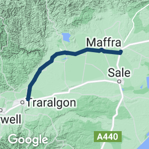
- Enjoy flat dairy-farm country with views of the Great Dividing Range to the north.
- Access by train or coach from Melbourne at both ends of the trail, making it possible to walk or ride one way and return by train, or continue on to Bairnsdale for the East Gippsland Rail Trail
- The long bridge over the Latrobe River floodplain and through-arch bridge over the Thomson are worth seeing
Nearby Attractions
- Fun activities for children in Stratford, with a skate park and exercise equipment.
- Gippsland Vehicle Collection, Maffra
- Heyfield Wetlands
- Latrobe Visitor Information Centre, Traralgon
- East Gippsland Rail Trail
Last updated: 29 January 2024
The trail rises only 50m. It has sections of bitumen but the surface is predominantly smooth gravel, which can get rutted when wet.
Access Points
- Traralgon Trailhead: Eastern side of Traralgon-Maffra Rd near Marshalls Rd intersection, 1 km north of the Princes Highway. Car park is a further 1.1km north of Princes Hwy with its entry off Burnets road, a few meters east of its intersection with the Traralgon-Maffra Road .
- If coming up from or going down to the highway, a new blue metal connecting path starts 40m north of the Princes Hwy and leads 1 km up to the trailhead, along the eastern side of Traralgon-Maffra Rd.
- Glengarry: Restored railway station opposite hotel on Main St.
- Toongabbie: Corner of Stringer and Traralgon-Maffra roads.
- Cowwarr: Western edge of town at old freight wagon on C105.
- Heyfield: Apex Park on Davis St (C105).
- Tinamba: On the C105 near CFA station.
- Maffra: Gippsland Vehicle Collection, Railway Place.
- Stratford: Apex Park by the Avon River.
Section Guides
Traralgon to Glengarry (8 km)
This section has a good quality, gravel surface.
- The official trailhead is 1 km north of the Princes Hwy on Traralgon- Maffra Rd near Marshalls Rd, but the car park is a further 1.1 km north at the Burnets Rd intersection. No toilets
- There are picturesque views across the Latrobe River floodplain and adjoining farmland with an impressively long embankment and four bridges. The original trusses and pylons have been topped with decking and handrails.
- Glengarry station is the only public railway building left on the trail and is now a cafe. The loading crane in the station precinct was brought from Rosedale on the Bairnsdale line to replace the original.
Traralgon is a large regional town serving the Latrobe Valley. It has a shopping plaza, fast-food outlets and accommodation.
Glengarry is a small town with a general store, bakery, hotel and BBQ area with a playground.
Glengarry to Cowwarr (16 km)
This section has a variable surface.
- The trail runs north to Toongabbie through a patch of remnant native grassland, with wildflowers in spring.
- A new bridge was installed across Eaglehawk Creek in 2020.
- Toongabbie to Cowwarr features peaceful riding through dairy country.
- About 3km after Toongabbie the path crosses a deep gorge with stone walls and steel barricades. These were installed in the 1950s to slow the erosion caused by Fells Creek.
- At Cowwarr, the station platform is 150m along the trail and several original bridges remain.
Toongabbie is a small town with a general store.
Cowwarr has a hotel, store and cafe.
Cowwarr to Maffra (28 km)
- The trail continues across the Thomson River bridge, which was completed in 2022, removing the last major diversion from the railway alignment. The bridge is a through-arch design and was craned into place as a single piece.
- The former Dawson siding is now a flora reserve.
- Approaching Heyfield, you pass the halfway point of the trail. The path plunges from the easement and travels several hundred metres along quiet Racecourse Rd, overlooking the wetlands reserve, before turning left on Davis St and right into the station precinct.
- The 6.5km to McKinnons Rd has a rougher surface but is suitable for hybrid and cyclocross bikes. The next 3km have an excellent gravel surface.
- From Tinamba the trail has an good surface and features several restored creek crossings.
- As the Macalister River floodplain is approached, the trail leaves the railway alignment due to a large dairy factory. Instead, the trail passes through a delightful wetland and forest on the way into Maffra.
- In Maffra, the service lanes along Johnson St need to be used to get through the CBD and back to the original alignment east of the old station. Take care on the busy road. The old station is still in Railway Place.
Heyfield is a small town but has a hotel with accommodation, cafes, a supermarket and other shops, a wetland, MTB park, and a large timber mill.
Tinamba is a small town with a general store and hotel.
Maffra is a regional centre with many facilities including cafes and restaurants.
Maffra to Stratford (10 km)
- This section is straight and flat.
- Where the Maffra branch line used to join the main one to Bairnsdale there is a steep ramp off the formation to cross Maffra-Stratford Rd, as a rail bridge has been removed.
- Continue alongside the working line to the Princes Hwy, where a shared path takes you across the Avon River road bridge into Stratford and under the highway to Apex Park.
- Note the new railway bridge across the Avon and the old one behind it.
- Continue north on McFarlane St to the station and town centre if desired.
Stratford is a small town with basic visitors’ facilities, including cafes and restaurants.
![Enjoying the rail trail near Glengarry [2014]](https://www.railtrails.org.au/wp-content/uploads/2022/07/V23-060-Traralgon-to-Glengary-5218-2014-05-300x169.jpg)
Enjoying the rail trail near Glengarry [2014]
![The long bridge over the Latrobe River near Traralgon [2014]](https://www.railtrails.org.au/wp-content/uploads/2022/07/V23-060-Traralgon-to-Glengary-5222-2014-05-300x169.jpg)
The long bridge over the Latrobe River near Traralgon [2014]
![Walking near the trailhead at Traralgon [2014]](https://www.railtrails.org.au/wp-content/uploads/2022/07/V23-060-Traralgon-to-Glengarry-5226-2014-05-WALK-300x169.jpg)
Walking near the trailhead at Traralgon [2014]
![Glengarry Station and its historic hand operated crane [2014]](https://www.railtrails.org.au/wp-content/uploads/2022/07/V23-110-Glengarry-5234-2014-300x169.jpg)
Glengarry Station and its historic hand operated crane [2014]
![Bridge across Eaglehawk Creek opened in 2020 [Deb Brown]](https://www.railtrails.org.au/wp-content/uploads/2022/07/V23-111-Glengarry-Eaglehawk-Creek-bridge-2020-11-300x201.jpg)
Bridge across Eaglehawk Creek opened in 2020 [Deb Brown]
![Toongabbie [2007]](https://www.railtrails.org.au/wp-content/uploads/2022/07/V23-157-Toongabbie-2007-03-1623_crop-300x169.jpg)
Toongabbie [2007]
![Enjoying a meal in Toongabbie [Gippsland Plains Rail Trail CoM 2014]](https://www.railtrails.org.au/wp-content/uploads/2022/07/V23-159-Toongabbie-6-2014-ECONOMY-200x300.jpg)
Enjoying a meal in Toongabbie [Gippsland Plains Rail Trail CoM 2014]
![Old GY type freight wagon at Cowwarr. These were once ubiquitous on branchlines around Victoria [Carolyn Crossley 2014]](https://www.railtrails.org.au/wp-content/uploads/2022/07/V23-210-GY-Wagon-Cowwarr-1-2014-05-300x141.jpg)
Old GY type freight wagon at Cowwarr. These were once ubiquitous on branchlines around Victoria [Carolyn Crossley 2014]
![Not quite the Sydney Harbour Bridge but, up close, the Thomson River bridge is still impressive and a great improvement for the trail [2022]](https://www.railtrails.org.au/wp-content/uploads/2022/07/V23-211-Thomson-River-Bridge-2022-06-300x184.jpg)
Not quite the Sydney Harbour Bridge but, up close, the Thomson River bridge is still impressive and a great improvement for the trail [2022]
![The Thomson River bridge north of Cowwarr was opened in 2022 completing the trail [Gippsland Plains Rail Trail CoM]](https://www.railtrails.org.au/wp-content/uploads/2022/06/V23-211-Thomson-Bridge-2022-06-1-300x169.jpg)
The Thomson River bridge north of Cowwarr was opened in 2022 completing the trail [Gippsland Plains Rail Trail CoM]
![Cycling between Heyfield and Dawson [Gippsland Plains Rail Trail CoM 2014]](https://www.railtrails.org.au/wp-content/uploads/2022/07/V23-210-Dawson-to-Heyfield-1-2014-300x200.jpg)
Cycling between Heyfield and Dawson [Gippsland Plains Rail Trail CoM 2014]
![Heyfield is a great place to stop for all ages [2014]](https://www.railtrails.org.au/wp-content/uploads/2022/07/V23-256-Heyfield-5176-2014-05-300x169.jpg)
Heyfield is a great place to stop for all ages [2014]
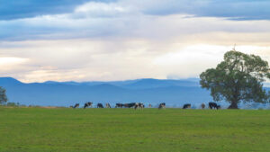
Views of the Great Dividing Range between Heyfield and Tinamba
![Cruising between Heyfield and Tinamba [2022]](https://www.railtrails.org.au/wp-content/uploads/2022/06/V23-257-Heyfield-to-Tinamba-RTA-T-shirts-PXL_20220226_050001797.MP_-300x225.jpg)
Cruising between Heyfield and Tinamba [2022]
![Old railway gates at Tinamba [2011]](https://www.railtrails.org.au/wp-content/uploads/2022/07/V23-305-Old-railway-gates-at-Tinamba-2011-300x225.jpg)
Old railway gates at Tinamba [2011]
![Wide-open dairy country between Tinamba and Maffra [Gippsland Plains Rail Trail CoM 2014]](https://www.railtrails.org.au/wp-content/uploads/2022/07/V23-307-Tinamba-to-Maffra-2-2014-300x197.jpg)
Wide-open dairy country between Tinamba and Maffra [Gippsland Plains Rail Trail CoM 2014]
![Bird hide on the Macalister River flats just before Maffra, which utilises the old railway bridge piers [Beth Ripper 2020]](https://www.railtrails.org.au/wp-content/uploads/2022/07/V23-360-Maffra-bird-hide-Macalister-River-flats-2020-06-8754-300x183.jpg)
Bird hide on the Macalister River flats just before Maffra, which utilises the old railway bridge piers [Beth Ripper 2020]
![Maffra Billabong trail on the diversion into Maffra [Gippsland Plains Rail Trail CoM 2014]](https://www.railtrails.org.au/wp-content/uploads/2022/07/V23-359-Maffra-Billabong-Trail-3-Walk-DOG-2014-300x168.jpg)
Maffra Billabong trail on the diversion into Maffra [Gippsland Plains Rail Trail CoM 2014]
![Maffra Station is, unfortunately, not part of the rail trail [2014]](https://www.railtrails.org.au/wp-content/uploads/2022/07/V23-359-Maffra-Station-5182-2014-05-300x169.jpg)
Maffra Station is, unfortunately, not part of the rail trail [2014]
![Maffra to Stratford in spring [2011]](https://www.railtrails.org.au/wp-content/uploads/2022/07/V23-358-Maffra-to-Stratford-5-2011-11-300x225.jpg)
Maffra to Stratford in spring [2011]
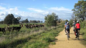
Interest from both sides of the fence between Maffra and Stratford (David Blundy 2012)
![Stratford Railway Station, where you can catch the train back to Traralgon and Melbourne [Gippsland Plains Rail Trail CoM 2014]](https://www.railtrails.org.au/wp-content/uploads/2022/07/V23-411-Stratford-Railway-Station-Vline-2-2014-283x300.jpg)
Stratford Railway Station, where you can catch the train back to Traralgon and Melbourne [Gippsland Plains Rail Trail CoM 2014]
Public Transport
There are PTV trains from Melbourne which service Traralgon and Stratford on the same line, typically with 3 trains a day in each direction. There are also PTV buses which service town along the trail. As always bicycle carrying restrictions apply.
Refer to the PTV web page for map and timetables, or your navigation program of choice.
Do you know of a bike hire or transportation service on this rail trail that should appear here? If so, let us know at admin@railtrails.org.au.
Information and Links
To report issues on the rail trail or for more information contact
Gippsland Plains Rail Trail Committee of Management – 7 Park Av, Cowwarr. 5148 9214
www.gippslandplainsrailtrail.com.au
Traralgon Visitor Information 1800 621 409.
Contact Rail Trails Australia
To contact us about this rail trail, email vic@railtrails.org.au
Background Information
Traditional owners
We acknowledge the Gunaikurnai people, the traditional custodians of the land and waterways on which the rail trail is built
Rail Line History
The line from Traralgon to Stratford via Maffra was built in 1883 and served as an alternative route to East Gippsland. It was busy until the 1950s carrying sugar beet from Maffra and timber from Heyfield. In its later years, the main purpose of the line was to serve the dairy industry in the Maffra area. The line closed in stages; from Traralgon to Cowwarr in 1986, then Cowwarr to Maffra in 1994. The rails were removed shortly afterward.
The first section of the rail trail opened in 2005 and it was fully opened in 2014, except for a diversion between Cowwarr and Dawson.
V-Line runs passenger train services from Melbourne to Bairnsdale via Traralgon, Sale and Stratford.
Another Reason to Visit Gippsland Trails
Posted: 29/01/24
Do you have Victoria’s 62 km Gippsland Plains Rail Trail on your bucket list? Or ...
More...‘Missing section’ of Gippsland Plains Rail Trail now completed
Posted: 30/06/22
The ‘missing section’ of the Gippsland Plains Rail Trail has finally been completed with the ...
More...Gippsland Plains Rail Trail (Vic) Fully Open
Posted: 12/05/14
The Gippsland Plains Rail Trail (GPRT) celebrated the opening of its final section from Traralgon ...
More...Opening of Gippsland Plains Rail Trail (Vic)
Posted: 30/04/14
The Gippsland Plains Rail Trail (GPRT) is celebrating the opening of its final section from ...
More...Gippsland Plains RT Receives Funding For Completion (VIC)
Posted: 30/10/13
Media release The Hon Peter Ryan MP Deputy Premier Minister for State Development Minister for ...
More...Funding for the Gippsland Plains Rail Trail
Posted: 04/06/13
Victorian Deputy Premier Peter Ryan, announced that $105,000 from RDV would be provided to Wellington Council ...
More...Surface upgrade on Gippsland Plains Rail Trail
Posted: 01/04/13
The newly upgraded surface on the Gippsland Plains Rail Trail from Glengarry to Cowwarr has ...
More...More Funding for the Gippsland Plains Rail Trail (VIC)
Posted: 19/10/12
Media Release: Wednesday 17 October 2012 $200,000 FOR GIPPSLAND PLAINS RAIL TRAIL – STAGE 1 Member for Morwell Russell Northe ...
More...Funding for Gippsland Plains Rail Trail (VIC)
Posted: 02/07/11
In May, State Member for Morwell, Russell Northe, announced an $800,000 State Government grant to help ...
More...State Budget Delivers for Gippland Plains Rail Trail (VIC)
Posted: 06/05/11
The Baillieu/Ryan Coalition Government's inaugural budget has delivered on its election commitments to Victorian ...
More...Opening of Gippsland Plains Rail Trail on October 1st
Posted: 12/09/05
Below is the contents of a flyer from the committee. Congratulations on all their hard ...
More...Nearby Trails
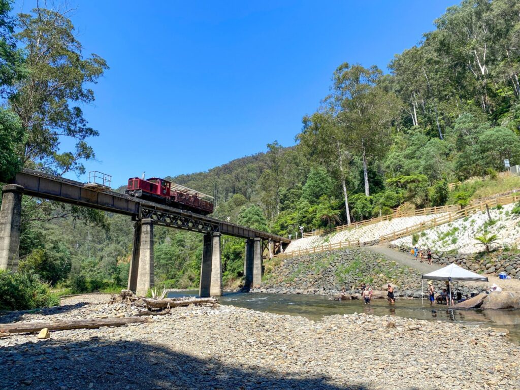
Walhalla Goldfields Rail Trail
165km east of Melbourne
7 km

Tyers Junction Rail Trail
Gippsland, 30km north of Moe, 160km from Melbourne
7 km


Moe – Yallourn Rail Trail
Latrobe Valley 130km east of Melbourne
7 km


Grand Ridge Rail Trail
Strzelecki Ranges, South Gippsland, Victoria, 160km from Melbourne
13 km


Noojee Trestle Bridge Rail Trail
100km east of Melbourne
3 km


Rokeby to Crossover Rail Trail
North of Warragul, 103km from Melbourne
5 km


Great Southern Rail Trail & Tarra Trail
South Gippsland, 130 km southeast of Melbourne
109 km


Powelltown Tramways
Yarra Ranges, 80 km east of Melbourne
31 km

Gippsland Lakes Discovery Trail
315km east of Melbourne
17 km


East Gippsland Rail Trail
East Gippsland, 280km east of Melbourne
96 km


Eastern Dandenong Ranges Trail
Dandenongs, 50 km southeast of CBD
15 km


Warburton Rail Trail/Yarra Valley Trail
Yarra Valley, 50 km east of Melbourne CBD
48 km




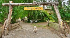 Rest and relax, only a short walk to the Tinamba Hotel.
28 reviews of “Gippsland Plains Rail Trail”
With 2 others I cycled this trail three days ago from Stratford to Traralgon, staying overnight in Maffra. Good accommodation at the Maffra Motor Inn and a good meal at the Community Sportsmen's Club. Good bakeries in Maffra and Heyfield for breakfast and lunch. A massive storm (strongest I have every experienced) the day before we rode had knocked down a couple of trees across the trail. But it was very easy getting around them. The trail is in excellent condition for all sorts of bikes, including a narrow tyre road bike ridden by one of us. The new bridge across the Thomson River is excellent and means the entire route can now be done off-road, unlike my previous ride along it which involved an on-road detour. The trail is well signed everywhere.
A big advantage of this trail is a train service at both ends (the only one in Vic?) 62km of flat terrain is not too demanding, plus two towns along the way with food and accommodation options allows for a relaxed ride. We overnighted in Heyford and loved the Stag & Doe cafe for the decor and the coffee. Maffco brewery and distillery in Maffra also good for beer lovers (nothing distilled is on sale yet despite the name). Ending in Traralgon, we took the option to do an extra 15km on new shared path to Morwell. It's a great initiative but half the trail is surfaced with loose gravel – not great unless you have a gravel bike. The rail trail surface was also a bit rough in places but generally OK. Signage lacking in places – we lost the trail heading west out of Heyford, also negotiating busy road bridges in Stratford and Maffra are both confusing if heading away from Stratford (the trail follows footpath on the right side of the road but not signed), both are no problem if heading towards Stratford.
loved the cows on everything in Cowwarr. Stayed in Mafra. Good ride for al.Good meal at the club.
I cycled this with a friend in March 2021. We brought our own bikes. We'd planned on cycling Traralgon to Heyfield and on to Stratford and catching the train back. But Vline service disruption (busses repalcing trains and unable to take bikes) meant my friend dropped me at Stratford, drove back to Traralgon, and then I slept at Stratford, her at Traralon, we both cycled to Heyfield (from opposite ends), slept there for second night, and then both cycled together to Traralgon.
Notes:
– CHECK vline train website in the days and hours before you go (we did, but otyhers didn't and got caught out)
– great cafes and bakery in Maffra for morning tea or lunch
– Heyfield Railway Hotel, enjoying great pub grub and cover band).
– Strong headwind Stratford to Traralgon, so recommend cycling the other direction.
– Track overall well maintained, various terrains, with one section that was very sandy and tricky. Signage mostly ok, but inadequate especially around Maffra where I had to ask locals.
– Lovely views of Strezlecki Ranges and fields
We enjoyed riding this trail very much on the 9/3/23. We started from a Caravan park 10 km Southwest of the start in Traralgon, and used the new Morwell to Traralgon shared path (just south of the Old Melbourne Road) to safely ride most of the distance to the start and avoid the Princes Highway until service lanes were available in town.
We started the trail proper at 10 am and arrived at Stratford at 4:30 with a number of breaks – we are slow riders but assisted greatly by a strong following wind!
The trail guide and map on this page were invaluable in helping us where the trail deviated from the rail formation east of Heyfield and in Maffra.
While the transverse planking on some of the bridges (including the Latrobe river flood plain) result in a rough ride, they are more than offset by the magnificent new bridge over the Thompson River. The trail surface was generally very good and while it went down to 2 wheel tracks on occasion, it was easy to follow and added to the sense of adventure.
We caught the 6:44 pm train back to Traralgon from Stratford after some exploring. Please note that good bike lights are needed to negotiate the shared trail back to caravan park if riding at night.
Overall a really enjoyable day!
Definitely four stars not three stars as i defaulted to below. Can we get the star rating moved to below this text box so that you see it just before hitting 'leave a review' button to finalise the review entry?
We rode this trail last weekend (long weekend for AFL Grand Final)over two days. Starting in Traralgon on Thursday we left our car at the train station and made our way out of town by back streets to the trail head. It would be great if a route for this could be signed. We stayed overnight at the approx halfway point of Heyfield at the modern motel style accommodation at the Railway Hotel. Beautiful weather that day was followed by rain on Friday. The only places open on the public holiday Friday morning were the IGA & the coffee van so breaky was egg & bacon muffins from the van in the park shelter. Five minutes on the trail in the rain saw us covered in gritty mud although some of us were worse than others which seemed to depend on how much muck our tire tread threw. Luckily it was not cold and the rain eased. We had a good morning's ride to Stratford, with a coffee stop in Maffra, before lunch and treats at the Stratford bakery (highly recommended). We then caught the V-line train from Stratford back to Traralgon to collect our car and continue on to explore other Gippsland trails over the weekend. This trail is lovely, with a good surface and easy to ride, and of course the new bridge is lovely and now means no road detour.Some of the sections could do with weed spraying to remove grass growing in the middle of the track and the distance signs need repainting to make them readable but the railway history information and town map signage is very good. The Railtrails trail info could do with an update to the one line on Heyfield being a small town and give details on it having pub, accommodation, cafes and supermarket.
See my review below. Definitely 4.5 stars not 3 ( which is the default on this site) A bit of maintenance required with mowing/weeding in a few spots. Cowwar has some cut "cows" and a food van
Heyfield to Cowwar section- the Thompson River Bridge is complete but the trail in and out of the bridge site is not and it is not officially open as of 30/4/22.
The detour on the road is very well signed and easy to follow. Apart from the section coming down into Heyfield this entire trail is very flat easy riding.
I rode this trail from Glengarry to Stratford after significant rain had fallen. The track was a little soft as a result, but hardened up on the return the following day. The track surface is very good and fine between Stratford and Heyfield. The gravel is coarser in sections between Cowwarr and Glengarry although still firmly packed. I rode 28mm road tyres inflated to 90psi. A wider tyre/lower pressure would be more comfortable.
The towns are well serviced and there is are places to get food and drinks without any major detour. There's a cute little cafe/kiosk at the Glengarry train station which was a nice place to finish the ride.
There is section of detour on the road which bypasses the Thompson river bridge (which I heard should be open as at 2/5/2022). The road section had minimal traffic and good sightlines.
The only annoyance were the gates at most road crossings which were difficult to ride through and often required dismounting.
The countryside that you ride through is very flat although still quite visually appealing and I enjoyed it more than I expected.
Rode this trail in one day immediately after a rain storm had passed through hadn't expected the significant and constant Westerly head wind. Based on bigger selection of accommodation in Traralgon and the less frequent rail service to Stratford decided to take V-line to and commence ride in Stratford and fight the head wind. Our e-bikes served us well but the wind took a hit on battery capacity such that a top up charge while enjoying lunch and a few wines at the Heyfield Railway hotel was required (thanks to the hotel hospitality). Trail surface is generally good but yes the weeds are encroaching on the trail. With side trips to retrace a childhood in the area the published 63km became 83km and the 11am start resulted in a sunset finish at 5:30pm in Traralgon. The Mantra Traralgon welcomed our e-bikes and provided secure storage. Enjoyed excellent V-line service return to Melbourne
This is a lovely trail. Pretty flat but gorgeous views of the mountains.
Surface is OK – needs a bit of weeding! – but bridge planks are very loose (not dangerous but also not secure).
Signage out of Traralgon is non-existant but OK when on the trail proper.
The local towns (especially Heyfield & Cowwarr) should buy-in to the trail and provide some support for the trail users (like simple food after 1pm on Saturday!).
Overall lovely experience but needs a bit of planning/food carriage which could be avoided.
Another new years day adventure. Initially it was to be the Cudgewa trail from Albury but the heat (38 degrees), timing and hills was not going to be ideal so I settled for the Beechy Rail Trail in the Otways however the train was full so I ended up selecting this with little knowledge as that was the next train out.
Exiting the train at Stratford, I was blasted with a hot breeze and burning sun. Being New years day there was only one cafe open and the IGA so I loaded up another 1.5litres of water just in case. This is not required as each town has an easy to access water supply to keep your bidons topped up. There is little foliage along the route to shelter you so on a hot day take lots of suncream. The surface is exceptional, flat and you can maintain a good pace apart from the odd small section. Do deviate along the river at Maffra, it's well worth it.
Signage is sometimes difficult to locate in the towns. In Stratford, the trail is on the northside of the highway bridge and Maffra and Heywood could do with some more signage. Kilometer markers are in some sections of the trail.
I agree with the narrow gates, especially on some of the quieter cross roads however they are fairly infrequent. The towns of Glengarry and Cowwarr were the surprise however if I was looking at doing a trail in Gippsland I would head to the Bairnsdale-Orbost trail.
Route will be up on Mapillary shortly… https://www.mapillary.com/app/?lat=-38.05851319073822&lng=146.82465824389988&z=10.523188348788413&mapStyle=OpenStreetMap
ISO, July 2020, another well signed rail trail start (including cafes ahead) next to toilets in the car park at Stratford. Perfect sunny weather and green paddocks made for a wonderful ride to Heyfield and a cabin at Blores Hill. I would have liked to camp in the small towns like Tinamba or Cowwarr near the pub but they don’t even have a small free camp area. At Traralgon the trail ends well out of town without clear directions to the railway station. I cycled back and again would have liked to camp at Glengarry and Toongabbie to support their community but no camp sites. After a relaxed week on this excellent trail I looked over the new Avon River rail bridge being constructed. I hope the Rail Trail will run over the old bridge, the last thing it needs is this piece of history to be demolished! A great Trail overall and I will be back.
15/27. This was my 15th rail trail on my journey to ride every trail in Victoria this year. The weather looked dodgy but it turned out ok for the ride undertaken on Sat 11/4. The area had 2mm of rain overnight, but the track was not wet at all and I think the moisture actually helped bind the surface together.
We started at the Traralgon end heading to Stratford, mainly because of the wind forecast. Sure enough we had a decent crosswind for the 1st 20km or so then a nice tailwind for the rest of it.
The 1st 4 bridges are not in very good condition, and in fact a lady, presumably from the management committee, was putting up warning signs as we rode past.
This Trail is very flat but a good track and a surprisingly pleasant ride through prime farmland and pretty towns. It has lovely views towards the ranges to the north.
I did it on a mountain bike with narrow tyres and the suspension locked, but my friend rode a road bike all the way. While it was a little uncomfortable on some of the stonier parts, and in particular the sandy section near Heyfield, she managed the whole way without too much trouble.
The signposting seemed to be ok in most places, but missing just where you need it most (eg. through some of the towns) meaning we took a couple of wrong turns. However the maps on the large signs were very helpful, and probably the best I’ve seen.
We had a nice lunch and coffee at Cafe 3858 at Heyfield, one of the few places that seemed to cater for cyclists. Heyfield is about half way to Stratford, so a logical place to stop.
The 5km on-road section was not a big issue as there was very few cars that passed us, and they were all courteous to cyclists.
My biggest criticism of this Trail is the very narrow gates at every road crossing. It is impossible to ride through them, especially on a flat bar, so it meant having to stop at every one. On a 60km + ride with dozens of crossings, that gets a little annoying.
My 2019 challenge is to ride every rail trail in Victoria this calendar year to promote organ donation. You can follow my rail trail exploits on FB Warwick Duncan – The 2nd Chance Man or Insta @warwick_rides. today.
My wife and I drove down from Dubbo in NSW to ride some of the Victorian Rail Trails. We decided to do the Gippsland Plains RT first as we had heard that there had been some upgrades done since we rode it many years ago. We had booked a motel in Traralgon for a few nights. We caught the morning train from Traralgon to Stratford with our bikes (cost a mere $4.20 each).
A quick coffee and cake at Stratford and we were on our way. The first section out of Stratford isn’t a rail trail, but a cycle path out a couple of k’s to the start of the actual trail. It is at a point where the old line junctioned off the main line, and sections of the old bridge overpass remain in place.
The surface is much improved since we last rode the trail, with a compacted fine gravel being the standard for the majority of the trail.
The first town you come to is Maffra, which is a busy thriving town with lots of traffic. The RT does not follow the original alignment through Maffra, and it can be a bit daunting riding with the traffic. Once you cross the river on the road bridge you are once again on a cycle path for a couple of k’s until you reach the old railway corridor. It becomes obvious why you can’t follow the old corridor as you discover the remains of a huge timber trestle bridge that crossed the flood plains at this point.
The trail continues through scenic farmland until we arrived at Heyfield where we enjoyed a delicious lunch. The trail out of Heyfield is a bit obscure with a steep incline to get back to the railway corridor. It isn’t long before you have to take a 2.5km diversion on some quiet country roads to get around a missing bridge over the Thomson River. Then on pass Cowwarr, Toongabbie and Glengarry. The old bridges across the Latrobe River and associated flood plains are now open. However they have been decked with chip board flooring, which is getting very weathered in some places. These will need some attention in the near future.
The trail finishes abruptly a few k’s short of Traralgon, forcing you to ride on the road into the town. The last bit of the old corridor is still available but not yet turned into a rail trail.
Our total distance from Stratford to Traralgon was 73kms. A really great ride with lots of little towns along the way.
Completed parts of the ride over several days whilst holidaying in the area. Stratford west to Tinamba had some great views back over the old tressle bridge. Traralgon north to Glengarie was interesting across the floodplain. Being through dairy country flies were a constant annoyance. Saw several riders even riding with insect nets!
Had a great time on this trail late October to early November 2017. Found the condition of the trail to be generally excellent. I did get a bit confused with the signage at Maffra. For more detailed information about my ride, feel free to read my rail trail cycling blog http://uncoolcyclingclub.com/gippsland-plains-rail-trail-heyfield-stratford/
My wife and I caught the V line to Traralgon, no issues, then difficult to find the start. of the trail. Glengarry for great coffee and yummy cake. Friendly town.On to Heyfield for a night at the Commercial Hotel. Excellent choice. Good grub and again friendly locals. Hope they get their wishes for the continuation of the hardwood timber industry. On to Maffra ,then Stratford for the train back to the city. Again , no worries with V line.The trail was good but needs constant upkeep with the wind blowing branches into your face due to new growth from the local edging shrubs. Signage was a bit hit and miss coming into Heyfield and again into Stratford. Resurfacing was evident and welcome as the track gets worn down to sand. Great work from the volunteers that maintain the trail. The crossings seem to be no problem if yyou slow a bit, same as other rail trails but , thankfully, no bollards at driveways.
Rode this Trail on 13/2/16 Traralgon->Stratford and return on 14/2/16. I found the trail to be very flat but does have some challenging sections around Heyfield. I had a trailer with our camping gear so the constant barricades were a bit off a pain although some had b-lines that could be navigated. The trail looked due for a bit of maintenance with a number of weeds coming through so hopefully this doesn’t get out of hand. The Dawson disconnect roads were very quiet. Overall a nice way to spend the weekend.
https://www.strava.com/activities/492162934
https://www.strava.com/activities/492981034
It it is a fantastic environment, rode a part of it yesterday.
However, the barricades/chicanes were a serious problem. I crashed trying to ride through one of them, luckily no damage.
I see other people have commented on them as well.
My thoughts go out anyone disabled especially if they don’t have a standard bike. Even if they can ride independently on roads they will need someone to help them out on the trail.
It would be far better if the trail met contemporary accessibility standards.
I rode the section between Heyfield and Stratford today (Tuesday 31st March 2015) to complete this trail. This section, between Heyfield and Stratford is much better than the trail between Traralgon and Heyfield. The trail quality is excellent, with only some sandy sections and machinery tyre churn up just outside of Heyfield – again the chicanes are too narrow. The surrounding farmland makes for a pleasant ride – with good distances between the towns. I had no issue riding through the centre of Maffra, with all of the vehicles giving me plenty of room on the road. It was a great day for a ride, pity about the haze.
I rode this trail from Traralgon to Heyfield and back yesterday (March 28th 2015). The trail has some great scenery attached to it. Heading north you get a great view of the Alps in the distance, while heading south you get the power station and Latrobe valley. I parked the car at the Burnetts Rd carpark, rode to Heyfield for lunch before returning. The only real hill in the whole section is just on the outside of Heyfield. The road detour between Cowwarr and Heyfield is no issue, as the few cars that passed me gave a wide berth. The two biggest issues I had are the trail surface and the chicanes! Between Traralgon and Cowwarr the surface is coarse gravel, while between Dawson and Heyfield it is sandy – this made it hard to build and maintain speed. While the chicane’s at the road crossings are far too narrow and long. It is impossible to ride through them, and every time I had to be careful not to snag a pedal. Overall a good day out.
I rode from Stratford to Traralgon yesterday 21 Oct 2014. A long day leaving Geelong at about 0500 and arriving back in Geelong at about 2000. I had no trouble taking my bike on the V Line Train services. An excellent ride most of the way with great scenery of mountains and farm land. Farmers and towns people were very friendly all the way. Magpies were irate with me riding past their home. A snake sunning it’s self on the edge of the trail was very agitated when I startled it. The grass is currently very long in places leaving only a narrow strip of gravel surface. It is being controlled but will take some time to complete. In some areas horses have left deep ruts. It would be good if horse riders would ride in the centre of the trail and leave both sides for bike riders. Several locations have Blackberries creeping out onto the trail surface. This will need attention quickly to avoid punctures and injuries. All Stations have signs however, a brief history of the site is required, eg, what was transported in and out of this station, and how flood effect the railway. All Station Sites were very nicely kept with plenty of shady rest areas. Great bridges across the Latrobe River and Flood Plain. Pity that the Thomson River section is yet to be completed, but no doubt it is in the planning. Overall, an interesting day, not too hard, and easily accessible from Melbourne. Quite an achievement for this sixty plus fella on a warm day. Highly recommended. Cheers.
I’ve been waiting and signing petitions for this trail for a long time now. We finally did it on Saturday 24th May. We live in Stratford. Caught the first train to Traralgon, met friends there then rode back to Stratty. They stayed the night at ours then caught the train home on Sunday morning. FANTASTIC. We had a brilliant day and it was nice to see the Boggy Ck crossing fixed (until the next flood) Next stage a trail beside the train track to Bairnsdale? Then you could link up with East Gippsland R/T and go all the way to Orbost.
Just completed the full length of this great trail from Stratford to Traralgon. Generally good surface conditions the whole way and the newly opened section from Glengarry to Traralgon is superb.
Many of the chicanes at the road crossings are very tight and almost impossible to negotiate without dismounting. A little more bike friendly would be appreciated. Some better signage to find the trail start/finish points at each end would be very useful. Also a bit tricky to find our way through Maffra.
We caught the morning train from Traralgon to Stratford which gets in a bit late (1030am) to comfortably do the whole ride in a day. Doing the ride first and getting the train back might be a better option. V Line can in theory refuse to take bikes if not enough room in the guards van but the very helpful station staff and guard juggled 4 bikes into the limited space available along with all the other passengers luggage. Perhaps an extra luggage van on the train as bike numbers grow?
Also need to make special mention of the lovely little town of Tinamba (halfway between Maffra and Heyfield) that doesn’t get a mention on the official trail description. Great country store with very friendly and helpful staff with a good selection of hot and cold food, coffees, snacks, newspapers, post office etc. Only 100m from the trail. The town also has a pub and a B&B.
I did this ride on the 13th of Jan, 2013. We started in Stratford with the intended end in Glengarry. The trail from Stratford to Heyfield was excellent, except for Tinamba to Traralgon-Maffra Road stretch where the track was half washed away with a rut big enough to break your bike. Heyfield to Cowwar via back roads was a very easy ride. Would recommend the back roads as the main road parts have a relatively high traffic flow with no shoulder room.
The track from Cowwar to Glengarry was by far the worst part. Track was over grown with blackberry bushes, I’m sporting a nice set of new scratches, parts of the track had washed away with the drainage underneath showing. The good thing though, the track areas a few km on each side of Toongabbie was fantastic, the locals obviously caring for it. An even better thing is at the time of riding new gravel was being laid about 6km north of Glengarry heading towards Cowwar.
I’d recommend this ride if they can improve the track significantly, and by look of the news section they are, from Glengarry to Cowwar. It would be even better if they can work on a set shoulder of the main road from Heyfield to Cowwar to encourage completing the full trail in a day.