
A high quality trail on the coastal fringe of Newcastle with significant bushland and wetlands despite its proximity to major population centres.
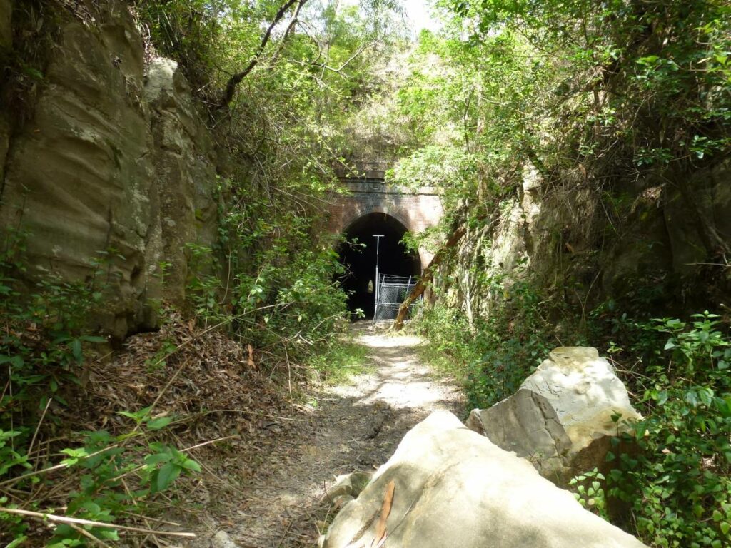
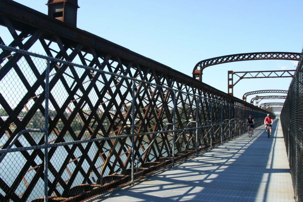
A major feature is the 180 m curved brick-lined tunnel beneath the Pacific Highway.
Public transport access at Adamstown.
The Fernleigh Awabakal Shared Track extends south from Belmont and will eventually connect to Blacksmiths and Swansea.
Nearby Attractions
- A short side trip to Redhead Beach.
- Connects with paths to the Lake Macquarie foreshore.
- The region has many historic sights.
The Newcastle region offers a large range of opportunities for visitors:
- The harbour front of Newcastle has been transformed into a major tourist venue, with many restaurants and shops.
- A light rail service connects Newcastle’s main railway station with the whole CBD and the beach.
- The Hunter Valley northwest of Newcastle is one of Australia’s prime wine production regions.
- Newcastle has a wide range of accommodation.
Last updated: 29 September 2024
Public transport access at Adamstown railway station, and access points at Whitebridge, Redhead, Jewells and Belmont have car parks.
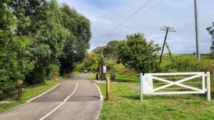
Two road crossings need care; at the start at the junction of Park Ave and Bailey St, and the busy connector between Park Ave and Brisbane Water Road, 700m from the start. The only other major crossing at Burwood Road has pedestrian lights.
Section Guides
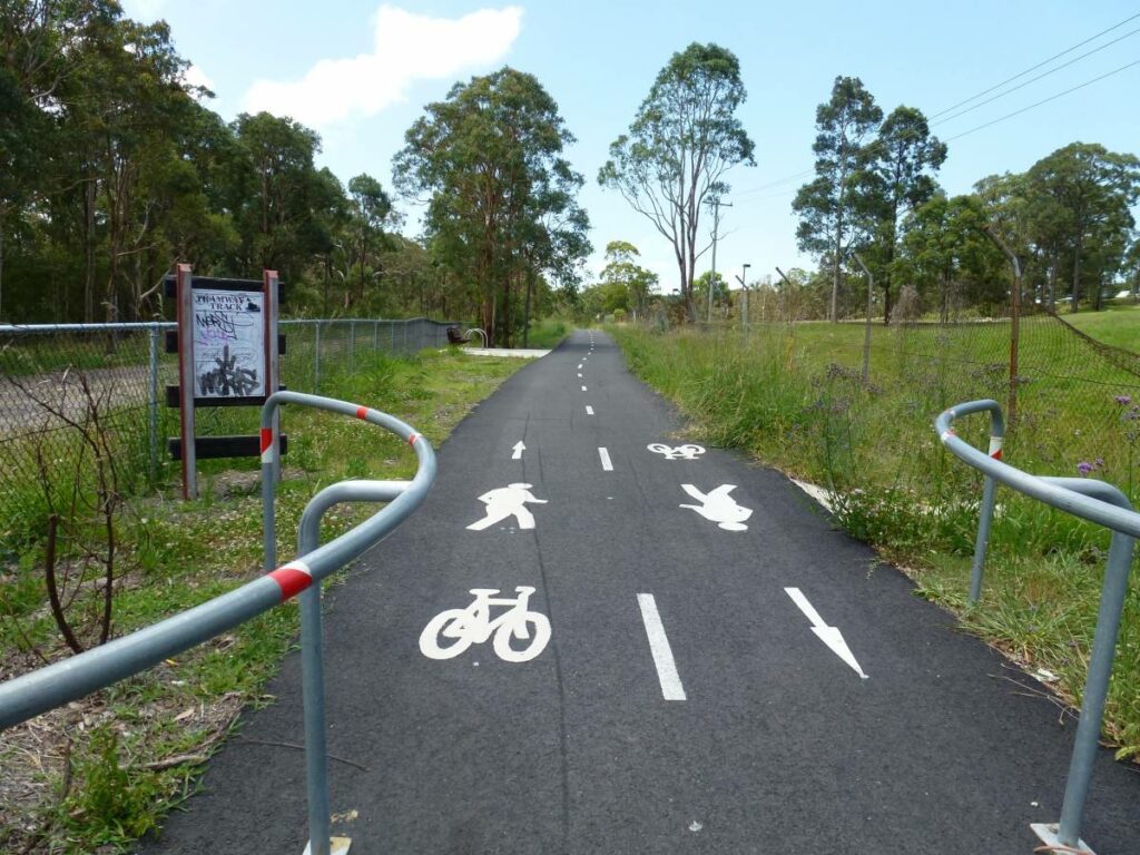
Adamstown to Whitebridge (6 km)
- From the south side of the Adamstown railway station (on the Newcastle Central Coast line), head southwest along Park Ave to the roundabout and the start of the rail trail proper. Or ride in from Newcastle CBD along well-signposted routes.
- The trail climbs on a slight gradient up to the 180m brick lined Fernleigh Tunnel under the Pacific Highway.
- It then runs through bushland in the Glenrock State Recreation Area.
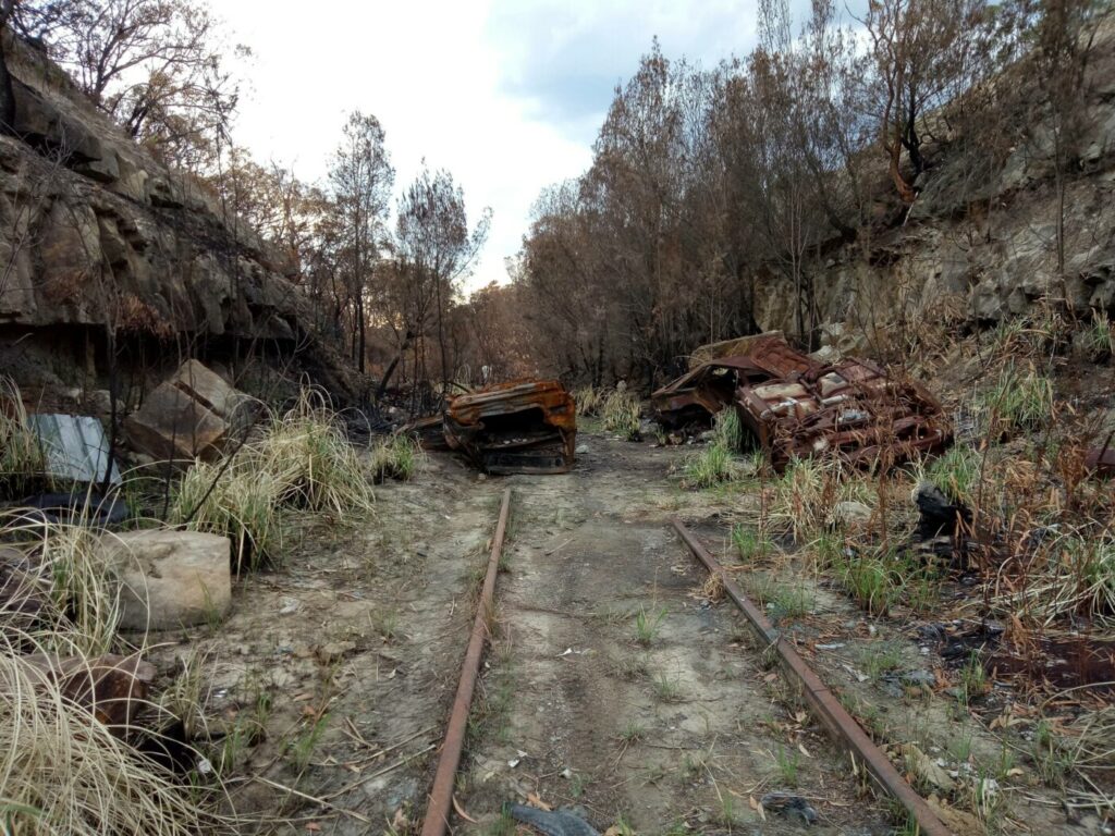
- Considerable traces of the original railway and the coal mines it serviced can be found along this stretch, including Kahibah Station (where the trail crosses the Great North Walk). Burwood Colliery Dam, etc. Interpretive signage tells the story of the mines and railway.
- Water and toilets are available at Whitebridge Station (5.5 km). This is the peak of the trail profile.
Whitebridge to Redhead (4.5 km)
- From Whitebridge the trail gently descends to Redhead through native bush.
- The restored station platform at Redhead is a major feature of this section. Here ‘up’ and ‘down’ traffic take different sides of the platform!
- Turn left at Cowlishaw St to ride 1.5km to Redhead Surf Beach (signposted), for shops and cafes. There is water available at Liles Oval near the turnoff.
Redhead to Belmont (5.5 km)
This section is basically flat and the scenery predominantly coastal bushland, the highlight being the boardwalk across wetlands.
- Kalaroo Rd must be crossed just prior to reaching the Jewells Station platform, where water is available.
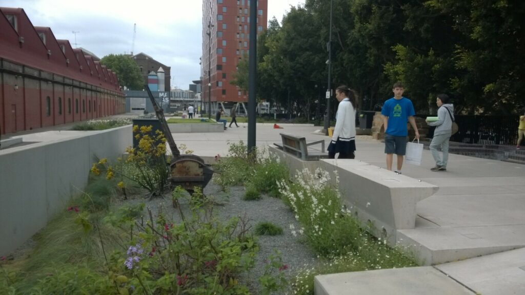
- The platform and surrounds at Belmont have had considerable landscaping and interpretive signage.
- The rail trail finishes in Railway Parade, a few hundred metres from the picturesque Lake Macquarie harbour at Belmont.
- Lake Macquarie City is extending the trail to the south towards Blacksmiths, in a project called the Fernleigh Awabakal Shared Track (FAST – under construction). While not a former railway, it will provide off-road access for much of the journey south to the Swansea Bridge (22 km) and Caves Beach (25 km).
- Belmont is the best place along the trail to buy refreshments, with a range of places to eat and drink close to that end of the track. There are also shops and cafes at Redhead and Adamstown.
Fernleigh Awabakal Shared Track
This trail has now been constructed from Belmont south to Swansea which also has a high quality sealed surface. The highlight is the Belmont Lagoon area just south of Belmont station. Once Belmont South is reached the trail is basically besides the Pacific Highway.
![Northern start at Adamstown railway station [2024]](https://www.railtrails.org.au/wp-content/uploads/2024/06/N21-020-Adamstown-station-2012-P1030555-300x225.jpg)
Northern start at Adamstown railway station [2024]
Start of the rail trail proper at Park Ave Adamstown
![Take care crossing this road at Kotara [2024]](https://www.railtrails.org.au/wp-content/uploads/2024/06/N21-030-Kotara-2024-05-25_114858-300x169.jpg)
Take care crossing this road at Kotara [2024]
![Heading up to the tunnel under the Pacific Hwy [2024]](https://www.railtrails.org.au/wp-content/uploads/2024/06/N21-030-Kotara-to-tunnel-2024-05-25_115556-300x169.jpg)
Heading up to the tunnel under the Pacific Hwy [2024]
![The tunnel under the Pacific Hwy is a real feature of the rail trail [2024]](https://www.railtrails.org.au/wp-content/uploads/2024/06/N21-050-Tunnel-2024-05-25_120123-300x169.jpg)
The tunnel under the Pacific Hwy is a real feature of the rail trail [2024]
![The tunnel under the Pacific Hwy is a real feature of the rail trail [2024]](https://www.railtrails.org.au/wp-content/uploads/2024/06/N21-050-Tunnel-2024-05-25_145852-300x169.jpg)
The tunnel under the Pacific Hwy is a real feature of the rail trail [2024]
![The site of the Fernleigh Loop siding. Significant effort has been made to leave historical remnants of the former railway line [2024]](https://www.railtrails.org.au/wp-content/uploads/2024/06/N21-055-Fernleigh-Loop-2024-05-25_120405-300x169.jpg)
The site of the Fernleigh Loop siding. Significant effort has been made to leave historical remnants of the former railway line [2024]
![Lots of clear signage, here at Kaihbah [2017]](https://www.railtrails.org.au/wp-content/uploads/2020/11/N21-111-Kaihbah-Fernleigh-Track-signage-3-2017-300x200.jpg)
Lots of clear signage, here at Kaihbah [2017]
![Typical woodland scenery between Kahibah and Whitebridge [2024]](https://www.railtrails.org.au/wp-content/uploads/2024/06/N21-105-Kahibah-to-Whitebridge-2024-05-25_121418-300x169.jpg)
Typical woodland scenery between Kahibah and Whitebridge [2024]
![Lots of interpretive signage about industrial and natural heritage of the corridor [2024]](https://www.railtrails.org.au/wp-content/uploads/2024/06/N21-105-Kahibah-to-Whitebridge-2024-05-25_121809-300x169.jpg)
Lots of interpretive signage about industrial and natural heritage of the corridor [2024]
![The former Whitebridge station site [2024]](https://www.railtrails.org.au/wp-content/uploads/2024/06/N21-150-Whitebridge-2024-05-25_123304-300x169.jpg)
The former Whitebridge station site [2024]
![Fern filled cutting after Whitebridge [2024]](https://www.railtrails.org.au/wp-content/uploads/2024/06/N21-155-Whitebridge-to-Redhead-2024-05-25_123811-300x169.jpg)
Fern filled cutting after Whitebridge [2024]
![Approaching the former Redhead station which had two tracks and now 'up' and 'down' traffic take different sides of the platform! [2024]](https://www.railtrails.org.au/wp-content/uploads/2024/06/N21-200-Redhead-station-2024-05-_DSF6346-300x200.jpg)
Approaching the former Redhead station which had two tracks and now 'up' and 'down' traffic take different sides of the platform! [2024]
![Redhead station was a major station on the railway line [2024]](https://www.railtrails.org.au/wp-content/uploads/2024/06/N21-200-Redhead-station-2024-05-25_143602-300x169.jpg)
Redhead station was a major station on the railway line [2024]
![Redhead beach is a short ride from the former station [2024]](https://www.railtrails.org.au/wp-content/uploads/2024/06/N21-200-Redhead-beach-2024-05-25_142011-300x169.jpg)
Redhead beach is a short ride from the former station [2024]
![Wetlands between Redhead and Jewells [2024]](https://www.railtrails.org.au/wp-content/uploads/2024/06/N21-205-Redhead-to-Jewell-2024-05-25_130222-300x169.jpg)
Wetlands between Redhead and Jewells [2024]
![Jewells station [2024]](https://www.railtrails.org.au/wp-content/uploads/2024/06/N21-250-Jewells-station-2024-05-_DSF6349-300x200.jpg)
Jewells station [2024]
![The trail is very popular due to the surrounding population and high quality so take care when walking or riding. [2011]](https://www.railtrails.org.au/wp-content/uploads/2024/06/N21-255-Jewells-to-Belmont-2011-04-P4020105-300x169.jpg)
The trail is very popular due to the surrounding population and high quality so take care when walking or riding. [2011]
![The long boardwalk over the significant Belmont Wetlands [2024]](https://www.railtrails.org.au/wp-content/uploads/2024/06/N21-255-Jewells-to-Belmont-2024-05-25_132239-300x169.jpg)
The long boardwalk over the significant Belmont Wetlands [2024]
![Vegetation is taking over the former terminus station of Belmont [2024]](https://www.railtrails.org.au/wp-content/uploads/2024/06/N21-300-Belmont-station-2024-05-25_133312-300x169.jpg)
Vegetation is taking over the former terminus station of Belmont [2024]
![On busy days a cafe operates at Belmont station [K Beard 2024]](https://www.railtrails.org.au/wp-content/uploads/2024/09/N21-300-Belmont-station-2024-09-6312-300x169.jpg)
On busy days a cafe operates at Belmont station [K Beard 2024]
![Continue a short distance south beyond Belmont station on the Fernleigh Awabakal Shared Track to the Belmont Lagoon [K Beard 2024]](https://www.railtrails.org.au/wp-content/uploads/2024/09/N21-310-Belmont-Lagoon-2024-09-6263-300x169.jpg)
Continue a short distance south beyond Belmont station on the Fernleigh Awabakal Shared Track to the Belmont Lagoon [K Beard 2024]
![To a lookout over the Belmont Lagoon wetlands which is a real feature. [K Beard 2024]](https://www.railtrails.org.au/wp-content/uploads/2024/09/N21-310-Belmont-Lagoon-2024-09-6286-300x169.jpg)
To a lookout over the Belmont Lagoon wetlands which is a real feature. [K Beard 2024]
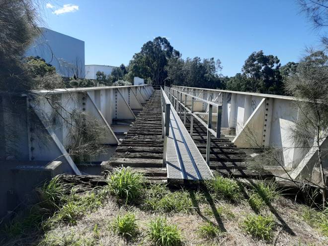
![Another bridge in the Belmont Lagoon area. [K Beard 2024]](https://www.railtrails.org.au/wp-content/uploads/2024/09/N21-310-Belmont-Lagoon-2024-09-6267-300x200.jpg)
Another bridge in the Belmont Lagoon area. [K Beard 2024]
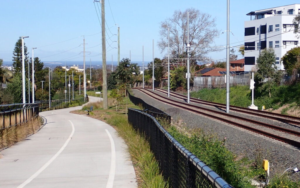
![From Belmont South on, the Fernleigh Awabakal Shared Track is mostly beside the Pacific Highway. [K Beard 2024]](https://www.railtrails.org.au/wp-content/uploads/2024/09/N21-350-Belmont-South-2024-09-6274-300x169.jpg)
From Belmont South on, the Fernleigh Awabakal Shared Track is mostly beside the Pacific Highway. [K Beard 2024]
 Leaders in Rail Trail Bicycle and E-Bike Hire in the Yarra Valley and Yarra Ranges. Customise your own riding adventure and help us support local businesses along the way. Family run and owned with extensive local knowledge, bike hire has never been so easy.
Bike Hire is available at Drift, just a short distance from the rail trail at Kotara.
Do you know of a bike hire or transportation service on this rail trail that should appear here? If so, let us know at admin@railtrails.org.au.
Information and Links
To report damage or problems contact City of Newcastle:
or Lake Macquarie: Lake Macquarie City Report an Issue
For more information on walking and cycling trails in this area, including maps:
City of Newcastle Fernleigh Track
Lake Macquarie City Fernleigh Track
Links to the region’s extensive pathway networks can be found on these pages.
Contact Rail Trails Australia
To contact us about this rail trail, email nsw@railtrails.org.au
Background Information
Traditional owners
We acknowledge the Awabakal people, the traditional custodians of the land and waterways on which the rail trail is built.
Rail Trail Background
Newcastle and Lake Macquarie councils purchased the land of the former private coal railway to Belmont and opened the first section of the rail trail, Adamstown-Kahibah (Burwood Rd), in 2003. Stage 3 of the Fernleigh Track from Whitebridge to Redhead opened in 2009. Stage 4 from Redhead to Jewells Station was completed in mid 2010 and the completed rail trail to Belmont was opened in March 2011.
A trail was extended south by Lake Macquarie Council as the Fernleigh Awabakal Shared Track project in 2024, and will eventually connect to Blacksmiths and Swansea.
Rail line history
The railway opened in the late 1880s to transport coal from mines in the Lake Macquarie area to the Port of Newcastle. Evidence of some of the mines is still visible from the track. It was also used as a passenger service between Belmont and Newcastle with stations at Kahibah, Whitebridge and Redhead. The last passenger train ran in 1971. Coal mines along the corridor began to close in the 1980s and the line ceased to be used in 1991. Remnants of the former railway are visible all along the Fernleigh Track.
Shiraz to Shore – The Hunter’s Cycle Tourism Opportunity
Posted: 26/08/24
The Hunter Joint Organisation of Councils in NSW is made up of the ten local ...
More...Design taking shape for new Fernleigh Track amenities block
Posted: 11/12/20
A new amenities block on the Fernleigh Track rail trail in NSW will include an ...
More...Cessnock City Council Trails Strategy recognises value of colliery rail network
Posted: 23/06/20
Cessnock City Council (CCC) recently released their Trails Strategy. The Strategy was developed by CCC ...
More...NSW continues the momentum for developing cycling facilities
Posted: 19/06/20
Lake Macquarie and Newcastle City Councils are showing what can be done when it comes ...
More...Newcastle’s Fernleigh Track to be extended
Posted: 19/02/20
The very popular Fernleigh Track – Adamstown to Belmont Rail Trail is set to be extended ...
More...Nearby Trails
Glendale to Wallsend Tramway Track
13 km from Newcastle City
8.5 km


Fassifern to Toronto Greenway Track
26 km from Newcastle
4 km


Awaba – Wangi Wangi Rail Trail
130 km north of Sydney

Richmond Vale Rail Trail
160 km north of Sydney, 12 km northwest of Newcastle

Lavender Bay “High Line”
Milsons Point to Waverton
Meadowbank Railway Bridge
15 km west of Sydney
0.5 km
The Goods Line
2 km from the Sydney GPO
1 km
Rosehill to Carlingford Railside Trail
Western Sydney, 23km from Sydney CBD
5 km
Pippita Rail Trail
19 km west of Sydney, near Sydney Olympic Park
Nearby Trails
Glendale to Wallsend Tramway Track
13 km from Newcastle City
8.5 km
Fassifern to Toronto Greenway Track
26 km from Newcastle
4 km
Awaba – Wangi Wangi Rail Trail
130 km north of Sydney
Richmond Vale Rail Trail
160 km north of Sydney, 12 km northwest of Newcastle
Lavender Bay “High Line”
Milsons Point to Waverton
Meadowbank Railway Bridge
15 km west of Sydney
0.5 km
The Goods Line
2 km from the Sydney GPO
1 km
Rosehill to Carlingford Railside Trail
Western Sydney, 23km from Sydney CBD
5 km
Pippita Rail Trail
19 km west of Sydney, near Sydney Olympic Park

16 reviews of “Fernleigh Track”
This track is stunning. We did find that we needed to ride slower as it was so pretty and filled with birds and lizards and we really wanted to take it all in. There are also lovely side tracks to explore. It was great to see a mix of people using the trail from young families to older families and even some cyclists in training. Everyone was courteous and friendly. Facilities were great and I could ride this every day.
If in Newcastle worth a visit, the trail is being extend towards Swansea, that will be good. The trail is well maintained, it can get very busy.
Great to ride the Fernleigh Track. Stayed at Belmont and were able to ride to the start of the trail from our accommodation. Beautiful ride, loved riding through the tunnel and past old stations.
My wife and I rode this yesterday for the first time, the track is really beautiful and very satisfying. We’re going back next week with friends, which will be a blast. We had planned to get something to eat at Fernleigh Cafe, but it was closed(closes at 11:30am on the weekend). We will be better prepared next time.
Been along this track many times. The tunnel is a feature, but I never grow tired of the cabbage tree palms around the Belmont TAFE end which has new toilets and good parking. A common exit for me is Redhead oval to go to the Beach. Great also to continue up past the old Redhead rail platform to Whitebridge platform, with plenty cafes nearby at shops above. The path continues on through beautiful bushland, the tunnel, and down to Adamstown. Best 30km return ride around, beautiful surroundings, no cars, just a couple of good crossing points, really nice cafes at Belmont (lake edge) and Whitebridge shops. 5 stars for sure.
Rode this on the 19th of August 2022.
Fantastic Rail Trail.
Nearly all of the trail has shade.
Loved the way that the old station platforms were kept as part of the trail (especially Redhead).
Lovely shady trail – great birdlife – tends to have slight incline running from Belmont to Adamston so downhill is on the way back 🙂 – for a coffee or a lunch at the Adamson end of the trail be prepared to go up the hill for an extra 500 metres to find the shopping precinct where the cafes are – for a healthy and tasty lunch or snack try the Ha Ha Cafe .. it was pretty good.
At Adamstown end goto Ha Has Cafe for healthy toasty lunch n coffee.
Have ridden this trail many times in the past. Walked a short section around the tunnel yesterday. A great trail passing through a variety of bush. It’s shorter than many but among the best trails in Australia, and is justifiably popular with local runners, walkers and cyclists. Note: was told that the trail and parts of the adjacent Glenrock Lagoon were closed due to fire. The trail at least now appears to be open.
A fantastic family ride with the kids (9 and 11). A few complaints and grumbling going up from Belmont, but much quicker and easier coming back Rail tunnel was fun. We were passed by some “serious cyclists”, but it was never a problem or a danger. You just need to keep an eye out for other trail users.
https://hikingtheworld.blog/2018/01/11/fernleigh-track-lake-macquarie/
This is a fantastic track and should be for everyone. I find the Lycra cyclist very arrogant on this track, pacing at fast road speeds and expecting everyone to get out of their way. It was not enjoyable taking my 4 yr old twins on a scooter ride with cyclist not slowing down. A bad accident waiting to happen if it hasn’t already. Should be a reinforced speed limit on this track.
I rode this trail over the Easter weekend 2017 with my partner and her brother. What a great asset for Newcastle, the ride was easy and as mentioned above even had areas where no pedaling was required. I know for certain of other areas in the Hunter Valley that have disused rail tracks which could easily be converted to this purpose. Look in Victoria where there are over 700 kms of tracks which attract many avid users. Get on-board to press the State Government to release this land to Local Councils so we can see more of this great activity.
Although NSW has very few rail trails, the Fernleigh trail is excellent. It has a great surface and traverses really nice country. It comes complete with some old stations and a tunnel. It will suit a family ride, no problem. Just watch the road crossings. Five stars from me.
I rode this trail this afternoon (26/3/16) with my brother, as part of doing the three main rail trails around Newcastle. This is a fantastic trail and I really enjoyed it. The highlight is the Fernleigh tunnel – which is the best rail tunnel I have come across on the trails I have undertaken. It is clearly a popular trail with a lot of other users on the whole of the trail. The trail is sealed and in very good state, though there a few road crossings that don’t provide good visual of the oncoming traffic. There is one long hill up to Whitebridge – and a great downhill, I don’t think I needed to pedal for 4 kms. I thoroughly recommend this trail and will be back.
I love this rail trail. It is well maintained and is easy to get to the start by train, which is just near the roundabout on Park Avenue just behind Adamstown Station. Once I get to Belmont I ride around the northern side of the lake and then link up with the Glendale to Wallsend track and onto Jesmond and Lambton and home.
The Address of the starting Point and End Point is not very apparent. For the benefit of the users the address should be provided in more detail along with GPS location, Street number and Street name