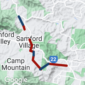
The surburban railway to Ferny Grove once extended a further 32km to Dayboro. Short sections of this railway are now rail trails. which are popular with Brisbane mountain bikers due to their proximity to the many trails in the Brisbane Forest Park and the Samford Valley.
- Some short but picturesque sections of rail trail close to Brisbane. Accessible from Ferny Grove railway station. Roads occupy the old rail corridor within the Brisbane City Council Area. The former railway is clearly evident in the Conservation Park, rejoining quiet local roads for the section into Samford.
- An extensive network of recreation trails has been mapped by the Moreton Bay Regional Council, more suitable for horse riders and mountain bikes than walkers. Trails within the and around Samford are easy to locate.
Last updated: 23 November 2022
The route is a combination of sealed quiet roads and sealed rail trail from Ferny Grove to Samford.
Section Guides
Lanita Road (2.5km)
- The Lanita rail trail can be easily accessed from Ferny Grove Station. Leaving Ferny Grove railway station, the first 2.5km (approx) of the old railway alignment is now road. Lanita Road is a quiet outer suburban street, suitable for walking or cycling.
Ferny Grove does not currently have any real facilities near the station except for a service station convenience store.
Lanita Rail Trail (1.8km)
At the end of Lanita Road is a vehicle turning circle. A path leads up to the start of the trail which runs through the southern part of Brisbane Forest Park. The rail trail can be distinguished from other forest trails being sealed and by substantial railway embankments and cuttings. The trail ends at a gate at the western edge of the park.
Information on connecting trails in the Brisbane Forest Park can be found at MTB Dirt’s Brisbane Forest Park and Ironbark Gully pages.
McLean Road
The busier McLean Road (South and North) then picks up the railway alignment. Along this road is the site of Queensland’s worst railway accident. On Labour Day, 5 May 1947, a picnic train descending the steep grade of the Samford Range left the rails resulting in the death of 16 people including the driver and fireman. The accident was due to excessive speed, apparently because the driver was unfamiliar with the stretch of track. A cairn marks the spot beside McLean Road.
Take care dog-legging across Camp Mountain Rd, the route is well signposted.
At the end of McLean Road North a sealed section of true rail trail begins again up to Petersons Rd.
The corridor is then out of bounds so take the quite undulating Petersons Rd and Camp Mountain Rd into Samford
Samford Village
The railway can be picked up again where it passes through Samford Village. A short section of the formation remains as a walking trail connecting the northern and southern sections of Cash Avenue. The Samford Museum complex houses the original Ferny Grove railway station and has information on the line.
Samford is now a popular visitor destination with numerous eating establishments and a park.
Currawong Rail Trail (1km)
A further 1km section of the line can be walked or ridden north from Currawong Road. It leads to the entrance to a railway tunnel under Mount Samson Road. The far end of the tunnel has been blocked and it is now used by Queensland University to study the resident bat colony. Steps lead up to the road above where there is a plaque marking the location of the tunnel. The section may be muddy after rain. The tunnel is not able to be entered; the northern end was filled when the site was used as the local rubbish tip.
![No guessing the name of the railway station! [2022]](https://www.railtrails.org.au/wp-content/uploads/2022/06/Q09-058-Ferny-Grove-station-2022-06-12_132911-300x169.jpg)
No guessing the name of the railway station! [2022]
![The road out to the start of the rail trails [2022]](https://www.railtrails.org.au/wp-content/uploads/2022/06/Q09-058-Ferny-Grove-start-point-2022-06-12_130516-300x169.jpg)
The road out to the start of the rail trails [2022]
![Start of the true rail trail at about 2.5km from Ferny Grove station [2022]](https://www.railtrails.org.au/wp-content/uploads/2022/06/Q09-058-Ferny-Grove-start-point-2022-06-12_130512-300x169.jpg)
Start of the true rail trail at about 2.5km from Ferny Grove station [2022]
![Typical scenery on the rail trail [2022]](https://www.railtrails.org.au/wp-content/uploads/2022/06/Q09-058-Lanita-Rd-to-Maclean-Rd-South-2022-06-12_140155-300x169.jpg)
Typical scenery on the rail trail [2022]
![The trail is popular with walkers and riders [2022]](https://www.railtrails.org.au/wp-content/uploads/2022/06/Q09-058-Lanita-Rd-to-Maclean-Rd-South-2022-06-12_140640-300x169.jpg)
The trail is popular with walkers and riders [2022]
![Finishing the first section at Maclean Rd South [2022]](https://www.railtrails.org.au/wp-content/uploads/2022/06/Q09-058-Maclean-Rd-South-end-2022-06-12_134041-300x169.jpg)
Finishing the first section at Maclean Rd South [2022]
![Travelling along Maclean Rd South to the next section [2022]](https://www.railtrails.org.au/wp-content/uploads/2022/06/Q09-105-Maclean-Rd-2022-06-12_142314-300x169.jpg)
Travelling along Maclean Rd South to the next section [2022]
![A dog-leg across Camp Mountain Rd. The route is well sign posted [2022]](https://www.railtrails.org.au/wp-content/uploads/2022/06/Q09-105-Maclean-Rd-2022-06-12_142949-300x169.jpg)
A dog-leg across Camp Mountain Rd. The route is well sign posted [2022]
![Start of the next section at end of Maclean Rd North [2022]](https://www.railtrails.org.au/wp-content/uploads/2022/06/Q09-105-Maclean-Rd-to-Peterson-Rd-2022-06-12_142649-300x169.jpg)
Start of the next section at end of Maclean Rd North [2022]
![End of the rail trail at Petersons Rd [2022]](https://www.railtrails.org.au/wp-content/uploads/2022/06/Q09-105-Maclean-Rd-to-Peterson-Rd-2022-06-12_143857-300x169.jpg)
End of the rail trail at Petersons Rd [2022]
![Some significant undulations in Petersons Rd on the way to Samford [2022]](https://www.railtrails.org.au/wp-content/uploads/2022/06/Q09-105-Peterson-Rd-2022-06-12_144047-300x169.jpg)
Some significant undulations in Petersons Rd on the way to Samford [2022]
![The park at Samford is very popular [2022]](https://www.railtrails.org.au/wp-content/uploads/2022/06/Q09-157-Samford-2022-06-12_152100-300x169.jpg)
The park at Samford is very popular [2022]
![Start of a short section to Yugar at the end of Currawong Court [2022]](https://www.railtrails.org.au/wp-content/uploads/2022/06/Q09-157-Currawong-Trail-to-Yugar-2022-06-12_150605-300x169.jpg)
Start of a short section to Yugar at the end of Currawong Court [2022]
![Currawong Trail [2022]](https://www.railtrails.org.au/wp-content/uploads/2022/06/Q09-157-Currawong-Trail-to-Yugar-2022-06-12_150624-300x169.jpg)
Currawong Trail [2022]
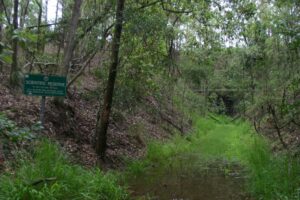
The Tunnel at the end of the Currawong section at Yugar (2007)
Do you know of a bike hire or transportation service on this rail trail that should appear here? If so, let us know at admin@railtrails.org.au.
Information and Links
Some rail trail sections and roads are managed by the Moreton Bay Regional Council. The sections of the corridor within Brisbane City Council are on road.
While in Samford visit the Samford Museum
http://www.vivasamford.org.au/userfiles/SamfordValleyTrailGuide_26Jul2012.pdf
Contact Rail Trails Australia
To contact us about this rail trail, email qld@railtrails.org.au
Background Information
Traditional Owners
We acknowledge the Waka Waka and Yuggera people, the traditional custodians of the land and waterways on which the rail trail is situated.
Development and future of the rail trail
In 2012 the Department of Transport and Main Roads considered two options for a commuter cycle route between Samford and Ferny Grove. Parts of the cycleway would utilise more of the former rail corridor.
In 2016, the Rail Trail $ 2.1 Million upgrade was completed (which included a new concrete bridge over Dry Creek)
Rail Line history
The railway opened in sections starting in 1916. It reached Dayboro in 1920. The line closed in 1955 after only 35 years of service. The line was closed beyond Ferny Grove in 1955 after the freight traffic was lost to road transport
On 5 May 1947, a packed excursion train derailed at Camp Mountain, after Ferny Grove railway station, in what is Queensland’s worst rail tragedy. There were 16 fatalities, including both the driver and fireman of the train, and 38 others were injured.
The Camp Mountain train disaster is still the largest loss of life in a rail accident on the Queensland railway network.
Stage one of the Ferny Grove to Samford Rail Trail upgrade is now complete.
Posted: 15/01/17
Stage one of the Ferny Grove to Samford Rail Trail upgrade is now complete. (more&...
More...Nearby Trails

Wulkuraka – Brassall Rail Trail
41 km west of Brisbane.
3 km


Caboolture – Wamuran & Loop Rail Trail
Caboolture, 47km north of Brisbane
10.5 km


Bethania to Beaudesert Rail Trail
South of Brisbane, 40km from Brisbane
3.5 km


Brisbane Valley Rail Trail
Wulkuraka is 46km southwest of Brisbane
161 km


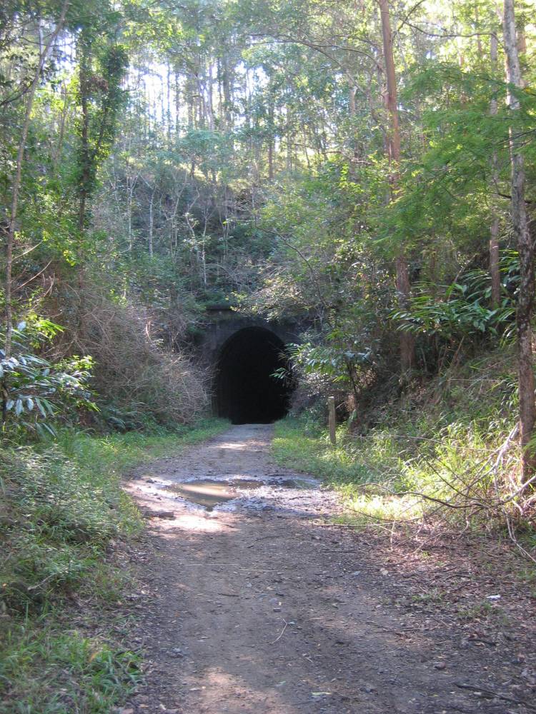
Dularcha National Park Rail Trail
North of Brisbane, 77km from Brisbane
3.2 km


Fassifern Rail Trail
Boonah South East of Brisbane
6 km


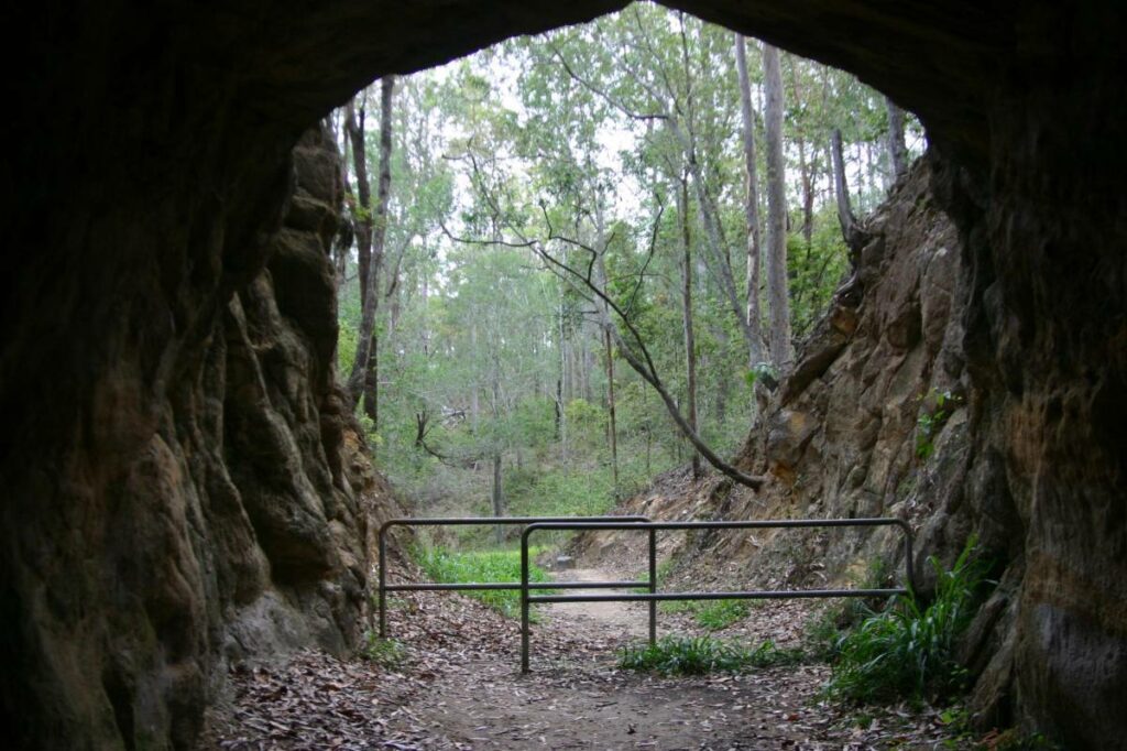
Canungra Tramway Tunnel
Canungra, south of Brisbane, 80km from Brisbane
1 km


Buderim Tramway Heritage Trail
100 km north of Brisbane
2 km

South Coast Rail Trail and Ernest Junction Tunnel
60 km from Brisbane
0.75 km

Westbrook to Wyreema Rail Trail
Toowoomba

Mary Valley Rail Trail
158km north of Brisbane (via Caboolture), 167km via Gympie, 53km west of Noosa
5 km


Muntapa Tunnel
15km south of Cooyar, north of Toowoomba, 210km from Brisbane
0.6 km


2 reviews of “Ferny Grove Rail Trail”
Great area for cycling really enjoyed my visit. The rail trail is not that long but when you join it up with the link cycling paths it makes it worthwhile. I rode from my friends home in Arana Hills to Samford Village and back so ended being around 32 kms. It's hard to pick out the rail trail apart from the signs I couldn't see any of the heritage of the train left .
Could recommend this trail glad I visited it.
The true rail trail sections are short but worth it, especially if walking or wanting to explore the surrounding mountain bike trails.
Images and map have been updated to reflect current good status