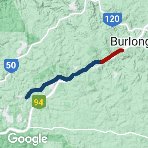
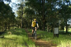
- The Kep Track (formerly known as the Farming Heritage Trail) runs from Mundaring Weir to Northam, passing through the communities of Mundaring, Sawyers Valley, Mount Helena, Wooroloo, Wundowie, Bakers Hill, and Clackline
- There are trail heads at Mundaring Weir and Northam, and multiple access points. Riders can park and ride from pretty much any town along the way
Nearby Attractions
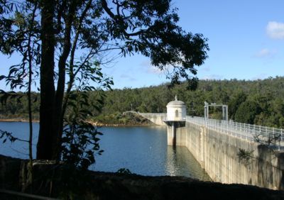
- The Goldfields Water Pipeline runs parallel to sections of the trail. Built between 1898 and 1903, the ‘Golden Pipeline’ runs for 560 km from Mundaring Weir to Kalgoorlie and remains in use. It was designed by C.Y. O’Connor, the Government Engineer-in-Chief. Sadly, O’Connor took his own life shortly before the pipeline was commissioned
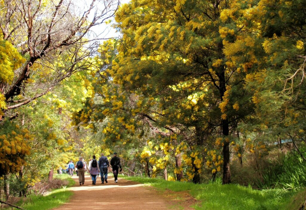
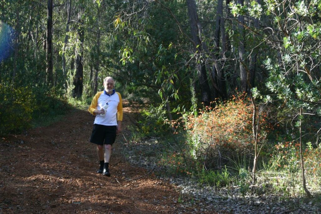
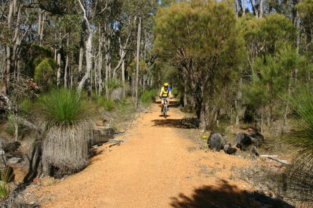
- Part of the trail is in Beelu National Park, where visitors journey through jarrah forest past marris and stands of wandoo. Wildflowers line the track in season.
Last updated: 9 December 2022
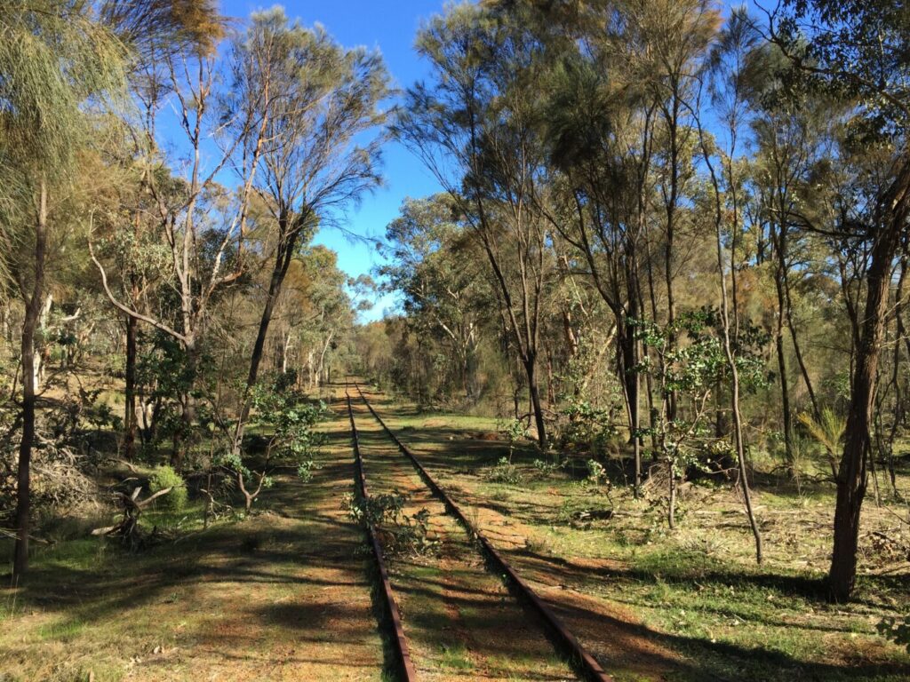
- the trail follows the alignment of the former Eastern Railway to Clackline
- east of Clackline, the trail uses a combination of sealed roads and gravel tracks
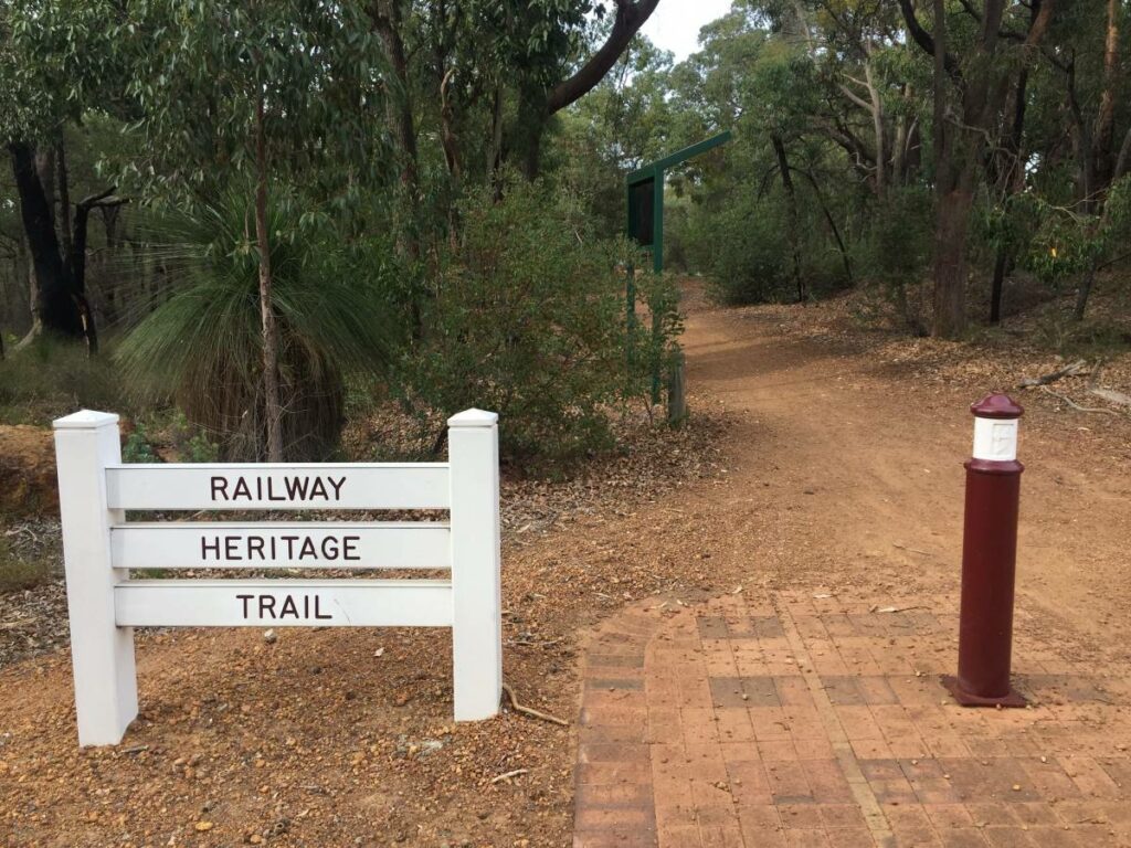
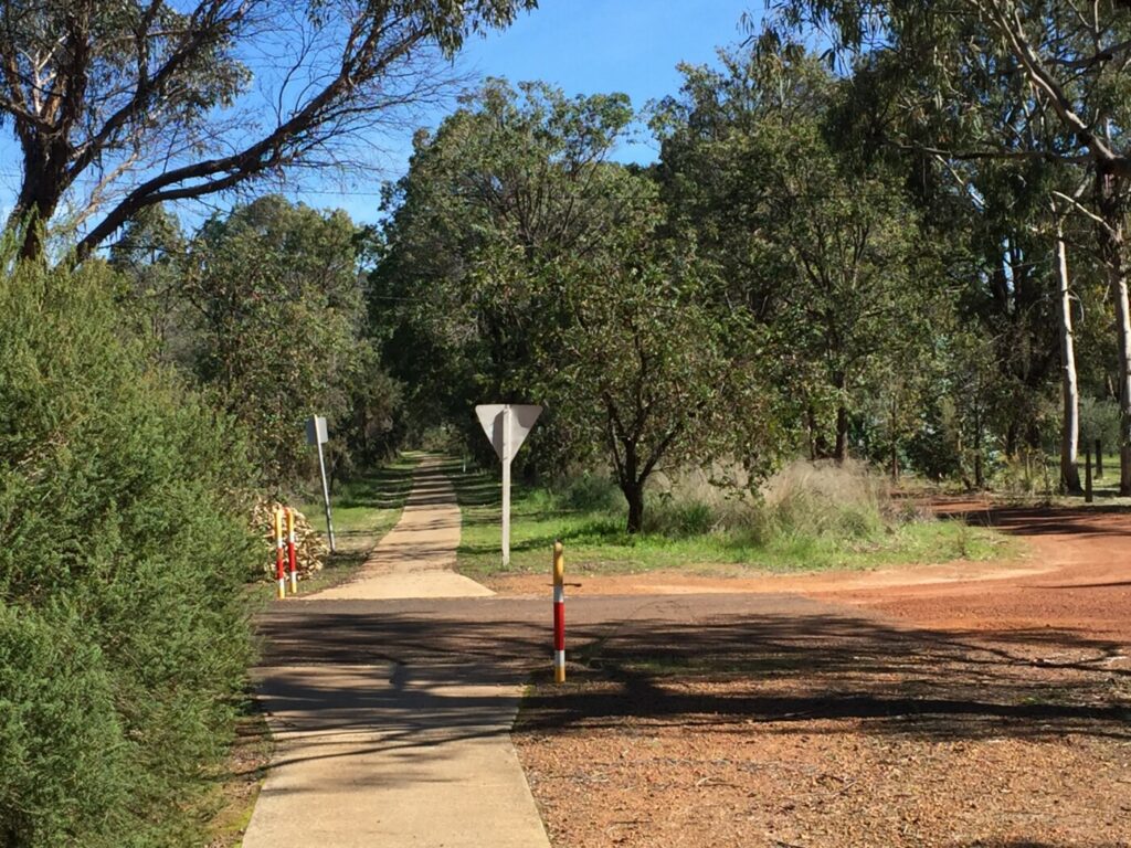
- the trail overlaps and is an extension of the Railway Reserves Heritage Trail, which runs from Midland to Mt Helena
- the trail also overlaps with the Mundaring Weir Rail Trail, which runs from Mundaring Weir to the town of Mundaring.
Section Guides
Mundaring Weir to Mt Helena (15 km)
- the western trailhead starts at Mundaring Weir and overlaps with the Mundaring Weir Rail Trail from the weir to Mundaring Sculpture Park. The trail also forms the first part of the Munda Biddi Trail
- the trail is uphill from the weir; it deviates from the railway formation occasionally and is a little steep in places
- at Mundaring, the trail links with the Railway Reserves Heritage Trail
- animals are not allowed closer to the weir than Firewood Rd; this is a water catchment area
Mt Helena to Wooroloo (18 km)
- shares the same route as the eastern section of the Railway Reserves Heritage Trail
- Chidlow was known originally as Chidlow’s Well: a railway dam was built here to supply trains
- Chidlow’s railway dam is today known as Lake Leschenaultia and is a favourite spot for picnics, walks and water activities. The road to the lake, just over 2 km from Kep Track, is well marked
- a sculpture at the site of Wooroloo’s old railway station commemorates the Goldfields Water pipeline
Wooroloo to Bakers Hill (17 km)
- passes through Wooroloo Reserve, where you can read about the railway’s history. You also pass the old red brick stationmaster’s house (now a private residence) as you head east from Wooroloo
- Wundowie was established as a town for workers in an iron and steel plant established in 1948. The plant is now closed; only a foundry still operates
- don’t miss the Bakers Hill Pie Shop for one (or more) of their famous pies
Bakers Hill to Northam (25 km)
- passes the remnants of the old Clackline Station, a double platform because it was a junction for lines to Northam and Toodyay. The town includes a restored rail carriage that now operates as a community post office
- after Clackline there is an occasionally steep 10 km on-road section along Eadine Rd; there is no railway reserve as the train used a more circuitous route via Spencer’s Brook to Northam
- the trail from Clackline is a mixture of single track next to the Goldfields pipeline, four-wheel-drive track and gravel roads
- the Northam trailhead for the start/end of Kep Track is at the west side of Poole St Bridge. The footbridge is no longer in use
On the Farming Heritage Trail
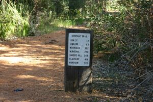
The trail near Wooloroo displaying a distance marker
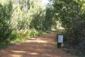
The trail colours
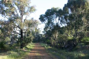
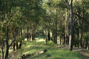
Relaxing views on the trail
Farming Heritage Trail2006-10

Do you know of a bike hire or transportation service on this rail trail that should appear here? If so, let us know at admin@railtrails.org.au.
Information and Links
See Services tab above for links to services and businesses along this trail
For more information:
The trail is managed by the Shire of Mundaring (Mundaring to Wooroloo section) and the Shire of Northam (Wundowie to Northam section).
To report any issues or problems please contact:
- Shire of Mundaring 7000 Great Eastern Highway, Mundaring, WA 6073; 9290 6666 or email sh***@mu*******.au
- Shire of Northam 395 Fitzgerald Street, Northam WA 6401; 9622 6100 or email re*****@no*****.au
Contact Rail Trails Australia
To contact us about this rail trail, email wa@railtrails.org.au
Background Information
Traditional owners
We acknowledge the Whadjuk and Ballardong people of the Noongar Nation, the traditional custodians of the land and waterways on which the rail trail is built. Kep (also spelt gep) is a Noongar word for water.
Rail line history
This trail traces part of the route of the Eastern Railway, which opened in 1885 and closed in 1966.
The Town of Mundaring grew up at the junction of the spur line to the weir and the main Eastern Railway.
Registration Open for Lifecycle for Canteen on Kep Track
Posted: 16/06/22
Lifecycle for Canteen is the biggest WA fundraiser for CanTeen, the cancer support charity dedicated ...
More...Nearby Trails
Mundaring Weir Rail Trail
39 km east of Perth
7 km


Railway Reserves Heritage Trail
19km East of Perth
59 km

Kalamunda Railway Heritage Trail
25km south east of Perth
16 km
17 km


30 km
20 km
Jarrahdale 1872 Timber Tramway
50km south east of Perth
10 km
Jarrahdale Balmoral Rail Trail
50km south east of Perth
11 km
Ranford Pool Walk Trail
135 km south east of Perth
2 km
Tullis Bridge Walk Trail
135 km south east of Perth
9 km
Nearby Trails
Mundaring Weir Rail Trail
39 km east of Perth
7 km
Railway Reserves Heritage Trail
19km East of Perth
59 km
Kalamunda Railway Heritage Trail
25km south east of Perth
16 km
17 km
30 km
20 km
Jarrahdale 1872 Timber Tramway
50km south east of Perth
10 km
Jarrahdale Balmoral Rail Trail
50km south east of Perth
11 km
Ranford Pool Walk Trail
135 km south east of Perth
2 km
Tullis Bridge Walk Trail
135 km south east of Perth
9 km
