This is a proposed trail only, and not yet developed or open.
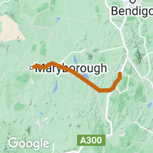
- The 55km trail can start at either Castlemaine or Maryborough and follow the now disused rail line, via the towns of Guildford, Newstead and Carisbrook.
- From a tourism perspective a unique feature of this trail would be that a traveller could take a train from Melbourne and head either to Castlemaine or Maryborough, traverse the trail to the other end and take a train back to Melbourne.
Nearby Attractions
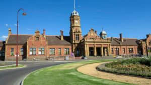
- A stand-out destination is the impressive Maryborough Railway Station once described by Mark Twain, the famous American writer, as ‘a railway station with a town attached ’.
Last updated: 15 April 2024
This is a proposed trail, and not yet developed or open.
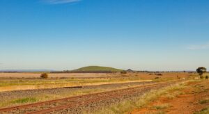
The rail corridor passes through an ancient volcanic plain landscape, crosses the Cairn Curran Reservoir and Moolort Plains, a very different environment to the goldfields landscapes closer to Castlemaine. A feature of the Plains is its wetlands and swamps, a habitat for a variety of wetland flora and birdlife. Several towns along the route are located on the Loddon River, which flows from the Great Dividing Range in the south to the Murray River in the north.
Section Guides
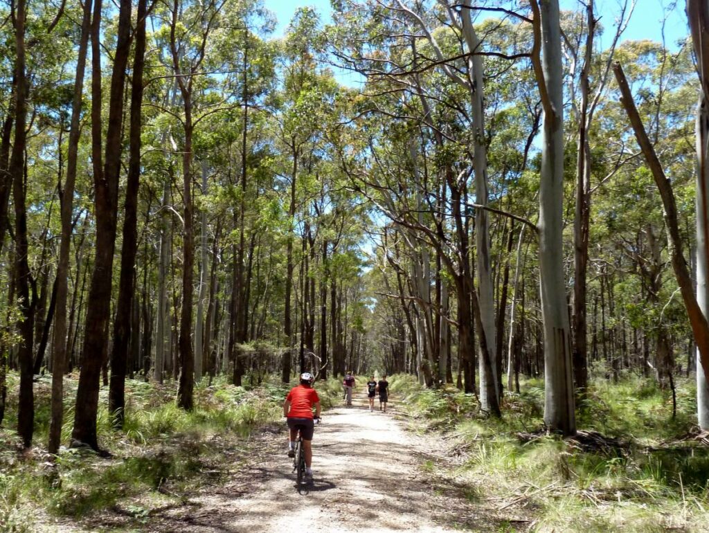
Castlemaine – Guildford (11km): This section of the rail trail will pass through Castlemaine and Campbells Creek before reaching a more rural environment with low hills following the edge of an ancient volcanic flow and crossing the Loddon River at Guildford.
Guildford – Newstead (12km): The route continues through farmland and forested historic goldfields. Newstead is a small town along the Loddon River.
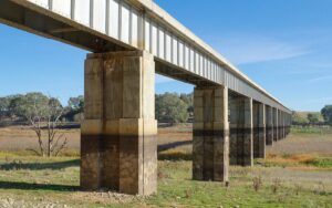
Newstead – Carisbrook (25km): The rail trail will continue past cropping and grazing land and crosses the Cairn Curran reservoir and wetlands. The Moolort Plain is a flat ancient volcanic landscape, with low hills on the approach to Carisbrook, a town on the Loddon River.
Carisbrook – Maryborough (7km): This part of the trail will pass through dry Box ironbark forest which formed part of the 19th Century goldfields in Central Victoria.
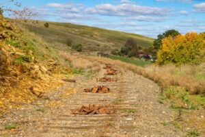
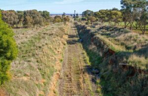
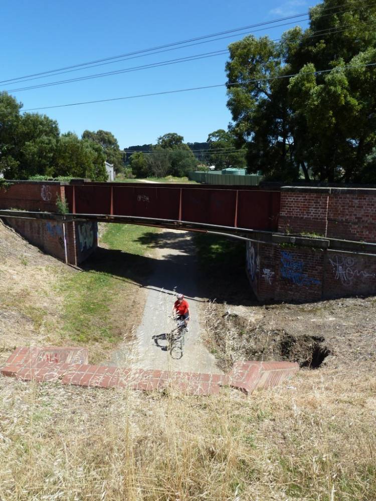
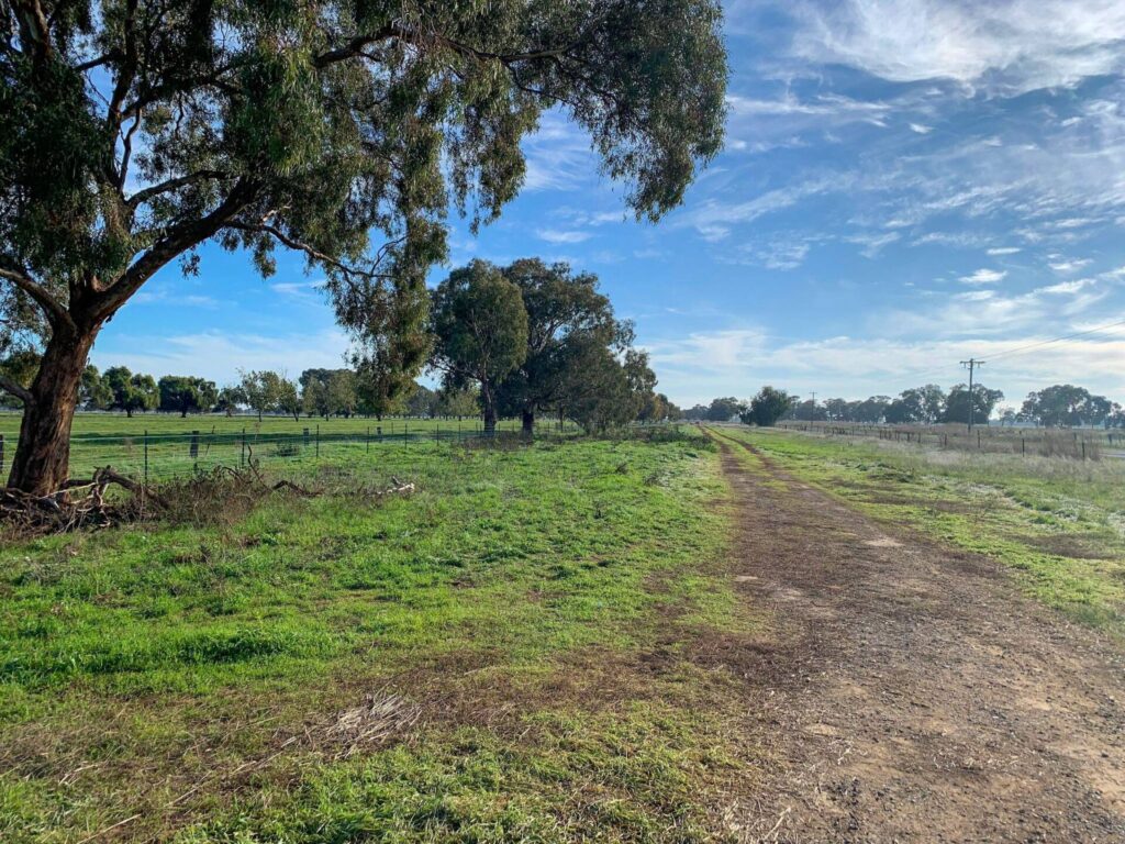
Rail Tracks removed near Guildford
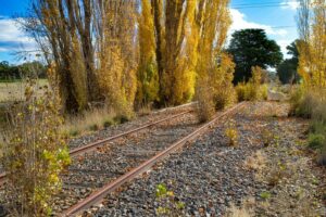
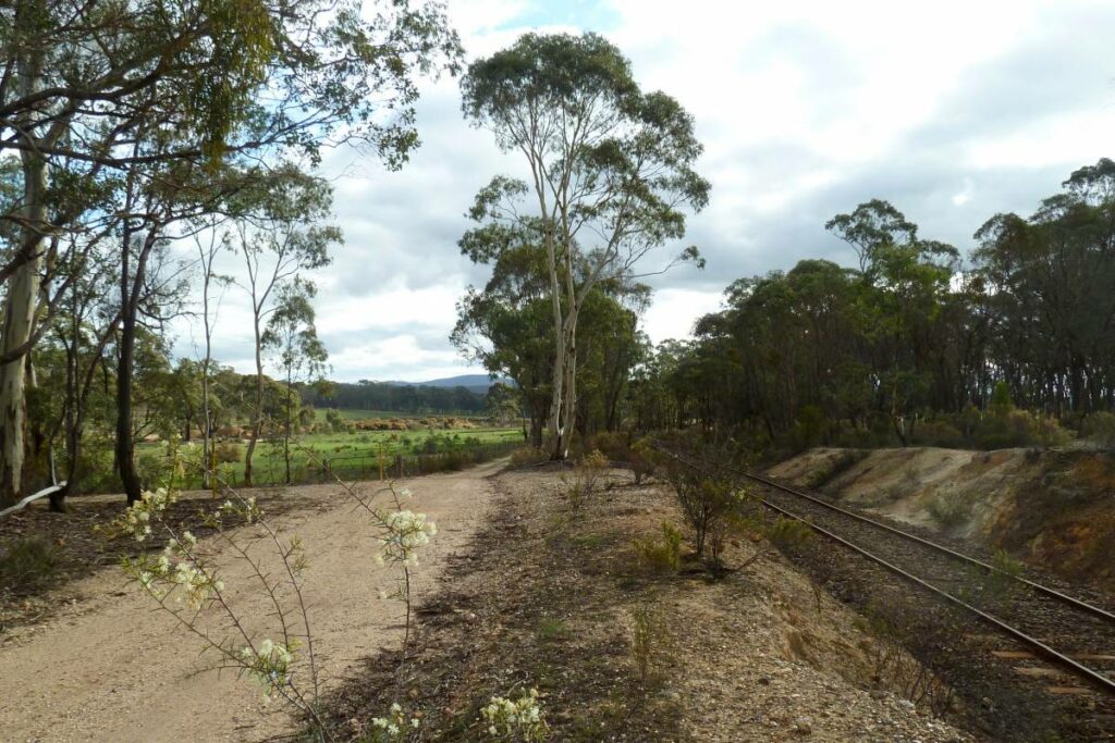
The corridor between Guildford and Newstead (2020)
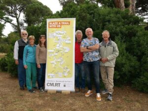
Castlemaine Maryborough Rail Trail group: L-R: Bob Forde, Julie Flynn (author), Christine Christie, Mick Evans, John Carruthers, Lou Citroen. Missing: Mark Brown

Back up Campbells Creek Valley from Guildford CMRT (2020)
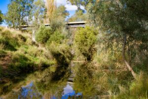
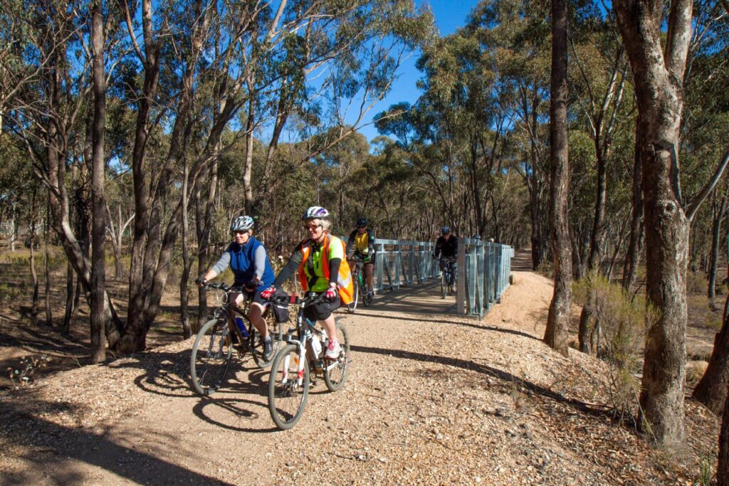
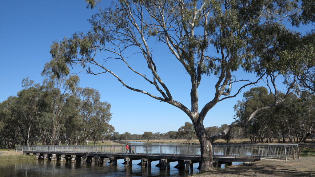
Bridge over Loddon CMRT Guilford (2020)
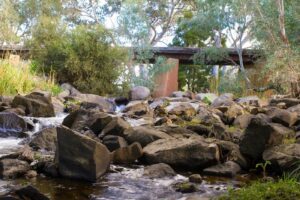
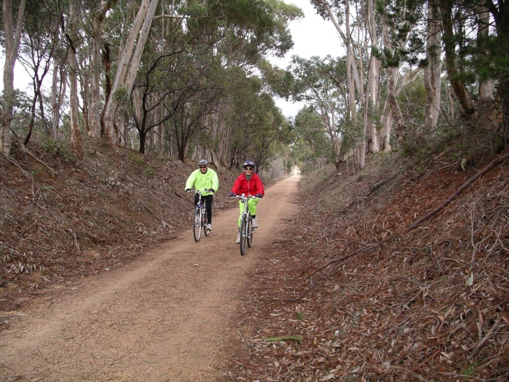
Rail bridge Jim Crow Creek near Newstead (2020)
Rail bridge Jim Crow Creek near Newstead (2020)
Moloort Plains Silos on the rail trail
Moolort Plains - Bald Hill Carrisbrook CMRT (2020)
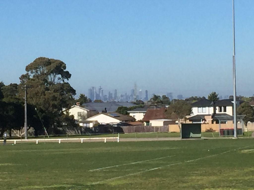
Maryborough (2017)
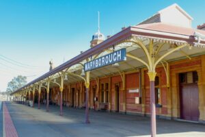
Maryborough Station platform CMRT (2020)
Do you know of a bike hire or transportation service on this rail trail that should appear here? If so, let us know at admin@railtrails.org.au.
Information and Links
A video has been produced by two of the CMRT members. The film can be viewed on the CMRT website. It is well worth having a look at – hearing and seeing how young people visualise the potential rail trail is brilliant.
- A brochure outlining this rail trail proposal can be downloaded here.
- Public transport: V/Line Train from Melbourne to Castlemaine (Bendigo line) or Maryborough (Mildura line) with bus services from Maryborough to Newstead, Guildford, Campbells Creek and Castlemaine and the reverse from Castlemaine.
See this weblink for information on the members, volunteers, supporters and friends who are working to develop this proposed trail corridor.
Contact Rail Trails Australia
To contact us about this rail trail, email vic@railtrails.org.au
Background Information
Traditional owners
We acknowledge the Dja Dja Wurrung people, the traditional custodians of the land and waterways on which the rail trail is built.
Current Progress
Over the past few years there has been a significant groundswell of interest to move ahead with the development of the Castlemaine to Maryborough Rail Trail that could be used by cyclists, walkers and horse-riders of all ages and abilities. A feasibility study commenced in November 2022 to gather information from all stakeholders to fully understand the opportunities, features and alignments required for the trail. It is anticipated that the six month study will be completed by April 2023. Further information about the next stage in its potential development will be provided as soon as it comes to hand.
Railway history
- Castlemaine Station is on the Melbourne to Bendigo line and was established in 1862.
- Maryborough Station is on the Melbourne to Mildura line and terminus for V/Line service from Ballarat. It opened in 1874 but the current station building was erected in 1890 with 25 rooms and a clock tower, of red brick with stucco trimming (excerpt from Wikipedia)
- The Maryborough – Castlemaine passenger service was withdrawn in July 1977, being replaced with a bus service. From that time, the track was then used only for freight until 2004 when the line was closed
Carisbrook to Maryborough Walk a Big Success
Posted: 14/04/24
As part of its ongoing advocacy work and community engagement, the Castlemaine Maryborough Rail Trail ...
More...Walk the line – Maryborough to Carisbrook
Posted: 27/01/24
Come along and join the members and supporters of the Castlemaine Maryborough Rail Trail Inc (...
More...Castlemaine Maryborough Rail Trail – your feedback is needed
Posted: 28/05/23
The community have the opportunity to provide direct feedback to assist the Mt Alexander Shire ...
More...An excellent way to finish the year for the Castlemaine-Maryborough Rail Trail
Posted: 29/12/22
Moloort Plains Silos on the rail trail Over ...
More...The Castlemaine Maryborough Rail Trail (CRMT) receives exciting funding announcement
Posted: 12/06/22
In a joint bid with Central Goldfields Shire Council and Mt Alexander Shire Councils, Castlemaine ...
More...Help Castlemaine to Maryborough Rail Trail make history by raising $12,000 in February
Posted: 06/02/22
This month, Castlemaine to Maryborough Rail Trail (CMRT) wants to shape its destiny. You can ...
More...Nearby Trails
Castlemaine to Maldon Railside Trail
120km north west of Melbourne
18 km


Woodend to Daylesford (incl Domino) Rail Trail
85km north west of Melbourne
5 km

The Bunny Trail
110 km west of Melbourne
1.0 km

O’Keefe Rail Trail
East of Bendigo, 150km from Melbourne
50 km
Ballarat-Skipton Rail Trail
110km north west of Melbourne
57 km

Meadowlink Rail Trail
Broadmeadows, 20 km north of CBD
1.2 km
Lockington to Kotta
198km north of Melbourne

Murchison – Rushworth Rail Trail
Northern Victoria
10 km
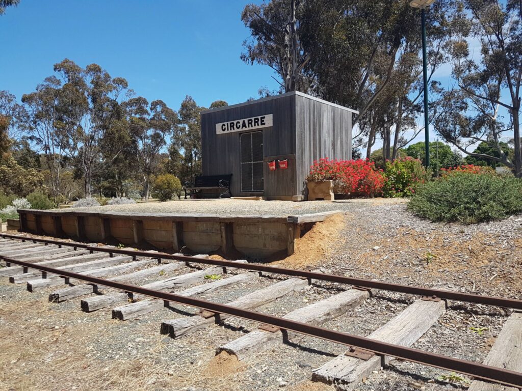
Girgarre Stanhope Rail Trail
200km north of Melbourne
5.5 km

Inner Circle Rail Trail
Inner suburbs, 5 km from the CBD
4.8 km

Sandridge Railside Trail
Melbourne city, 1 km from GPO
4 km
Webb Dock Bridge
Docklands, 1 km from Melbourne CBD
0.2 km
Fyansford Rail Trail
North Geelong, 5 km from town centre
4.4 km
Hawthorn to Kew Rail Trail
Inner suburbs, 9 km east of Melbourne CBD
1 km
Nearby Trails
Castlemaine to Maldon Railside Trail
120km north west of Melbourne
18 km
Woodend to Daylesford (incl Domino) Rail Trail
85km north west of Melbourne
5 km
The Bunny Trail
110 km west of Melbourne
1.0 km
O’Keefe Rail Trail
East of Bendigo, 150km from Melbourne
50 km
Ballarat-Skipton Rail Trail
110km north west of Melbourne
57 km
Meadowlink Rail Trail
Broadmeadows, 20 km north of CBD
1.2 km
Lockington to Kotta
198km north of Melbourne
Murchison – Rushworth Rail Trail
Northern Victoria
10 km
Girgarre Stanhope Rail Trail
200km north of Melbourne
5.5 km
Inner Circle Rail Trail
Inner suburbs, 5 km from the CBD
4.8 km
Sandridge Railside Trail
Melbourne city, 1 km from GPO
4 km
Webb Dock Bridge
Docklands, 1 km from Melbourne CBD
0.2 km
Fyansford Rail Trail
North Geelong, 5 km from town centre
4.4 km
Hawthorn to Kew Rail Trail
Inner suburbs, 9 km east of Melbourne CBD
1 km
5 reviews of “Castlemaine to Maryborough Rail Trail”
MBTC had 7 riders on this trail 10'9'23. Reading comments below (to 7'22), I had trepidation about erosion gullies and level water crossings on the trail. None of it. We had a pleasant ride in undulating territory, with good cafe offerings at trails-end in Maldon. It has a mainly gravel/dirt surface, and winds a bit as the recreational train still has original track alignment; so a degree of bike skill is useful to charge hills and negotiate bendy corners with sandy edges. One or two older folks on ebikes hadn't mastered this skill set, so looked a bit bamboozled when regular bikes overtook them. After the RT, we carried on to Maryborough, for a total 58km ride, which proved a bit demanding with a 'light' W-SW'ly headwind of perhaps 15kmh. Wind picked up a notch about 4km W of Maldon, as we popped in front of a hilly range. We trained up on Bendigo line, and returned with Maryborough line; which doubled the scenery outlook by train. Train spotters with cameras on return line were waiting for a steam train appearance; we saw a stoker shovelling coal at one station in prep. Maldon apparently was registered en masse has a historic town in 1970s, and Casltelmaine/Maldon/Marysborough all have interesting house and civic architecture. The RT could prove tricky after decent rain, as multiple creeks were (concrete) level crossings and not bridged. We had an enjoyable day in the saddle, but were happy to kick back on the train home and let muscles recharge. A 3:20pm last train for day, meant we couldn't explore Maryborough as we'd hoped.
The overwhelming evidence is that locals across the region DO want a world class trail from Castlemaine – Marybough. Over the past few months in particular they have helped sign a petition in their thousands and donated more than $20,000 towards the cause. They want a trail because they understand that the investment will be relatively modest, and they know it will bring substantial economic and social benefits for their communities. Meanwhile, the most recent government study showed that bringing back rail on this route is uneconomic, and is unsupported by sufficient passenger or freight demand. Meanwhile, in the next month or so, work will begin on a major study to examine the economics and feasibility of the trail. Let's pause a little and let the evidence fall where it will.
A rail trail between Maryborough and Castlemaine is neither needed nor wanted by the majority of locals. What IS wanted is the reinstatement of the railway line between the towns. We are being told to cut emissions, while at the same time being forced to drive – those who can – to Castlemaine and onto Bendigo. The current alternative is the train from Bendigo to Castlemaine and bus to Maryborough. More often than not, this involves a wait of up to FOUR HOURS at Castlemaine.
Unfortunately the cost of reinstating the railway line is totally prohibitive. I live near the Okeefe rain trail in Bendigo and a huge number of people use it on a daily basis. Many are visitors from other places, staying overnight and spending money in our area. The benefits of the Castmaine to Maryborough rail trail would be Hugh.
This trail is for thousands of people who don't live in Maryborough or Castlemaine, but who would come and spend money in both towns. A new trail just opened has had 8000 people us it so far this month.people like us who travel all over the country to ride these trails.