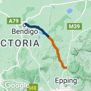
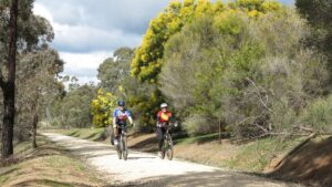
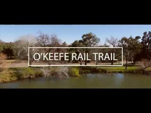
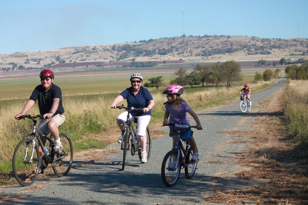
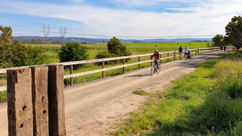
- A well established easy rail trail that provides options of half- or full-day rides between Bendigo, Axedale and Heathcote through box ironbark and yellow gum woodland and grazing farmland, across the Campaspe River and past Lake Eppalock
- Take a two-hour train ride from Melbourne to Bendigo, ride 23km to Axedale Tavern for a country pub lunch, then head for home or ride on and stay overnight in Heathcote and enjoy all these regional towns have to offer.
Click on the Get Around section below for public transport options, including bikes on buses.
Nearby Attractions
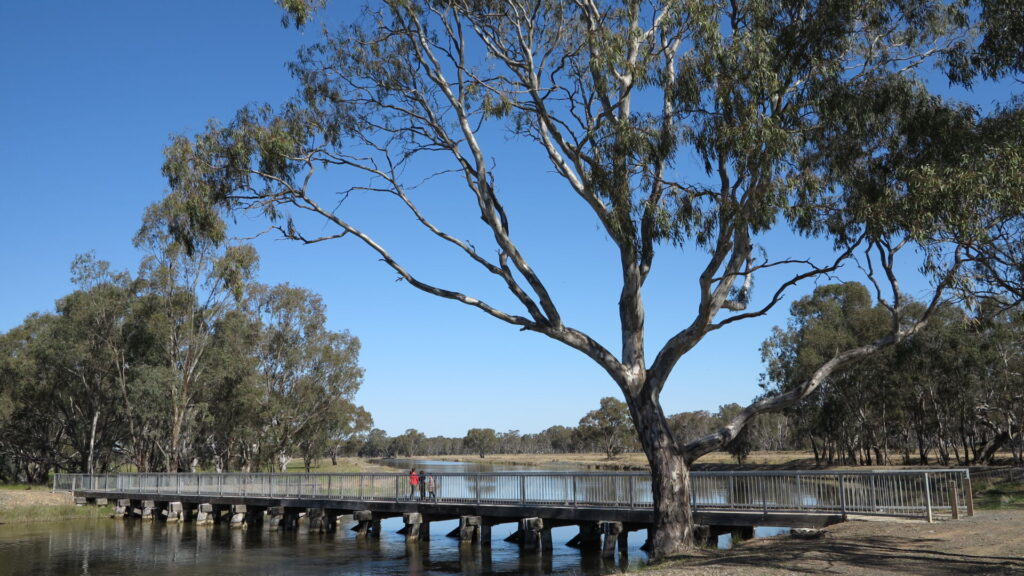
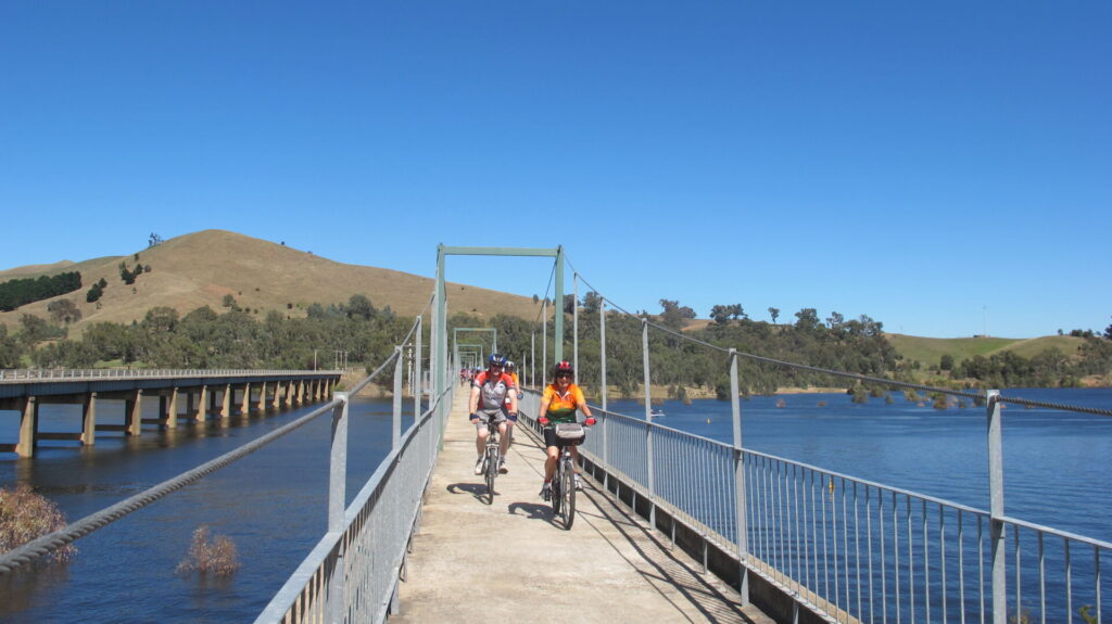
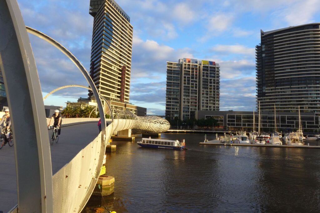
- A stunning new bridge across the Campaspe River
- Heathcote is an attractive town with several accommodation options, a new brewery and is well known for its quality shiraz wines
- The Pink Cliffs Geological Reserve is close to town and shows off colourful eroded cliffs that remain from sluice mining
Last updated: 5 March 2024
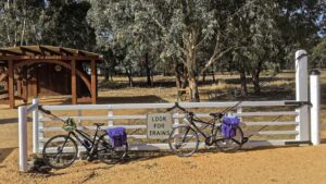
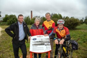
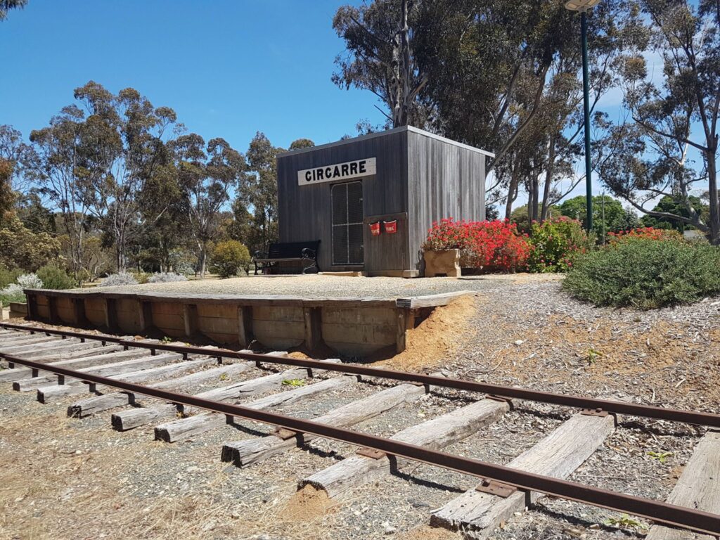
Sites of former stations are marked on the map but generally little remains of them. The Friends of the Bendigo Kilmore Rail Trail have erected replica station signs and are recreating sections of platforms to add to the experience of the rail trail.
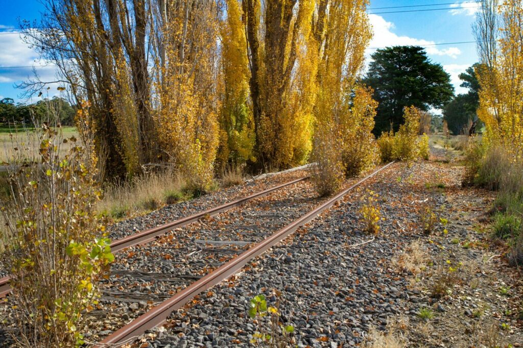
Wildflowers, including orchids, appear in spring.
Access Points
- Bendigo – at the north western end of Lake Weeroona, off Weeroona Ave. Parking is available next to Bendigo Rowing Club rooms
- Cafe and toilets around the lake area
- Bendigo station is 3 km south on Railway Place
- East Bendigo – Pratts Park Rd (parking on Rifle Range Rd)
- Junortoun – car park off Wikie Rd
- Longlea – park along Longlea Lane
- Axedale – corner of High St (McIvor Hwy) and Mitchell St at Axedale Public Hall: parking, playgrounds and toilets
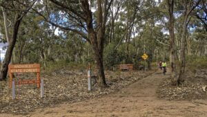
- Knowsley Forest – an entry point for the trail is near the intersection of Toolleen-Axedale Rd and McIvor Hwy; this leads into Knowsley Forest near the power line transformer pole. Note: take care entering and leaving McIvor Hwy
- Knowsley – parking near where the trail crosses Moorabbee Rd at Knowsley Tennis Courts
- Derrinal – a trail rest stop and replica station name board is opposite the former Derrinal Railway station, off Old Bendigo Rd, (park on the side of Old Bendigo Rd)
- Heathcote – carpark off Herriot St at the new rail trail shelter. Heathcote Visitor Information Centre, corner of High and Barrack Sts, has parking and trail information, or at the end/start point of the trail at Pink Cliffs Rd.
For public transport and bike repair options click on “Get Around” below.
Section Guides
North Bendigo to Axedale (23 km)
- From Lake Weeroona, follow the Bendigo Creek Trail north to a T intersection and turn right to begin the trail
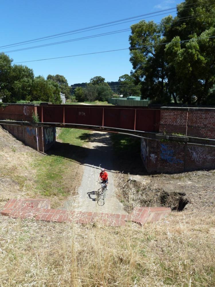
- Cross Midland Hwy with care and go through the brick-lined culvert beneath the Bendigo–Echuca railway line
- Bendigo Bushland Trail crosses the trail at Markovitch Lane
- At the 4km point a trail branches to the north (to the former Department of Defence ammunition storage facility, Rangelea siding): follow signs for the main trail
- Take care crossing the McIvor Hwy next to the Baptist Church at Junortoun
- At 12 km is Axe Creek, with a new at-grade bridge and a possible stop for a picnic
- The trail passes the former Axedale station before reaching Axedale Racecourse station
- The trail now diverts off the original railway alignment to follow a newly built sealed trail into Axedale township
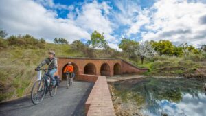
- Continue within street reserves down to River Reserve on the Campaspe River frontage, where there are picnic tables and art installations
Axedale has drinking water, toilets, a general store and Axedale Tavern.
Axedale to Derrinal (17 km)
- The trail follows an underpass beneath McIvor Hwy, then crosses a rail trail bridge north of the highway over Campaspe River
- The trail meets quiet Ingham Rd; follow this up the hill to the dedicated trail
- Take care crossing McIvor Hwy near the Toolleen-Axedale Road
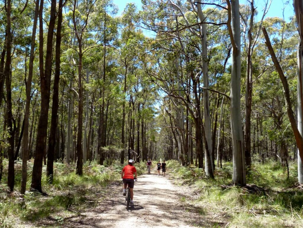
- The trail now enters Knowsley Forest. Within the forest there is the Smart Track Day Visitor Area, about 800 m north-east from the rail trail’s intersection with Smart Track. This area has toilets, a shelter with gas BBQs and table-seats, an interpretive sign/sculpture, and a water dam. This area is also accessible by motor vehicles via Smart Track from the McIvor Hwy.
- Once reaching the Old Railway Dam, the trail returns to the former railway alignment within the Forest.
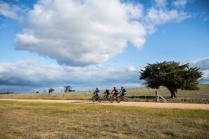
- After Knowsley, the trail passes Moorabbee Hill Rest Stop where table-seats and bike racks provide an opportunity to relax and enjoy views of the Great Dividing Range.
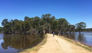
- The trail continues into Lake Eppalock, which originally flooded a section of the original railway. A purpose-built trail causeway and the 90 m Mt Ida Creek bridge allow the trail to stay close to the original alignment. There is another picnic area on the causeway giving views of the lake.
- There is a trail rest stop and replica station name board opposite the former Derrinal station (now on private property) off Old Bendigo Rd.
NOTE: Trail users should respect all privately owned land. Take care crossing cattle grids between Knowsley Forest and Derrinal.
Derrinal to Heathcote (9 km)
- The trail skirts McIvor Hwy and enters One Eye Forest near Hills Rd
- ‘Rail trail users only’ status continues from Hills Rd to the Mia Mia-Derrinal road section, but take extreme care on the shared section between Mia Mia-Derrinal road and Burnt Track shared, especially at several narrow areas
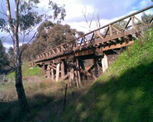
- The last trail bridge in One Eye Forest is located directly above a complete section of an original, yet once much longer 1888 timber railway bridge.
- The Heathcote trail head is located at Herriott St where there is a unique timber shelter, local information and maps.
- Heathcote Visitor Information Centre, corner of High St and Barrack St, provides trail information and parking.
Heathcote is a medium sized regional town with most facilities and options for food and drink.
![Start of the rail trail proper at Napier St in Bendigo [2023 Garry Long]](https://www.railtrails.org.au/wp-content/uploads/2023/02/V40-064-Bendigo-Napier-St-approach-2023-02-1-300x170.jpg)
Start of the rail trail proper at Napier St in Bendigo [2023 Garry Long]
A grand entrance to the rail trail under the Bendigo - Echuca railway (2016 Bendigo Tourism Bradd Worrell)
The only original bridge on the outskirts of Bendigo (2009)
![One of numerous bridges between Strathfieldsdaye to Axe Creek [2013]](https://www.railtrails.org.au/wp-content/uploads/2022/10/V40-109-Strathfieldsaye-to-Axe-Creek-2013-05-1972-300x200.jpg)
One of numerous bridges between Strathfieldsdaye to Axe Creek [2013]
![Typical scenery between Strathfieldsdaye to Axe Creek [2013]](https://www.railtrails.org.au/wp-content/uploads/2022/10/V40-109-Strathfieldsaye-to-Axe-Creek-2013-05-1978-300x200.jpg)
Typical scenery between Strathfieldsdaye to Axe Creek [2013]
![Crossing the Axe Creek bridge between Junorton and Axedale [City of Greater Bendigo, 2015]](https://www.railtrails.org.au/wp-content/uploads/2022/10/V40-165-Axe-Creek-2015-09-8F8A5512-300x200.jpg)
Crossing the Axe Creek bridge between Junorton and Axedale [City of Greater Bendigo, 2015]
![The Friends of the Bendigo Kilmore Rail Trail have put a huge amount of work into recreating Axedale station and restoring a once ubiquitous goods wagon [Colin Scott 2020]](https://www.railtrails.org.au/wp-content/uploads/2022/10/V40-215-Axedale-wagon-install-DSC_0056-2020-03-300x199.jpg)
The Friends of the Bendigo Kilmore Rail Trail have put a huge amount of work into recreating Axedale station and restoring a once ubiquitous goods wagon [Colin Scott 2020]
![The rail trail passing safely under the busy highway at Axedale [Garry Long, 2019]](https://www.railtrails.org.au/wp-content/uploads/2022/10/V40-214-Axedale-underpass-school-2019-11-300x221.jpg)
The rail trail passing safely under the busy highway at Axedale [Garry Long, 2019]
Cruising betweem Axedale and Heathcote. (2016 Bendigo Tourism Bradd Worrell)
The trail enters the forest at Knowsley (Andrew Lecky 2019)
![The Friends of the Bendigo Kilmore Rail Trail have also partially recreated many other station sites [2016]](https://www.railtrails.org.au/wp-content/uploads/2022/10/V40-255-Knowsley-Sign_post-2016-04-300x181.jpg)
The Friends of the Bendigo Kilmore Rail Trail have also partially recreated many other station sites [2016]
![Picnic area on the causeway of a full Lake Eppalock. It has been this way for several years but can also be completely dry [2023 Garry Long]](https://www.railtrails.org.au/wp-content/uploads/2023/05/V40-300-Lake-Eppalock-area-FoBKRT-ride-2023-04-25_184106-300x169.jpg)
Picnic area on the causeway of a full Lake Eppalock. It has been this way for several years but can also be completely dry [2023 Garry Long]
Lake Eppalock was at 100% in the spring of 2016 (Brad Worrell)
![Riding across the long Mount Ida Creek bridge which is now part of a very full Lake Eppalock [2023 Garry Long]](https://www.railtrails.org.au/wp-content/uploads/2023/05/V40-300-Lake-Eppalock-Ida-Creek-2023-04-25_184153-300x225.jpg)
Riding across the long Mount Ida Creek bridge which is now part of a very full Lake Eppalock [2023 Garry Long]
![Lake Eppalock at 100% when the rail trail is still passable, it is not when the lake gets higher. [Graham Hosking / Heathcote Tourism and Development, 2016]](https://www.railtrails.org.au/wp-content/uploads/2022/10/V40-309-Lake-Eppalock-full-aerial-2016-10-DJI_0514-300x225.jpg)
Lake Eppalock at 100% when the rail trail is still passable, it is not when the lake gets higher. [Graham Hosking / Heathcote Tourism and Development, 2016]
![Enjoying the scenery near Derrinal [2023 Garry Long]](https://www.railtrails.org.au/wp-content/uploads/2023/05/V40-300-Derrinal-2023-04-25_125759-300x169.jpg)
Enjoying the scenery near Derrinal [2023 Garry Long]
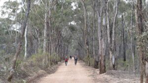
Forest scenery approaching Heathcote (2015)
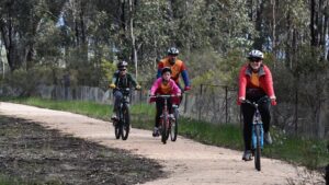
Family time on the rail trail (Les Lewis 2015)
![Walkers passing Bald Hill, approaching Heathcote [2013]](https://www.railtrails.org.au/wp-content/uploads/2022/10/V40-356-Heathcote-2013-05-2026-300x200.jpg)
Walkers passing Bald Hill, approaching Heathcote [2013]
Spring time near Heathcote (2015)
![There are no remains of the former Heathcote station site [2015]](https://www.railtrails.org.au/wp-content/uploads/2022/10/V40-358-Heathcote-6355-2015-08-300x169.jpg)
There are no remains of the former Heathcote station site [2015]
Community groups have contributed to turning the access point at Heathcote from a bare paddock into a feature (Andrew Lecky 2019)
![Heathcote has many historic buildings and one of the longest main streets in Australia [2019]](https://www.railtrails.org.au/wp-content/uploads/2022/10/V40-360-Heathcote-Mechanics-Institute-2019-05-3-300x225.jpg)
Heathcote has many historic buildings and one of the longest main streets in Australia [2019]
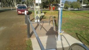
One of three water and bike repair stations at Junortoun, Axedale and Heathcote. (Ken Hanson 2019)
![The volunteer Friends of the Rail Trail have made and installed replica mile posts (distance from Melbourne) along the trail [2011 Garry Long]](https://www.railtrails.org.au/wp-content/uploads/2021/04/6501619527629-300x169.jpg)
The volunteer Friends of the Rail Trail have made and installed replica mile posts (distance from Melbourne) along the trail [2011 Garry Long]
![Plans are being developed to extend the rail trail south towards Kilmore to pass through other historic towns such as Tooborac [2012]](https://www.railtrails.org.au/wp-content/uploads/2022/10/V40-405-Tooborac-Hotel-6738-2012-300x200.jpg)
Plans are being developed to extend the rail trail south towards Kilmore to pass through other historic towns such as Tooborac [2012]
![The impressive Mollison Creek bridge at Pyalong would be a landmark of the extended rail trail but likely to be too expensive to open for trail users [2011 Garry Long]](https://www.railtrails.org.au/wp-content/uploads/2022/10/V40-455-Pyalong-Mollison-Crk-2011_-009-300x225.jpg)
The impressive Mollison Creek bridge at Pyalong would be a landmark of the extended rail trail but likely to be too expensive to open for trail users [2011 Garry Long]
![The former rail corridor south of Pyalong [2013 Garry Long]](https://www.railtrails.org.au/wp-content/uploads/2022/10/V40-455-Pyalong-south-cutting-looking-south-2013-300x201.jpg)
The former rail corridor south of Pyalong [2013 Garry Long]

Ideas for other rides in the area
Comedian Tracy Harvey visits the O\'Keefe Rail Trail.
Wonderful view of the rail trail


The Friends of the Bendigo-Kilmore Rail Trail, with the assistance of awarded community grants, its own funds/volunteer labour plus cooperation from the trail manager (City of Greater Bendigo), have installed a bike repair station and water station adjacent to the trail’s Wilkie Rd car park Junortoun, a water station east of Bennetts Rd Junortoun, plus a bike repair station and water station adjacent to the toilets in Axedale Park, Axedale. There is also a local community provided bike repair station at the Heathcote Visitor Information Centre.
The Bendigo-Heathcote PTV bus service has an external two-bike carry rack, for its customers. It’s a ‘first come, first served’ rack, with no pre-booking possible. A number of bus stops are close to the trail, refer to the PTV web page for map and timetables. This bus service does not have the MYKI card facility. So be sure to take a credit or debit card or some cash with you when heading out on the O’Keefe Rail Trail.
Goldfields Bike Tours & Hire – Unique opportunity to experience hybrid or E-bike riding to explore the rail trails and in conjunction with an air conditioned bus and 15-bike trailer.
Do you know of a bike hire or transportation service on this rail trail that should appear here? If so, let us know at admin@railtrails.org.au.
 Located at Axedale, halfway between Bendigo and Heathcote and a short 3kms from the trail and Axedale township. The comfortable farmhouse sleeps up to 7 people or 3 couples. A truly comfortable and relaxing place to stay after a day riding the trail. A complete bike repair kit is available.
Information and Links
Rail Trail Management and Inquiries
RTA endeavours to keep our rail trail information up to date but for any enquiries regarding management of the rail trail including the current state, or to report any issues, please contact the rail trail manager.
This rail trail is managed by the City of Greater Bendigo.
Website: (www.bendigo.vic.gov.au)
Email: requests@bendigo.vic.gov.au
Phone: 1300 002 642
Rail Trail Supporters
The Friends of the Bendigo – Kilmore Rail Trail is a local volunteer group that has been very active in developments on this rail trail, runs events, participates in working groups and carries out physical improvements on the rail trail.
Refer to Friends of the Bendigo – Kilmore Rail Trail for further information and news, and contact details as they welcome more involvement.
Further Information
The City of Greater Bendigo has invested a lot in this rail trail and would appreciate your feedback about your experience here (Don’t forget to add a Review at the tab above)
Other riding and walking options.
Bendigo Tourism website. The Bendigo Visitor Information Centre is located in Pall Mall, Bendigo.
Contact Rail Trails Australia
To contact us about this rail trail, email vic@railtrails.org.au
Background Information
Traditional owners
We acknowledge the Dja Dja Wurrung and Taungurung people, the traditional custodians of the land and waterways on which the rail trail is constructed.
Development and future of the rail trail
Mitchell Shire Council received a Feasibility Study in 2018 that considered:
- an extension of the trail from Heathcote to Wallan (connecting with the railway passenger service between Melbourne to and Wodonga)
- a link between Wallan and the Craigieburn Bypass Trail and then to Melbourne’s network of bicycle trails
- a linking trail between Kilmore to Tallarook and the start of the Great Victorian Rail Trail
The Friends Group have produced two brochures outlining the vision for the first two sections.
The Friends of the Bendigo-Kilmore Rail Trail group is working with the City of Greater Bendigo and the Campaspe Shire to investigate creating a Heathcote Rushworth Trail (route referenced in the Heathcote to Murchison Trail Business Case (outline brochure here), that would link the Murchison-Rushworth (Waranga) Rail Trail to the O’Keefe Rail Trail.
Campaspe Shire is seeking funding to construct the Heathcote to Murchison Trail (outline brochure here) to complete the Murchison-Rushworth (Waranga) Rail Trail and link it to with the O’’Keefe Rail Trail.
Rail line history
This line was built in 1888 by Andrew O’Keefe to link Bendigo and Heathcote, from where here the it line continued to Heathcote Junction, near Wallan, on the North Eastern main line. The Heathcote – Bendigo section of that line closed in 1958 (as the construction of Lake Eppalock reservoir was taking place and the rest of t) This lightly -trafficked branch line was then was completely closed by 1968.
The first section of a rail trail between Bendigo and Axedale was opened in 1993 (by the former Shire of Strathfieldsaye Council. The second stage constructed and opened in 1999 (built by current City of Greater Bendigo Council), though like its the former railway, it was basic affair with rough surface and many low- level crossings.
The potential was there though, and in 2009 the Friends of the Bendigo – Kilmore Rail Trail was formed by locals to lobby for the extension of the rail trail and advise the councils. In 2010, the Bendigo Council and the Victorian Government committed to a significant upgrade of the rail trail, including installing bridges on the Axedale section, and extending it a further 26 km extension to Heathcote. This work was completed in 2015.
Community input invited into the Draft O’Keefe Rail Trail Plan 2024
Posted: 05/03/24
The City of Greater Bendigo (COGB) Council is now inviting the wider community to provide ...
More...O’Keefe Rail Trail Facilities Upgrade and Customer Feedback
Posted: 27/05/23
The City of Greater Bendigo will shortly commence a project to construct and install public ...
More...Light the Trail Night Ride is back!
Posted: 27/03/23
The O’Keefe Challenge is gearing up for its annual Light the Rail Trail on ...
More...New Facilities for O’Keefe Rail Trail Users
Posted: 08/08/22
The Knowsley Forest’s Smart Track Day Visitor Area has recently had new facilities installed ...
More...Bikes on Buses Benefits O’Keefe and Maldon Rail Trails
Posted: 05/02/22
(Imaged courtesy PTV) Victorian Minister for Public Transport ...
More...VicJam 2022 rides O’Keefe Rail Trail
Posted: 26/01/22
Rock climbing - one of the many activities for ...
More...A Hidden Gem Exposed for Off-Road Trail
Posted: 08/12/21
Members of the working bee working to uncover the ...
More...New Whistle Posts for the O’Keefe Rail Trail (Victoria)
Posted: 19/07/21
The Whistle Post installation team Recently the Friends ...
More...Heritage Railway Wagon Returns to O’Keefe Rail Trail
Posted: 07/03/20
A former Victorian Railway’s wagon can now be admired on the O'Keefe Rail Trail ...
More...History Revealed on O’Keefe Rail Trail in Victoria
Posted: 28/07/19
The Friends of the Bendigo-Kilmore Rail Trail (FBKRT) group have informed us of new signs ...
More...Bike Repair Stations on the O’Keefe Rail Trail
Posted: 08/04/19
The last bolt had barely been inserted before the ...
More...Wallan to Heathcote Rail Trail (VIc) Feasibility Study Feedback
Posted: 11/02/17
The Mitchell Shire, City of Greater Bendigo, and State Government have funded a feasibility study ...
More...More History Recreated on the O’Keefe Rail Trail (Vic)
Posted: 23/04/16
The hard working volunteers from the Friends of the Bendigo-Kilmore Rail Trail report on their ...
More...Wallan to Heathcote Rail Trail Feasibility Study Begins
Posted: 13/03/16
The Wallan to Heathcote Rail Trail feasibility study formally began on 22 February 2016, with the selected ...
More...O’Keefe Rail Trail Developments (northern Victoria)
Posted: 11/10/15
Now that the extension of the O'Keefe Rail Trail is open providing 50km of continuous ...
More...Unofficial Opening of O’Keefe Rail Trail Extension (Northern Victoria)
Posted: 20/08/15
Following five years of hard work the Friends of the Bendigo Kilmore Rail Trail celebrated ...
More...O’Keefe Rail Trail Now Open to Heathcote
Posted: 27/06/15
The Friends of the Bendigo-Kilmore Rail Trail (FBKRT) group have informed us of new signs ...
More...O’Keefe Rail Trail Extension Updates (Northern Victoria)
Posted: 23/11/14
The ongoing project to extend the O'Keefe Rail Trail in northern Victoria a futher 26km ...
More...O’Keefe Rail Trail Upgrade Continues (Vic)
Posted: 13/07/14
Heavy machinery provided a good start in the autumn[/...
More...O’Keefe Rail Trail Improvements Continue
Posted: 25/11/12
Improvements and developments on the O'Keefe Rail Trail in northern Victoria continue apace. Over the ...
More...O’Keefe Rail Trail funding bears fruit (VIC)
Posted: 31/10/10
O'Keefe RT upgrade. Following up from the announcement of funding by Regional Development Victoria and ...
More...O’Keefe Rail Trail Receives Funding for Extension (VIC)
Posted: 27/06/10
The Victorian Government has committed $1.9 million for a 24 km extension of the O'Keefe Rail Trail ...
More...O’Keefe Rail Trail (Victoria) Community Ride
Posted: 19/08/09
The following notice has been provided by the Friends of the Bendigo - Kilmore Rail ...
More...O’Keefe Rail Trail (Vic) Community Meeting
Posted: 04/07/09
The following notice has been provided by the Friends of the Bendigo - Kilmore Rail ...
More...Nearby Trails
Castlemaine to Maldon Railside Trail
120km north west of Melbourne
18 km


Murchison – Rushworth Rail Trail
Northern Victoria
10 km

Castlemaine to Maryborough Rail Trail
Central Victoria, 124 km from Melbourne

Woodend to Daylesford (incl Domino) Rail Trail
85km north west of Melbourne
5 km
Girgarre Stanhope Rail Trail
200km north of Melbourne
5.5 km

Lockington to Kotta
198km north of Melbourne
Great Victorian Rail Trail
90 km north of Melbourne
134 km

Meadowlink Rail Trail
Broadmeadows, 20 km north of CBD
1.2 km
The Bunny Trail
110 km west of Melbourne
1.0 km

Inner Circle Rail Trail
Inner suburbs, 5 km from the CBD
4.8 km

Sandridge Railside Trail
Melbourne city, 1 km from GPO
4 km
Webb Dock Bridge
Docklands, 1 km from Melbourne CBD
0.2 km
Hawthorn to Kew Rail Trail
Inner suburbs, 9 km east of Melbourne CBD
1 km
Outer Circle Rail Trail
Eastern suburbs, 6 km from Melbourne CBD
17 km
Rosstown Rail Trail
Southern suburbs, 9 km from the CBD
8.8 km
Dookie Rail Trail
North East Victoria, 220km from Melbourne
8 km
Warburton Rail Trail/Yarra Valley Trail
Yarra Valley, 50 km east of Melbourne CBD
48 km
Heathmont to Belgrave Trail
Eastern suburbs, 40 km from the CBD
16 km
Nearby Trails
Castlemaine to Maldon Railside Trail
120km north west of Melbourne
18 km
Murchison – Rushworth Rail Trail
Northern Victoria
10 km
Castlemaine to Maryborough Rail Trail
Central Victoria, 124 km from Melbourne
Woodend to Daylesford (incl Domino) Rail Trail
85km north west of Melbourne
5 km
Girgarre Stanhope Rail Trail
200km north of Melbourne
5.5 km
Lockington to Kotta
198km north of Melbourne
Great Victorian Rail Trail
90 km north of Melbourne
134 km
Meadowlink Rail Trail
Broadmeadows, 20 km north of CBD
1.2 km
The Bunny Trail
110 km west of Melbourne
1.0 km
Inner Circle Rail Trail
Inner suburbs, 5 km from the CBD
4.8 km
Sandridge Railside Trail
Melbourne city, 1 km from GPO
4 km
Webb Dock Bridge
Docklands, 1 km from Melbourne CBD
0.2 km
Hawthorn to Kew Rail Trail
Inner suburbs, 9 km east of Melbourne CBD
1 km
Outer Circle Rail Trail
Eastern suburbs, 6 km from Melbourne CBD
17 km
Rosstown Rail Trail
Southern suburbs, 9 km from the CBD
8.8 km
Dookie Rail Trail
North East Victoria, 220km from Melbourne
8 km
Warburton Rail Trail/Yarra Valley Trail
Yarra Valley, 50 km east of Melbourne CBD
48 km
Heathmont to Belgrave Trail
Eastern suburbs, 40 km from the CBD
16 km
38 reviews of “O’Keefe Rail Trail”
The O'Keefe is a wonderful asset for the Bendigo community and visitors. As a local it's fantastic to be able to ride out to Axedale from Bendigo and have coffee and/or a meal at Axedale Tavern. Bendigo to Axedale is an easy fourty-ish kilometre return ride from Lake Weeroona. We have also ridden to Heathcote and back in a day, an achievable albeit solid ride for moderately fit riders.
The O'Keefe has an excellent hard-packed gravel surface and is well maintained. It's extremely popular with walkers and cyclists of all levels.
The trail is a corridor through a state forest and private farmland. Yes, it does go through urban areas at both ends. If you're concerned about the crossings, you can pick up the O'Keefe at the Baptist Church in Junortoun and avoid the busier Bendigo end. And yes there are a few cattle grids but these are to the required Australian Standards and are necessary due to traversing working grazing properties. If you feel nervous, get off and cross on foot.
I thoroughly recommend the O'Keefe, and it's fabulous meeting people from all over the globe when we ride it as we do several times a month. If you want some variety on the return trip, it's an easy diversion through the Welsford Forest to the north. Just make sure you have a mapping app at hand.
We rode the O'Keefe trail over a two-day period. The first day we rode from Heathcote to Axedale and return. The next day we rode from Bendigo to Axedale and return. We stopped for coffee at the “Rise and Grind” coffee shop at Axedale on each day, and it was very good coffee and cake. We visited this trail some years ago, and it has been extensively improved since. Bridges now replace detours around Creek crossings, and the surface material has improved greatly. The trail has trees on each side for most of the way, making a nice shady corridor. There is plenty of interpretive signage which makes for a restful and interesting ride. The trail follows the old railway corridor for most of the way. There is a large deviation at Axedale towards Heathcote due to a missing bridge over the Campaspe River. Apparently this bridge was destroyed when the railway was closed and it means a large diversion approximately five kilometers long. Apart from that, we thoroughly enjoyed riding this trail.
I caught the train from Melbourne to Bendigo paying the now very affordable $10.00 Myki charge. I was riding in the middle of the day in 34c so the going was a bit tough on a fully loaded road bike converted to a tourer with rear racks and panniers. The trail is pretty easily found by following the cycle path from the station to Lake Weeroona where you pick up the O'Keefe Trail. The trail is mostly flat to undulating on solid compacted gravel so for most of it my rig with 25mm tyres was fine apart from a few loose gravel sections where things got a little "swimmy" at times. The section through the Lake and the River are the most scenic and a great spot to stop for a lunch break or a rest. My only criticism of the trail was the poor signage at the Axedale bridge where it is a bit ambiguous that you need to head up a fairly pinchy climb on the asphalt road before you pick up the trail again. This could be helped with some better signage and maybe some bike symbols painted on the road
I camped at the Heathcote Caravan park and had a delightful shaded spot on the lawn under mature oak trees. Facilities here are very good with hot showers, camp kitchens and laundry facilities, all at a very reasonable nightly rate of $28.00.
I made the return trip the following day. All in all a very nice two day trip.
The sixth and last rail trail of this trip saw us journey to the O’Keefe rail trail. We rode this trail in two days – Axedale to Lake Weeroona return, then Heathcote to Axedale return – and thoroughly enjoyed it. The track is in excellent condition, apart from a few grippy sections towards the Heathcote end and the route well signposted. Much of the trail is shaded and as it’s gently undulating makes very pleasant pedalling. Road crossings are mostly minor apart from the McIvor Hwy crossings. The O’Keefe Rail Trail merges into the Bendigo Creek Trail near Lake Weeroona where we stopped for lunch on day 1.
Lake Eppalock and Knowsley forest were highlights on day 2. There’s a steep descent heading towards Axedale leading to the bridge then some riverside meandering before arriving at the park and toilets near town where we enjoyed coffee and cake before returning to Heathcote.
In all we clocked up 45km on day 1 and 59km on day 2. We’ve thoroughly enjoyed the last 3 weeks riding on beautiful safe trails soaking in the natural beauty of the countryside. Thanks @railtrailsaustralia 🙏🏼
The first 6km from Bendigo has seven busy road crossings. The section from Lake Eppalock to Heathcote has three cattle stops with the bars set very wide apart, making them dangerous.
I rode this trail in both directions a week ago. It is an excellent trail in good condition. Easy to ride with very good signage. Great cafe at the pub in Axedale. Very easy to get to and from the train station in Bendigo. Just follow the Bendigo Creek trail which joins to the rail trail after about 3 kms. This is one of the best rail trails in Victoria. Just watch out for magpies at this time of the year. They are very aggressive due to nesting; as should be expected.
I rode the entire trail last month (April) and the surface of the track is in excellent condition. Some sections have recently been upgraded and there was one section between Bendigo and Axedale which is the most beautifully smooth compacted unsealed surface I have encountered on a rail trail. The trail offers a wonderfully treed corridor for almost the entire length making for a very pleasant pedal in sheltered and shaded conditions. Signage is excellent and the pub at Axedale, about halfway, has excellent coffee in addition to the usual pub beverages. The trailhead at Bendigo is accessible from the Creek Trail that runs through the city and the trailhead at Heathcote is easy to locate behind the main road in Heathcote. This is a delightful trail.
Confirmation from the PTV bus service Bendigo – Heathcote contractor (Organ's Coaches 03 5422 1788) is that the buses on that service are now fitted with an external front mounted bike rack. This rack holds two (2) bikes maximum. The location of the PTV bus stops on the service route can be found via this map
https://www.ptv.vic.gov.au/route/13132/heathcote-bendigo-via-junortoun-and-axedale-and-knowsley/
As per the 'Trail Guide' notes, recent high water levels in Lake Eppalock and the Campaspe River have caused the trail in two sections to be closed until repairs have been undertaken. Both closed sections can be bypassed using short sections of the McIvor Highway, at the risk of the individual. Updates on the trail condition can be obtained from the Heathcote Visitor Information Centre or the Bendigo Visitor Information Centre
Friday 1st July put bike and myself on bus from Bendigo railway station to Heathcote then rode the O'Keefe trail back to Bendigo on my hybrid e-bike. Trail remains packed gravel but good and appreciate the use of grids instead of negotiating sharp turn chicanes or gates. I thought that i would use this as a test of the much publicised folding bike racks on front of the local busses. During my three days in Bendigo I saw many of the buses fitted with the bike racks but none in use. as per instructions i got to bus stop 11 at Bendigo station early and remove from my bike the battery, water bottle and Topeak bag. The bus arrived on time but was not fitted with a bike rack, my heart sank with my ride plans but was saved by Rick the driver who suggested that in future I should contact the local Christian's bus depot ((03) 5447 2222) some days before to advise of my bike rack requirements and a suitable bus can be scheduled. But now I needed a rack but no rack on the bus. Rick helpfully strapped my bike inside the bus in the wheelchair bay. This practice is only possible when there are no wheelchair passengers.
Correction: The bus company that operates the Bendigo-Heathcote route is NOT Christian's but is Organ's, phone number (03) 5422 1788
Update: Advice the Friends group of this trail has received from DoT Victoria is that this Bendigo Heathcote bus service will have its new bus fitting with a 2 bike rack by 9 December 2022. In the interim, the bus driver will make arrangements internally, as per Daryl's comments above. Anyone seeking to use this facility, just within weeks after that stated date, should contact the bus company.
Today rode from Axedale to Bendigo on hybrid bikes with panniers. Trail surface was still good despite recent rain. Would be great if something could be done about the highway crossings, other than that a very enjoyable ride.
A mate and I rode 50km from Bendigo to Heathcote on 26-27'4'22. We caught the 7:39am train Southern Cross up to Bendigo arriving 9:55am, and cycled 25km to Axedale just in time for lunch at Axedale Tavern. It has an extensive patio out the back when the weather's nice. They also do coffee, scones and a few pastry/cake offerings. Trail signage entering/leaving Axedale was thin on the ground (if at all). We got to Heathcote around 3:00pm, and checked into our room at the Commercial Hotel ($90/night, queen & single bed). Gaffeny's Bakery (2 blocks south) served us coffee and pie/pasty/roll that arvo, and sandwich/pie for breakfast next morning. The trail was in good shape for the entire 50km, despite having received 50mm rain 1 week earlier. We hiked a trail up to Lookout Rock on the hill east of town, at sunset, and the view was worth the effort. Next morning, the pink cliffs reserve about 1km SW of town was worth the ride, giving context to the 19th century gold mining in the region. Melb to Bendigo by rail is $36 each way; and we got a V-Line loco up (with baggage area for our bikes in the rear carriage) and a velocity train on return to Melb (our 2 bikes strapped upright into a luggage area alright). We had numerous sightings of roos, and the occasional fleeting glimpse of colourful parrots, plus sheep and cattle. I rode a flat bar rigid 3 x 9spd with 38mm tyres, and my mate an MTB; both of which worked well. Two 50km days riding worked well, and doing 100km in a day on dirt with a 6kg saddlebag would've depleted these two 70y olds; especially with the 3hrs spent train commuting each way. An enjoyable ride.
Alan, if you're both 70 year olds you should do yourself a favour and get a "Seniors Concession" MyKi.
My travel using VLine Velocity trains each way was only $9.74 Southern Cross to Bendigo plus $2.30 for the Metro train to Southern Cross.
🙂
This is a lovely trail to ride! We rode from Axedale to Bendigo and back. The trail is in good condition and easy to follow due to the excellent signage. The surroundings vary from forest to open fields and there was lots of birdlife. The old stations have informative signage about the history of the rail line. A very pleasant trip.
April 2022
Hired mountain bikes from Moronis in Bendigo. They proved to be quite good. We drove to Axedale then rode to Heathcote and back. Heathcote was a nice place to have a beak and a meal.The next day we rode from Bendigo to Axedale and back.
We're road riders and found the trail much more strenuous than what we're used too.The start at Bendigo has a lot of road crossings.Its probably worth skipping the first 3km.
Having said that, the trail was well worth doing, well signed posted,not much gravel with nice scenery!
This is a rail trail worth visiting! Our group rode from Heathcote to Bendigo and spent 2 nights in Bendigo before doing the return trip to Heathcote. The trail itself was in really good condition, with excellent signage and mix of scenery. Lake Eppalock is one highlight – we saw some amazing birds including Falcons and Herrons. Axedale is very good place to stop for lunch. Bendigo itself is a place worthwhile spending some time — beautiful parks and gardens, magnificent buildings, excellent museums and galleries, and of course great cafes and pubs.
Unexpected last minute changes to our trip meant I only got to walk from Heathcote to Axedale. This is a great track, especially the forest sections. The kangaroos and birdlife were lovely but the goanna was the star. He even paused half way up the tree so I could take a few flattering pictures of him. Finished off with a picnic lunch by the Campaspe and a coffee at the Axedale Inn. That the trail runs so close to the highway at times can’t be helped but it’s not for long stretches. A few more distance markers though would be appreciated. Great walk. Will have to return soon for the Axedale/Bendigo section.
I rode the O'Keefe Rail Trail over the recent Cup Day long weekend. What a wonderful trail it is – well signposted (without being too obtrusive), a great surface throughout and plenty of wildlife to sustain interest (mainly a range of birdlife but also a rather large black snake about 5km south of Bendigo).
For me the distances and gentle grades worked well on my hybrid bike.
There a plenty of overnight accommodation and dining options in Heathcote, so the trail is a great option for a weekend of cycle touring.
1 Nov 2019 living “close” in Sunbury its an easy V/line trip I did this wonderful trail for the fifth time over many years and was very happy with the extension to Heathcote and the facilities (bridges, water, picnic tables) added over the years. Its only due to this railtrail that I come and spend money in Bendigo, Axedale and Heathcote. The only thing I can add to the previous comments is DON’T do this trail when its HOT! To a lesser extent avoid magpie swooping season because there are lots.
A group of four of us rode this trail in two days – Heathcote to Axedale return, then Axedale to Lake Weeroona return – and thoroughly enjoyed it. Two rode mountain bikes, one a hybrid and one a tourer and all were suitable although the wider tyres were clearly better in the rougher and sandier sections. We weren’t hurrying and each 25 km section took us 1.5 to 2 hours, including drink stops, photo stops, chat stops etc. (You could ride the whole 100 km return in one day, but that wouldn’t leave much time for doing other things.) The track is in excellent condition, apart from a few short rough or sandy sections towards the Heathcote end, and the infrastructure impressive: super bridges and the route well signposted at every turn. There is even a bike repair post by one of the picnic tables along the way, and another being installed at Axedale, where there is also a public toilet. Much of the route has dappled shade and as it’s gently undulating to flat, makes very pleasant pedalling. Road crossings are mostly minor; however, the McIvor Hwy crossing near Bendigo could be tricky for anybody slow on their feet and I would hope that a safer crossing will be implemented here before too long. The Axedale to Bendigo section appears to be the most-used, and we passed a good number of walkers and runners as well as cyclists. Very pleasing to see! The O’Keefe Rail Trail merges seamlessly into the Bendigo Creek Trail near Lake Weeroona; this route is shown on a useful sign by the path near the lake, and you could easily extend the ride through Bendigo if you wanted to. We didn’t do that this time around … it was a fairly hot day, and the prospect of lunch by the lake got the better of us. After a very dry summer, the countryside was brown and bare; it would be rather nice to do this ride again in the Spring, when there was water in Lake Eppalock and the wildflowers were at their best. Congratulations and a big thankyou to all who got this rail trail up and running, as well as to those who continue to maintain and improve it. We will be back!
4/27 28th Jan 2019. 4th Rail Trail completed in my quest to ride every RT in Victoria this year. I got a lift to Heathcote where I met 2 friends. It was a warm day, starting in mid 20s, but was over 30 degrees by the time we finished. The surface, inexplicably started quite rough as it was quite stony. Luckily this flattened out within a few kms. There were a few hills, but they were long and not steep so easily climbed by any level of cyclist.
We planned to stop at the halfway point in Axedale for lunch and coffee (there are no other places to buy food & drink, which is an issue). As the signage from the trail to the town is non-existent, we overshot by about 1km, meaning we ended up riding a little more than the 49km advertised.
Another issue with the signage as there were very few, and not easily seen, distance indicators. I saw one only, but one of my friends did see at least one other. Unlike the Ballarat Trail where they are placed at every km, this needs to be improved.
The trail was really quite shady, and had plenty of places to stop and rest if required. It was also quite picturesque, a pleasant surprise. All in all, a great ride and a credit to the people that restored this trail recently. A great improvement from where it was before. The best trail I have been on so far in this challenge.
You can follow my exploits completing this challenge on FB Warwick Duncan – The 2nd Chance Man or Insta @warwick_rides
Rode this trail in a day with an urban bike (28 inch tyres) and had no issues completing the whole length in one day. I disagree with the previous comments that you would need to be very fit in order to complete the trail (to Bendigo and back) in one day. I’m not an Olympic athlete by any stretch of the imagination, and with an average speed of about 17km/h we completed the entire trail in about eight hours from Bendigo Station to Heathcote and back, (including about 1.5 hours cumulative stops and breaks along the way). Caught the train to Bendigo and rode for the first stretch to Axedale where we stopped for lunch. It’s a great spot and the food is very good. Overall, the trail is pretty flat. The only steep section is just after Axedale where there is a crossing of the Campaspe River – it seems that this could be improved to avoid these steep gradients, which can be quite dangerous if it’s wet. Despite earlier comments about the trail’s surface, we found it to be very good. There are only a few sections past Knowsley where it gets a bit hairy and there are some sharp rocks in the surface. Heathcote is a beautiful town with plenty of places to eat, drink and rest – I wish we had a bit more time to explore! Some of the road crossings in Axedale and Heathcote make no sense and there are some spots where it is must easier to just ride on the road (quiet side streets). Also be aware of cattle grids around Knowsley and Lake Eppalock; they’re OK to ride on, just make sure you slow down. A few highway crossings that need some work, particularly with directional signage and visibility improvements. Overall, definitely one of the more interesting rail trails that I have ridden and can recommend it for others.
My husband and I did this trail on Easter Sunday 2018. We commenced at Junortoun and rode to Heathcote and back. About 80ks. I too nearly got lost at Axedale, but we sort of knew the area so my husband knew where to go, but more signs would be better. However, I must say the rest of the trip was great. This is a really well maintained trail and well used. We said “Hi” to so many people; either riding, running or walking dogs. We had a great lunch at the Heathcote Winery which is right in town. All in all an enjoyable day. Got rid of some of those extra chocolate calories!!
i hoped on the o’keefe rail trail at Axedale going east toward Longlea. after following an unexpected unusual route down to the river, it seemed confusing weather to follow the path onto the bridge or straight ahead and stay on the east side of the river, i crossed the river because that felt like i would be heading east. the trail disappeared i peddled up a steep hill, still not sure i was going the right way, there are no signs and no trail just a road. it began to rain so i turned back because i was in so much doubt i was not on the correct route. when i returned to the other side of the bridge i followed the other trail which didn’t go very far. so guess i was going the right way.VERY DISAPPOINTED AT LACK OF SIGNS
Ok, just got back from doing the trail with a group of friends – all moderately fit – and thought I’d share a few comments to hopefully help future riders.
Firstly it was a great ride and the section through Lake Eppalock is a winner – it is 50km from Bendigo to Heathcote and it is almost all on a dirt trail – I suggest it best suits a hybrid bike. Mountain bikes are fine to but you will be slower because of heavy wheels. Racing bikes can be used but are not really ideal as trail is quote soft and sandy in parts and if it rains, you may have problems with mud.
Directions – it is pretty obvious most of the way, but the trail has been washed out and closed just short of Axedale (coming from Bendigo) so it is the perfect detour to go into town and get coffee or lunch from Axedale Tavern. They have a nice courtyard out back so can cater for pretty much any sized group – we had a group of 18.
When leaving Axedale, you must take the road down to Campaspe River and rejoin the trail at the foot of the hill which is a beautiful spot by the river.
Wineries: There are quite a few near Heathcote. We went to Armstead Estate which overlooks Lake Eppaloch. It requires a 5km detour at Knowsley but Peter and Sharon are lovely hosts and they have white and red options. There’s also Meehan Winery which is close to Heathcote. But it is always best to ring and tell them you are coming, just in case they are away.
We just did the ride one way from Bendigo – it was 60km all up with the Armstead Estate detour so it really would be a major stretch to ride both ways in a day – only a really fit rider would cope as you can’t go mega-fast on a dirt trail.
One big bonus was that we found a cheap person to collect our bikes at Heathcote and they had a bus that took all 18 of us back to Bendigo – contact@bendigocoachlines.com.au
The guy who helped us was Lez and the cost was $330 for his bus and trailer – which works out to be under $20 per head which is pretty good. The guy from Ballarat was going to be $45 per head.
We stayed at the Schaller Arts Series Hotel – it was great for a group our size and had a nice chatting area. It is also less than a 1km from the start of the O’Keefe trail in Bendigo so is an ideal spot.
For dinner, you cannot go past Masons of Bendigo – unless of course that you are a vego or don’t like gourmet food. It is sensational and walkable from the Schaller.
Have just completed the enjoyable cycle Bendigo-Heathcote. Stayed 2 nights in Heathcote then returned to Bendigo. Great trail, Heathcote to Axedale is wide, smooth & a good gradient. Axedale to Bendigo does narrow towards Bendigo but still a pleasant ride,
Coffee & tucker @ Axedale Pub is very good but be warned it closes on Mondays. The coffee at the service station is awful. They need a decent bean & some Barista lessons, they need to know, rail trails provide business to good coffee stops.
2 nights in Heathcote with a winery lunch was enjoyed
Today, Monday we passed a large number of cyclists, was wonderful to see the trail being so well used. The money recently spent on upgrading the trail has been well spent.
We rode this rail trail on 8th. & 9th. April, with a group and enjoyed it immensely. Oher than a few parts of course gravel, the trail was very good and riding through the Australian bush was a wonderful experience. It was great to see so many others using this trail also – cyclists, walkers and runners, from various places, including a couple from New Zealand. The trail will be a boost to the entire area, as we users of the trail enjoy the hospitality offered at the quaint, old Axedale Tavern, the modern caravan park near the trail, the hotel at Heathcote and the city of Bendigo. The Friends of the Rail Trail are doing an excellent job too. We will be back to explore more of what this trail has to offer in the near future.
We rode this in trail in early November, just a few weeks after the new section had opened. Had a brilliant 2 days. We parked the car at Heathcote. The official start of the trail is at the ‘other’ end of town, should have parked at the Axedale end – oh well. The track is in good condition and weaves through some beautiful Australian bush. There is a short steep hill down into Axedale where they have obviously lost the original rail line. We ate lunch at the Axedale pub – great food and atmosphere but if you are bringing a picnic lunch, by the river in Axedale is also lovely. The ride into Bendigo winds through the outer suburbs of the city before bringing you into the city proper via the lake. Bendigo is beautiful and well worth a day or two visit, unfortunately we only had the one night before returning to the car the next day. A perfect weekend ride!
Rode from Heathcote to Axedale and return on Sunday 13 Sep 15. One of the best days for riding for ages. Plenty of other riders also on the trail. A great ride and the surface found to be more than satisfactory. Be sure to dismount and look at the range of culverts under the surface. There are Redgum box and beautiful brick types. Also have a look at the bridge remains at various locations. I found the surface generally flat though two steep climbs at Axedale. One along the River Reserve heading into town and the other leaving heading back to Heathcote. Be prepared for the two climbs. The River Reserve at Axedale was very interesting and a very pleasant ride. I found the many cattle grids little problem as I soon found to hit them fast and that seemed to make them a smooth crossing. One for the Friends of the Trail is that a narrow strip can be placed across the grid and colour coded to indicate the grid is an easy fix. This is common in the NT and WA at cattle grids. A diversion along the Campaspe River at Axedale and behind the Golf course to the original River Crossing would be an interesting side trip. It is a pity that the trail has to divert around the Quarry and skirt the McIver Highway. Overall a great ride especially through the Forest. Enjoyed by this mid sixties bloke.
We both rode from Axedale to Heathcote on the weekend. The trail was great apart from the loose gravel near Axedale, as the bike was slipping on the loose stones. The part I hated was the extremely steep section on the road near Axedale. We had to walk it, this was a disappointment. Motorbike and horses also made deep marks in the soft surface. Overall a very enjoyable ride. L
I rode this trail yesterday (24th December 2014) – Started in Knowsley forest (parked by the transformer) and rode into Bendigo and back – perfect day. The trail is good quality most of the way, with small rough sections around Peppercorn park – but a hybrid bike will be fine. The scenery is typical Australian bush – there are no impressive vistas. Most of the old stations have been restored as rest stops – which is really good. All in all, a good rail trail – will do again when it gets extended all the way to Heathcote.
Comments relating to VinceB 15 April 2014. These RTA web pages for O’Keefe Rail Trail did say “North Bendigo to Axedale 23kms” (to the Campaspe river), i.e. not 27kms. The RTA web pages did state “For cycling, the trail surface overall is currently most suitable for MTB and hybrid bikes.” For off-road gravel trails, suggest slick tyres are inappropriate! Within the stated “first 8 or so KM from Axedale”, this includes sections of smooth ‘hot mix’ asphalt surface trail and newly constructed rolled-compacted gravel-clay mix surface. There was one below standard (and quite rough) surface section at 3.4km – 4.2km west from the new Axedale toilets, which the base and drainage have now been fully reconstructed (late May-June) yet is unable to be completed at present due to effects of wet weather. A section at 7.2km – 7.7kms west from Axedale toilets, was being reconstructed prior to late May, and is now 95% completed (except for final surface finish, again due wet weather). Other trail sections closer to Bendigo, in the Junortoun area, were upgraded in 2012, 2013 and 2014. Due to the older Bendigo to Axedale section having had no maintenance done for about 19 years, all sections of this trail have been surveyed. Those deemed below standard have been identified, and the trail’s manager (City of Greater Bendigo Council) is progressively addressing these within allocated budget. Trail users are asked to be patient in the short term, while out enjoying this trail, as work is being programmed so that this will be recognised as a high quality rail trail. 2015 will see the trail extension Bendigo to Heathcote, approx 49kms long, finished. The totally new section’s route going through Axedale’s ‘tunnel’, along the natural river environment of the Campaspe River with its platypus, wine growing areas, two additional State forests, a causeway through Lake Eppalock, new bridges, and into famous shiraz wine country. Many will be excited!
My wife and I decided to traverse the O’Keefe trail on a sunny day in April. We drove up from Melbourne and so decided to start at Axedale and parked at the public hall where there are very clean toilets. According to this website the trail was 27kms long and so had not planned to do it up and back the whole way. I rode a touring bike and my wife a slick tired hybrid. We found that although we managed ok felt that mountain bikes would have been more appropriate. The first 8 or so KM from Axedale were pretty rough but got significantly better after that. The website said that there was a picnic area near the bridge at 12 kms from Bendigo and so thought that would be 15 kms from Axedale. We asked a local at this point for directions and were surprised that the bridge we had past a few Kms from Axedale was it. The local also said that at 15kms we only had a few to go! At this point we turned around anyway. The actual trail itself is ok if you like dry Aussie scrub. Its not spectacular but the old railway sites are a feature.
Over from the UK staying with family in Bendigo. I needed to do some cycling training for an event later in August and saw the O’Keefe trail advertised on Google. Borrowed a mountain bike , found the start point on Google Earth and off to Axedale starting from Bendigo. The sign posting is excellent and makes it very easy to follow the trail. The surface is ideal for a mountain bike, although a hybrid with not so skinny tyres would cope. The gradient is typical of old railway lines so don’t expect to either freewheel or struggle up hills. For me from the UK the scenery is typically Australian but I like it! Met some great blokes at the Axedale end of the trail who were working on the new sign, and they took the time to explain the origins of the trail and the work they have been doing. They suggested having a look at the Bendigo Creek Trail when I got back to Bendigo which I did , and enjoyed that, although I only managed a part of that before running out of time, and needed to go back to family matters. The O’Keefe trail seems to me to be ideal for families, children, and anybody else who just wants to get off the beaten track but in a safe and controlled manner. I can thoroughly recommend this route!
Updates to comments made by AndiJ (16/12/2012)
1. Referring to the township of Axedale facilities, these are currently the Axedale Tavern (drinks, meals, coffee etc), and Axedale General Store (food etc, plus fuel), plus a new public toilet facility completed next to the rail trail in the Axedale Hall reserve.
2. As of May 2013, the trail starts/end in Axedale River Reserve Campaspe River (access via Williams St), yet this will change soon with the current construction of a new trail bridge over this river plus an underpass under the McIvor Hwy in Axedale River Reserve. There is a new replica railway ‘Axedale Racecourse Platform’ to be viewed, that has been completed next to the trail.
3. Regarding AndiJ’s comments about trail surface being “….rough” and “rocky outcrops”, many of these sections that were experienced have now be upgraded in 2013, to “splendid rolled gravel” surfaces, especially in the Junortoun area. More trail maintenance upgrades are planned in 2013-14.
4. Where the trail meets Napier St/ Midland Highway in Bendigo/White Hills, trail users need to cross over this highway to the remainder of the trail (that is directly opposite, now with a sign) rather than using Weeroona Ave as AndiJ mentioned. The remainder of O’Keefe trail’s asphalt surface section opposite then connects directly with the Bendigo Creek Trail. NOTE: Crossing the Midland Highway should be carried out with care. An improved cycle/walk crossing at this point has been highlight as an issue (VicRoads).
5. Once on the Bendigo Creek Trail, this will allow access to Lake Weeroona and the city via off road paths.
6. Bennetts Rd crossing mentioned has been completely realigned and upgraded (that sandy section has been bypassed), plus the nearby rocky reef trail surface has completely upgraded with reconstruction works.
7. New trail crossing approaches to the McIvor Highway had been planned, and these are now completed, making this a much safer experience.
It is great to hear that riding this trail was “..SO much better than it was in 2005” AndiJ. It is hoped that other users also have a great experience, some of this from the hard work that is currently occurring from efforts by the Greater Bendigo City Council and the Friends of the Bendigo-Kilmore Rail Trail partnership. The currently funded project, to extend the trail between Axedale and Heathcote, is progressing well. New trail sections in the Heathcote township are now open, and other new rural sections are expected to be opened later in 2013.
We cycled this trail December 2012. A bit rough in places for a hybrid bike, but a very enjoyable ride through attractive Bendigo scrub and bush.
We started at Axedale; partly because Axedale is nearly 30 metres higher than the other end (there are rises & falls all along, none too extreme), and partly as our midway point was the Lake Weeroona cafe (lovely iced coffee). So far as I could ascertain, Axedale has a general store (“cold drinks and sandwiches” we were told) but no cafe.
In Axedale we left the car under a tree by the CFA shed, and set off on an excellent new bitumen track, which took us out of town. The bitumen gave way to an splendid rolled gravel & dirt surface, which lasted until after we met the old rail formation (nearly 1km SW of the McIvor Highway). From here the surface varied from quite good gravel, through bloody rough, to rocky outcrops. Most of the old stations are marked by attractive replica rail signs, and the bridges are a special delight to anyone who cycled this path a few years back.
On arriving at the Bendigo rail track, the O Keefe track does not join it cyclists are whisked sideways and down through a pipe, emerging in Bobs St. Here a path takes one through to Napier St, aka the Midland Highway. To get to Lake Weeroona, cross this, then follow Weeroona Avenue, and 100m after crossing that railway line, go left onto the path going round Lake Weeroona.
This trail is SO much better than it was in 2005!! even the worst surface (East of the remains of Junortoun station) is not so bad as the rutted and eroded parts used to be; especially where there was no bridge, and one had to lug the bike down off the formation then back up again. And that unspeakable Swing Bridge is gone, replaced by a simply lovely bridge on which to swoop over the Axe Creek.
WARNINGS:
Bowles Rd – riding back up off the road to the gate leading back to the rail trial is tricky.
Bennets Rd – just to the east is a very nasty fine sand section.
Crossing the McIvor Highway needs attention, the rail trail DOES continue, a little to the left of whichever point you leave it; look for the white railway crossing sign. Do not cycle along the track by the McIvor.
Coming from Bendigo, be sure to turn Right at the Rangelea Station sign.