Outer Circle Bridge Plan
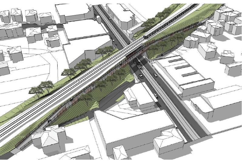
A proposal to bridge Toorak Rd for the Outer Circle Rail Trail is back on the agenda and under the wing of Victoria’s Department of Transport. The busy tram route is a major issue for residents using the trail, which is a rail-side path in this area.
People approaching from the north are faced with a pedestrian level crossing, followed by a steep decline to a car park off Toorak Rd. There cyclists are supposed to dismount and walk to a signalised pedestrian crossing to the west, then back on the other footpath to the trail. Naturally, there’ve been some inventive alternative routes created.
The bridge proposal last surfaced in 2018, when the City of Boroondara considered it a good candidate for the Safer Cyclists and Pedestrians Fund. At that stage, the project was estimated to cost $4 million but now that’s up closer to $10 million. The bridge would require considerable nightworks and possible disruption to tram and train services.
Cheaper options include continuing the trail on the eastern side of the Alamein line gradually down to road level and installing an extra signalised pedestrian crossing to get trail users back to the trail on the southern side of Toorak Rd. The department is due to present its final design early in 2023 with work to start in the middle of 2024.
More News

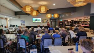
The 2024 Rail Trail Conference brought together 110 delegates (RTA’s biggest conference yet!) in Melbourne to lear...

You are looking longingly at one of Australia’s longer rail trails and dreaming of a multi-day ride with local meals a...

In the Spring 2024 edition of Connections, Jeff Nolan, RTA Southeast Queensland Representative, explores the developme...

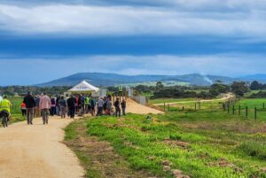
Missed out on a seat at the 2024 Rail Trails Conference? You can still join us for a walk or ride on the Warby Rail Trai...

The vagaries of Melbourne’s weather continue to hamper progress on the massive Yarra Valley Trail project, but the loc...

The Ringwood to Belgrave Trail has made it tantalizing close to the Melbourne suburb’s bustling railway station after ...

We’re inviting you to attend what may be the largest gathering ever of rail trail volunteers and supporters at our...

The East Gippsland Rail Trail from Bairnsdale to Orbost formally ends at Burn Rd, Newmerella, just 2km short of the old ...

The Great Ocean Road Coast and Parks Authority (GORCAPA) released its draft Great Ocean Road Regional Trail Strategy 202...

In March 2024 Rail Trails Australia reported that the City of Greater Bendigo (COGB) Council had put out the draft O’K...

The Adelaide Hills Council is interested in hearing from the Adelaide Hills Community and those who use the bike infrast...

On the 3 September 2024 the Detailed Design and costing for the Bethania to Logan Village Rail Trail (part of the Bethan...

Campaspe Shire Council recently awarded Northern Construction Group the contract to build approximately 10km of gravel c...

On 2 September, a very excited and proud Castlemaine Maryborough Rail Trail (CMRT) group celebrated the exciting announc...

The Great Victorian Rail Trail runs from Tallarook to Mansfield in Victoria’s High Country, with a branch line to ...

The Queensland Department of Transport and Main Roads (DTMR) have been working on the 7km section of the Atherton Tablel...
Calendar of Events
See upcoming eventsNews Archives
Receive Our Free Email News
Stay up to date with the latest news about Rail Trails with our free email news.
Register for news updatesFeatured Articles


More News
The 2024 Rail Trail Conference brought together 110 delegates (RTA’s biggest conference yet!) in Melbourne to lear...
You are looking longingly at one of Australia’s longer rail trails and dreaming of a multi-day ride with local meals a...
In the Spring 2024 edition of Connections, Jeff Nolan, RTA Southeast Queensland Representative, explores the developme...
Missed out on a seat at the 2024 Rail Trails Conference? You can still join us for a walk or ride on the Warby Rail Trai...
The vagaries of Melbourne’s weather continue to hamper progress on the massive Yarra Valley Trail project, but the loc...
The Ringwood to Belgrave Trail has made it tantalizing close to the Melbourne suburb’s bustling railway station after ...
We’re inviting you to attend what may be the largest gathering ever of rail trail volunteers and supporters at our...
The East Gippsland Rail Trail from Bairnsdale to Orbost formally ends at Burn Rd, Newmerella, just 2km short of the old ...
The Great Ocean Road Coast and Parks Authority (GORCAPA) released its draft Great Ocean Road Regional Trail Strategy 202...
In March 2024 Rail Trails Australia reported that the City of Greater Bendigo (COGB) Council had put out the draft O’K...
The Adelaide Hills Council is interested in hearing from the Adelaide Hills Community and those who use the bike infrast...
On the 3 September 2024 the Detailed Design and costing for the Bethania to Logan Village Rail Trail (part of the Bethan...
Campaspe Shire Council recently awarded Northern Construction Group the contract to build approximately 10km of gravel c...
On 2 September, a very excited and proud Castlemaine Maryborough Rail Trail (CMRT) group celebrated the exciting announc...
The Great Victorian Rail Trail runs from Tallarook to Mansfield in Victoria’s High Country, with a branch line to ...
The Queensland Department of Transport and Main Roads (DTMR) have been working on the 7km section of the Atherton Tablel...

3 comments on “Outer Circle Bridge Plan”
I agree that a bridge is needed at Toorak Road to provide a high level crossing for Cyclists and Walkers to safely cross Toorak Road but disagree that this should be built on the Western side of the existing railway bridge.
At some point The Outer Circle Rail Trail has to cross the Alamein railway line between Hartwell and Burwood Stations and for the following reasons this would be achieved far more safely by constructing the proposed new Bike Path Bridge and its approaches on the Eastern side of the line.
The existing railway crossing at Fordham Avenue is located approximately half way between the Burwood and Hartwell railway stations where trains are travelling at high speed and where the line is slightly higher than the surrounding ground and with its zig-zag layout this makes it extremely difficult for cyclists (young and old) to negotiate it.
In contrast, there is an existing very easy to use bike & pedestrian level crossing adjoining the northern end of the Burwood Railway Station where trains are travelling at no more than platform speed and would be able to stop in time if someone (again young or old) is caught on the tracks.
This crossing adjoins the Station Carpark on the eastern side of the rail line and extends northwards half way to Toorak Road and one side of this carpark could easily be used the for the Bike Path giving it direct access to the Southern side of Toorak Road.
Using a route through the existing Burwood Station crossing and its eastern Carpark should not be any more expensive and would allow the existing access paths on the Western side of the Rail Line to remain untouched.
It may also avoid some future tragedy at the high speed Fordham Road crossing point.
The elevated bridge is the only option to secure a safe and accessible crossing for the trails' users. The other option mentioned is additional signals 50 metres from the existing signalised crossing at Summerhill Rd. That doesn't qualify as an option merely an unnecessary duplication. It would still leave users making their way through the existing carpark and the existing near impossible climb.
Cost. the $10m is expensive but when amortised over the life of the bridge is well covered by the annual benefit (safety/accessibility). As to the amenity of adjoining (a few only) property owners, there are existing train/tram lines in case you hadn't noticed or heard.
While we're at it, the existing trail terminates at the Gardiners Creek/Malvern Valley GC. The Outer Circle rail line commenced at Hughesdale RS. Some planning should commence to "bridge" the Glen Waverly rail line/Monash Freeway and then Dandenong Rd from its existing terminus to "complete" the trail. The reserves (with their paths) are already there.
This project goes back well before 2018, it was included in the 2008 Boroondara Bicycle Strategy as the preferred long term option for a safe Anniversary / Outer Circle crossing of Toorak Road.
In 2011 the short term option, traffic signals on the east side of Summerhill Road intersection were installed, it is noteworthy that VicRoads deemed installation of traffic signals in line with the shared path were considered too dangerous at that location, yet this is what DOT/VicRoads is now proposing as an alternative to the bridge (the East side solution). At that time the path through Hartwell was designated as a shared path, however, the Hartwell traders decided they did not want to share "their" footpath with cyclists and the shared path status was removed. (Hartwell Traders Assocation was headed up by Bob Stensholt, former member for Burwood)
In 2014 council put the bridge option out for public consultation and it received overwhelming support from the community, that is, all but a small but vocal group of locals whose street backs onto the shared path and includes Bob Stensholt, the former member for Burwood. Council was forced to look at all possible alternatives and in May 2018 reported to council that the bridge was the safest option and sought approval seek funding for it's construction.
There is insufficient land to deliver a DDA path along the DOT's proposed "East side" option, it would require the lengthy and costly land acquisition process, land acquisition was acknowledged in the VicRoads DOT survey.
If the east side option gets up, rather than the bridge, we will be waiting another decade for the land situation to be resolved, with no improvements delivered in that time, in the meantime the cost to deliver the bridge escalates even further putting this safest option further out of reach.
It is also worth noting that signs erected by VicRoads along the shared path alignment, notifying riders of the recent public survey were stelthily removed twice, preventing many path users from having the oportunity to participate in this survey.