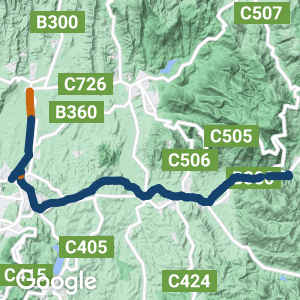
- The Warburton Rail Trail is one of Australia’s most popular. With a backdrop of the mountains in Yarra Ranges National Park, it passes through a picturesque landscape in the Yarra River valley
- Starting from the end of the metropolitan rail network at Lilydale it heads east through increasingly rural vistas to the resort town of Warburton
- The Yarra Valley Trail also starts in Lilydale but heads north for 7.5km towards Yarra Glen. It is planned to continue it to Healesville as a railside path and then across country to the Warburton Rail Trail somewhere around Woori Yallock, forming a loop of up to 50km
Nearby Attractions
- Plenty of good places to stay and great things to consume in the region’s cafes, pubs, wineries and restaurants
- Many towns at regular intervals along the route
- Healesville Sanctuary
- O’Shannassy Aquaduct Trail
- Mt Donna Buang
- Cement Creek Redwood Forest
- TarraWarra Museum of Art
- Yarra Valley Railway
- Gulf Station heritage farm
Last updated: 28 April 2024
There are two sections to this trail:
- The 40km Lilydale to Warburton Rail Trail
- The 7.5km Yarra Valley Trail shared path from Lilydale to Yering (with the 4.5km on to Yarra Glen still in the planning stages)
Most of the original platforms, featuring replica station signs, are still there but many station buildings are not. While some of the busy road crossings have treatments to assist trail users, there are still some requiring care and patience. ESTA Emergency Markers are installed on this trail. In an emergency, call 000 and quote the alphanumeric code on the marker closest to you, eg SYR22. Trail hubs have been constructed with restrooms, car parking, picnic tables, bike racks, information boards and water refill stations. There are horse stabling facilities at Woori Yallock.
For public transport options scroll down to ‘GET AROUND’ and click on ‘SHOW MORE’
Section Guides
Lilydale to Mt Evelyn (7km)
- This section has a climb of 130m up to Mt Evelyn through semi-urban bushland, including an owl reserve. There’s a tunnel under Birmingham Rd
- Elevated Lilydale station is a terminus of the suburban rail network and it has toilets and car parking. The suburb is a major one with all facilities.
- Signage leading to the rail trail is a bit vague, so refer to our map
- The trail hub off Beresford Rd has more parking. Use the signalised pedestrian crossing to cross this busy road
- There are some steep gradients on the way out of town, due to a diversion around Mt Lilydale College, which took over some of the rail corridor
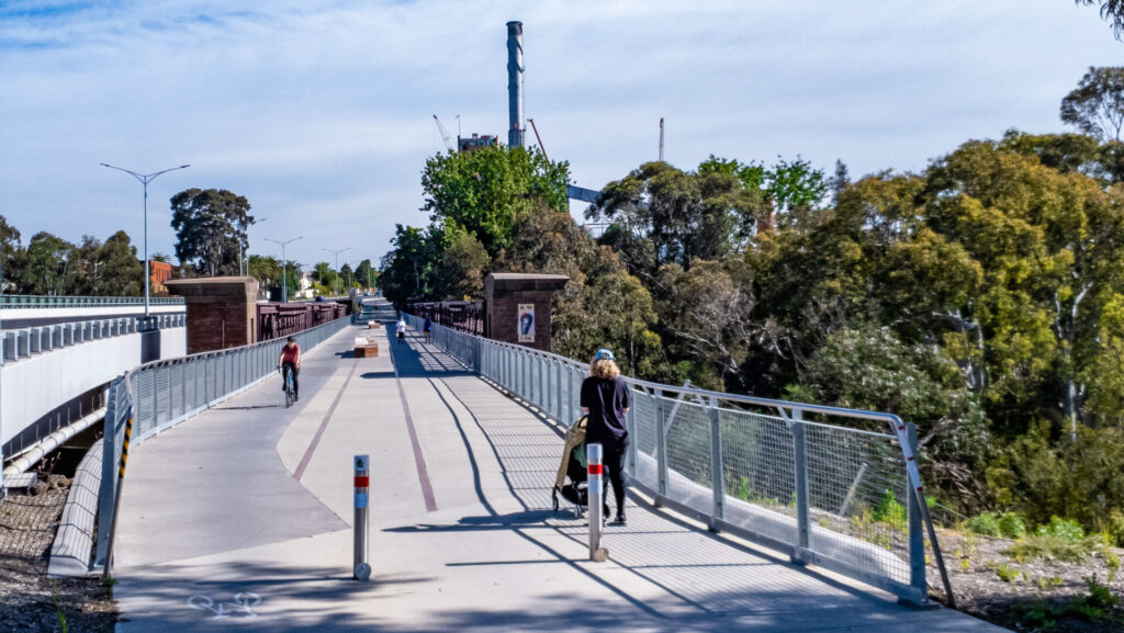
- The Red Bridge over the six-lane Maroondah Hwy at Lilydale is a major feature
- At Old Gippsland Rd more car parking is available.
- The former Mt Evelyn Station has plenty of car parking and community facilities, with toilets nearby. The town has a small shopping strip with several cafes and takeaway outlets.
Mt Evelyn to Woori Yallock (16km)
- There is a 135m drop in elevation to Woori Yallock. There is a forested descent to Wandin, then farmland and wineries the rest of the way
- At Monbulk Rd, Mt Evelyn, there is more car parking available at the Trail Cafe.
- Wandin has parking at the trail hub at the station site, off the Warburton Hwy. Toilets are up at the shops, about 400m up the highway.
- Seville has car parking at the station site on the north side of Victoria Rd. Carriage Cafe is a short walk away on the south side of Victoria Rd.
- Killara Station site, between Seville and Woori Yallock, has car parking in Kylie Lane and picnic tables.
- Woori Yallock’s trail hub and horse facilities are at the station site at the bottom of Syme Rd. Toilets are opposite the car park. The town has a small shopping area with a good bakery-cafe, up Symes Rd.
Woori Yallock to Yarra Junction (9km)
- A nice stretch of trail following the river closely, with woodlands and pasture flats and views to Mt Donna Buang
- Launching Place has plenty of car parking near the station site. A hotel is also nearby.
- Yarra Junction has plenty of car parking. Toilets are next to the trail. The station building is the original one from Lilydale and is now a museum. The town is a medium-sized one with many facilities, cafes, bakery etc.
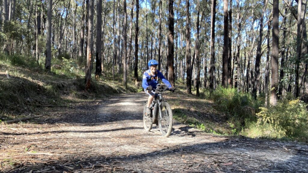
Yarra Junction to Warburton (8km)
- The trail follows the river through bushland and open pasture to Millgrove. Toilets are right next to the trail near the mountain bike trailhead. There are small curio shops and a kids playground in Millgrove. From Millgrove the trail is sealed.
- Warburton has car parking at the station site. Cog Bike Cafe and Cog Bike Shop both trade in this area, but there are plenty of other options in the town. Warburton is a medium-sized town with a hotel and is a stepping-off point for Mt Donna Buang.
Lilydale to Yering (7.5km)
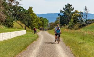
- This is a trail through open rural pastureland and scattered bushland with open views of the Yarra Valley and surrounding mountains.
- Coldstream has toilets, a pump track and parking at the station site, with a variety of shops and a brewery in the town, east on the concrete shared path along Station St
- Yering has parking available, with other facilities planned. There may be a food van on site.
CONNECTING TRAILS
- Yarra River Walk (4km) The Warburton railway line didn’t stop at the station but continued over the highway to La La Siding, where the engines were turned around for the return trip to Lilydale (the turntable is still visible). It was also home to narrow-gauge timber trains coming in from the east. This trail takes you past a stand of redwood trees and through a caravan park but peters out on Woods Point Rd after nearly 4km. You can catch a bus back or return via Riverside Drive on the other side of the Yarra River
- Mt Evelyn Aquaduct Trail (6.4km) This shared path leaves the Warby Rail Trail after Mt Evelyn and is a pleasant way to reach the Olinda Creek Trail
- Warburton to Carrum Trail (90km) The Olinda Creek Trail near Swansea St in Lilydale goes through Lions Park before becoming the Warburton to Carrum Trail and heading across the outer suburbs via the Dandenong Creek Trail and others to Port Phillip Bay
![Start of the trails in Lilydale with the elevated Metro station in background [2022]](https://www.railtrails.org.au/wp-content/uploads/2022/10/V13-127-Lilydale-20221016_103523-300x169.jpg)
Start of the trails in Lilydale with the elevated Metro station in background [2022]
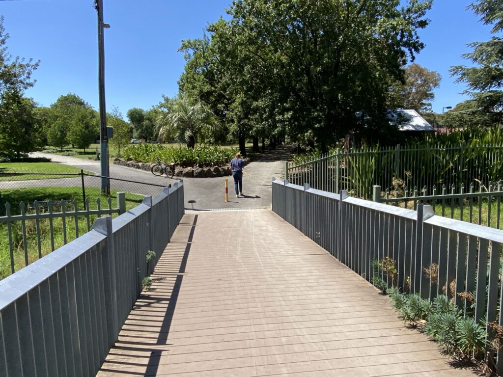
![The trail junction at Lilydale; Yering to the left, Warburton to right [2021]](https://www.railtrails.org.au/wp-content/uploads/2021/11/V13-126-Lilydale-20211031_122032-300x169.jpg)
The trail junction at Lilydale; Yering to the left, Warburton to right [2021]
![Enjoying the bridge over the six-lane Maroondah Hwy at Lilydale [2011]](https://www.railtrails.org.au/wp-content/uploads/2021/11/V13-120-Lilydale-Maroondah-Hwy-Bridge-2011-08-P1000695_crop-266x300.jpg)
Enjoying the bridge over the six-lane Maroondah Hwy at Lilydale [2011]
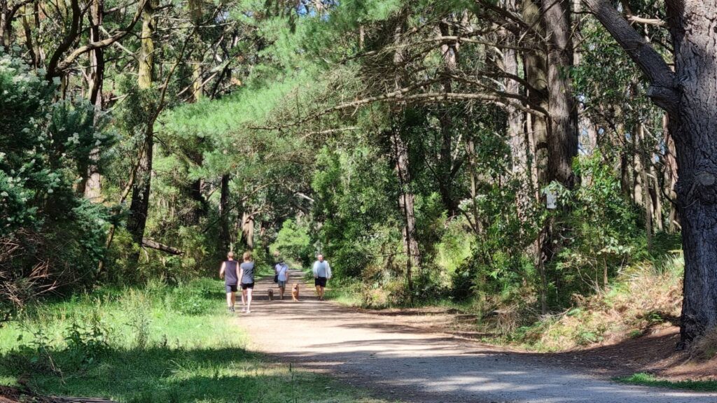
![Riding up and walking down between Lilydale and Mt Evelyn [2021]](https://www.railtrails.org.au/wp-content/uploads/2021/11/V13-126-Lilydale-to-Mt-Evelyn-walkers-2021-10-31_123719-300x169.jpg)
Riding up and walking down between Lilydale and Mt Evelyn [2021]
![The Mt Evelyn Community House blends in at the station precinct [2021]](https://www.railtrails.org.au/wp-content/uploads/2021/11/V13-162-Mt-Evelyn-2021-10-31_124904-300x169.jpg)
The Mt Evelyn Community House blends in at the station precinct [2021]
![The Mt Evelyn Station's former platform is a shady resting spot [2021]](https://www.railtrails.org.au/wp-content/uploads/2021/11/V13-162-Mt-Evelyn-2021-10-31_125044-300x169.jpg)
The Mt Evelyn Station's former platform is a shady resting spot [2021]
![A bit further on from Mt Evelyn Station is another cafe on the trail [2021]](https://www.railtrails.org.au/wp-content/uploads/2021/11/V13-162-Mt-Evelyn-2021-10-31_125534-The-Trail-Cafe-Economy-300x169.jpg)
A bit further on from Mt Evelyn Station is another cafe on the trail [2021]
![The beautiful scenery between Mt Evelyn and Wandin [2021]](https://www.railtrails.org.au/wp-content/uploads/2021/11/V13-162-Mt-Evelyn-to-Wandin-walkers-2021-10-31_130017-300x169.jpg)
The beautiful scenery between Mt Evelyn and Wandin [2021]
![Typical signage along the rail trail, here at Wandin [2021]](https://www.railtrails.org.au/wp-content/uploads/2021/11/V13-211-Wandin-2021-10-31_130958-signage-169x300.jpg)
Typical signage along the rail trail, here at Wandin [2021]
![The peaceful site of Wandin Station [2021]](https://www.railtrails.org.au/wp-content/uploads/2021/11/V13-211-Wandin-2021-10-31_140317-300x169.jpg)
The peaceful site of Wandin Station [2021]
![Spring and wattyls in bloom in Seville [2015]](https://www.railtrails.org.au/wp-content/uploads/2021/11/V13-262-Seville-wattles-2015-08-P8026018-300x258.jpg)
Spring and wattyls in bloom in Seville [2015]
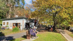
![The Carriage Cafe at Seville is a real landmark and popular stop [2022]](https://www.railtrails.org.au/wp-content/uploads/2022/10/V13-263-Seville-Carriage-Cafe-20221016_130455-300x169.jpg)
The Carriage Cafe at Seville is a real landmark and popular stop [2022]
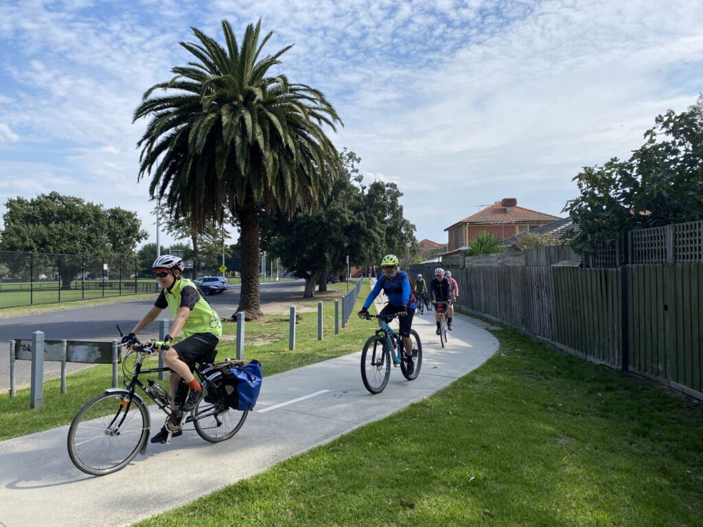
![The busy rail trail welcomes all users, here at Killara [2020]](https://www.railtrails.org.au/wp-content/uploads/2021/11/V13-291-Killara-2020-05-0677-HORSE_crop-300x170.jpg)
The busy rail trail welcomes all users, here at Killara [2020]
![Killara Station is another popular rest and access point [2020]](https://www.railtrails.org.au/wp-content/uploads/2021/11/V13-291-Killara-2020-05-30_145416-300x169.jpg)
Killara Station is another popular rest and access point [2020]
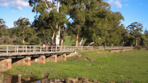
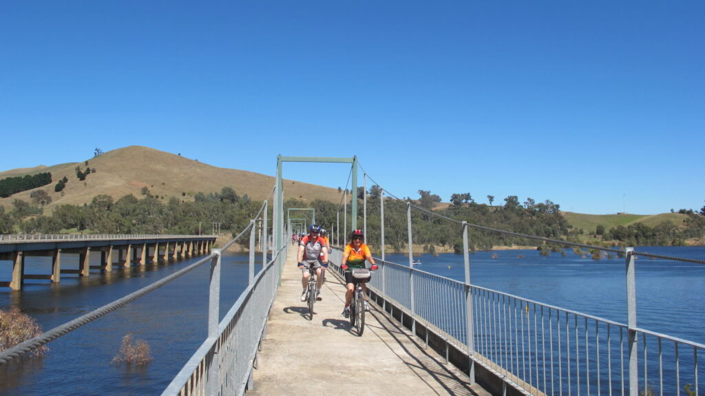
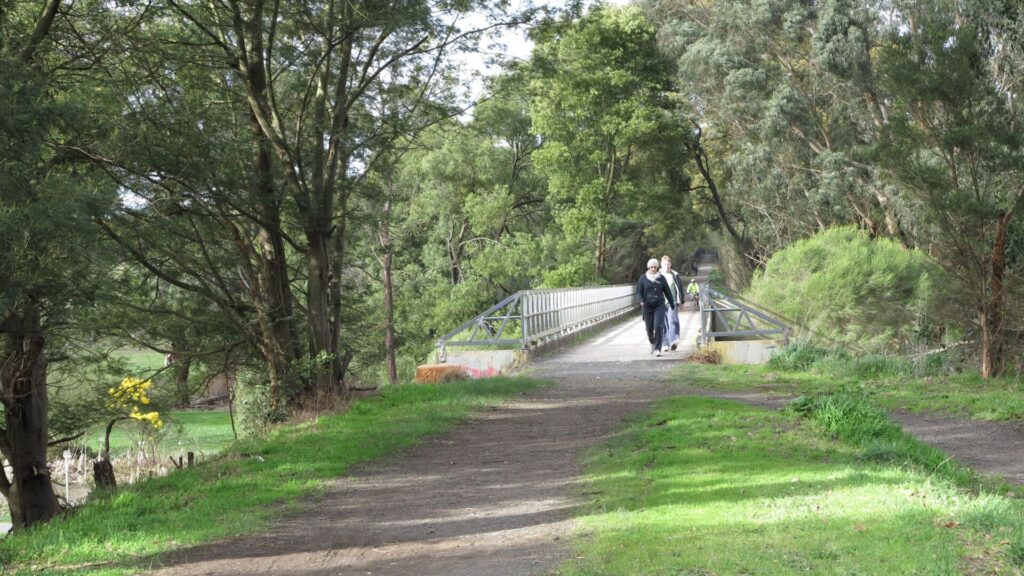
The Woady Yallock bridge is the longest on the trail and was restored with the help of the CFA (2020)
![The Woori Yallock Station site is a popular trail hub [2020]](https://www.railtrails.org.au/wp-content/uploads/2021/11/V13-311-Woori-Yallock-2020-05-30_142833-hub-300x169.jpg)
The Woori Yallock Station site is a popular trail hub [2020]
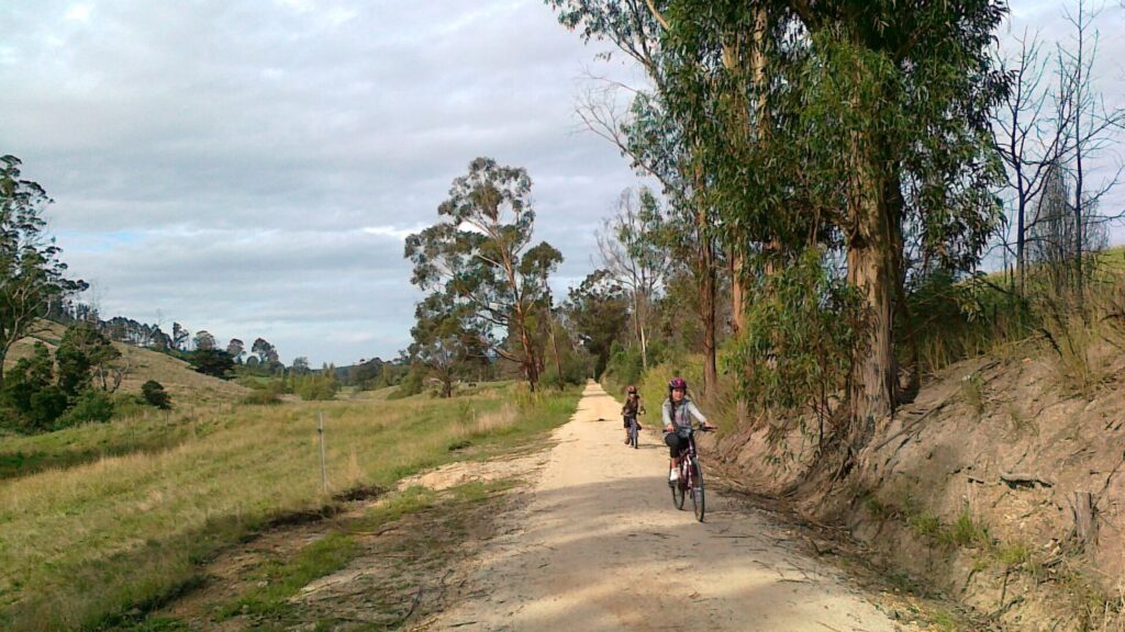
![Typical scenery, here at Woori Yallock [2020]](https://www.railtrails.org.au/wp-content/uploads/2021/11/V13-311-Woori-Yallock-2020-05-0665-300x169.jpg)
Typical scenery, here at Woori Yallock [2020]
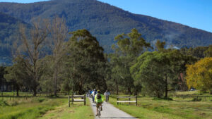
Riding near the Yarra River at Launching Place (2020)
![Enjoying the trail at Yarra Junction [2020]](https://www.railtrails.org.au/wp-content/uploads/2021/11/V13-409-Yarra-Junction-2020-05-30_104810_crop-300x169.jpg)
Enjoying the trail at Yarra Junction [2020]
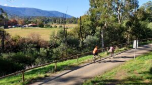
The scenery at Wesburn with Mt Donna Buang in the background (2020)
![Most major road crossings have traffic lights, as at Millgrove [2020]](https://www.railtrails.org.au/wp-content/uploads/2021/11/V13-460-Millgrove-2020-05-0642-300x169.jpg)
Most major road crossings have traffic lights, as at Millgrove [2020]
![Enjoying the autumn colours at Millgrove [2024]](https://www.railtrails.org.au/wp-content/uploads/2024/04/V13-450-Millgrove-autumn-colours-2024-04-_DSF5856-300x169.jpg)
Enjoying the autumn colours at Millgrove [2024]
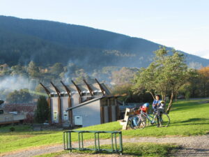
End of the trail at Warburton overlooks the town and the river below
Cog Cafe and bike hire at Warburton is busy on weekends. (2020)
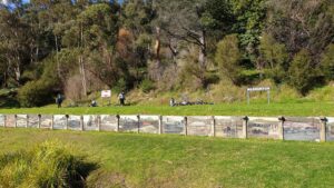
Warburton Station site is a great place for a picnic. Don't miss the historical paintings on the old platform wall. (2020)
![The Yarra River is a feature of Warburton with walks and picnic spots [2024]](https://www.railtrails.org.au/wp-content/uploads/2024/04/V13-500-Warburton-Yarra-River-2024-04-27_140139-300x169.jpg)
The Yarra River is a feature of Warburton with walks and picnic spots [2024]
![This turntable was used to turn around steam locomotives at La La Siding, east of Warburton station. The Yarra River Walk is on the left[2024]](https://www.railtrails.org.au/wp-content/uploads/2024/04/V13-500-Warburton-La-La-Sidings-2024-04.-Yarra-River-Walk-on-left-2-300x225.jpg)
This turntable was used to turn around steam locomotives at La La Siding, east of Warburton station. The Yarra River Walk is on the left[2024]
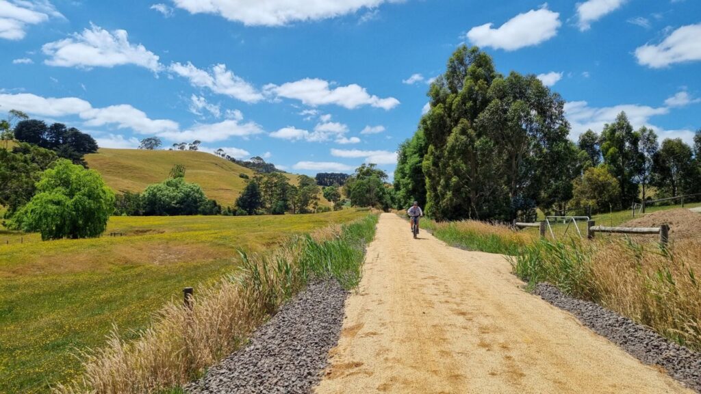
![Scenery between Lilydale and Coldstream on the Yarra Valley Trail [2020]](https://www.railtrails.org.au/wp-content/uploads/2021/11/V13-125-Lilydale-Blacks-Quarry-2020-11-03_092326-300x169.jpg)
Scenery between Lilydale and Coldstream on the Yarra Valley Trail [2020]
![Coldstream Station site on the YVT now has toilets and pump track [2020]](https://www.railtrails.org.au/wp-content/uploads/2021/11/V13-662-Coldstream-2020-11-03_110512-300x169.jpg)
Coldstream Station site on the YVT now has toilets and pump track [2020]
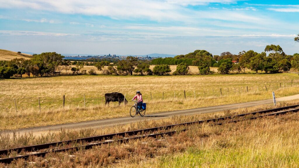
![The scenery between Coldstream and Yering [2022]](https://www.railtrails.org.au/wp-content/uploads/2022/12/V13-663-Coldstream-to-Yering-8969_crop-300x169.jpg)
The scenery between Coldstream and Yering [2022]
The current northern end of the Yarra Valley Trail at Yering (2020)
![The YVT is designed for all users to enjoy, here at Yering [2020]](https://www.railtrails.org.au/wp-content/uploads/2021/11/V13-711-Yering-station-Adaptive-bike-2020-11-03_103410-300x169.jpg)
The YVT is designed for all users to enjoy, here at Yering [2020]
![Restored Yarra Glen Station awaiting the arrival of heritage trains [2023]](https://www.railtrails.org.au/wp-content/uploads/2020/11/V13-750-Yarra-Glen-station-2023-10-restored-and-tracks-relayed-on-concrete-sleepers-2023-10-1-300x169.jpg)
Restored Yarra Glen Station awaiting the arrival of heritage trains [2023]
Bike hire in Lilydale – Yarra Valley Cycles
Public Transport
The start of both trails is at the end of Metro’s Lilydale train line, which has regular services. There are Route 683 buses operated by local company Martys between Lilydale to Warburton which are fitted with fold-down front racks that carry two bikes for those who want to do shorter sections of the Warby Trail. Route 685 PTV buses run to Coldstream. On this route, more serous bicycle carrying restrictions apply.
Refer to the PTV web page for map and timetables, or use the navigation app of your choice.
Do you know of a bike hire or transportation service on this rail trail that should appear here? If so, let us know at admin@railtrails.org.au.
Information and Links
The Warburton Rail Trail and Yarra Valley Trail are managed by the Yarra Ranges Council. Contact them via the link below regarding damage to the trail from flooding or fallen trees, etc. Please note, however, when reporting issues with the trail do not quote the Emergency Marker numbers to identify the location because the shire’s maintenance dispatch system is not compatible with it. The SYR numbers are for use by emergency services only.
Friends of Warburton Trail – Lilydale at this LINK.
Contact Rail Trails Australia
To contact us about this rail trail, email vic@railtrails.org.au
Background Information
Traditional Owners
We acknowledge the Woiworung people, the traditional custodians of the land and waterways on which the trails are built.
Development and future of the rail trail
The Lilydale to Warburton Rail Trail was one of Australia’s first, in the mid-1990s, and was completed back to Lilydale in 1999. The impressive bridge across the Maroondah Hwy was constructed in 2011, completing the trail from Lilydale Station. In April, 2016, the Yarra Ranges Council authorised design of the Yarra Valley Trail as far as Yarra Glen. In 2019 work started, with Stage 1A producing with a high-quality, 7.5km trail as far as Yering. Stage 1B from Yering to Yarra Glen will feature rebuilt bridges to replace the 500m of heritage bridges across the Yarra Flats that were damaged or destroyed in the 2009 “Black Saturday” bushfires. There will be a new bridge over the Yarra River with an elevated trail leading to the Yarra Glen Station. The reinforced and repaired bridges will retain the existing character.
The trail may continue on a rail-side path to Healesville then along an aqueduct path and other avenues to Woori Yallock on the Warburton Rail Trail, forming a huge picturesque loop for cyclists and other users. There will also be north and south Yarra Glen loops connecting to the Yarra Valley Trail, leading to amazing scenery, many wineries and the Yarra Valley Chocolaterie.
The Feasibility Study Summary can be downloaded here, which contains full details of the proposal.
Rail Line History
The Warburton line was opened in 1901 to carry farm produce from the Yarra Valley to Melbourne. Timber was also a major commodity being transported on the line after many tramways through the Yarra Valley forests were linked with the line at Warburton and Yarra Junction. The line closed in 1965 and the track was removed in 1969, although rails are still visible at some of the level crossings. An historic bridge near Anderson St, Lilydale, is on the original alignment of the main road over the line.
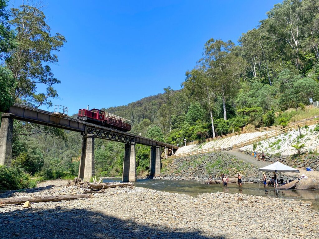
The Healesville line was completed by Victorian Railways in 1889 and closed in 1981. The Yarra Valley Railway group has access to the Yarra Glen – Healesville section and currently runs services between Healesville and one of the major features of the line, a tunnel about 4km away. Reconstruction of the line on to Yarra Glen is ongoing. The trail would complement the railway as happens on the Bellarine Rail Trail near Geelong.
Junction gets Connecting Trail
Posted: 22/03/24
Riders and walkers will soon have another escape from the very popular Warburton Rail Trail ...
More...Yarra Valley Trail Stage 2A – Good news
Posted: 28/02/24
The Shire of Yarra Ranges announced this week that it had secured promised funding of $4.1...
More...Safer crossing for Yarra Valley trails
Posted: 02/11/23
The unstoppable Yarra Ranges Council have been at it again, with pedestrian-activated traffic lights installed ...
More...“Ride into History” along the Lilydale-Warburton Rail Trail
Posted: 24/10/23
Join the Upper Yarra Valley Historical Society's slow paced bicycle ride from Warburton to Yarra ...
More...Back on Track
Posted: 13/04/23
The scenery between Coldstream and Yering (2022) The Yarra ...
More...Safer route for Lilydale to Warburton Rail Trail users
Posted: 13/09/21
Artist's impression of refurbish Lilydale Railway Station after level-crossing ...
More...Murals at Woori Yallock Railway Station along the Warburton Trail (Vic)
Posted: 26/03/20
Woori Community House (WCH) and community members have been working together to design and install ...
More...Yarra Valley Trail Stage 1a Officially Opened
Posted: 29/02/20
All ages enjoyed the new trail in all conditions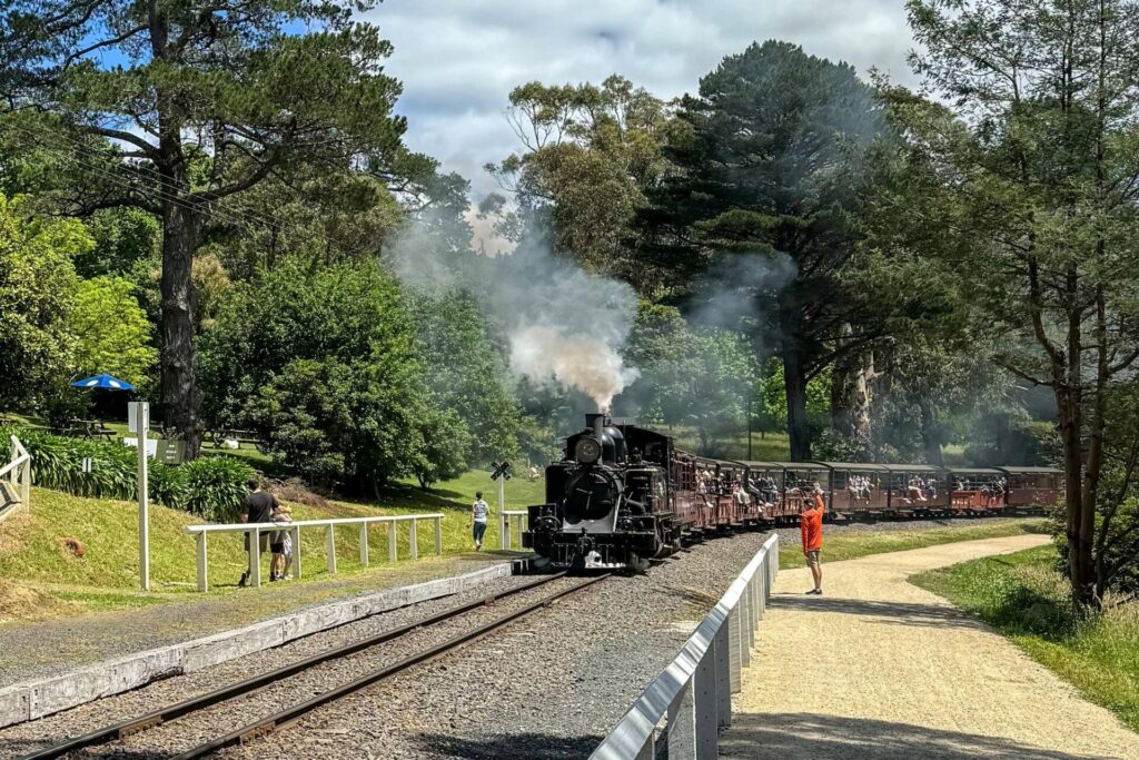
Eastern Dandenong Ranges Trail
Dandenongs, 50 km southeast of CBD
15 km


Heathmont to Belgrave Trail
Eastern suburbs, 40 km from the CBD
16 km


Powelltown Tramways
Yarra Ranges, 80 km east of Melbourne
31 km
Outer Circle Rail Trail
Eastern suburbs, 6 km from Melbourne CBD
17 km
Hawthorn to Kew Rail Trail
Inner suburbs, 9 km east of Melbourne CBD
1 km
Rosstown Rail Trail
Southern suburbs, 9 km from the CBD
8.8 km

Inner Circle Rail Trail
Inner suburbs, 5 km from the CBD
4.8 km
Noojee Trestle Bridge Rail Trail
100km east of Melbourne
3 km

Rokeby to Crossover Rail Trail
North of Warragul, 103km from Melbourne
5 km
Sandridge Railside Trail
Melbourne city, 1 km from GPO
4 km
Webb Dock Bridge
Docklands, 1 km from Melbourne CBD
0.2 km
Meadowlink Rail Trail
Broadmeadows, 20 km north of CBD
1.2 km

Mornington Railside Trail
Mornington Peninsula, 60 km south of CBD
4 km
Great Victorian Rail Trail
90 km north of Melbourne
134 km
Tyers Junction Rail Trail
Gippsland, 30km north of Moe, 160km from Melbourne
7 km
Red Hill Rail Trail
Mornington Peninsula, 90 km south of CBD
6.3 km
Bass Coast Rail Trail
130km south-east of Melbourne
23 km
Walhalla Goldfields Rail Trail
165km east of Melbourne
7 km
Moe – Yallourn Rail Trail
Latrobe Valley 130km east of Melbourne
7 km
Grand Ridge Rail Trail
Strzelecki Ranges, South Gippsland, Victoria, 160km from Melbourne
13 km
Bellarine Rail Trail
Bellarine Peninsula, 75 km southwest of Melbourne's CBD
35 km
Great Southern Rail Trail & Tarra Trail
South Gippsland, 130 km southeast of Melbourne
109 km
Fyansford Rail Trail
North Geelong, 5 km from town centre
4.4 km
O’Keefe Rail Trail
East of Bendigo, 150km from Melbourne
50 km
Woodend to Daylesford (incl Domino) Rail Trail
85km north west of Melbourne
5 km
Gippsland Plains Rail Trail
Near Traralgon, Gippsland, 190km east of Melbourne
62 km
Nearby Trails
Eastern Dandenong Ranges Trail
Dandenongs, 50 km southeast of CBD
15 km
Heathmont to Belgrave Trail
Eastern suburbs, 40 km from the CBD
16 km
Powelltown Tramways
Yarra Ranges, 80 km east of Melbourne
31 km
Outer Circle Rail Trail
Eastern suburbs, 6 km from Melbourne CBD
17 km
Hawthorn to Kew Rail Trail
Inner suburbs, 9 km east of Melbourne CBD
1 km
Rosstown Rail Trail
Southern suburbs, 9 km from the CBD
8.8 km
Inner Circle Rail Trail
Inner suburbs, 5 km from the CBD
4.8 km
Noojee Trestle Bridge Rail Trail
100km east of Melbourne
3 km
Rokeby to Crossover Rail Trail
North of Warragul, 103km from Melbourne
5 km
Sandridge Railside Trail
Melbourne city, 1 km from GPO
4 km
Webb Dock Bridge
Docklands, 1 km from Melbourne CBD
0.2 km
Meadowlink Rail Trail
Broadmeadows, 20 km north of CBD
1.2 km
Mornington Railside Trail
Mornington Peninsula, 60 km south of CBD
4 km
Great Victorian Rail Trail
90 km north of Melbourne
134 km
Tyers Junction Rail Trail
Gippsland, 30km north of Moe, 160km from Melbourne
7 km
Red Hill Rail Trail
Mornington Peninsula, 90 km south of CBD
6.3 km
Bass Coast Rail Trail
130km south-east of Melbourne
23 km
Walhalla Goldfields Rail Trail
165km east of Melbourne
7 km
Moe – Yallourn Rail Trail
Latrobe Valley 130km east of Melbourne
7 km
Grand Ridge Rail Trail
Strzelecki Ranges, South Gippsland, Victoria, 160km from Melbourne
13 km
Bellarine Rail Trail
Bellarine Peninsula, 75 km southwest of Melbourne's CBD
35 km
Great Southern Rail Trail & Tarra Trail
South Gippsland, 130 km southeast of Melbourne
109 km
Fyansford Rail Trail
North Geelong, 5 km from town centre
4.4 km
O’Keefe Rail Trail
East of Bendigo, 150km from Melbourne
50 km
Woodend to Daylesford (incl Domino) Rail Trail
85km north west of Melbourne
5 km
Gippsland Plains Rail Trail
Near Traralgon, Gippsland, 190km east of Melbourne
62 km
27 reviews of “Warburton Rail Trail/Yarra Valley Trail”
Rode from Warburton to Killara station and back – mostly compacted gravel and fairly flat which made for an enjoyable trip. Very scenic trail through farms and pastures – even saw a couple of camels.
A very popular trail – not much to add to previous reviews, it's one of the best. In Warburton we dined at a new South Indian restaurant Babaji's which we liked a lot. It's at the western edge of town and we were camping at the caravan park at the eastern edge, it's about 2.5km but there is a lovely riverside walking path the whole way, or you can do 50/50 road and rail trail. Where else is there a great restaurant served by both walking trail and rail trail? We had breakfast at the 3383 cafe which is also new – not recommended. I left my cycling gloves at Woori Yallock station, they've done quite a few rail trails.
We headed off from Warburton on Saturday morning in cold, drizzly weather. Fortunately the drizzle cleared and we had a lovely ride to Wandin and back. The trail was in excellent condition given the preceding rain. We stopped at the Carriage Cafe for coffee and cake then continued back to Warburton. All up 60km enjoying the beautiful scenery of the Yarra Valley.
My favourite local trail. I live just 20-minutes drive from Lilydale and Mount Evelyn, and am lucky to have completed this in many ways and all seasons:
– Lilydale-Warburton return, staying overnight at "hike and bike" motel
– One way in each direction (MUCH more scenic going towards Warburton, and best in afternoon so sun isn't in your eyes and photos not backlit. However, Warby-Lilydale is faster)
– Small sections with my kids (ideal start/end point is Seville because it is flattest 10km either side, and have a snack/meal at the Seville train cafe where kids can safely run around without a car in sight.)
The adjoining section of the Yarra Valley Trail from Lilydale to Yering is pretty, especially heading towards Yering. The "food van" mentioned sells salami and jellies to eat with cheese, so recommend BYO snacks/lunch if going with kids. There's a fun bike/BMX park beside the trail near Coldstream. I still prefer sections of the Warburton Rail Trail though.
Rode from Lilydale to Warburton and return yesterday. Perfect weather with no wind. The trail was in great condition with a new surface treatment between Launching Place and Millgrove. There were literally hundreds of people using this trail. I have never in my life seen so many dogs of different shapes and breeds all in one day. There was a line of people at every cafe in Warburton and the Carriage Cafe at Seville was also very busy. It will possibly be a bit less crowded after school holidays. Very popular trail, and very enjoyable ride.
We came down from NSW to explore some of the new extensions to existing rail trails in Victoria. This trail between Lilydale and Yarra Glen was third on our list. It is only 7.5km out to Yering at this stage, but it is very good so far. Great smooth surface and lots of interpretive signs. The BMX park at Coldstream was very popular today. No coffee shops or refreshments on the trail yet, but hopefully it will be extended on to Yarra Glen in the near future.
The best rail trail we've ridden so far. So pretty – even in February.
We stayed in Worri Yallock and rode to Warburton and back one day and to Lillydale and back the next day.
The donuts at the Warburton bakery weren't as good as we'd hoped.
The signage is a bit scarce at the Lilydale end.
We ride this trail about once a week on average, such a great trail to ride.
1/ There is water available from Yarra Valley water stations at most station locations.
2/ There are toilets available at most stations.
3/ There are plenty of seats provided for those walking or riding to stop.
4/ There are great views of the valley past Killara station to make your ride very enjoyable.
5/ On the sunnier days, remember the sun cream, their is a fair amount of open trail.
6/ Trip: The donuts & coffee at the Warburton bakery are great, before the ride back!
Rode from Lilydale to Yering and back. New Lilydale station is impressive!
Hopefully signage is clearer now.
Usual wonderful scenery and the trail is in good shape given all the rain and flooding.
Also visited Seville and the Carriage Cafe, all very popular.
I thoroughly enjoyed this trail, even though, once again (sorry to labour this point), NO SIGNAGE in Lilydale pointing you to the start of the actual trail! I found what I thought was the correct trail however, that turned out to be the Carrum to Warburton Trail which takes you in a big loop through suburbia and back to the Lakes area! Eventually I found the Olinda Creek Trail which lead me, eventually, to Wandin and thence to Woori Yallock, where I actually found the trail. However, yet AGAIN, there's no signage in the village pointing you to the actual trail which is about 2km away.
Once on the correct trail, it was simply AWESOME! Well marked, smooth, hard-packed gravel, stunning scenery, lots of bird life and very, easy and pleasant riding. I especially liked the 3-4kms downhill roll into Lilydale, but, AGAIN, no signage directing you into town from the end of the gravel path!
Incredibly, to my utter surprise, the trail ended less than 100m from my car, however, as there was NO SIGNAGE indicating my car was parked at the start of the Trail, I had gone the opposite direction onto the Carrum to Warburton Trail. Oops!!!
SIGNAGE MUST be improved if these trails are to be used by non-locals.
Thoroughly enjoyed the new Lilydale to Yering section when we rode this on Melbourne Cup day.
Beautiful scenery and very popular.
Rode this trail today from where I live in Warburton to Seville and enjoyed it greatly. We need to lobby our politicians to build a bike overpass at Yarra Junction to take away this extremely dangerous road crossing Its disaster waiting to happen on a busy weekend or even a set of lights would be great to reduce the risk. Lots of families with young kids ride this trail and the bike bridge they built at Patterson Lakes in Thompson Rd is exactly whats needed.All that said its a beautiful ride and despite a very sore bottom from saddle ache I really love this ride. Its so very peaceful with magnificent mountain scenery. Looking forward to riding the Lilydale end section of the ride in coming times
Rode this trail again over 31/12/19 & 1/1/20. Deservedly a popular trail, with great scenery, trail condition, facilities. To and from Lilydale by train. Hired a normal bike and an e-bike from Cog bikes who delivered to Lilydale for us to pick up, and collected afterwards. Overnight at the lovely Warburton – lots to look at and a variety of food and accommodation. Day 2 we went via the also popular O’Shannassy Aqueduct Trail between Warburton and Millgrove – highly recommended.
Dec 2019 mid-week it was fantastic! I got an early Met train from far north of Melbourne. Quiet day not many people around so it was perfect for the ride. I agree with all these wonderful comments my only concern would be avoid a really busy weekend with too many walkers, horses & cyclists. Coffee cafe stops everywhere and spent lunchtime laying on the green grassy river bank in Warburton before riding back to Lilydale station.
I have changed my mind. I thought the Great Southern RT was the best in Victoria, but now I think Lilydale to Warburton is better.
A great well-maintained surface for the entire length, with the last few kms from Millgrove to Warburton recently sealed with smooth bitumen. The rest is hard-packed gravel so good I even used my road bike part of the way.
Apart from the steep pinch at the Lilydale end near the beginning, the hills are the smooth gradient you would expect from a rail trail. Going downhill on the other side was fun.
It was a beautiful spring day, sunny and no wind. The views are stunning, and endless.
There are plenty of nice towns along the way to stop and explore, and indulge in whatever takes your fancy. Warburton itself is a beautiful picture and worthy of the effort to get there.
You are well catered for with bike hire options, bike shops, and pick-up services too.
If you only ever do 1 railtrail in your life, do this one.
This was my 23rd railtrail in my challenge is to ride every trail in Victoria this year as thanks to my donor in this the 30th year after my liver transplant. Only 4 to go!
I’ve just finished a 3 day return trip with two 7 year olds and this is a great introduction to overnight cycling for kids. There’s more information about our trip here https://afamilycyclist.wordpress.com/2017/11/13/lilydale-to-warburton-rail-trail/
Completed this trail yesterday. Probably the best rail trail that I have done so far in Victoria. It is well-signed, wide and generally well-maintained. Most of the major road crossings are signalised which make it much easier and safer to cross. However, the crossing at the Warburton Highway in Wandin North is quite hazardous and can take a long time to wait for the road to be clear of vehicles. The other major hazard is in some sections of the unsealed path where gravel washes up on the sides making it very unstable and slippery. Other than these two grips, the trail is very scenic and has many facilities along the way. Highly recommended journey.
Rode to Warburton for the second time yesterday and returned today. If anyone is contemplating the ride, this is a great one to do. Beautiful scenery all the way, good safe road crossings for all ages. Plenty of views of the Dandenong and Yarra Valley Ranges and also the Yarra River. There are side tracks to explore if desired and a Museum at Yarra Junction. Some of the Stations still have the Railway house nearby. There are plenty of eateries along the trail and all within easy distance, and staff are friendly. An interesting feature along the trail is the fruit trees. They range from plums to apples, peaches to nectarines and an occasional citrus. Fire preparedness in full swing with slashing. This is causing grass sticks and stones to be on the trail and hard to see in the cut grass. However it is essential work. Great to see so many other riders and walkers and even a horse rider using this facility. Commencing and finishing at Lilydale makes is so easy when using the MET System. Extending this trail to Yarra Glen would be the cream on the cake and put it in a higher use no doubt. This trail has a marvellous emergency locator system if ever needed. The reference points are approximately one kilometre apart. A beautiful flat surface all the way making it suitable for young ones. Works currently underway around Mt Evelyn Wandon to resurface it. Even these workers are friendly. I stayed at the Warburton Alpine retreat with it’s good food and friendly staff. The town has a walking track along the river and was a great way to relax after the ride. I would highly recommend this to all ages, and I am sure that you will not be disappointed. Well done to the friends of the trail for their work. Will see me again.
I rode this trail on Sunday 17th May 2015, and it was magnificent all the way from Lilydale to Warburton and back. This rail trail is my favorite, which I have done many times. The best are the sunny autumn days – like Sunday was; where you can see all the way up the Yarra valley as you come off Mt Evelyn at Serville, out into the open. It is good to see maintenance work being done to the trail to improve the surface in parts (especially the bridge) – but I’m glad it remains gravel and hasn’t been sealed. The hardest part is the climb back up Mt Evelyn, but the downhill into Lilydale makes it worthwhile. Plenty of places to stop and eat – a great day out.
Hi if people are a bit weary of horses, best thing to do is ride on the opposite side slow until you have passed them both good for riders and on bikes and horses, and please be patient.
I had a wonderful ride from Woori Yallock to Mt Evelyn on the weekend … perfect weather, no wind. I have to agree with some of the other comments regarding horse poo, it was everywhere, and also there were a group of horse riders and the biggest horse in the group was kicking its back legs out, very scary if you’re on a bike.
Rode the whole trail in early March. A great trail. I left the car at Killara (Gruyere?) and rode to Lilydale, then to Warby, then back to the car (80km all up) – riding up the Mt Evelyn grade towards the end of an 80km return trip didn’t sound like something I wanted to experience! Plenty to see along the way, from suburban scenery to farmland to mountain ranges. Trail in good condition, but was an abundance of horsey poo in some places. This trail is used a lot, especially between Woori Yallock and Lilydale so watch out for other trail users.
Excellent ride this weekend with a perfectly maintained trail. Great weather too – not too hot or cold. We stayed overnight in Warburton at Oscars on the Yarra (excellent by the way) before returning the following day. Lots of “horse manure’ around though which was a shame. Some sections were like a poo slalom!
On Saturday the 16th of February 2013 we rode the trail from Lilydale to Warburton and it was fabulous. We are from interstate on a cycling holiday based in Melbourne and over the last 12 months we have enjoyed riding about 9 of the Victorian trail trails following the set of Rail Trail maps. On advice from that map were intending to catch the Martyr’s Bus service back from Warburton ” if the driver had room” the brochure said. Well the truth is that the bus can only carry one bike. Luckily at 4.30pm it was a very pleasant late afternoon because we found ourselves having to ride the return 38 kms unexpectedly to get back to Lilydale. We made it but we just wanted to alert others to this possibility. We were quite lucky because the train line at Lilydale had been restored after having been out of service that afternoon too and a substitute bus service provided, which is of course not much use to tired cyclists. The trail itself was excellent , very well maintained and picturesque .
Love this trail with some great wildlife on the way too.
Some minor storm damage to the new section of the trail around Mt Lilydale Mercy College was recently repaired by extending the sealed section further down the hill. Drainage was also improved along the length of this section to the top.
This is a great rail trail, I enjoyed walking on it as part of the Oxfam Trailwalker and it’s also great to cycle on. I’ve written a write up of our ride on my blog: http://www.mycycle.com.au/blog/